Download Agreement, Release, and Acknowledgement of Risk:
You (the person requesting this file download) fully understand mountain climbing ("Activity") involves risks and dangers of serious bodily injury, including permanent disability, paralysis, and death ("Risks") and you fully accept and assume all such risks and all responsibility for losses, costs, and damages you incur as a result of your participation in this Activity.
You acknowledge that information in the file you have chosen to download may not be accurate and may contain errors. You agree to assume all risks when using this information and agree to release and discharge 14ers.com, 14ers Inc. and the author(s) of such information (collectively, the "Released Parties").
You hereby discharge the Released Parties from all damages, actions, claims and liabilities of any nature, specifically including, but not limited to, damages, actions, claims and liabilities arising from or related to the negligence of the Released Parties. You further agree to indemnify, hold harmless and defend 14ers.com, 14ers Inc. and each of the other Released Parties from and against any loss, damage, liability and expense, including costs and attorney fees, incurred by 14ers.com, 14ers Inc. or any of the other Released Parties as a result of you using information provided on the 14ers.com or 14ers Inc. websites.
You have read this agreement, fully understand its terms and intend it to be a complete and unconditional release of all liability to the greatest extent allowed by law and agree that if any portion of this agreement is held to be invalid the balance, notwithstanding, shall continue in full force and effect.
By clicking "OK" you agree to these terms. If you DO NOT agree, click "Cancel"...
Climbers: Mike Rodenak (Chicago Transplant) & Darin Baker
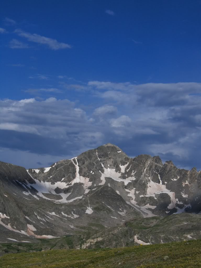
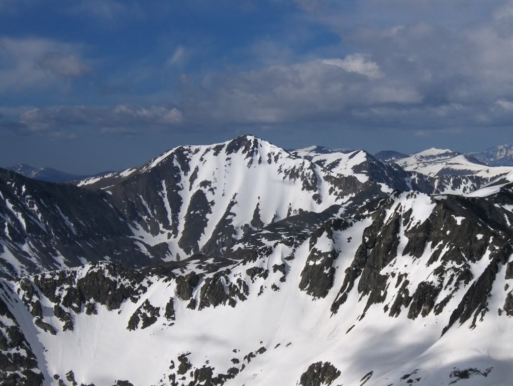
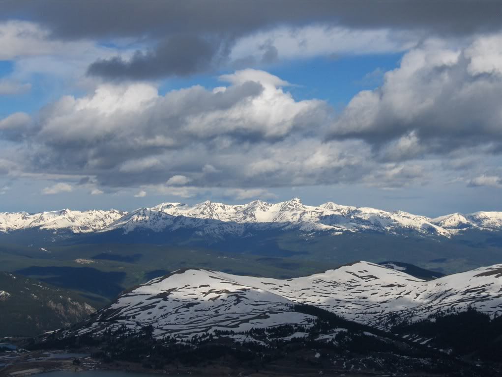
Fletcher Mountain (13,951')
Tenmile Range
Trailhead: McCullough Gulch Route: East face, right branch Distance: ~7mi RT (roundtrip) Elevation Gain: ~2900'
Gear: daypack w/Essentials, helmet, crampons, ice axe, avy gear (beacon, probe, shovel), & snowshoes"which we didn't need
Resources Used For Trip Planning: Dave Cooper's Colorado Snow Climbs guidebook, beta from friends (Bill Tarvin & Sam Campbell) that recently climbed the route, NOAA weather forecast
Foreword
My outings have been few & far between recently, and I was in need of a mountain fix. A snow climb was the remedy I needed, and it didn't matter to me what mountain.
Mike didn't have plans for Sunday, so I fixed that for him!
Mike threw out the idea of either Fletcher Mountain via the E face, or Atlantic Peak via Atlantis couloir. Coincidentally, my friends Bill and Sam had climbed both routes within the past week or two, so I was able to glean route conditions from Bill.
Even though both Mike and I have been up these centennial peaks before, either of these routes would be new to us, and it would be a snow climb! Fletcher's E face has been on my wish list for a while, and it's the more appealing line so that's what we planned for.
Fletcher Mountain in leaner summer conditions...July 2010
We left Avon sometime after 3am, and made the drive to the trailhead outside of Breckenridge. While driving past the Quandary Peak TH at ~4:30am, there was not a car in sight. Hmm. I guess folks are sleeping in these days?
The Approach
We left my truck carrying our snowshoes in hand awaiting the moment we would need to put them on. That moment never came throughout the day. This day was an exercise in proper snowshoe carrying, and I think I failed. (I shouldn't have carried them at all!"but we didn't know that starting out.)
The first section of the road leading into McCullough Gulch is spotty, although there's lingering snowdrifts. The snow was a bit soft, but it was firm enough to get by without flotation for us. Plus it has seen foot-traffic, hence the firmly packed snow.
Once we left the road and got into the trees, the snow was more continuous but we were still able to get by without snowshoes. We followed the trail as best we could: sometimes on open ground, other times on snow, and then there were times we were not on the "trail" at all. No matter. We got where we needed to be. It also helped that I've been down this trail before!
"What's that mountain?" "I'm not sure Mike. It's a quandary for me."
The snow became firmer higher in the gulch, giving us hope for hard snow in the couloir. We had the occasional posthole close to rock outcrops, but other than those moments we were still practicing our snowshoe carrying skills.
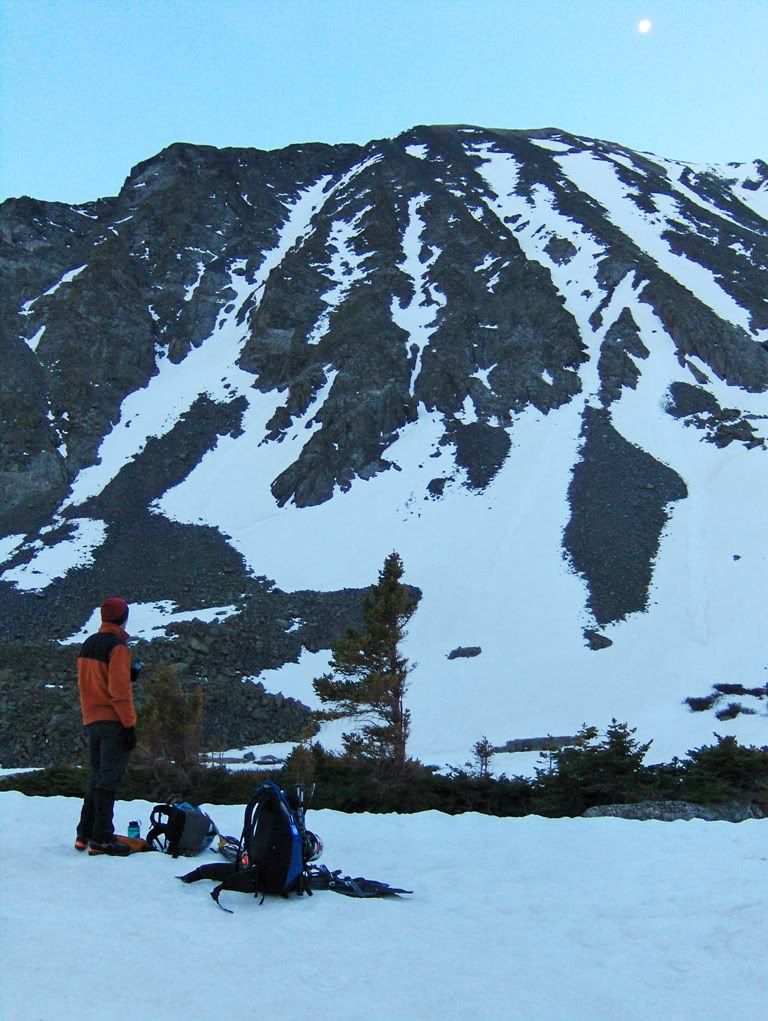
First light on Fletcher Mountain
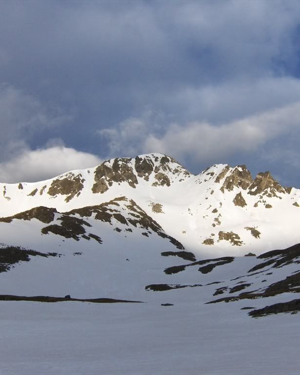
A Peak in McCullough Gulch
Somewhere near 12,600' when the terrain flattens out, we stopped to stash our snowshoes. With shoes stashed, we continued on towards our goal: the east face of Fletcher Mountain.
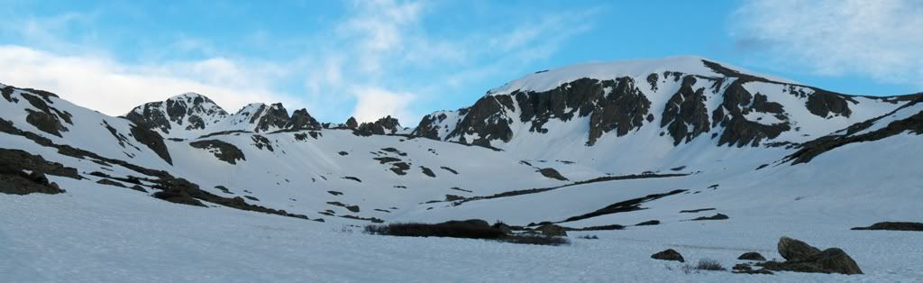
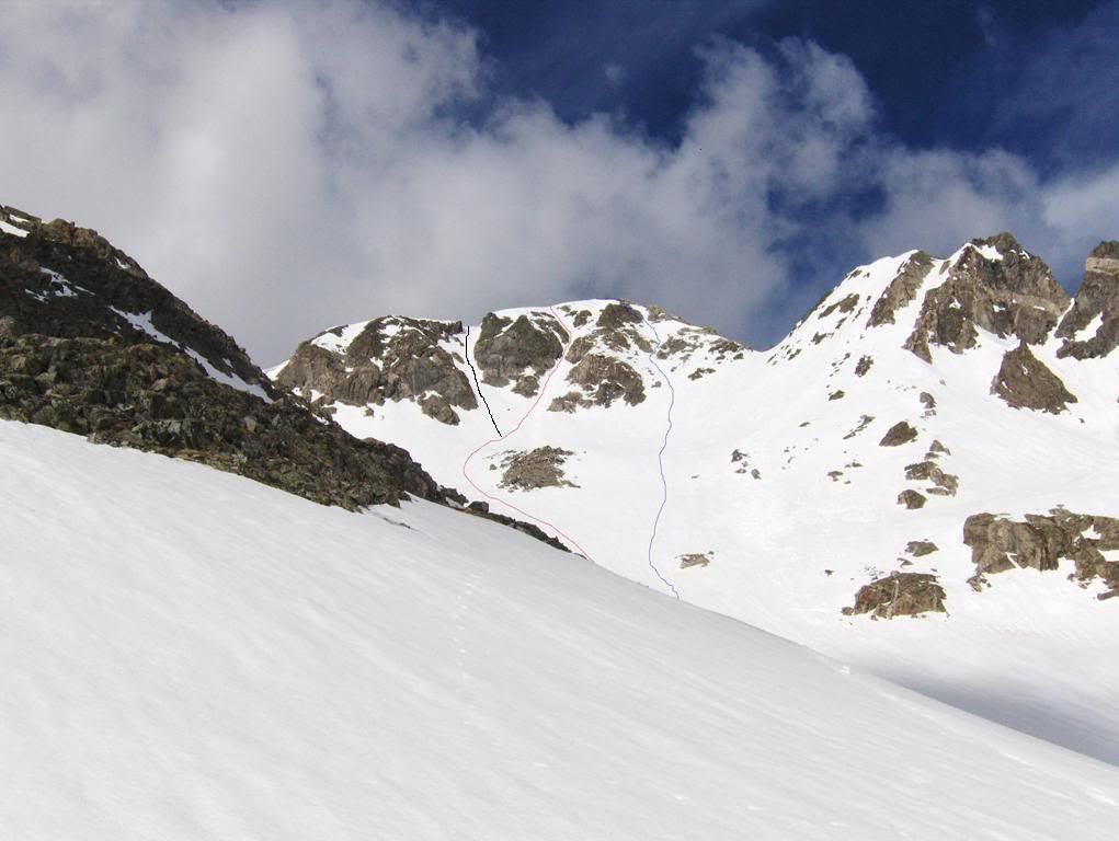
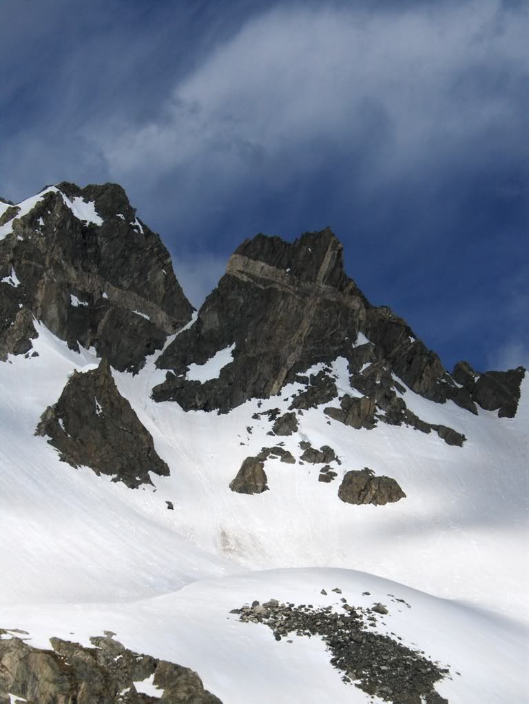
In Cooper's guidebook, he describes two routes that go up the face. The left branch is the steeper of the two lines, and sometimes it's guarded by a cornice in early season. It looked corniced, but there might be an exit to climber's left at the top. (Note: there were tracks going up the left branch when we were climbing up to the start of the right branch. It might have been doumall's track.)
Our routes: red = ascent of right branch, blue = descent; (black = left branch)
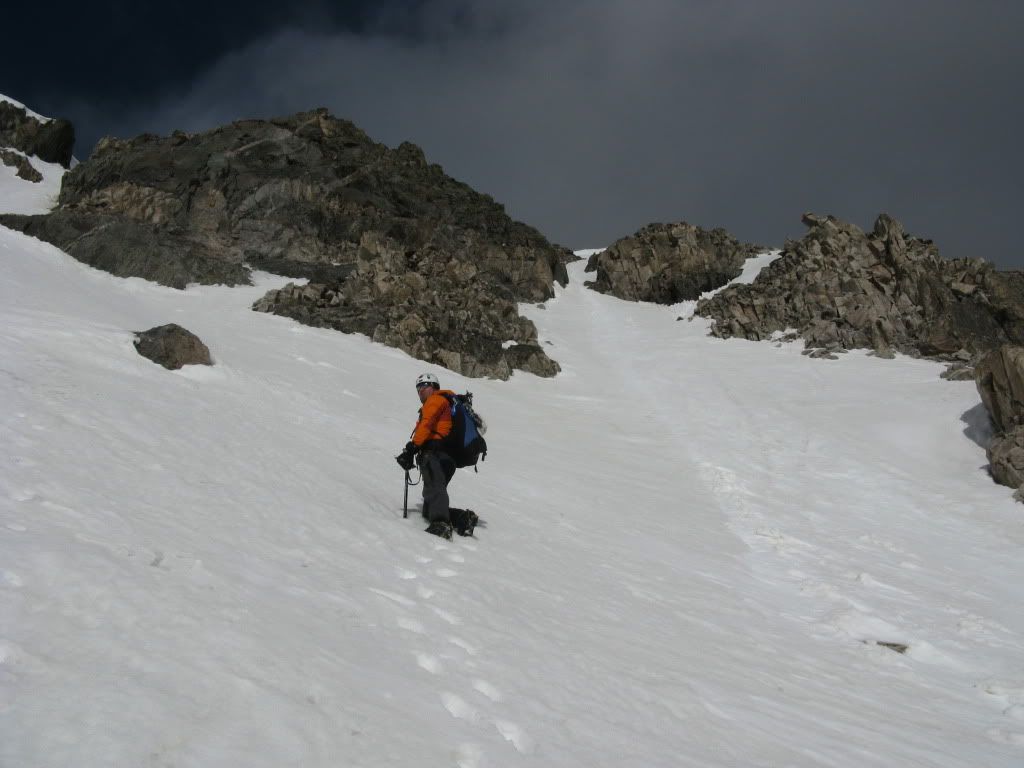
We skirted to the south of the lake at 12,760' and traversed across the slope. It was at that point I decided to stop to get out my axe and shortly thereafter I opted for my crampons as well since they would be more efficient than slicing the harder snow with the edge of my boot. Points are nice!
The Climb
We were near the bottom of the fat apron around 7:30am. The skies were a bit overcast and the wind was cool, so we hoped it would help keep the snow cold. But the sun was starting to make more of an appearance. And as we got higher, the snow wasn't as firm as it was below, but it felt safe and it wasn't saturated yet. Boot deep though.
Up the right line we go
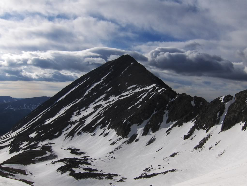
Atlantic Peak (13,841')
Mount Quandary Peak Mountain (14,265')
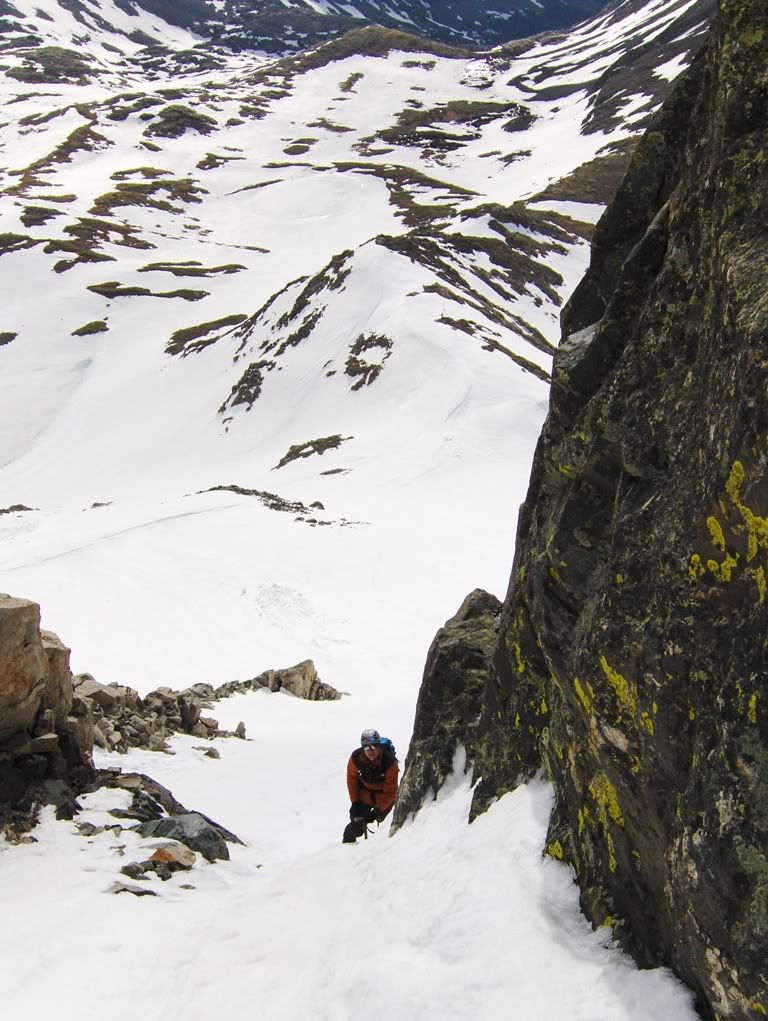
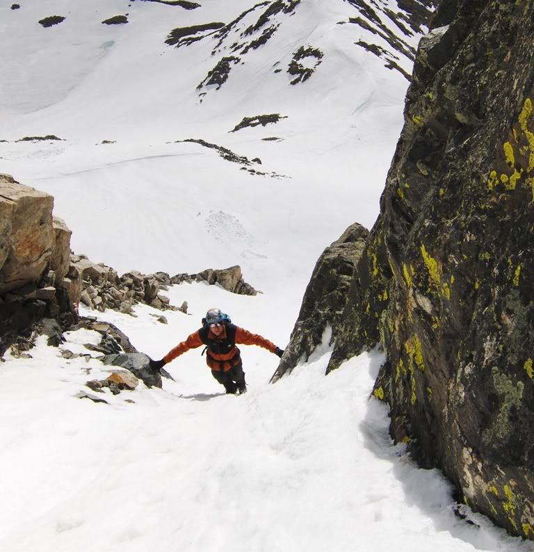
I started the lead up the apron and into the couloir, and my quads started to feel the effects from my mountain climbing deprivation! My lungs didn't seem to take in enough oxygen as well. What the hell! Oh well. At least the climbing is fun!! It got better when Mike took over the lead for a spell to give my whining ass a break.
Me on the upper part of the apron Photo by Mike
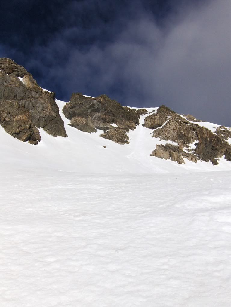
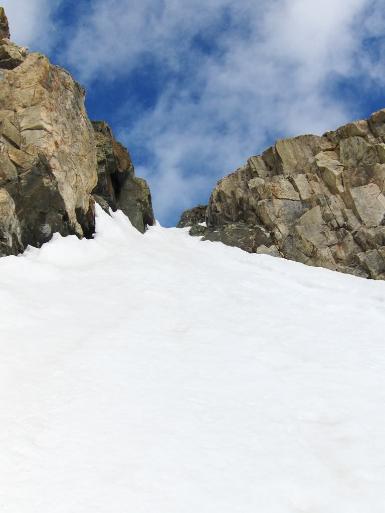
Approaching a constriction
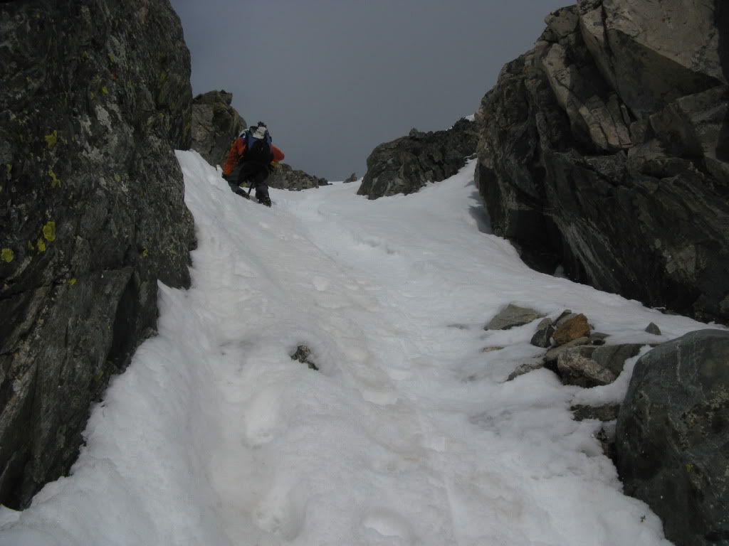
Me just past the constriction Photo by Mike
The constriction was the steepest section, maybe in the low 40 degree range. It also had some ice in it, but it wasn't hard alpine ice and our front points and axe did the job.
Mike rounding the corner to the constriction
After the constriction, the couloir bends to the left and heads for the SE summit ridge, where it exits within ~30 vertical feet from the summit. Now that's a nice way to finish!
Less than an hour after starting from the apron, we were on the summit of Fletcher Mountain.
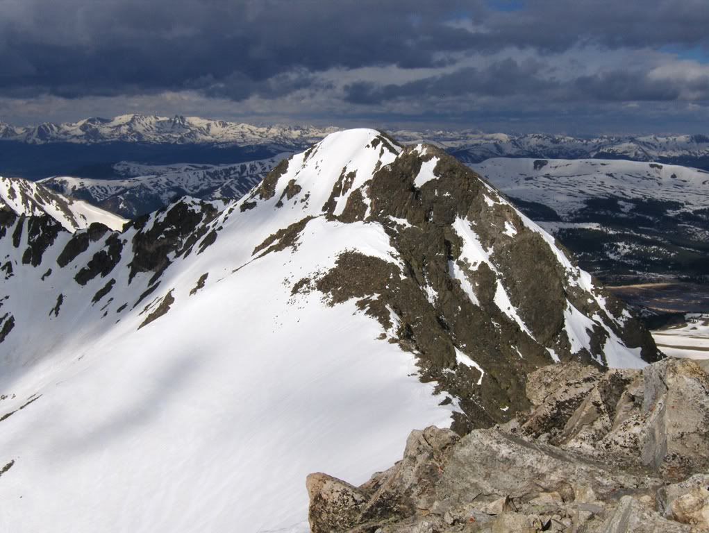
Mount Democrat (14,148')
"Drift Peak" (13,900')
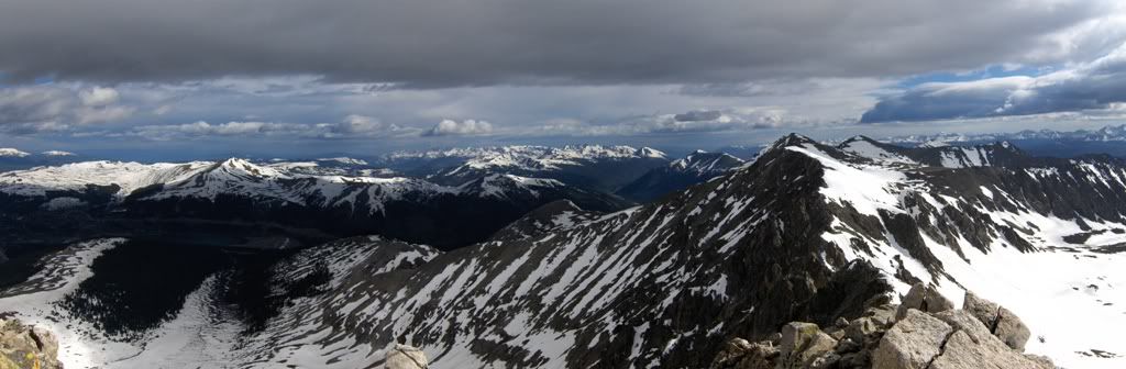
To the north
The Mountains of the Holy Cross Wilderness
Fletcher's version of the Cross
In Cooper's guidebook, he suggests a couple of different descents. One involves dropping into Blue Lakes on Quandary's south side, and either have a car shuttle set up, or walk the road back around to the McCullough Gulch TH. That's not going to happen.
The other one he mentions is to drop down the SE ridge and descend from the saddle of Quandary and Fletcher. Currently there're cornices along the saddle.
When talking to Bill about his and Sam's climb of Fletcher early last week, they descended the N ridge of Fletcher until they came to the first low point on Rockfountian Ridge (which connects with Atlantic Peak), and then they dropped down a big snow field. Sounds good, but we didn't stay on the ridge proper like my friends did. Instead we went to the first continuous snow field we saw from the summit.
The Descent
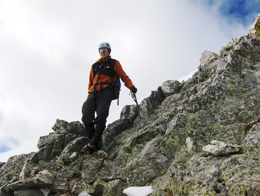
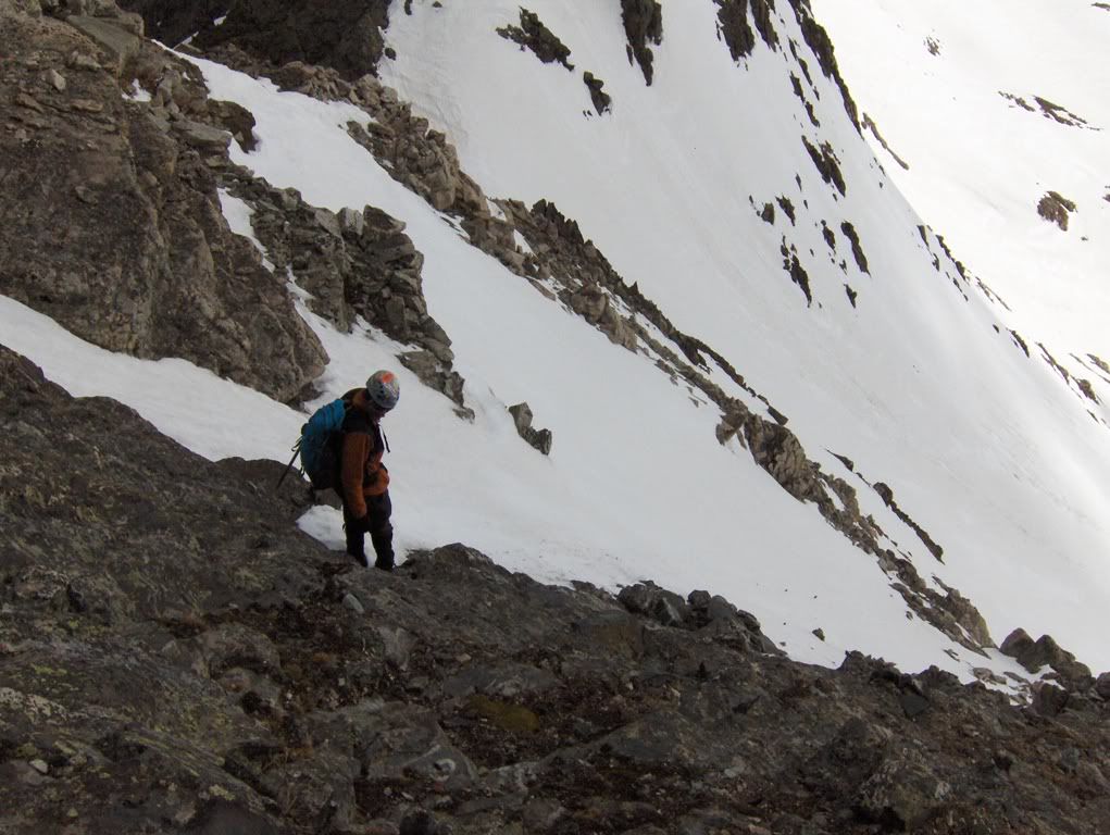
Mike and I kept our crampons on for the rocky start of the descent. Some interesting class 3 climbing ensued, but soon we were back on snow.
"Well that was interesting!"
The short but fairly exposed class 3 in crampons went ok. There were a few sections of down-sloping rock to contend with, but it wasn't too difficult.
Back on the snow, we found it to be rotten and steep(ish). I didn't like my leg plunging that deep while facing out, concerned it could pitch me forward, so I faced in and downclimbed while Mike plunge-stepped the whole slope. Once we got down on the apron, it went much better as the angle eased off and the snow wasn't as rotten. But it was past prime glissade conditions.
Back to the truck at 11:30ish, I think.
Driving out, the Quandary TH was overflowing.
End of story.
Post Climb Feast
Q-4-U BBQ"in Frisco.
For me, the Smothered Sausage!
Mike had some tips burnt or something. I don't know about people from Chicago. Why would you pay to have your food burnt? ;)
Sorry Helmut, no pictures. The food wasn't on our (i.e., my) plate long enough to capture an image.
for the report and pics. I've been thinking of getting to these centennials soon and this helps me to plan accordingly. (Of course, I still need to get to Boudoir as well - I missed an opportunity on that one this weekend.)
Solid time to be passing through Frisco after a climb. Mtnfiend and myself were there saturday afternoon after Wheeler, but opted for the Buffalo Chicken (The Chuffalo) at Peppino's on the corner of 7th and Main. A gluttonous atmosphere indeed.
Good time to be hitting the Tenmile. Couloirs still filled in, ease of access, aesthetic basins, etc.
Great to get out on another snow climb with you Darin, still plenty of good lines to be had! Atlantis is quickly moving up the ”must ski” list after seeing it last weekend.
Lunch was Burnt Ends, a Kansas City delicacy, which are made from the points of a brisket. They may sound a little strange, but they are pure smoky goodness and taste great after a climb!
...is clearly where all the cool kids are hanging out these days. 8) Papi and I were just across the valley from you guys on North Star. We were amazed at how still it was, esp. b/c the forecast had been calling for pretty strong winds.
We enjoyed a little leftover Amica's on the summit, so no post-hike feast for us. We'll have to check out the fine eateries in Frisco next time we're out there.
Terry, Atlantic looked fine for several different lines. I wouldn't be worried. Get after it!
And, I should give kudos to Mike. Saturday he did 9 peaks in the Sangres, with a bunch of elevation gain (5,000+ I think) and then only got about 3hrs of sleep. He didn't bail on me, and stuck it out on Sunday! Still strong too. Nice work Mike!
And it was another good day in the mountains with you, hopefully we'll get on some more snow before end of summer.
Caution: The information contained in this report may not be accurate and should not be the only resource used in preparation for your climb. Failure to have the necessary experience, physical conditioning, supplies or equipment can result in injury or death. 14ers.com and the author(s) of this report provide no warranties, either express or implied, that the information provided is accurate or reliable. By using the information provided, you agree to indemnify and hold harmless 14ers.com and the report author(s) with respect to any claims and demands against them, including any attorney fees and expenses. Please read the 14ers.com Safety and Disclaimer pages for more information.
Please respect private property: 14ers.com supports the rights of private landowners to determine how and by whom their land will be used. In Colorado, it is your responsibility to determine if land is private and to obtain the appropriate permission before entering the property.