Download Agreement, Release, and Acknowledgement of Risk:
You (the person requesting this file download) fully understand mountain climbing ("Activity") involves risks and dangers of serious bodily injury, including permanent disability, paralysis, and death ("Risks") and you fully accept and assume all such risks and all responsibility for losses, costs, and damages you incur as a result of your participation in this Activity.
You acknowledge that information in the file you have chosen to download may not be accurate and may contain errors. You agree to assume all risks when using this information and agree to release and discharge 14ers.com, 14ers Inc. and the author(s) of such information (collectively, the "Released Parties").
You hereby discharge the Released Parties from all damages, actions, claims and liabilities of any nature, specifically including, but not limited to, damages, actions, claims and liabilities arising from or related to the negligence of the Released Parties. You further agree to indemnify, hold harmless and defend 14ers.com, 14ers Inc. and each of the other Released Parties from and against any loss, damage, liability and expense, including costs and attorney fees, incurred by 14ers.com, 14ers Inc. or any of the other Released Parties as a result of you using information provided on the 14ers.com or 14ers Inc. websites.
You have read this agreement, fully understand its terms and intend it to be a complete and unconditional release of all liability to the greatest extent allowed by law and agree that if any portion of this agreement is held to be invalid the balance, notwithstanding, shall continue in full force and effect.
By clicking "OK" you agree to these terms. If you DO NOT agree, click "Cancel"...
Antero- Little Brown's Creek route
Years ago, I climbed Antero from the Baldwin Creek side. I remember a pretty valley, miles and miles of 4x4 road, yielding to jeeps on the road, and driving up the brutal road to the creek that bottomed out my CRV several times. Good day, but my friend Matt was looking at doing Antero from the other side. I did some research, but found little- Roach wrote it up as a variation without definite mileage or elevation gain, and hiker63 had a great trip report about it. It was definitely much longer with more elevation gain, but I'm surprised how little you hear about this route- if you're willing to work harder, it feels like a far superior route to me.
I left Denver at about 4:00AM, and along the way, nearly hit, in order, a dog, a fox, a wolf, a heard of elk with full racks, deer, and a solemn looking cow. Everytime I see a cow that close, I mutter under my breath, "See you at the Cricket." Then we saw a group of antelope, and on the way home, a bird actually bounced off my windshield. Good day to see wildlife, bad day for the bird. Matt and I arrived at the trailhead about 6:30, confident of our directions, thanks to hiker63's report. Matt forgot his GPS, but I used other high tech equipment to construct this map of our general route. If you have trouble viewing it, I used software consisting of some crayons and markers. High tech map of the route with our times
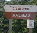
The route starts low, at 8920 feet on the deck of the Arkansas River Valley, and climbs 5350 feet to the summit. Parking is quick and easy, and we were on the trail at 6:40. The first leg is 1.3 miles to the Colorado Trail on a strong trail. At this point, turn right, and go a very short distance, less than ten minutes, to the junction of trail 1430. From here, there is a strong trail for probably close to five miles. It meanders through a charming forest, and even though you pick up a great deal of elevation, it doesn't feel straight up, but rolls along nicely, eventually popping out into a meadow for views of shoulders of Antero and White. The first section in the forest: Beginning of the trail. Their "map," clearly of inferior quality to mine. Coming up of the first junction. Sign at the first junction- turn right. Second junction, less than ten minutes away. Sign at the second junction. Turn left. Mt. White appears through the trees. Much of the forest is along Little Brown's Creek. Typical trail in the forest.
Eventually, you make your way to timberline- we arrived at 8:50, and spill out into a beautiful meadow. This was when I got that "where else would I rather be?" feeling, and was so glad to have gotten up so early. To be clear, this was not five miles from the last junction- probably closer to three based on my time splits. We stopped to eat a bite and enjoy the views- Mt. White rises up on your left, and the shoulder of Antero is to the right. The trail grows faint at times the higher up you go and other trails appear off to the right climbing the sides of Antero. We chose one of these side routes, which appeared to be a time saver, but regretted it when we got to the top. Steep, loose, and beat us up, but it seemed like a good idea at the time. We agreed that the better approach would be to aim for the V in the top of the drainage, and the trail does go almost all the way to that top point, crossing the creek about halfway up. This is probably the only real route finding, but so long as you point off toward the right, left of the subpeak, you'll be fine. Roads are found at the top of the meadow that will lead you to the standard route off to the right, and it becomes clear quickly where you are heading to summit Antero.
After a bite, we took off, weighing our options, eventually choosing a more well worn path off to the right, which went straight up. It was loose and sandy, and we agreed it was the only real frustrating part of the day. When we got there, we joined a road that went hard left, and met up with the standard route at the point when it wraps around the shoulder to Baldwin Gulch. There are signs with trail numbers at the junction, and the 4x4 switchbacks went up to the shoulder that would reveal the Antero summit. Pictures from the meadow : Breaking into the meadow. Looking back at timberline and the valley. Antero's shoulder. Entire basin- keeping aiming for the V at the top. Off to the right, many trails appear. Ignor them! Nearing the top. Looking back at the meadow. Gaining the 4x4 switchbacks. Back at entire valley. Terrific view of Shav/ Tab.
The switchbacks went quickly, and we gained the saddle before what can't really be called a "catwalk," but the thin ridge leading to the rise to the summit. A healthy, friendly mountain goat was waiting for us, maybe expecting us to show our tickets. We stopped to take pictures, and we walked to within five or six feet of us before peeling off to the left. I quoted the little girl from Despicable Me: "He's so fluffy!" It was now 10:30, and I had been struggling a bit with my stomach, heavy legs, and a bit light headed. We crossed the ridge on an easy path, and I encouraged Matt to go on ahead for the summit push. Here we started to see other people, the first of the day. Everyone was friendly and happy on their way down, and by 11:00, Matt and I found ourselves on the summit, happy. We took a half an hour to rest, eat, and enjoy the views- clouds were starting to take shape, but we knew we had time. About a million gnat-like bugs started to use me as their perch, and they wouldn't get off. I've never had so many bugs on me at one time.
The way back down went quickly to start- back to the saddle, and we rejoined the Little Brown's Creek trail farther up in the meadow this time. Before we knew it we were back in the forest, feeling close to the car. From that point, it is a loooong haul out of there. A couple times we caught ourselves speculating on how long till the trailhead, and we would catch a glimpse through the trees of how far off the valley bottom was- it was waay down there. We were moving very fast, but four miles is still four miles. It's not going to be a 20 minute walk. Finally we gained the junctions , and found ourselves dropping down the final ridge to the parking lot, with Pepperidge Farm Brussels cookies waiting in the car. Mountain goat checking credentials. Ridge and final push to summit. Summit shot of Matt. On the top. Back at saddle, happy, Antero behind. Roads everywhere, sponsored by NASCAR. Descending 4x4 switchbacks. Regaining the trail.
This was a long day, but to me, a much higher reward than the standard route. If you're looking for solitude, or just ways to make peaks more interesting, this would be a route worth trying.
Thumbnails for uploaded photos (click to open slideshow):
great teaching partner who specializes in cartography and freehand mapping! She would be very proud of his work!
Yeah, I forget to check the batteries in the Garmin, it has been out five or six days between hiking and mountain biking, so shame on me for being unprepared.
I did Antero from Baldwin Gulch back in early June and there was a lot more snow. I didn't see anyone on the trail all day and nearly had to turn around about 200 ft from the summit because of backtracking to find a dry route up without getting super exposed. Looks like it was a lot less nerve racking! Thanks for the post!
Really quiet, except for someone whining on and on 7/7/2011 11:02pm
about too much Gelato! I'd started up Baldwin Gulch last Thursday, WAY too late for any real sensible summiting. I left the car at 9:30, after parking just beyond the second stream. I was able to reach the saddle at 13,100 ft. where you decide whether to stick to the road or go up the sholder. Based on cloud conditions I decided to head back down. This is what prompted us to start looking at an alternative route. EXILEDMICHIGANDER did this route, thought turning up the valley even before we did, maybe a mile below the crest of Little Brown's. He described an arduous scramble up never-ending scree.
I'll try and get some pictures posted but the shor answer is ”yes,” but only after dropping in to the Brown's Lake Basin. I know there are some other threads that describe this, but essentially you would have easier access from Brown's Lake, on the south side of White Mt. This basin for Little Brown's is on the north side of White Mt.
Caution: The information contained in this report may not be accurate and should not be the only resource used in preparation for your climb. Failure to have the necessary experience, physical conditioning, supplies or equipment can result in injury or death. 14ers.com and the author(s) of this report provide no warranties, either express or implied, that the information provided is accurate or reliable. By using the information provided, you agree to indemnify and hold harmless 14ers.com and the report author(s) with respect to any claims and demands against them, including any attorney fees and expenses. Please read the 14ers.com Safety and Disclaimer pages for more information.
Please respect private property: 14ers.com supports the rights of private landowners to determine how and by whom their land will be used. In Colorado, it is your responsibility to determine if land is private and to obtain the appropriate permission before entering the property.


 High tech map of the route with our times")
 Beginning of the trail.")
 Their \"map,\" clearly of inferior quality to mine.")
 Coming up of the first junction.")
 Sign at the first junction- turn right.")
 Second junction, less than ten minutes away.")
 Sign at the second junction. Turn left.")
 Mt. White appears through the trees.")
 Much of the forest is along Little Brown's Creek.")
 Typical trail in the forest.")
 Breaking into the meadow.")
 Looking back at timberline and the valley.")
 Antero's shoulder.")
 Entire basin- keeping aiming for the V at the top.")
 Off to the right, many trails appear. Ignor them!")
 Nearing the top.")
 Looking back at the meadow.")
 Gaining the 4x4 switchbacks.")
 Back at entire valley.")
 Terrific view of Shav/ Tab.")
 Mountain goat checking credentials.")
 Ridge and final push to summit.")
 Summit shot of Matt.")
 On the top.")
 Back at saddle, happy, Antero behind.")
 Roads everywhere, sponsored by NASCAR.")
 Descending 4x4 switchbacks.")
 Regaining the trail.")