Download Agreement, Release, and Acknowledgement of Risk:
You (the person requesting this file download) fully understand mountain climbing ("Activity") involves risks and dangers of serious bodily injury, including permanent disability, paralysis, and death ("Risks") and you fully accept and assume all such risks and all responsibility for losses, costs, and damages you incur as a result of your participation in this Activity.
You acknowledge that information in the file you have chosen to download may not be accurate and may contain errors. You agree to assume all risks when using this information and agree to release and discharge 14ers.com, 14ers Inc. and the author(s) of such information (collectively, the "Released Parties").
You hereby discharge the Released Parties from all damages, actions, claims and liabilities of any nature, specifically including, but not limited to, damages, actions, claims and liabilities arising from or related to the negligence of the Released Parties. You further agree to indemnify, hold harmless and defend 14ers.com, 14ers Inc. and each of the other Released Parties from and against any loss, damage, liability and expense, including costs and attorney fees, incurred by 14ers.com, 14ers Inc. or any of the other Released Parties as a result of you using information provided on the 14ers.com or 14ers Inc. websites.
You have read this agreement, fully understand its terms and intend it to be a complete and unconditional release of all liability to the greatest extent allowed by law and agree that if any portion of this agreement is held to be invalid the balance, notwithstanding, shall continue in full force and effect.
By clicking "OK" you agree to these terms. If you DO NOT agree, click "Cancel"...
Peak(s):
Mt. Aetna - 13,747 feet Taylor Mountain - 13,655 feet
Missouri Hill - 12710
Lost Mountain - 12614
Mount Aetna 13,745
Taylor Mountain 13,651
Missouri Hill 12,710
Lost Mountain 12,614
Partner: Tyler (tdawg)
Stats:
~12 miles
6000 Feet
With a stellar forecast on Sunday I couldn't pass up another opportunity to climb some Bi-centennial peaks. I called Tyler and he was down so we met in Boulder and left for Garfield. The forecast called for high winds and mild temps. This was accurate. We parked at Monarch Lodge which won't open for another month. At 7:40 we set out on FS 228, it was a nice road which ends at a marble quarry. After the quarry it was a rough road over the SE shoulder of Taylor. From there we descended 250 feet to another quarry where we traversed around the South ridge of Missouri Hill. Tyler ascended the Talus and I descended into the valley. We met up at the saddle. Both routes were quick, it just depends on your preference for talus or grass. The climb up Lost Mountain went quickly. We were greeted by strong winds. Luckily we were able to find shelter on the North side of the summit.
Mount Ouray
Missouri Hill is a very quick climb from Lost. After fighting the wind and nearly being blown off the mountain we made the 25 minute traverse. Taylor looked far away from here.
We were able to find some protection from the wind on by staying a few feet below the ridge crest. In the wind it was cold, out of the wind it was warm. The traverse to Taylor was straightforward. At about 13k we ran into some snow, it was only a few inches deep and didn't hinder our progress. The wind was the strongest on Taylor. Again the traverse looked long. The wind made it look that much further.
The wind battered us as we made our way to the saddle. We had to stay on the south side of the ridge because of cliffs on the north side of the ridge. At the saddle we saw the crux of the traverse. A short 20 foot headwall which provided some brief scrambling. The rest of the ridge was talus and went quickly. We sat and enjoyed the summit of Aetna for 30 minutes before making our descent. There were three options for a descent. Our first option was to go back to the Taylor Aetna Saddle and follow the route described by Garratt and Martin, our second option was to descend the South ridge, our third option was to descend the western of the two south ridges. Each option required roughly the same distance and effort. We chose the third option. This ridge was steep, descending nearly 3000 feet in a mile.
the class 3 headwall Looking back at Taylor
We followed the ridge proper down to treeline where we followed an animal trail down the ridge to about 11.4k there we dropped into a drainage which took us to two cabins and the road out. We took another 20 minute break at the cabins enjoying the mild October afternoon, knowing this there might not be anymore of these until next June. It was a quick 45 minute hike out from the cabins.
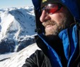
enjoying my new home Aetna's famous rock gully
Thumbnails for uploaded photos (click to open slideshow):
I checked out the cabins after climbing Aetna in late June; the snow was too far gone to ski the Grand Couloir. With a bit of work, they could be decent ski huts. Primitive, but simpler than winter camping, if you want to share with the mice. Looking forward to skiing Aetna next May.
Caution: The information contained in this report may not be accurate and should not be the only resource used in preparation for your climb. Failure to have the necessary experience, physical conditioning, supplies or equipment can result in injury or death. 14ers.com and the author(s) of this report provide no warranties, either express or implied, that the information provided is accurate or reliable. By using the information provided, you agree to indemnify and hold harmless 14ers.com and the report author(s) with respect to any claims and demands against them, including any attorney fees and expenses. Please read the 14ers.com Safety and Disclaimer pages for more information.
Please respect private property: 14ers.com supports the rights of private landowners to determine how and by whom their land will be used. In Colorado, it is your responsibility to determine if land is private and to obtain the appropriate permission before entering the property.


")
")
")
 Mount Ouray")
")
")
")
")
")
")
")
 the class 3 headwall")
 Looking back at Taylor")
")
")
")
")
 enjoying my new home")
")
 Aetna's famous rock gully")