Download Agreement, Release, and Acknowledgement of Risk:
You (the person requesting this file download) fully understand mountain climbing ("Activity") involves risks and dangers of serious bodily injury, including permanent disability, paralysis, and death ("Risks") and you fully accept and assume all such risks and all responsibility for losses, costs, and damages you incur as a result of your participation in this Activity.
You acknowledge that information in the file you have chosen to download may not be accurate and may contain errors. You agree to assume all risks when using this information and agree to release and discharge 14ers.com, 14ers Inc. and the author(s) of such information (collectively, the "Released Parties").
You hereby discharge the Released Parties from all damages, actions, claims and liabilities of any nature, specifically including, but not limited to, damages, actions, claims and liabilities arising from or related to the negligence of the Released Parties. You further agree to indemnify, hold harmless and defend 14ers.com, 14ers Inc. and each of the other Released Parties from and against any loss, damage, liability and expense, including costs and attorney fees, incurred by 14ers.com, 14ers Inc. or any of the other Released Parties as a result of you using information provided on the 14ers.com or 14ers Inc. websites.
You have read this agreement, fully understand its terms and intend it to be a complete and unconditional release of all liability to the greatest extent allowed by law and agree that if any portion of this agreement is held to be invalid the balance, notwithstanding, shall continue in full force and effect.
By clicking "OK" you agree to these terms. If you DO NOT agree, click "Cancel"...
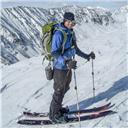
I knew I could be encountering some windy conditions in the mountains when I walked out to my car in Lone Tree, CO at 02:45 and encountered a fairly strong breeze. Regardless, I headed to the trail head at that point. I drove up the Stevens Gulch access road with no problems in my Subaru Outback. As mentioned in other spots the road may be tricky to navigate with a low clearance vehicle. I arrived at the trail head at 04:15 and was greeted by some strong winds. You could hear the wind howling through the nearby trees and rocks.
I started out at the Grays Peak trail head at 04:30 under a moonless starlit sky. The moon had set behind the mountains as I was driving through Highlands Ranch, CO on C-470. I could see at least one other hiker's headlamp high up on the standard route up Grays Peak. As I was hiking solo I really took my time to enjoy the surroundings as light started to fill the sky. The standard route trail was nearly completely dry. All the lower patches of snow that were on the trail two weeks prior, when I had skied Dead Dog Couloir, had completely melted and dried up. As I hiked under Kelso Ridge I found some snow patches to test and found them to be frozen solid. By 06:15 I was nearly halfway up where the trail crosses the flat rocky water run out area and begins to climb to the southwest. It was at this point that the wind got the best of me for the first time. A strong gust came down over the ridge and knocked me to my hands. I decided to take some shelter in the rock outcroppings on the left side of the trail going up as I was making too fast of progress for how hard the snow was. I'd rather burn some time in a sheltered area versus exposed to the elements at the summit. Working against the snow softening up was a thick group of clouds that kept billowing up in the east and blocking the sun's rays on the snow that I planned to ski. To add to that, the wind was not helping either as it was keeping the snow surface cool.
At the trail head, blinded by the flash First light on Grays and Torreys Grays Peak and Lost Rat Couloir Beautiful sunrise hitting the mountains Morning sun on Grays Peak Route becomes more visible Sun finally above the mountains
I spent about 30 minutes sitting in the rocks protected and had a conversation with the three hikers who's headlamps were visible earlier in my approach. I got some feedback from them that the winds were the strongest they've ever experienced on the summit. As I was getting chilled sitting idle I decided it best to get on my way as the sun was now higher in the sky and hitting the snow slopes very well. I met up with 14ers user "mitrik" soon after I started hiking again. I found out that he had intended on skiing Torreys' Dead Dog Couloir and was planning on achieving the summit via the saddle between Grays and Torreys. We hiked together for a while discussing skiing and our past backgrounds. It was ironic to find out that he posted on the same thread that I started earlier in the week and that he grew up in an area in NY where I spent three years of my life. It was good to have his company as once again the waiting game was coming into play. The snow was extremely firm still with maybe the upper 1/2 inch starting to soften by 08:30. We were about 50 yards from the saddle at this point and decided to find some rocks to rest on as we were still fairly protected from the wind blowing from the west at this point. We spent a good 45 minutes there and gave the snow some time to soften up the upper 2 to 3 inches. At this point we set out for the saddle where I headed up Grays Peak and he went towards the summit of Torreys.
Bowl between Grays and Torreys Torreys East face
By 10:00 I made it to the summit of Grays and snapped some photos of the surrounding peaks and the south side of Grays looking into Horseshoe Basin. The snow on the south side of Grays appeared to be continuous from the peak to the unnamed lake above Grays Lake from the best that I could see.
At the summit of Grays Horseshoe Basin Torreys Peak Mount Edwards Horseshoe Basin with the unnamed lake and Grays Lake South Ridge of Grays Out towards Breckenridge
At this point I had enough of the wind on the summit and hiked back down with all my gear to the highest skiable line off of Grays. I hiked back down three switchback sections before I reached continuous snow. At that point I geared up and prepped for my descent. You can see a video of my descent from the saddle low point into the bottom of the bowl here (http://www.youtube.com/watch?v=Ybpo9Jf6H44). I've excluded the video of skiing the saddle as it was primarily a traverse with a couple nice turns thrown in. The line I choose from saddle into the bowl went along the rock wall on the Torreys' side and through a chute. The snow was absolutely excellent corn; it was like making turns in butter. As I approached the bottom of the chute I opened it up in preparation on carrying enough speed to make it to the trail head. The 50 feet of walking from my stopping point to the trail consisted of post holing knee deep at many spots so I was glad I carried some speed.
Bowl between Grays and Torreys Ski descent
Back on the trail I met up with "mitrik" once again who had just skied Dead Dog Couloir. From the looks of things he had made some great turns and experienced great conditions until the runnel approximately 2/3 the way down. At that point navigating the runnel become tough as the alternate line on skiers right that avoids the runnel had now melted out. He mentioned that there was a lot of debris in and around the runnel that made it tough to ski through.
Dead Dog Couloir
We made it back to our vehicles by 12:00. The trail conditions on the way out were nearly all dry with just a few wet spots where water was flowing. Overall, it was a great morning out in the mountains. I snapped one last photo of Torreys on the way out at the Grizzly Gulch intersection.
Torreys Northwest face
Thumbnails for uploaded photos (click to open slideshow):
I have a question about the avalung. I was under the impression that a spring/summer slide, although certainly dangerous, can't bury you. Is this not true? Thanks.
This is merely my thought so take it for that, I am not an expert in avalanches, but yes you are more unlikely to be buried in the spring/summer. The entire snowpack would have needed to slide, as the snow is assumed to be one homogeneous layer, in order for it to have more chance of burying you. Obviously CO mountains get spring/summer snow and depending on numerous factors that may create a layer capable of sliding on the preexisting snow. This scenario would have greater chance of causing a slide that would bury you. This was not the case yesterday; however, my thought is never go out without all my avalanche gear regardless of risk. Clearly it's unlikely that the equipment will be all that useful, but I'd rather be prepared for the unexpected. As you pointed out, slides during this time of the year mostly happen once the snowpack warms up enough due to solar heating and the higher danger is being taken off a cliff, into a rock, etc due to sluffing. Personally I don't assume anything is a certain in regard to avalanches.
nice work getting a june descent in this year. i just looked at my pics from a may 30th ski in 2010. there was at least double the coverage.
i totally agree with you about taking all your avy gear with you even in the spring with conditions as safe as they are. for me its also about practicing good habits and superstition. i feel like if i decide not to pack and wear my transceiver its just asking for something bad to happen - even f i am skiing alone!
Caution: The information contained in this report may not be accurate and should not be the only resource used in preparation for your climb. Failure to have the necessary experience, physical conditioning, supplies or equipment can result in injury or death. 14ers.com and the author(s) of this report provide no warranties, either express or implied, that the information provided is accurate or reliable. By using the information provided, you agree to indemnify and hold harmless 14ers.com and the report author(s) with respect to any claims and demands against them, including any attorney fees and expenses. Please read the 14ers.com Safety and Disclaimer pages for more information.
Please respect private property: 14ers.com supports the rights of private landowners to determine how and by whom their land will be used. In Colorado, it is your responsibility to determine if land is private and to obtain the appropriate permission before entering the property.


 At the trail head, blinded by the flash")
 First light on Grays and Torreys")
 Grays Peak and Lost Rat Couloir")
 Beautiful sunrise hitting the mountains")
 Morning sun on Grays Peak")
 Route becomes more visible")
 Sun finally above the mountains")
 Bowl between Grays and Torreys")
 At the summit of Grays")
 Horseshoe Basin")
 Torreys Peak")
 Mount Edwards")
 Horseshoe Basin with the unnamed lake and Grays Lake")
 South Ridge of Grays")
 Out towards Breckenridge")
 Bowl between Grays and Torreys")
 Ski descent")
 Dead Dog Couloir")
 Torreys Northwest face")
 Torreys East face")