Download Agreement, Release, and Acknowledgement of Risk:
You (the person requesting this file download) fully understand mountain climbing ("Activity") involves risks and dangers of serious bodily injury, including permanent disability, paralysis, and death ("Risks") and you fully accept and assume all such risks and all responsibility for losses, costs, and damages you incur as a result of your participation in this Activity.
You acknowledge that information in the file you have chosen to download may not be accurate and may contain errors. You agree to assume all risks when using this information and agree to release and discharge 14ers.com, 14ers Inc. and the author(s) of such information (collectively, the "Released Parties").
You hereby discharge the Released Parties from all damages, actions, claims and liabilities of any nature, specifically including, but not limited to, damages, actions, claims and liabilities arising from or related to the negligence of the Released Parties. You further agree to indemnify, hold harmless and defend 14ers.com, 14ers Inc. and each of the other Released Parties from and against any loss, damage, liability and expense, including costs and attorney fees, incurred by 14ers.com, 14ers Inc. or any of the other Released Parties as a result of you using information provided on the 14ers.com or 14ers Inc. websites.
You have read this agreement, fully understand its terms and intend it to be a complete and unconditional release of all liability to the greatest extent allowed by law and agree that if any portion of this agreement is held to be invalid the balance, notwithstanding, shall continue in full force and effect.
By clicking "OK" you agree to these terms. If you DO NOT agree, click "Cancel"...
MOUNTAIN: Crestone Peak (14,294'), Crestone Needle (14,197'), East Crestone(14,260'), Northeast Crestone (14,260'),
ROUTE: North Buttress (Crestone Peak, NE Crestone, & E Crestone) & Crestone Traverse (Needle); descended Needle's standard route
RT MILEAGE: 12.1 miles
RT DISTANCE: 8,200'
RT TIME: ~15:45 (we walked backwards the entire time - needed to make it a sporting affair)
LADIES' PHONE NUMBERS RECEIVED: None - I'm married...
CLIMBERS: Greg (gregory_fischer), Terry (Tmathews) & Andrew (aerohr - for the traverse & descent)
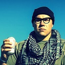
Epic Hero Shot - That's right. We begin with one of theseTerry's Awesome Side - Ladies, send numbers via PM to tmathews
Prior to the days when the world was not burning down and our town (Colorado Springs) offered clear(ish) skies, Terry and I left at 1am and began from the upper TH at 3:45. The plan was to head up the upper basin of South Colony Lakes to Bear's Playground, climb the North Buttress for the Peak and continue onto the Crestone Traverse. Terry and I knew we had the traverse in the bag; it's status as one of the 4 great traverses is embellished. Terry's kind of a big deal in France - he soloed Mt. Blanc in Crocs. I'm not as well known sadly... My highly publicized free-solo of El Capitan last July didn't happen; my tummy hurt.
We reached the Upper South Colony Lake in under 2 hours. Child's play. Awesome Photo
The next portion of the hike sucked, even for expert climbers like us. The class 2 wasn't the challenge (if you stay on the right side of the lake you can avoid more of it), but the smoke. The haze from fires across the state was settling around 12,500 and it made breathing much more difficult. Since conditions in the state have deteriorated since then be aware that if you have breathing problems or trouble with smoke it won't be pleasant to climb. The views also became more obscured, too. After the steep climb to Bear's Playground, we took a break to catch our breath from the smoke before continuing. View of the Needle from Bear's Playground. Despite it close distance, the haze from the smoke was very apparent.
Terry and I were fully aware that we needed to continue up the ridge for the Buttress route. However, we're more adventurous climbers and decided to take an off-route approach by contouring towards the NW Couloir before heading up the North Buttress. I mean, it doesn't count unless it's somewhat challenging. There are cairns marking the route but they're sporadically placed. Just follow the ridge of the North Buttress before turning right and heading towards the Peak. This portion of the trail is a mix of class 2/3. Granted, it felt more like Class 0 for us. View of the Buttress Route. Follow ridge after gaining Bear's Playground before turning right towards the PeakButtress TerrainButtress Terrain
Here's a look at the gendarmes on the Northern ridge which must be crossed over to reach the crossover into the top of the NW Couloir. There's a notch between the gendarmes to cross between. Photo looks towards NE Crestone. Notch to pass through gendarme is not visible in photo.
Here's where the fun section begins. After getting into the notch, we turned left and head up and over it to the following notch. the summit appears and looks to be within jumping distance. On the opposite of this notch is a low class 5 downclimb (image 10). There's plenty of exposure on the downclimb, that would would give a it a difficult day for a lady, but not for us. I know it looks like I'm using hands on the terrain, but I was really doing burpees.The 5th class portion
We continued to the low point of the notch and were about to begin our downclimb towards the Couloir where the supposed ledges exist. DO NOT try and climb up the following gendarme; it's definite class 5 (and if we didn't do it, why would you??? Exactly.) and not the correct route. The chimney we were looking at was a long descent and the hand/foot holds were spaced far apart adding to the difficulty. Terry gave it a try and I decided to head back up to the headwall where we just completed the downclimb and find an alternative route. This proved much easier. The chimney
The next portion consistent of the 4th class lateral traverse which offered plenty of exposure as we were still high above the NW Couloir. Now it was an easy day for a lady. The easiest portion of the lateral traverseLateral Traverse ExposureThe "ledges"
With the underwhelming part behind us, we gain the saddle and proceed to gain NE Crestone. Some inferior climbers might want beta on NE Crestone from Britt Jones. The climb was class 3+ for us; if you're more prodigious (or less-adventurous) you can keep it to class 3. Summit lounging
From the saddle to Crestone Peak's summit was class 3 and marked with cairns; the route goes on the left side of the ridge. We took a break, at some food, talked to some other climbers and offered Andrew an invite to join us on the Crestone traverse. We went back down to the saddle and climbed the opposite side to East Crestone which was a quick Class 2+ climb. The exposure on the East side was sheer. If you fell, you would have plenty of time to thing about your impending doom. View of Crestone Needle from East Crestone
PSA On the descent of the Red Gully to begin the traverse, we passed numerous idiots who did not wear a helmet. That is NOT a route you'd want to be without head protection. The route for the traverse is a decent ways down the Red Gully. If possible, stay to the left and keep an eye open for a cairn which marks the turnoff. After the turnoff, the route is fairly well cairned and is a combination of class 2+/3 for the most of the way. Just be aware that the route is well below the ridge. TurnoffThe Black Gendarme. Terry free soloed this before I could even pull out my camera.
Nearing the Needle, the route becomes more difficult in both terrain and route-finding making a GPS a useful tool. Personally, I found the carins easier to spot while moving along the traverse and not searching for the next one while standing next to a cairn. The entire traverse took us roughly 2 hours. Terrain & route-finding becoming more difficultTerry on the upclimb
The final pitch up the Needle's summit is AWESOME. Class 4 climbing, huge exposure, and awesome photo opportunities equals EPICNESS!!! Now we know what Sunlight Spire is like. Terry on the upclimb Andrew from above. BTW, he fucking hates moths. I'm freaking amazing. Praise me. More summit pitch shots Andrew summit pitch shot Terry summit pitch shot. Easy 5.13d move
On the summit, we ate some food, talked, listened to Andrew rant about his hatred of moths, and I took my usual nap. This route did not energize me as I thought it would. The descent was uneventful. There's a little snow near the pinch in BHP. Most of it can be avoided through careful navigation.
Thus ended our easy hike. However, unlike SurfNTurf, this isn't satire and we need your validation and praise. So, LOOK AT US!!!
Humbly Yours,
Fish
Thumbnails for uploaded photos (click to open slideshow):
I love #27 - 4th Class with exposure + camera in-hand. Classic. More like an ”Easy day for an over-rated self-promoter”. Nice job, gents. Tough route I'm sure.
On a serious note: I'm planning on doing Crestone Peak (not needle) this weekend. Will this require a helmet for the Red gully area? Are there any other precautions I should heed?
How does CP's ”red gully” and summit pitch compare to the Keyhole on Long's? I felt comfortable on all of LP. If I go I'll be doing it with some experienced climbers who have done most all of the 14ers, however I would still like to get some feel for what to expect.
PSA: These peaks may contain more moths than you have ever seen in your life. They will slam into your face, spread their dust in your mouth, nose, or eyes and then depart before you can grab them and separate them from their powdery disgusting wings and throw the whole mess onto the talus at your feet. THEY ARE AGILE!
The moths start around the base of Broken Hand Pass and don't relent until you are back in your tent. They flap around and slam into your face all day long. THESE ARE NOT BUTTERFLIES. They will follow you. They are vile creatures and will stop at nothing to slam themselves into your face, leaving a powdery mess, all day long. This happened during the day (not exactly my finest alpine start, departing camp at 7:45... but loaded with packages of Haribo gummy bears (PSA #2: Shot Blox etc. have inferior nutrition to Haribo Gummy Bears), a summer sausage log and smoked Gouda as nutritious snacks, how could I become tired?). I can't imagine the consequences of starting in the dark with a headlamp. You may suffocate from all of the moth dust in your face.
I would like some GPS tracks for this route, do you have any? Also, do you find taking hero shots slows you down at all, and how do you deal with that? What's the best technique to climb while holding a DSLR?
Terry wasn't lieing when he said he was going back there this weekend. My favorite part of the report is the blatant display of humility throughout the entire walk in the park.
YES!!! Bring a helmet. The rock is loose in the Red Gully and if something gets knocked, it doesn't take much for it to gain speed. In terms of comparison with Longs, I would say that the Red Gully combines of the steepness of the Homestretch and the looseness of the Trough.
Caution: The information contained in this report may not be accurate and should not be the only resource used in preparation for your climb. Failure to have the necessary experience, physical conditioning, supplies or equipment can result in injury or death. 14ers.com and the author(s) of this report provide no warranties, either express or implied, that the information provided is accurate or reliable. By using the information provided, you agree to indemnify and hold harmless 14ers.com and the report author(s) with respect to any claims and demands against them, including any attorney fees and expenses. Please read the 14ers.com Safety and Disclaimer pages for more information.
Please respect private property: 14ers.com supports the rights of private landowners to determine how and by whom their land will be used. In Colorado, it is your responsibility to determine if land is private and to obtain the appropriate permission before entering the property.


 Epic Hero Shot - That's right. We begin with one of these")
 Terry's Awesome Side - Ladies, send numbers via PM to tmathews")
 Awesome Photo")
 View of the Needle from Bear's Playground. Despite it close distance, the haze from the smoke was very apparent.")
 Buttress Terrain")
 View of the Buttress Route. Follow ridge after gaining Bear's Playground before turning right towards the Peak")
 Buttress Terrain")
 Photo looks towards NE Crestone. Notch to pass through gendarme is not visible in photo.")
 I know it looks like I'm using hands on the terrain, but I was really doing burpees.")
 The 5th class portion")
 The chimney")
 The easiest portion of the lateral traverse")
 Lateral Traverse Exposure")
 The \"ledges\"")
")
 Summit lounging")
 View of Crestone Needle from East Crestone")
 Turnoff")
 The Black Gendarme. Terry free soloed this before I could even pull out my camera.")
 Terrain & route-finding becoming more difficult")
 Terry on the upclimb")
 Andrew from above. BTW, he fucking hates moths.")
 I'm freaking amazing. Praise me.")
 More summit pitch shots")
 Andrew summit pitch shot")
 Terry summit pitch shot. Easy 5.13d move")
")
")