Download Agreement, Release, and Acknowledgement of Risk:
You (the person requesting this file download) fully understand mountain climbing ("Activity") involves risks and dangers of serious bodily injury, including permanent disability, paralysis, and death ("Risks") and you fully accept and assume all such risks and all responsibility for losses, costs, and damages you incur as a result of your participation in this Activity.
You acknowledge that information in the file you have chosen to download may not be accurate and may contain errors. You agree to assume all risks when using this information and agree to release and discharge 14ers.com, 14ers Inc. and the author(s) of such information (collectively, the "Released Parties").
You hereby discharge the Released Parties from all damages, actions, claims and liabilities of any nature, specifically including, but not limited to, damages, actions, claims and liabilities arising from or related to the negligence of the Released Parties. You further agree to indemnify, hold harmless and defend 14ers.com, 14ers Inc. and each of the other Released Parties from and against any loss, damage, liability and expense, including costs and attorney fees, incurred by 14ers.com, 14ers Inc. or any of the other Released Parties as a result of you using information provided on the 14ers.com or 14ers Inc. websites.
You have read this agreement, fully understand its terms and intend it to be a complete and unconditional release of all liability to the greatest extent allowed by law and agree that if any portion of this agreement is held to be invalid the balance, notwithstanding, shall continue in full force and effect.
By clicking "OK" you agree to these terms. If you DO NOT agree, click "Cancel"...
Date: August 19th, 2012 Distance: ~5 miles, Elevation ~3,000k Roundtrip time: 10 hours - not very relevant or indicative due to a number of factors, including a blue bird weather day allowing us to take our time. Party: Natalie (nkan02), Mike Malick (mikemalick) and Greg (farcedude).
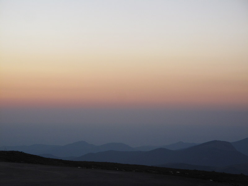
After horrendous Friday night traffic on I-70 (highway closure between Eisenhower tunnel and Silverthorne due to an accident) nixed my plans to do the Bells traverse this weekend, I made a few last minute calls and found some willing participants for Tour d'Abyss on Sunday. Weather forecast called for a blue bird day, perfect for a long ridge scramble.
We reached the pullout spot at 13,300 feet on the Evans highway just before 6am, and was hiking by 6.15am. A faint trail starts right from the pullout. We believed that the "proper" or the easiest gully was starting from the lowest point in the saddle, but the first one we saw looked doable, so we dropped in.
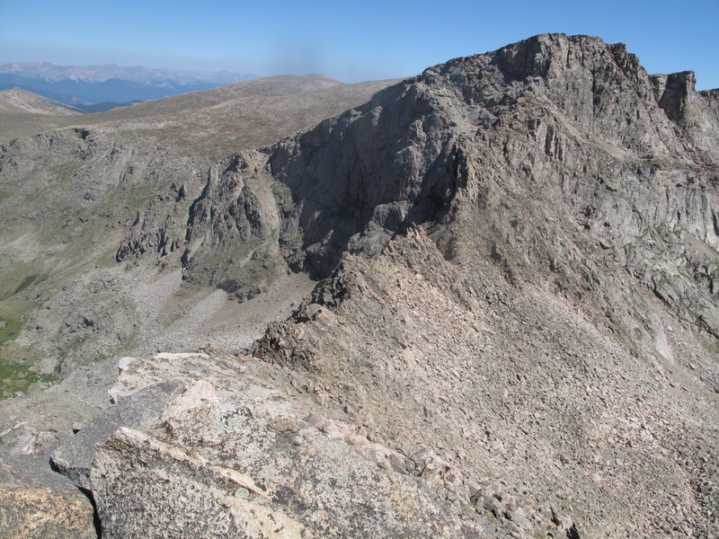
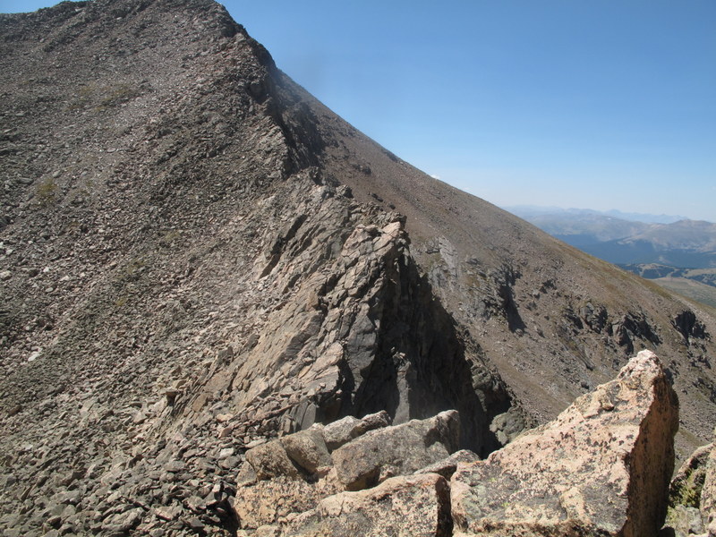
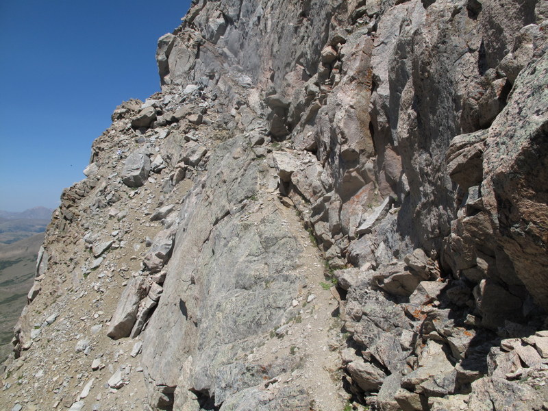
The gully
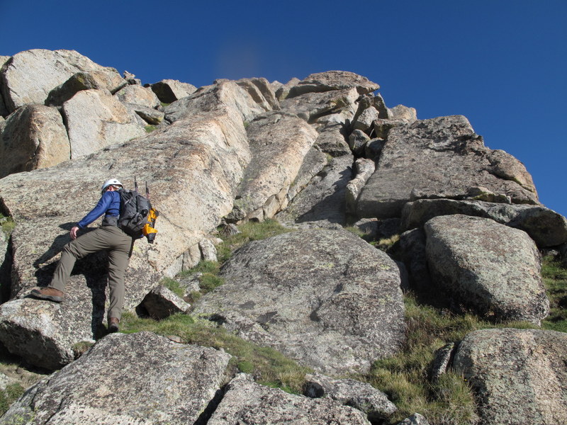
After descending about 1,000 feet and crossing the valley floor, our next goal was to ascend the East ridge of Bierstadt. I angled a bit left to gain the ridge as early as possible and reached the ridge around 12,900, but the initial "difficulties" of the East Ridge have appeared to have ended hundreds of feets below. I was not too discouraged - we still had over a mile and 1,000 feet to go to the Bierstadt summit. We started navigating the ridge by following the 14ers.com route description. The crux came too quickly and was over too soon.
Gaining the East Ridge
Point 13,120 of East Ridge
Scrambling begins
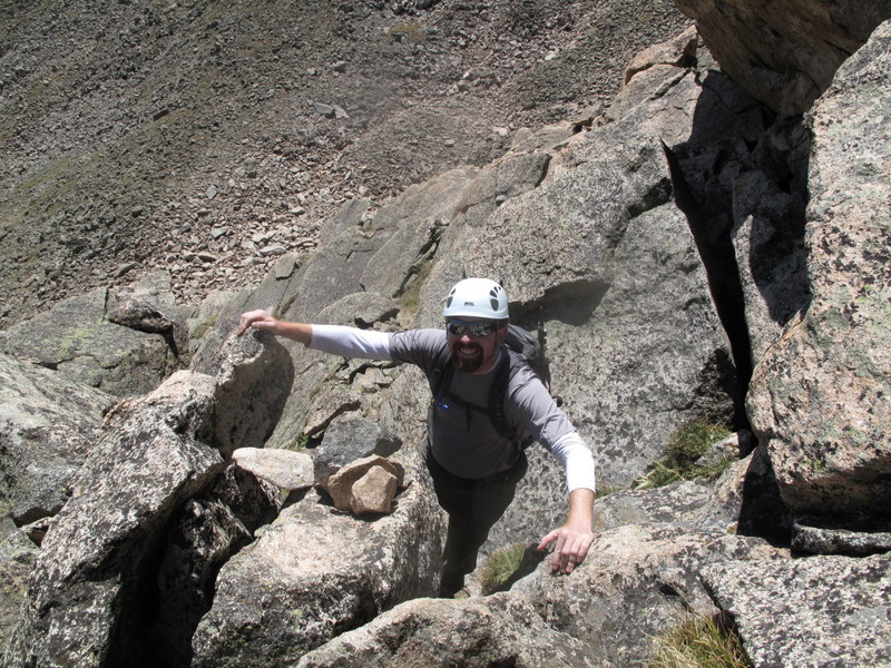
Greg
me
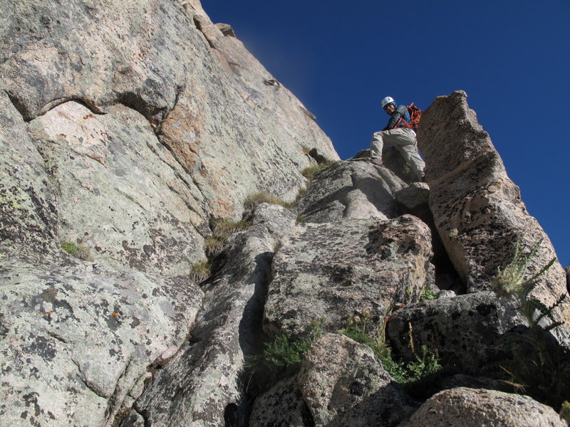
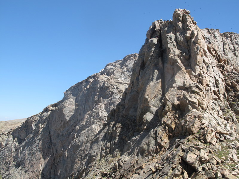
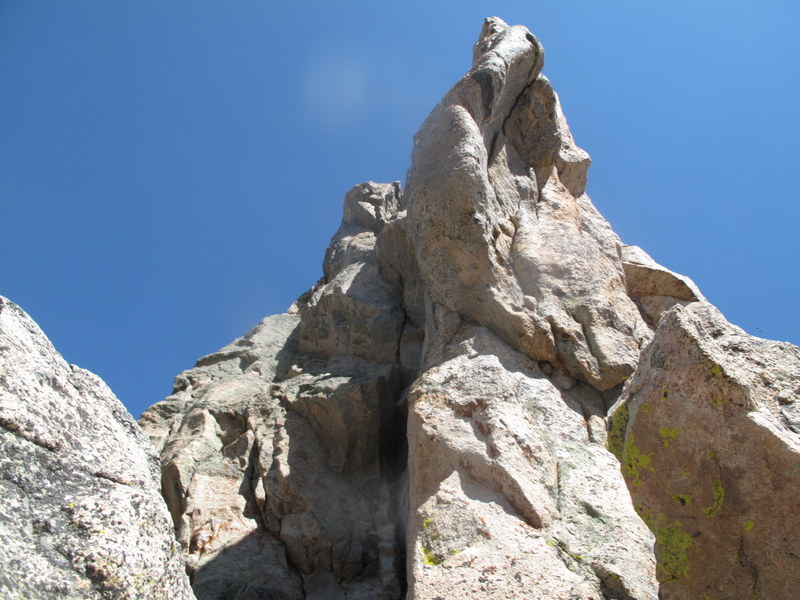
Crux ahead (Pt 13,641)
Mike Malick in the crux
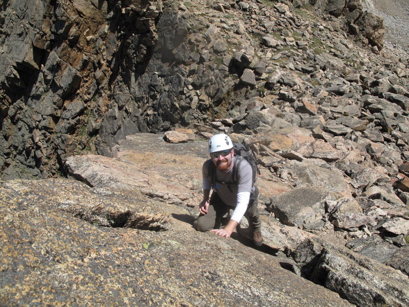
Greg is pleased with himself after a few Class 5 moves (completely optional)
Scrambling continues, but it is not sustained
After that, our goal became to maximize every possible scrambling opportunity and we tackled every ridge bump heads-on. The found the ridge rick to be very solid, with great holds. Although certainly fun, we did not think the East Ridge lived up to its reputation - and with only 2 spires to navigate, the scrambling was short lived. In addition, we were pounded by strong winds all morning. Bierstadt summit provided a fodder for some amusing conversations - "hey, look at those, they have helmets on", and "I'd like to do the Sawtooth, but it is too dangerous", but no relief for wind, so we continued.
Our next objective
Staying high
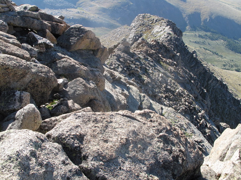
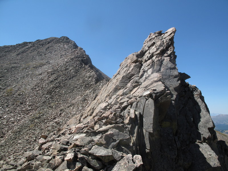
Warmed up on the East Ridge and hungry for more scrambling, we decided to make the Sawtooth a bit more fun (the standard, cairned route looked too mellow for our mood). Staying as high on the ridge as possible and tackling every impossible-looking spire heads-on became our new goal. It sure took longer than expected, but proved to be a lot of fun. The rock was beautiful, solid, with great holds, exposure to the left exhilarating, and even the winds managed to die down. After nearly 2 hours of sustained Class 3-4 (with a few low Class 5 moves thrown in) scrambling, we were sorry to see the ridge end. What a great line and we did not see anybody in the vicinity.
Navigating the spires
More challenges ahead
Greg on some typical terrain
Spire in rearview mirror
Same spire
Staying high
Next challenge
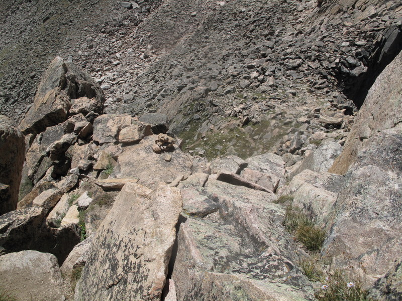
Looking down
Greg looks like he is having a ball
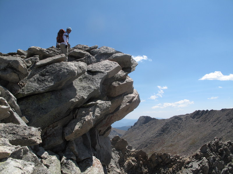
Aww, Sawtooth is over. The ramp is ahead. Wait, can we climb those walls too?
While exiting to the ramp, we thought the upcoming scree & dirt patch was going to be too unpleasant and looked for an alternative. An impossible-looking ar�te seemed to have a flattish top that might be walkable - and sure enough, it was! Then it was time to bag the unranked 13er, the Sawtooth, which I walked by a few times before.
Figuring the way to get to the "high" ramp. Main route/ramp below.
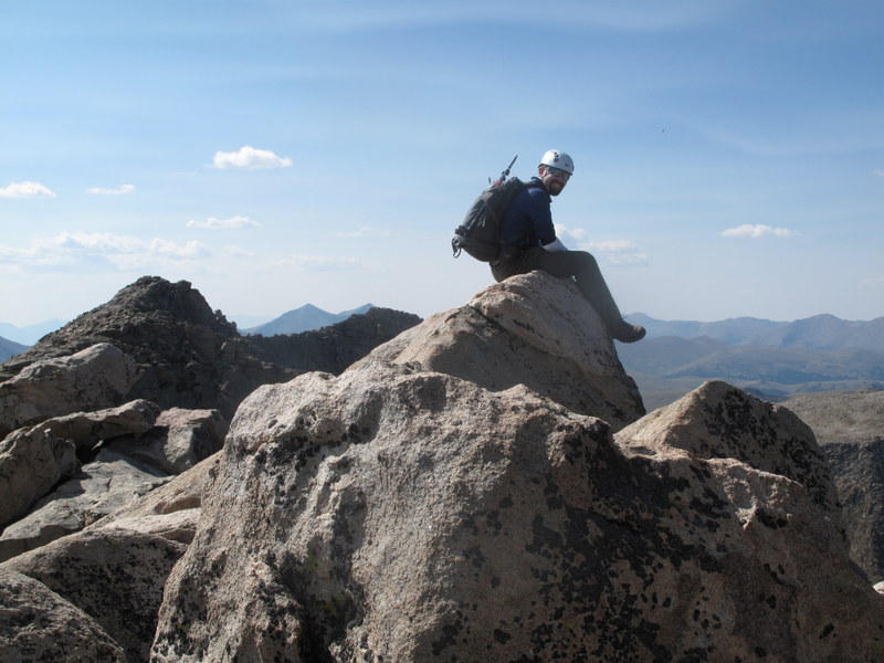
Mike Malick on the Sawtooth, the centennial 13er.
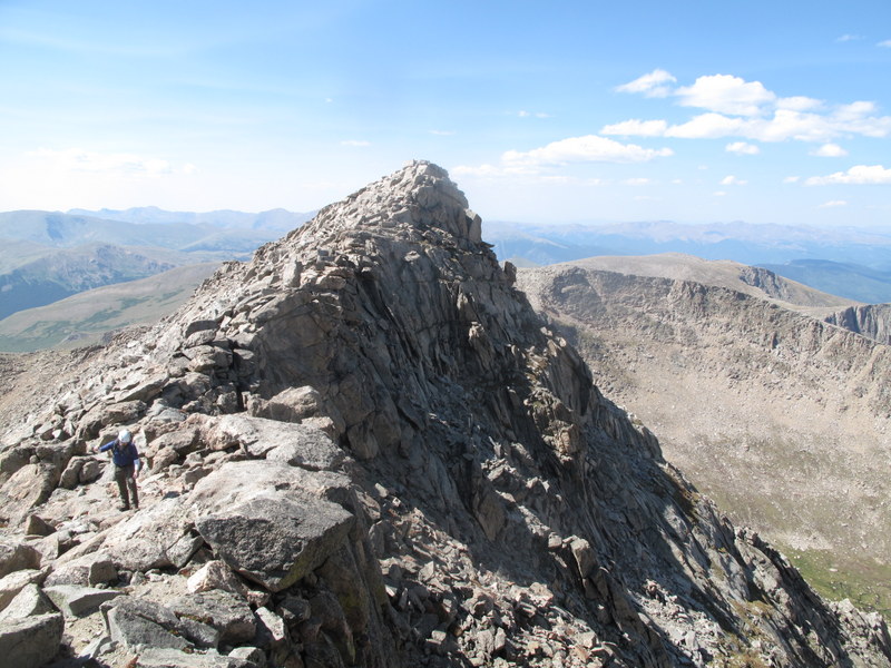
Having done the "standard" Evans route from the Spaulding saddle twice before, I was not looking forward to a mile-long Class 2 slog, so I convinced my partners to take the "haute" route again. We gained the West ridge of Evans as early as we could and the scrambling continued.
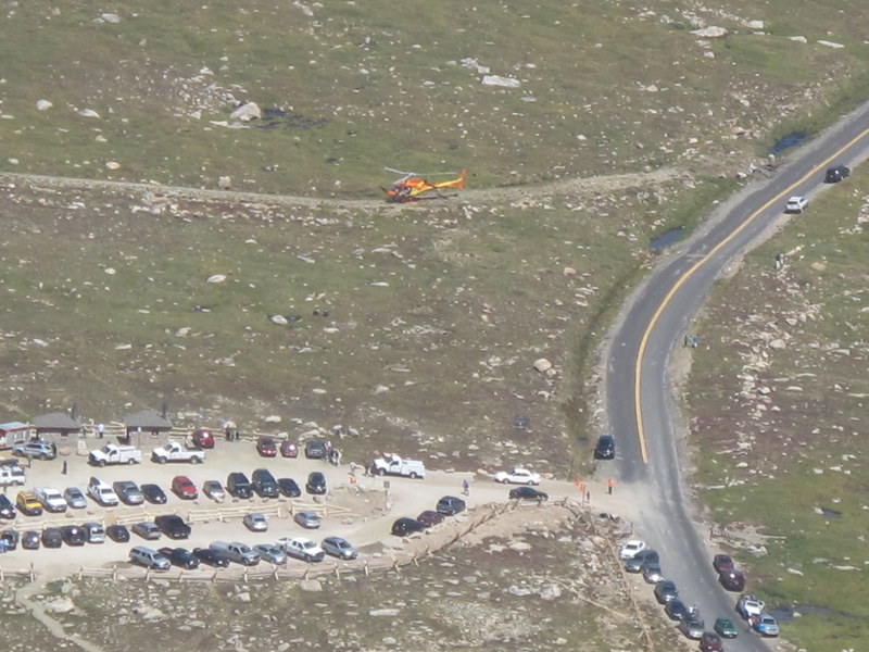
We could see waves of people descending Evans (it was getting late in the day), but again, did not see anybody on our route. Several parties have done the Sawtooth, but were not sure how to get back to Guanella pass without reclimbing Bierstadt. So Greg put on his good Samaritan hat, pulled out the maps and explained how to avoid the willows - hikers were in gym shoes! This happened several times in a row, so it slowed our progress quite a bit. We also spent time watching the maneuvers of a helicopter at the Summit Lake parking lot (it happened to be this story).
Rescue helicopter near the Summit lake
West ridge of Evans. Greg is catching up after explaining to a party how to get back to Guanella pass TH
Greg is demonstrating that some of the rocks are indeed wobbly
West Evans
Greg will do fine on the Knife edge
Remaining scramble to the Evans summit
Later we entertained the assembled crowd on the Evans by refusing to walk the "ramp" and scaling the last remaining boulders to reach the summit. By then, I was quite beat. Thankfully, the car was parked just some mere 0.5 miles (as the crow flies) and only a short talus and tundra walk away.
Almost back at the car
We highly recommend the route - it is a great testing piece for harder routes and I particularly enjoyed the options to dial the difficulty up or down throughout the day depending on the mood and energy levels.
My GPS Tracks on Google Maps (made from a .GPX file upload):
Nice report on a great route. I will have to go back and do this some day. The out-of-shape tourists on the Mt. Evans summit sure are a unique experience, huh? I'll have to try the ”tour” next time I am in the area.
Definitely a good route to do, lots of good class 3, with some nice class 4 variations thrown in (definitely not up to doing class 5 unroped, whatever Natalie may say). Takes longer just because you're going up and over stuff so much of the time.
my Garmin file shows exactly 6 mile RT with 3,170 ft elevation gain.
So the grade was too soft for you, huh, Greg?
Caution: The information contained in this report may not be accurate and should not be the only resource used in preparation for your climb. Failure to have the necessary experience, physical conditioning, supplies or equipment can result in injury or death. 14ers.com and the author(s) of this report provide no warranties, either express or implied, that the information provided is accurate or reliable. By using the information provided, you agree to indemnify and hold harmless 14ers.com and the report author(s) with respect to any claims and demands against them, including any attorney fees and expenses. Please read the 14ers.com Safety and Disclaimer pages for more information.
Please respect private property: 14ers.com supports the rights of private landowners to determine how and by whom their land will be used. In Colorado, it is your responsibility to determine if land is private and to obtain the appropriate permission before entering the property.