Download Agreement, Release, and Acknowledgement of Risk:
You (the person requesting this file download) fully understand mountain climbing ("Activity") involves risks and dangers of serious bodily injury, including permanent disability, paralysis, and death ("Risks") and you fully accept and assume all such risks and all responsibility for losses, costs, and damages you incur as a result of your participation in this Activity.
You acknowledge that information in the file you have chosen to download may not be accurate and may contain errors. You agree to assume all risks when using this information and agree to release and discharge 14ers.com, 14ers Inc. and the author(s) of such information (collectively, the "Released Parties").
You hereby discharge the Released Parties from all damages, actions, claims and liabilities of any nature, specifically including, but not limited to, damages, actions, claims and liabilities arising from or related to the negligence of the Released Parties. You further agree to indemnify, hold harmless and defend 14ers.com, 14ers Inc. and each of the other Released Parties from and against any loss, damage, liability and expense, including costs and attorney fees, incurred by 14ers.com, 14ers Inc. or any of the other Released Parties as a result of you using information provided on the 14ers.com or 14ers Inc. websites.
You have read this agreement, fully understand its terms and intend it to be a complete and unconditional release of all liability to the greatest extent allowed by law and agree that if any portion of this agreement is held to be invalid the balance, notwithstanding, shall continue in full force and effect.
By clicking "OK" you agree to these terms. If you DO NOT agree, click "Cancel"...
$999 Savings or Mt. Sneffels winter attempt on skis
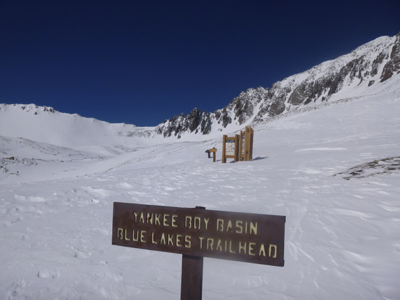
Route: Standard from Yankee Boy Basin
Distance: ~14 miles (from the winter road closure @9,200 feet)
Elevation gain: ~4,500 feet
Time: ~ 9.5 hours (6.5 hours up, 3 hours down)
Mode of transportation: ski
Party: solo
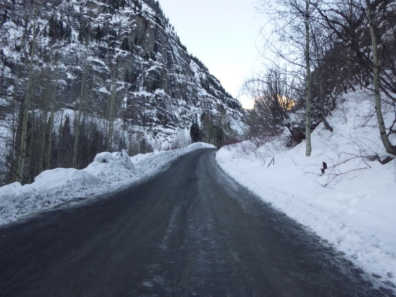
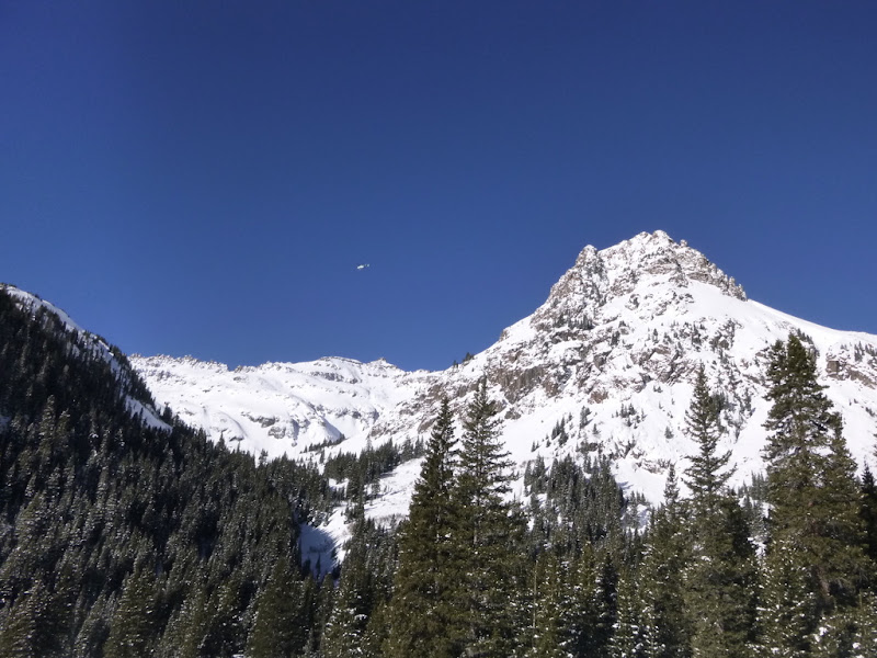
Not willing to squander a perfectly hikable bluebird day on sitting in an ice box of Ouray Ice park (in pink font specifically for SurfnTurf), I decided to take a stroll in the direction of Mt. Sneffels on Saturday. Coming on the heels of two days of backcountry touring in the vicinity of Red Mountain pass, and solidly hooked on skiing by now, the decision was to ditch snowshoes and try to get as far as I can on skis. Lacking partners, and not anticipating to make the summit, I took an ice ax and whippet as an afterthought (I am not getting on any steep terrain today, am I?) and started from the winter road closure at 7.30am (yup, late). Another major reason for the late start was to see the avalanche conditions in broad daylight (although, admittedly, I expected to hike the road in the first couple of miles and would not need daylight for that). The earlier start would have been better for no other reason but to escape the questions of mine workers and ice climbers, such as: "How far are you going with those skis?".
Off I go
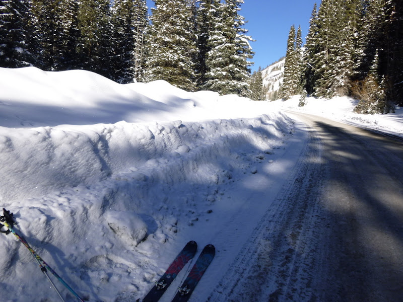
Hiking the road with skis
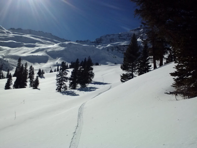
In the next couple of miles I am beginning to question my wisdom for choosing such a long approach before a skinnable terrain. About a couple of miles in, the snow on the road finally materializes, and I take the earliest opportunity to start skinning the shoulder.
Passing the mine at mile marker 3. The road becomes legitimately skinnable.
Dancesatmoonrise would do well here on his bike
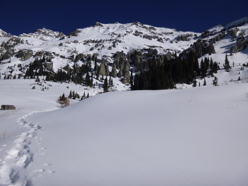
Soon, the showshoe track miraculously appears (made a couple of days prior by Mad Mike and Dani), which I work to turn into a skin track
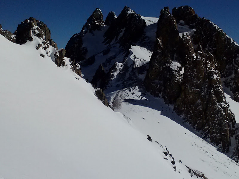
The first sign of instability, albeit it looks pretty mellow.
The peace and quiet in the basin is suddenly disrupted by a helicopter. First, I hear several loud blasts on the western side of the basin, fully expecting to see an avalanche come crashing down shortly thereafter. I am guessing that the Telluride ski patrol is doing their avy work (although I am a bit puzzled why they are doing it on the other side of the ridge - but what would I know). The helicopter keeps circling around and at some point goes directly over my head, very likely noticing my presence in the basin. "Maybe they are trying to warn me of dangers of the solo travel?", I think, but at this point, I am not doing anything particularly dangerous, just skinning up the road and minding my own business.
The helicopter keeps circling around, while I continue.
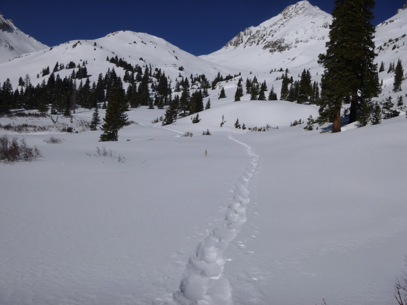
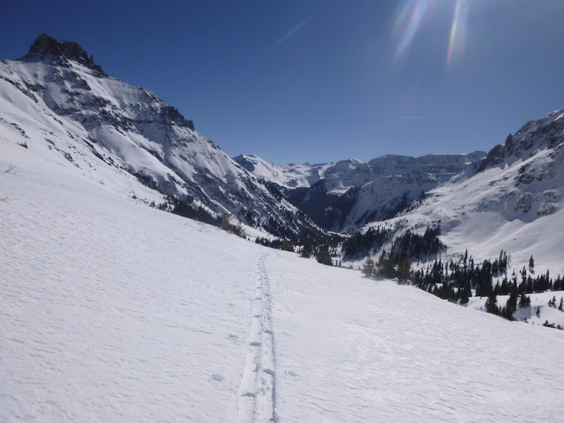
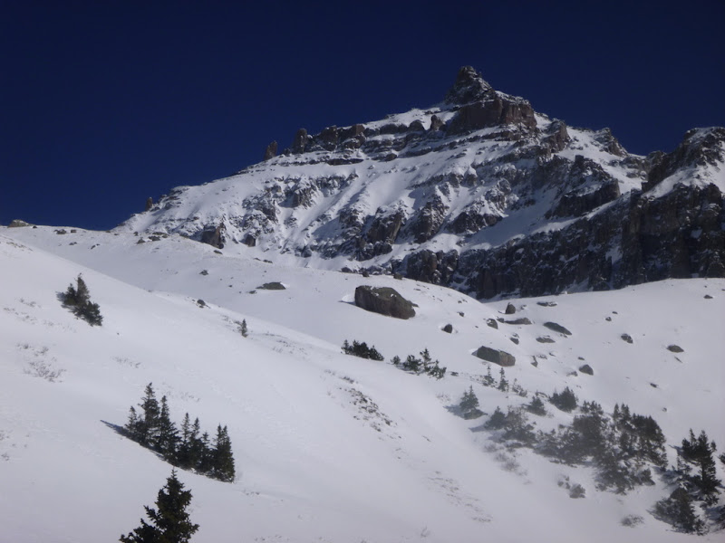
Finally the terrain starts opening up.
My observations continue and I notice a small avy slide on the western aspect, likely caused by warm temperatures.
Lo and behold, I am making pretty good time and find the summer TH within the striking distance just around 10am or so. The thought of the possibility of a summit bid creeps into my head for the first time that day. I press on.
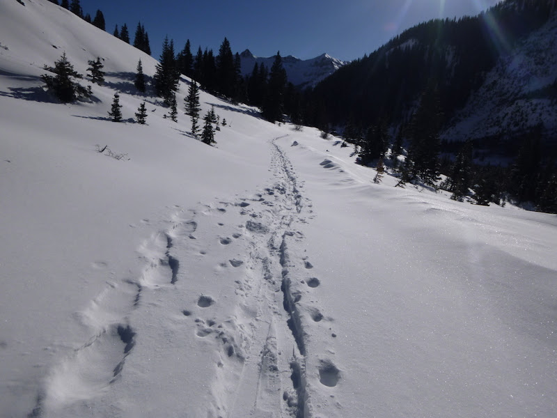
Up to this point, I am following the snowshoe track, which is starting to veer off to the right of the summer route, but I agree with its general direction, so I proceed.
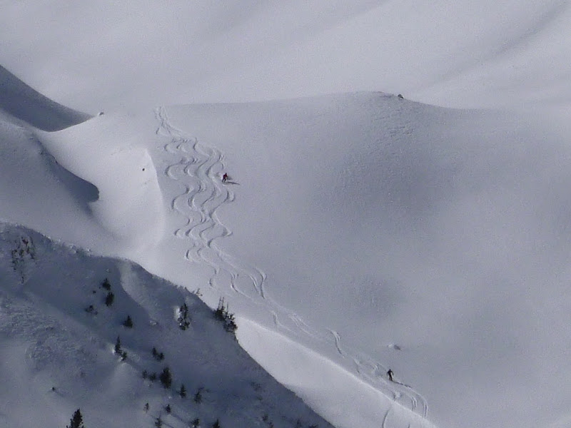
The helicopter's loud noise, however, continues, and looking across the basin at Mt. Emma, I notice the peculiar thing:
The close-up:
The next group is getting ready to launch:
The landing zone:
What I thought was the Telluride ski resort avy control operation, turns out to be the heli-skiing operation. For a second, I got jealous, until I remembered the cost - $999 per person per day (Silverton Mtn prices, which possibly could be higher at Telluride). Wait a minute, I am pretty much doing the same thing - hiking and skiing in the adjacent basin, only for free. The discovery lifts up my spirits, as it turns out I am not the only crazy person who decided to ski in this beautiful basin on a gorgeous blue bird day. Oh, and if anybody recognizes themselves in the photos and would like a full-resolution one, I will gladly accept a donation, which hopefully would cover a portion of my own heli trip.
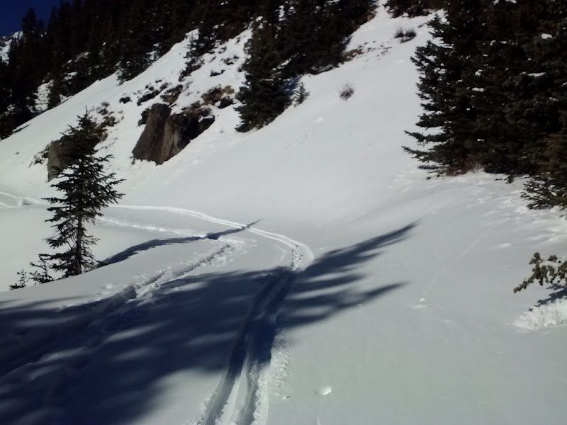
Skin track
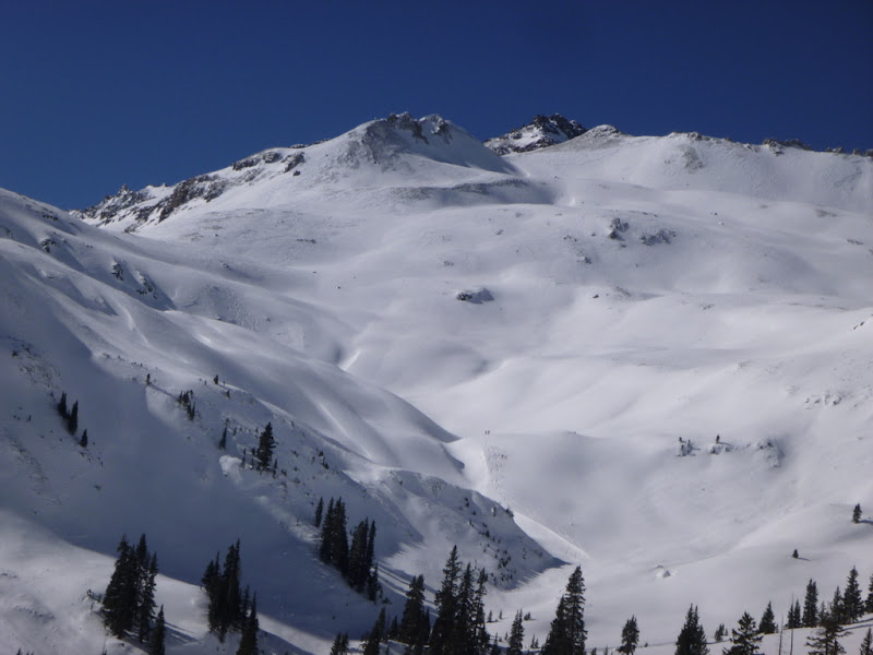
Right around 12K feet, the terrain starts to get more complicated, but still, most of the avy slopes are avoidable. Forget the summit, I anticipate some great skiing later in the day, as the snow coverage looks great.
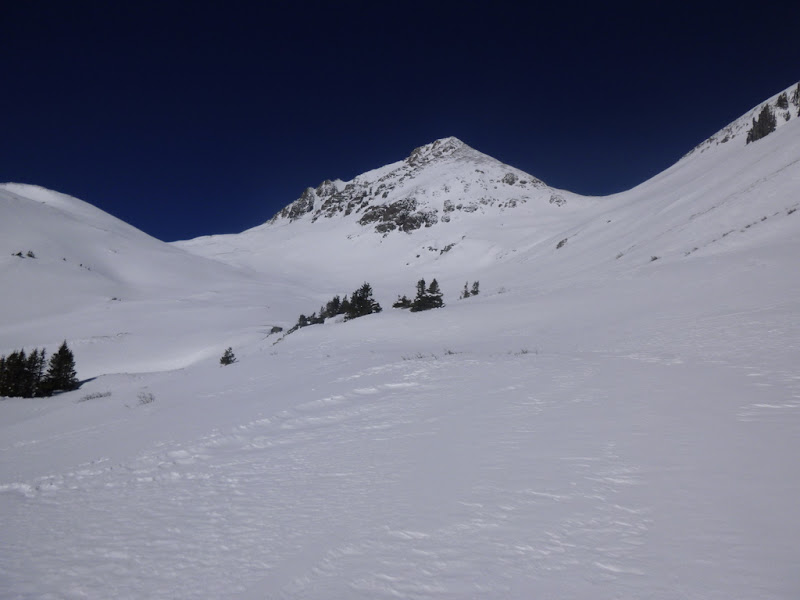
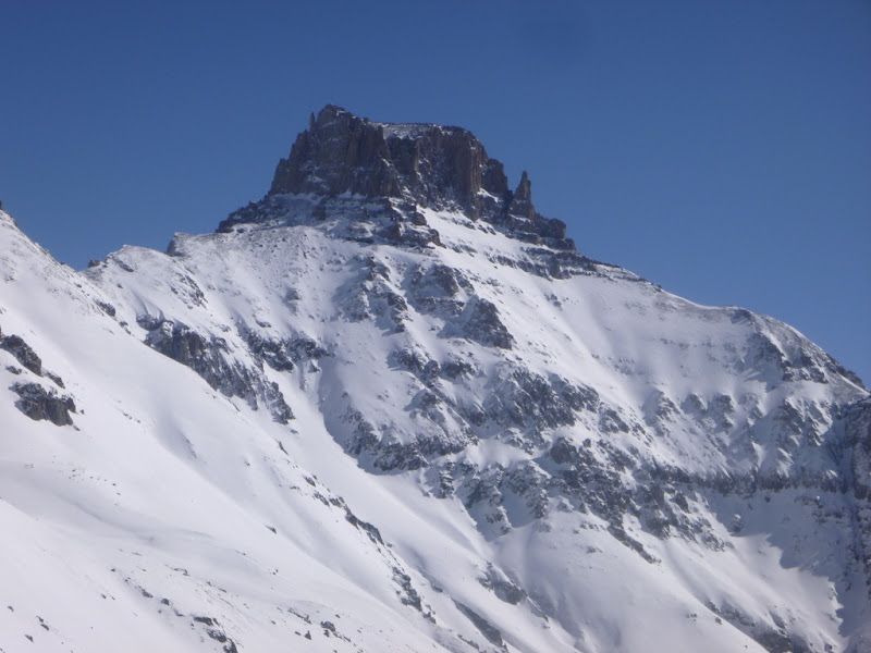
Teakettle
Potosi
Slowly but surely, I reach the upper summer TH
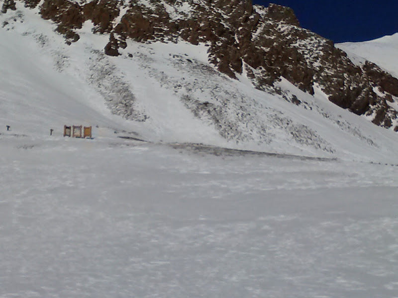
and am greeted by another sign of instability - an avy debris on the Blue Lakes pass - which dashes my hopes of climbing up and skiing the pass, since it would be the same aspect.
Another look at the same slide from up higher.
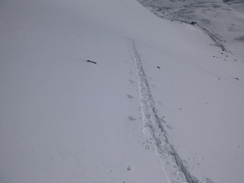
Skinning is starting to take its toll and my pace slows down (the prior snowshoe track is long gone, fully obliterated by the wind).
Not ready to ditch the skis yet, I decide to take the standard summer route. The slope meter shows the 20-25 degree angle, which I am comfortable with, but I concede that the slope is likely to get steeper up higher. I am concerned that taking the SW ridge route would be time consuming as I anticipate some route finding issues.
I ate some "gu" and start making my way up. The snow looks stable and supportive so far.
Kickturns are starting to pile up
I counted about 26 of them
The views are unfolding (Gilpin Peak)
Lizard Head, Wilsons group, Dallas
Nearing the saddle at 13,600 feet
Up to this point, the snow felt very supportive, but the last kickturn unexpectedly resulted in some (minor) cracks and exposed some layers. I stopped to evaluate the situation. The slope was approaching 35 degrees, it was getting late in the day, the last 600 feet took 3X longer than expected, and the Lavender couloir and the summit ridge were still ahead. I was roughly at 13,560 feet, and although the summit did not seem to be that far, I estimated that at my current pace, I might get there by 4pm, which would most likely mean skiing out of the basin in the dark and on crusty snow. Suddenly, the summit fever was gone. I checked my phone - there was a text from Surf that they are done ice climbing (already!?!) and will be heading out for beers soon. The idea of soaking in Ouray hot springs and having dinner with friends started to sound like a much better alternative than fighting tooth and nail for another winter summit so late in the day and in questionable snow conditions. The decision to turn around came easy. Besides, I was getting excited about skiing. I quickly made a transition to a ski mode and picked the line that looked reasonable.
Making a transition to a ski mode while dangling off a rock.
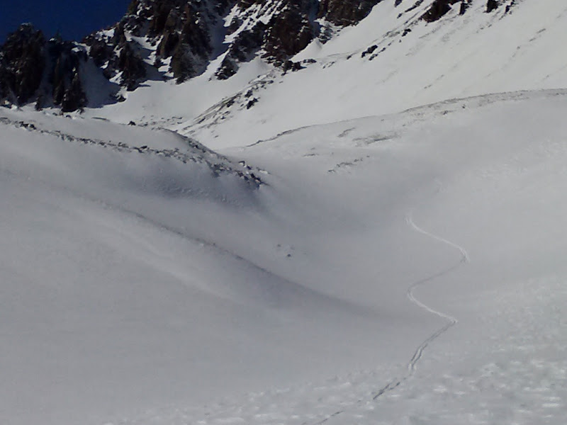
The skiing actually turned out to be quite good. (The camera battery died, so the rest of the photos are taken by the phone camera).
Happy to be down safely
Soon came another decision point - do I ski/hike to the register and sign out or do I folow a nice skiable line?
The skier in me easily won over hiker.
Closely sticking to the summer route on the way out.
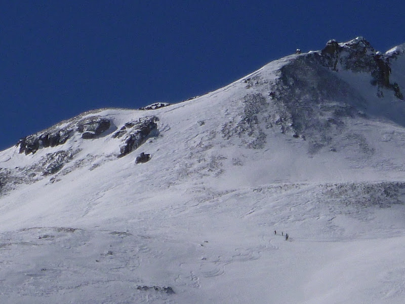
Next, I decided to check on my heli skiing "neighbors" as the helicopter noises in the basin had subsided some time ago, and spotted another peculiar view.
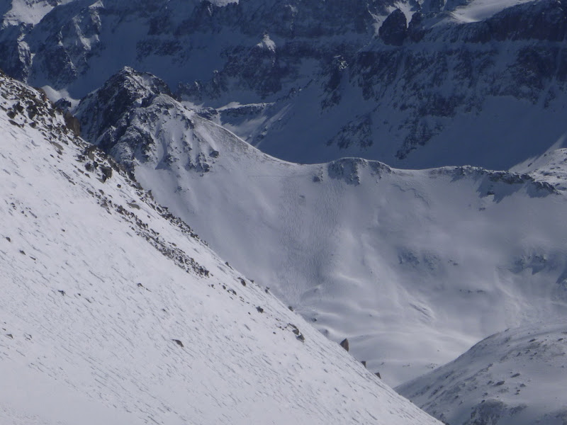
Apparently, they decided to ski the slope immediately next to what seems to be the crown of an old avy. I guess the guides felt pretty confident about the conditions there.
Another look at the terrain they skied (Stony Mountain)
Skiing out of the basin
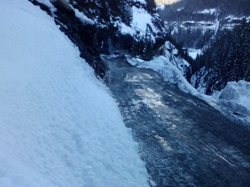
Reaching the end of the skiable terrain. Just over a mile of road hiking remains.
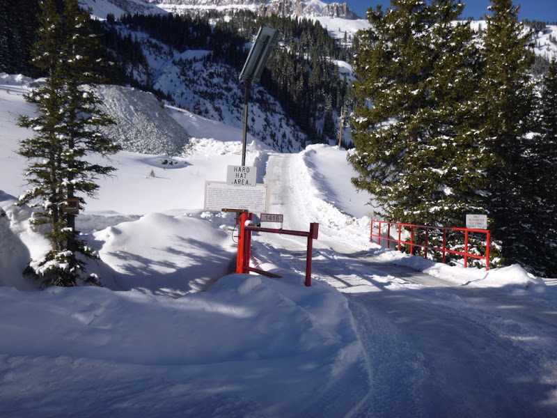
The winter closure gate that was locked in the morning was open...
My GPS Tracks on Google Maps (made from a .GPX file upload):
That basin is breathtaking in the summer, but in the winter...wow. Let me know when you want to go back for the summit. I'll be ready within 20 minutes. Nice solo effort!
Yes, I hope to ride that road before March 20. Looks like 3 miles to the mine, and then maybe another mile might be rideable after that?
The decision for sticks vs. wheels is tough, given the easily skiable terrain above, but hauling the skis over dirt tips the scales, especially if it's more than 3 miles of rideable terrain.
Thanks for the photos; they are a nice addition to Mike's report.
You and Surf are welcome to join me if you'd like to go back and wear that Sneffels snowflake patch on your front forks.
and awesome turns!!! Summit or not, looks like an amazing ski day. I'm a little surprised at the route selection of the Telluride heli guys...seems like some pretty risky terrain they were on given the current state of the snowpack...although it probably looks steeper than it actually is. In the 5th to last photo you can see where one of the guides threw a bomb before they skied it...though in my opinion they should've thrown at least 2-3 more in that general area. Maybe they ski these lines with their clients frequently after every storm, in which case it would've been more skier compacted and therefore more stable? Just my guess. I like your ski-for-free approach much better as well!
That same day Steve and I were 25 miles south enjoying a mis-guided adventure in NW basin below Vermillion Peak (a few miles west of Lizard Head Pass). There were ski and board tracks everywhere, but no people and certainly no one would have skinned up that slope 10 times in a day. I speculated heli-skiing, but we saw no heli...I guess they were there the day before.
@Jeff - to go back for Sneffels? Yankee Boy Basin? Anytime, really. It is really amazing out there.
@Jim - only about 0.1 or 0.2 miles of the road is rideable after the mine. The decision about wheels vs. sticks is not that tough, really. Sticks provide the most elegant entry into/exit from the basin, but generally yield no summits on long(ish) routes (at least for me ) as even the lightest sticks are damn heavy. The trade-off is worth to me though as skiing is so much fun. Those ugly bear traps (or whatever you call them showshoes) actually do the summit job, but provide no style points and no enjoyment of the way down. We need to do what Mike and Dani did - get as close to the summer TH as possible. Maybe we'll have to charm some mining workers - whatever it takes to get a winter snowflake, right?
@Sarah - thanks a lot. Those turns mean a lot to me, since I haven't been much of a skier until moving to Colorado some 3 years ago. I had never understood the concept of ”enjoying the hike without the summit”, well, not until I started skiing Now it is like ”to hell with the summit as long as I got my turns in”. It was a spectacular day to get some touring in the backcountry. No regrets whatsoever.
I checked the Mt. Emma runs on my slope meter and it looks like they were around 20-25 degrees. Pretty sure Stony Mountain runs were in the same ballpark. I do agree though, I was pretty surprised to see the avy crown in the immediate vicinity of their runs. At least they threw the bomb in first - I did not recognize it until you pointed that out. Fun stuff.
@Shawn - mystery solved on my end too. I saw Steve the night before at a Subway, but didn't get a chance to talk to him. I was wondering where he was climbing that weekend
P.S. Thank you everybody for comments and ”thumbs up” and to Bill M for making the TR writing user-friendly
Caution: The information contained in this report may not be accurate and should not be the only resource used in preparation for your climb. Failure to have the necessary experience, physical conditioning, supplies or equipment can result in injury or death. 14ers.com and the author(s) of this report provide no warranties, either express or implied, that the information provided is accurate or reliable. By using the information provided, you agree to indemnify and hold harmless 14ers.com and the report author(s) with respect to any claims and demands against them, including any attorney fees and expenses. Please read the 14ers.com Safety and Disclaimer pages for more information.
Please respect private property: 14ers.com supports the rights of private landowners to determine how and by whom their land will be used. In Colorado, it is your responsibility to determine if land is private and to obtain the appropriate permission before entering the property.