| Peak(s): |
Quandary Peak - 14,272 feet Mt. Democrat - 14,154 feet Mt. Cameron - 14,248 feet Mt. Lincoln - 14,293 feet Mt. Bross - 14,178 feet |
| Date Posted: | 08/01/2013 |
| Modified: | 11/13/2015 |
| Date Climbed: | 07/26/2013 |
| Author: | Summit Assassin |
| Peak(s): |
Quandary Peak - 14,272 feet Mt. Democrat - 14,154 feet Mt. Cameron - 14,248 feet Mt. Lincoln - 14,293 feet Mt. Bross - 14,178 feet |
| Date Posted: | 08/01/2013 |
| Modified: | 11/13/2015 |
| Date Climbed: | 07/26/2013 |
| Author: | Summit Assassin |
| Quandary - West Ridge + DeCaLiBron |
|---|
|
Quandary - West Ridge Friday, July 26th, 2013 Depart Blue Lakes TH: 5:31am Summit: 10:23am Descend: 11:04am Arrive East Ridge TH: 1:05pm Climbing the west ridge was not an easy choice. The up and back east ridge hike had been the plan all along. One day prior to leaving Salida we decided to switch routes, and agreed to start very early due to route finding and the inevitable pausing due to not having appropriate protection (helmets). That being said, climbing Quandary from the west is absolutely exhilirating. Your Class 3 skills will be tested but rest assured, given enough time, you will rise from the west ridge and float the last .1 mile to the summit. Starting from the dam it's a gentle hike up and into the west basin. Here's an important tip. If you have crossed the stream you have gone too far. You can see the trail behind us in this picture:  This mistake ended up adding some unnecessary bushwhacking and route finding to our morning. Our path is highlighted in red below:  Finding our way through the boulders en route to rejoining the trail: 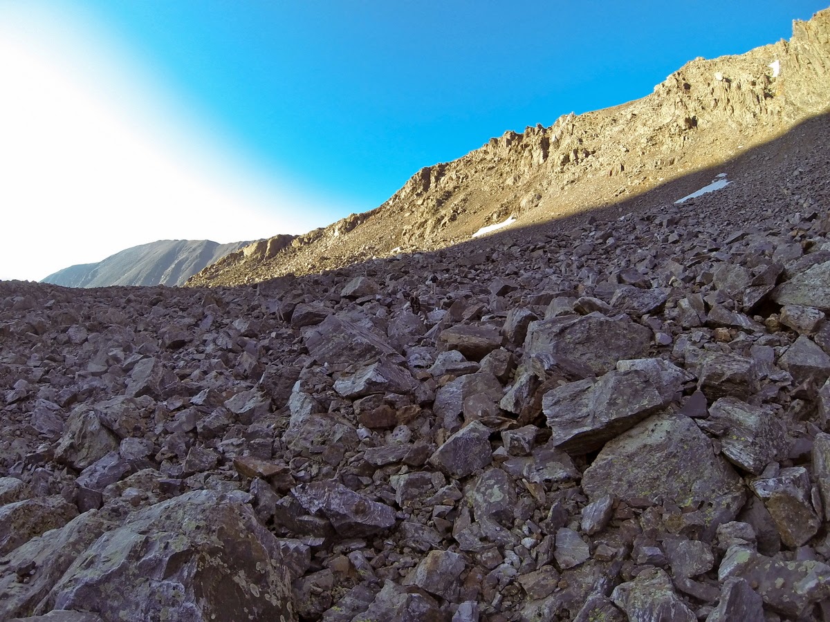 From the small body of water in the upper west basin - one of many route finding discussions:  Our path to regain the west ridge trail (photo courtesy of 14ers.com):  We finally gained the saddle and prepared for the west ridge climb. Our weather window was wide open and we had plenty of food and water. Bill's route description was pulled and reviewed by the group. Route decisions would be made as a team, with areas of exposure and potential rockfall demanding extreme caution. Minus helmets we would send one member forward to a stopping point, then call out to the next member that it was safe to proceed. Even the smallest rock movement would be called out. Safely summiting Quandary was absolutely paramount. From the saddle, with Quandary to the left and the basin to the right: 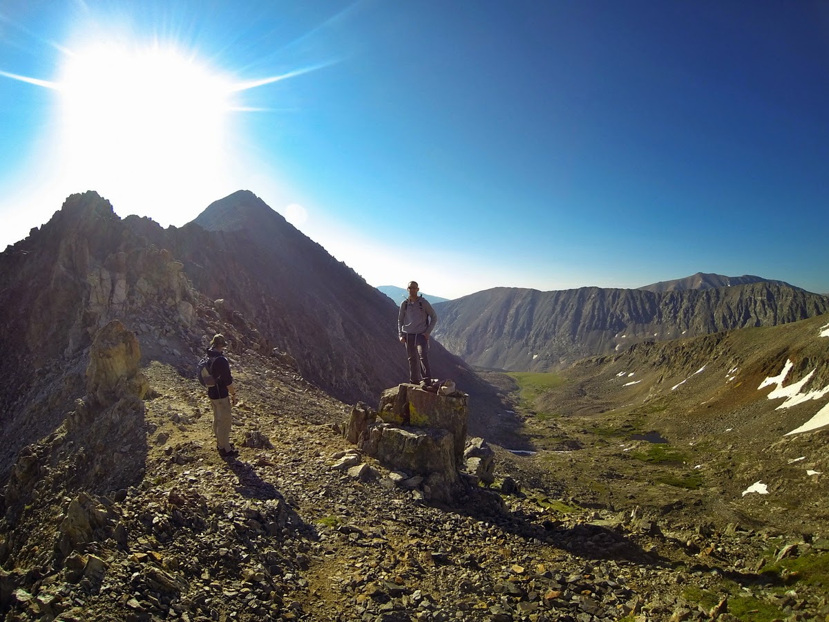 The best advice I can give is to follow Bill's route description. We pulled it multiple times, and at several key junctions it helped guide the way. After about an hour of route finding across the ridge we arrived at the first of what I would consider three crux's, all escalating in exposure and difficulty. The Big Gully (photo courtesy of 14ers.com): 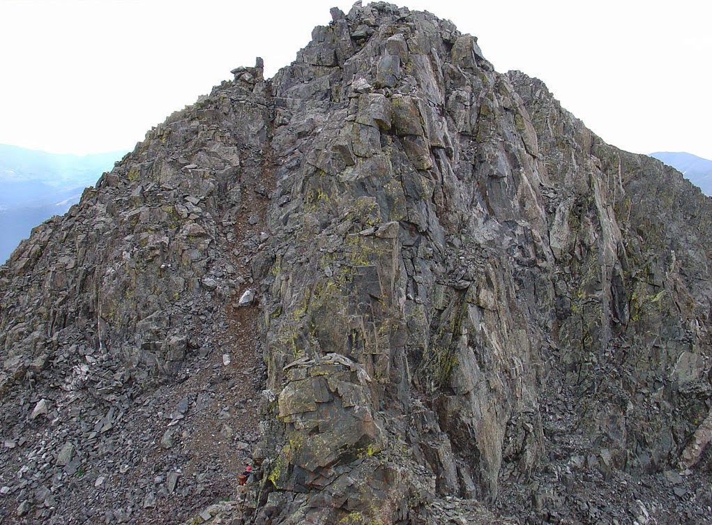 Unbeknownst to most climbers, The Big Gully use to be called The Big Rockfall Factory. Armed with this historic knowledge we sent one member up while the other two stayed a safe distance away. We then repeated that process for the other two members until we were all safely on top. View of The Big Gully from its base: 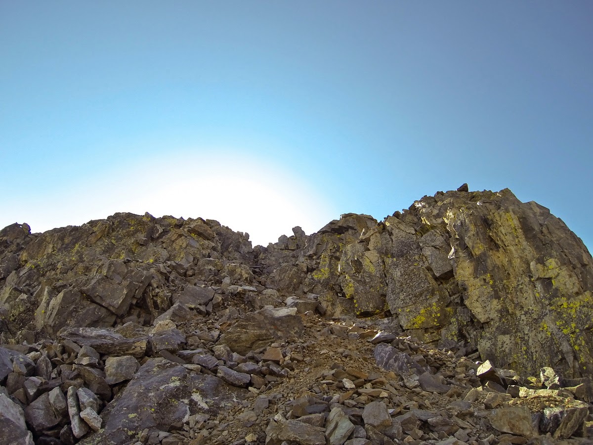 Shortly after conquering The Big Gully we arrived at The Small Crack (photo courtesy of 14ers.com):  We had the best luck working The Small Crack from right to left, once again going one-by-one to maintain a safe approach. View from the top of The Small Crack (photo courtesy of 14ers.com):  The Giant Wall, easily the most complex aspect of the entire climb, awaits you not long after defeating The Small Crack. After dropping below The Giant Wall (and crossing a very exposed gully), you make your way up the first crack. Then, working right to left, you climb a natural set of rock stairs (excellent hand holds here). Once you arrive in the second crack you have two choices. Ascend directly up the crack, or work right to left. Both ascent options have firm hand and foot holds that make it challenging but, given plenty of time and selection, will yield to you the final summit ridge. I chose the path to the left. My quad was cramping and I didn't have the flexibility or range to go straight up the crack (photo courtesy of 14ers.com):  View from the top of The Giant Wall looking down (photo courtesy of 14ers.com):  From the top of The Giant Wall we hiked the rest of the .1 miles to the summit. It was quite shocking. All morning we had been the only ones on the west ridge. Greeting us on the summit was over fifty of our friends, all hiking from the standard east ridge route.  From the summit of Quandary, with the west ridge in the background:  It's at this point when someone loudly asked, "Where did you guys come from?" Later in the hike down the east ridge we passed a couple that had been on the summit when we arrived. I overheard one say to the other, "Those guys came from the other side!" I'd be lying if these remarks didn't fill up my accomplishment meter. It's absolutely rewarding to climb/hike the mountain how you want to do it, without retracing any steps. I'm just happy to of been able to do so safely. Quandary summit selfie:  D preparing for the first ever summer ski descent:  The mass of people continued to grow on the summit. After thirty minutes the crowd had grown to over eighty people + five or six dogs. It was time to go. From the east ridge looking west to the summit: 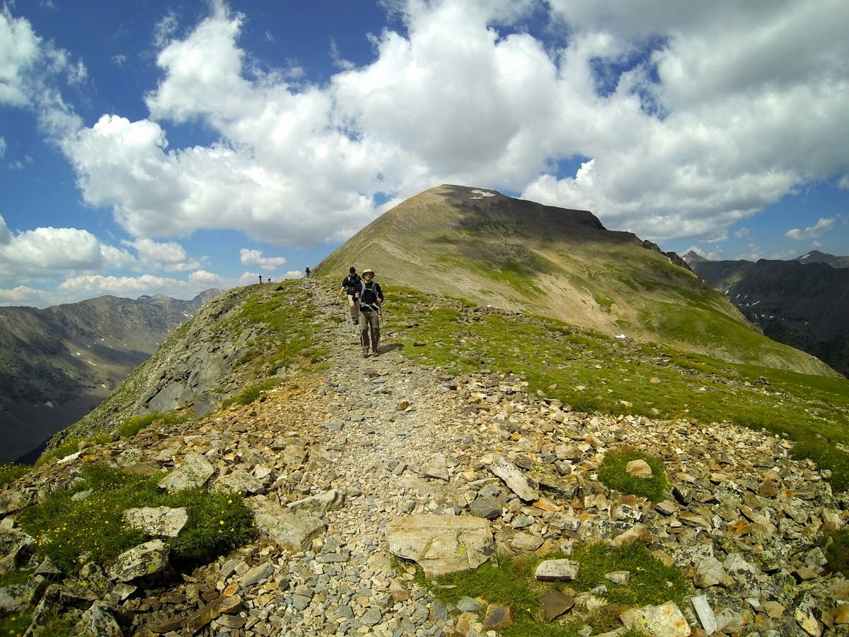 Three mountains goats were taking a break near treeline:  Closer look at the mountain goats:  Quandary was packed. Hiking down the east ridge reminded me of walking through the mall on a Saturday afternoon. Not exactly what I look for when going to the mountains. The experience further cemented my desire to take non-standard routes going forward. After eight hours of hiking the idea of schlepping two miles back to the dam parking lot was not high on our To Do list. Thankfully, a friendly hiker named Mitch drove us up to the truck and dropped us off. After ditching our packs and switching into camping shoes we set off for Kite Lake. The weekend masses were coming and we wanted a campsite close to Kite Lake. Mt. Democrat, Mt. Cameron, Mt. Lincoln, Mt. Bross Saturday, July 27th, 2013 4:30am Depart Kite Lake TH 6:30am Democrat Summit 7:45am Cameron Summit 8:10am Lincoln Summit 9:15am Bross Summit 10:29am Return Kite Lake TH The upper Kite Lake TH was already filling up when we arrived at 2:30pm. We parked, paid the $12 fee, quickly found an excellent campsite, and got to work establishing our area.  Our tent, the REI Kingdom 6, was plenty spacious for the three of us. We received multiple comments about the tent, with my favorite being "what is that thing, the Tent Mahal?" 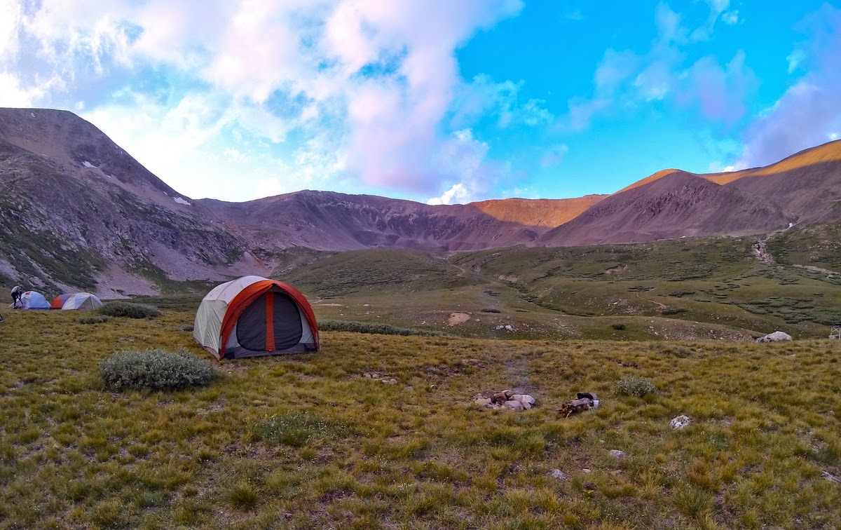 Following setup we rested then went about the business of making dinner. On the menu for the evening was Chili con Turkey followed by Cocoa with Marshmallows and Disaronno. Needless to say, rest came very easy that night. 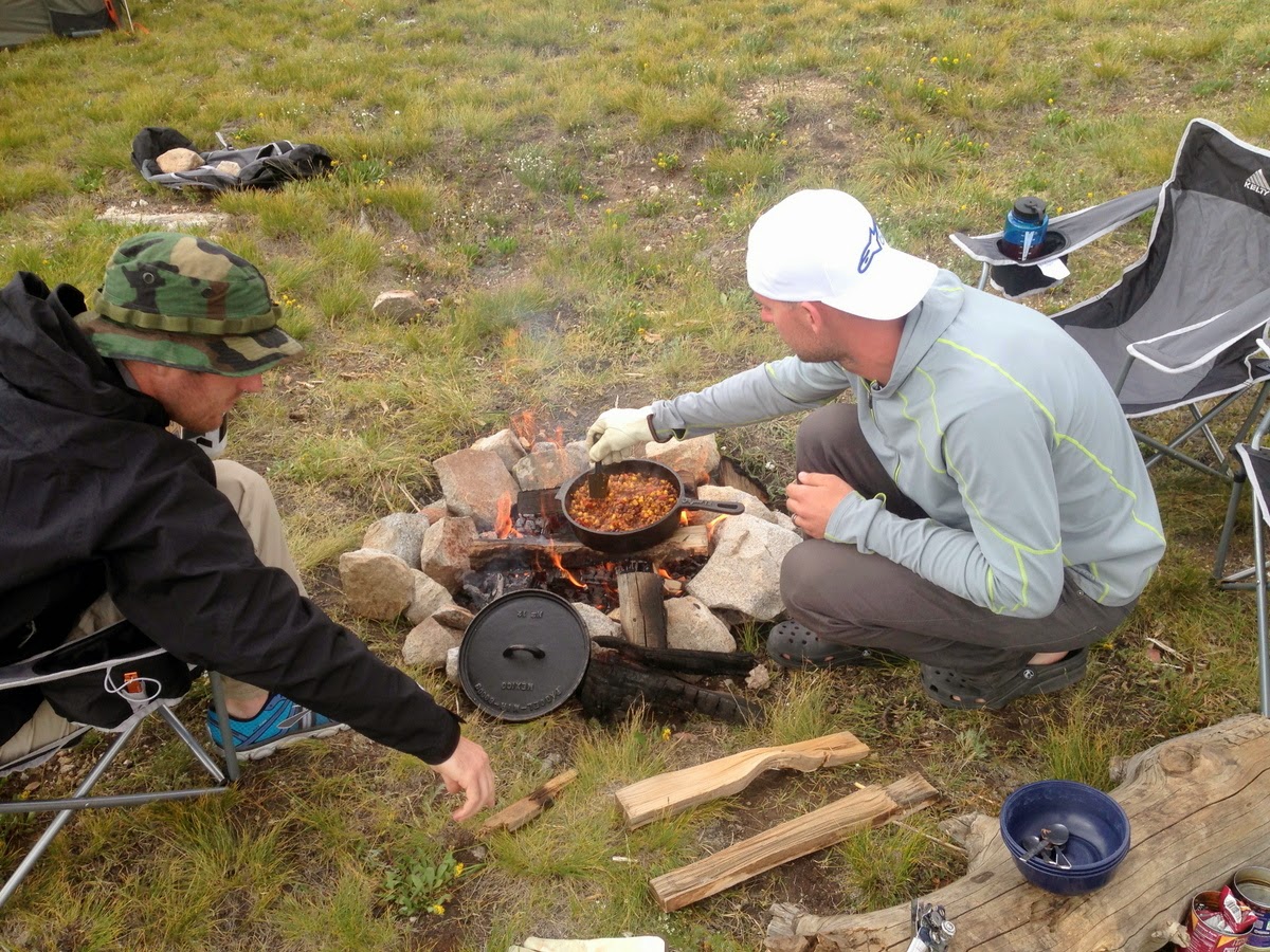  We awoke at 4:00am and were off by 4:30. I figured we would be one of the first up and going, turns out we were nearly tenth. Our goal for the day was to move quickly with short stays on Democrat and Cameron, leaving the longer stay for Lincoln should we feel good. This hike represents a lot of time at or above 13,000'. I've had altitude sickness and was in no mood for a return visit. From the Democrat and Cameron saddle, looking north towards Quandary: 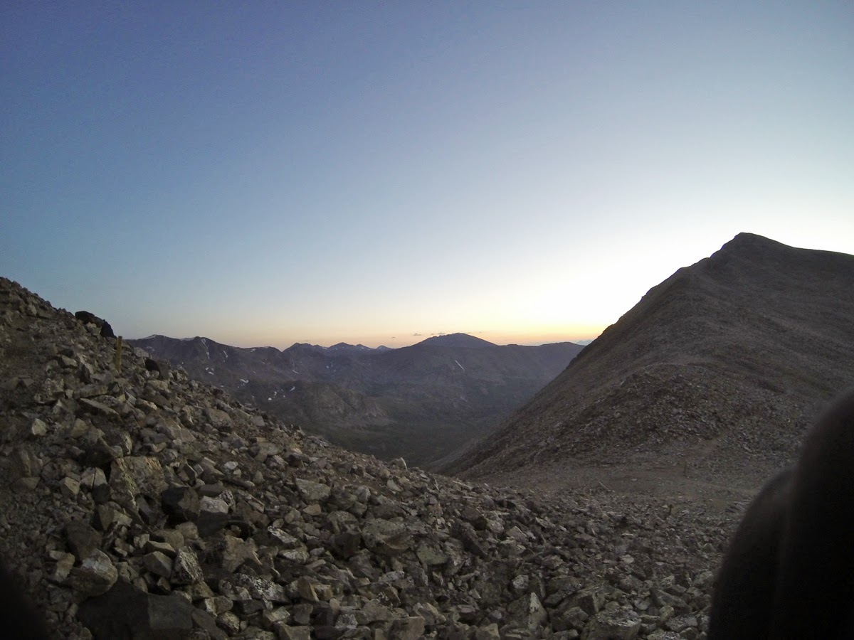 Further up the ridge to Democrat, Quandary in the background with the sun just peaking: 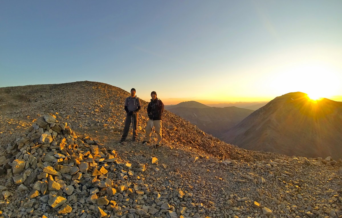 After two hours of hiking we arrived at the summit of Mt. Democrat. Group summit shot: 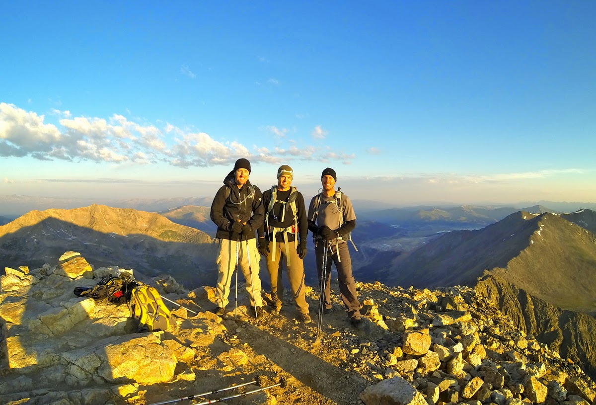 The summit of Democrat held a surprising amount of debris. I picked up this log for my Crossfit DIEM brothers and sisters! 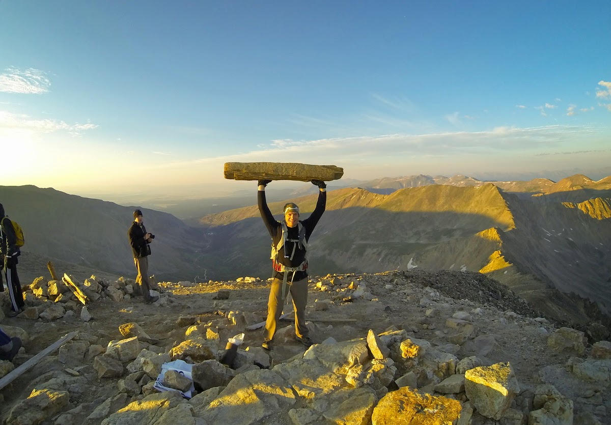 D, prior to his second summer ski descent of the trip:  We stayed on Democrat for less than ten minutes. The return trip to the saddle and up Cameron would be the last remaining significant gain of the day. That, and the line of people coming up Democrat was growing. We wasted no time. Summit of Mt. Cameron:  After pausing on Mt. Cameron for five minutes, we set out for Lincoln. Summit of Mt. Lincoln: 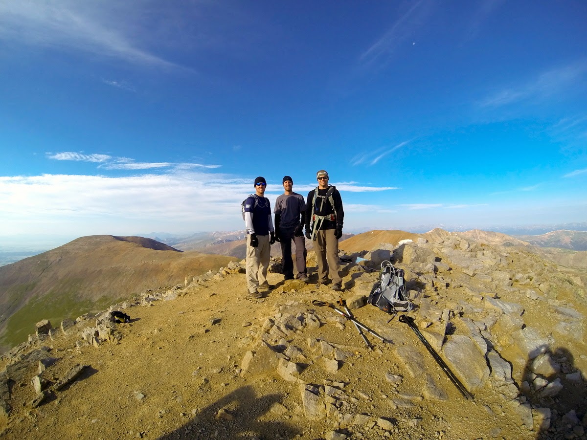 Our previous day's adventure was readily available throughout the hike. I couldn't resist getting a picture with Quandary's West Ridge in the background!  Now that we had reached three of the four peaks, and were very much ahead of schedule and the crowds, we decided to relax and took some time on Lincoln's summit. We shared our whiskey flask with a nice couple. We texted and called loved ones. Of the four peaks that day, Lincoln was easily my favorite. It was more like the Sawatch and San Juan summits that I'm use to. After about thirty minutes, we set off for Bross. From the eastern flanks of Cameron, looking north at Mt. Lincoln:  Same position, looking southeast towards Bross:  The summit of Bross is just as described, huge, flat, and really boring. We stayed long enough to take these pictures and find the route down. Sadly, Bross is not worth much more than that. From the summit of Bross, with Cameron, Lincoln and Quandary in the background:  Bross summit shot, with Democrat, Cameron, Lincoln and Quandary in the background: 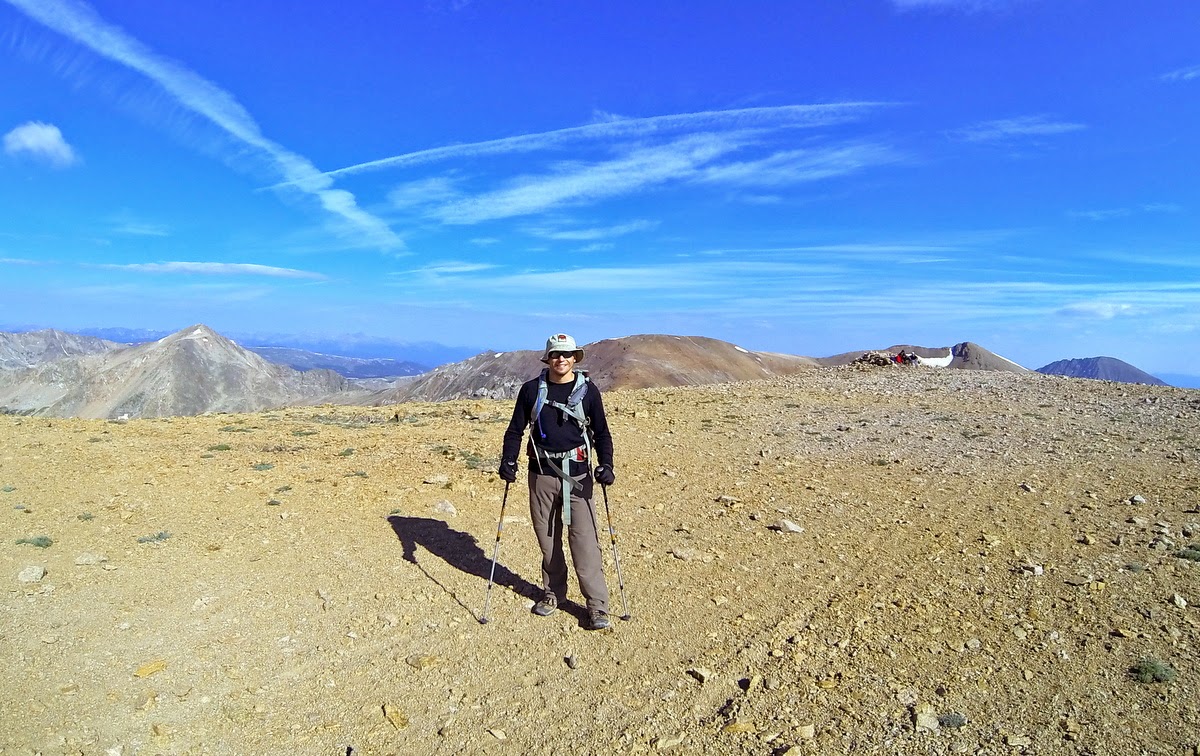 Waterfall nearing the base of the Bross trail and the Kite Lake TH: 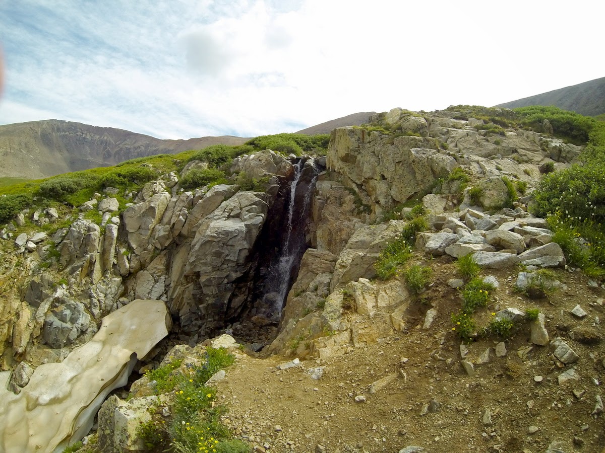 It took us seventy-two minutes to get back to our campsite from the summit of Bross. Speaking of Bross, the trail down (or up it for that matter) was crummy. I wouldn't advise anyone going up that way. The only entertaining aspect was the Kite Lake parking lot. By now over 100 cars had arrived. The road and trail was packed. We quickly broke camp and headed towards Sherman - our goal for day 3. After setting up camp at Horseshoe Campground (excellent site) we experienced periodic rainstorms throughout the evening and early morning. Our start got pushed back from 4am, to 5am, and then 6am. We geared up and set off for the upper trailhead only to realize that hiking Sherman in this weather would be miserable. After checking the weather (70% storms all morning) we agreed to pass on Sherman. It was an excellent trip. We traversed Quandary and retraced only a few steps on DeCaLiBron. We added to our Class 3 skillset and made some friends along the way. I'm eagerly awaiting the next adventure in God's country! |
| Comments or Questions | |||
|---|---|---|---|
|
Caution: The information contained in this report may not be accurate and should not be the only resource used in preparation for your climb. Failure to have the necessary experience, physical conditioning, supplies or equipment can result in injury or death. 14ers.com and the author(s) of this report provide no warranties, either express or implied, that the information provided is accurate or reliable. By using the information provided, you agree to indemnify and hold harmless 14ers.com and the report author(s) with respect to any claims and demands against them, including any attorney fees and expenses. Please read the 14ers.com Safety and Disclaimer pages for more information.


