| Report Type | Full |
| Peak(s) |
Vermilion Peak - 13,909 feet |
| Date Posted | 09/05/2013 |
| Date Climbed | 09/01/2013 |
| Author | geojed |
| A Nickel of Cents in the San Juans - Part 2: Vermilion Peak - From Hope Lake |
|---|
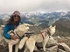
 TH/Route: Hope Lake TH, West Slopes and SE Ridge from Hope Lake, Climbers: Solo. Saw Bez on the summit Distance/Elev: 7.3mi RT w/ 3500' elevation gain Weather: Normal Monsoon conditions, clear in morning storms by afternoon Trip report for Part 1 is here. As I tried to sleep at the Hope Lake TH I kept hearing this scratching and tapping noise beneath my car. I got out several times to see what it was but I couldn't see anything. Finally, one time I got out and listened for a couple minutes and discovered that the noise was coming from the plastic shell on my bumper. So I started banging on it with my hand and out peaks the head of a squirrel! I banged on the bumper a couple more times and he ran away into the night. I got up at 5:30am again in order to beat the afternoon storms and after I had cooked my breakfast and was packing up two huge pickup trucks pulled up to the TH. 4 Guys got out decked out in camouflage gear and holding their compound hunting bows. "Elk hunting?" I inquired "Yep" they replied. I was thinking, "Oh crap, I hope they don't mistake me for an elk and shoot me!" I hadn't even thought about elk season and did not have bright clothing on. Oops! Anyways, I set off from the TH around 6:45AM in order to catch the sunrise on the Wilson Group across the valley. The sunrise did not disappoint in the least.   I cruised up the very nice Hope Lake Trail and began to climb the nicely graded switchbacks. Once I got above tree line the trail approached the creek one last time before switchbacking again. I left the trail here and headed cross county across the basin towards the pass between Fuller and Beatie Peak.  After weaving my way across a talus cone up some tundra and past a small pond I came to the first talus bench. Here I stayed in the middle of the drainage and hopped my way up to the next bench as the rising sun began to illuminate the colorful peaks around me.    Above the 1st Talus Bench I crossed a little bit of tundra and then reached the 2nd talus bench. Past this bench it is just more talus hopping up to the 13,000' pass.    I rested and refueled on the pass for 15min or so. I then headed about 50' up Fuller's SW ridge where a noticeable use trail headed left and did an upward traverse across Fuller's west slopes. The trail is fairly easy to follow. There is a section where it kind of disappears for 50' or so but I just kept angling up and I found it again.     As I neared the Fuller-Vermilion saddle the trail sort of split and I took the right one. It looked like it had a more constant angle.  From the saddle I got my first view of the supernal Ice Lakes Basin, Golden Horn Peak, and Pilot Knob. WOW!  West Panorama from Vermilion Peak Saddle West Panorama from Vermilion Peak Saddle East Panorama from Vermilion Peak Saddle East Panorama from Vermilion Peak Saddle  After soaking in the views I headed up the SE ridge route on Vermilion. It's pretty easy to follow as it is well used and has some cairns to follow too.    When I could finally see the final stretch I noticed another climber just about to make it to the summit. I yelled and waved and he waved back.  When I finally reached the summit I immediately recognized Bez and said "Hey Bez! How's it going?" We chatted and enjoyed the summit and the amazing views together. He even took a summit shot of the both of us as my phone couldn't connect to the data network. (He had AT&T, I have Verizon).    For my descent I had been eyeing a couloir that bisects Vermilion's west face. Mad Mike had climbed it w/ snow and during my approach it definitely looked doable. So after climbing down from the summit block I headed 1400' straight down the gully surfing and skiing on the nice and loose talus.    Once I finally reached the tundra below I stopped to take my boots off and shake out all the rocks. I headed back across the basin towards the Hope Lake Trail frequently turning around to gaze at the bright red Vermilion Peak. Ahead, I could see the numerous people hiking up and down the Hope Lake Trail. I didn't realize that it would be so busy.   They regarded me as a "curiosity" wondering where I had been. I then hiked the short distance up to the lake and was BLOWN AWAY by its beauty. I took panorama after panorama with my IPhone 5 in order to get the lighting and positioning just right. 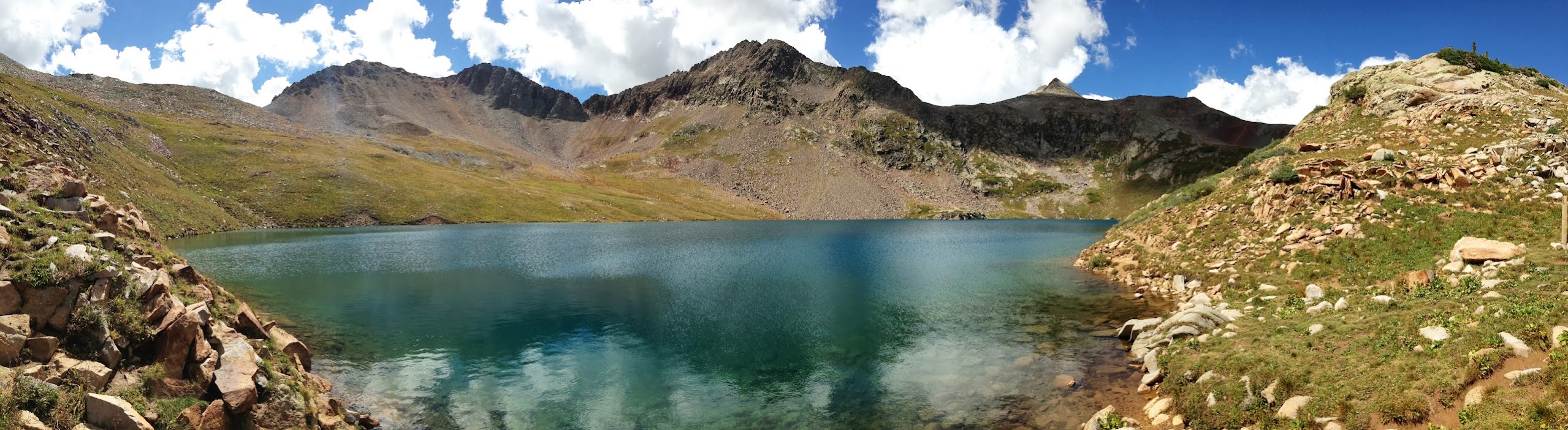 Hope Lake Panorama Hope Lake PanoramaAfter 15min or so I could hear thunder rumbling to the west so I figured I should try to get to the TH before the rain hit. I headed down the pleasant switchbacks and noticed a beautiful cascade I hadn't seen on my way up.  Just as I reached the TH, the first drops of rain hit and I quickly loaded up and headed down the road. I was thanking my lucky stars I wasn't up by Hope Lake right then, and at the same time, feeling sorry for all the people that were!  Big storm just about to hit Hope Lake Basin Big storm just about to hit Hope Lake Basin
Thumbnails for uploaded photos (click to open slideshow):
|
| Comments or Questions | ||||||
|---|---|---|---|---|---|---|
|
Caution: The information contained in this report may not be accurate and should not be the only resource used in preparation for your climb. Failure to have the necessary experience, physical conditioning, supplies or equipment can result in injury or death. 14ers.com and the author(s) of this report provide no warranties, either express or implied, that the information provided is accurate or reliable. By using the information provided, you agree to indemnify and hold harmless 14ers.com and the report author(s) with respect to any claims and demands against them, including any attorney fees and expenses. Please read the 14ers.com Safety and Disclaimer pages for more information.
Please respect private property: 14ers.com supports the rights of private landowners to determine how and by whom their land will be used. In Colorado, it is your responsibility to determine if land is private and to obtain the appropriate permission before entering the property.