Download Agreement, Release, and Acknowledgement of Risk:
You (the person requesting this file download) fully understand mountain climbing ("Activity") involves risks and dangers of serious bodily injury, including permanent disability, paralysis, and death ("Risks") and you fully accept and assume all such risks and all responsibility for losses, costs, and damages you incur as a result of your participation in this Activity.
You acknowledge that information in the file you have chosen to download may not be accurate and may contain errors. You agree to assume all risks when using this information and agree to release and discharge 14ers.com, 14ers Inc. and the author(s) of such information (collectively, the "Released Parties").
You hereby discharge the Released Parties from all damages, actions, claims and liabilities of any nature, specifically including, but not limited to, damages, actions, claims and liabilities arising from or related to the negligence of the Released Parties. You further agree to indemnify, hold harmless and defend 14ers.com, 14ers Inc. and each of the other Released Parties from and against any loss, damage, liability and expense, including costs and attorney fees, incurred by 14ers.com, 14ers Inc. or any of the other Released Parties as a result of you using information provided on the 14ers.com or 14ers Inc. websites.
You have read this agreement, fully understand its terms and intend it to be a complete and unconditional release of all liability to the greatest extent allowed by law and agree that if any portion of this agreement is held to be invalid the balance, notwithstanding, shall continue in full force and effect.
By clicking "OK" you agree to these terms. If you DO NOT agree, click "Cancel"...
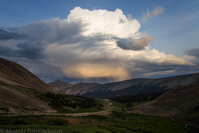
My plans this weekend were to drive over to the Tenmile - Mosquito Range so that I could climb at least one 14er and hopefully a second one, too. I left work on Friday and headed east. A few hours later I had my campsite setup along Fourmile Creek just outside of Fairplay. I had a little time before dark, so I decided to drive up to the trailhead for Mount Sherman and check it out. Mount Sherman was my planned hike on Saturday morning.
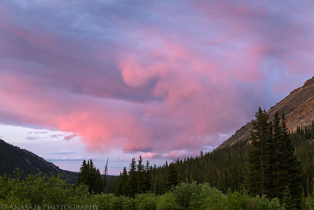
When I arrived at the trailhead for Mount Sherman the distant storm was lit up by evening light.
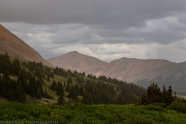
That night it stormed on and off frequently with heavy rain, lightning and thunder. I didnt sleep very well, so it didnt help that I woke up at 4:00am to have a quick breakfast and start my hike to the top of 14,036 Mount Sherman. By this time the storms had stopped, but there were still plenty of darker clouds in the sky.
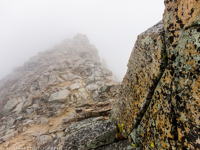
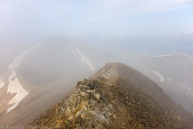
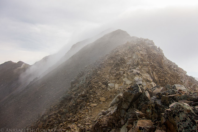
I was a little hesitant to start the hike with all the clouds in the sky this morning, but I did anyway...
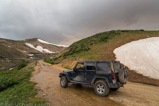
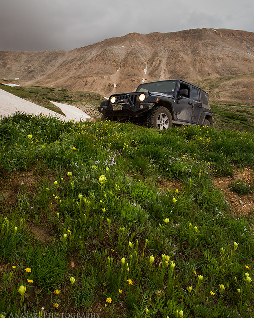
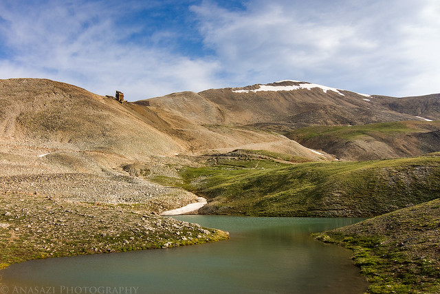
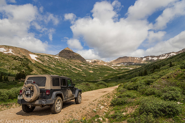
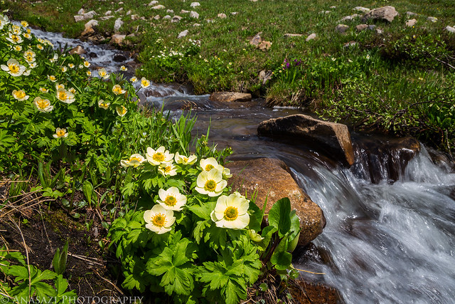
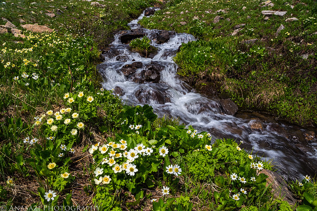
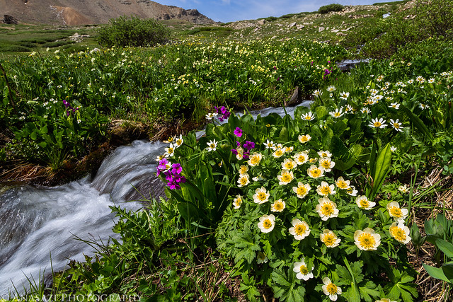
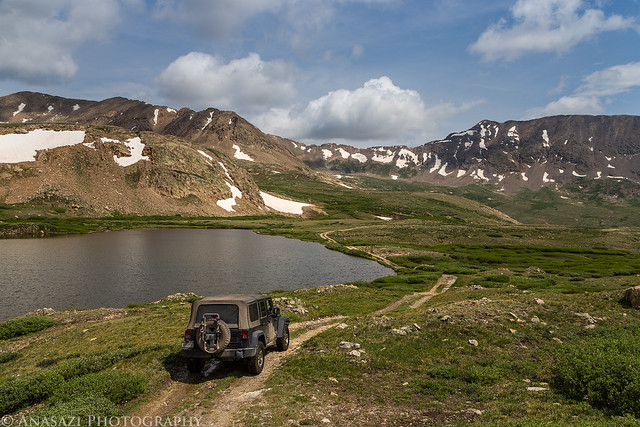
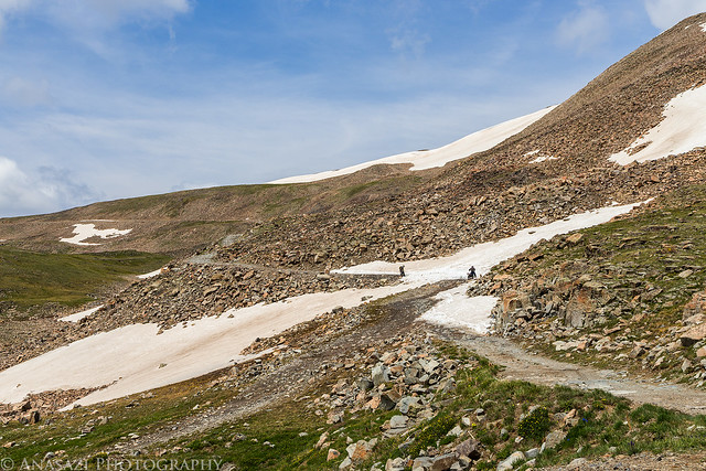
I must say, Mount Sherman is probably the easiest 14er I have climbed to date. I was feeling pretty good when I got back down and knew I would be able to attempt another one on Sunday. I had hiked to the peak and back in about 3 hours, so it was still very early when I was done. I stopped in Fairplay for a quick breakfast/lunch and then made my way over to the Mosquito Pass Road so I could do a little exploring in my Jeep and search for some wildflowers. I was hoping Id be able to make it over the pass to Leadville, but near the top there was a large snow drift that was still blocking the road, so I had to return the same way.
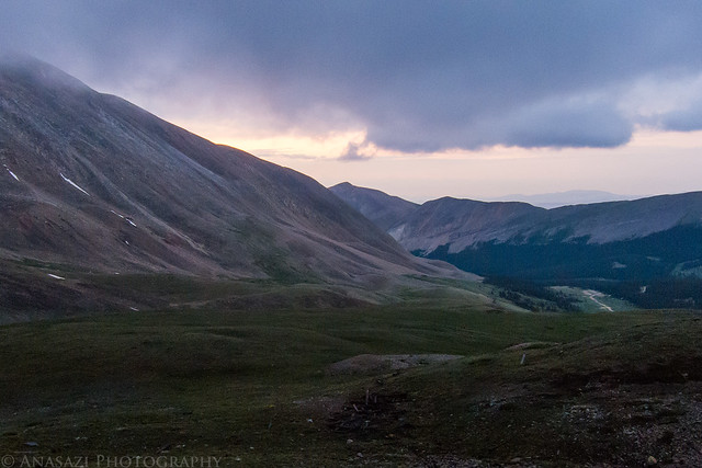
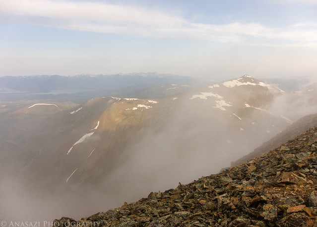
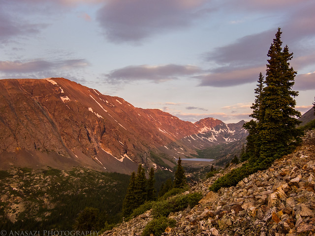
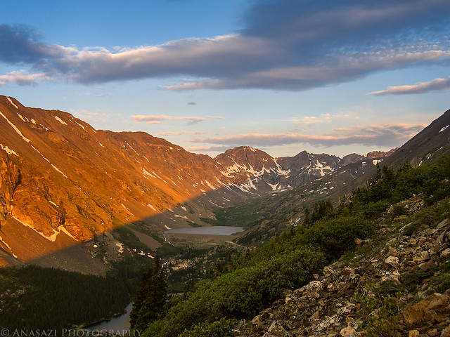
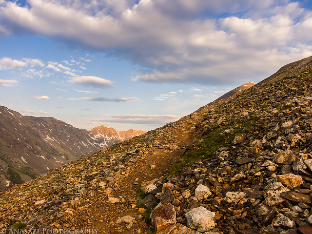
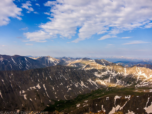
On Sunday morning I was up at 4:00am again and had my camp taken down and loaded into my Jeep in no time. I had a quick breakfast and was the first person at the trailhead for Quandary Peak by 5:15am. The weather was looking much better this morning for my climb up to the top of 14,265 Quandary Peak. I started the hike in the dark and got to watch the sunrise on the surrounding mountains as I hiked to the top. It was a great morning!
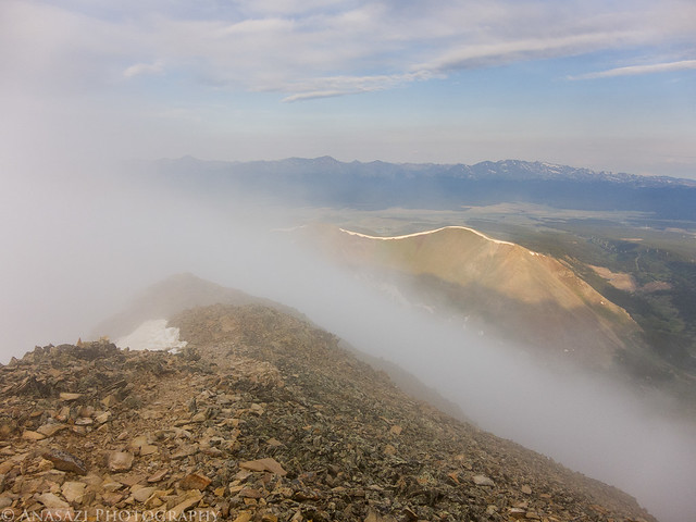
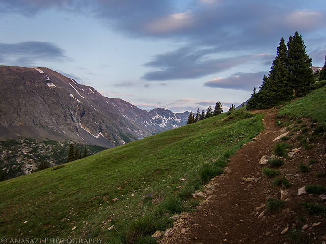
Following the trail to Quandary Peak above treeline before the sun makes an appearance.
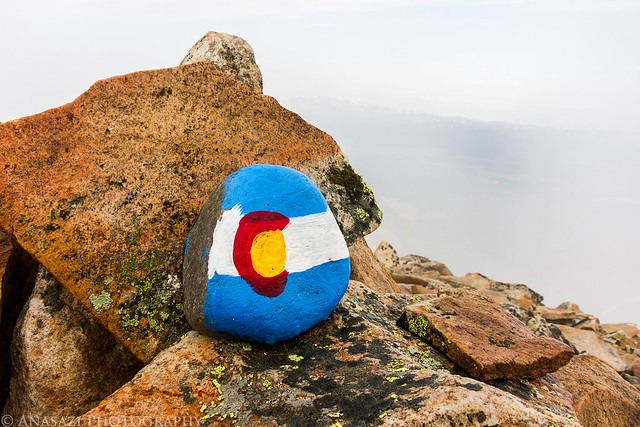
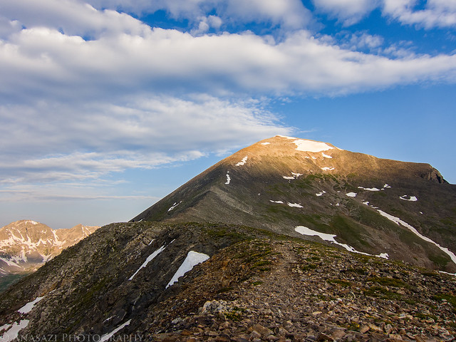
The hike to the top of Quandary Peak was a bit tougher than Mount Sherman since it is a longer hike with more elevation gain, but I was feeling pretty good on the hike thanks to getting better acclimated to the elevation by hiking Mount Sherman the day before. It took my just under 3 hours to reach the summit, but that was with a lot of stops for photos along the way. It only took me an hour and a half to get back down to my Jeep. From there I headed back home to finish off the weekend, with only one stop at GRIND in Glenwood Springs for an excellent burger. It was another great weekend in the mountains!
Thanks Daniel, I actually didn't drag my DSLR on the hikes to the summits on this trip, so many of the photos were just taken with my little Canon S90. The rest of the photos were taken with my Canon 6D which is the camera I usually use the most.
Another compliment on your sweet photos ! You definitely have an eye for photography ! Keep posting your reports so I can realize what crappy photos I take.
Caution: The information contained in this report may not be accurate and should not be the only resource used in preparation for your climb. Failure to have the necessary experience, physical conditioning, supplies or equipment can result in injury or death. 14ers.com and the author(s) of this report provide no warranties, either express or implied, that the information provided is accurate or reliable. By using the information provided, you agree to indemnify and hold harmless 14ers.com and the report author(s) with respect to any claims and demands against them, including any attorney fees and expenses. Please read the 14ers.com Safety and Disclaimer pages for more information.
Please respect private property: 14ers.com supports the rights of private landowners to determine how and by whom their land will be used. In Colorado, it is your responsibility to determine if land is private and to obtain the appropriate permission before entering the property.