Download Agreement, Release, and Acknowledgement of Risk:
You (the person requesting this file download) fully understand mountain climbing ("Activity") involves risks and dangers of serious bodily injury, including permanent disability, paralysis, and death ("Risks") and you fully accept and assume all such risks and all responsibility for losses, costs, and damages you incur as a result of your participation in this Activity.
You acknowledge that information in the file you have chosen to download may not be accurate and may contain errors. You agree to assume all risks when using this information and agree to release and discharge 14ers.com, 14ers Inc. and the author(s) of such information (collectively, the "Released Parties").
You hereby discharge the Released Parties from all damages, actions, claims and liabilities of any nature, specifically including, but not limited to, damages, actions, claims and liabilities arising from or related to the negligence of the Released Parties. You further agree to indemnify, hold harmless and defend 14ers.com, 14ers Inc. and each of the other Released Parties from and against any loss, damage, liability and expense, including costs and attorney fees, incurred by 14ers.com, 14ers Inc. or any of the other Released Parties as a result of you using information provided on the 14ers.com or 14ers Inc. websites.
You have read this agreement, fully understand its terms and intend it to be a complete and unconditional release of all liability to the greatest extent allowed by law and agree that if any portion of this agreement is held to be invalid the balance, notwithstanding, shall continue in full force and effect.
By clicking "OK" you agree to these terms. If you DO NOT agree, click "Cancel"...
Mileage: ~9 miles
Elevation gain: ~2,500 ft
Time: ~5 hours
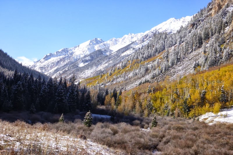
The visit to the Elk range was long overdue. So when I received an invite to make a trek to Conundrum Hot Springs in mid-October with a group of hiking friends, I got excited. While studying the map of the drainage, I noticed a number of 13ers in the basin, most notably "Castleabra", a bi-centennial (it is quite interesting, though, that Roach labels "Castleabra" as one of the centennials in his 13er book - likely a typo). It made sense for me not only to visit the hot springs, but also try to get at least one of the thirteeners while there. The group drove to the trailhead after work and camped by the trailhead. The next morning, we woke up, packed out "big packs" (mine clocked in at 40 lb) and started hiking up the trail shortly after 9am. A nice warm sunny day soon after the area received several inches of snow made for a spectacular setting. The trek is long, but somehow goes fairly quickly - there is so much to see!
The trek begins
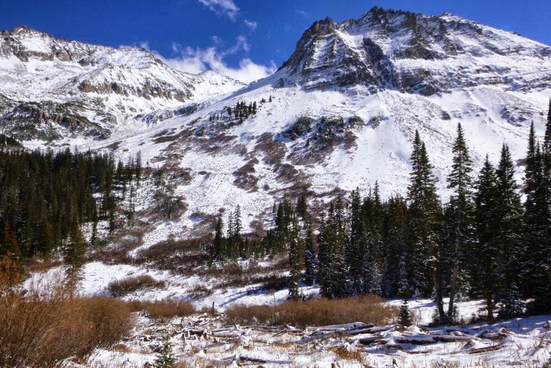
At about 4 miles in, Castleabra appears
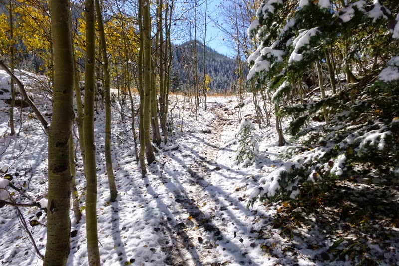
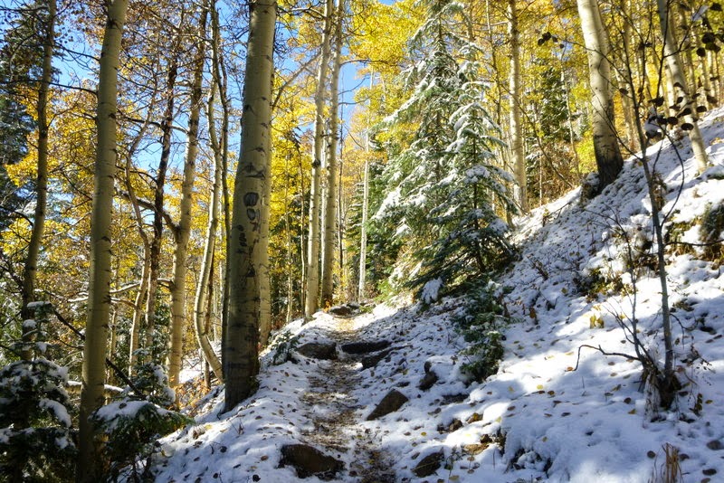
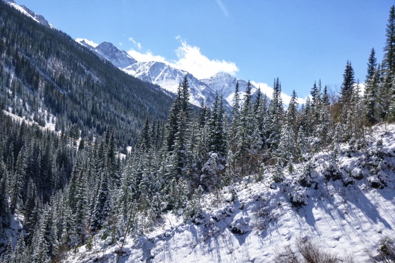
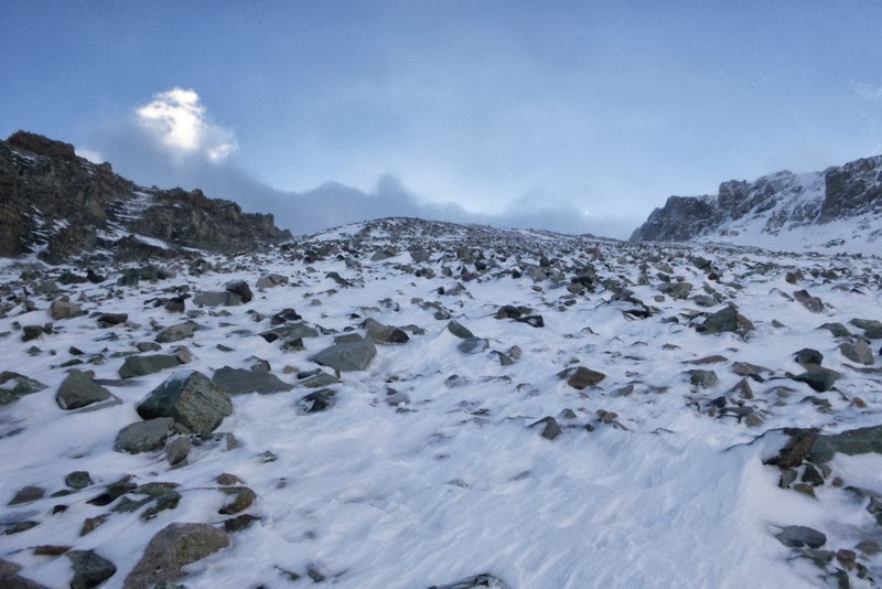
The higher you go, the more wintery landscape looks
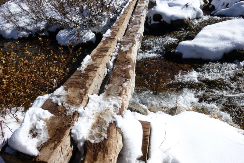
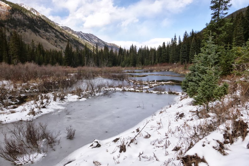
Creek crossings, that late in the season, didn't present any problems. But I can see how it can be an issue in spring.
Less defined river crossing - hiking poles might be helpful here
Even in the snowy (shady) sections, a day after the snowfall, the trail was boot packed - a reflection of how popular this trail is with backpacking crowd
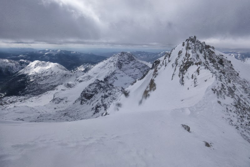
Castleabra dominates the approach in the last few miles
Final creek crossing
Since we had a large group with several other smaller groups arriving on the same day, everybody rushed to get a campsite. I haven't camped in the snow for over a year, since Rainier. Thankfully, once you learn the basics, it doesn't go away - it is just like riding a bicycle. Jetboil gets fired up and water melting commences. Ahh, the little luxuries of backcountry camping.
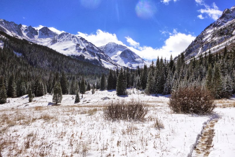
A camp with a view
A short scouting trip to the base of tomorrow's climb revealed that this approach is doable, while other peaks in the basin would require snowshoes (which I didn't bring).
Some potential targets, which at present would require snowshoes
At the base of the climb
Content with the findings, I joined the rest of the group in the famed (or infamous?) hot spings. The pool is rather small (by the developed hot springs standards) and quite a bit muddy. Still, it was very nice to soak after a long day of backpacking. Most people wore swimsuites, but quite a few were in the nude. So, be prepared...
A look from the pool back into the valley
After about couple of hours, I extracted myself from the pool and retired to the tent. Some of our group stayed up until midnight and enjoyed the evening under the stars, but they didn't have a 13er hike the next day. I didn't think I would be sound asleep by 7.30pm, but somehow it happened.
Day 2 - "Castleabra" via West Face and hike out
Mileage: ~12 miles
Elevation gain: ~2,800 ft
Elevation loss: ~5,300 ft
Time: ~10 hours (5.5 hours for the summit bid + just over 4 hours for the hike out)
Initially, several people in the hiking group expressed interest in Castleabra. However, upon closer inspection, one turned out to be injured, with his arm in a cast; another didn't bring an ice ax and spikes, and quite understandably, was having second thoughts looking at snow-covered slopes; and the third didn't have enough experience for the shoulder season. Solo it is. After restfull 10 hours of sleep in the toasty warm 0 degree bag, the alarm went off at 5.30 am. I forgot, however, that it takes longer to get ready when it is cold outside, and having a hot oatmeal for breakfast was too enticing, so I didn't set out from the camp until 6.50 am. The weather showed a stark change from the day before - gray clouds were swirling on top of the mountains and the winds were howling.
Castleabra turns a cold cheek
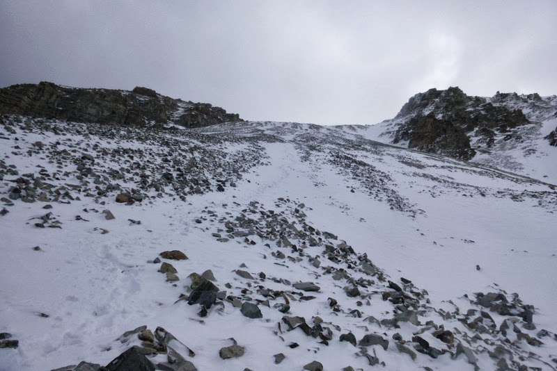
Still, I kept telling myself - it is only 2,500 ft and just 2 miles! This is so close... I made a good progress to the bottom of the climb, but soon thereafter my pace slowed. Roach hints that the early season snow may make the gully a bit more stable. If that is the case, I just can't imagine what it looks like when dry. One step forward-slide-repeat sequence ensued for 800 feet.
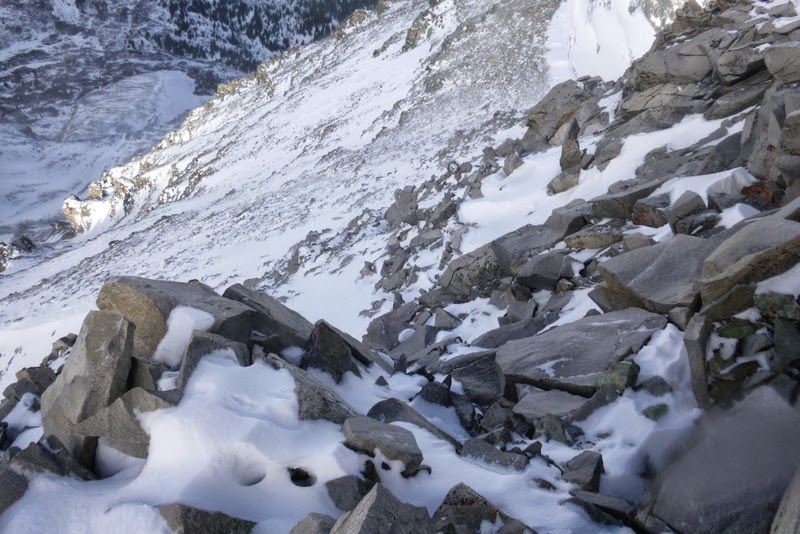
Slippery talus
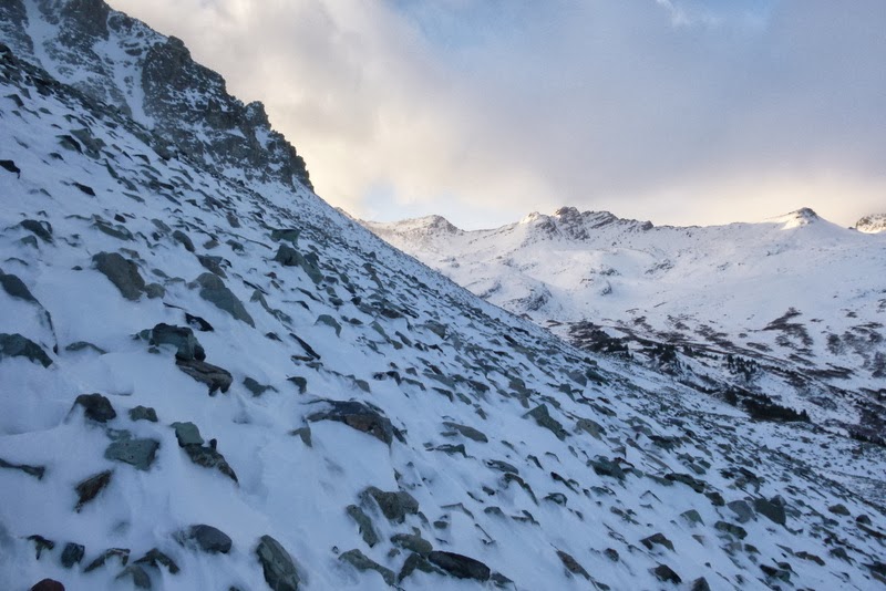
Approaching the top of the 1st headwall ~ 12,000 ft
I decided to take a slow and measured approach, as I didn't want to get tired too quickly, which could lead to frustration, and given the subpar weather conditions, bailing too soon. At the snail's pace I pressed onward. Rather surprisingly, I felt rather comfortable. I had my face mask, warm gloves and a hat, gaitors, ice ax, microspikes, 4 layers of clothing (an extra one still in the pack) and lots and lots of GU (the latter gives you a delusion that you are feeling strong). At around 12k, the slope flattens for a bit.
Looking at upper reaches of the mountain. 2nd headwall ahead
Trying to find a surface that doesn't slide
After scaling the 2nd headwall, I found myself near 13k. While the wind became quite punishing and I was horrified to watch the clouds "flying" over the ridge, meaning 50+ mph gusts up higher, I kept telling myself that the summit is "only" 700-800 ft away. The "standard" gully looked very snow covered, so my options were either postholing or more of the sliding talus. Trying to avoid either of those options, I went with the leftmost gully - although it looked a bit steeper (I guestimated it at Class 3+), I hoped it would provide some handholds to pull myself forward.
Looking for some holds to counterbalance the wind pressure
Not sure which way would have been faster, but by carefully pulling on ice and rime-covered rocks alternated with manageable postholing, I was able to propel myself to the ridge near 13,600 ft. From there, I looked for a reasonable traverse line around the cliffs surrounding the summit.
Traverse to bypass the cliffs
After a few carefully placed moves, I made the ascending traverse and was relieved to spot a snowed-in trail near the ridge.
Summit becomes visible
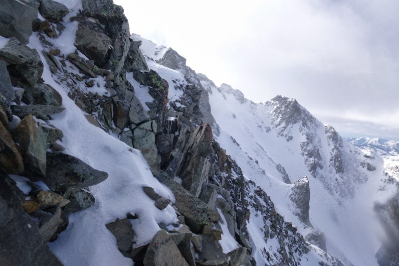
The ridge towards Pt 13,550
Full view of the ridge towards Pt 13,550
I followed the trail and then the straightforward ridge to the summit. It was cold and windy and the 2,500 ft ascent took 3.5 hours. I didn't have any aspirations to continue to another summit. "Castleabra" (my first Elk) in "wintry" conditions required my full undivided attention and the mountain got it. Somehow, reaching this snow- and rime-covered summit felt incredibly satisfying. The full views of Castle and Conundrum were obstructed by the clouds, but I could see Cathedral and the Pyramid group.
Summit cairn
The view of Castle is obscured by clouds
Cathedral
The Pyramid group
The descent went far better than expected and only took 1.5 hours. I was able to connect the snowfields and step-plunged or glissaded all the way to the base. The snow felt very stable - it was strange to realize that there were no "weak" or "rotten" layers underneath - just a knee/thigh deep October powder. If this trend continues, this could be a great year for skiing (or at least Joel Gratz says so).
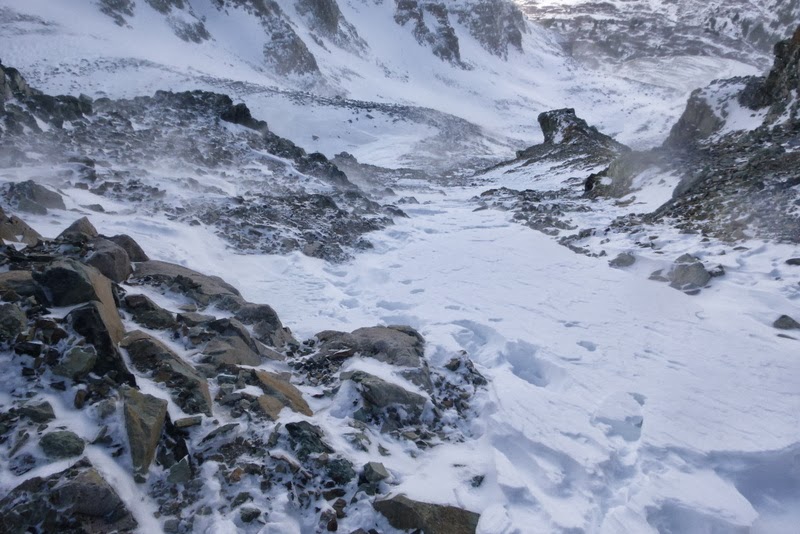
The descent gully
This is not a black and white photo
Finishing the descent
I got backed into the camp just past noon to the visible relief of my camp-mates (who actually watched my descent off the mountain from the comfort of the hot springs). After a welcome hot meal, melting snow for the hike-out and packing the camp, we were on the move soon after 1pm.
Parting shot of the Hot Springs
Me on the hike out
North face of Castleabra. Still cold
Teeth marks on a tree
Probably this house needed some remodeling
It was amazing to see how much snow had already melted just 24 hours later. The trail was boot-packed. The pack felt heavy, feet in mountaineeriing boots were sore, but we made great time, arriving at the trailhead by 5.30pm. What a great trip! I think Conundrum Hot Springs is something to see or experience, at least once, and getting a 13er just makes a trip that more exciting. Thank you for reading.
In my dreams for this last weekend I thought of doing Castle-Castleabra-Castle-Conundrum-Cathedral....with the amount of snow on those ridges that is evident in your pictures, I'm glad I changed my plans!
The Roach is not a misprint--he admits in the preface that he takes a ”broad” view to defining a Centennial. The book covers 59 peaks over 13,800, and considers them all Centennials.
I did this hike this past summer and thought it was sketch at best with all the loose rock. Props to you for completing this in much worse conditions, that's awesome!
You amaze me with your solo ascents! What awesome colors! Glad you were safe and didn't get mauled by the hot springs freak show! Excellent trip report...great detail!
People won't be able to understand how mentally and physically exhausting that sliding talus is like until they've done it. Fantastic job on pushing through that. I tried that route to Castle two Septembers ago and it was extremely difficult. We didn't make it.
What did the traverse from Castlebra to Castle look like? I was wondering what you thought about the doability of camping at springs and doing Castle and Conundrum in one day?
Castleabra,Castle,Conundrum from springs 10/21/2013 2:30am
Stiffler, I camped a few miles down from the hot springs because we had our dog with us and there's a sign posted to tell you not to camp at the spring with your dog. I hiked from there to the spring, up Castlebra, then Castle, Conundrum, back to the spring to meet my wife for a quick dip, before heading down to our tent. I did it in Sept '11, no snow, so the route up Culebra was loose. Snow would make for a faster return, as you could glissade off the northwest face of Conundrum, but might make spots on the ridge dicey.
Very well presented Natalie. I have taken it upon myself to settle, once and for all, which route(s) are the best and which are the worst to attain Castle/Con & Castleabra. Your review is essential.
for your kind comments and ”thumbs up”. Much appreciated.
Jedi - C^5 would be a tad challenging in current conditions. Glad you were able to tag the French group without much trouble.
MtnHub - not often I lament the lack of DSLR on a hiking trip. This was one of those occasions I wish I had a bigger badder camera. Not sure how much progress I would have made though - maybe couple of miles? Elks in the fall after a snowstorm provide for some jaw dropping scenery.
screeman57 - Great comment - thank you for clarification. I need to re-read the preface. Always learning something new about peaks and ”rankings”.
Shattuck311 Roach hints that the scree gully might be better when snow covered. Not sure, but I am not intent on redoing it in dry conditions to find out.
Jane - great area. I am surprised you guys haven't made it up there yet. Put it on the list.
goingup - even if you do go nude, you won't be out of place.
Fire - thanks. I am so jealous you guys managed to bag half the basin while out there, but I won't mind a return trip. Can't believe you don't use the GU - how would I otherwise explain your unnatural speed?
ChicagoMike - the idea is intriguing, but execution can be difficult. Imagine 8 miles of almost flat terrain on the way back - add fallen trees and multiple creek crossings - so I don't believe it would be much fun as a ski out. I'd look for other lines with shorter approaches.
Rick - I missed most of the freak show as I retired early in the tent, but with the right amount of alcohol, I hear the springs can get rowdy.
Steve - thanks. This was nothing on the scale of your typical solo exploits, but still fun.
summers - you are welcome, and do enjoy your trip when you go.
Stiffler - thank you! The route from 12k to 13.8k required a lot of patience and full mental concentration on my part. Glad Steve/Marmot72 was able to answer your question since he has done all 3 peaks from this approach.
Caution: The information contained in this report may not be accurate and should not be the only resource used in preparation for your climb. Failure to have the necessary experience, physical conditioning, supplies or equipment can result in injury or death. 14ers.com and the author(s) of this report provide no warranties, either express or implied, that the information provided is accurate or reliable. By using the information provided, you agree to indemnify and hold harmless 14ers.com and the report author(s) with respect to any claims and demands against them, including any attorney fees and expenses. Please read the 14ers.com Safety and Disclaimer pages for more information.
Please respect private property: 14ers.com supports the rights of private landowners to determine how and by whom their land will be used. In Colorado, it is your responsibility to determine if land is private and to obtain the appropriate permission before entering the property.