| Peak(s): |
Mt. Wilson - 14,256 feet |
| Date Posted: | 06/30/2014 |
| Date Climbed: | 06/22/2014 |
| Author: | rob runkle |
| Peak(s): |
Mt. Wilson - 14,256 feet |
| Date Posted: | 06/30/2014 |
| Date Climbed: | 06/22/2014 |
| Author: | rob runkle |
| Mt Wilson via Silver Pick #59 |
|---|
|
Last year, I made the conscious decision to not climb Mt. Wilson, along with its sister peak, El Diente. I had multiple reasons why I made that choice. One of those reasons was so that I could climb my final Colorado fourteener as a snow climb. What was I thinking? In order to make that happen, I started planning for a May or June weekend trip to Colorado. My buddy Jared and I ultimately targeted the weekend of June 21, 2014. In a typical year, this might be a bit late for good snow. But, in 2014, we got very lucky. Colorado had gotten a bunch of snow in the Spring, including a late snow in mid May. In fact, if Jared and I had targeted May, I think that we might have set the trip up for failure. I flew into Grand Junction where Jared and his wife Jen picked me up at the airport. We packed up their truck, and all three of us headed toward the Wilson group. Our attempt on Saturday would be from the Kilpacker Trailhead. We arrived at the trailhead around 10 pm, and got one of the last reasonable camping spots. We tucked ourselves in for an early start. We got up, ate a fulfilling egg breakfast, and got started just after 5 am in the morning. For the Kilpacker attempt, it would only be Jared and I. Jen was planning just a casual day hike because she was favoring a knee that she had injured the week before. Jared and I worked our way up into the basin. I'm going to skip to the challenging parts, because, to make a long story short, our summit bid on Saturday was a failure. We made our way past the rocky slopes, above the waterfall, and up onto the snow. I ended up taking to the snow travel better than I had expected. I was very comfortable. I'd been on Mt. Rainier, Mt. Washington in Winter, and a Winter trip to Colorado. So, my snow experience was moderadate. But, I was really enjoying the early Summer snow. There was plenty of snow up in the basin. Jared and I could stay almost exclusively on snow if we wanted to.  Where did things go wrong? Well, multiple things accumulated in our summit bid failure. It started with Jared and I convincing ourselves that Mt. Wilson was straight up the basin, in front of us. It continued, with me not double checking our progress on the GPS. I later looked at the GPS track, and it was blatantly obvious that we had not followed the correct route. Our targeted route ended being the saddle between Mt. Wilson and South Wilson. The scramble up to the saddle was about as loose as anything that either us had ever dealt with in the fourteeners. The unusual looseness should have clued us in to our mistake also. We ultimately reached the saddle, and at that point, we thought that we were on the ridge traverse between El Diente and Mt. Wilson. We crossed an exposed catwalk, and worked our way around the right side of the ridge. The presence of an exposed catwalk should have been another clue to us that we weren't on the route. I'm not aware of such a catwalk on the traverse. As we worked around to the right, we spotted a gulley up towards the ridge. This gulley seemed to be the only reasonable route, so we took it. The gulley was loose and very nasty. And, everything above the gulley was loose and nasty. Both Jared and I started to become concerned that we had become overly risk averse. This route was really starting to sketch us out. As we mucked around on this nasty gulley climb, we noticed people on the top of the peak to our North. At the time we didn't know it, but these people were on top of Mt Wilson. Jared and I were confused at why these people would be hanging out so long on the traverse ridge. Ultimately, the loose nasty crap that we were climbing creeped us out so much that we decided to abandon the attempt, and head down. We got down the gulley without much issue, and worked our way back to the nasty loose saddle. We weren't looking forward to downclimbing the loose rock back to the snow. So, Jared and I skirted the ridge a little bit, until we could get safely to the snow. We ultimately reached the snow. Jared strapped on his crampons. I was too lazy to pull them out of my pack, and decided to try and kick step my way down the steep snow. It was about noon at this point, so the snow was getting pretty soft. I ended up being very happy with my choice to skip out on the crampons for the descent. Between kicking steps and some glissading I was easily able to handle the snow field descent. Once we got below the ridge, we saw another pair of guys that were heading up towards the peak to our North. One of the guys yelled to ask us what we were doing. Across the snowfield, we yelled back and forth, comparing notes. Ultimately, it was revealed to us that we had made a huge mistake in route finding. What a huge let down. At this point it was starting to get late in the day, and we were mentally and physically shot. We waited about 30 minutes to see if the skies would clear up. But, ultimately, our summit attempt on the first day was over. Jared and I started down. As we hiked, we discussed how we would attempt again on Sunday, but we would go via the Silver Pick Basin route. We traveled down the snow fields, the rock fields, into the woods, and back to the trailhead. We broke the news to Jen at the trailhead, and she was very comforting. She knew how bummed we were about not getting the summit. With Jen's blessing, we made plans to head to the Silver Pick trailhead. Jen and Jared had been there the previous weekend, so I was thankful that they were willing to repeat the Silver Pick hike after having done it so recently. We packed up the truck, left the trailhead, made a quick stop in Telluride, and ultimately made camp along the road to Silver Pick. At camp, we had a relaxing evening, with camp fire, roaring creek, and a tasty meal of elk, homemade bread and peas. After dinner, we tucked into our tents early. The next moring, we got out of our tents a bit earlier. Ultimately, by the time we had another tasty egg breakfast, packed up camp, and moved the truck to the trailhead, we got started up the trail at around 5 am again. We cruised up the trail. The Silver Pick Route (aka. Rock of Ages Trail, aka. Northeast Ridge Route) ultimately gains 5,300 feet of elevation. So, we weren't surprised when the trail started at an uphill grade, almost immediately. This was much different than the Kilpacker trail, which is totally flat for the first few miles. We worked our way up the switchbacks, through an early easy snow field, and finally began the approach into the Silver Pick Basin. At this point, the snow became almost impossible to avoid. We donned our crampons, and started up the snowfields in the Silver Pick Basin towards the Rock of Ages saddle. The travel was steep and tough on my Ohio-lungs, but I was able to manage. I forgot to mention, but I'm happy to say that Jen decided to accompany us on our second attempt of Mt. Wilson. Both Jen and Jared were pumping up the slopes rapidly leaving me struggling to keep up. I was feeling stronger than on Saturday, but still not as strong as these two Colorado residence. I was glad to have Jared and Jen to lead the way, and keep me on pace. I struggled to keep up with them, but without them, I'm convinced that I would have been considerably slower. This snow travel was harder on my legs than I expected it would be. I think that the major factor was the additional weight, and the heavy boots. I'm usually a lite hiker, and almost always in trail shoes. I almost never wear boots. On this trip, I was wearing Jared's stiff ice boots, crampons, and I had a bunch of extra gear in my pack in case of emergency. Ok, so I'm a weight-snob.  We traveled mostly on snow to get to the RoA saddle. We ended up gaining most of the elevation to the saddle, then traversed the Summer route the rest of the way tot he saddle. We rested on the saddle for a short period, and plotted out our route up the North East Ridge of Mt. Wilson. Jared and I were determined to not make another route finding mistake after yesterday. There was plenty of snow on the face of Mt. Wilson, so it was difficult to identify the normal route to the summit. Ultimately, we dropped off of the RoA saddle and down into the Navajo Basin, to the base of Mt. Wilson. I think that the drop into the basin is around 700 feet, which is a notable contributor to the 5,300 feet total gain. I was gaining more and more confidence on the snow, and chose to boot walk/ski down into the basin. That worked well for me, and I only landed on my butt a few times; no bruises. We ultimately made it down into the basin, and started up the ridge route. Initially the ridge was all rock and dirt. eventually, we wandered out onto the snow slopes. I was comfortable on the snow, but it started to get steep, and that slowed me down a bunch. At this point, Jared and Jen had made the conscious decision to make me lead. The rationale was that this peak was mine to gain, or lose. And, they wanted me to be driven by my own pace and my own determination. It worked. At times, I felt like I was actually starting to pull away from the Coloradians. I have a feeling that they were letting me pull away, to make me feel better about my pace. Eventually, we tired of the snow climbing, and wandered back onto the rocks. The rocks sucked. They were loose and steep. Eventually, as we got higher, the rock travel became easier, and more stable. About 200 feet below the upper ridge, we paused, and started contemplating giving it up for the day. None of us were eager to traverse the steep snow slopes. And, all of us were exhausted. On top of that, the weather was not looking great. Jared had a bit more energy than Jen and I, so he ascended an additional 50 feet to scout out the route. He was trying to determine if there was a reasonable route that could avoid the snow. I was very skeptical. After yesterday, I was not eager to try an unproven route. We were pretty sure that we had already gone above the Summer traverse. So, it was starting to look like we were going to be off route, and on to unproven terrain. But, as I mentioned before, we were not eager to traverse steep snow at this point. And, the standard route had multiple snow fields to be crossed.  While Jared was scouting the upper route, Jen and I chatted. We discussed seriously the possibility that we might not reach the summit today. I was frustrated, but in a way it was so comical that I could miss this summit so many times. I felt that I might be able to accept not reaching the summit. When Jared finally popped his head up, he started to explain a contrived route that he thought he saw. The key component to his description was that he said there were cairns up where he was at. When Jared first came back, Jen started to say, "Jared we are ready to head down now." But, I yelled,"no, tell us what you found, before we decide." What he described sounded interesting, so Jen and I worked our way up towards Jared. As I already mentioned, the fact that Jared mentioned cairns gave me the most hope. When Jen and I got up to Jared, he explained that he thought I could go above the snow, traverse class 3 rock, and eventually get below the summit pitch. Jared thought that I would have to cross one last snow field, but I was only 200 feet from the summit. He talked as if he and Jen were not going to be summiting with me. And, that was exactly what he meant. He explained that they were done with the snow for the today. They were concerned with the snow field conditions, and did not want to traverse the steep snow. Jared told me that he thought I was looking good and comfortable on the snow, and that I should go for it. It was my peak to get! I told them that I would investigate, and return if I got uncomfortable. From our vantage point, I went up a short class 3 gully, with a snow slope on my right. I was able to cross the snow field in a very short section at the top; only about 10 feet across, with rock islands in the middle. I cleared the snow, and worked my way around the next class 3 buttress. at this point, I got a good view of my next challenge. I saw another class 3 buttress traverse. It looked reasonable, but most importantly, there was no snow. I cleared the next buttress pretty easily. It would have been easier, if Ihadn't been carrying my crampons and ice axe. I was tripping over my gear, and it was getting snagged on rocks. I was expecting to have to use them again, so I didn't want to pack them away. As I cleared the second class 3 buttress, I was at the top of a gully, which was the intersection of three peaks. None of the three peaks was more than 40-50 feet away from the central point. It was pretty clear to me that the peak to my south was the highest peak. But, it was also clear to me that the peak to my south was the scrariest, and had the most exposure. That of course meant that this was the summit of Mt. Wilson. I wasnt sure if I was prepared to make the final summit pitch. I was physically exhausted, mentally wasted and just not sure that I could trust my strength and balance. I was very close to giving up, for yet another time. I decided to take a look at some route pictures to confirm that what I was looking at was the summit. If I was going to attempt this thing, I want to be 100% sure that I was climbing onto the right summit. Again, I was cautious because of our mishaps on Saturday. The route pictures confirmed to me that I was indeed looking at the summit pitch, and it also said to "stay to the left for an easier ascent." So, I stripped off the boots, packed away the axe and crampons, put on my trail shoes, and placed my pack on the ground. If I was going to do this thing, it was going to be sans heavy pack and boots. I made moves towards the summits pitch, and comtemplated my route. I decided that I would indeed stick to the left. Around the left side, I was able to find abundant handholds, and foot holds. I made one tough move, then another, and another. After about 5 small crux moves, I was on top. I spotted the summit register immediately, and I was ecstatic. I "whooped" aloud, and it echoed throughout the Wilson's. I'm sure that Jared and Jen could hear me celebrating on the summit. I was 7 hours 40 minutes from trailhead to the summit. I only spent 2 minutes on the summit, then began the down climb.        The down climb required a bit of thinking. Multiple times I thought to myself, "how the heck did I get up that?" At this point, I was definintely running strong on adrenaline. Getting to the summit had given me a whole new spark. I was full of energy and confidence. And, I was handling this tough down climb like I as on fresh legs. I made the down climb in about 5 minutes. I got back to my pack, and took another break. I gobbled some calories, drank some water, and tightened up my pack. I had decided to go ahead and make the descent in my trail shoes. I was done with the boots and crampons, and I was convinced that I could avoid any major snow fields during the descent. I traversed the class 3 buttresses, and started back down the rocks. Jen and Jared had already yelled to me that they would meet me lower on the ridge. I got back to them about 40 minutes from leaving the summit. I tried to joke with them about how I didn't make the summit, but my pure joy was hard to hide. They didnt fall for it. After I met back up with Jared and Jen, we continued down the ridge, into the basin. In the basin, Jen and Jared put on their crampons. I decided that I was done with boots and crampons, and stayed with my trail shoes. Since I didn't change footwear, I was able to get started up the RoA saddle ahead of Jared and Jen. I crossed the snow in the basin without issue. When I start up the slopes towards the saddle, I struggled to get enough traction. So, I worked my way onto the rocks. I ended up being able stay on rocks almost the whole way to the saddle. Jared and Jen took snow most of the way. We ended up getting to the saddle at about the same time. I was glad that I had converted back to my trail shoes, and still been effective at travel.  We stopped at the saddle for a break, then plotted our route out of the basin. We would need to navigate a lot of late afternoon soft snow. Ultimately, we decided to traverse the Summer trail, on dry rock, until we hit snow. Once we hit snow, we contemplated going down the rock field, or the soft snow. Initially, it looked like the rock field would be better, but it was very steep and loose. It looked miserable. So, I went ahead to check out the snow. It ended up being great for kicking steps downhill and traversing. There was only a small amount of posting holing. Most of the snow was perfect. We scampered down pretty quickly, with a little glissading to make it fun and fast. Ultimately, we made it back to the main road/trail, at the top of the switchbacks. We crossed several snow fields that had been much harder in the morning. In the afternoon, they was soft, and easy to cross. After the final snow crossing, it was just dirt road the rest of the way. Honestly, even though the Kilpacker route seemed to be potentially faster roundtrip, the final hike out for Kilpacker was grueling and long. The final hike out of Silver Pick was pleasant and seemed shorter. It was almost completely downhill also. We made it back to the trail head in 4 hours 10 minutes from the summit; 11 hours 50 minutes for the round trip. I think that I could have walked away without the summit this weekend, and been happy. It would certainly have been an entertaining story to tell: "How I made multiple attempts at my final peak, and continued to fail; and the many flavors of failure." But, I'm glad that I was able to finally get my last Colorado Fourteener. Now, I can focus on starting them all over again. Why stop now? Thumbnails for uploaded photos (click to open slideshow):  Fail on Saturday. We targeted the saddle just right of center. Ended up cliffing out in notch far right. Should have hooke")
 Mt Wilson from RoA Saddle")
 Snow conditions")
 El Diente from summit")
 Gladstone from summit")
 Summit final pitch")
 Expansive summit")
 Pano El Diente to Gladstone")
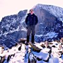
 Me, pretty happy")
 Thumbs up!")
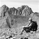
 Pose from the RoA Saddle on the descent")
|
| Comments or Questions | ||||||||||||||||||
|---|---|---|---|---|---|---|---|---|---|---|---|---|---|---|---|---|---|---|
|
Caution: The information contained in this report may not be accurate and should not be the only resource used in preparation for your climb. Failure to have the necessary experience, physical conditioning, supplies or equipment can result in injury or death. 14ers.com and the author(s) of this report provide no warranties, either express or implied, that the information provided is accurate or reliable. By using the information provided, you agree to indemnify and hold harmless 14ers.com and the report author(s) with respect to any claims and demands against them, including any attorney fees and expenses. Please read the 14ers.com Safety and Disclaimer pages for more information.