Download Agreement, Release, and Acknowledgement of Risk:
You (the person requesting this file download) fully understand mountain climbing ("Activity") involves risks and dangers of serious bodily injury, including permanent disability, paralysis, and death ("Risks") and you fully accept and assume all such risks and all responsibility for losses, costs, and damages you incur as a result of your participation in this Activity.
You acknowledge that information in the file you have chosen to download may not be accurate and may contain errors. You agree to assume all risks when using this information and agree to release and discharge 14ers.com, 14ers Inc. and the author(s) of such information (collectively, the "Released Parties").
You hereby discharge the Released Parties from all damages, actions, claims and liabilities of any nature, specifically including, but not limited to, damages, actions, claims and liabilities arising from or related to the negligence of the Released Parties. You further agree to indemnify, hold harmless and defend 14ers.com, 14ers Inc. and each of the other Released Parties from and against any loss, damage, liability and expense, including costs and attorney fees, incurred by 14ers.com, 14ers Inc. or any of the other Released Parties as a result of you using information provided on the 14ers.com or 14ers Inc. websites.
You have read this agreement, fully understand its terms and intend it to be a complete and unconditional release of all liability to the greatest extent allowed by law and agree that if any portion of this agreement is held to be invalid the balance, notwithstanding, shall continue in full force and effect.
By clicking "OK" you agree to these terms. If you DO NOT agree, click "Cancel"...
| Report Type |
Full |
| Peak(s) |
Mt. Bierstadt - 14,066 feet
|
| Date Posted |
07/01/2014 |
| Modified |
07/02/2014 |
| Date Climbed |
07/01/2014 |
| Author |
swashbuckler |
| Mt. Bierstadt - Sawtooth - Mt. Evans |
Hopefully this helps some others who are unsure about the Sawtooth route.
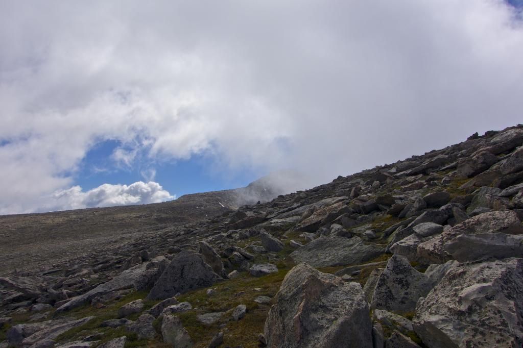
View from the Guanella Pass parking lot with a general idea of the trail
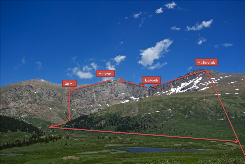
MT. BIERSTADT
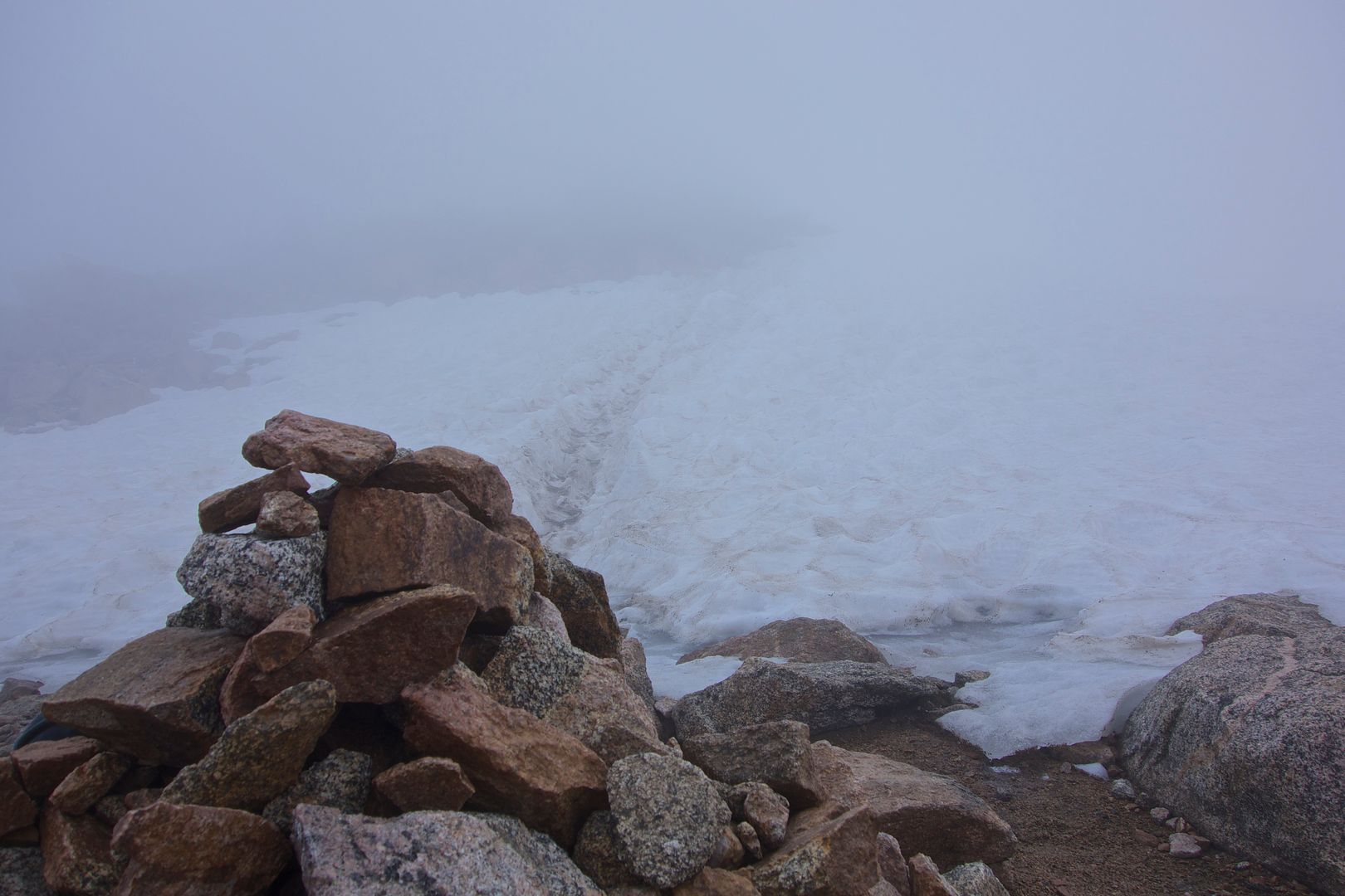
It's what you would expect. Easy and quick. Nothing more than a trail and some knee high rocks with a little bit of snow on the final climb. I started at 0530 and summited by 0725. There was only 20ft of visibility due to the clouds.
Heading up to the summit
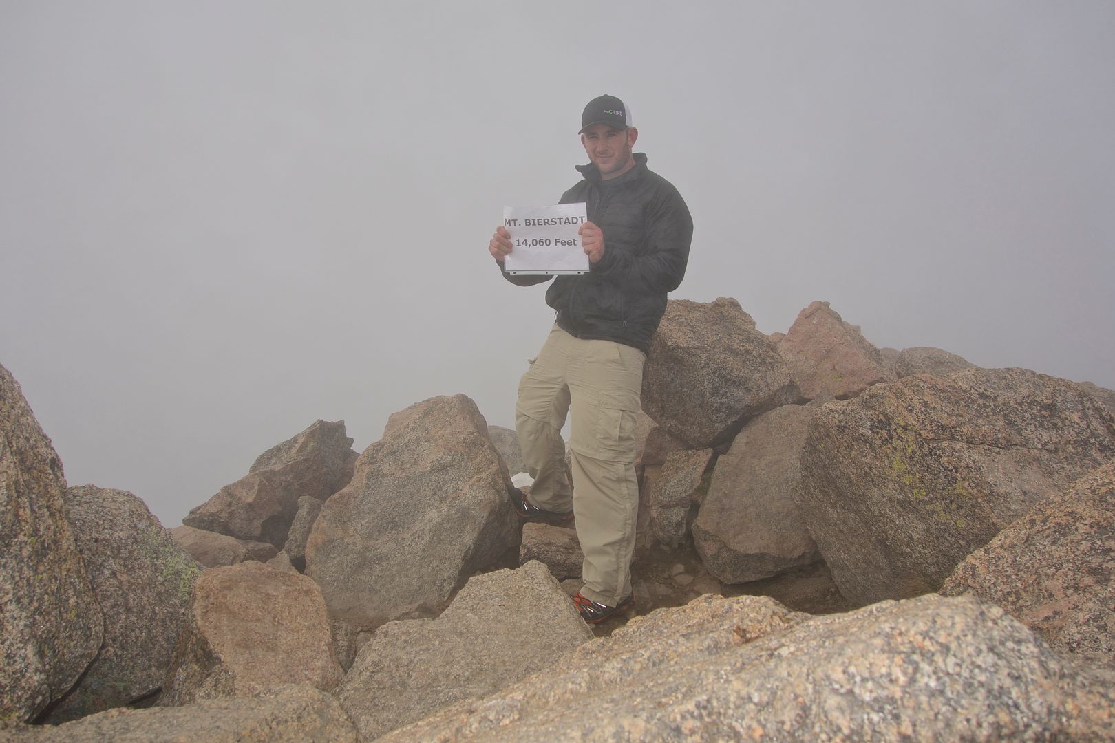
Mt Bierstadt summit
SAWTOOTH
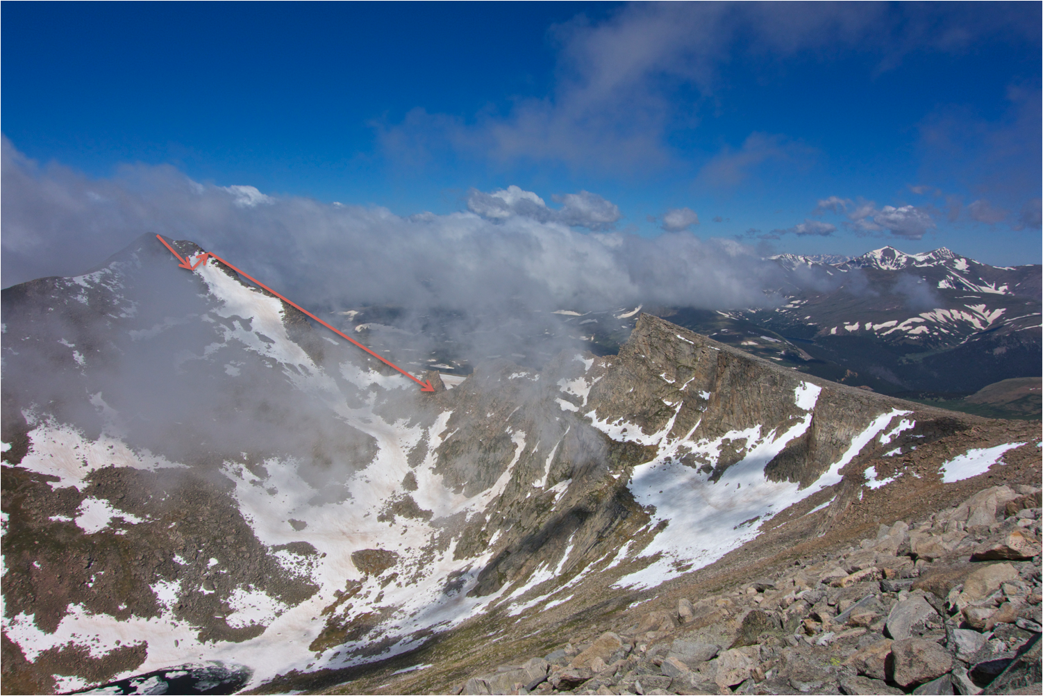
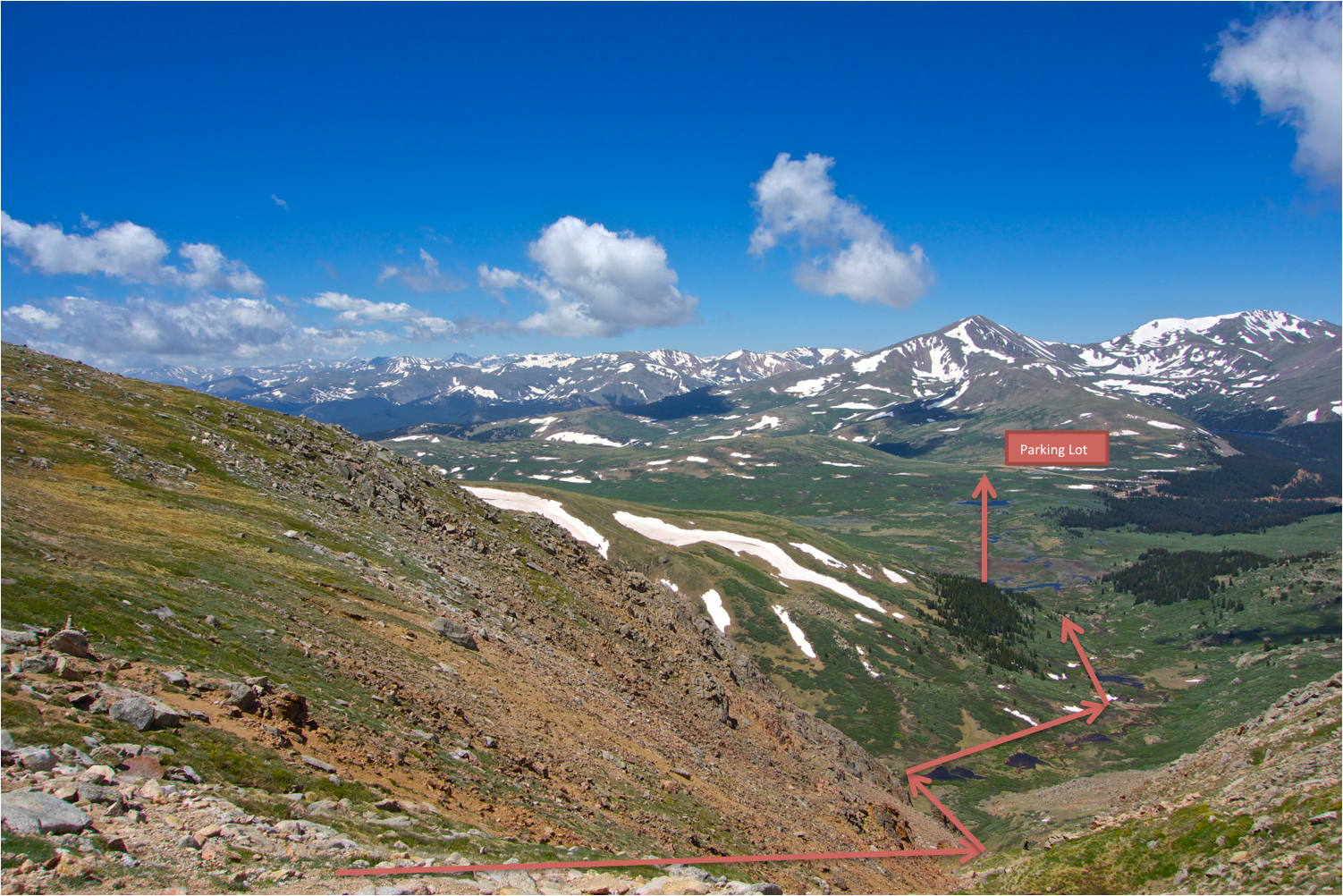
I had extremely limited visibility when I started the Sawtooth and was fully prepared to turn around at any point, as I was unsure about the climb. I had a gps with the gpx. file from this website. I took, what I assumed, was the path to start the sawtooth. I started descending down Beirstadt towards the sawtooth. No drops were more than hip high. Approximately 50 yards down I noticed that I was off trail on my GPS. I was unable to find any trail or cairn so I decided to head up to the spine where my GPS said the trail was. I climbed up to the spine and was still only 50 yards from the summit of Bierstadt. I couldn't see any trail or cairns and it seemed too dangerous to be where I was so I headed back to my original position. Looking at the sawtooth there was the spine to the left, about 50 yards of snow, and an open rock area on the right. I decided to head down the rock area because it seemed logical. After climbing down another 100 yards I noticed that I was far off trail from my GPS and the open rock area was descending further away from the sawtooth spine. I wasn't able to find any trail or cairns and looking down the rock trail I was on, and the trail didn't seem to make any sense. I then decided to head back towards the spine (where the gps said I was supposed to be) and hope for the best. I was only a 30-45 minute climb back to Bierstadt's summit and was still fully prepared to turn around if things didn't look right. This is when things were a little more dangerous, as I crossed over the 50 yards of snow to back to the spine. The snow was hard packed with a layer of ice on top. I pulled out my poles and put my microspikes on. It took a good 30 minutes to make my way across those 50 yards of snow. Every time I moved I'd spend 30 seconds trying to dig in my foot or pole through the layer of ice and hard snow. But once I was across I found the trail on the spine of the sawtooth only 100 yards down from Bierstads summit. Due to the limited visibility I must have missed the trail at the top of Bierstadt.
This was my line as I headed down the rocks and crossed over the snow to the spine. Looking back it was a bad idea to cross the snow, but I took my time and was extremely careful.
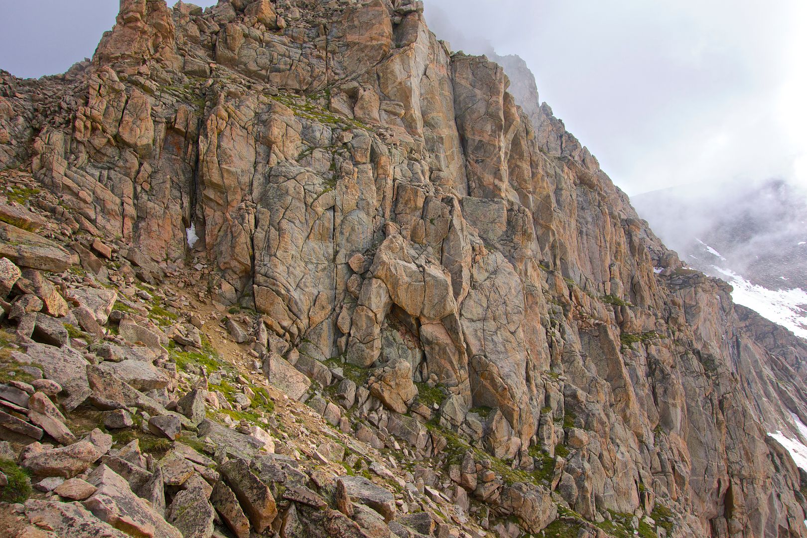
Once I was on the sawtooth trail I became relieved. The trail was relatively easy. Most drops were only hip high. There was plenty of room on either side to pick and chose my own line. But, if I did fall, and mange to tumble for another 10ft, I'd eventually fall off and it could be fatal. I made quick way down the trail and didn't encounter anything that was challenging. There were cairns every so often and there were signs of a trail. If I didn't know where I was supposed to go I'd just pick the most logical movement and it would almost always lead to a cairn or trail. There wasn't any snow on the trail, and I didn't see any need for climbing gear.
Looking down the sawtooth
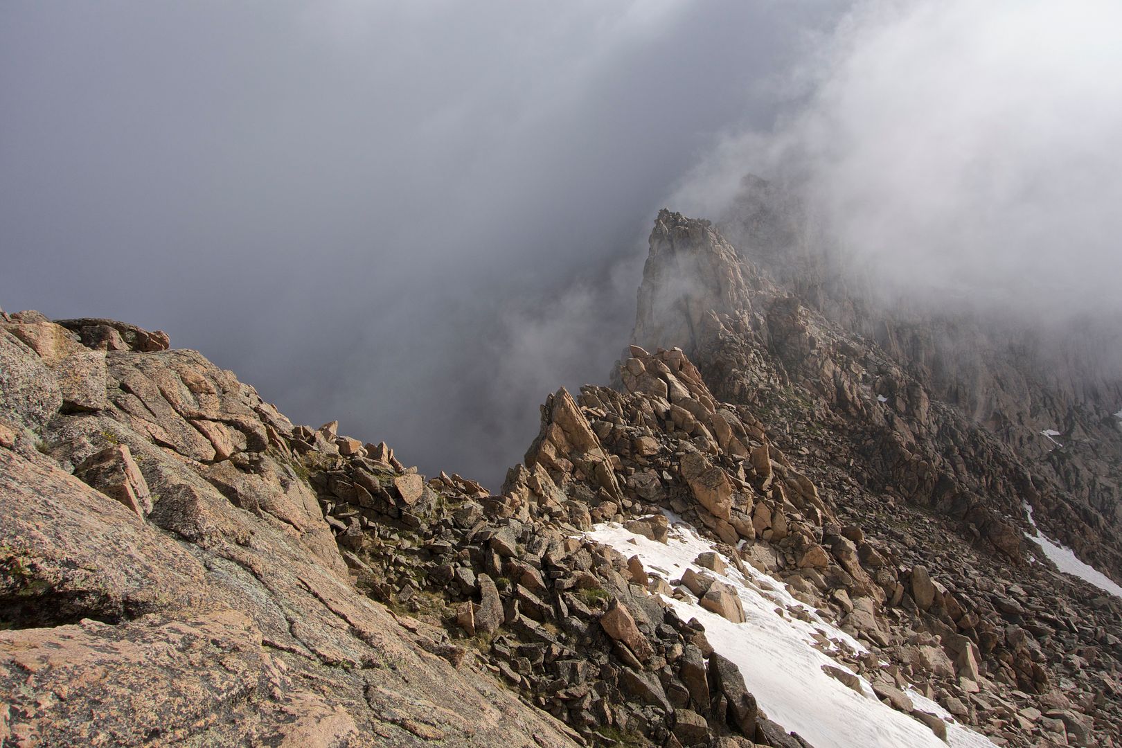
I was extremely nervous crossing over to the north face of the sawtooth. The pictures I found on this website didn't make the trail look safe. But once I crossed over, which was clearly marked with cairns, I was relieved with how big the trail actually was.
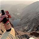
Me on the north face of sawtooth (OK, not me, but an idea of how much room I had)
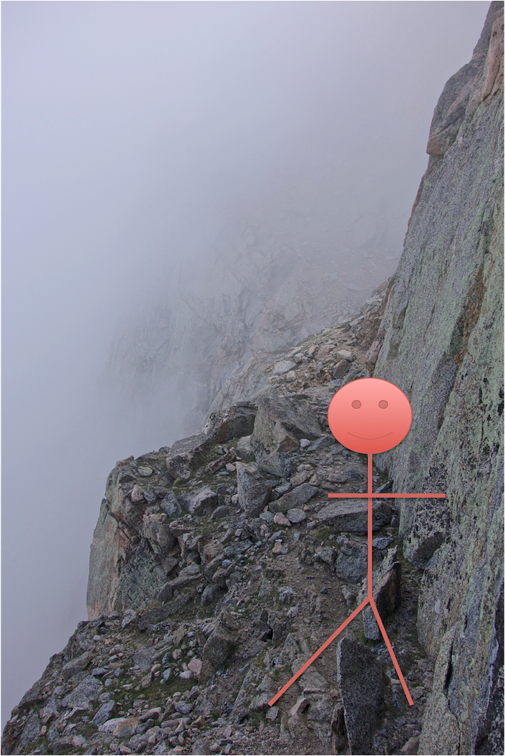
There was plenty of room for me to walk. Of course if I tripped and fell and tumbled I'd probably go off. But being careful was enough for me. I was able to normally walk along this ridge to the final ascent of the sawtooth. (My pic didn't turn out of the final ascent) Basically it's a steep climb up loose rocks and dirt. It's about 20-30ft wide. There was plenty of room to make my own way. And again, if I did lose my footing and slid for quite a ways, I'd eventually fall off, but it would take a good tumble to do so. As I continued the ascent of sawtooth I rounded the corner and couldn't believe what I saw.....the end of sawtooth. I was really in disbelief that it was as easy as it was. It took 2 hours to complete and that's including getting lost at the beginning.
OVERALL IMPRESSION OF SAWTOOTH
Sawtooth ended up being a lot easier that I expected. The key for the sawtooth is to just be confident and careful. Always know when to stop and turn around. If the trail doesn't make sense then you're probably doing something wrong and need to stop and collect yourself. I wouldn't attempt to do the trail if it was raining as those rocks would be too slippery for me. It is a physical climb with lots of bouldering. If you twist an ankle or knee it's going to be a long way out. Careful and confident.
Finished the sawtooth and looking up at Mt Evans
MT EVANS
I wasn't prepared for the hike to Mt Evans. I thought it was just a little ways away after sawtooth, and it ended up being another long hike. I started hiking up towards Evans and found it easy. Be Advised: Once you get to the first summit - IT IS NOT MT EVANS. I scrambled up the first summit in a blaze of glory only to find that Mt Evans was still a ways away  I suggest finding the trail and sticking with the cairns as this trail brings you through the easiest route to the summit of Mt Evans. This took another 2 hours to get from the end of sawtooth to the summit of Mt Evans, but it was an easy hike with only a few areas of hip high rocks. I suggest finding the trail and sticking with the cairns as this trail brings you through the easiest route to the summit of Mt Evans. This took another 2 hours to get from the end of sawtooth to the summit of Mt Evans, but it was an easy hike with only a few areas of hip high rocks.
RETURNING TO GUANELLA PASS PARKING LOT VIA GULLY: THE HARDEST PART OF MY CLIMB
This is the route
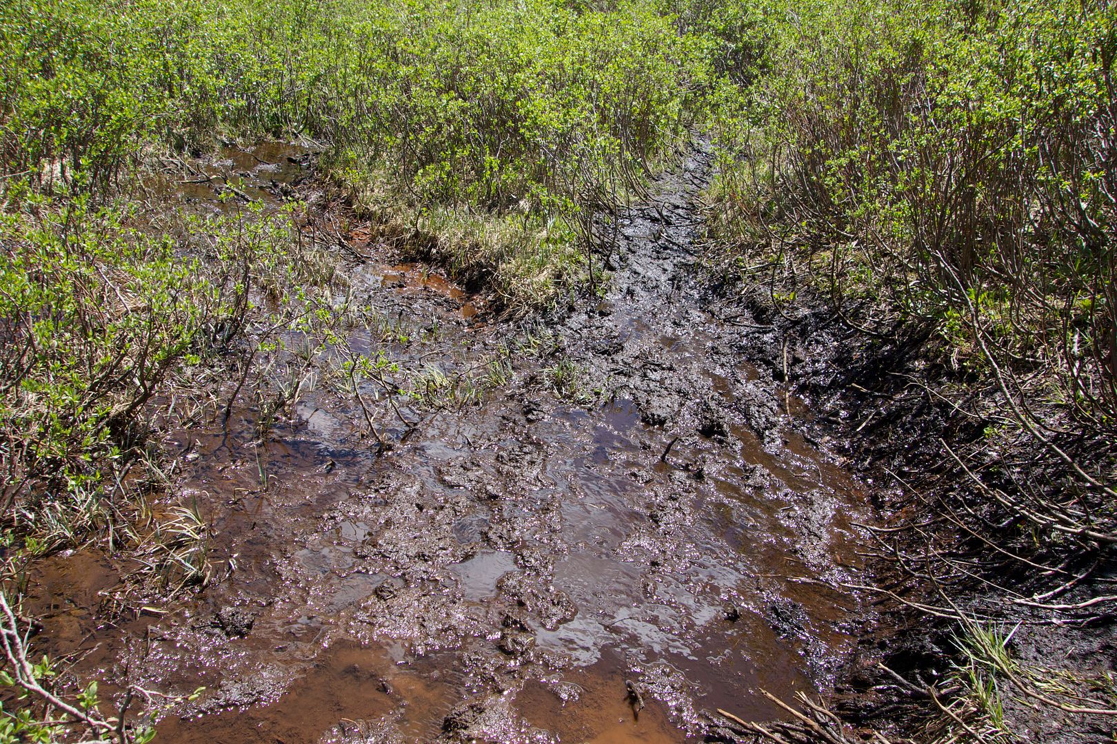
It's easy to find the gully when you leave Mt Evans. Just head back towards the sawtooth and you'll see the gully on the right. I didn't find any trail to it so I just b-lined the gully. The actual gully was a very hard descent for myself. I had to use my poles as it's all loose rock. Even though I was as cautious as could be I still fell numerous times and ended up bending my poles on one fall. At one point some basketball sized rocks fell off the top of the mountain up to my right (I don't know how), and they eventually crashed through the trail about 50 yards down from me. There were a few shoulder high drops and a lot of hip high drops, all of which were on loose rock. It didn't end there. I was still in for quite the hike once I finished the descend of the gulley and ended up at the beginning of the trail through the marshes back to the parking lot. The trail started fine. There were some spots when the trail was deep mud and water. I lost the trail about halfway to the parking lot. There is so much snow melt that trails started to form in all different directions. The trail was also lined with head-high thick branches and bush so I was unable to look ahead to see where to go. I eventually go lost and ended up on a small game trail that brought me to a dead end. I then pushed through the branches and bush (words can't describe how much pain this was). I have cuts all over my legs and arms, I had mud up to my knees, and I still never found the trail. I gave up on trying to find the trail and just followed whatever open lines I could find. Eventually, I found the Beirstadt trail after. It took me another 2 hours to leave Mt Evans and return to the trail.
Here is an idea of what you'll be dealing with. The trail is about 10ft wide. Those branches were over my head at 5'10"
OVERALL TRAIL STATS AND THOUGHTS
The entire loop took me 8 hours and few minutes, but I was alone and hustling most of the way. Unfortunately I didn't reset my GPS before doing the trail so I can't tell you how many miles the complete trail was, or the amount of elevation change. The sawtooth was a lot easier than I anticipated, and it would have been even easier if I had found the initial trail to the sawtooth instead of going the wrong direction. The views are amazing! There weren't too many people on Bierstadt at 0530, and there were only a couple people on Evans, after-all it was a Tuesday. I didn't encounter anyone else on the sawtooth, but it would have been more calming to have another person there.
Gear I brought, used, and needed:
Cold weather rei primaloft jacket. I wore it all the way until I got to the marshes.
Cold weather gloves
Summer weight rei pants/shorts combo
Salmon Goretex hiking/running boots and dual layer socks
Poles: Needed to cross the snow and for the descent through the gully
Microspikes: Only used when I crossed the snow to the spine or I wouldn't have needed them. But I'm glad I brought them!
70oz camelback: I ran out of water as soon as I returned to the Bierstadt trail
Sunscreen: Even though I used it and it was cloudy for most of the day I'm still burnt today
Hat and sunglasses
Gear I brought and didn't use:
Rain jacket and pants
Winter hat: I sweat way too much to need this
Gear I wished I'd brought:
Summer weight climbing gloves: My winter gloves were too hot to climb the sawtooth. I wish I would have brought my mtn bike gloves!
Have fun!
|
Caution: The information contained in this report may not be accurate and should not be the only resource used in preparation for your climb. Failure to have the necessary experience, physical conditioning, supplies or equipment can result in injury or death. 14ers.com and the author(s) of this report provide no warranties, either express or implied, that the information provided is accurate or reliable. By using the information provided, you agree to indemnify and hold harmless 14ers.com and the report author(s) with respect to any claims and demands against them, including any attorney fees and expenses. Please read the 14ers.com Safety and Disclaimer pages for more information.
Please respect private property: 14ers.com supports the rights of private landowners to determine how and by whom their land will be used. In Colorado, it is your responsibility to determine if land is private and to obtain the appropriate permission before entering the property.