| Peak(s): |
Mount Whitney - 14494 |
| Date Posted: | 07/11/2014 |
| Modified: | 08/05/2014 |
| Date Climbed: | 04/28/2014 |
| Author: | BirdMan |
| Peak(s): |
Mount Whitney - 14494 |
| Date Posted: | 07/11/2014 |
| Modified: | 08/05/2014 |
| Date Climbed: | 04/28/2014 |
| Author: | BirdMan |
| Mt. Whitney - Day 2: Two Halves Finally Make a Whole |
|---|
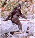
Day 2 - Mount Whitney, Finally!!!Route Stats 2 Day Total ~30 Miles Round Trip and ~10,000 Feet Elevation Gain * Day 1 - Mountaineers Route via the Whitney Portal: 10 Miles / 3,800 Feet Elevation Gain * Day 2 - Mt. Whitney (Standard) Route via the Whitney Portal: 20 Miles / 6,200 Feet Elevation Gain Having been shut down on the Mountaineers Route due to snow conditions the previous day and given the additional distance of climbing Mt. Whitney via the standard route we decided to get an even earlier start than the previous day. When the alarm clock went off at 3:00 am we had a Groundhog Day type of experience trying to get ourselves outfitted, driving to the trail head at 3:30 am and again hiking under headlamps - though this time an hour earlier at 4:00 am. Ouch... We figured later that it was good we couldn't see the initail trail and start of the 99 switchbacks due to the darkness. If we had been able to see what we were doing it might have sapped our enthusiasm. But knowing we had a long way to go and in spite of the previous day's exertion we lit out of the Whitney Portal TH and made good time all the way to Mirror Lake where we caught our first light. The alpenglow lighting up the surrounding rock walls.  As we pushed on, we got higher up to a more open section of the standard route - I think this was around 8 am or so. We were in a relatively wide open space and began to get battered by wind and blowing snow. I've certainly been in worse conditions but this was really starting to get unpleasant. We dashed behind some large rocks as quick as we could to get on extra layers and batton down the hatches. Mount Whitney, c'mon! Give a guy a break for cripes sake...   And after 30 to 45 minutes, almost as quickly as it started it stopped. The wind let down, the blowing snow was no longer pelting us in the face and conditions changed back to just a nice, spring hike up a 14er.  Steve pointing towards our destination. And what's that on his face? After being shutdown yesterday and coming through cold, blowing snow it almost looks like a smile!  The snowfield to the right of me is our route up to the ridge line. It looks pretty gradual from this angle but it held knee deep heavy snow and got fairly steep towards the end. It served to be my undoing in that it sapped my strength in a big way and showed me I wasn't eating enough.  I'm sure this sign means more (and is more plainly visible) in the summer months.  Slogging up the snow field to the ridge line. Some of the folks we passed on the way up are below us.  Not to brag, but the folks below us on the route were back-country camping. Steve and I were happy to still be doing so well, setting a good, strong pace and actually passing most everyone we saw. Glad we were representing Colorado mountaineering proudly!  Though truth be told, Steve ruled the day as shown by the shot here. Here he is kicking back, with his crampons front and center - while he waited for me to get up to the ridge line! I just love this shot.  Made it to the ridge at last, but at what price?!? Here I am sucking wind.  Getting to the ridge took it out of me, but we weren't finished yet. The ridge line was exposed and we felt the effects of the wind. It was time to put on almost every layer we had and press on.  As we got closer to Mount Whitney the summit house came into view. So close, but yet still so far.  After proceeding along the ridge trail for a while you come to a turn-off. Have we really only gone 8.7 miles from the Whitney Portal trail head? It seems like a lifetime ago...  Steve - staying positive and, as was the norm for the weekend, out in front.  A little "S" curve snowdrift. In the minutia we see grandeur - or maybe it was just the lack of oxygen talking!  But lo and behold, after all that pain and suffering there was finally nowhere higher to go.  Yeah!!!  The summit house is in sight.   Steve looking calm, cool and collected on top!  Me - hamming it up on top, but actually it wasn't too far from how I felt. Relieved, exhausted but very happy to have made it!!!  Making it official - the summit survey marker.  Looking down towards Lone Pine. Did we really get all the way up here under our own steam?!?  On the way down we ate more and I started to feel better having some more calories in me.  Steve hoofing it off the mountain - he's probably already thinking about a steak dinner and some drinks!  A last look back at the painful beauty of Mt Whitney.  The only large wildlife we saw on the mountain - towards the Mt Whitney Portal road.  A last shot from our hotel as the sun set on Mt Whitney. Thank you Mt. Whitney, it was wonderful...  Pretty hilarious but when we reached the summit I checked my watch and noticed it was 12:22 pm. I remember because it was kind of a funny number - the twos repeating and all. Anyway, a day later we went to the beach in Los Angeles to kill time while waiting for our plane to take us back home to Colorado. I glanced at my watch and saw it was 12:22 pm again and no, my watch hadn't stopped... It seems by some miracle of coincidence, it was exactly 24 hours to the minute from when we were on the top of Mt Whitney (the tallest peak in the lower 48 states) to when we were sitting on the beach at sea-level. Only in California, right?  Day 1 on Whitney: http://www.14ers.com/php14ers/tripreport.php?trip=15127 Day 2 on Whitney: http://www.14ers.com/php14ers/tripreport.php?trip=15128 Thumbnails for uploaded photos (click to open slideshow): ")
")
")
")
")
")
")
")
")
")
")
")
")
")
")
")
")
")
")
")
")
")
")
")
")
")
")
")
")
")
|
| Comments or Questions | |||||||||||||||
|---|---|---|---|---|---|---|---|---|---|---|---|---|---|---|---|
|
Caution: The information contained in this report may not be accurate and should not be the only resource used in preparation for your climb. Failure to have the necessary experience, physical conditioning, supplies or equipment can result in injury or death. 14ers.com and the author(s) of this report provide no warranties, either express or implied, that the information provided is accurate or reliable. By using the information provided, you agree to indemnify and hold harmless 14ers.com and the report author(s) with respect to any claims and demands against them, including any attorney fees and expenses. Please read the 14ers.com Safety and Disclaimer pages for more information.