Download Agreement, Release, and Acknowledgement of Risk:
You (the person requesting this file download) fully understand mountain climbing ("Activity") involves risks and dangers of serious bodily injury, including permanent disability, paralysis, and death ("Risks") and you fully accept and assume all such risks and all responsibility for losses, costs, and damages you incur as a result of your participation in this Activity.
You acknowledge that information in the file you have chosen to download may not be accurate and may contain errors. You agree to assume all risks when using this information and agree to release and discharge 14ers.com, 14ers Inc. and the author(s) of such information (collectively, the "Released Parties").
You hereby discharge the Released Parties from all damages, actions, claims and liabilities of any nature, specifically including, but not limited to, damages, actions, claims and liabilities arising from or related to the negligence of the Released Parties. You further agree to indemnify, hold harmless and defend 14ers.com, 14ers Inc. and each of the other Released Parties from and against any loss, damage, liability and expense, including costs and attorney fees, incurred by 14ers.com, 14ers Inc. or any of the other Released Parties as a result of you using information provided on the 14ers.com or 14ers Inc. websites.
You have read this agreement, fully understand its terms and intend it to be a complete and unconditional release of all liability to the greatest extent allowed by law and agree that if any portion of this agreement is held to be invalid the balance, notwithstanding, shall continue in full force and effect.
By clicking "OK" you agree to these terms. If you DO NOT agree, click "Cancel"...
Welcome to Rocky Mountain National Park photo credit: Cameron
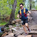
I did this same route in July 2012 and enjoyed it very much, and as I am always up for repeats of trips I like, decided to come back for it again this year. Ryan joined me for the pack in on Friday afternoon, and Cameron packed in later and met us at camp after dark. The pics for this TR are not in chronological order, but should give what I think is a good overview of the trip. Ryan and I left the Lawn Lake trailhead at about 1:30 and took our time packing in to the Tileston Meadows campsite, approximately 6.5 miles from the trailhead.
Mummy Mtn as seen from the Lawn Lake trail, just before the Black Mountain trail junction, photo credit: Ryan
flood damage and erosion along the Lawn Lake trail, photo credit: Cameron
here looking back along the trail toward Longs Peak, photo credit: Cameron
life is fragile, photo credit: Cameron
and beautiful, photo credit: Cameron
Arriving at our campsite at Tileston Meadows, we were attacked by swarms of mosquitoes and hurried to set up our tents before heading off for a bonus 11er twilight summit of Mt Tileston. It was a short and sweet bushwhack to the hikers' right / west of Potts Puddle and up the gentle slopes to the summit.
Ryan on the summit of Tileston, with one of the next day's objectives beyond
We hiked back to camp just before dark to chill out in our tents and wait for the temperature to drop enough to ward off the mosquitoes, then made dinner as Cameron made it into camp at about 9:00. Saturday morning we were on the trail just after 6:00. Retracing our approach on the Black Mountain trail, we regained and lost some elevation to the Lawn Lake trail junction, close to where the next pic was taken.
photo credit: Cameron
photo credit: Ryan
photo credit: Cameron
looking back toward Lawn Lake, photo credit: Ryan
turn right here for the Fairchild / Hagues saddle
photo credit: Cameron
Fairchild Mtn, photo credit: Ryan
a closer look at the trail to the saddle, photo credit: Cameron
from the broad saddle, the initial approach to Hagues is a grass / talus walkup, photo credit: Cameron
looking back at Lawn Lake again, photo credit: Cameron
The talus gradually steepens up into class 3 terrain without a defined trail. We aimed to the right of the pinnacles in pic #16 for the most fun part of the day.
all smiles 100 feet below Hagues' summit
Ryan close to topping out, photo credit: Cameron
summit pano from the 4th highest peak in the Park, photo credit: Ryan
looking west toward the Never Summers, photo credit: Cameron
Crystal Lakes and Fairchild, photo credit: Ryan
after a quick break and signing the summit register, onward to Mummy Mtn, photo credit: Cameron
looking north toward Rowe Glacier, photo credit: Cameron
approaching the Hagues / Mummy saddle, photo credit: Cameron
photo credit: Ryan
Mummy Mtn is a talus walkup from the saddle, but is the 8th highest peak in the Park. I didn't get the summit in 2012 because thunder and lightning make me paranoid, so it was good to get back and complete all of the peaks in this cirque. We didn't stay on the summit long as the weather was changing. Instead of dropping back to the Hagues / Mummy saddle and down to Lawn Lake, we continued southeast from the summit of Mummy and dropped into the drainage just north of our campsite on the map below, making for a very nice loop. Cameron was happy that our descent was more grass than talus.
photo credit: Cameron
photo credit: Cameron
in the descent drainage, aiming toward Potts Puddle and Mt Tileston
We made it back to camp in just under 7-1/2 hours where the mosquitoes were hungrily waiting for us, then packed up and packed out. Total estimated mileage for the trip about 20 miles and 5,000 or so of net gain, none of us were carrying a GPS. This is a long pack in but it is a remote and beautiful part of the Park, and one I'll be sure to visit again.
Thanks to Ryan and Cameron for making the trip, and thanks for reading...
Thumbnails for uploaded photos (click to open slideshow):
I mean, don't tell people. 13ers are getting too crowded these days.
Really though, great report of a wonderful part of the Park. Looks like you guys had some neat lighting; some of those pictures do indeed highlight some must-explore areas.
Caution: The information contained in this report may not be accurate and should not be the only resource used in preparation for your climb. Failure to have the necessary experience, physical conditioning, supplies or equipment can result in injury or death. 14ers.com and the author(s) of this report provide no warranties, either express or implied, that the information provided is accurate or reliable. By using the information provided, you agree to indemnify and hold harmless 14ers.com and the report author(s) with respect to any claims and demands against them, including any attorney fees and expenses. Please read the 14ers.com Safety and Disclaimer pages for more information.
Please respect private property: 14ers.com supports the rights of private landowners to determine how and by whom their land will be used. In Colorado, it is your responsibility to determine if land is private and to obtain the appropriate permission before entering the property.


 photo credit: Cameron")
 Mummy Mtn as seen from the Lawn Lake trail, just before the Black Mountain trail junction, photo credit: Ryan")
 flood damage and erosion along the Lawn Lake trail, photo credit: Cameron")
 here looking back along the trail toward Longs Peak, photo credit: Cameron")
 life is fragile, photo credit: Cameron")
 and beautiful, photo credit: Cameron")
 Ryan on the summit of Tileston, with one of the next day's objectives beyond")
 photo credit: Cameron")
 photo credit: Ryan")
 photo credit: Cameron")
 looking back toward Lawn Lake, photo credit: Ryan")
 turn right here for the Fairchild / Hagues saddle")
 photo credit: Cameron")
 Fairchild Mtn, photo credit: Ryan")
 a closer look at the trail to the saddle, photo credit: Cameron")
 from the broad saddle, the initial approach to Hagues is a grass / talus walkup, photo credit: Cameron")
 looking back at Lawn Lake again, photo credit: Cameron")
 all smiles 100 feet below Hagues' summit")
 Ryan close to topping out, photo credit: Cameron")
 summit pano from the 4th highest peak in the Park, photo credit: Ryan")
 looking west toward the Never Summers, photo credit: Cameron")
 Crystal Lakes and Fairchild, photo credit: Ryan")
 after a quick break and signing the summit register, onward to Mummy Mtn, photo credit: Cameron")
 looking north toward Rowe Glacier, photo credit: Cameron")
 approaching the Hagues / Mummy saddle, photo credit: Cameron")
 photo credit: Ryan")
 photo credit: Cameron")
 photo credit: Cameron")
 in the descent drainage, aiming toward Potts Puddle and Mt Tileston")
")