Download Agreement, Release, and Acknowledgement of Risk:
You (the person requesting this file download) fully understand mountain climbing ("Activity") involves risks and dangers of serious bodily injury, including permanent disability, paralysis, and death ("Risks") and you fully accept and assume all such risks and all responsibility for losses, costs, and damages you incur as a result of your participation in this Activity.
You acknowledge that information in the file you have chosen to download may not be accurate and may contain errors. You agree to assume all risks when using this information and agree to release and discharge 14ers.com, 14ers Inc. and the author(s) of such information (collectively, the "Released Parties").
You hereby discharge the Released Parties from all damages, actions, claims and liabilities of any nature, specifically including, but not limited to, damages, actions, claims and liabilities arising from or related to the negligence of the Released Parties. You further agree to indemnify, hold harmless and defend 14ers.com, 14ers Inc. and each of the other Released Parties from and against any loss, damage, liability and expense, including costs and attorney fees, incurred by 14ers.com, 14ers Inc. or any of the other Released Parties as a result of you using information provided on the 14ers.com or 14ers Inc. websites.
You have read this agreement, fully understand its terms and intend it to be a complete and unconditional release of all liability to the greatest extent allowed by law and agree that if any portion of this agreement is held to be invalid the balance, notwithstanding, shall continue in full force and effect.
By clicking "OK" you agree to these terms. If you DO NOT agree, click "Cancel"...
Chatter began between my husband and I about possibly taking a week off work this summer to hike. I took a look at the time-off calendar at work and found only one available week for me to take time off. I quickly put in my request before someone else snatched up the last full week available. Once I got the approval back, planning began. Where would we go? What peaks would we hike? After a few days, we finally had a fairly solid plan - we'd head to the San Juans to grab the Chicago Basin peaks and Mt. Sneffels, and then stop by the Maroon Bells on our way back to Denver. Train reservations were made and before we knew it, we were driving down 285 on our way to Silverton on an August Wednesday morning.
We made it to Silverton with just enough time to grab a quick bite to eat, park the car, do a last minute bag check, and hop on the train. We enjoyed our hour long ride to the Needleton stop, where just the two of us and two Forest Service members hopped off. It was 3:30pm, and we had a 6 mile hike into camp ahead of us. We waved goodbye to the train passengers as it left us to head back to Durango, and we hit the trail with a goal to make it to camp before dark. Despite my (overpacked) pack causing a slower pace, we made it to a great campsite about 3/4 of a mile below the Twin Lakes/Columbine Pass junction in about three hours. We got the tent set up, ate dinner, and snuggled into our sleeping bags as dark fell. Our alarms were set for an ambitious 4am wake up to go for the first two peaks of our trip - Eolus and N. Eolus.
Needleton Train Stop
Our alarm went off at 4am and we quickly reset it for 5am. Waking up while it's still dark and you're all cozy in your warm sleeping bag it rough. After an hour long snooze, we were up and on the trail to Twin Lakes for the first time by 5:30am. I was feeling quite sluggish after our hike into camp the previous day, but I kept pushing forward. I was surprised at how steep the trail was up to Twin Lakes, but it was very well maintained which made it easier. We made it to Twin Lakes in just about an hour, and we quickly turned left to start heading up toward Mt. Eolus.
Twin Lakes
The ascent from this point to the saddle was pretty uneventful. We just kept pushing forward and making progress upward. We met Brian & Ron at the turnoff for the "ramp" and enjoyed talking to them for awhile. The four of us hiked up to the saddle together. It was just below the saddle that we met up with another group of three - Corey (from CO), Jeff & Rob (both from KY). We all made quick work across the catwalk (FUN) to reach the face of Eolus. All of us worked as a team to find the best route up the ledge-y face, taking turns leading in routefinding. The route is rated Class 3, but because of the tricky routefinding we may have made a few Class 4 moves. Eolus's face is probably the most continuously exposed section of our whole Chicago Basin trip, but it wasn't terrible. Brian & Ron made it to the summit first, followed by Jordan and I, and then the group of three. We enjoyed some time on the summit together, taking photos, and having some snacks. Brian & Ron took off first to head for N. Eolus. Jordan and I were not too far behind. We quickly descended to the saddle and made our way up the awesome, fun, grippy rock to N. Eolus's summit. We enjoyed the amazing weather and Jordan & I started our leisurely descent back to camp. We arrived back around 1:30pm, where we made lunch, filtered water from the creek, napped for a bit, fended off goats, and enjoyed a few hands of War before dozing off for the night.
Summit of Mt Eolus Grippy rock up to N. Eolus's summit Corey, Jeff & Rob on the Catwalk Us on the summit of N. Eolus Eolus from Twin Lakes Goats in our campsite
The next morning, we planned to again wake up at 4am since we knew Sunlight & Windom would be a longer day. However, when the alarm went off we once again reset it for 5am. We were on the trail at 5:30am to make our second trip up to Twin Lakes. I was feeling a lot better today, but had been having some pain in my left ankle since the previous day. I pushed through it and before we knew it, we were taking in the views from Twin Lakes again. This time, we turned right and started up the headwall to the upper basin between Sunlight and Windom Peaks. The ascent to this point was pretty uneventful. It wasn't long until we were ascending the scree gully between Sunlight Peak and Sunlight Spire. I'm not a fan of loose, scree gullies (but who is?) and this gully definitely didn't make me like them any better. It was loose, fairly steep and had many different trail segments heading all the way up. The route description states to stay left in the gully as you near the top so that you top out to the left of a large rock outcropping at the saddle. We must have missed this piece of information and we topped out to the right of the rock outcropping. Bad decision. We were now facing a steep, loose, rotten gully on the backside of the mountain that we had to ascend/cross for approximately 15 feet. We had two options: (1) down climb the original gully, cross below the rock outcropping, and re-ascend to the saddle on the left side of the rock; or, (2) carefully cross the rotten gully we were now looking at. We decided to cross the rotten gully since the distance was shorter. I'm not sure if this was the best decision or not. Everywhere I put my hand down, the rock just crumbled in my palm. I almost slipped at one point when the scree under my left foot slid out from under me. Luckily I had my right foot planted well and one hand on some solid rock to my left. A fall here would not end well due to the steepness and length of the gully. I mustered up some mental strength and made my last few steps to get across this incorrect gully and stand safely on the saddle between Sunlight Peak and Sunlight Spire. I shook out my nerves and calmed myself down so that I could focus on the remainder of the climb.
Heading to the gully in the upper basin Stay to the left of this rock outcropping Or you'll be treated to this loose gully. The white rock is all rotten and crumbles upon touch
The rest of the climb from the saddle was exhilarating. It was definitely the hardest climbing I've done on any 14er thus far, but it was so much fun and didn't have huge exposure. We again met up with the group of three that we met on the Eolus's - Corey, Jeff and Rob. The five of us climbed as a team all the way from the saddle to the summit. It took the 5 of us a little while to find the best route up the section that the route description calls "the hardest climbing of the day." We took a shot at one chimney - Corey made it up, so it was do-able, but not the best option. Corey found another chimney a few feet to the left that looked like a more feasible option with better hand and foot holds, especially for my 5'3" self. There was an incident with someone else in another group who was downclimbing off the summit from the incorrect spot. When we topped out on this section, we saw her injuries being tended to and she apparently was able to hike out back to camp on her own. When we arrived at the summit, there were about 5 people already there - one of which was attempting the summit block. Once it was available, Jordan took a shot at the summit block. He could have made it all the way up there, but didn't feel like the risk was worth it. My ankle was bothering me too much to make a legitimate attempt, which was not a big deal for me. We took our obligatory summit shots, and started our descent down to the cross-over point to Windom Peak.
Jordan only got this far on the summit block Fun on the summit
Corey, Jeff & Rob descended ahead of us. I took my time down the loose gully to prevent hurting my ankle more, and when we got to the bottom of the gully, we found the three waiting for us so that we could climb to Windom together. We worked our way across the upper basin to a point where we could ascend to the ridge 800 feet below Windom's summit. I was expecting Windom to be an easy "walk-up" compared to the previous three peaks, but I was pleasantly surprised with some fun, easy scrambling. Windom is rated a "Difficult Class 2" but I would consider it more of a Class 3, personally. We were all feeling pretty burned out by this point, but we pushed on. Windom's summit is fun and very unique. It's fairly small and there was already a group at the summit when the five of us arrived. We had to wait at a "landing" spot just below the official summit for this group to take their photos and descend off it in order to make room for the 5 of us. Once they were down, we quickly scrambled up to the block-y summit and enjoyed our final summit of Chicago Basin. I was really surprised at how much I enjoyed climbing Windom. The descent off Windom, on the other hand, was not very fun at all. There are apparently two different ways you can ascend/descend Windom back to Twin Lakes. We way we chose ended up being pretty loose and with my ankle, it was just painful. It looked like the other way was where the climbed up from the upper basin, which had larger, more solid boulders versus the loose scree on the way we went. We made it back to camp around 3:30pm, filtered water, ate, and played some more War to pass the time.
Looking to Windom at our cross-over point Sunlight and Sunlight Spire seen from Windom Peak Summit of Windom Peak Our campsite
We had to be back to the Needleton train stop by 11am the next morning (Saturday) for our 11:15am pickup to head back to Silverton. We woke up at 6am to begin packing up camp and to filter water. We were on the trail by 7:45am. We enjoyed a leisurely hike out and were at the train stop by 10:15. Our train arrived promptly at 11:15am and we snagged some open air seating so that we didn't stink up one of the enclosed cabins. Once we arrived back to Silverton, our first stop was High Noon Hamburgers where we devoured some delicious cheeseburgers and fries. Then it was off to check-in at the Bent Elbow hotel where we could get some showers and sleep in a real bed that night. We enjoyed that afternoon/evening and the next day hanging out in Silverton, relaxing (and drinking the best drinks ever at Montanya). We had originally only built in Sunday as a rest day, but we decided to add Monday as a second rest day to let my ankle recover as much as possible before hitting the trails again. We decided to spend our second full rest day in Ouray, so we made a reservation at the Ouray Inn. We spent our day in Ouray checking out Box Canyon Falls, eating chocolate from Mouses Chocolates, and having some drinks at the Ouray Brewery. It was at this point that we decided to nix the idea of doing the Maroon Bells and the traverse. I'd rather feel 100% to do the traverse, rather than dealing with even a slightly sore and weak ankle.
Train arriving at Needleton stop Train ride back to Silverton Ouray from Box Canyon Falls
We made our way to Yankee Boy Basin Monday afternoon to car camp before our ascent of Mt. Sneffels on Tuesday. (Sidenote: A Forest Ranger pulled up next to us and told us we couldn't camp up there. Not sure if he thought we were putting up a tent, as we were parked about 50 ft below the outhouse, but he said it was a new "thing" due to heavy traffic in the area and camping wasn't allowed above the two designated camping areas WAY below 853 1B road. We stayed because we were just basically parking our car to sleep in it, and it was late already.) We had been up to Yankee Boy Basin in May for a ski descent, but I fell about 500 feet short from the summit due to softening snow and my slow pace. Jordan had boarded off the summit and I skiied from the top of the Lavender Col, but we had to go back so that I could check it off my list. We decided to go for the SW Ridge to spice things up a bit. It was a completely different place with no snow. But it's still one of my favorite areas.
Car camping at the Yankee Boy Basin TH
We awoke and hit the trail by 5:30 (are you sensing a pattern, here?). We were to the upper 4WD TH by sunrise and started our way up the Blue Lakes Pass trail to the start of the SW Ridge route. We donned our helmets and started the fun ascent up the ridge. There was definitely some loose rocks in some of the gullies, but nothing that was too exposed. We made it to the "notch" where you downclimb about 50 feet to bypass a pinnacle. I am not positive, but I think we downclimbed just a tad too far, as when we turned back left to head up the next gully, the rock was very loose and it freaked me out a bit. We safely made it up to some more solid rock to finish ascending this gully. The next gully (this route is full of gullies!) definitely had the hardest climbing of the day, but nothing harder than any climbing we had done on the trip thus far. My short stature may have made it a bit more difficult, but I managed just fine. Once out of the gullies and on the ridge, the rock became fun and super grippy. We quickly scrambled up the solid rock and we were quite surprised when we topped out on the summit so fast! We were the only ones on the summit - two guys were already on their way back down the standard route. We spent a good amount of time on the summit since the day was so calm - there was no wind and it was nice & warm. We ate and took some photos, texted our moms, and then started our descent down the standard route to the V notch.
Snow was up to the bottom of this sign last time we were here Top of Blue Lakes Pass just before we cut right to the SW Ridge A look up one of the gullies Jordan reaching the ridge proper Love this area! Scrambling up the ridge Sneffels summit
The V notch definitely was a bit more difficult than I expected it to be since the route is rated Class 2. Once in the couloir/gully, we spotted a small stretch of snow that we'd have to descend. We headed down to it, tested the firmness with our poles, and decided to put on our microspikes and pull out the axe. The snow lasted for about 50 feet and was still firm at that time of day so we wanted some traction. We made it safely down the snow and decided to leave our spikes on for the remainder of the downclimb of all the remaining scree. Descending the Lavender Col was definitely the loosest part of the descent from the summit. I just kept thinking back to three months prior when the Col was completely filled in with snow and I had an enjoyable, fun ski descent. The descent on the Col today was not enjoyable at all and I was just begging for it to be over. I am SO glad we ascended the SW Ridge and only had to deal with the scree one way. I almost wondered if we should have descended the SW Ridge as well. We made quick work of the descent after we were out of the loose crap, and found ourselves back to the car by noon-ish, just as rain started to sprinkle down. We headed back to Ouray for lunch at the Mexican restaurant (YUM) and then talked about our plans for our final day of the trip - should we head back home to Denver to have a day off at home before going back to work; or should we try to grab one more peak?
The V Notch Loose Lavender Col The Lavender Col last time we were here
One more peak it is. We decided to close out our trip with San Luis - a nice, easy Class 1 hike. We decided to do it from the Standard Route since it was "on the way home." We drove to Gunnison, made the turn to CO 114 and before we knew it we were driving the 28 miles on dirt roads to the TH. It's definitely no joke that this TH is in the middle of n.o.w.h.e.r.e. We had to dodge a few cows and cow patties on the way before we hit forest land. There are two creek crossings that aren't mentioned in the TH directions, but they are very low right now and have excellent entry and exit ramps built into them, so they should be no problem for any vehicle. It took us about an hour and 15 minutes to drive 47 miles (from the time we turned off onto CO 114), which is actually quite a bit faster than my Google Maps app estimated. We arrived to the TH, parked the car on the side of the road (the parking lot is closed to restore it to its natural grassy state), and settled in for the night. The Eddiesville TH about 1/4 mi farther down the road has some VERY nice outhouse facilities that we walked to once. BYOTP. It was also nice to know there were other people close-ish to us camping down there. We were terrorized by a huge mutant mouse in the middle of the night who was up in our engine compartment. We ultimately got him out by starting up the car for a few minutes and then propping the hood open the rest of the night. I had read somewhere that leaving the hood cracked open helps prevent critters from hiding out in there since it allows light to shine through the top. Luckily the moon was super bright that night, because it worked!
Cows in the road to Stewart Creek TH
We hit the trail around 5am (wow, 30 minutes early!) and made very quick work of the first 4 miles to the area where you exit the forest. We did see two baby moose in the willows while we were still in the forest. Not sure where Mom was, but we didn't stick around to find out. We snapped a quick photo and got outta there. By this point in our trip, our legs were starting to feel like Jell-O, and my boots were giving me blisters on the back of my heels. We kept pushing on and through the low clouds that were rolling in. We topped out on what we hoped was the summit just 3 hours and 10 minutes after leaving the car. We were completely in the clouds and couldn't tell if this was a false summit or not. Luckily we spotted the summit marker so we could feel assured that we had made it. We snapped some photos, ate a candy bar and headed down before more weather rolled in. It sprinkled off and on during our descent, but by time we were in the forest the sun was shining bright and hot. We made quick work of our time in the forest and made lots of noise so as to not stumble upon the Mama and baby moose. We definitely didn't want to surprise them or end up between Mama and her babies. We made it back to the car in under 6 hours round trip, tired and sore. Despite San Luis being a Class 1, it definitely kicked our butts being on the tail-end of our trip and being the longest hike of our trip at 13.5 miles.
A look up the beginning of the route Baby moose Such a pretty hike In the clouds on the San Luis summit #48! #50!
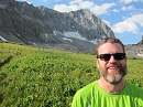
Well, the hiking portion of our week long adventure in the San Juans was done. Now we had a 5 hour (or so) drive ahead of us back to Denver. We stopped in Buena Vista for some food and a driver switch. We were back at our house in Denver by around 5pm. It was an amazing trip getting me to 48 14ers and Jordan to the big 5-0 with San Luis being his San Juan finisher. I've got the Wilson group left to finish out the San Juans and have an ambitious goal of finishing this fall. We had a great time together and met some great people in Chicago Basin.
Almost done with our trip
Thumbnails for uploaded photos (click to open slideshow):
I enjoyed Montanya Distillery as well (in Crested Butte) during a rainy day a couple weeks ago. Great place! I agree with you on the SW Ridge on Sneffels, my wife and I took the ridge up and the standard down. If I were to repeat it, I would just do the ridge both ways.
Hey Alicia and Jordan (Corey here) it was great to meet you guys and climb the Chicago Basin group together! The rest of your trip sounds like it was awesome, congrats to both of you for getting so much closer to your goals. Perhaps our paths will cross again on some peaks but you will both be done with your checklist long before I am . Great trip report and way to shake the nerves after that messy gully on Sunlight!
Most awesome photos (color). Such an enjoyable story. Congrats!
Caution: The information contained in this report may not be accurate and should not be the only resource used in preparation for your climb. Failure to have the necessary experience, physical conditioning, supplies or equipment can result in injury or death. 14ers.com and the author(s) of this report provide no warranties, either express or implied, that the information provided is accurate or reliable. By using the information provided, you agree to indemnify and hold harmless 14ers.com and the report author(s) with respect to any claims and demands against them, including any attorney fees and expenses. Please read the 14ers.com Safety and Disclaimer pages for more information.
Please respect private property: 14ers.com supports the rights of private landowners to determine how and by whom their land will be used. In Colorado, it is your responsibility to determine if land is private and to obtain the appropriate permission before entering the property.


 Needleton Train Stop")
 Twin Lakes")
 Summit of Mt Eolus")
 Grippy rock up to N. Eolus's summit")
 Corey, Jeff & Rob on the Catwalk")
 Us on the summit of N. Eolus")
 Goats in our campsite")
 Eolus from Twin Lakes")
 Heading to the gully in the upper basin")
 Stay to the left of this rock outcropping")
 Or you'll be treated to this loose gully. The white rock is all rotten and crumbles upon touch")
 Jordan only got this far on the summit block")
 Fun on the summit")
 Looking to Windom at our cross-over point")
 Sunlight and Sunlight Spire seen from Windom Peak")
 Summit of Windom Peak")
 Our campsite")
 Train arriving at Needleton stop")
 Train ride back to Silverton")
 Ouray from Box Canyon Falls")
 Car camping at the Yankee Boy Basin TH")
 Snow was up to the bottom of this sign last time we were here")
 Top of Blue Lakes Pass just before we cut right to the SW Ridge")
 A look up one of the gullies")
 Jordan reaching the ridge proper")
 Love this area!")
 Scrambling up the ridge")
 Sneffels summit")
 The V Notch")
 Loose Lavender Col")
 The Lavender Col last time we were here")
 Cows in the road to Stewart Creek TH")
 A look up the beginning of the route")
 Baby moose")
 Such a pretty hike")
 In the clouds on the San Luis summit")
 #48!")
 #50!")
 Almost done with our trip")