Download Agreement, Release, and Acknowledgement of Risk:
You (the person requesting this file download) fully understand mountain climbing ("Activity") involves risks and dangers of serious bodily injury, including permanent disability, paralysis, and death ("Risks") and you fully accept and assume all such risks and all responsibility for losses, costs, and damages you incur as a result of your participation in this Activity.
You acknowledge that information in the file you have chosen to download may not be accurate and may contain errors. You agree to assume all risks when using this information and agree to release and discharge 14ers.com, 14ers Inc. and the author(s) of such information (collectively, the "Released Parties").
You hereby discharge the Released Parties from all damages, actions, claims and liabilities of any nature, specifically including, but not limited to, damages, actions, claims and liabilities arising from or related to the negligence of the Released Parties. You further agree to indemnify, hold harmless and defend 14ers.com, 14ers Inc. and each of the other Released Parties from and against any loss, damage, liability and expense, including costs and attorney fees, incurred by 14ers.com, 14ers Inc. or any of the other Released Parties as a result of you using information provided on the 14ers.com or 14ers Inc. websites.
You have read this agreement, fully understand its terms and intend it to be a complete and unconditional release of all liability to the greatest extent allowed by law and agree that if any portion of this agreement is held to be invalid the balance, notwithstanding, shall continue in full force and effect.
By clicking "OK" you agree to these terms. If you DO NOT agree, click "Cancel"...
Rocking This Party Eight Days a Week! - Part 1 of 4: Warming up the Tea
Introduction
Since the birth of my daughter last December I hadn't been able to get out much except for a climb of Elbert in March. I was REALLY itching to try something BIG and grab a bunch of the Highest 100 peaks I had yet to climb. My original idea was to do a N-S sweep through the Weminuche grabbing all the peaks >13,700' from Arrow to Pigeon including the Chicago Basin peaks. Since I was planning to be a Point-Point hike I realized that I would basically have to carry my pack over EVERY peak! (Not looking forward to that!) Plus, with the heavier snow pack still sticking around I was worried several of the gullies/couloirs I was going to depend on to reduce the distance and elev gain/loss would not be easily passable. But, as I looked at my peak list more, the idea came to me of doing a grab-bag of the Highest 100 peaks that can be done as day trips from their respective TH's. I started counting the peaks up and ended up with 10 peaks from the Highest 100 list and 5 more nearby high peaks that could be added on fairly easily.
Two of the peaks (Dallas & Teakettle) were technical peaks so I posted on the forum for partners for these climbs. Kelly (moon stalker) joined me for Teakettle/Potosi and Dallas, Jim (Yikes) and Brandon (jbchalk) joined me for Dallas. Thanks guys! The rest of the peaks I did solo.
Stats: 8 days, 94mi, 39,300' elevation gain
7/3 - American, Jones, Niagara from Burns Gulch = 9.5mi, 4000' 7/4 - Teakettle and Potosi Peak = 7mi, 4600' 7/5 - Dallas Peak = 11mi, 5700' 7/6 - Half Peak and 8 miles towards RGP = 18.8mi, 6141' 7/7 - Rio Grande Pyramid = 12.8mi, 2600' 7/8 - Phoenix Peak = 11.4mi, 4400' 7/9 - Kit Carson Group:Kit Carson-North Ridge, Columbia Point, Kitty Kat Carson, Obstruction Peak, Challenger Point = 15mi, 7725' 7/10 - Cathedral Peak via Cathedral Couloir = 9mi, 4063'
A BAD Start can be a GOOD Sign
In the morning, I dropped off my wife and kids at the airport to catch a flight out to Utah to stay with her parents. I then hurried home and finished packing up my Forester and headed west along HWY 285/50 arriving in Silverton around 6pm. I then headed up towards Animas Forks and the Burns Gulch TH. When I got to the bridge to cross the Animas River for the Burns Gulch 4WD road, the 4WD road didn't look too bad so I headed up the road crossing the two creeks with ease. My Forester was able to handle the road just fine and I was looking forward to starting the next day around 11,500' up Burns Gulch. Then....I came to spot where I needed to gun the engine a little to get over some rocks (I could've gone around them I later realized), as I made it over one rock another rock anchored deeply in the road took direct aim at the sidewall on the driver-side front tire and blew it to smithereens! I let slip a barrage of Nazarene cuss words knowing the tire was toast and began to back down the road to a more "level" spot to change the tire. That not really "level" spot was about 100' down the road right about where the hub cap of the wheel fell off, the tire folded like a cheap suit and the rim started grating on the rocks. I set the parking brake, got out the spare tire and started jacking up the car. One thing I forgot was to set the jack on top of a single, solid, flat rock. Its base was on several smaller rocks. BAD IDEA!!!! As the car began to raise the jack start leaning TOWARDS ME!!! OH CRAP, my car was about to fall towards me and probably pin the jack underneath it! So I frantically began trying to lower the car back down before it fell over. Since the jack was now leaning towards me it caused the knuckles on my left hand to keep hitting the ground each time I rotated the jack wrench. I FINALLY got the rim back down to resting on a rock. Phew! I re-positioned the jack, placing the base on a single flat rock and then began raising the car again, this time much more successfully. Around the time I had tightened the "donut" spare tire on some nice guys in a big truck came up the road to check on me to see if I needed help. They then watched me as I backed down the road to make sure I made it alright, which I did.
That night, with the combination of sleeping at such a high altitude and the stress of blowing out a tire to start the trip, I did NOT sleep well at all... A funny thing is that tire blowout echoed the start of a peak bagging trip I did with my brother 4yrs ago where we severely punctured a tire beyond repair our first day heading up to Yankee Boy Basin for a climb of Sneffels. The rest of that trip went off without a hitch. So maybe the bad, no good, horrible start to this trip was in fact a GOOD sign of how my peak-bagging would go? It turns out that it most definitely was!
Evening Alpenglow on Niagara Peak
American-Jones-Niagara from Burns Gulch: 9.5mi, 4000', 5hrs
These peaks were a great group to start off with: high TH, easy approach, not too much elevation gain. The forecast for that day and just about every day of the entire trip was 50% chance of thunderstorms by either 9 or 10am. So I woke up at 4:30am for a 5:30am start up the Burns Gulch 4WD road. The road went quickly (Why did I try driving up it?!?! Why?!?!) and I soon reached the upper basin below Niagara's impressive north face.
Looking down Burns Gulch from near the top of the 4WD road
Looking up towards the saddle below Niagara's East Ridge.
I followed the old mining road as far as possible and then struck off across the talus towards the Jones-Niagara saddle which I reached 1:30 after leaving the car.
View from saddle: Half Peak and Rio Grand Pyramid are visible
I followed a used trail up Niagara's East Ridge as gorgeous views of the Grenadiers/Needles opened up to my south. There was a nice section of sun-cupped snow I had to cross near the summit.
Looking South towards the Needles on the way up Niagara's East Ridge
15mins from the saddle I reached Niagara's summit.
Looking West from Jones Mtn's Summit: Wilson Group to Sneffels visible
I soaked in the panoramic views that surrounded me for 15min or so and had a GU packet before I headed towards Jones Mtn.
Jones Mtn from saddle
30min later I reached the summit of Jones Mtn which has arguably the most extensive panoramic views in the San Juans. You can easily see from the Wilson group to the west to the San Luis/Phoenix group to the east and from Wetterhorn/Uncompahgre to the north to the Needles/La Platas to the south.
Looking back at Niagara from Jones Mtn summit
Handies and American Peak from Jones Mtn. Redcloud and Sunshine also visible
After another 10min rest atop Jones I headed for the long, loose, talus slog that is American Peak. The highlight of this slog is the view one gets of Handies and American Basin down the many couloirs that intersect the ridgeline. I could see several groups of people heading up Handies.
Icy and snowy Sloan Lake, Handies, Wetterhorn and Uncompahgre view from top of couloir on American Peak
50min (~9am) after leaving Jones I reached the highest bump on American Peak and took a 15min break.
Looking back at Niagara and Jones from American Peak
After the break I headed back across American Peak, choosing to stay on the crest of the ridge as much as possible to avoid the loose talus on the south slopes.
Impressive north face of Jones Mtn.
About 100' above the American-Jones saddle I headed west down into the basin. The gravel sized talus was easy to run down.
Looking back up towards American and Jones Mtn
Around 12,500' I came upon a gorgeous little lake that still had snow in it.
Soon I found an old mining road that I followed back to the Burns Gulch 4WD road which led me quickly back to my car; arriving there at 10:30am.
Jones and the impressive N Face of Niagara viewed on way down Burns Gulch 4WD road
I quickly jumped in my car and made the drive to the Montrose Wal-Mart to get a new tire for my car. (It felt SO good when I got back on pavement!) The whole time I was worried that I had damaged the rim on the wheel by backing down the rocky 4wd road so far with a flat tire. (The sound of my rim "grating" on the rocks still haunted me!) But they installed it just fine and I was on my way back to Ouray to soak in the Hot Springs for a couple of hours in prep for the next day's climb of Teakettle and Potosi Peak.
Teakettle Mtn and Potosi Peak: 7mi, 4600', 8hrs
I cooked dinner that night at the YBB TH and waited for Kelly. We both arose at 4:30am in the morning and were off by 5:30am. Teakettle doesn't mess around with any type of introduction. We walked down the road ~100' or so and once you leave the road the route is straight up the slopes to Coffeepot. About 30min after we started the sunrise began to illuminate the peaks across YBB from us.
It took us about 1 hour to climb the 0.8mi & 2200' to the shoulder of Coffeepot. Here we got a great view of the "Black Gully" on Teakettle and Mt Sneffels. After a short break we began the traverse to TeaK by dropping down a very loose gully. We followed cairns and climbers trails across to the base of the Black Gully which we climbed quickly.
Teakettle from Coffeepot's shoulder
Morning light on Mt Sneffels from Coffeepot's shoulder
Another view of TeaK as we near the Black Gully
Looking up the Black Gully
From the top of the Black Gully we were a little bit unsure where the sandy gully was that would take us above the cliffs to the next level on TeaK. As you can see from the photo below it's not immediately apparent. We figured since no one really commented about any difficulty finding this gully it must just be hidden. Sure enough, once we crossed the sandy slopes of the bench a wide open and sandy gully appeared to our right at the location of the arrow in the picture below.
Red arrow shows where dry, sandy gully opens up to get above cliffs
Once on this sandy bench we got to a 100' wide snow field we needed to cross. It was steep enough that we both decided to put on our microspikes for safety's sake.
Icy, snowy section we put Microspikes on for. Potosi looking impressive in background
Shortly after the snow crossing we arrived at the classic viewpoint of Teakettle and we of course had to take the classic picture where one stands in the hole of TeaK's handle.
Classic shot in the handle of TeaK
When we reached the 5.3 summit block we put our harnesses on and I went over to inspect the route. It didn't look too difficult to me and was much shorter than I thought it would be (~30'). So Kelly and I decided to just solo it "sans" rope. Kelly brought her rope for the rappel down. I didn't end up doing the rappel as I just soloed the descent while Kelly rappelled it. She figured that she had carried that rope ALL the way up there and she was for darn sure going to use it!
Kelly finishing her rappel. (taken on way down)
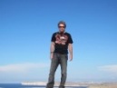
Selfie w/ Sneffels behind
Kelly gearing up with Sneffels behind
Curvy, Sexy rock glacier below TeaK. Humina, humina, humina....
Once back down from TeaK's summit block we set our eyes on the next "prize" for the day. 13,786' Potosi Peak. We did the traverse back to Coffeepot's shoulder and then followed the climbers trail along the ridgeline and down to the Coffeepot-Potosi saddle.
The mighty Potosi Peak!
I was a bit worried about a couple of the snowfields on the bench we would have to traverse across to get around to Potosi's SE ridge. Fortunately, we were able to get below and bypass them fairly easily without getting too close to the cliffs below the bench.
Snow fields above cliffs that we were thankfully able to get around without any problem
Circumnavigating Potosi all the way to the SE ridge took awhile as we kept wondering which gully was the correct one to ascend. You have to go pretty much ALL THE WAY to the SE ridge to get to the correct gully.
STILL circumnavigating Potosi to the SE corner!
Then we had to pick our way up the gully trying to stay on rock as much as possible and avoid the sloppy wet snow filling much of it.
The jumbled mess that is Potosi. This is gully we climbed/descended
1.5hrs after leaving TeaK we made it to Potosi's flat summit. A nice 45min rest/lunch allowed us to soak in the incredible views that surrounded us.
Looking west from Potosi's summit. Sneffels and Dallas Peak visible
View of Wilson Group from Potosi's summit
Looking South from Potosi. Needles in the distance.
We descended back down and around Potosi until the Coffeepot-Potosi saddle. Here we descended the loose talus straight down towards the YBB road.
Kelly coming down from Potosi-Coffeepot saddle
Tales of people not traversing enough and getting cliffed out coming down this way ran through my mind so I made sure to keep traversing south/left across the grassy slopes.
Tundra cruising. Be careful, it's slippery!
Well, we ended up going a couple of gullies too far actually! I peered down the gully I finally came to and it was VERY steep, bare rock with ball bearing gravel in it. One slip and you are toast! So we went one gully back to the north, descended down a ridge splitting it and found a ramp to exit onto the nice talus in the middle of the gully.
"Talus Running" down the gully that got us past the cliffs
Halfway down this gully I looked back up and saw the easiest gully to descend was in fact one more further to the north from the one we went down and has a distinctive "fin" right at the top of it that can be actually be seen from the grassy slopes above. In the pics below the red line was our approximate route while the yellow line is an alternative.
Red Line = Approx route we took. Yellow Line = Alternative? "Red Circle" shows where the "fin" is that
Zoom in of "The Fin"
We finally reached the YBB road right when the first rain drops started to fall and cruised back on up to the cars getting there at 1:30pm.
Phew! What a day! And this was only day #2 of 8!
Kelly headed back to Ouray and I chilled and relaxed by my car for awhile. Once I got down to Ouray I gave Kelly a call. Her friend Shawn (sdkeil) and some others were climbing Dallas that day and she got a conditions update from them for the north face of Dallas as it tends to hold snow longer. Shawn told her that they made it to the top of the ramp Roach says you have to descend for 60' and saw that the ramp was covered by very steep snow that they weren't prepared to traverse. A slip on this slope and you go "bye-bye" off a 1000' cliff! Plus it was getting late for them and thunderstorms were threatening. Their group made the decision to turn around just 100' from Dallas' summit.
We then spent the next hour texting furiously back and forth with each other and with Jim (Yikes) and Brandon (jbchalk) about what we wanted to do. We thought about trying the more technical options Roach describes for the South Face of Dallas but I didn't have my climbing shoes with me. In the end, Brandon's enthusiastic and infectious confidence in being able to lead the normal route and the fact that Kelly had a snow picket we could use to protect the traverse won everyone over.
I know exactly which rocks you are referring to up on Burns Gulch. Go around!
Caution: The information contained in this report may not be accurate and should not be the only resource used in preparation for your climb. Failure to have the necessary experience, physical conditioning, supplies or equipment can result in injury or death. 14ers.com and the author(s) of this report provide no warranties, either express or implied, that the information provided is accurate or reliable. By using the information provided, you agree to indemnify and hold harmless 14ers.com and the report author(s) with respect to any claims and demands against them, including any attorney fees and expenses. Please read the 14ers.com Safety and Disclaimer pages for more information.
Please respect private property: 14ers.com supports the rights of private landowners to determine how and by whom their land will be used. In Colorado, it is your responsibility to determine if land is private and to obtain the appropriate permission before entering the property.


")


 Evening Alpenglow on Niagara Peak")
 Looking down Burns Gulch from near the top of the 4WD road")
 Looking up towards the saddle below Niagara's East Ridge.")
 View from saddle: Half Peak and Rio Grand Pyramid are visible")
 Looking South towards the Needles on the way up Niagara's East Ridge")
 Jones Mtn from saddle")
 Looking West from Jones Mtn's Summit: Wilson Group to Sneffels visible")
 Looking back at Niagara from Jones Mtn summit")
 Handies and American Peak from Jones Mtn. Redcloud and Sunshine also visible")
 Icy and snowy Sloan Lake, Handies, Wetterhorn and Uncompahgre view from top of couloir on American Peak")
 Looking back at Niagara and Jones from American Peak")
 Impressive north face of Jones Mtn.")
 Looking back up towards American and Jones Mtn")
 Jones and the impressive N Face of Niagara viewed on way down Burns Gulch 4WD road")
 Teakettle from Coffeepot's shoulder")
 Morning light on Mt Sneffels from Coffeepot's shoulder")
 Another view of TeaK as we near the Black Gully")
 Looking up the Black Gully")
 Red arrow shows where dry, sandy gully opens up to get above cliffs")
 Icy, snowy section we put Microspikes on for. Potosi looking impressive in background")
 Classic shot in the handle of TeaK")
 Kelly finishing her rappel. (taken on way down)")
 Selfie w/ Sneffels behind")
 Kelly gearing up with Sneffels behind")
 Curvy, Sexy rock glacier below TeaK. Humina, humina, humina....")
 The mighty Potosi Peak!")
 Looking west from Potosi's summit. Sneffels and Dallas Peak visible")
 View of Wilson Group from Potosi's summit")
 Looking South from Potosi. Needles in the distance.")
 The jumbled mess that is Potosi. This is gully we climbed/descended")
 STILL circumnavigating Potosi to the SE corner!")
 Snow fields above cliffs that we were thankfully able to get around without any problem")
 Kelly coming down from Potosi-Coffeepot saddle")
 Tundra cruising. Be careful, it's slippery!")
 \"Talus Running\" down the gully that got us past the cliffs")
 Red Line = Approx route we took. Yellow Line = Alternative? \"Red Circle\" shows where the \"fin\" is that")
 Zoom in of \"The Fin\"")