Download Agreement, Release, and Acknowledgement of Risk:
You (the person requesting this file download) fully understand mountain climbing ("Activity") involves risks and dangers of serious bodily injury, including permanent disability, paralysis, and death ("Risks") and you fully accept and assume all such risks and all responsibility for losses, costs, and damages you incur as a result of your participation in this Activity.
You acknowledge that information in the file you have chosen to download may not be accurate and may contain errors. You agree to assume all risks when using this information and agree to release and discharge 14ers.com, 14ers Inc. and the author(s) of such information (collectively, the "Released Parties").
You hereby discharge the Released Parties from all damages, actions, claims and liabilities of any nature, specifically including, but not limited to, damages, actions, claims and liabilities arising from or related to the negligence of the Released Parties. You further agree to indemnify, hold harmless and defend 14ers.com, 14ers Inc. and each of the other Released Parties from and against any loss, damage, liability and expense, including costs and attorney fees, incurred by 14ers.com, 14ers Inc. or any of the other Released Parties as a result of you using information provided on the 14ers.com or 14ers Inc. websites.
You have read this agreement, fully understand its terms and intend it to be a complete and unconditional release of all liability to the greatest extent allowed by law and agree that if any portion of this agreement is held to be invalid the balance, notwithstanding, shall continue in full force and effect.
By clicking "OK" you agree to these terms. If you DO NOT agree, click "Cancel"...
7/3 - American, Jones, Niagara from Burns Gulch = 9.5mi, 4000' 7/4 - Teakettle and Potosi Peak = 7mi, 4600' 7/5 - Dallas Peak = 11mi, 5700' 7/6 - Half Peak and 8 miles towards RGP = 18.8mi, 6141' 7/7 - Rio Grande Pyramid = 12.8mi, 2600' 7/8 - Phoenix Peak = 11.4mi, 4400' 7/9 - Kit Carson Group:Kit Carson-North Ridge, Columbia Point, Kitty Kat Carson, Obstruction Peak, Challenger Point = 15mi, 7725' 7/10 - Cathedral Peak via Cathedral Couloir = 9mi, 4063'
From Part 1, after climbing Teakettle
Kelly headed back to Ouray and I chilled and relaxed by my car for awhile. Once I got down to Ouray I gave Kelly a call. Her friend Shawn (sdkeil) and some others were climbing Dallas that day and she got a conditions update from them for the north face of Dallas as it tends to hold snow longer. Shawn told her that they made it to the top of the ramp Roach says you have to descend for 60' and saw that the ramp was covered by very steep snow that they weren't prepared to traverse. A slip on this slope and you go "bye-bye" off a 1000' cliff! Plus it was getting late for them and thunderstorms were threatening. Their group made the decision to turn around just 100' from Dallas' summit.
Picture of Dallas Peak's North Face taken 6/28, a week prior to our climb!Photo Source TR
We then spent the next hour texting furiously back and forth with each other and with Jim (Yikes) and Brandon (jbchalk) about what we wanted to do. We thought about trying the more technical options Roach describes for the South Face of Dallas but I didn't have my climbing shoes with me. In the end, Brandon's enthusiastic and infectious confidence in being able to lead the normal route and the fact that Kelly had a snow picket we could use to protect the traverse won everyone over.
Dallas Peak: 11mi, 5700', 9hrs
Kelly, Jim and I met up in Telluride for dinner. Telluride was having their Independence Day Celebration and about a gazillion people were there. It seemed the chief "independence" the visitors were really celebrating was independence from having to walk on the sidewalk! They would just wander everywhere not looking for cars at all and would just randomly stand there in the middle of the street while you honked at them to get out of the way. Then they would give you strange looks like "What is a car doing in the street?" We were going to do dinner at Smuggler's Brew Pub but the wait was ~1hr. Jim said that Oak's Beer, Bourbon & BBQ had no wait so we went over there. After dinner we drove up to the Mill Creek TH and bedded down just as the fireworks began in Telluride.
The forecast for Dallas Peak was 50% chance of thunderstorms after 8am which, combined with the longer approach, impelled us to go for a 4:30am start. Brandon showed up right on time and we set off in the darkness up the Deep Creek Trail. Our first break was at the junction with the Sneffels Highline Trail and we reached the spot where you leave the trail to head up the south slopes of Dallas at 6:15am. The soft morning light shining on the peaks to the south was quite sublime.
Sublime morning light above T-ride
I suggested we backtrack a little bit and head up a grassy ridgeline just before the location Roach tells you to leave the trail. I'd rather go up nice grass instead of loose scree and talus. The others concurred and we made quick time up this enjoyable slope.
Grassy ridge forms left hand border of picture. Red line is our route, Yellow line is standard route
Kelly and Jim climbing up the Grassy Ridge. Photo Credit: Brandon
As we got close to the top of the ridge we located an exit spot where we could begin our traverse right/East to rejoin the normal route. Once we got over to the gully Jim put on his crampons and headed up the snow that filled it. The rest of us stayed to the right of the snow and picked our way up to the base of the cliffs. The whole time you are approaching this section the route to surpass the cliffs is not obvious. You just have to trust that a passable route will appear. Then, once you get there, pick your way up the broken ledges until you get to the bench above the cliffs. Once above the cliffs there is a nice climbers trail that goes right/East.
Bench above 1st set of cliffs. Dallas Peak has a way of making you feel really small! There is a nice climbers trail to fol
The climbers trail leads you shortly to the East facing slopes of Dallas. (This next section always confused me so I annotated the next several pictures to aid others in the future.) You then begin an ascending traverse of the East slopes here. There is still a climbers trail in some spots and there are also cairns occasionally. (see picture #5 & #6 below)
View after turning the corner to the East side. Red line marks general route.
Looking down on this section. Red line marks route.
Once you get to the location of Picture #6 you continue to head further E/NE for 100 yards or so then you will need to turn to the left/West and gain a ledge that leads you to the Class 4 section. Once we reached the Class 4 section, Brandon went straight up a small dark stained gully. I noticed an easier route just to its left that had excellent handholds and footholds. Kelly and Jim chose this route too and we all agreed that it was easier than the dark gully. (See Pics #25 & 26 for more views of the Class 4 section)
Looking up from location of Pic #6 towards summit towers. Annotated
Looking down from top of Class 4 section. Line shows route. Red circle is where Pic #7 was taken from for reference.
Above the Class 4 section we continued up the loose rocks towards the towers that make up the summit. We weren't surprised to see the cave under the "car-sized chockstone" was still filled in with snow. This just meant we would have to rappel over the top of the chockstone on the descent.
Route above the Class 4 section, annotated. Red circle shows location of Pic #10. Photo credit: Brandon
We aimed for the Class 4 chimney that was just to the right of the chockstone gully. We all agreed that this chimney required some low Class 5 moves but was fine without a rope.
Brandon in Class 4 chimney. We all felt moves were low 5th class.
Looking down the chimney as we climbed up. Photo credit: Brandon
After the chimney you traverse around to the North side of the summit block and climb a bit to get to the top of the ramp Roach mentions. Now we would FINALLY see if the ramp was indeed too dangerous to traverse as Shawn and his group from the previous day had said. The whole way up, with all this work and elevation gain, the question still remained as to whether we would be turned back also as Shawn and his group did the day prior.
Brandon approaching the top of the "Ramp"
When we got to the top of the ramp (You know what? No one in our group took a picture looking down the ramp! Doh!) we could see that there was a 2-3' foot section along the right edge of the ramp that was dry with snow to the left. We descended down it 15' or so and then there was a 3' step down where we needed to put our hands in the snow to anchor ourselves (ice axe would've been better but it was just one step). A slip here and you would fall down the 1000' cliff that is the North face of Dallas Peak. After the step, the dry section on the ramp widened gradually over the next 15' or so from 3' to 6' wide. When we got to this widest spot we looked up and lo and behold, there was the crack that would lead us to the summit! Hallelujah!! We're going to make it! We all put on our harnesses and with Jim belaying, Brandon started up the 15' of snow that was at the base of the crack. He placed Kelly's picket to protect the snow portion and then began the rock portion of the crack. He only placed one more cam until he reached the belay position. I then tied in to the middle of the rope and Kelly at the end as we basically simul-climbed up to the summit arriving around 9:15am. So it took us 4:45 from the TH to the summit.
Brandon climbing the "Crack" on the summit block
Jim belaying Brandon as Kelly and I watch on. 2 feet behind Kelly is a 1000' cliff!
Man, it felt SO good to be on the summit after all the pent up worry about the snow on the ramp. Jim cleaned the route as he climbed and made it up in short order.
Jim topping out after cleaning the route. You can see Brandon's belay position below.
Our Fearless Leader!!!
We relaxed on the summit, soaking the sun and the mind-blowing views, for about 45mins. Fortunately, the clouds weren't yet forming into storm clouds so we didn't need to feel in a hurry to leave. When I signed the summit register I noticed that no one had signed it since September of 2013! We just may have been the first ones to summit in 2014!
Way to go Team! Photo credit: Brandon
Wilsons! to the SW
Looking South
Looking SE. Grenadiers and Needles visible in far distance.
Looking West
Around 10am Jim started to set up the rappel from the rappel station on the SE side of the summit using the 2 30m ropes Brandon brought. Since Jim set it up he had to be the guinea pig to test it! We had to go OVER the chockstone because the cave was filled with snow. The ropes were a perfect length, making it to a dry ledge about 20' up from the bottom of the snow below the chockstone.
Jim prepping the rappel. Sneffels, TeaK and Potosi visible and Uncompahgre lurking in background.
Since this was my first time ever rappelling in an "alpine" environment it took me about 5mins for my nerves to calm down and for me to finally go over the edge and begin my rappel. Brandon was very kind and patient with me, talking me through my nervousness. Thanks dude!
Me starting the rappel. You can see Kelly and Jim far below. Photo credit: Brandon
Me rappelling down the South face of Dallas Peak. Photo Credit: Kelly
We then headed back down to the Class 4 section. Some people rappel down this section and there is even a sling set up at the top of it to do a rappel. For us, we all felt the route we came up was so solid, with plentiful hand & footholds, we decided not to use a rope and didn't regret it.
Getting ready to head down
Below the Class 4 section. We didn't set up a rappel here as it was pretty solid with good hand & foot holds.
Another view at Class 4 section with summit towers visible. Kelly and Jim are coming down the Class 4 section.
We quickly retraced our steps down and around to the bench above the cliffs on the south side of the peak.
Brandon on a nice perch w/ gorgeous Mill Creek Basin behind
Once we got below the cliffs we followed the normal route back down to the Sneffels Highline Trail.
Heading down
Talus running!
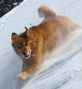
Back at the trail, we cruised down to meet Brandon's wife Kristine who was waiting with their dogs Kona and Rainier at the junction of the Deep Creek and Sneffels Highline Trails. We chatted with her for 10mins or so and then all headed back to the Silver Creek TH, arriving there a little after 1pm.
After everyone split up, I headed into town to grab my ritual quart of chocolate milk and a HUGE sandwich from the grocery store, which I ate just outside of town at a scenic overlook. I then drove back to Ouray to soak in the hot springs again for a couple of hours and to get a nice hot shower as well.
Views from Hwy 62
Views from Hwy 62
After the hot springs I drove back through Montrose, ate another huge sub sandwich at Wal-Mart and then drove on Hwy 50 to the Blue Mesa Cutoff which lead me back to Lake City and the Cataract TH in prep for the next day's climb of Half Peak via the East Face/NE ridge.
To be continued in Part 3....
Thumbnails for uploaded photos (click to open slideshow):
You really had a streak of getting out there. We had no snow when we did Dallas, for which I was quite thankful. In your image #2, we went up the grassy shoulder to the right of your yellow line standard route; we found it a nice talus alternative, too. I agree that the route traversing to the east face seemed confusing on paper but was pretty straightforward once on the route--never really exceeding Class 2ish. I thought the Class 4 chimney presented the biggest obstacle on the day. Helpful annotations. Congrats!
JosephG - That's exactly how we felt too with regards to the East Face portion. Kinda confusing and Roach is light on description. I couldn't find any TR's that were annotated at all, that why I did so much on mine. You're right though, once you are there the route is fairly logical if you have good route finding skills and there are cairns to help too.
Dillon - It was quite the privilege to be in the presence of greatness! Talked a bunch about his Seven Summits accomplishment.
Wow what a great post. I will eventually do dallas and this is such a great set of pics and route on the pics. Good job
Caution: The information contained in this report may not be accurate and should not be the only resource used in preparation for your climb. Failure to have the necessary experience, physical conditioning, supplies or equipment can result in injury or death. 14ers.com and the author(s) of this report provide no warranties, either express or implied, that the information provided is accurate or reliable. By using the information provided, you agree to indemnify and hold harmless 14ers.com and the report author(s) with respect to any claims and demands against them, including any attorney fees and expenses. Please read the 14ers.com Safety and Disclaimer pages for more information.
Please respect private property: 14ers.com supports the rights of private landowners to determine how and by whom their land will be used. In Colorado, it is your responsibility to determine if land is private and to obtain the appropriate permission before entering the property.


 Sublime morning light above T-ride")
 Grassy ridge forms left hand border of picture. Red line is our route, Yellow line is standard route")
 Kelly and Jim climbing up the Grassy Ridge. Photo Credit: Brandon")
 Bench above 1st set of cliffs. Dallas Peak has a way of making you feel really small! There is a nice climbers trail to fol")
 View after turning the corner to the East side. Red line marks general route.")
 Looking down on this section. Red line marks route.")
 Looking up from location of Pic #6 towards summit towers. Annotated")
 Looking down from top of Class 4 section. Line shows route. Red circle is where Pic #7 was taken from for reference.")
 Route above the Class 4 section, annotated. Red circle shows location of Pic #10. Photo credit: Brandon")
 Brandon in Class 4 chimney. We all felt moves were low 5th class.")
 Looking down the chimney as we climbed up. Photo credit: Brandon")
 Brandon approaching the top of the \"Ramp\"")
 Brandon climbing the \"Crack\" on the summit block")
 Jim belaying Brandon as Kelly and I watch on. 2 feet behind Kelly is a 1000' cliff!")
 Jim topping out after cleaning the route. You can see Brandon's belay position below.")
 Our Fearless Leader!!!")
 Way to go Team! Photo credit: Brandon")
 Wilsons! to the SW")
 Looking South")
 Looking SE. Grenadiers and Needles visible in far distance.")
 Looking West")
 Jim prepping the rappel. Sneffels, TeaK and Potosi visible and Uncompahgre lurking in background.")
 Me starting the rappel. You can see Kelly and Jim far below. Photo credit: Brandon")
 Getting ready to head down")
 Below the Class 4 section. We didn't set up a rappel here as it was pretty solid with good hand & foot holds.")
 Another view at Class 4 section with summit towers visible. Kelly and Jim are coming down the Class 4 section.")
 Brandon on a nice perch w/ gorgeous Mill Creek Basin behind")
 Heading down")
 Talus running!")
 View of Wilson Group from Sneffels Highline Trail")
 Views from Hwy 62")
 Views from Hwy 62")
 Me rappelling down the South face of Dallas Peak. Photo Credit: Kelly")