Download Agreement, Release, and Acknowledgement of Risk:
You (the person requesting this file download) fully understand mountain climbing ("Activity") involves risks and dangers of serious bodily injury, including permanent disability, paralysis, and death ("Risks") and you fully accept and assume all such risks and all responsibility for losses, costs, and damages you incur as a result of your participation in this Activity.
You acknowledge that information in the file you have chosen to download may not be accurate and may contain errors. You agree to assume all risks when using this information and agree to release and discharge 14ers.com, 14ers Inc. and the author(s) of such information (collectively, the "Released Parties").
You hereby discharge the Released Parties from all damages, actions, claims and liabilities of any nature, specifically including, but not limited to, damages, actions, claims and liabilities arising from or related to the negligence of the Released Parties. You further agree to indemnify, hold harmless and defend 14ers.com, 14ers Inc. and each of the other Released Parties from and against any loss, damage, liability and expense, including costs and attorney fees, incurred by 14ers.com, 14ers Inc. or any of the other Released Parties as a result of you using information provided on the 14ers.com or 14ers Inc. websites.
You have read this agreement, fully understand its terms and intend it to be a complete and unconditional release of all liability to the greatest extent allowed by law and agree that if any portion of this agreement is held to be invalid the balance, notwithstanding, shall continue in full force and effect.
By clicking "OK" you agree to these terms. If you DO NOT agree, click "Cancel"...
09.02.14
Approach: Cataract Gulch TH
Routes: Quarter peak from Cataract gulch; Half peak via East Face (Class 3), South ridge descent (standard); Pt. 13,164 from Half, descent via Cataract gulch
Mileage: 16.6 miles
Vertical: 6.3k
Time: under 13 hours
Party: solo
With no firm plans for September 2nd (I took an extra day off in order to avoid the inbound Denver traffic on Monday), I was eyeing an attempt on Gladstone and saving Half for a later date. However, with the trailhead being so close to the RGP Reservoir and weather forecast and conditions nearly perfect, it really made sense to attempt the peaks the following day. After refueling in Lake City at a burger joint, I made my way to the Cataract Gulch TH. I slept pretty well, maybe too well, and didn't start on the trail before 7am. Well, at least I felt well rested and was moving right along. Following some beta from the recent trip reports (special thanks to Doggler and Benners/Dillon), it really made sense to me to start with Quarter peak first. I cruised past the impressive waterfall to just past the tree line near 11.5k and left the main trail once it started going over the rock glacier. The gentle grassy ridge seemed like a reasonable ascent route. I even encountered cairns here and there.
Waterfall
Leaving the trail ~11.5k and heading uphill on a grassy slope
Looking back at the vertical gain
Quarter comes into view
For whatever reason, I just wasn't sure which point on the ridge is the correct summit, so I kept stopping, looking at the GPS and maps, and losing time. As I drew close, the ascent line was getting more obvious, but I was frustrated with the lost time.
Talus slog from the saddle
(False) summit comes into view
Loose terrain which will steepen near the (false) summit
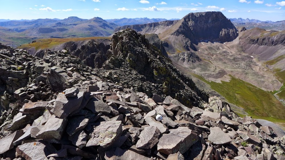
True summit comes into view
Terrain near the summit
I went to the right of the ridge which got steeper and looser which made me slightly uncomfortable. As expected, it was only a false summit. Finally reached the summit at 11am, or roughly 4 hours after leaving TH. I thoroughly enjoyed the summit view, but the peak itself wasn't giving me a good vibe. It was strange. I was anxious to get down, but the loose descent route and circumventing the entire basin didn't appeal to me.
Half peak from Quarter
As I descended to the saddle with the false summit, I looked left (West) and the talus slope didn't look too bad as a descent option to me. The slope angle didn't look too steep and talus wasn't too crumbly. After studying maps and determining that the slope shouldn't cliff out, I took the plunge - for whatever reason I just didn't like the ascent route.
Initial descent from Quarter
A faint trail traversing the slope
For the first 600 hundred feet I was wondering if it would be a "first descent" route since all the reports I've seen were for the Cataract gulch side. Alas, a cairn and then a faint trail put my FD aspirations to rest. The slope looked loose, but the faint trail certainly helped - just watch the footing. After about 0.15 miles the trail unfortunately ended, as it looked like the person might have descended lower. I stubbornly decided to continue crossing talus fields trying not to lose much elevation.
The going was slow though - I encountered stable talus, unstable talus, dangerously steep talus and everything in between. Eventually, I decided to bite the bullet and descend to the grassy slope lower in the basin. The lowest elevation on my GPS read 12,575 ft, which I thought was comparable with the drop on the East side. Not sure if the route I chose was any better - although shorter in mileage, it was rather tedious. I took it slow, not willing to risk a twisted ankle or worse. The bonus, though, were the views. I got to stare at the Half peak for the duration of the "traverse" and gauging my progress (or lack of thereof), and also had a very nice view of Handies and the Jones group.
Handies and friends
Looking back at Quarter and the low traverse on talus
Once actually reaching the saddle with Half, the fun climbing began. The slope is gentle, with some cool rockbands and not too loose. I was making up for some time lost on the traverse.
Gentle slope ends in a knife edge ridge
Up higher, I tried to follow Roach's cryptic description of finding the "shallow gully marked with cairns". The first gully after topping on the lower ridge seemed to have cairns, so I followed it to the top of the ridge. The climbing was fun and fairly solid, reminiscent of Crestone Needle and I wasn't getting that weird funky feeling as back on Quarter. But I didn't see any cairns on the ridge, so it was likely the wrong gully. Oops, but a little extra scrambling wasn't a chore. I descended back about 100 feet or so and examined the next gully. I t seemed a bit steeper and looser than the first one, but I decided to give it a go.
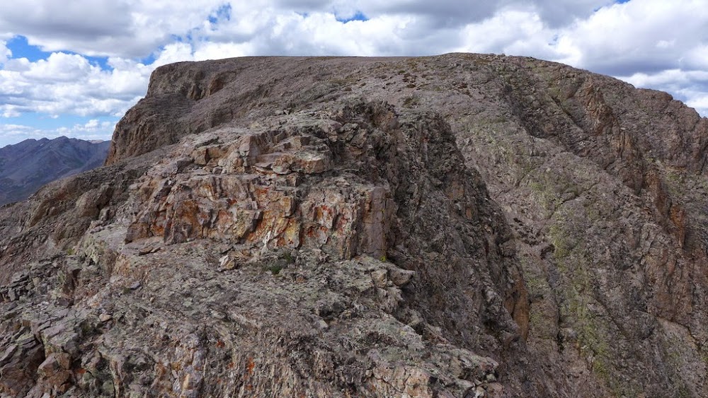
Top of the 2nd (correct gully)
After a few moves I topped out above the steeper section and immediately saw a bunch of cairns. The terrain quickly mellowed and it was an easy stroll to the summit. I looked for a register but there was none.
Summit ahead
Quarter from Half
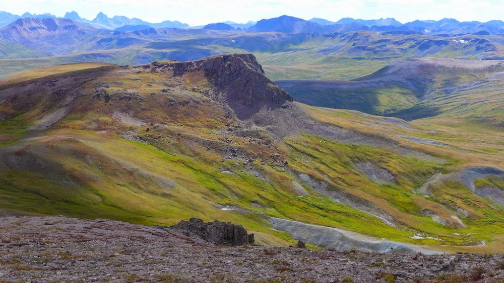
I was going to descend the standard route and PT 13,164 was tantalizingly close to the turnoff back to the Cataract lake. Although it was getting late (summit of Half at 3pm), I figured this extra peak shouldn't add that much time. In fact, it went pretty quickly with the roundtrip close to 45 minutes and provided a great view of Half and neighboring peaks, particularly the Jones group.
Pt 13,164 in the distance
Class 2 trail on the descent from Half
Pt 13,164 from Half
Fall colors starting to pop
Half from Pt 13,164
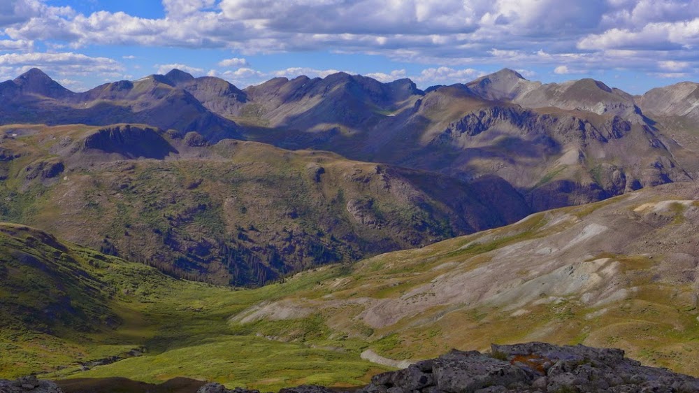
Niagara, Jones, American and Handies from Pt 13,164
Off the final summit at 4.44pm, out of water and about 6 miles to go back to the TH. Yeahaw. Well, at least it was the nicest trail I could imagine with the perfect downhill pitch. I even tried running despite clunky GPS, camera and an oversized backpack, so the first mile or two went pretty quick. After that the trail flattened out and the scenery became too distracting, so my pace slowed. The last two miles were sort of painful, as I slowly inched my way back to the TH for the ~3 hours deproach time, with the roundtrip total of 13 hours.
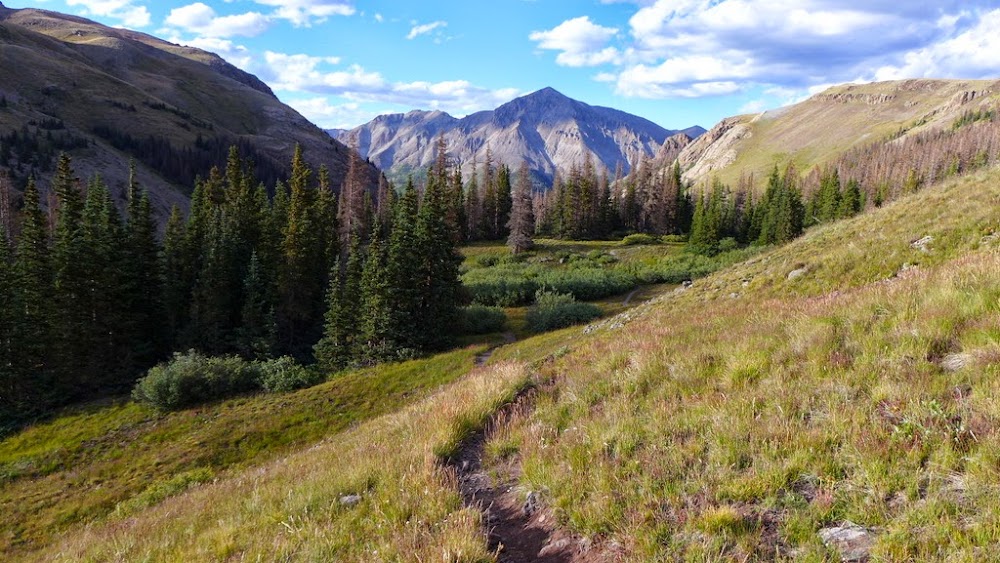
trail to Cataract lake
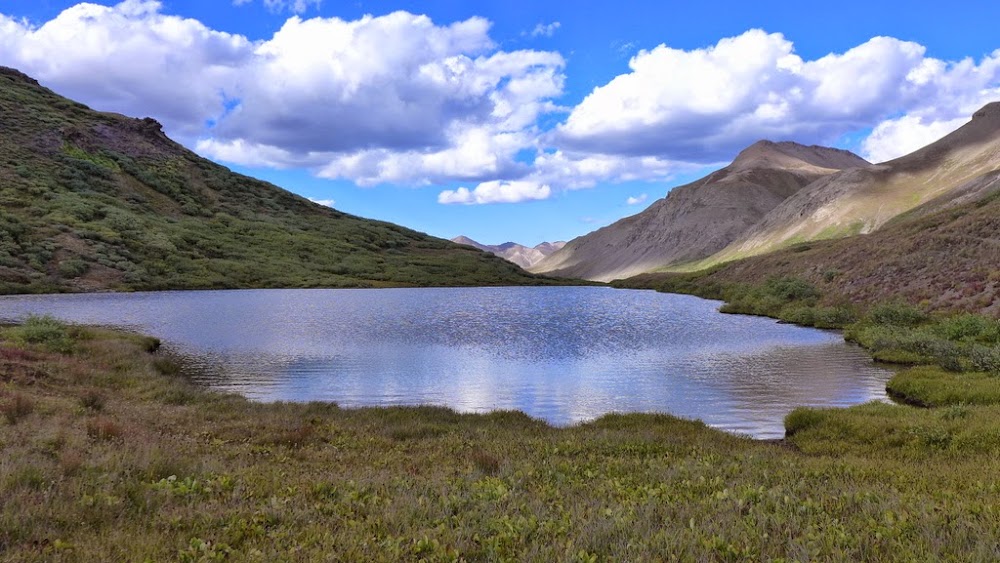
Unnamed lake next to Cataract lake
My GPS Tracks on Google Maps (made from a .GPX file upload):
Great pictures as always, Natalie. Looks like a really nice 13er sort of day, agree with the comment above that fall is on the way.
Hope all is well,
-Tom
PS: I was down in the Cimmaron Valley a few weeks back (Chimney Rock) looking at our Coxcomb traverse. Much more melted out, downright easy. Oh well, timing is everything, no?
I think the best thing about Quarter is that view of Half and the Grenadiers looming in the vastness behind it that you captured so well. Also the waterfall on the trail is one of the coolest ”up close” waterfalls I've hiked by. Great report and way to add on the bonus 13er at the end.
I think my camera likes fall colors and lighting - not sure why
Tom - great to hear from you, and yeah, who can forget that traverse 8) Brandon - it is a lovely basin indeed. It is in the San Juans after all. Steve - thanks for the kind words. Quarter definitely has some great views, but the combo of loose rock and solitude wasn't giving me a good vibe... The waterfall is very impressive (as well as the smaller one closer to the TH), I think earlier in the season it would have been even better. A bonus 13er was easy to add indeed - so close to the great trail and barely extra 300 ft vert. Wish I was moving a bit quicker, but the SJ views are always so distracting
Caution: The information contained in this report may not be accurate and should not be the only resource used in preparation for your climb. Failure to have the necessary experience, physical conditioning, supplies or equipment can result in injury or death. 14ers.com and the author(s) of this report provide no warranties, either express or implied, that the information provided is accurate or reliable. By using the information provided, you agree to indemnify and hold harmless 14ers.com and the report author(s) with respect to any claims and demands against them, including any attorney fees and expenses. Please read the 14ers.com Safety and Disclaimer pages for more information.
Please respect private property: 14ers.com supports the rights of private landowners to determine how and by whom their land will be used. In Colorado, it is your responsibility to determine if land is private and to obtain the appropriate permission before entering the property.