Download Agreement, Release, and Acknowledgement of Risk:
You (the person requesting this file download) fully understand mountain climbing ("Activity") involves risks and dangers of serious bodily injury, including permanent disability, paralysis, and death ("Risks") and you fully accept and assume all such risks and all responsibility for losses, costs, and damages you incur as a result of your participation in this Activity.
You acknowledge that information in the file you have chosen to download may not be accurate and may contain errors. You agree to assume all risks when using this information and agree to release and discharge 14ers.com, 14ers Inc. and the author(s) of such information (collectively, the "Released Parties").
You hereby discharge the Released Parties from all damages, actions, claims and liabilities of any nature, specifically including, but not limited to, damages, actions, claims and liabilities arising from or related to the negligence of the Released Parties. You further agree to indemnify, hold harmless and defend 14ers.com, 14ers Inc. and each of the other Released Parties from and against any loss, damage, liability and expense, including costs and attorney fees, incurred by 14ers.com, 14ers Inc. or any of the other Released Parties as a result of you using information provided on the 14ers.com or 14ers Inc. websites.
You have read this agreement, fully understand its terms and intend it to be a complete and unconditional release of all liability to the greatest extent allowed by law and agree that if any portion of this agreement is held to be invalid the balance, notwithstanding, shall continue in full force and effect.
By clicking "OK" you agree to these terms. If you DO NOT agree, click "Cancel"...
Ellingwood & Blanca via Zapata Falls
~12.7 miles
~ 6,800ft elevation gain
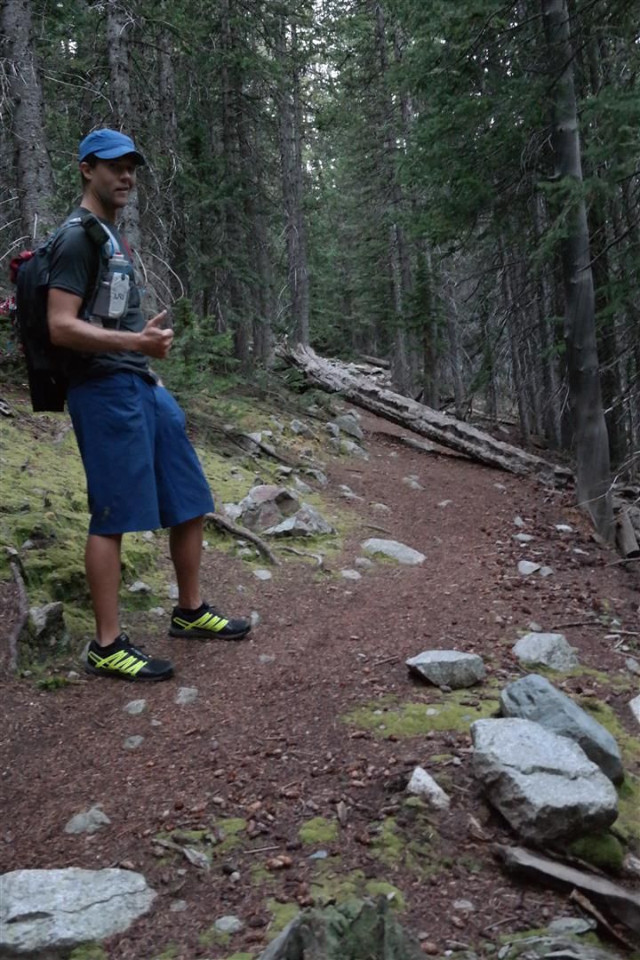
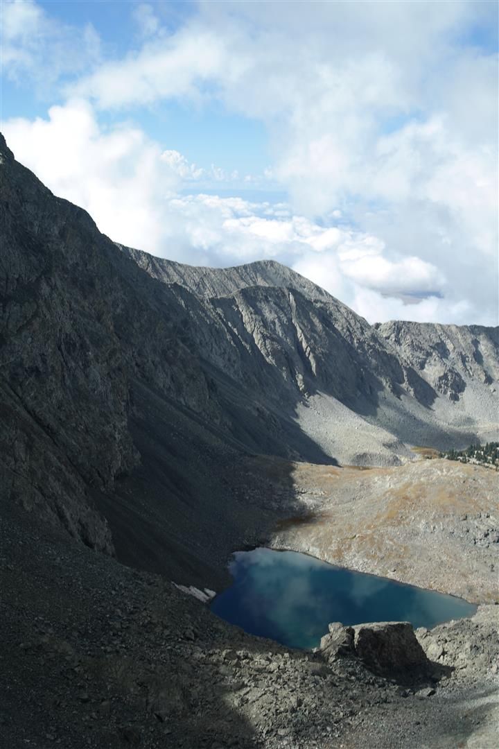
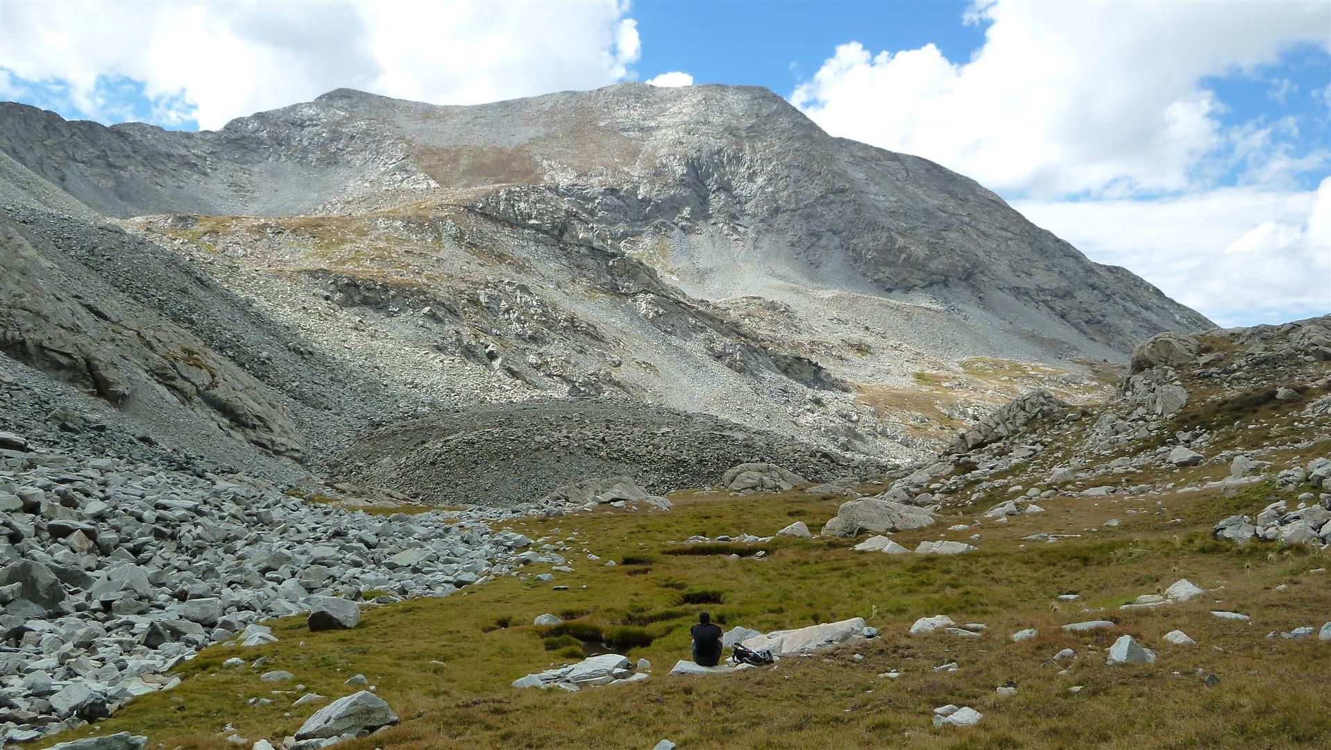
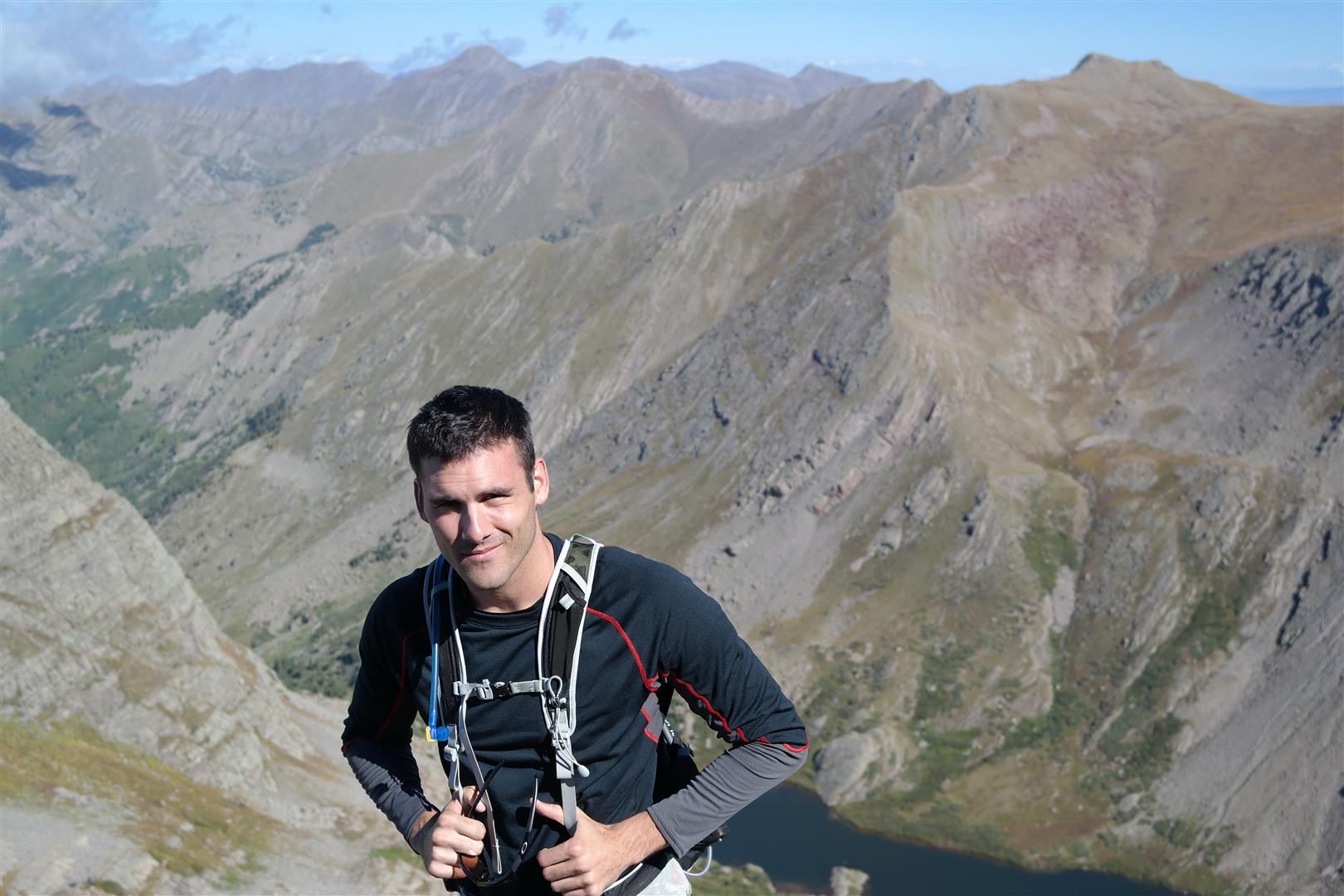
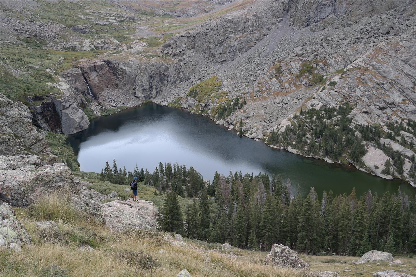
The anathema to the Lake Como Road...Zapata Falls. Dan and I were more than excited to give this route a try, we were both on the Lake Como Road in the spring and agreed that once a year on that road was more than enough. We camped near the trailhead and had trail runners on the ground at about 4am. We were really impressed with how well the trail was, all the way to the base of the C2 gully is a very well worn trail. Quite a bit of it below treeline was actually nice smooth dirt, and when you compare that to the Lake Como Road, well there is no comparison.
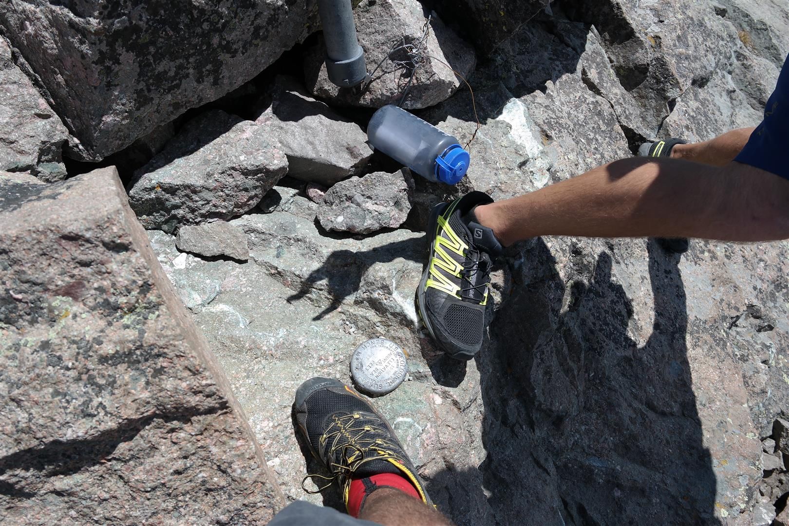
Check this thing out:
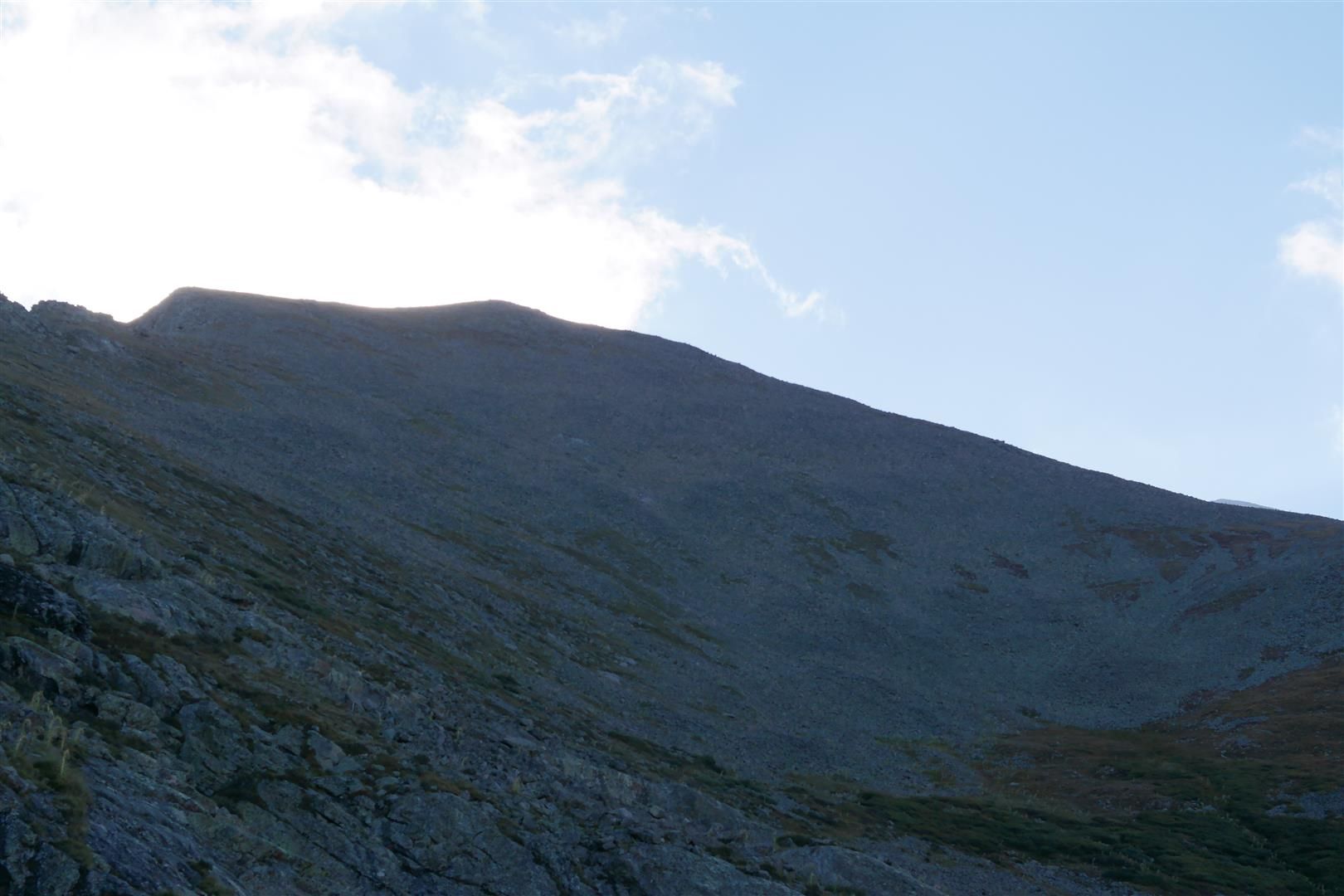
Near the end of the trail:
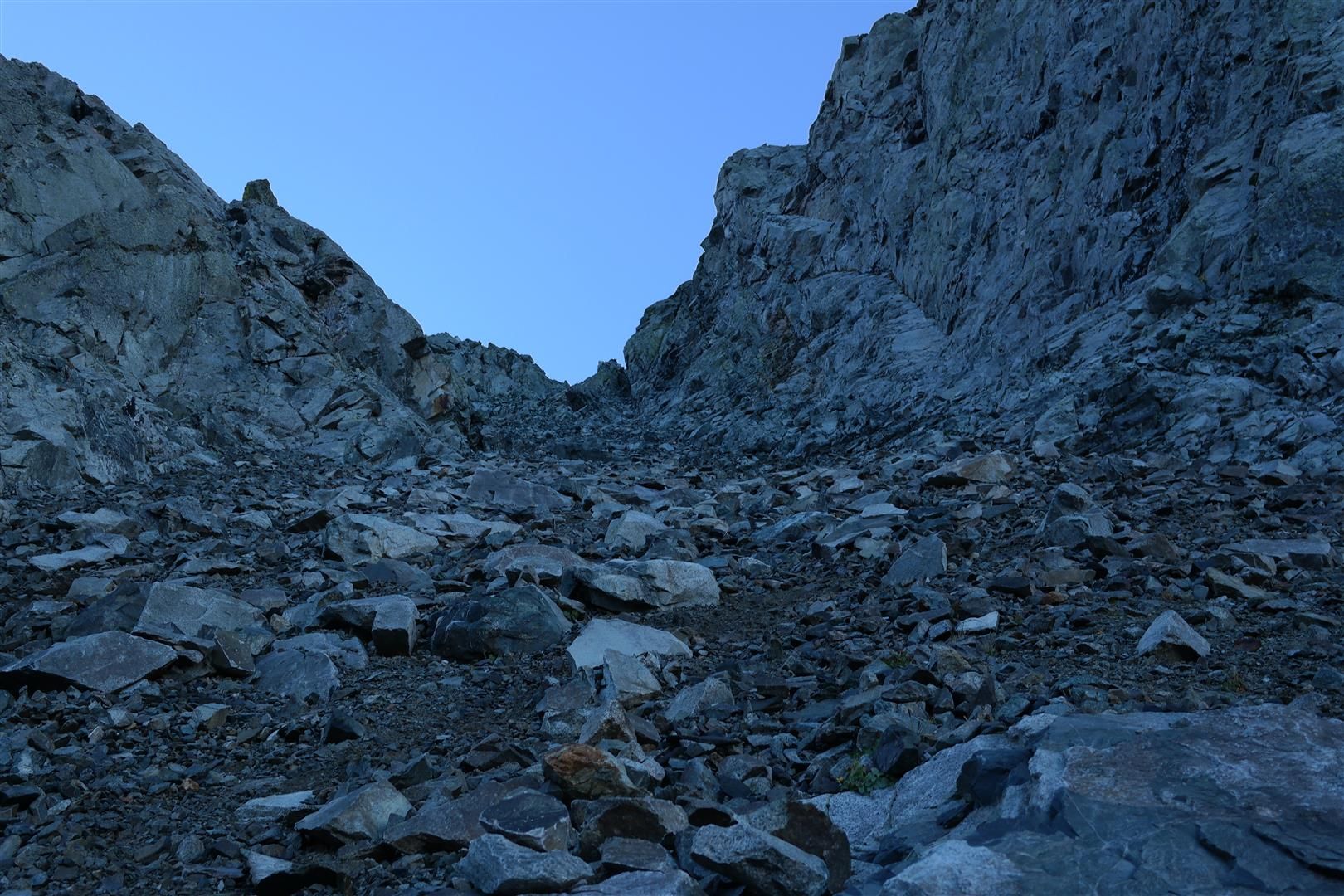
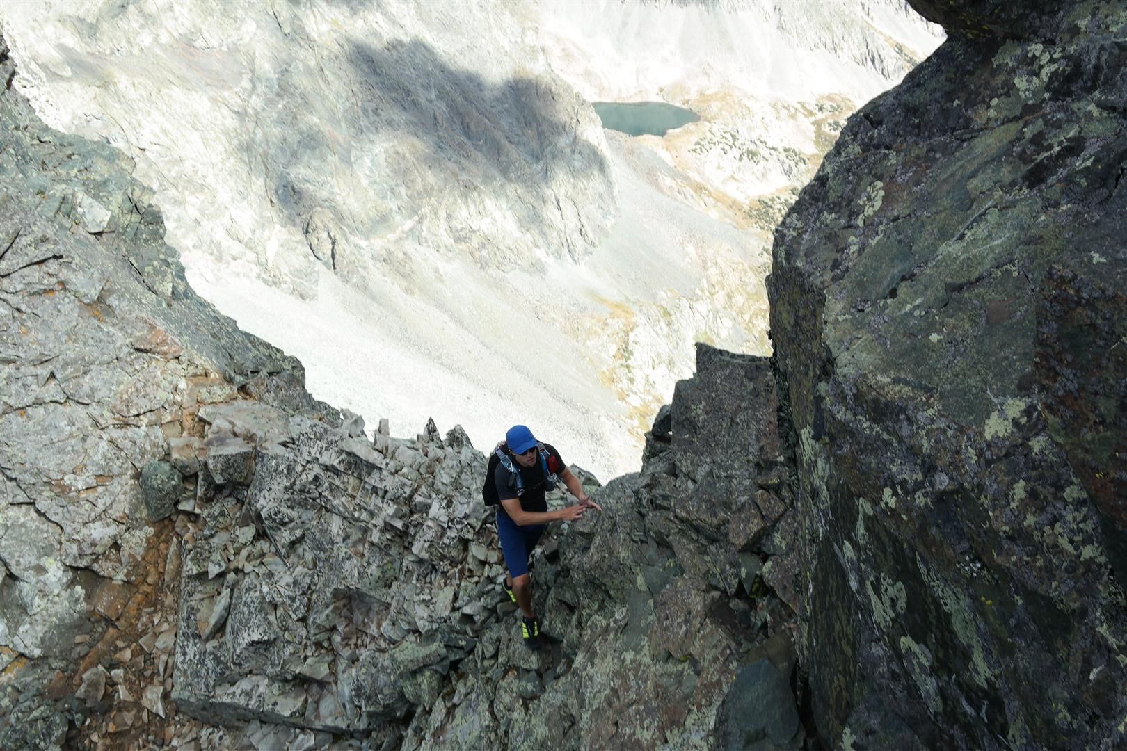
The C2 gully required some focus, it is fairly steep and there were some loose rocks. Not quite Hourglass, but enough that it shouldn't be taken lightly. We found that hugging the right wall of the gully provided the best way up, the rock was more stable.
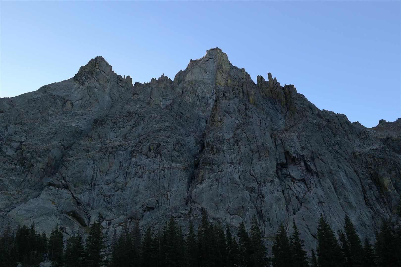
View up C2:
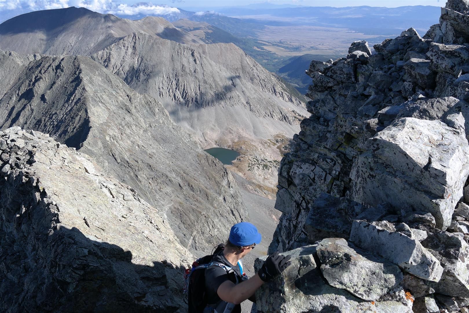
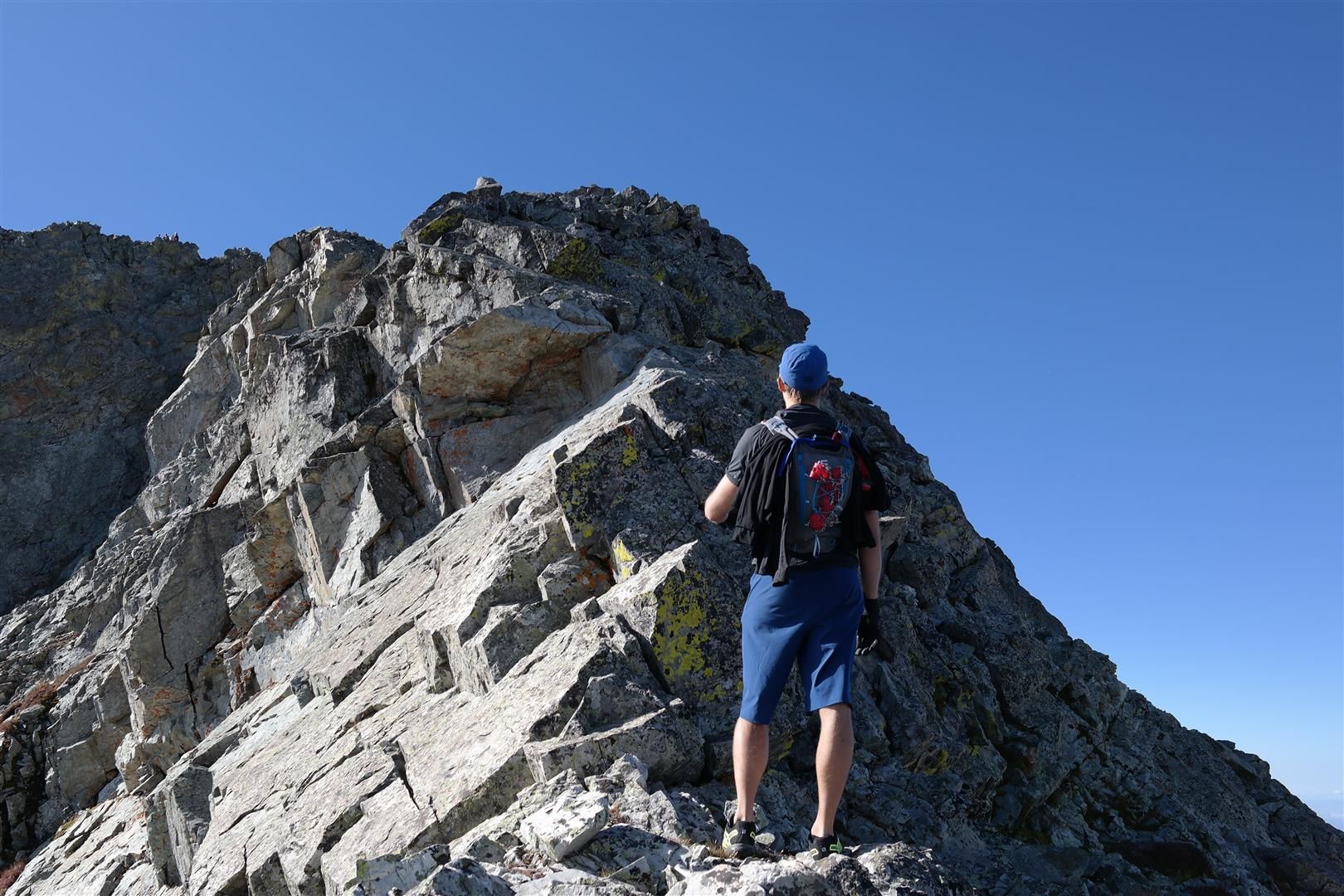
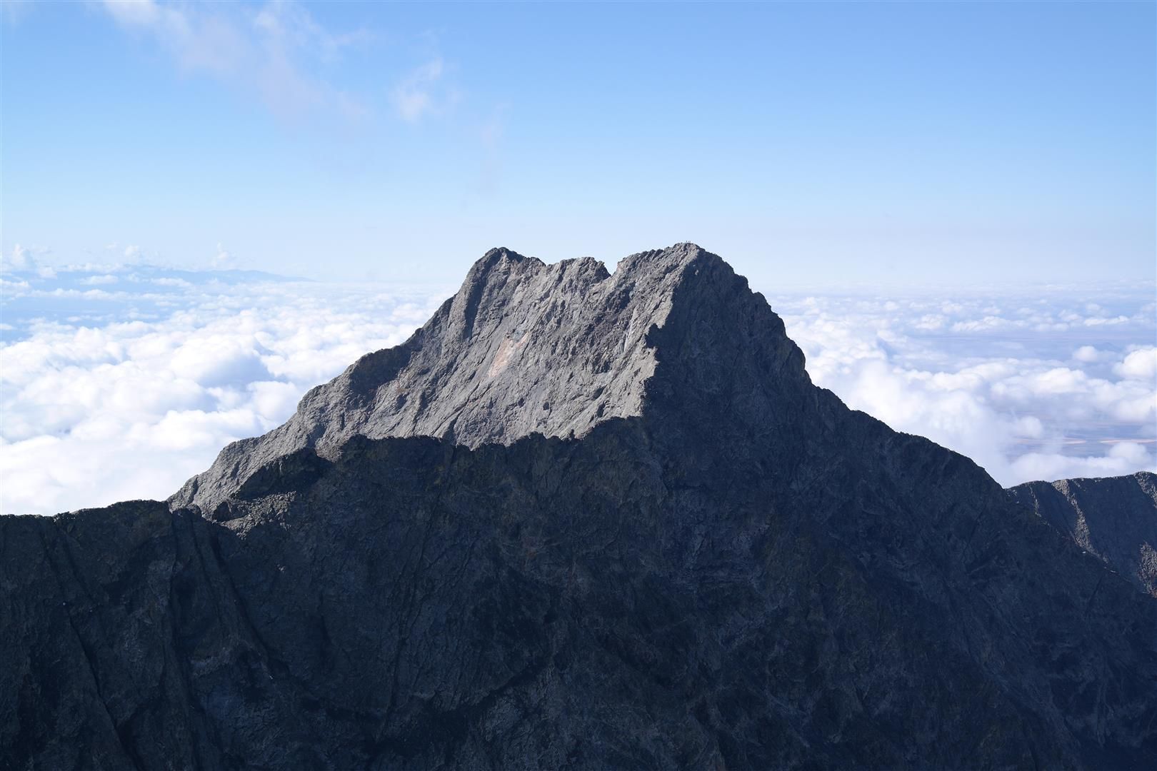
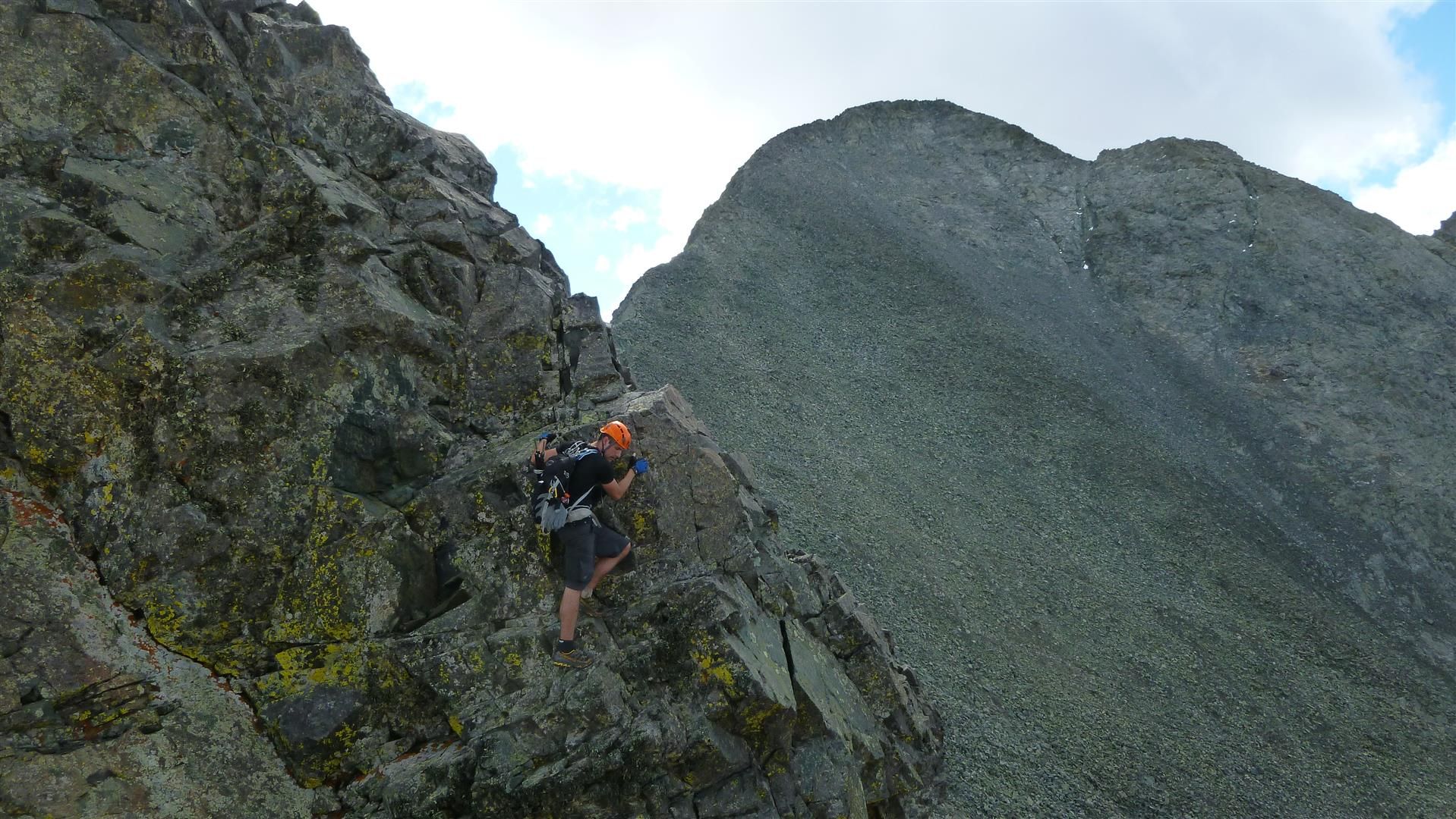
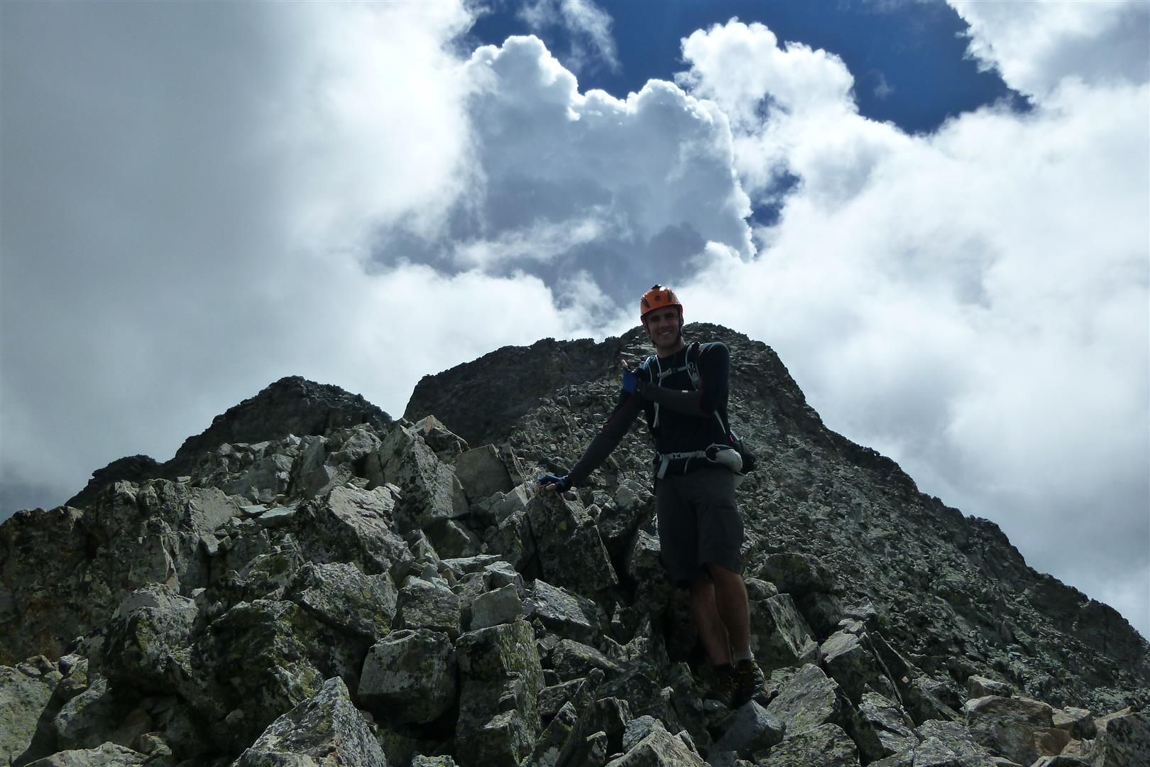
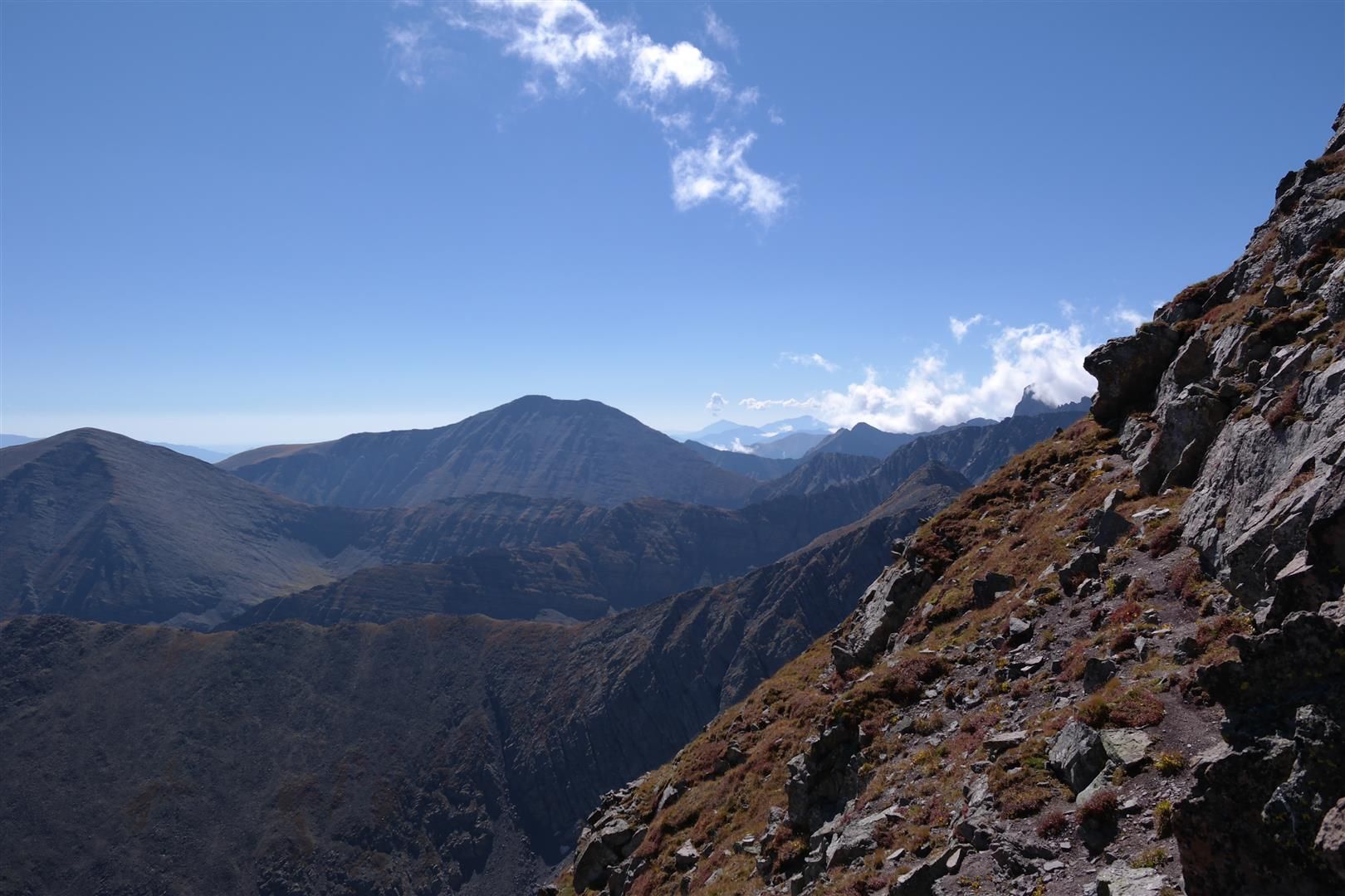
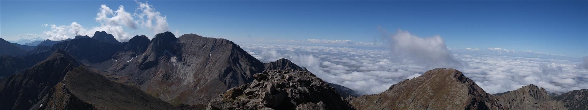
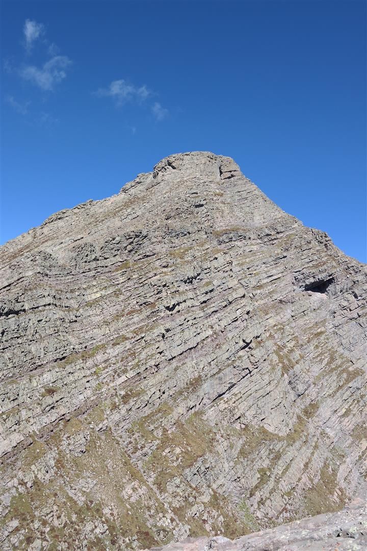
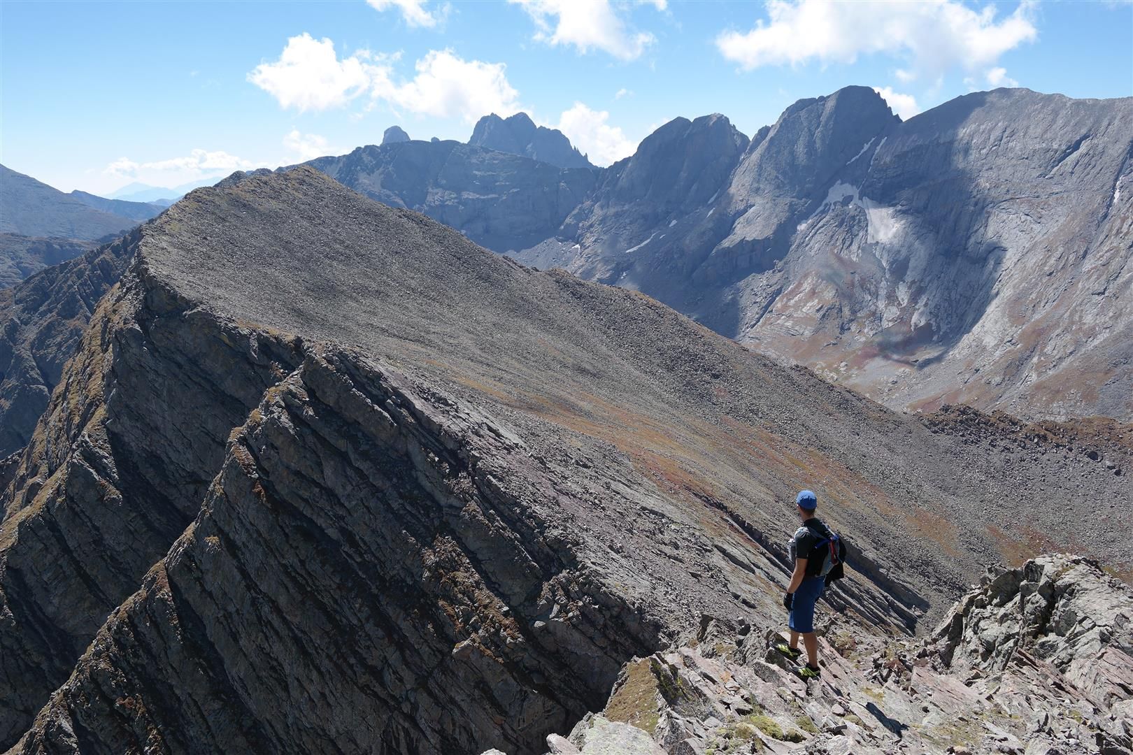
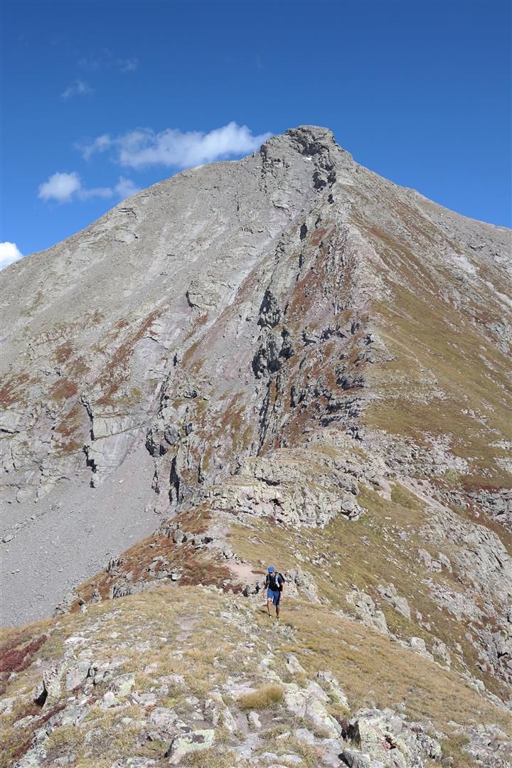
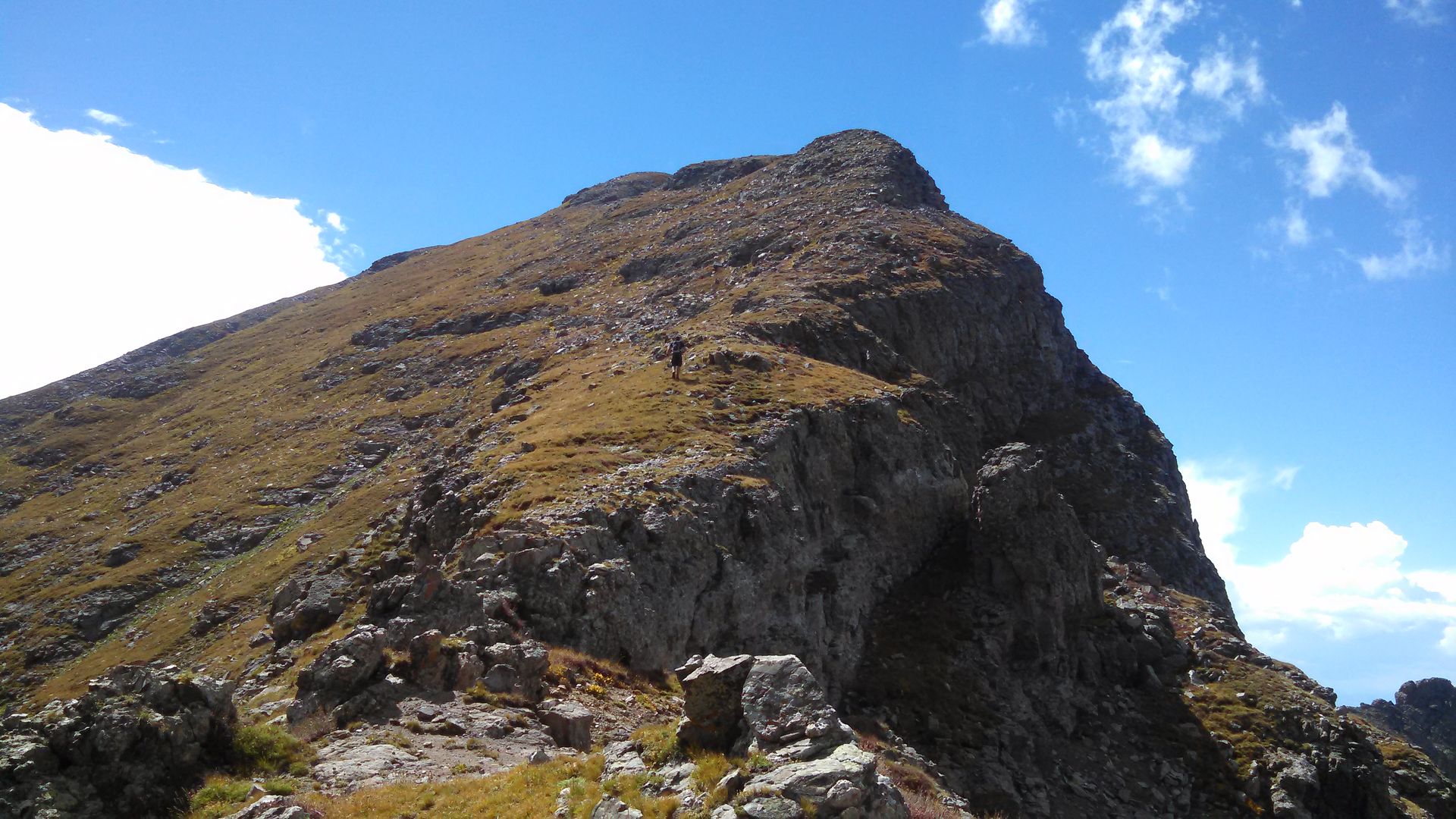
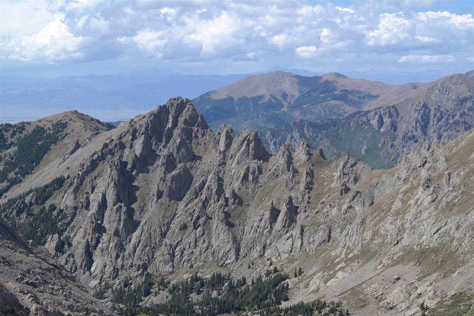
Once out of the gully and on top of the North Ridge of Ellingwood, you will be rewarded with some amazing views of the rest of the Blanca massif. Also from this point, the rest of the route up Ellingwood is obvious. There is some nice class 3 rock nearing the summit and also a miniature "knife edge". We had a blast on the last few hundred yards of the climb up, great solid class 3 rock.
Some pics from the final pitches up Ellingwood:
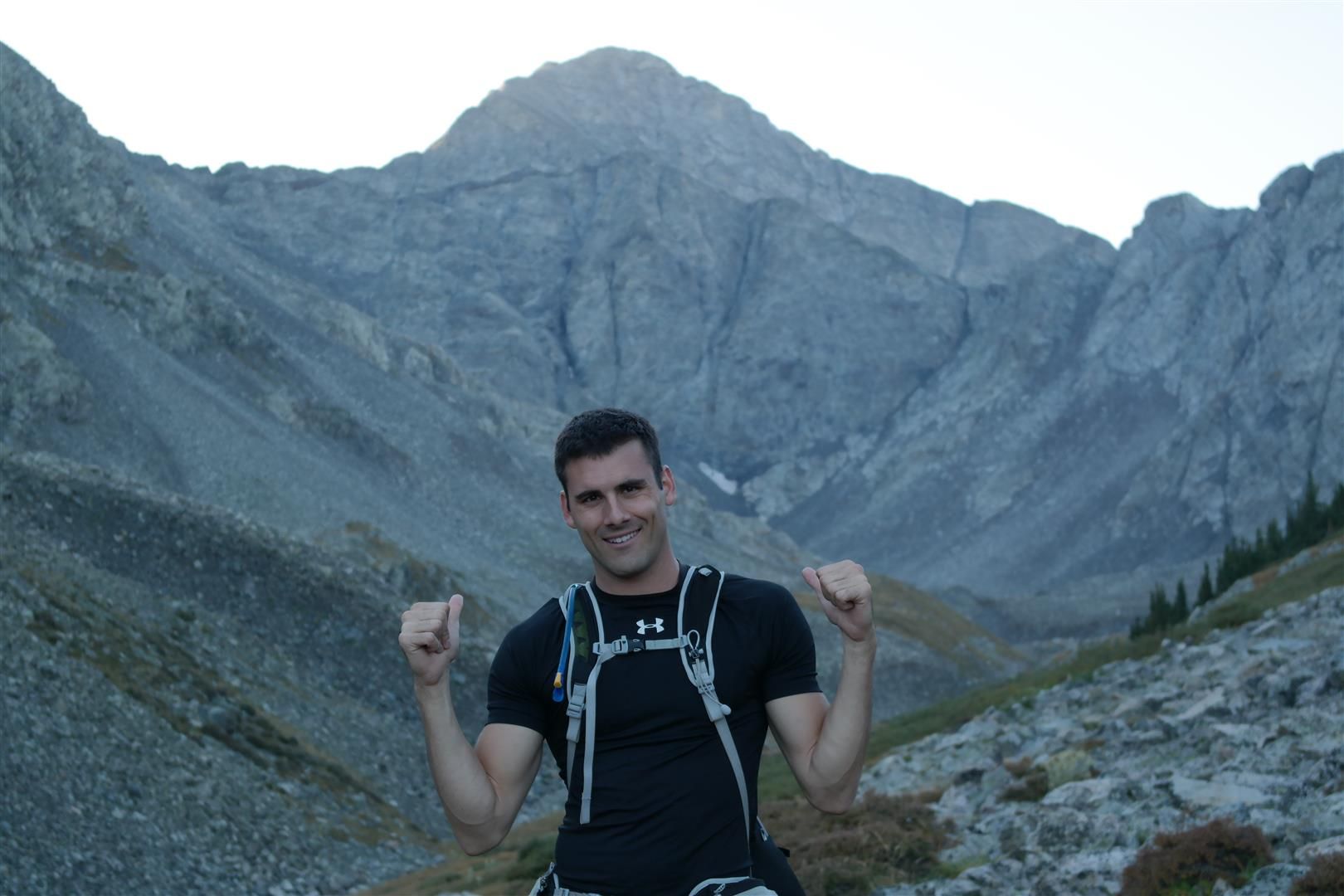
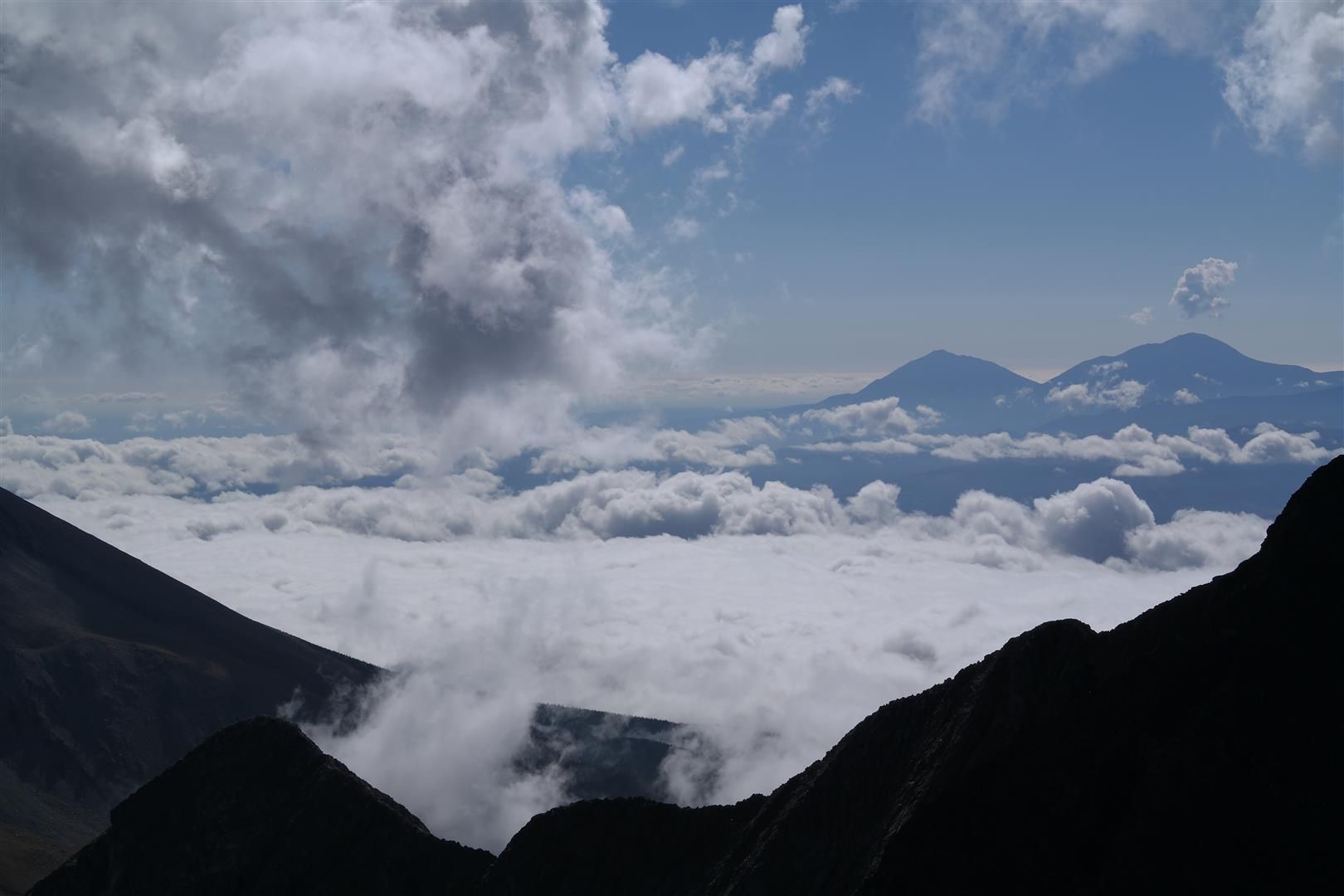
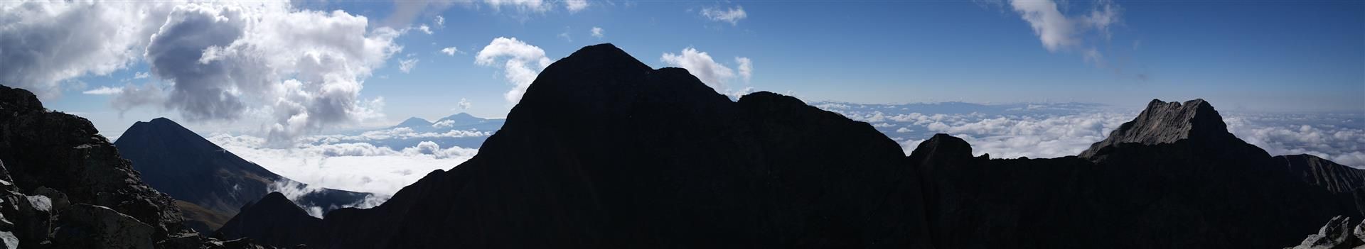
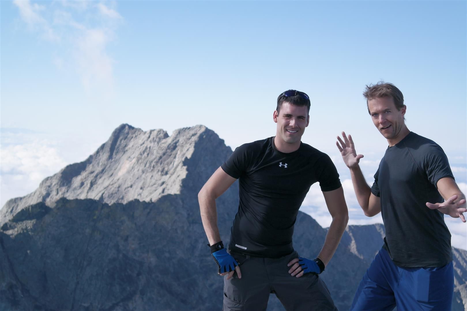
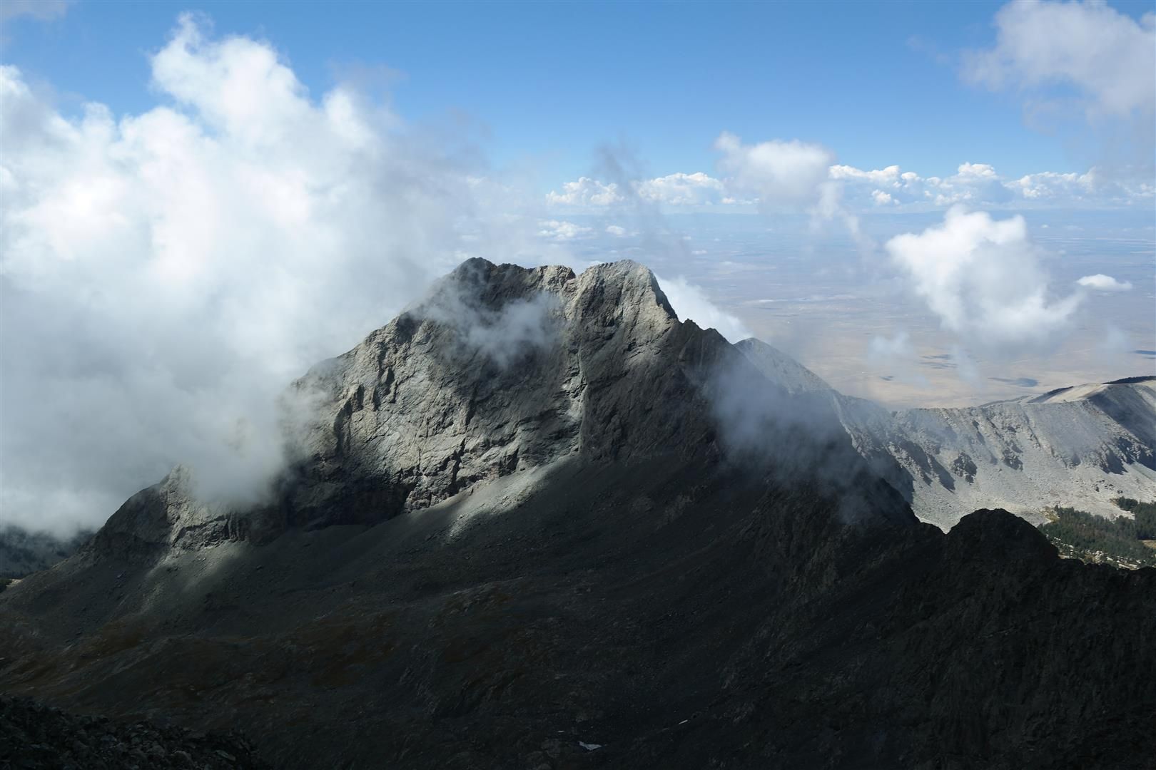
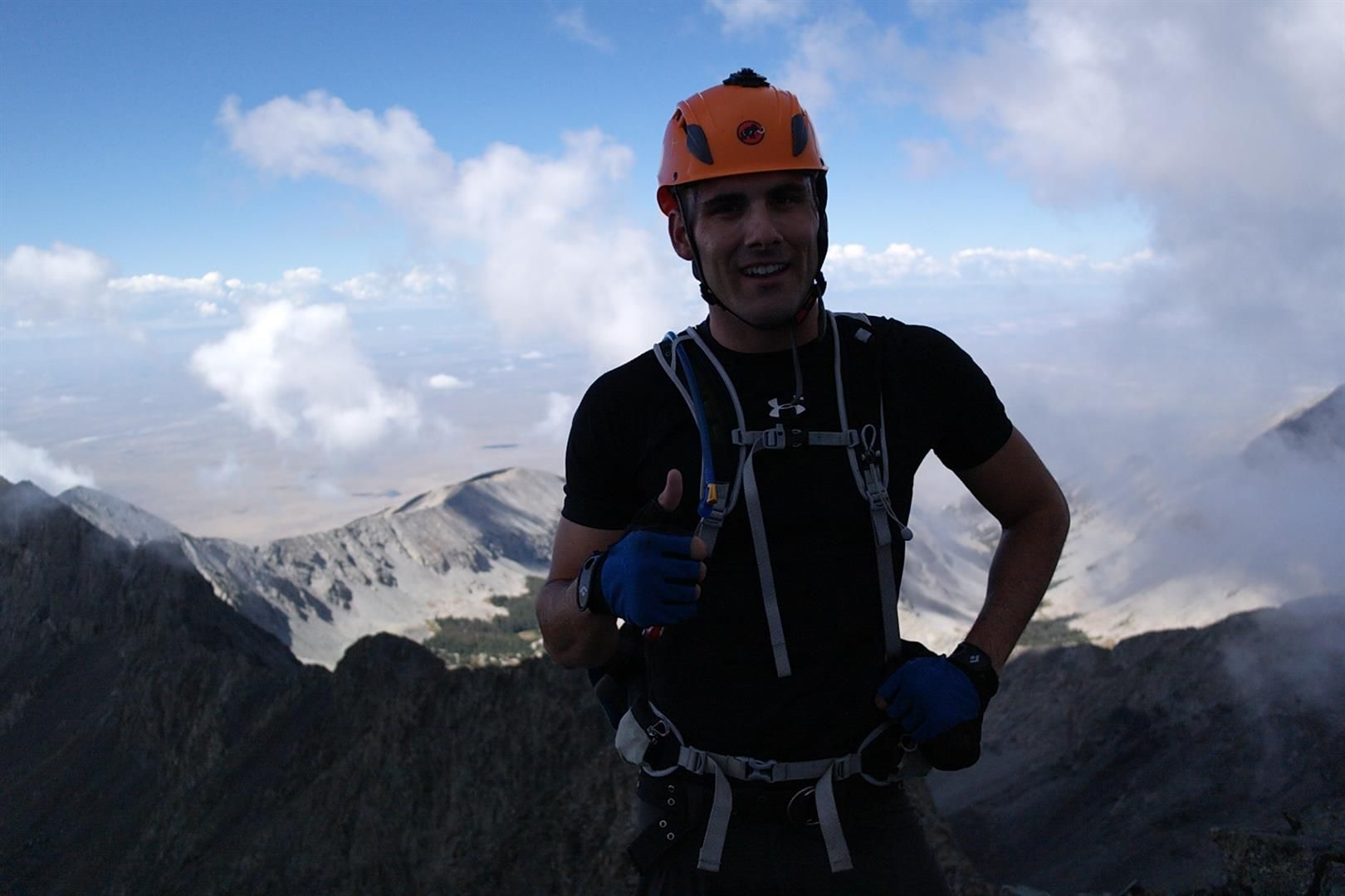
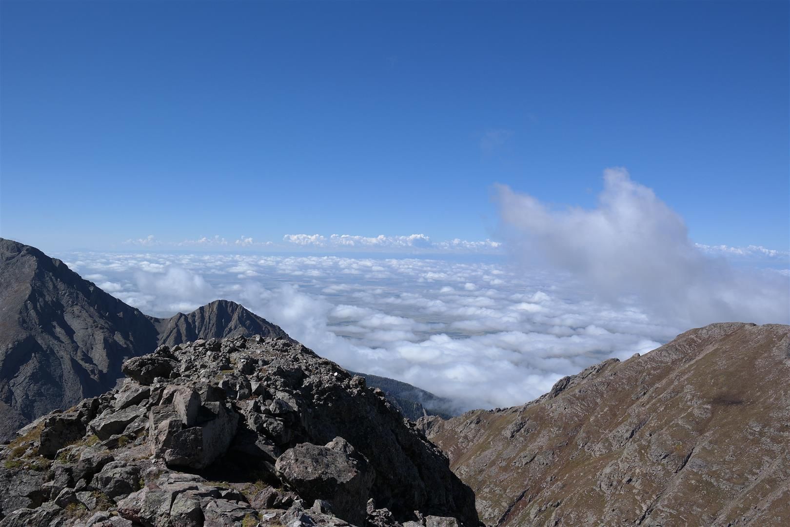
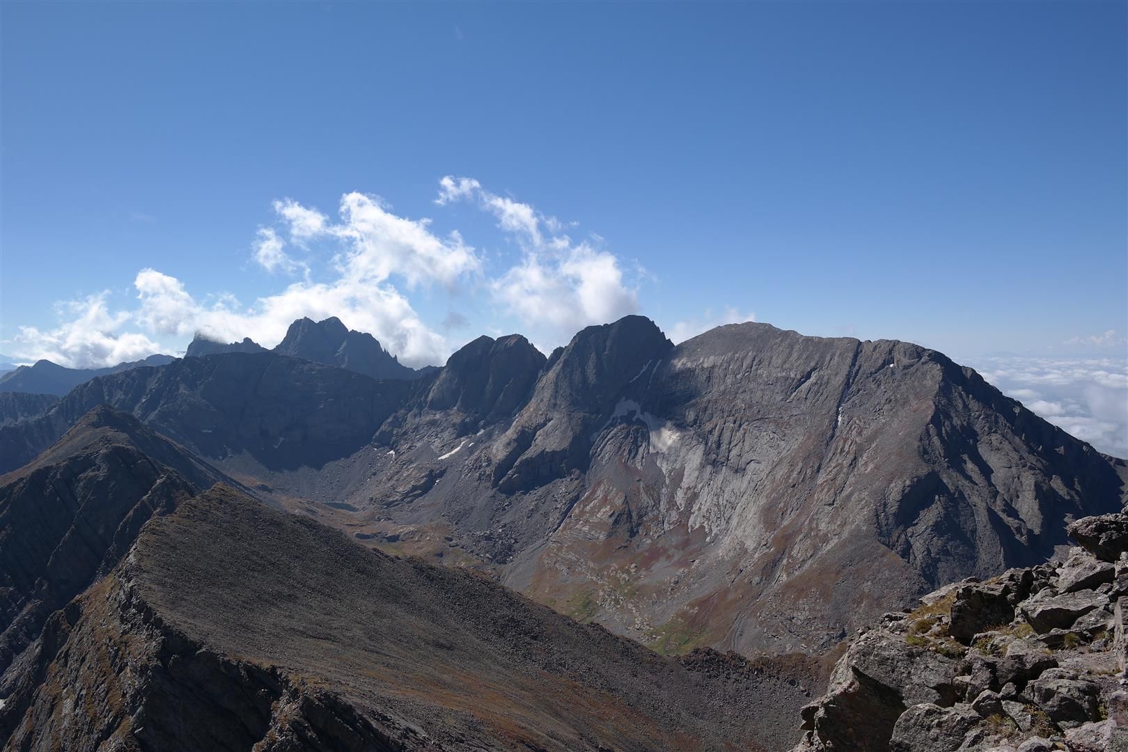
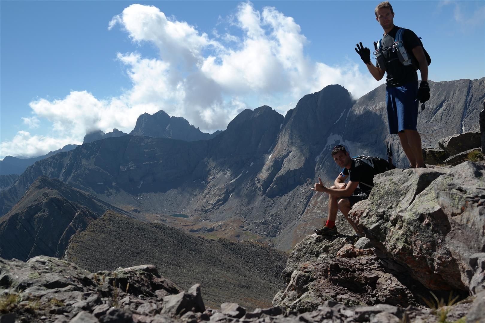
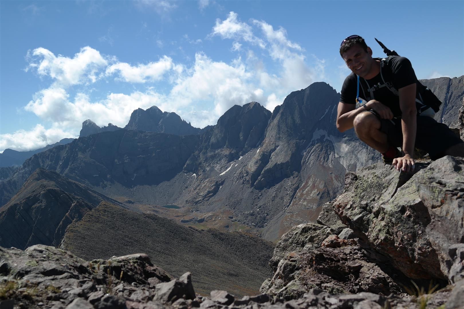
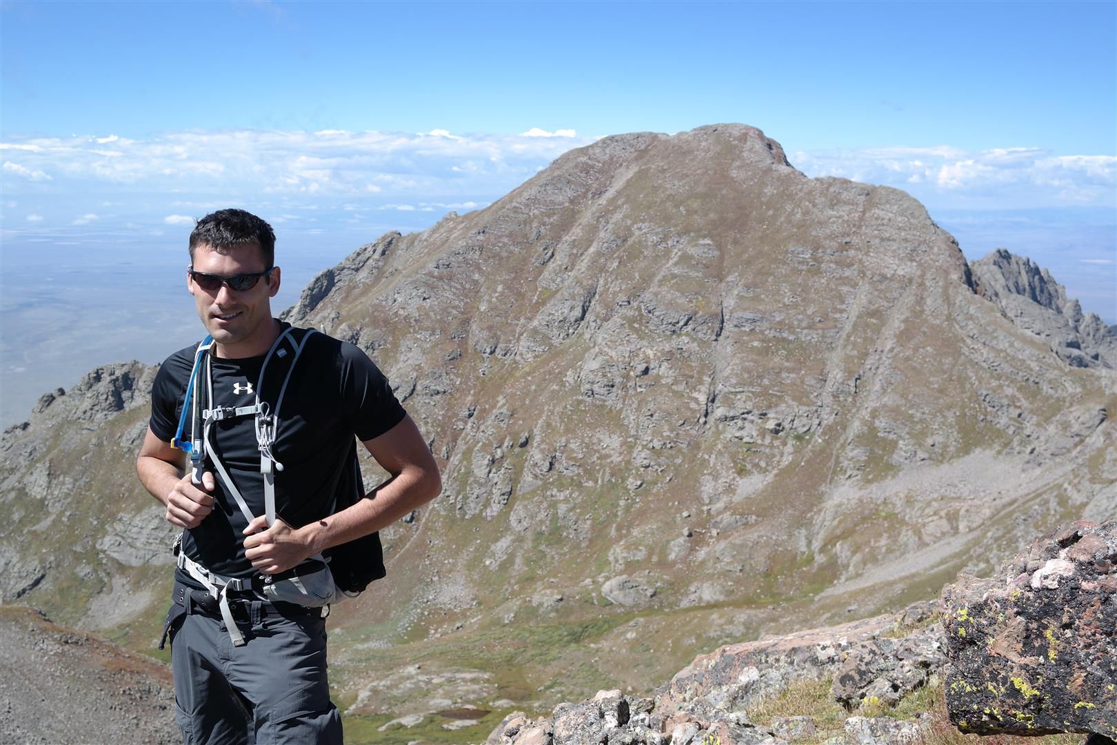
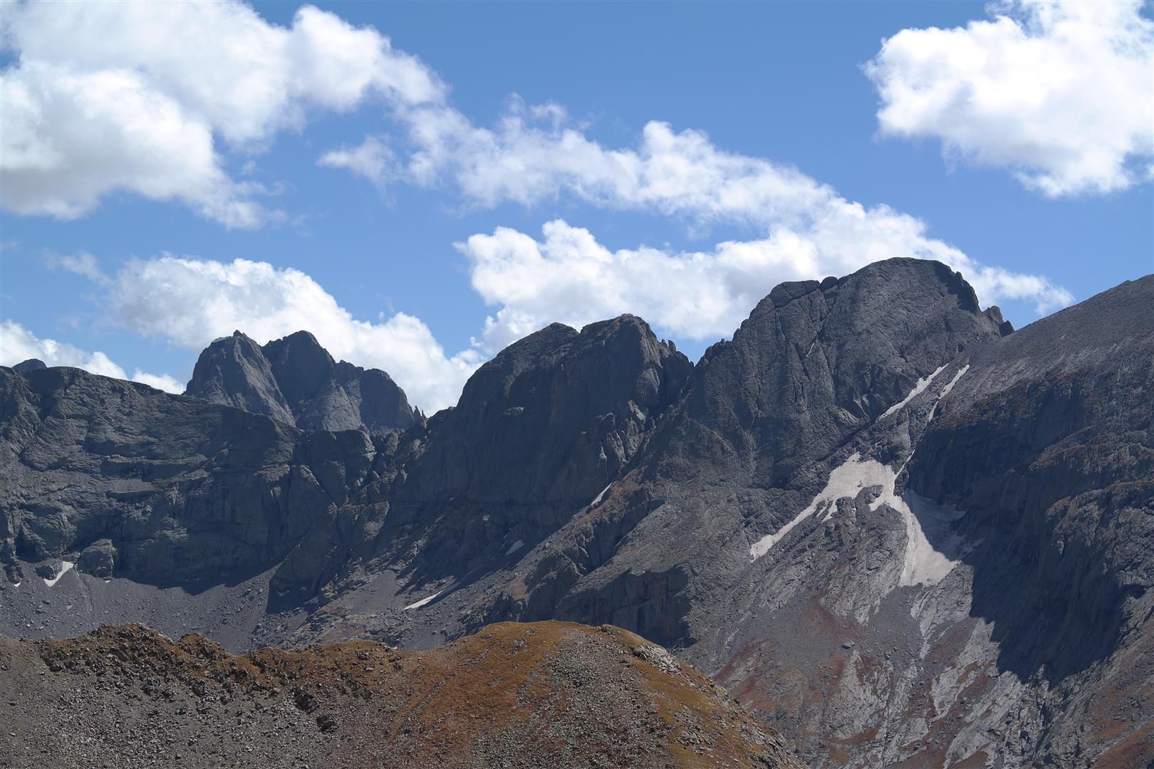
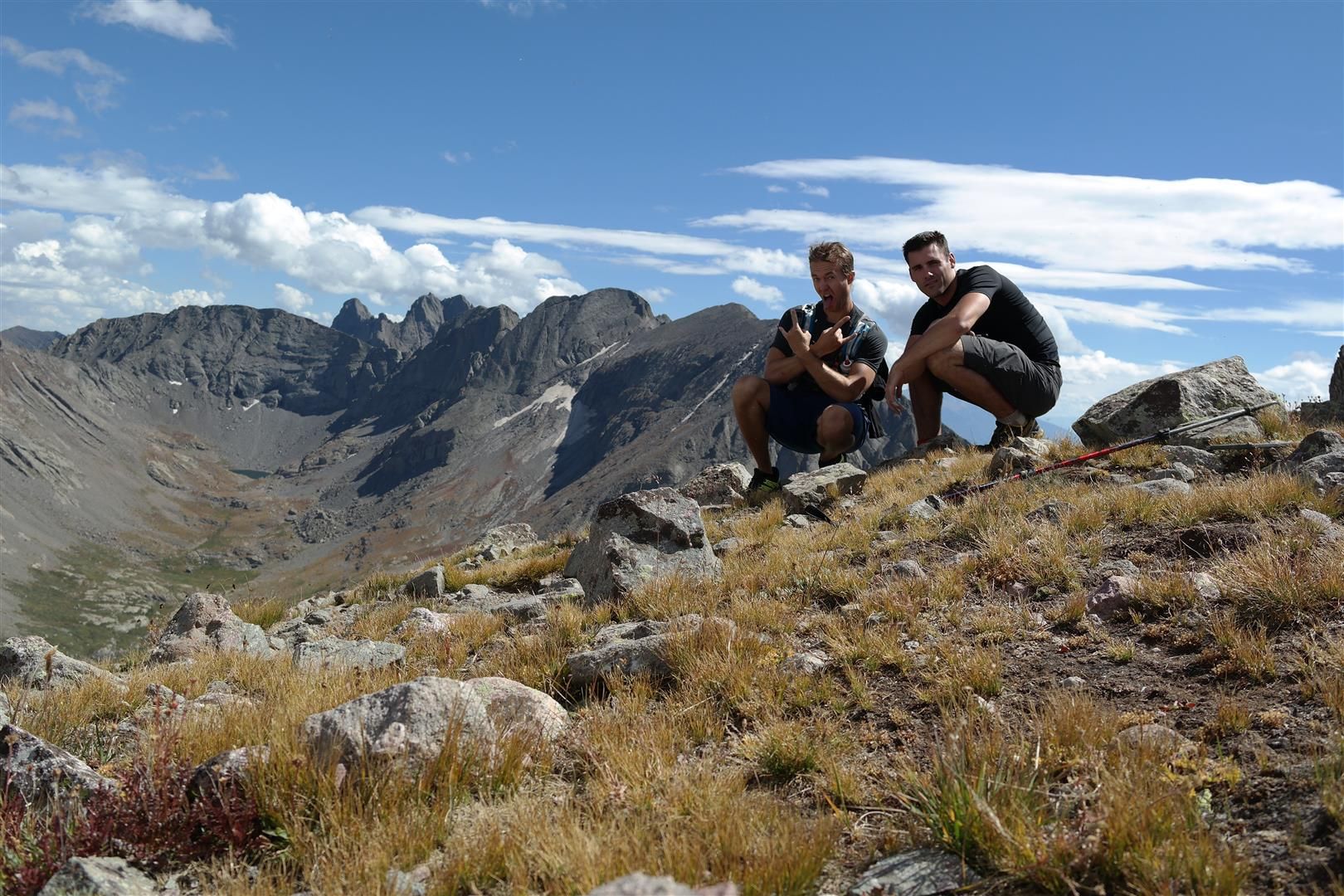
Once on the summit of Ellingwood we snapped some photos of the clouds exploding off the sides of the nearby mountains, ate some snacks, then began our traverse to Blanca.
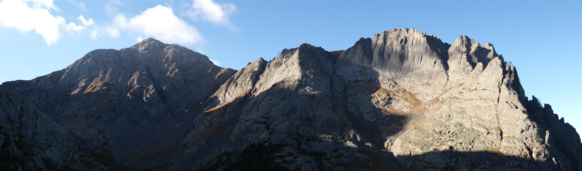
Ellingwood summit shots:
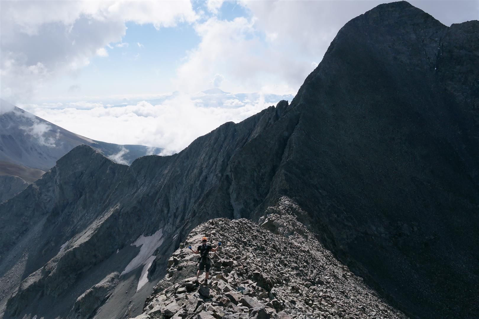
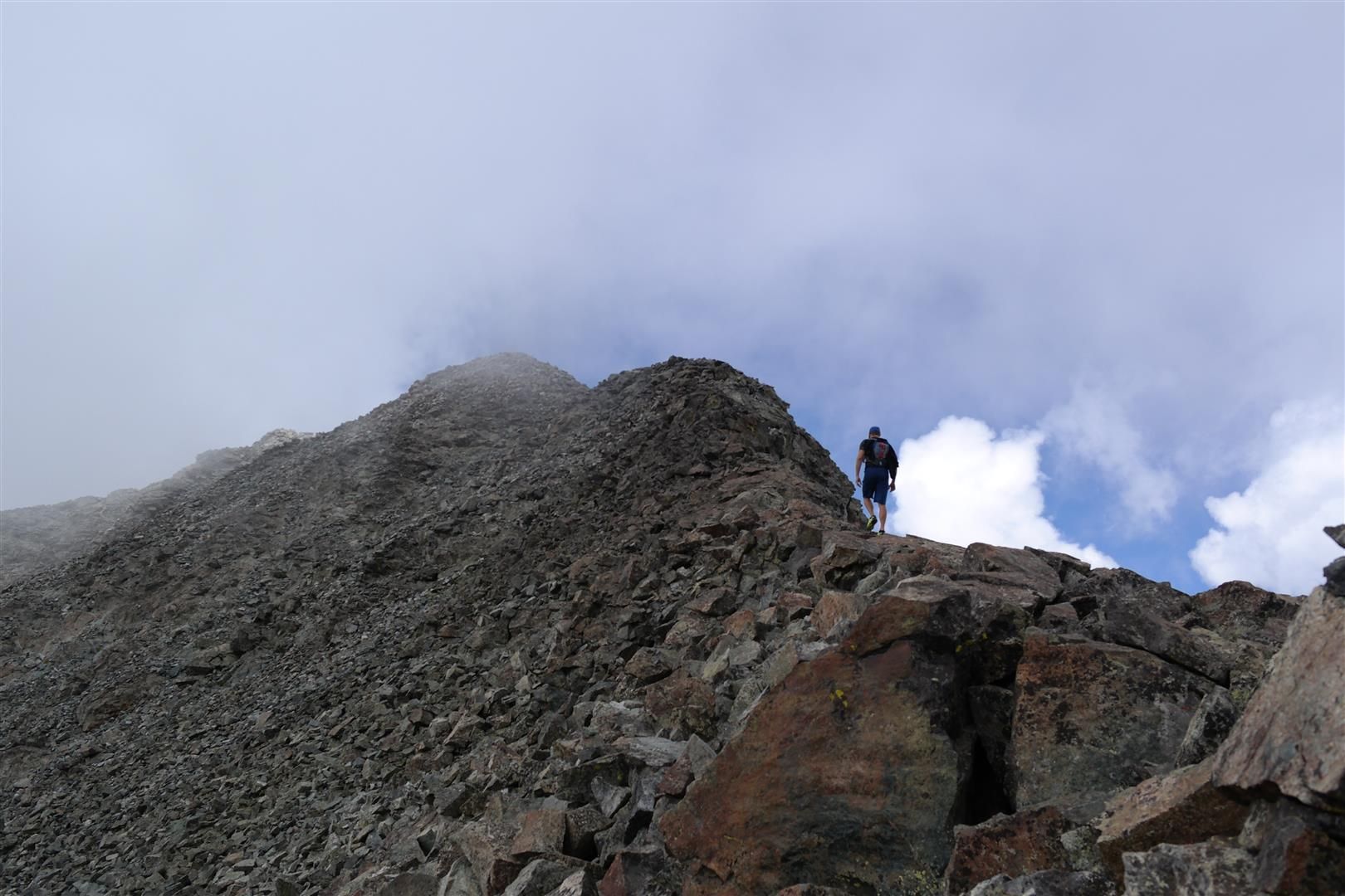
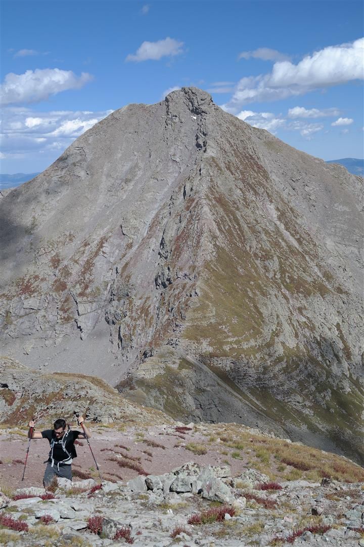
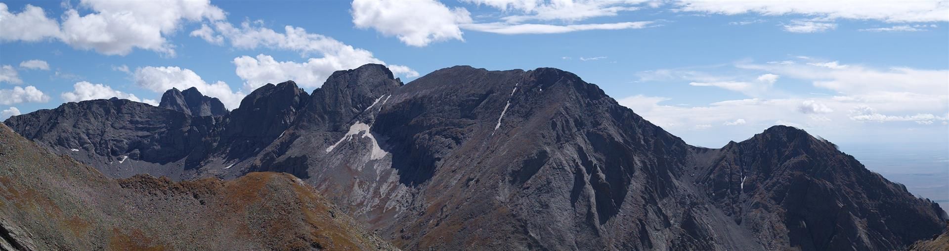
We wanted to spice things up a bit and decided to stay as close to the ridge proper that we could. We ran into some class 4 stuff that we had fun climbing around. About this point we noticed the clouds behind Blanca were building at a rapid pace. Discussion of bailing was tossed out but in the end we decided to put it into 5th gear once we began the 800ft gain ascent up Blanca. I had never climbed so fast in my life, Dan and I put away the 800ft of gain in 25 minutes, already 5,500ft into the day. We knew by going up Blanca we were locking ourselves into the whole enchilada, as they say. We threw out the idea of bailing down the standard route towards Lake Como if the clouds opened up and hitchhiking or running back to Zapata Falls.
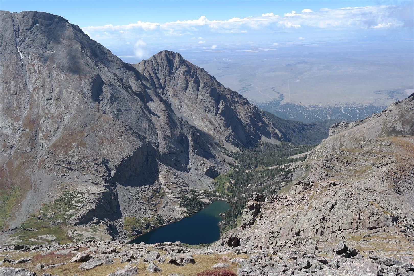
Shots heading towards Blanca:
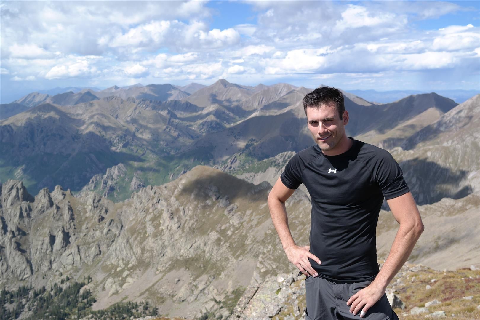
We hit the summit of Blanca, chatted with a crew that had just done the LB/Blanca traverse for about 5 minutes and then we started our haul back up Ellingwood, looking over our shoulder at the clouds about every 20 seconds.
Blanca summit shots:
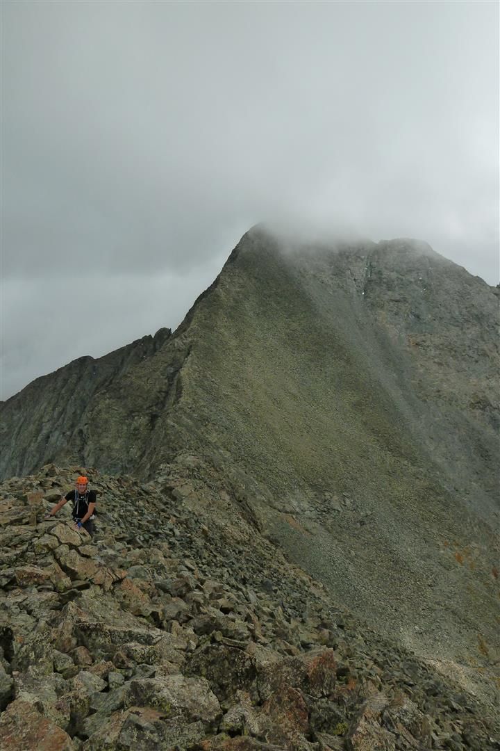
We traversed lower on the ridge heading back to Ellingwood, and at this point I slipped and fell on the rock and landed on my ribs right on the crown of a pointy rock. I thought I broke or fractured ribs right away, and with the clouds building up I thought I had just put Dan in a terrible position. I couldn't breath and had a look of terror on my face I'm sure. After a minute or so to collect myself I figured I had just bruised them something awful and was good to go. I grimaced the pain away, tossed on the pack and followed Dan up Ellingwood.
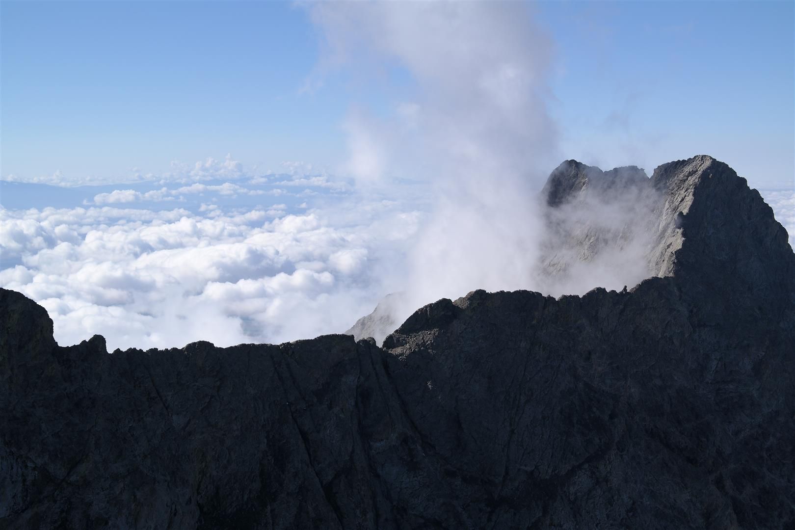
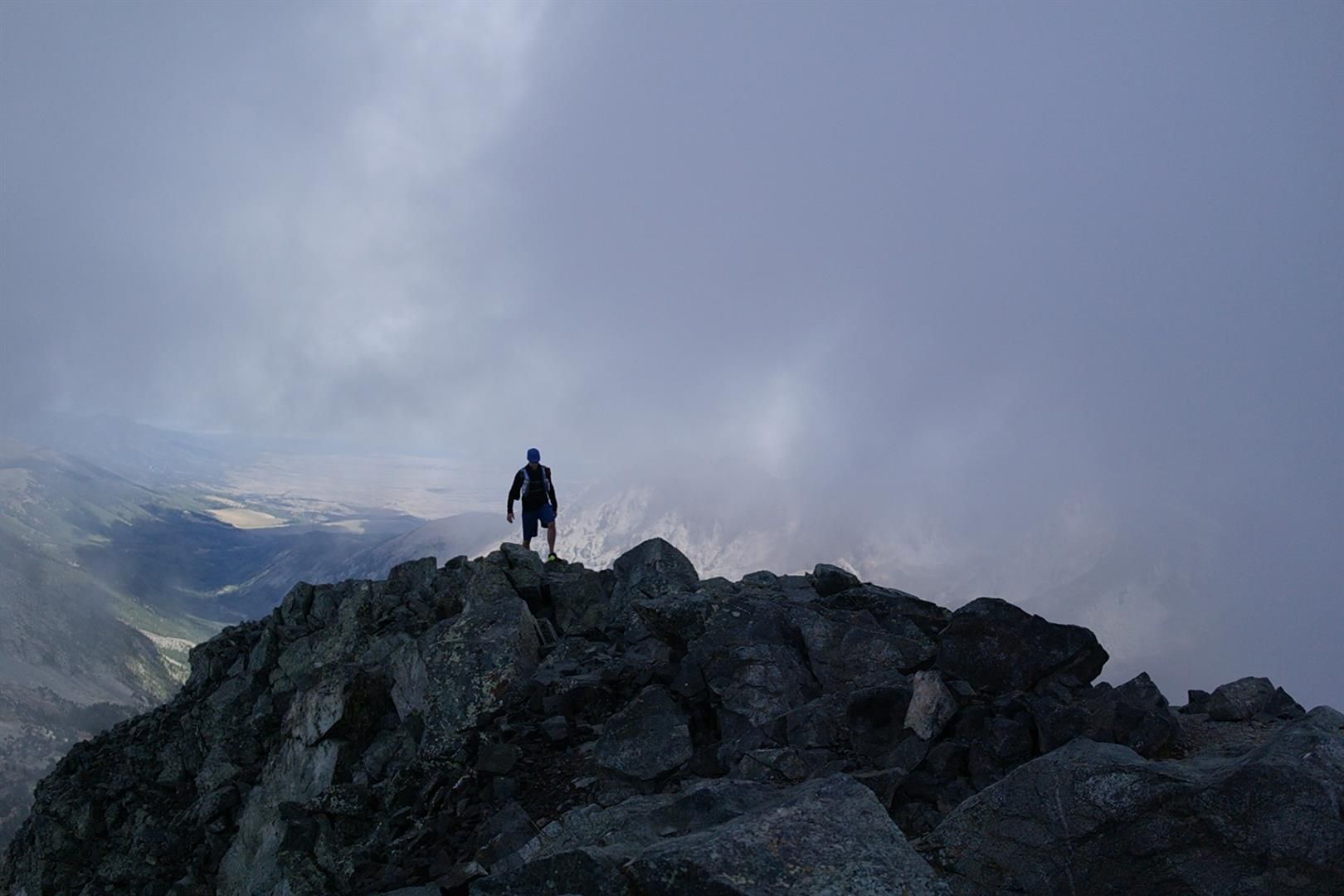
Once over Ellingwood and headed towards the C2 gully, we noticed the clouds were HUGE...
Check out the sucker that was chasing us:
Going down the C2 gully took as much if not more time for us to go down than it did to come up. The steepness and chossy rock really limited our speed. I'd move to a waypoint that shielded me from falling rock, then Dan would come down to me and I'd continue to the next safe stopping point. Slow going under severe threat of a storm was frustrating but it was all we could do at the time. We got down and the clouds still held their rain...
Relaxing after descending C2:
We made it to treeline and once in the trees it started to rain and then lightly hail. No doubt the peaks were getting pounded. The way out to the car I realized that I wasn't having my best day. I felt somewhat sluggish and knew I hadn't eaten enough food while climbing. Perhaps the storm rushed me so much I forgot to eat, either case I had a pretty lethargic descent out. For a few minutes I had some serious doubts about doing an even BIGGER day the next day on little sleep. I shook off those thoughts and pressed on.
We got to the car and headed to Alamosa for some grub and then drove to the Willow Lake trailhead in Crestone to sleep.
Final thoughts on this route:
I found this route to be excellent and a lot of fun, and certainly much preferred to the Lake Como Road. Some caveats, however. Yes it is less miles than from starting at the Lake Como Road, but it is the exact same elevation gain. You get more, faster. Also, once you descend Ellingwood towards Blanca, you really are locking yourself into the route with no easy escape if the weather sours. Yes you can bail out to Lake Como, but you better then call a cab or hitch a ride back to Zapata.
Day 2 9/7/14
South Crestone Lake approach to Pt. 13,153, traverse to Mt. Adams via NW Ridge, descend to Pt. 13,580 via S/SE ridge of Adams, reascend Adams for the hell of it, descend the W ridge of Adams and ascend Pt. 13,546, then descend from the saddle to the Willow Lake trail and head back to the car.
~ 17.3 miles
~ 7600ft elevation gain
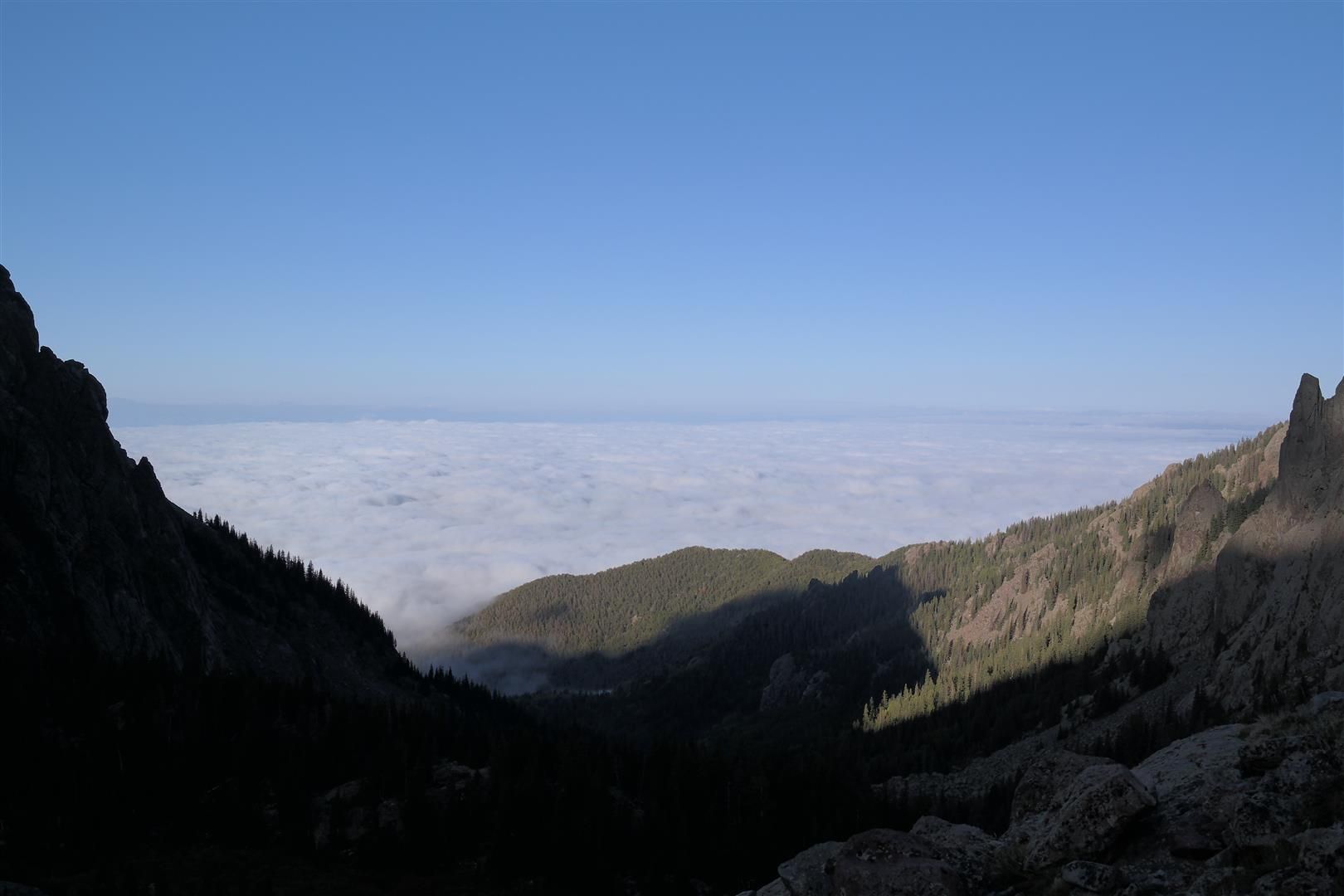
Alarm came fast at 4am, but I felt pretty darn good considering the previous day. We were on the South Crestone Lake trail by 4:30 and making quick work of all the initial switchbacks. Once we got some sunlight we noticed the amazing sea of clouds blanketing the San Luis Valley, they made for great pictures for nearly the entire day.
Views heading towards South Crestone Lake:
Once at South Crestone Lake, we banked a hard left and took the grassy slope and angled it up to the ridge proper of Pt. 13,153 and sat on the ridge to the summit. There were some great views headed up this peak. Despite being 40 something into the 14ers, this was the first summit register I had ever opened. I noticed WILL-I-AM had climbed the mountain, which was pretty cool. It was also very neat to see signatures from over a decade ago on the paper as well.
View of Pt. 13,153 shortly after the lake:
Looking over at Adams I thought "holy crap that looks daunting" and for some reason I failed to take a decent photo of the NW ridge of Adams. Take my word for it though, even though it looks fairly crazy it's not bad. Just stick to the right and its maybe a difficult class 2 until the summit block.
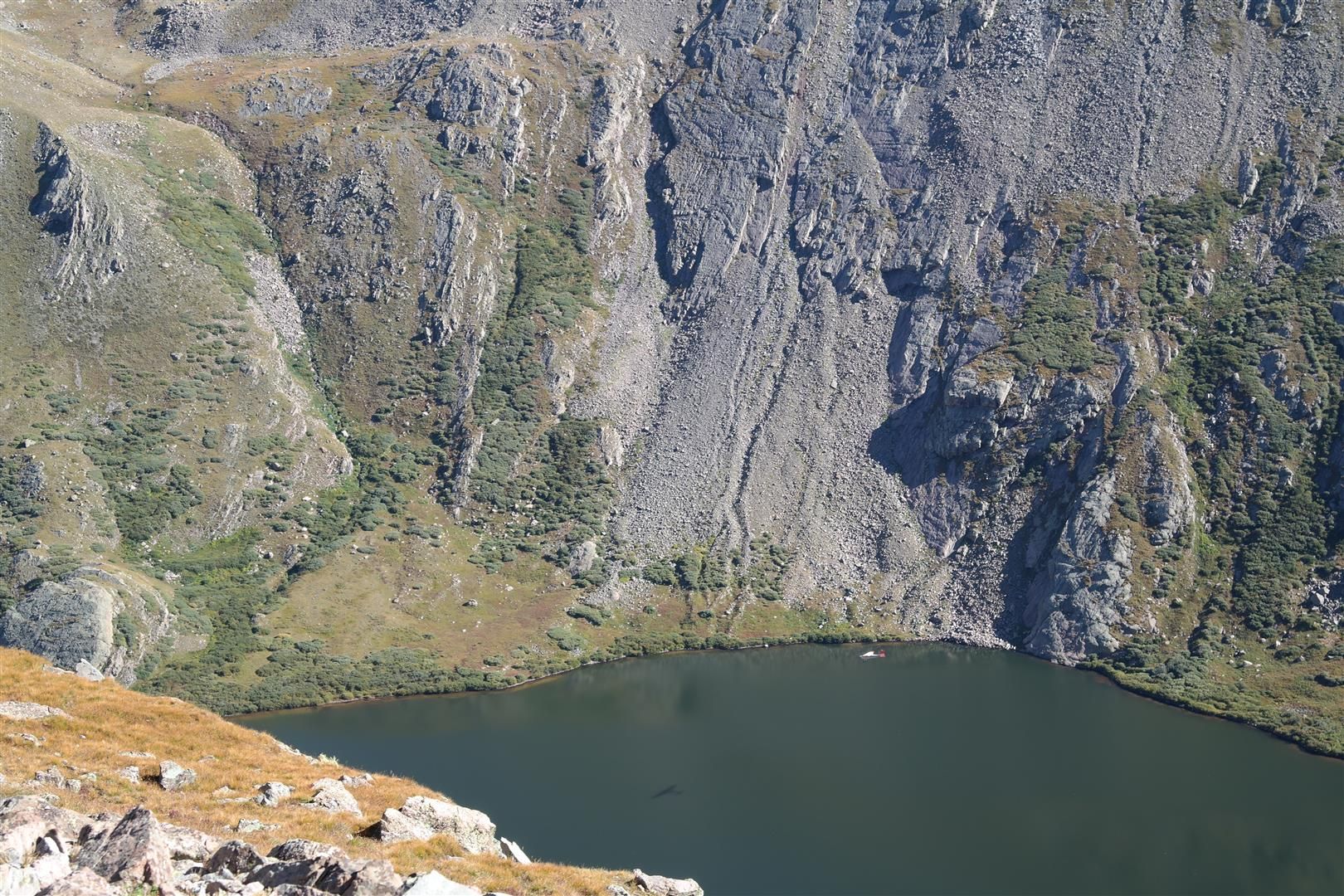
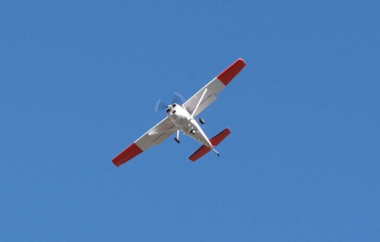
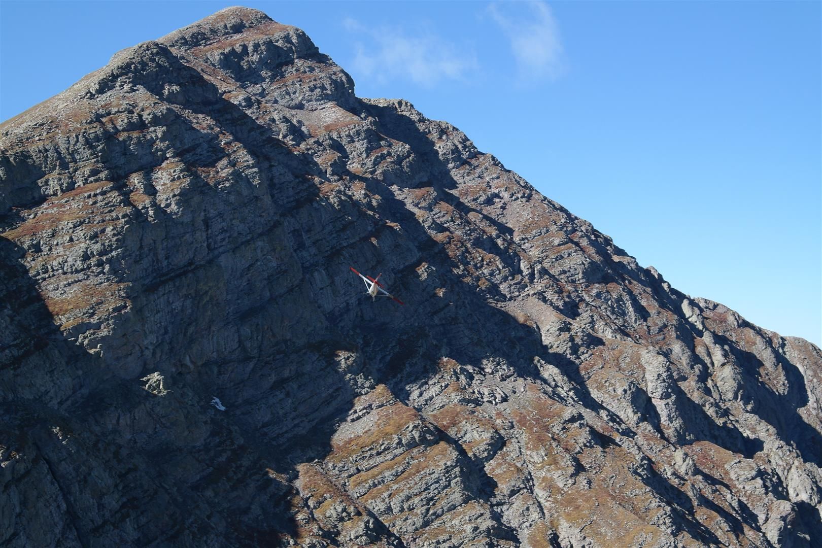
On the saddle between Pt. 13,153 and Adams we noticed a prop plane was flying around the valley below us having a blast. Soon enough it came fairly close to the saddle we were on and we thought we saw it blink its headlights at us. It took off back around the peaks to the north of us and I saw it dip its left wing and start to head for us. "It's going to buzz us" I told Dan. We started waving our arms and sure enough it came RIGHT over the top of us. We were cheering and high-fiving and I'm sure the pilot and passengers were having a blast too. Very neat experience.
Plane over the lake:
Getting buzzed in the Sangres:
Off he went:
Headed up Adams:
Back to Adams...we reached the summit block and after a few class 3 moves we were on the summit. What amazing views from Adams. The Crestones/Kit Carson looked sick. We ate some grub, took some photos, then headed down the S/SE Ridge of Adams towards Pt. 13,546.
Views from Adams:
Downclimbing this ridge of Adams took some care, as there were several class 3 and maybe a class 4 section to downclimb. We picked the best route we saw down and eventually made it to the saddle. Once we looked back I said "We down climbed that?!"
View towards Pt. 13,580
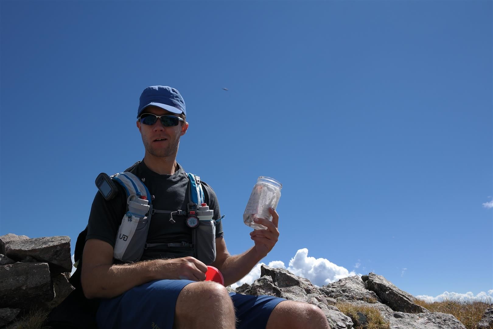
We made quick work of Pt. 13,580. Nothing crazy to note on the climb up this one, just stick to the ridge and you're peachy. Dan was digging through the peanut butter jar for a summit register and I started to notice clouds building to the west across the San Luis Valley. Distant, but still something to note.
Summit from Pt. 13,580 (13,546 in the background):
We headed back up Adams. We only needed to go about of the way up to start traversing across the grassy slope towards the saddle between Adams and Pt. 13,546 but we wanted to re-summit Adams for the extra elevation gain on the day. We touched the USGS pin on Adams and set off back down.
Twice!
The descent across the grassy slope below the summit of Adams, to the saddle, was tedious and slow going. It was grass for the most part, but it was very steep.
View back towards Adams from the ascent of Pt. 13,546:
Once on the saddle I could see the clouds getting closer and bigger. I turned to Dan and said "Blanca beastmode time". He nodded and we HAMMERED our way to the summit of Pt. 13,546. I was sweating buckets and pushing the body into overdrive. Dan had more in the tank and cruised a bit ahead of me. I really wanted this last summit and not too much was going to get in my way at that moment in time.
Heading up Pt. 13,546:
Overdrive:
Summit shots from Pt. 13,546:
We snapped a few photos and bailed out fast. Once down in the basin, heading towards Willow Lake, we had a heck of a time finding the trail from Willow Lake that lead to Adams. Stay to the LEFT of the drainage. The trail is right about in the middle of the basin. I use the trail very loosely, as there isn't much of one at all and the deer tracks confused us a few different times.
Dan just above Willow Lake:
The entire sky was gray at this point and as soon as we hit Willow Lake and sat down, BOOM. A HUGE thunder crack to our left, in the valley we just came out of. The skies opened up and even though I was tired, cold, and wet, I had never been so happy to be being rained on below treeline in my entire life. I was smiling and laughing to myself on my wet and muddy slog out of Willow Lake.
The rain let up near the final set of switchbacks and Dan and I wanted a bit more punishment and ran out to the car. Hell of a day.
Shameless pat on my back
I think I was smiling ear to ear because I was actually pretty darn happy with myself. I had a rough go at it the previous day and wasn't feeling very well. Sticking it out for Day 2 was tough mentally and I was beyond happy I sucked it up. I had the absolute time of my life.
Dan was strong as an ox for both days, pretty dang impressive I must say.
This was my first day dedicated to 13ers and I cannot wait for more. Now I know how people get addicted to them.
Yea man, a couple packets of gummies, a box of sour patch, and some jerky with a bonus jagged rock to the rib is a one way ticket to physical and mental bonktown, but you whooped some ass the next day! That last charge up 13,546 rocked!
As for 13ers, this is barely a start. The SJ calls! (Though the view of the Crestones, KC, and C is right up there with some of Colorado's best!)
Otina, rub it in. I was just reading your report - what a way to crush it! Making everybody else look like pansies
p.s. I was just glad I ”found” Mt. Adams on my first 13er trip in the Sangres.
Caution: The information contained in this report may not be accurate and should not be the only resource used in preparation for your climb. Failure to have the necessary experience, physical conditioning, supplies or equipment can result in injury or death. 14ers.com and the author(s) of this report provide no warranties, either express or implied, that the information provided is accurate or reliable. By using the information provided, you agree to indemnify and hold harmless 14ers.com and the report author(s) with respect to any claims and demands against them, including any attorney fees and expenses. Please read the 14ers.com Safety and Disclaimer pages for more information.
Please respect private property: 14ers.com supports the rights of private landowners to determine how and by whom their land will be used. In Colorado, it is your responsibility to determine if land is private and to obtain the appropriate permission before entering the property.