Download Agreement, Release, and Acknowledgement of Risk:
You (the person requesting this file download) fully understand mountain climbing ("Activity") involves risks and dangers of serious bodily injury, including permanent disability, paralysis, and death ("Risks") and you fully accept and assume all such risks and all responsibility for losses, costs, and damages you incur as a result of your participation in this Activity.
You acknowledge that information in the file you have chosen to download may not be accurate and may contain errors. You agree to assume all risks when using this information and agree to release and discharge 14ers.com, 14ers Inc. and the author(s) of such information (collectively, the "Released Parties").
You hereby discharge the Released Parties from all damages, actions, claims and liabilities of any nature, specifically including, but not limited to, damages, actions, claims and liabilities arising from or related to the negligence of the Released Parties. You further agree to indemnify, hold harmless and defend 14ers.com, 14ers Inc. and each of the other Released Parties from and against any loss, damage, liability and expense, including costs and attorney fees, incurred by 14ers.com, 14ers Inc. or any of the other Released Parties as a result of you using information provided on the 14ers.com or 14ers Inc. websites.
You have read this agreement, fully understand its terms and intend it to be a complete and unconditional release of all liability to the greatest extent allowed by law and agree that if any portion of this agreement is held to be invalid the balance, notwithstanding, shall continue in full force and effect.
By clicking "OK" you agree to these terms. If you DO NOT agree, click "Cancel"...
Fall Colors 2014
Saturday & Sunday, September 20-21, 2014
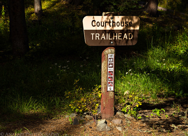
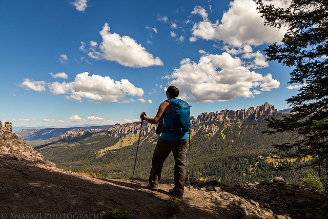
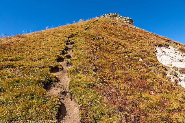
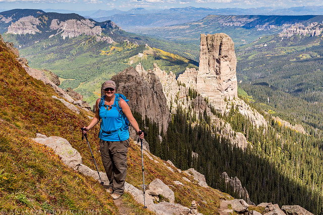
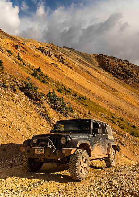
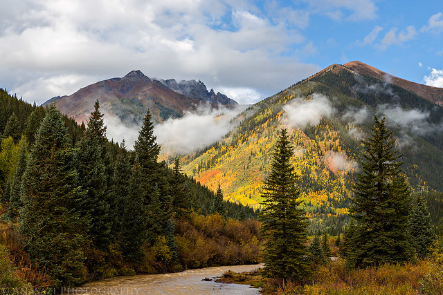
On Saturday, Diane and I headed back down to the San Juan Mountains again so we could climb to the top of Courthouse Mountain in the Cimarron's . While this mountain is short compared to the surrounding peaks in the area at only 12,152 feet, it is uniquely shaped and has over 1,000 feet of vertical prominence. It's also a very distinguishable peak near Owl Creek Pass that is often photographed, especially in the fall when the surrounding mountainsides are changing colors. I have seen this mountain in the skyline for many years when I would drive to Ouray and Silverton, and decided it was finally time to climb to the top a few weeks ago when I had a different view of it during our hike into Wetterhorn Basin. While there were afternoon storms predicted after 3:00pm today, we didn't need to get too early of a start for this hike since it's a relatively short trail, clocking in at just under 2 miles, but it climbs almost 2,000 feet of elevation in that short distance.
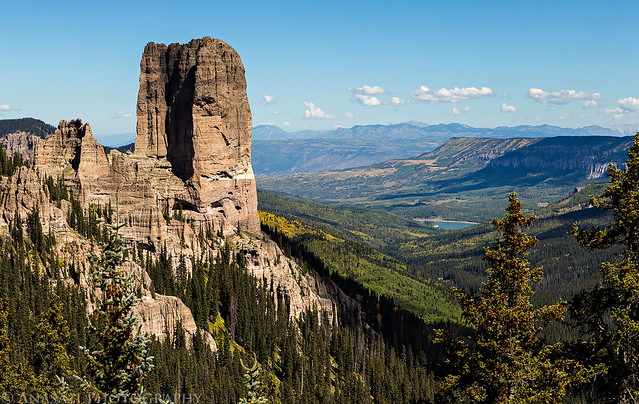
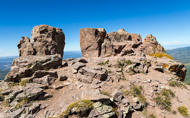
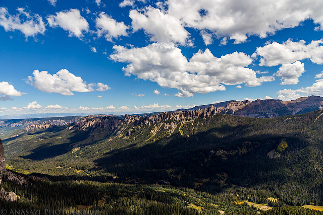
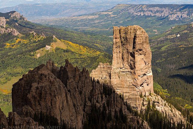
Surprisingly, much of the trail was in the trees and offered limited views. However, once we finally broke free of the trees we had outstanding views over Chimney Rock (11,781 feet) and down the Cimarron River Valley towards Silver Jack Reservoir.
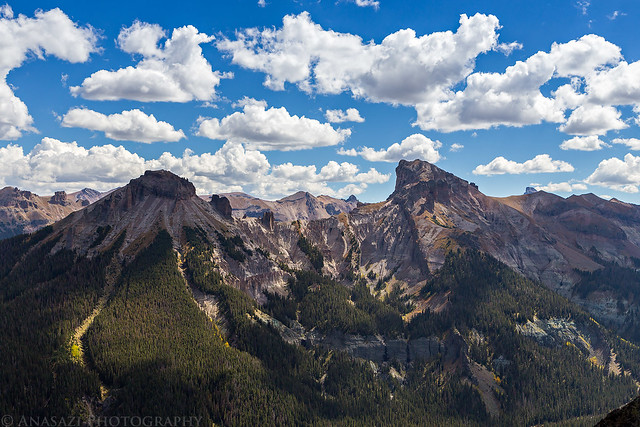
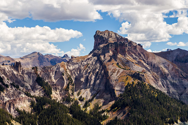
When we reached the Courthouse Trail Pass again, I climbed a narrow outcrop of rock nearby for some different views above the trees. Looks like there was a storm over the Sneffels Range, so it's a good thing we were on our way back down. That small rounded peak on the far right at the horizon line is Baldy Peak (10,603 feet) which was the first peak we climbed this summer.
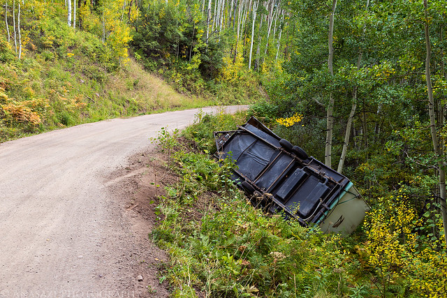
After finishing the hike and driving back over Owl Creek Pass to Ouray for dinner, we passed this scene which wasn't there when we drove by in the morning. Looks like they got a little too close to the edge with the trailer.
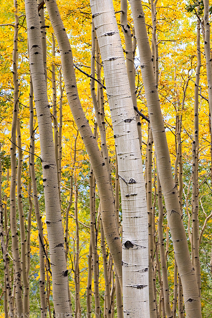
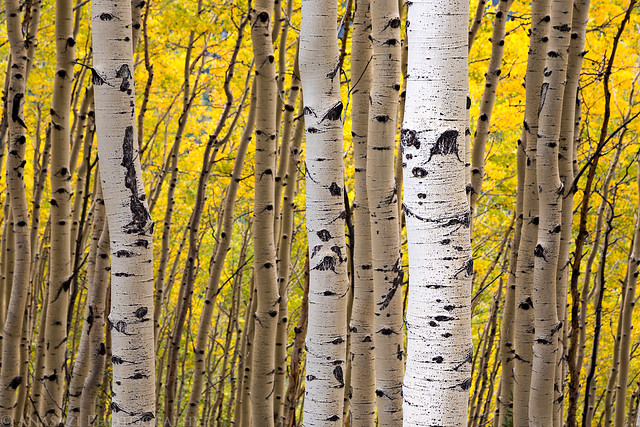
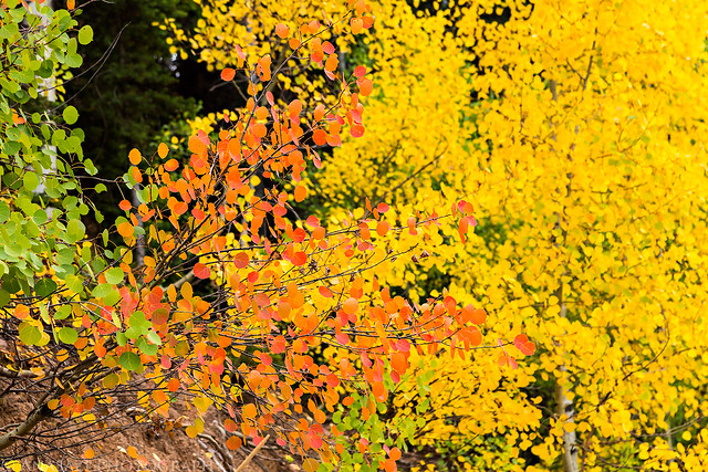
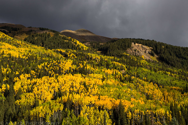
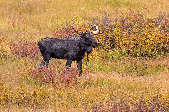
While much of the area around Owl Creek Pass was still very green, there were a couple of patches of aspen trees that had changed color already. I stopped for a few photos.
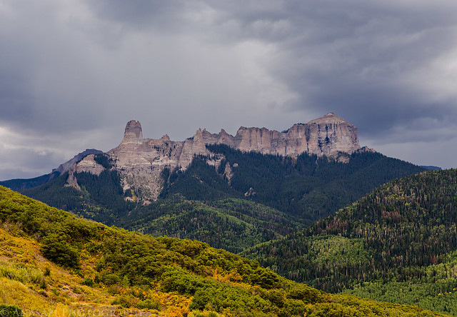
I made sure to stop at Vista Point for another photo of Courthouse Mountain and Chimney Rock. Dark storm clouds had moved in and there were a few bolts of lightning near the mountain after I took this shot.
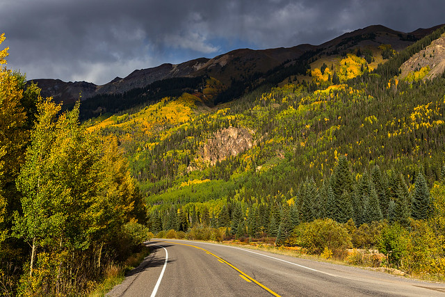
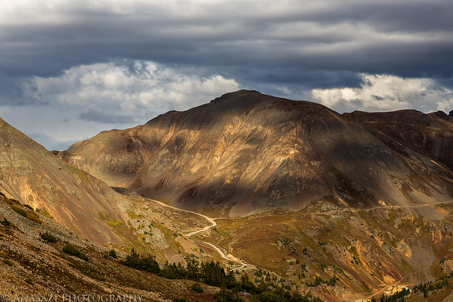
After dinner in Ouray we took the Million Dollar Highway towards Red Mountain Pass so we could see how the fall colors were coming along and find somewhere to camp for the night.
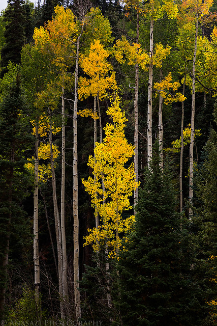
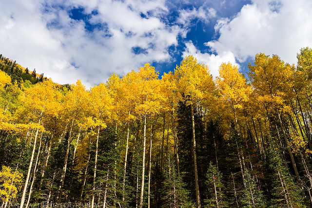
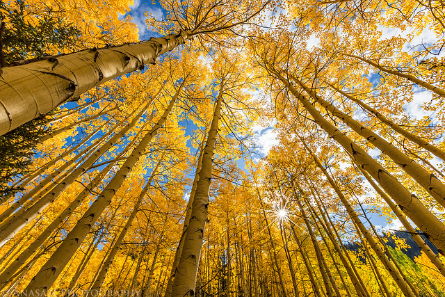
As we neared Ironton Park we could see that the aspens were already changing pretty nicely around here.
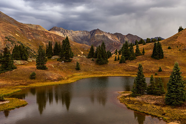
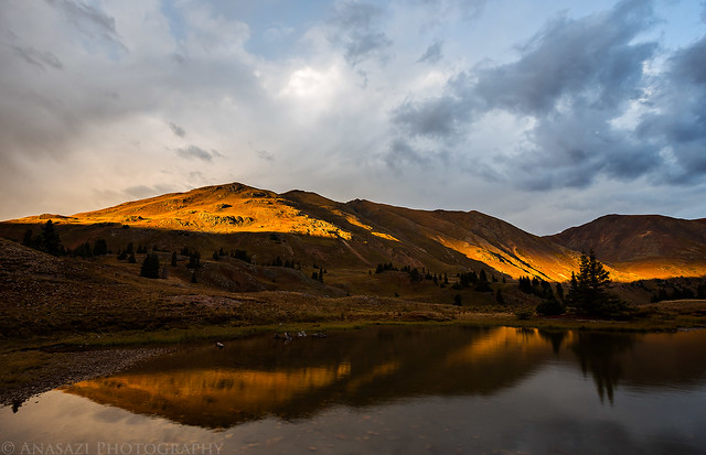
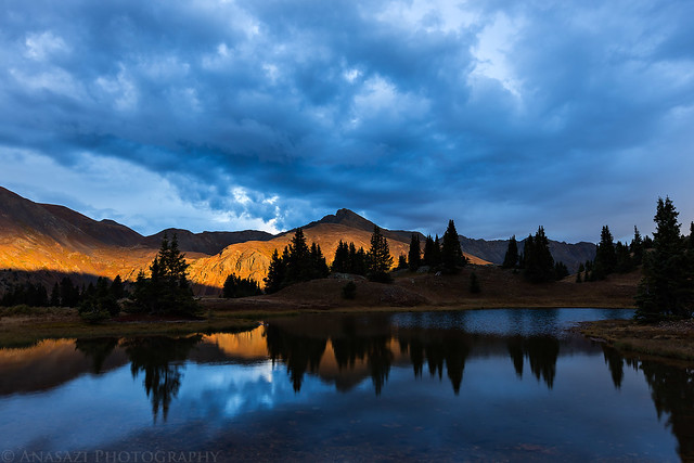
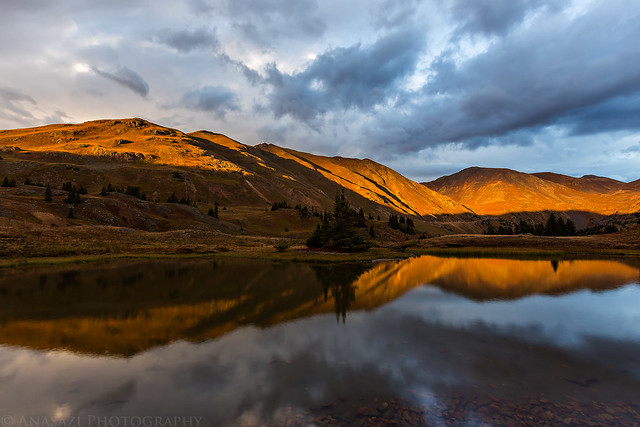
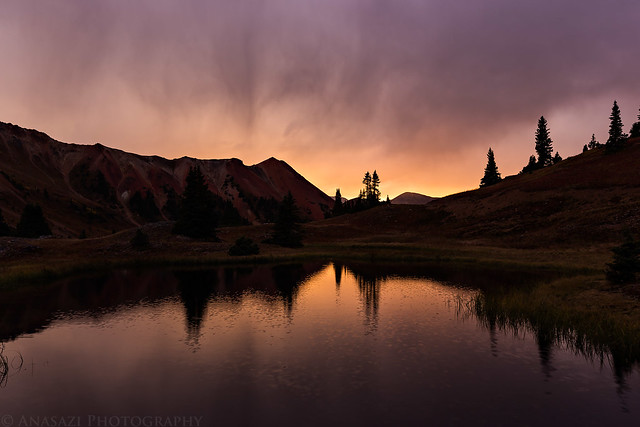
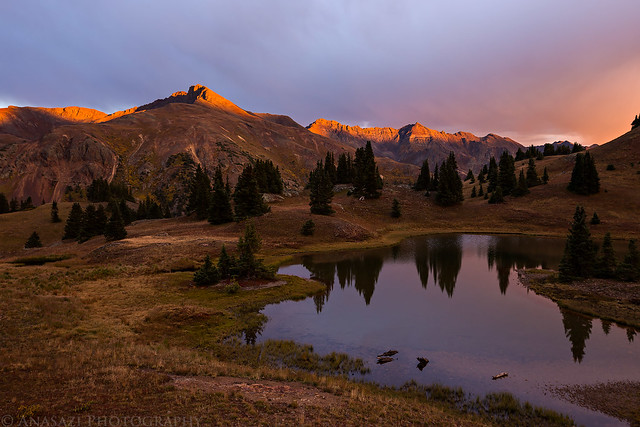
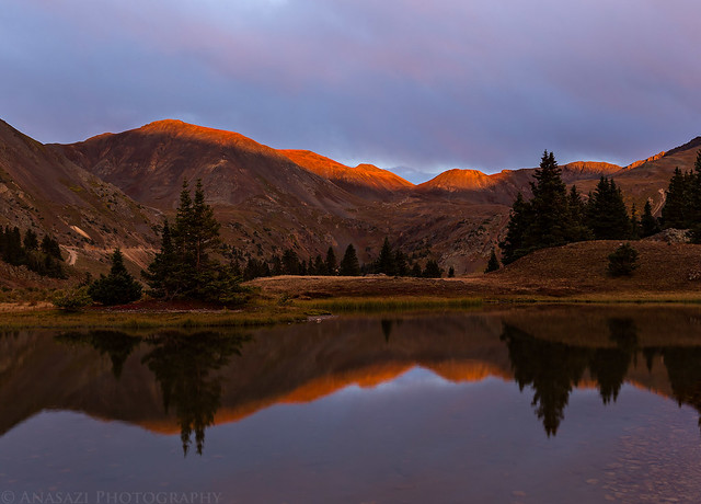
We ended up setting up camp in Gray Copper Gulch for the night. Not only is this a very beautiful place to camp, but we were also planning on climbing a peak or two in the morning. This location turned out to be a great choice since we were treated to an amazing sunset!
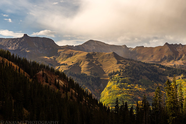
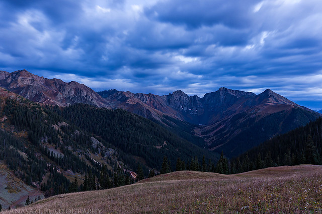
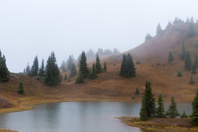
We went to bed shortly after sunset...and then the rain started. We woke up around midnight and looked outside of the tent to see the sky filled with stars and the Milky Way was visible, so we thought that the rain was done for the night. Were we wrong! Sometime between 2:00am and 2:30 it started to rain heavily again and didn't stop. It was still raining when I woke up to see about photographing sunrise. I looked out of the tent and saw that we were in the clouds and there was no hope of them clearing out. We tried to wait for the rain to stop or at least slow, but that didn't seem to happen, so we ended up having to quickly break down camp in the rain. With the poor weather conditions, the mountains we had planned to climb would have to wait for another day. Instead, we decided to drive down to Silverton for some breakfast.
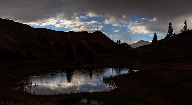
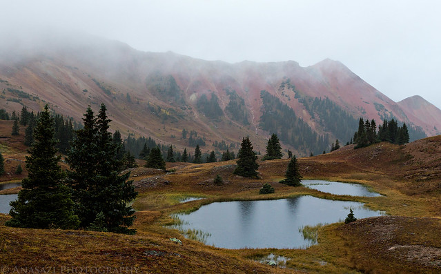
View from our camp shortly after we woke up for the morning.
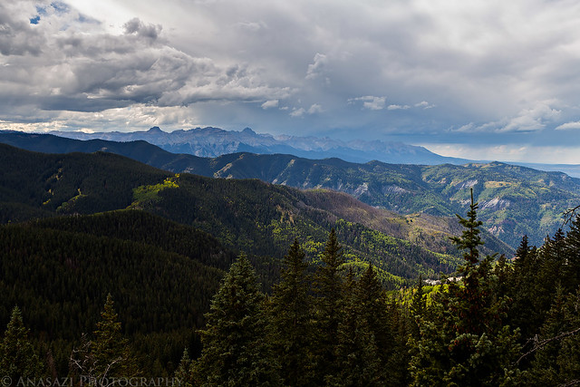
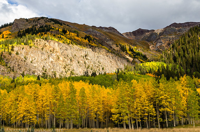
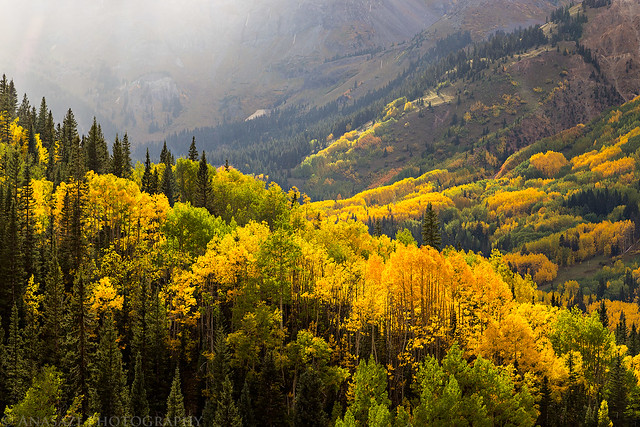
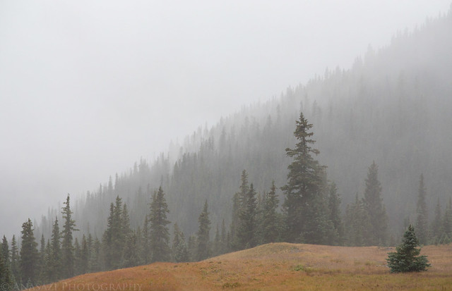
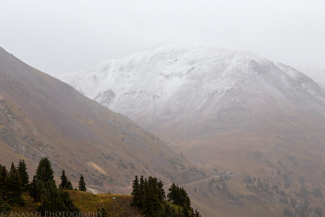
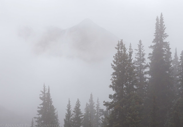
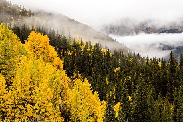
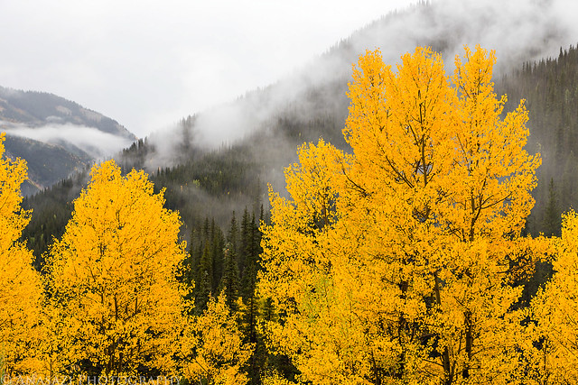
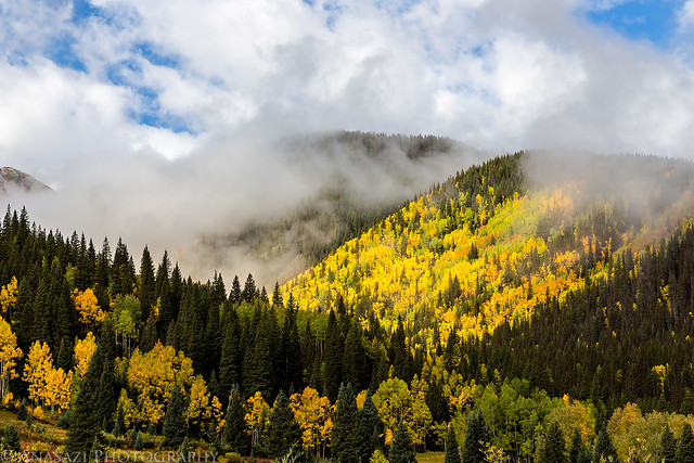
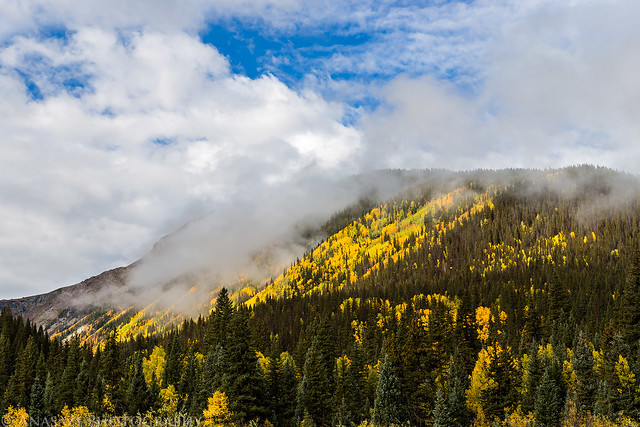
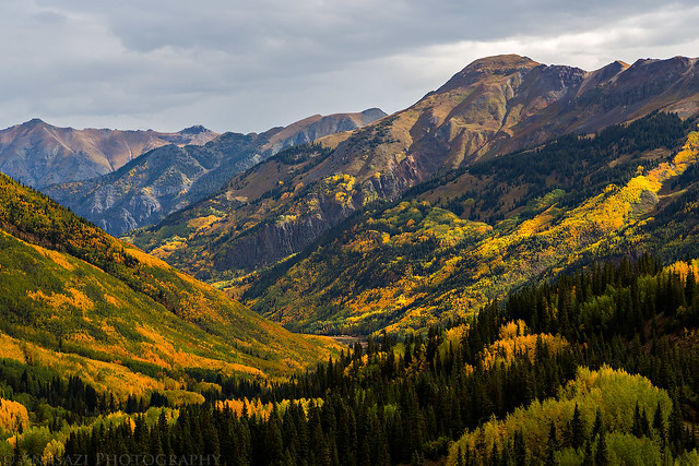
After breakfast the clouds finally started to clear out a little, so I took the opportunity to photograph the low clouds and fall colors on our drive back over Red Mountain Pass to Ouray.
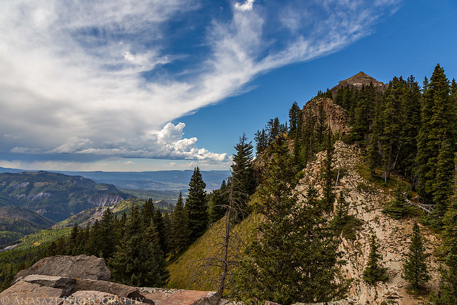
While we may not have been able to climb all the mountains we had wanted to this weekend, the beautiful sunset on Saturday night and clearing clouds on Sunday with plenty of nice fall colors certainly made up for it.
Hi, we enjoyed our climb of Courthouse then picnic by the Cimarron River two summers ago. We really like seeing your pictures with the Fall colors. It changes the landscape
Hi Jay
From the traffic light at the intersection of US 550 and Colorado 62 in Ridgeway, it is 18.9 miles to the trailhead, mostly on dirt roads. Following the signs to Owl Creek Pass covers the first 18 miles of the route.
Start measuring milage at the traffic light and travel 1.8 miles north on US 550 to a right turn (east) on County Road 10.
At 2.7 miles (from the traffic light), bear left toward Owl Creek Pass and Silver Jack Reservoir, staying on CR 10.
At 4.5 miles, continue straight on CR 10.
At 6 miles bear right on CR 8.
Go left at 7.5 miles, staying on CR 8.
The Uncompaghre National Forest boundary is at mile 10, where the road becomes Forest Road 858.
Bear left again at mile 11. Continue on FR 858 to Owl Creek Pass at 17 miles.
At 17.3 miles, take a right onto FR 860. Follow it for 1.6 miles to the trailhead, which is well marked on the right, with ample parking on the left side of the road.
Hi Osprey - thanks for the very complete directions. MUCH appreciated!
Caution: The information contained in this report may not be accurate and should not be the only resource used in preparation for your climb. Failure to have the necessary experience, physical conditioning, supplies or equipment can result in injury or death. 14ers.com and the author(s) of this report provide no warranties, either express or implied, that the information provided is accurate or reliable. By using the information provided, you agree to indemnify and hold harmless 14ers.com and the report author(s) with respect to any claims and demands against them, including any attorney fees and expenses. Please read the 14ers.com Safety and Disclaimer pages for more information.
Please respect private property: 14ers.com supports the rights of private landowners to determine how and by whom their land will be used. In Colorado, it is your responsibility to determine if land is private and to obtain the appropriate permission before entering the property.