Download Agreement, Release, and Acknowledgement of Risk:
You (the person requesting this file download) fully understand mountain climbing ("Activity") involves risks and dangers of serious bodily injury, including permanent disability, paralysis, and death ("Risks") and you fully accept and assume all such risks and all responsibility for losses, costs, and damages you incur as a result of your participation in this Activity.
You acknowledge that information in the file you have chosen to download may not be accurate and may contain errors. You agree to assume all risks when using this information and agree to release and discharge 14ers.com, 14ers Inc. and the author(s) of such information (collectively, the "Released Parties").
You hereby discharge the Released Parties from all damages, actions, claims and liabilities of any nature, specifically including, but not limited to, damages, actions, claims and liabilities arising from or related to the negligence of the Released Parties. You further agree to indemnify, hold harmless and defend 14ers.com, 14ers Inc. and each of the other Released Parties from and against any loss, damage, liability and expense, including costs and attorney fees, incurred by 14ers.com, 14ers Inc. or any of the other Released Parties as a result of you using information provided on the 14ers.com or 14ers Inc. websites.
You have read this agreement, fully understand its terms and intend it to be a complete and unconditional release of all liability to the greatest extent allowed by law and agree that if any portion of this agreement is held to be invalid the balance, notwithstanding, shall continue in full force and effect.
By clicking "OK" you agree to these terms. If you DO NOT agree, click "Cancel"...
A few notes about our trip up castle and conundrum from the Hot Springs. We used Roach's 25r4 Castle Peak- West Face route.
We did use helmets and the rock quality is poor almost the whole way.
Roach also says you ought to cross the creek about .5 miles back down from the hot springs, or just a few hundred yards before the lower campground. We did this on our ascent, and the willows are horrible and about 200 yds of bushwhacking is in store. The ground was soppy and muddy and this part of the journey was limited fun. ALTERNATIVELY- on the way home, and i'll put a picture up here... we crossed the river at the actual lower campground area. This was much easier because as soon as you cross the river, you are at the established campground area- with real trail and no bushwhacking. The limited bush whacking is done on the approach to the creek from the other side- you'll come to an area where there are a bunch of fallen trees and you have to trunk walk your way thru all of the dead trees. ** ONE NOTE- you will only be able to cross the creek from the campground in one spot- literally- the rest of the creek side is lined by a mud cliff ~15' tall. If you can find the funnel of passage it is a steep grassy hill... ascend the hill and you will enter the fallen tree zone... continue west and you will pop out on the never ending talus field- go left... WAY LEFT.. or you will end up attempting to ascend scree and it will eventually cliff out. Or just go back down the trail from the campground and bushwhack thru the willows, across the creek and then you will pop out onto the never ending talus field.
Looking at the basin from the conundrum creek trail
this is the river crossing from the lower campground, a better alternative to the bushwhack .5 mile back.
--Finding a place to turn off, so if you're heading thru the willows (we walked on game trails that helped ease the trip) you will leave the conundrum creek trail a few hundred yards before the lower campgrounds- the one land marker that we continued to use is a giant avy slide on the opposing slopes. So if you're looking into the basin w/ castle and conundrum (both of which are out of view, to the east of the conundrum trail)- look to the opposite side of the conundrum trail (west) and there is a large clearing from the top almost all the way to the bottom where a past rock or avy slide has cleared all of the trees. This giant land mark is on the right side (west) of the trail approximately where you will turn left and take out off of the trail (heading east) - look for the path of least resistance and the first ~100 yds was mostly knee high grasses, fallen trees (from the avy/rock slide that cleared the opposite hill side), and avoidable willows... after you pass that easy part you will approach the river and thats where the bushwhacking really begins... but otherwise no- no cairns- no trail- no signs or markers... just take the path of least resistance into the basin. We found the easiest passage was from the actual lower campgrounds. From the campgrounds you can get down to the river easily- then just walk the banks until you can find a place to cross and a place to get up the banks on the other side- either way you go to cross the river- as soon as you cross you will be on the Talus field.... and head left.... use the avy shoot on the opposite side of the valley as a rough estimate for when you can stop going straight left and start going left and up... or north (left) and then eventually turn northeast (left and up) and eventually straight east (up)--
Once on the talus- roach describes a steep talus ascent to the ridge. This is pretty much what happens but note here that you will head up and *left. Especially if you come from the crossing at the campgrounds, you will actually just go left without going up, for while. There are a couple of willowgroves that look like they block passage and you will be tempted to go up- but don't go up very high or again you will scree up and cliff out. The trees do have clearing areas and just walk the tree line until you find the space that allows you to pass thru and continue to head left or north. Eventually you will have gone left enough to where you can see that if you continue left you will reach the end of the basin. At this point turn east or head up. This appears as sort of the 'end of the talus field' and if you continued left you would enter grass and trees and willows. Head up the hill while still on the talus.
Looking up the last stretch of talus- from here we aim high left to gain the ridge
You will continue up and you will be able to finally see some solid rock. We headed up thru the solid rock/grass area. Once over the first giant boulder feature, the talus begins again- but this will be the end of the terrible stuff for a while. Ascend the talus, again staying left- and shoot for ridge proper.
Finally above the talus, looking back- conundrum creek trail would be the bottom of the valley
You should see two nubs or (the west face boobs) and you will shoot to ascend directly between them- this will put you on the ridge.
The rock is finally starting to stabilize a bit, we're almost ridge proper at this point
Stay ridge proper all the way to the top of the 'point' which will put you just next to the summit of conundrum.
** Important** the ridge passage looks like it is blocked by a couple of cliff bands. These cliff bands are very close to the point next to conundrum and if you can gain these- you are there. DO NOT GO AROUND TO THE RIGHT. We tried to scale past the cliffs by moving around them to the right. The earth over here is extremely loose, extremely steep and if you started to slide- giant cliffs await you not far below- we kicked a couple of slides and every move is sketchy. Coming down we stayed ridge proper and down climbed the two or three ~10' tall +/- cliffs and staying ridge proper is absolutely the best rock you will find... it is at least passable. You should approach the cliffs straight on and climb up them.
Once your ridge runs out- you should literally be on the common trail. Head left to bag conundrum and right to traverse to castle.
Looking over to castle from the top of the ridge- which is the end of the ridge run for this ascent
It took us 6.5 hours to go from camp- to get both peaks- and get back to camp. We weren't flying- i think this would be a pretty average pace. We arrived at the hot springs at about 10a.m. ... spent the day soaking and napping then left the lower camp ground at 4 p.m. and watched the sunset from the top of Castle. We arrived back at the campground around midnight.
The summit of Castle. One dot is my head lamp- the other dot is the full moon.
stay ridge proper for the most stable passage
Use the avy line on the opposite side of the valley (back across to the other side of conundrum creek trail) to keep your bearings. Your exit from the trail, your ridge line and your descent will all be almost in line with that avy trail.
don't try to ascend the basin- you will scree to cliff and it is impassible, and once you enter the scree basin- you won't be able to gain the ridge to the north because it turns to cliff straight away- and you need to be on top of it, enter thru the west face nubs.
We had a lot of fun doing it- the worst part is the talus on the approach to the ridge... it is never ending, loose/ wobbly and the rocks are big enough to break an ankle. Once your on the ridge it is fun.
The next worst part (our mistake) was when we tried to skirt the cliffs on top and headed right- the terrain immediately deteriorated and we were no longer on class 3+.
Thumbnails for uploaded photos (click to open slideshow):
This is what I've been looking for! 10/6/2014 1:59am
After the description of this (attempted) route on Summitpost, I have been very interested in how well this goes. I tried the West face route and hated it, so this looked like a possibility. Is there a good indication of just where you leave the trail? Do the cliff bands ever exceed Class 3+? Thank you for posting this!
Yeah good question actually, sorry for not including- so if you're heading thru the willows (we walked on game trails that helped ease the trip) you will leave the conundrum creek trail a few hundred yards before the lower campgrounds- the one land marker that we continued to use is a giant avy slide on the opposing slopes. So if you're looking into the basin w/ castle and conundrum (both of which are out of view, to the east of the conundrum trail)- look to the opposite side of the conundrum trail (west) and there is a large clearing from the top almost all the way to the bottom where a past rock or avy slide has cleared all of the trees. This giant land mark is on the right side (west) of the trail approximately where you will turn left and take out off of the trail (heading east) - look for the path of least resistance and the first ~100 yds was mostly knee high grasses, fallen trees (from the avy/rock slide that cleared the opposite hill side), and avoidable willows... after you pass that easy part you will approach the river and thats where the bushwhacking really begins... but otherwise no- no cairns- no trail- no signs or markers... just take the path of least resistance into the basin. We found the easiest passage was from the actual lower campgrounds. From the campgrounds you can get down to the river easily- then just walk the banks until you can find a place to cross and a place to get up the banks on the other side- either way you go to cross the river- as soon as you cross you will be on the Talus field.... and head left.... use the avy shoot on the opposite side of the valley as a rough estimate for when you can stop going straight left and start going left and up... or north (left) and then eventually turn northeast (left and up) and eventually straight east (up).
yeah class 3+ would be mostly as hard as it gets if you stay ridge proper. The approach to the ridge and much of the ridge would likely be considered 2+, mild 3... it gets more sketchy near the top.... The cliff bands may be considered 4 but it's a no protection climb regardless because the rock quality is so poor that any gear placements would be adding danger
Your photo #6 of Castle looks awesome, almost like you're standing on the rim of a volcanic crater.
Caution: The information contained in this report may not be accurate and should not be the only resource used in preparation for your climb. Failure to have the necessary experience, physical conditioning, supplies or equipment can result in injury or death. 14ers.com and the author(s) of this report provide no warranties, either express or implied, that the information provided is accurate or reliable. By using the information provided, you agree to indemnify and hold harmless 14ers.com and the report author(s) with respect to any claims and demands against them, including any attorney fees and expenses. Please read the 14ers.com Safety and Disclaimer pages for more information.
Please respect private property: 14ers.com supports the rights of private landowners to determine how and by whom their land will be used. In Colorado, it is your responsibility to determine if land is private and to obtain the appropriate permission before entering the property.


 Looking at the basin from the conundrum creek trail")
 Finally above the talus, looking back- conundrum creek trail would be the bottom of the valley")
 Looking up the last stretch of talus- from here we aim high left to gain the ridge")
 The rock is finally starting to stabilize a bit, we're almost ridge proper at this point")
 Looking over to castle from the top of the ridge- which is the end of the ridge run for this ascent")
 The summit of Castle. One dot is my head lamp- the other dot is the full moon.")
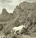
")
 this is the river crossing from the lower campground, a better alternative to the bushwhack .5 mile back.")