| Peak(s): |
Castle Peak - 14,274 feet |
| Date Posted: | 10/16/2014 |
| Modified: | 07/21/2016 |
| Date Climbed: | 10/12/2014 |
| Author: | SoCool |
| Peak(s): |
Castle Peak - 14,274 feet |
| Date Posted: | 10/16/2014 |
| Modified: | 07/21/2016 |
| Date Climbed: | 10/12/2014 |
| Author: | SoCool |
| How to Summit Castle from Conundrum Hot Spring? |
|---|
|
Disclaimer: did not summit Castle, just a counterclockwise circumnavigation of Castleabra. My first TR so please don't bash me! The full backstory: My very first visit to Aspen was in 2009, word of mouth said it could be fun to pack in to Conundrum Hot Springs and attempt Castle/Con, it made me want to try it soon. So I was pretty excited on a late September day as I hiked up from the spring following a route description from Summitpost.org, called "Conundrum to Conundrum," which went okay for awhile until leading me into dangerous terrain high on Conundrum's west ridge. The guy that had written this route description and TR never even completed it, but rather abandoned his ascent 1200 feet shy of the summit. He didn't even see the remainder of the route because of the clouds. He claims it was described to him by "several denizens" of the hot spring and the local ranger, "Locals assured me that the climbing was no harder than class 2." I left the ridge and forced a traversing route to the right to attain the Castle/Con saddle, then was pleased to summit both 14'ers. But it was certainly not some great locals route. I admit it's still possible there is a doable route, mainly up the ridgecrest and probably avoiding cliff bands on the left (north) side. But I cannot find anybody that has completed it except Evan Ravitz, who has done it several times and mentions a 10-foot cliff, and tree_beard, who says, "...it gets more sketchy near the top.... The cliff bands may be considered Class 4." He may think I'm a jerk now because I keep saying the highest portion of his route was not Roach's West Face, as he claims, but rather the Conundrum to Conundrum "route" that I am trying to shut down. My certainty comes from this tree_beard quote, "Stay ridge proper all the way to the top of the 'point' which will put you just next to the summit of Conundrum." (Roach's 25.3 attains the Castle/Con saddle.) In 2014, surprised that this deplorable info on Summitpost is still intact with not a single person correcting it, I started a thread on 14'ers.com to caution others. From the responses I realized that all of the routes up Castle/Con from the spring are tedious at best, and horrible/dangerous at worst. Once this became clear, I was more bothered then ever because there are numerous questionable websites suggesting an ascent from this side. http://www.14ers.com/forum/viewtopic.php?t=45134 From living in Aspen for several years I was aware of rumors of a great locals route, but am now convinced they largely stem from Summitpost. Today I spoke to a Forest Service employee that's been around for 45 years and he confirmed there is no good route, and never was. My search seems like a parallel of the miners': "The name 'Conundrum' comes from early-day miners, who found gold in the stream but could never locate a profitable bonanza." This valley and hot spring are so special, and so much fun, that I feel it would make a large contribution to our 14'er knowledge to settle, once and for all, which route(s) are the best for ascent/descent, and which are the worst. This may take me several trips, but the end result could be a profitable bonanza. I wrote a list of possibilities, most excited about the extremely aesthetic NW ridge of Conundrum. I am not talking about a "first ascent" because surely someone has ascended this ridge before, probably even Native Americans. But currently it is not an "established route," which I feel it could be, and would be awesome. Also Boggy B and FireOnTheMountain once ascended the Sloman Couloir up the north side of Castleabra subPeak, which looks awesome for expert snow climbers in perfect conditions. Many describe the pack-in to Conundrum Hot Spring as "easy," but this is only true if you are very well conditioned to carrying a pack and have good balance crossing the wet areas on rocks and logs. Also spring runoff can be extremely challenging. The reality is that many people make this trip with little or no conditioning or experience, and have very heavy packs full of alcohol, towels and swimsuits, etc. It's 8.5 miles with 2500 gain, which requires a lot of effort.   and Castleabra subPeak (right). The girls kept saying they felt like they were in")   When you finally reach the "lower campsites" it's tempting to stop here, mainly because fires are allowed, but IMO it's better to be adjacent to the hot spring. (Beware it's rather demoralizing if you find the upper sites occupied and have to go back downhill with your heavy pack.) You will know when you have passed above the lower unnumbered sites when you reach the sign: "Camp only in numbered sites 1 - 16, no fires." From here it's still 1/4 mile uphill to the spring, nearly at treeline. Explanation of numbered sites: 1 - 5 are on the left, some too close to each other and the trail for my preference, not to mention too far from the spring. Then you will see the old useless cabin on the right side and shortly after will find a trail junction. You can go right to reach sites 14 - 16, this is also the trail that continues to the head of the basin providing access to peaks and passes. Going left (east) will lead you across the log bridge to the spring surrounded by sites 6 - 13, each about a 30 second walk away. The name "Springs" implies multiple pools so I refer to it as the "Spring", singular, because the smaller pools aren't hot, I've never seen anyone in them. Good thing the main pool is large enough to accommodate dozens of people, which is rather common on weekends. Proof is the sign at the trailhead, "All parties must register.." Of course, this is "The highest hot spring in N. America." Also it is not muddy, as some have reported, but rather crystal clear when nobody is sloshing around, and is over 100 degrees. It was a Saturday night, it was not surprising there were twenty or more people in the pool, most nude. It was an epic party. I tried to write about some of the shenanigans but it looked so ridiculous and unbelievable on paper that I had to delete it. The next morning (Sunday 10/12) I awoke to a snowstorm, nobody wanted to hike anymore. I knew this was in the forecast but had hoped to sneak out early in advance. Part of me wanted to start hiking immediately before the snow became too deep, but a more rational part convinced me to roll over and sleep in and maybe the temperature would rise a little. I also took my time with breakfast and getting dressed, finally heading out mid-morning. There were moments with some blue sky visible, I foolishly hoped it would clear up. To try the NW ridge of Conundrum today would be crossing the line from confidence to over-confidence. Instead I chose the "safest" exploration on my list: looking for an easy way around Castleabra subPeak on the south side as a way to reach Castle's West Ridge Route without having to traverse over Castleabra subPeak's summit. From the hot spring I went upslope where you immediately arrive at the large talus pile, the foot of the notorious Castleabra subPeak west face scree/talus gully route. This is sometimes called "the rock glacier," though I'm not sure it truly qualifies. For those going up the scree here, some say early season snow may make the route more stable, a rare endorsement for early season snow. Because my goal is to find good routes that mostly avoid loose talus, I stayed off it and simply kept to the right edge of the talus, heading south and upslope.  This turned out to be a very pleasant way, just choose the path of least resistance and continue to the upper basin until you eventually have a view to the left (east) and can see the gully leading to the gap between Castleabra subPeak and Point 13,550 south of it. From prior reports, I expected this gully to be easy and it was, though it could be sketchy in certain conditions. There were several inches of powder by this time, but it didn't slow me down very much. I chose to focus on the positive: the slightly older snow under the powder was conducive to flat steps.   When I reached the gap I found two gullies leading down on the east side. The one on my left looked steep, but doable. The one on my right looked steep but very doable, I literally could not resist the temptation to descend it even though it was clearly a mistake to do so, being alone in poor weather. I even huddled in a semi-protected spot for a couple minutes to rest and give my rational side a chance to influence my actions. Nope, I was doing this.   This is the lee side of the ridge, where the snow is deposited by the wind and is always far deeper than the side I ascended. Here the snow was probably deep enough to slide, but it wouldn't be a huge avalanche in such a tight gully. Regardless, I was a little nervous but of course it was only a few feet down to safe ground. It was exciting to be in Cumberland Basin and I made good progress north towards Dawson's established route 4.3.6, which gains a saddle east of Castleabra subPeak (aka Roach's 22.2 in his CO 13'ers book). I had proven to myself that this was a viable path to gain Castle. I'm also extremely optimistic that the safest, easiest, and most enjoyable way to reach Castle is along my route but taking an even shorter direction in Cumberland Basin, trending NE to gain the gap between Point 13,820 and Castle. The terrain is reportedly steeper to gain that gap, hence the recommendations for Dawson's, but I would like to have a look some day, especially since Mojah recently ascended near there, somewhere to the right of that other gap.  and Point 13,830 (") It was a little steep for the last part to reach Dawson's gap, but not too dangerous. From here, one can go to the right up and over Point 13,830 to gain Castle's West Ridge, or left up easy terrain to Castleabra subPeak's summit. (I would consider descending its notorious west face gully down to the spring, this would be far more logical to me than ascending.) But I did neither peak, the weather was ugly and I had nobody to help break trail. I was eager to see the Cunning Couloir firsthand, it was obvious to find and looked steep. The conditions were sort of okay for my descent, but I will probably only consider this couloir as an ascent route in perfect snow conditions.   As I exited this gully I headed left to descend back to the spring, being careful not to lose too much elevation in order to answer another question: is it a good route to and from the hot spring into this basin staying as close as possible under Castleabra subPeak's cliffs? I made slow and steady progress through the snow, wallowing past my waist about 3 or 4 times but gradually covering distance and losing elevation. As I rounded the corner, with the hot spring nearly in view now, I realized this entire slope below Castleabra subPeak is steep enough to be difficult and annoying, and certainly dangerous with snow or ice. In total I have traversed this slope to and from the spring several times, so now I can say with confidence that this slope is not a good route. Roach's and/or tree_beard's starting point from the creek, which is near to or downstream of the lower campsites, is probably better overall. It was nearing dark and I was tired, it was such a relief to be closing in on the spring. I was looking forward to seeing humans, but when I arrived it was desolate and abandoned. I didn't even soak, my priority was eating and going straight to sleep.  But the next morning I did soak, it was indescribably blissful. It really felt like a womb with a view. Wait, cancel that, this place is horrible, almost as ugly as the Gore Range. Don't ever go there.     After several hours, I knew my pack would feel unpleasant if I got any more sunburned so I finally extricated myself from the pool. Everyone had hightailed out the morning of the snowstorm, now there were articles of clothing emerging. Of course I had to preserve the pristine beauty of this place, my pack was heavy with a plastic bag filled with several pounds worth of wet socks and shorts. Who here wants to try Conundrum's NW ridge in the springtime, with the ridgecrest completely dry? Stay tuned for final results of my project... Edit: On 7/5/15 I finally completed the NW Ridge of Conundrum, it was exhilarating. TR here: http://www.14ers.com/php14ers/tripreport.php?trip=16206&cpgm=tripmine Thumbnails for uploaded photos (click to open slideshow):  Conundrum Valley.")
 Packing in. NW ridge of Conundrum (left) and Castleabra subPeak (right). The girls kept saying they felt like they were in")
 NW ridge of Conundrum rising from right, culminating in highest point in center.")
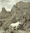
 Still smiling.")
 Just walk upslope from the hot spring.")
 These gullies are located south of Castleabra subPeak, the one on the right goes to the proper gap, the one on the left might")
 Looking back down on Conundrum basin, from halfway up the gully.")
 Looking south from the gap towards Point 13,550, reportedly a fun scramble.")
 A flume with a view. Looking down the gully, east side of the ridge, leads to Cumberland Basin.")
 Going up Dawson's 4.3.6 from Cumberland Basin, the gap in center is between Castleabra subPeak (left) and Point 13,830 (")
 A cwm with a view. Looking back up towards Cunning Couloir after descending it. Sometimes it doesn't have to be fun to")
 My icy tomb with a view. The inside becomes coated in ice every night, which then rains down on me during breakfast.")
 Hot Spring below the notorious west face gully route of Castleabra subPeak.")
 Hot Spring with view of my longed for NW ridge of Conundrum illuminated.")
 Nude selfie. A womb with a view. Mike longs for the NW ridge of Conundrum.")
 Looking up the basin from the hot spring.")
 View from Hunter Pk, descent of Cunning Couloir/circumnavigation of Castleabra. Castle summit just out of picture on left si")
|
| Comments or Questions | |||||||||||||||
|---|---|---|---|---|---|---|---|---|---|---|---|---|---|---|---|
|
Caution: The information contained in this report may not be accurate and should not be the only resource used in preparation for your climb. Failure to have the necessary experience, physical conditioning, supplies or equipment can result in injury or death. 14ers.com and the author(s) of this report provide no warranties, either express or implied, that the information provided is accurate or reliable. By using the information provided, you agree to indemnify and hold harmless 14ers.com and the report author(s) with respect to any claims and demands against them, including any attorney fees and expenses. Please read the 14ers.com Safety and Disclaimer pages for more information.