Download Agreement, Release, and Acknowledgement of Risk:
You (the person requesting this file download) fully understand mountain climbing ("Activity") involves risks and dangers of serious bodily injury, including permanent disability, paralysis, and death ("Risks") and you fully accept and assume all such risks and all responsibility for losses, costs, and damages you incur as a result of your participation in this Activity.
You acknowledge that information in the file you have chosen to download may not be accurate and may contain errors. You agree to assume all risks when using this information and agree to release and discharge 14ers.com, 14ers Inc. and the author(s) of such information (collectively, the "Released Parties").
You hereby discharge the Released Parties from all damages, actions, claims and liabilities of any nature, specifically including, but not limited to, damages, actions, claims and liabilities arising from or related to the negligence of the Released Parties. You further agree to indemnify, hold harmless and defend 14ers.com, 14ers Inc. and each of the other Released Parties from and against any loss, damage, liability and expense, including costs and attorney fees, incurred by 14ers.com, 14ers Inc. or any of the other Released Parties as a result of you using information provided on the 14ers.com or 14ers Inc. websites.
You have read this agreement, fully understand its terms and intend it to be a complete and unconditional release of all liability to the greatest extent allowed by law and agree that if any portion of this agreement is held to be invalid the balance, notwithstanding, shall continue in full force and effect.
By clicking "OK" you agree to these terms. If you DO NOT agree, click "Cancel"...
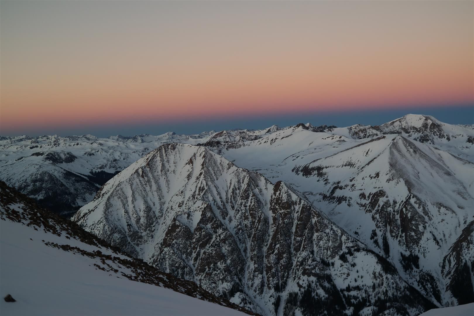
Sunrise on Sunshine, plus Redcloud.. from Mill Creek.
Valentines Day...a good day for some suffering!
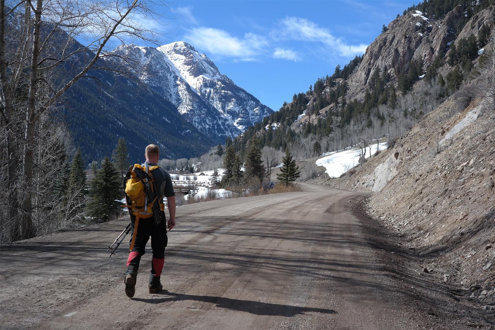
Chad and I pulled into our campsite right across the road from the Mill Creek Trailhead around 10pm. Something to note, some directions say it's about 7.5 miles to the Mill Creek Campground, however its easily 10 miles or a little more. I followed the directions found here:
...and it messed us up a bit with the off mileage. We turned around thinking we missed it around 8.5 miles, only to turn around again and push on until we finally found it. We wasted a good 15 or 20 minutes trying to hunt this down.
We set our alarms for 2am, with the hope of catching nice frozen snow for as much of the early route as possible. Having read a few previous trip reports about this route, one thing was certain...it's a VERY steep route right out of the gates. Do NOT be fooled by the mileage of this route, ignore it completely. You gain a LOT of elevation in a very short distance, mileage wise. We ended up with boots on the trail at 2:35am. The trail was dry for the first good chunk of it, then the snow started. The early start was clutch, we booted right over it for the majority of the trail below treeline. Closer to treeline the snow relented and we started postholing, we finally donned our snowshoes...but not before doing a significant amount of damage to this route. I cannot stress it enough, start early on this route in winter. If you're having to wallow through all of the snow below treeline getting Redcloud will probably be out of reach, let alone Sunshine. It will drain your spirits and melt your soul.
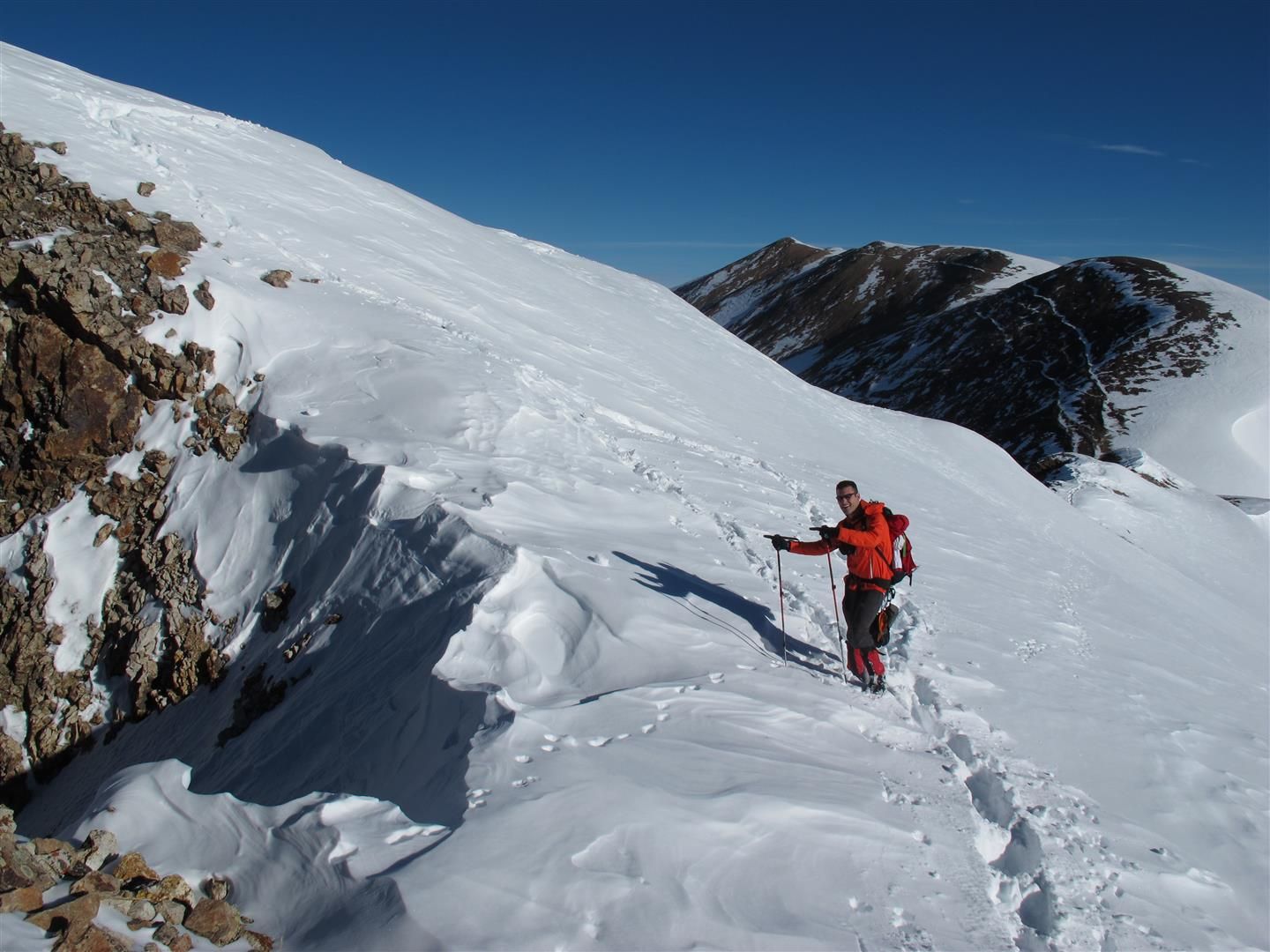
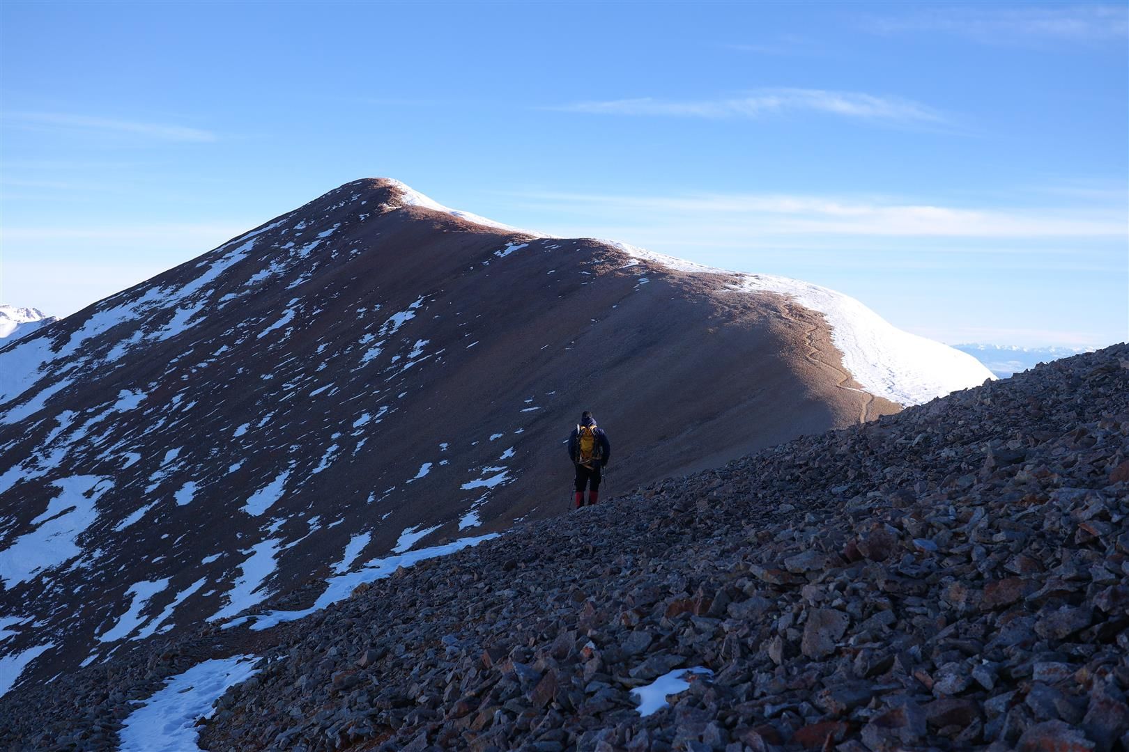
Once out of treeline, there were 3 major hills to get up before we finally topped out on Sunshine. All of the snow for us was frozen pretty well, but we left our snowshoes on for the majority of the way up to Sunshine. On the last stretch of the ridge to the summit we put our snowshoes on our packs and booted the rest of the way to the top.
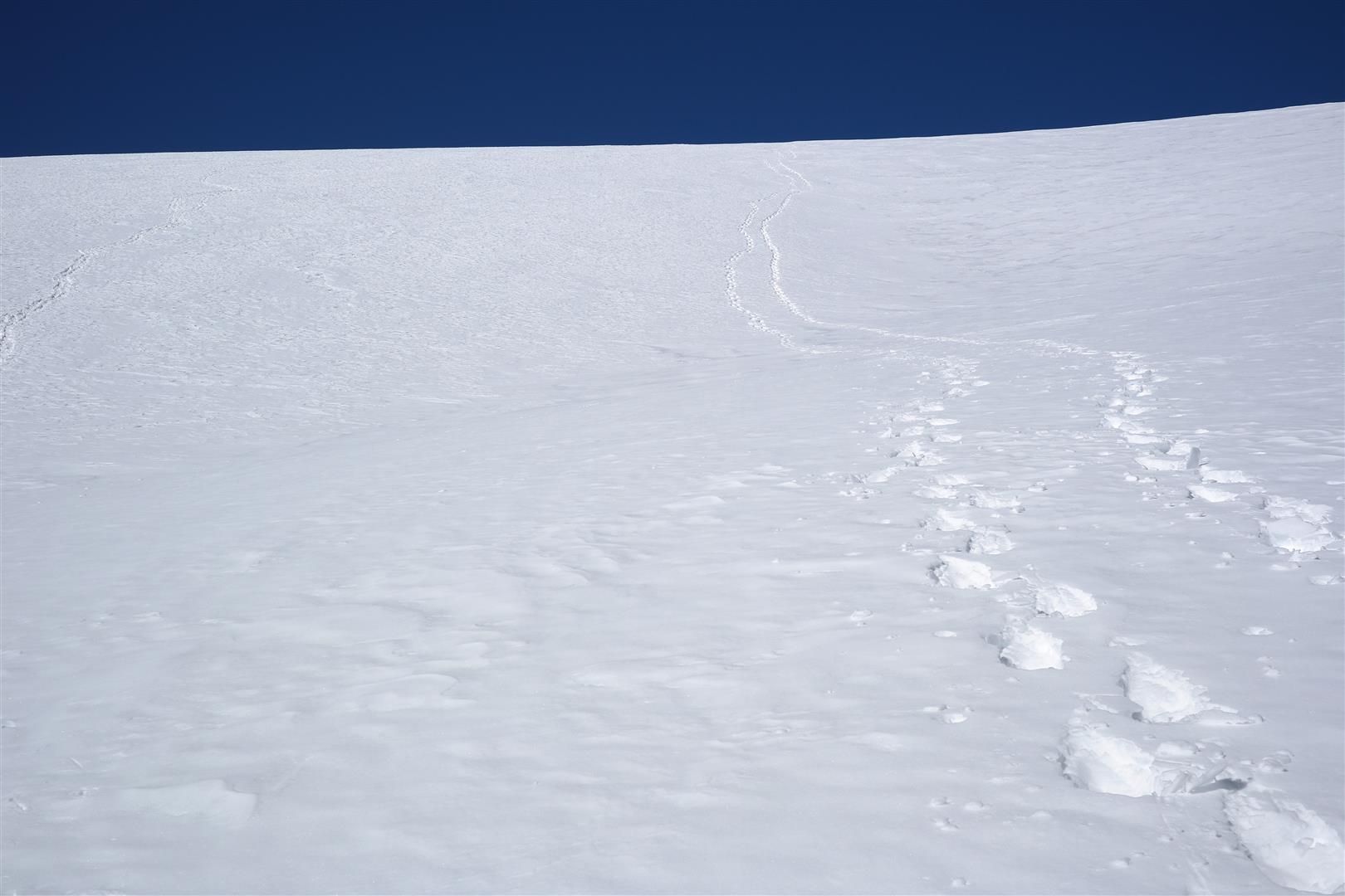
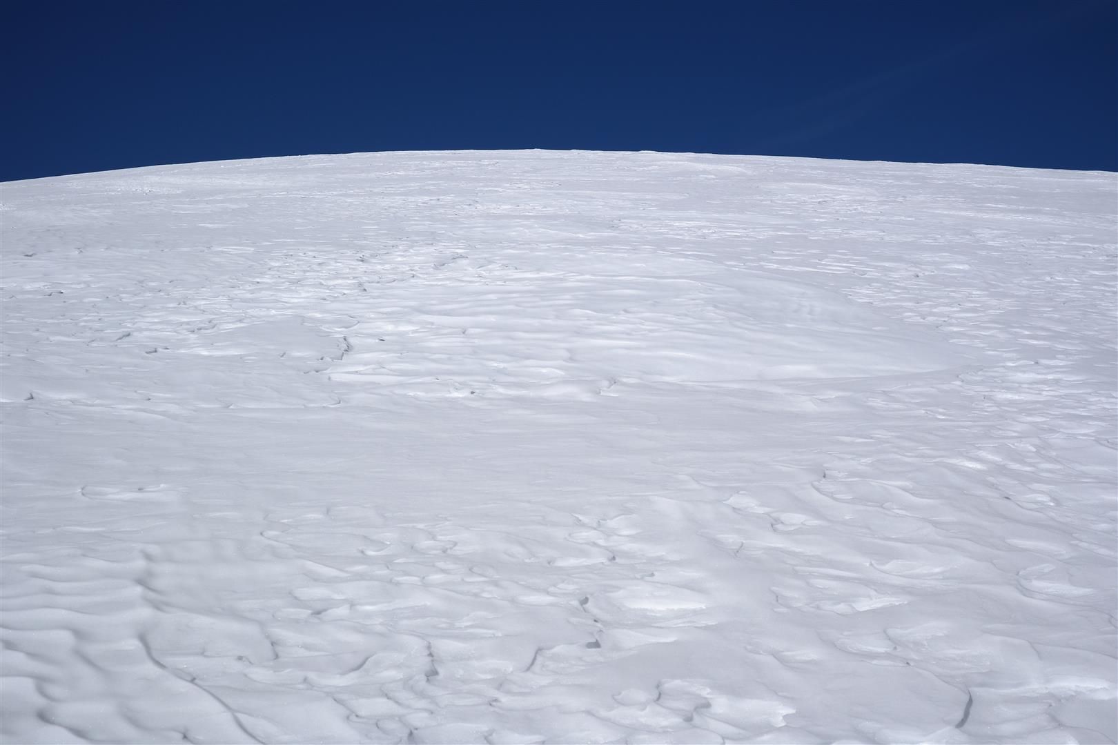
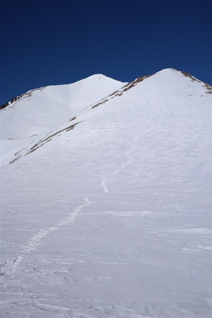
**These images show the 3 major hills you encounter before the summit of Sunshine. These images were taken on the way down, as it was pitch black on the ascent
View right out of treeline:
2nd bump:
Final major gain of elevation. Sunshine summit can be seen in the background. Snowshoes were taken off shortly after the top of this bit of gain:
Again, if you start late on a sunny, clear day...the above section will be a thigh deep mess of hell on earth.
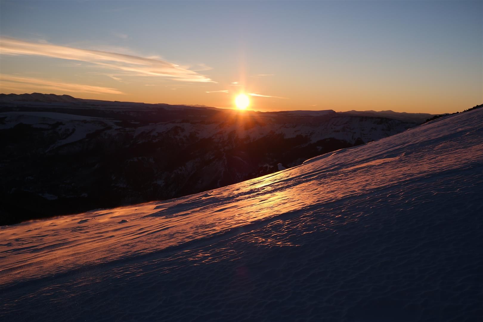
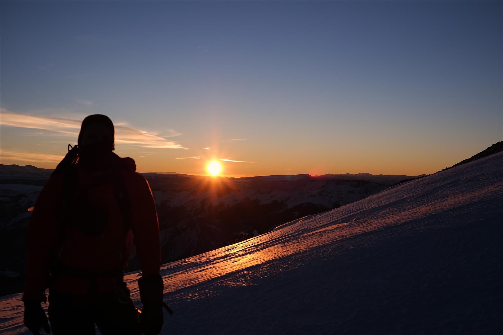
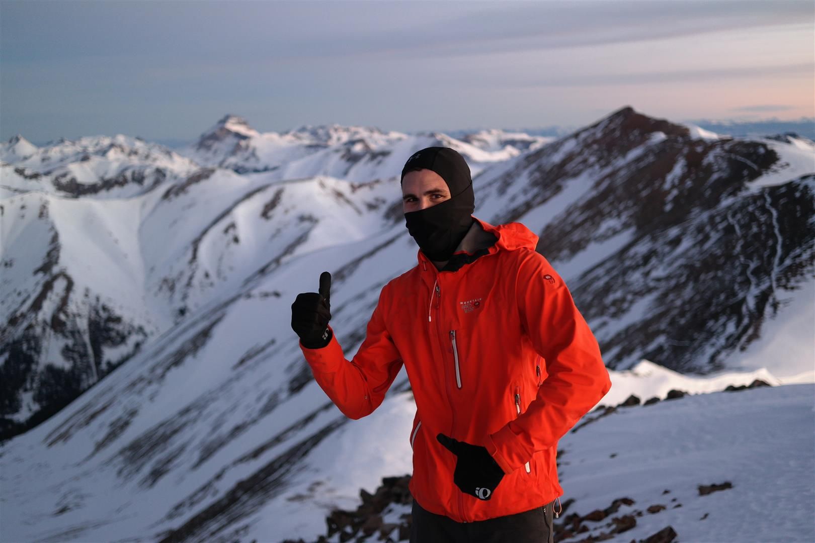
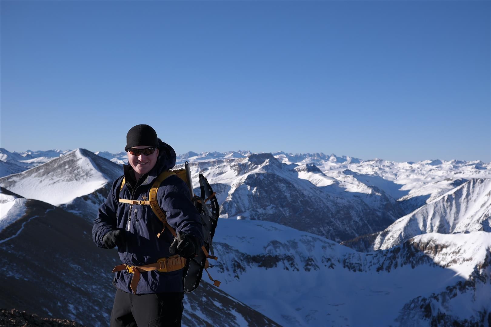
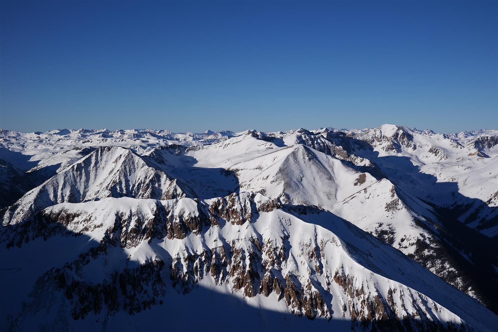
We hit the summit of Sunshine at 6:40am, just a hair over 4 hours from the start. We had some great shots of the sun rising over the San Juans. Enjoy:
As soon as we left the summit of Sunshine, we donned our microspikes and wore them for the rest of the day until we were halfway down to treeline coming off Sunshine.
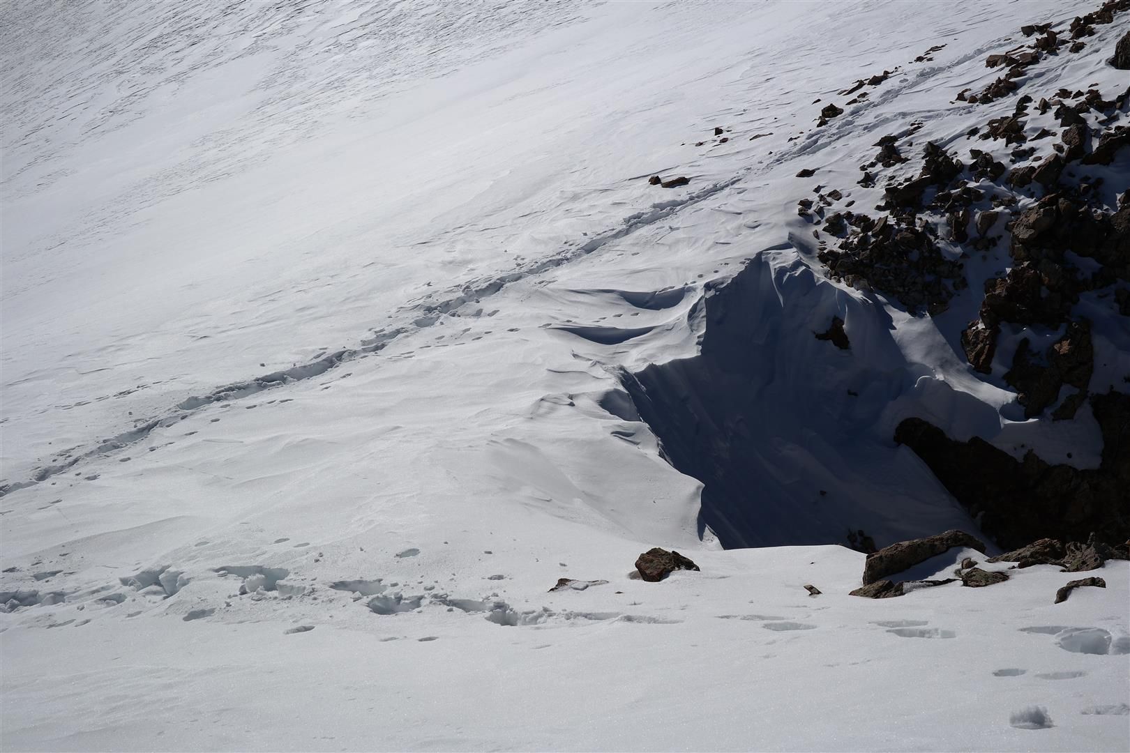
Shortly after we descended Sunshine to head to Redcloud, we hit the crux of the route...not that I was expecting a crux at all. There was quite a bit of snow that had been windblown onto the ridge. We had seen avy debree in other areas (not on the route), and this section looked like it was holding a good chunk of snow. Trying to stay super high on the ridge proper was also a tad risky, as it was corniced from the wind in several sections. For a moment I honestly thought Redcloud was not going to happen. I was scared to get off the ridge for fear of triggering a slide, and also scared of following the ridge and falling off a broken cornice. Chad spotted a few rocks poking through the snow not far below the ridge, a good sign that it was not corniced in those sections. Chad lead the way through this part...which was maybe 100 meters or so of what I considered to be the tricky section.
Some of our prints during a portion of the aforementioned section of the route:
It may not look like much in the pictures, but when you're seeing avy debree on other sections of the mountain it was a concern. Once safely over this section we resumed the cruise to Redcloud. There is a nasty false summit when you're headed to Redcloud. Here is the view of the remainder of the route AFTER the false summit:
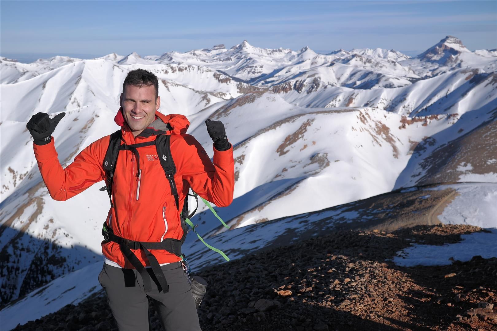
We hit the summit of Redcloud at 8:15am. We were a little tired but feeling fairly strong overall. Spirits were high having gotten the 2nd summit, and coming in ahead of the schedule we set for ourselves.
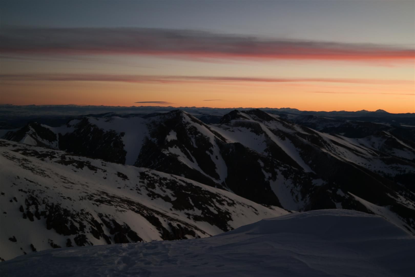
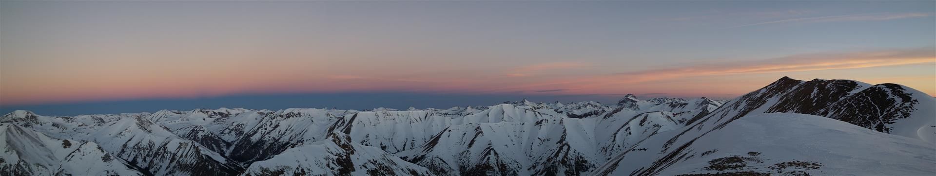
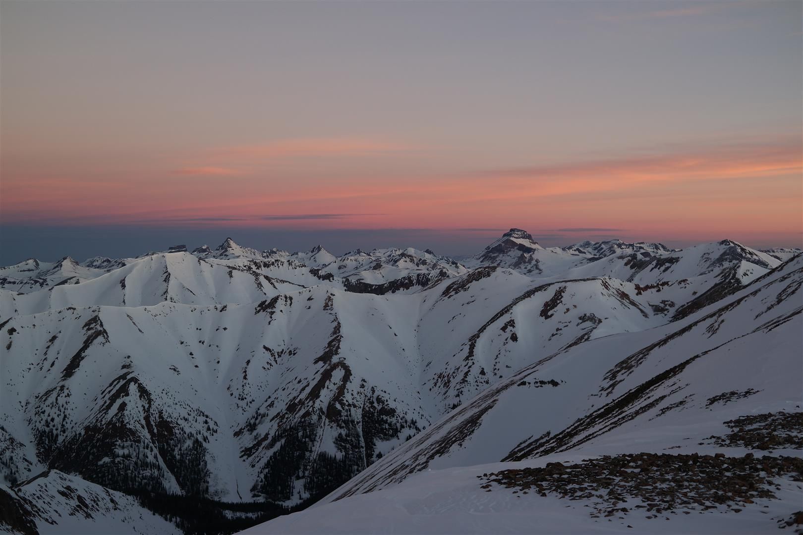
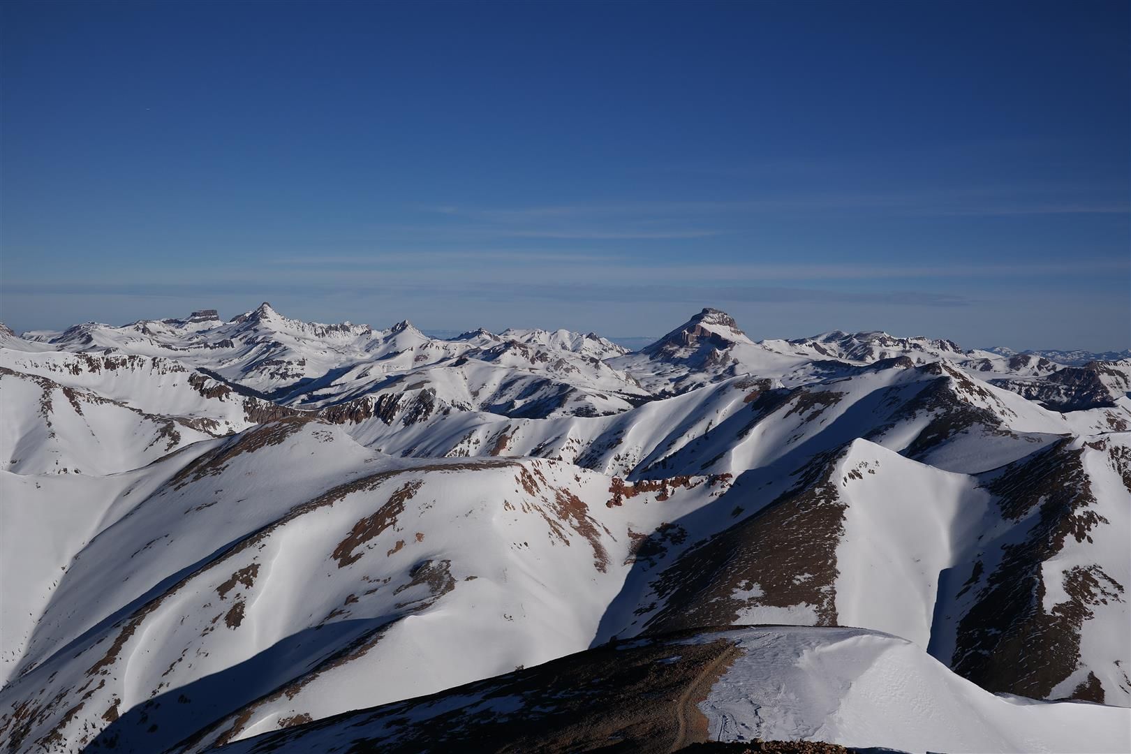
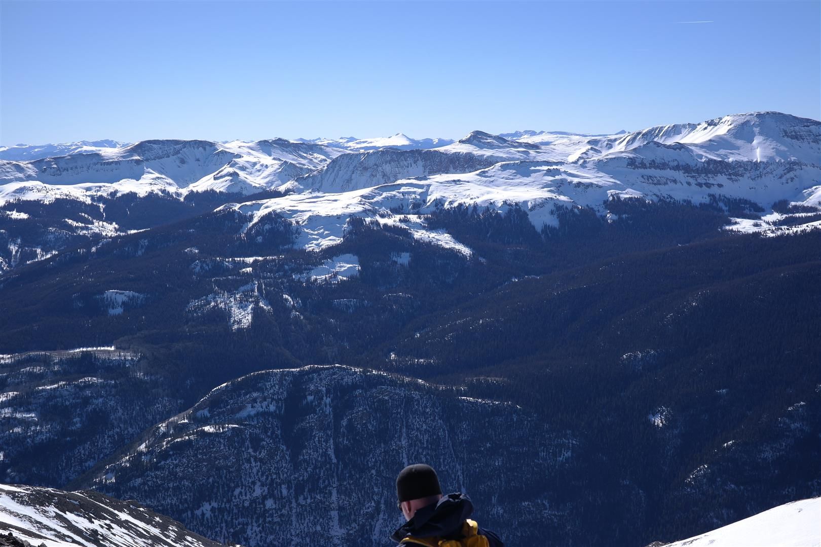
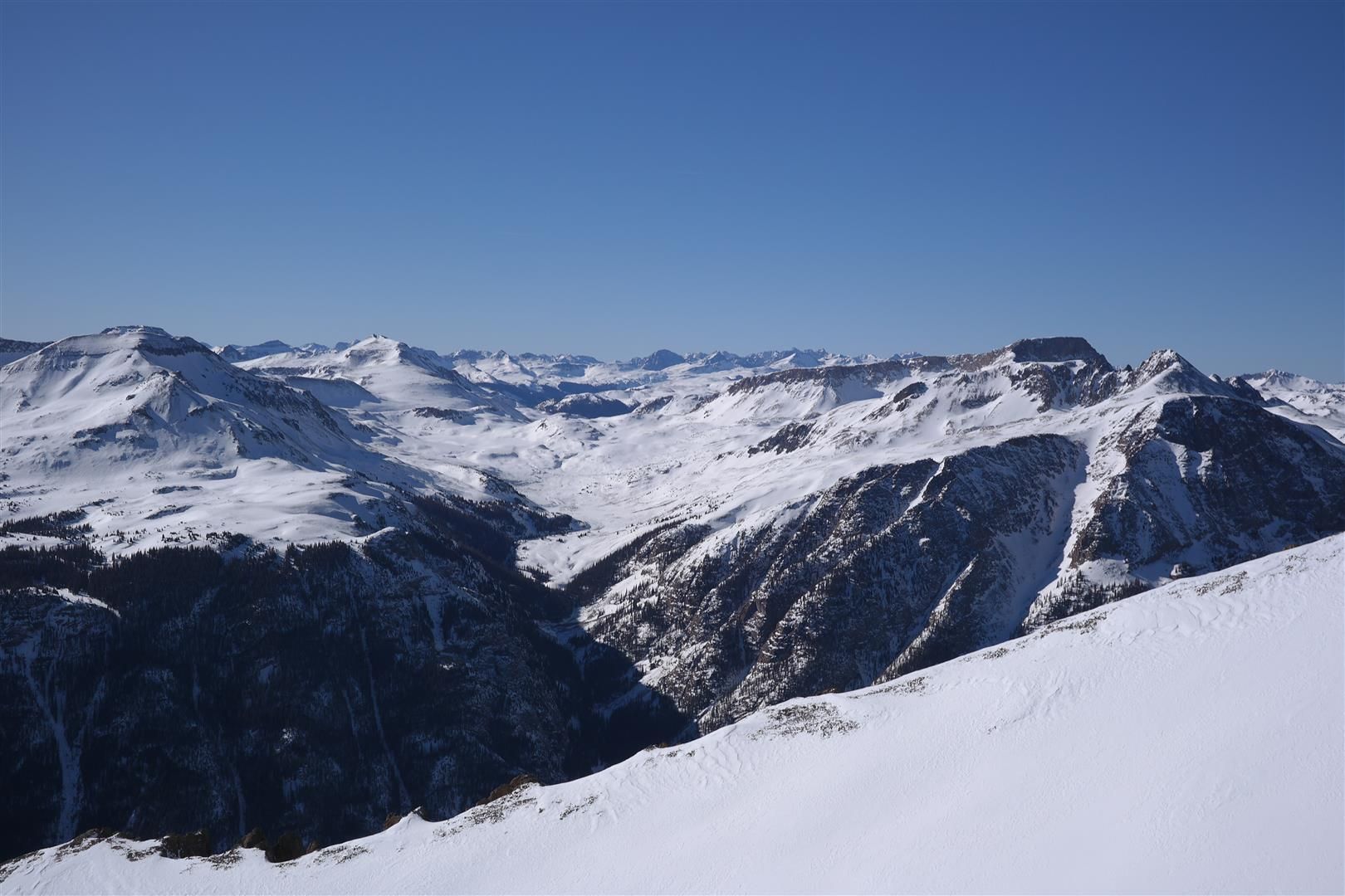
Some pictures of the views from the route to Redcloud, and some summit shots:
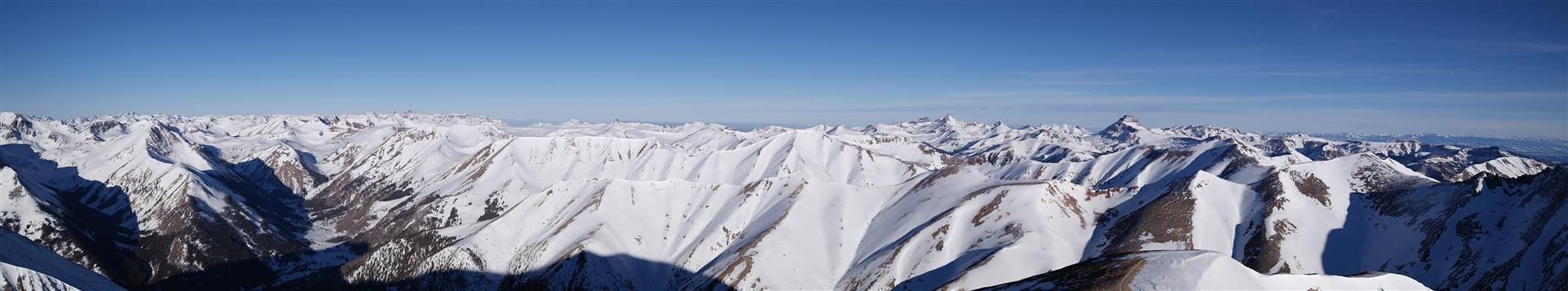
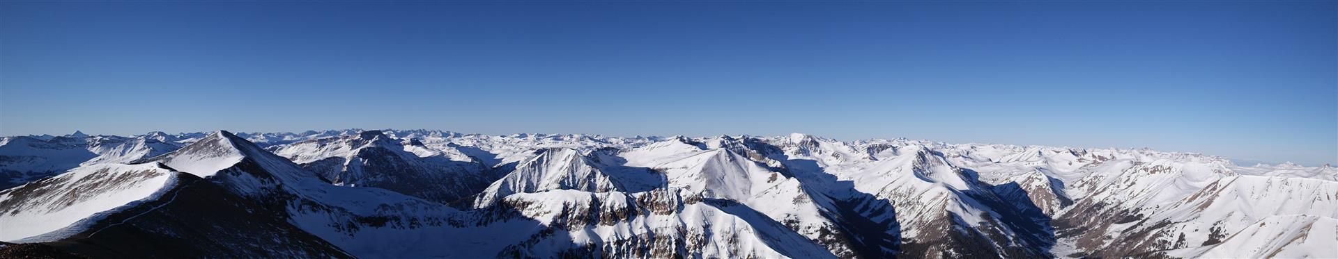
Summit of Sunshine seen in this Panorama:
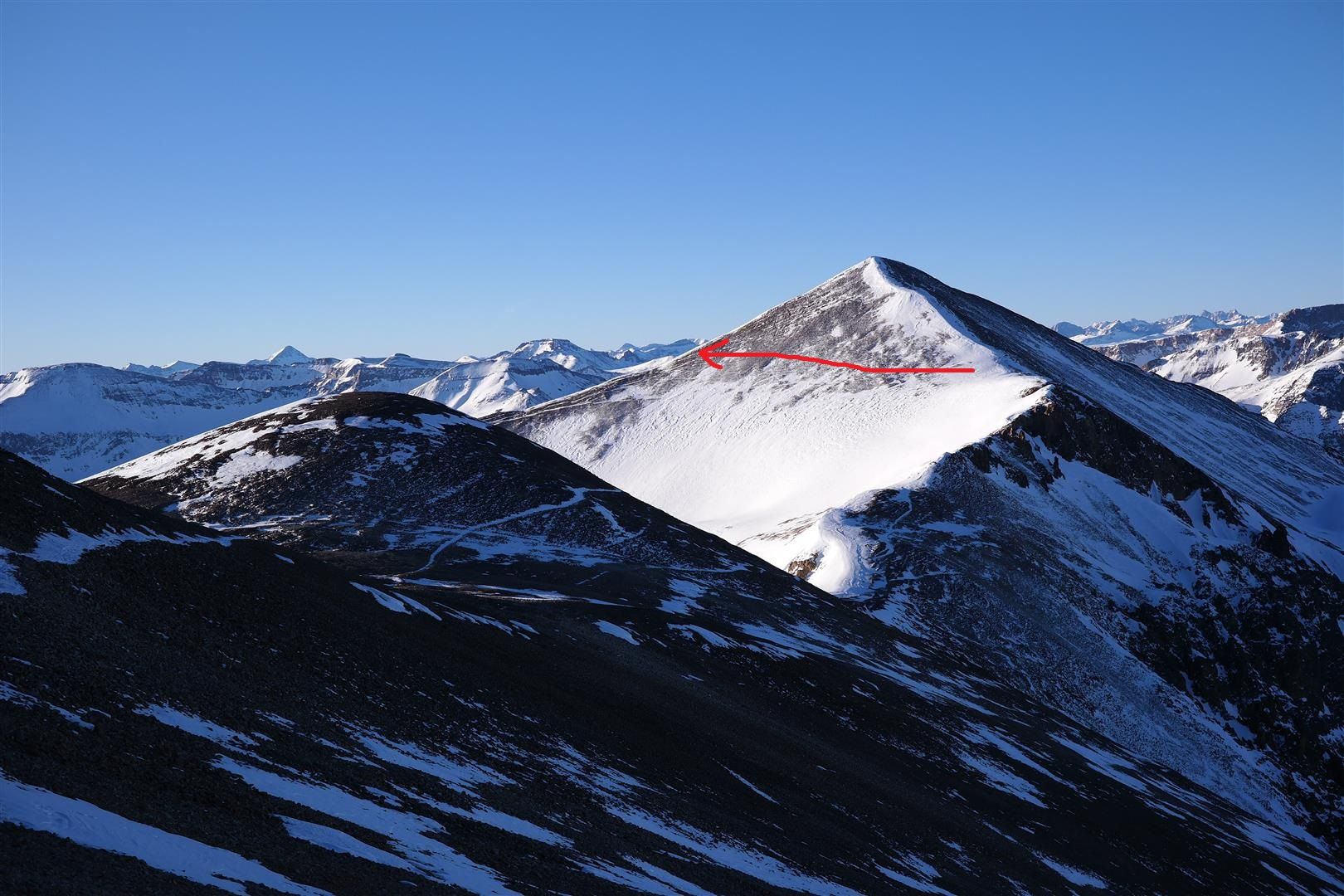
View of Sunshine from the false summit of Redcloud
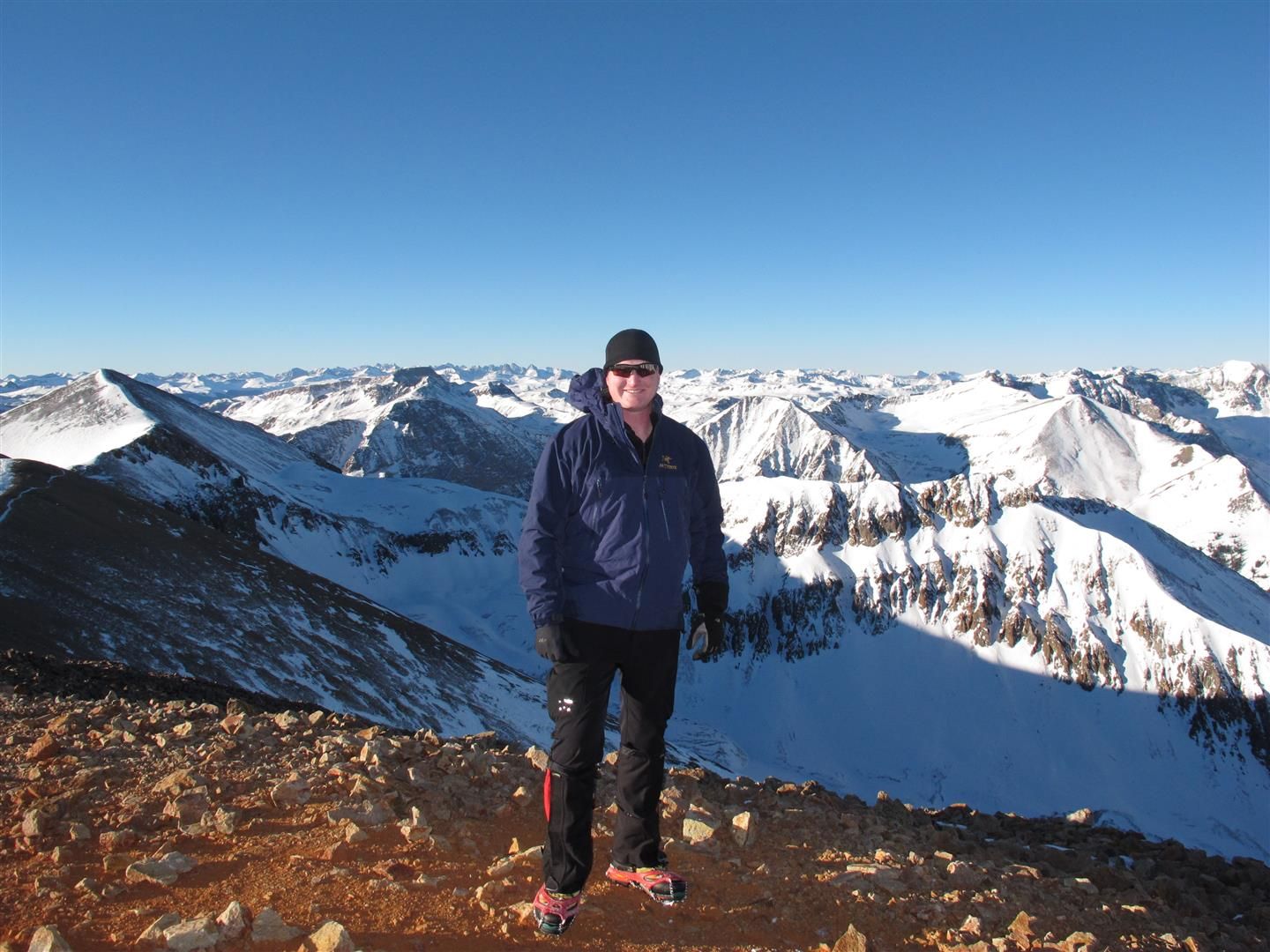
Grenadier range is to the left of Chad's head. Chicago Basin is just a little further left of the Grenadiers:
Some random thoughts about the ridge to and from Redcloud. I felt this 2.5-3 mile stretch was easier than the Belford/Oxford traverse, if you're looking for a comparison. It is a lot of mileage above 13,000 feet so it's not to be taken lightly, however. We also had GREAT weather on this day. Some wind, but nothing major. If the weather was worse, this has the ingredients of being a massive sufferfest. We were just lucky today.
We were back at the saddle below Sunshine's summit at 9:15. You do NOT have to summit Sunshine again, there is a trail that leads down and off to the side of Sunshine that will connect you with the ridge you took to the summit of Sunshine.
View of the trail mentioned above:
Headed down Sunshine to the trees we finally got to see the views we missed in the morning:
It wasn't yet 10am, and we made it about half way to the trees before the snow finally caved under the weight of the sun. After a few plunges up to our thighs we relented and put on our snowshoes. We were slipping and sliding through the trees, and occasionally postholing WITH snowshoes on. This part sucked really hard, and it only got worse. We got lulled into a false sense of security thinking we would have no problem following our trail from the morning back to the car. Before we knew it, we were surrounded by an ocean of talus. There are a few small sections of talus that you travel over that is part of the route, but there are also several football field-sized talus fields on the way down that are most definitely not part of the route. We lost a LOT of time and took several spills in the ocean of talus. We were trying to make our way over to where we thought the trail would be and it was absolute misery. Every rock slid, even the ones that weighed a hundred pounds. I tweaked my ankle a bit, and Chad also had a fall or two that didn't look too great. After a lot of wasted time and a lot of pain, we finally linked up with the trail...for a little bit. We relaxed again and lost the trail again. Even out of the snow in daylight, this trail is easy to lose. We stumbled and bumbled our way to the road and got ejected off the mountain a couple hundred yards from the official trailhead. At this point, we were both frustrated and tired. Once below treeline, do not put yourself in cruise control or you too may find yourself in a sea of talus. Stay on point all the way to the car, it's very easy to get yourself in a world of hurt.
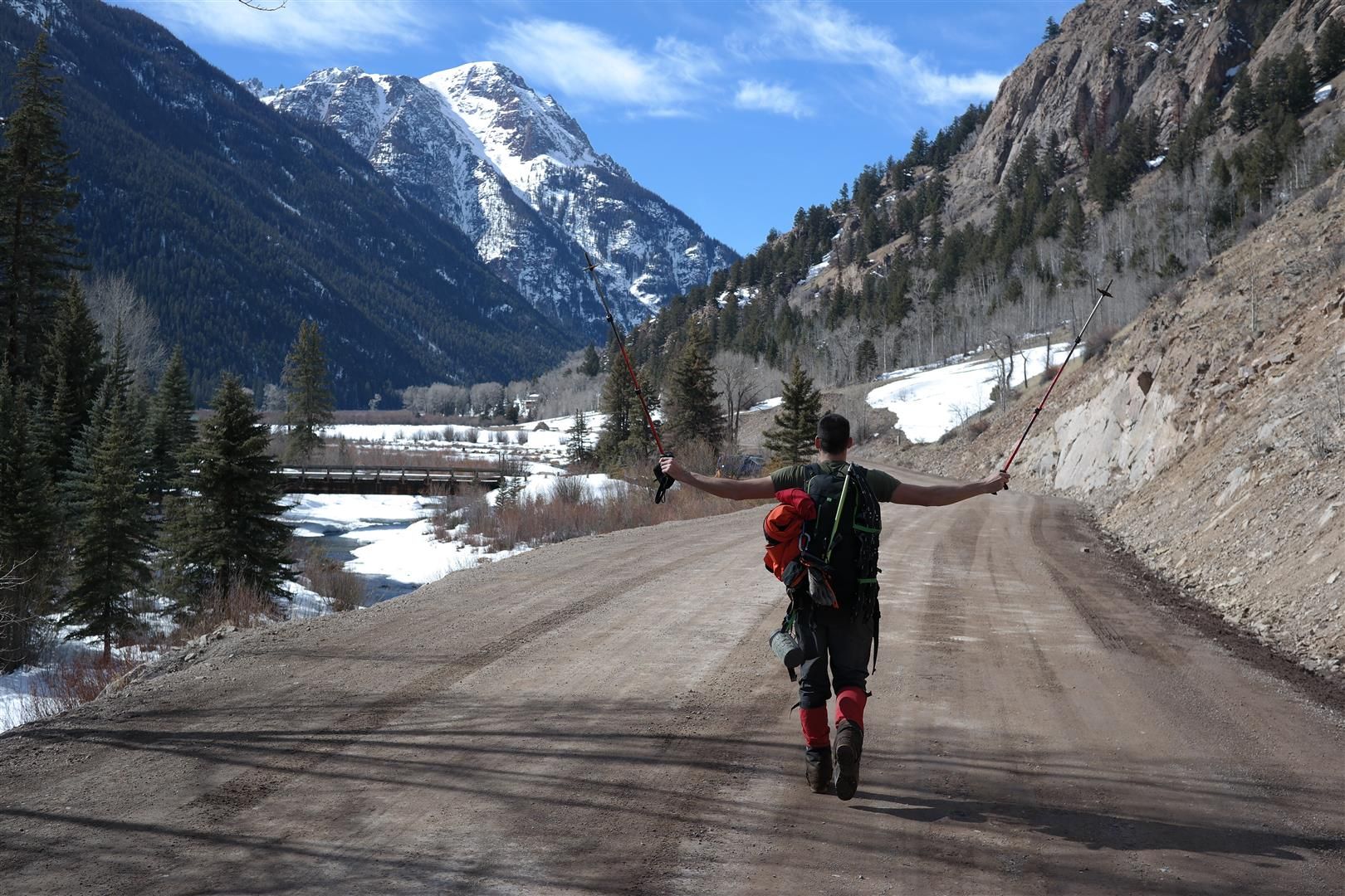
Shortly after being spit off the mountain:
We got back to the car at 12:30. It took us roughly the same amount of time to descend from Sunshine to the car as it took us to ascend, misery.
We finished the route in a grand total of 9 hours and 55 minutes. We both agreed there would be hours added on if we had started at 6 or 7. Start early. If you can time this with a full moon to help navigate through the trees before sunrise I would recommend that as well. Chad happens to have a headlamp that is brighter than the sun, so that helped too.
We took turns driving/sleeping all the way back home...and I still made it to my dinner reservations with the girlfriend for Valentines which was the true victory of the day.
A summer ascent thru steep trees left me wondering ’where’ the trail was at many points–––nice work guys!!!
Caution: The information contained in this report may not be accurate and should not be the only resource used in preparation for your climb. Failure to have the necessary experience, physical conditioning, supplies or equipment can result in injury or death. 14ers.com and the author(s) of this report provide no warranties, either express or implied, that the information provided is accurate or reliable. By using the information provided, you agree to indemnify and hold harmless 14ers.com and the report author(s) with respect to any claims and demands against them, including any attorney fees and expenses. Please read the 14ers.com Safety and Disclaimer pages for more information.
Please respect private property: 14ers.com supports the rights of private landowners to determine how and by whom their land will be used. In Colorado, it is your responsibility to determine if land is private and to obtain the appropriate permission before entering the property.