Download Agreement, Release, and Acknowledgement of Risk:
You (the person requesting this file download) fully understand mountain climbing ("Activity") involves risks and dangers of serious bodily injury, including permanent disability, paralysis, and death ("Risks") and you fully accept and assume all such risks and all responsibility for losses, costs, and damages you incur as a result of your participation in this Activity.
You acknowledge that information in the file you have chosen to download may not be accurate and may contain errors. You agree to assume all risks when using this information and agree to release and discharge 14ers.com, 14ers Inc. and the author(s) of such information (collectively, the "Released Parties").
You hereby discharge the Released Parties from all damages, actions, claims and liabilities of any nature, specifically including, but not limited to, damages, actions, claims and liabilities arising from or related to the negligence of the Released Parties. You further agree to indemnify, hold harmless and defend 14ers.com, 14ers Inc. and each of the other Released Parties from and against any loss, damage, liability and expense, including costs and attorney fees, incurred by 14ers.com, 14ers Inc. or any of the other Released Parties as a result of you using information provided on the 14ers.com or 14ers Inc. websites.
You have read this agreement, fully understand its terms and intend it to be a complete and unconditional release of all liability to the greatest extent allowed by law and agree that if any portion of this agreement is held to be invalid the balance, notwithstanding, shall continue in full force and effect.
By clicking "OK" you agree to these terms. If you DO NOT agree, click "Cancel"...
I had originally planned to ski this peak a month ago, but as I arrived in Breckenridge at 7am, I saw that the entire north ridge was bare of snow. Nada. So in a sleep deprived state that couldn't find another winter safe option to ski, I turned tail and headed to ski Copper. Since then, we've gotten a decent drop of sticky spring snow, that has plastered the previously bare summit ridges. So after a day of speed skiing Copper to see how much vertical in a day I could ski (66.4K), it was off to get some sunny turns on the last weekend of winter.
Good Morning Quandary
From the tiny winter parking lot, I set out up the well packed trail up to the junction with the north ridge. Plan A is to just skin up the north ridge and then down it. It's perfectly avy safe, and I was solo. Simple, safe, kinda boring. It seemed like a good plan at the time. I hadn't been on backcountry snow in a little bit, so it was time to dip my toes in again.
The morning was cool, so I was wearing my standard winter ski kit, minus the fleece and puffy jacket I had on at the resort the day before (yeah - I skied fast enough to warrant all the layers, face mask included). The shell didn't even make it to the meadow, so into the pack with the puffy it went. Glad I left the fleece in the car, at least I wouldn't be carrying that all day too.
Once at the meadow, it was a matter of choosing which uphill track to follow. As well as avoiding skinning up a downhill track... yeah that's not fun. After a bit of navigating, I found a good uphill track that took me to the top of the sparsely treed ridge. Once out in the blazing sun, I kept having to stop frequently. It was hot! I kept bargaining with myself, just make it to that next tree. Eventually I had to stop, and remove a top and bottom base layer. Down to 1 baselayer now. That should suffice! Right?
First good view of the north ridge Meadow stream crossing 10 Mile range
I didn't get many photos of the way up, as I figured I would be skiing down it. Plus I hadn't planned on writing a TR. Fritz (killingcokes) wrote one for the north ridge a couple years ago. It's also in his guide book as well. The north ridge is fairly devoid of trees and low angle.
Baldy looking fat
Once above the last tree, I had expected some wind, but nothing. So with one top base layer remaining, it had to go. I should have swapped the clothing for more water on this trip. I don't think I've ever been this hot on an ascent before. I'm usually the freezing one.
I chose a route that skirted the bare ridge above, for a snowy traverse slightly below, figuring I would need to find the continuous snow line for the way down. Once I got to the last saddle with a view of the east face and the final ridge push, I could see a way to skirt the east face off the ridge to stay on snow the entire way up (and down). It would work, not pretty, but it would work.
East face of Red Mounatin C
On the way up the ridge, a large herd of bighorn sheep were grazing. I slowly approached, wishing that I had my longer lens with me. I was downwind, but they soon spooked and moved further west away from me.
4 legged visitors Moon over the fairies
Above the excitement of the sheep, it was a short stroll along the non-corniced ridge all the way to the summit. Fritz warned of the monster cornice, so I didn't even consider the Horsehoe Basin route, which is also in his book. But as I made that final push, I started to ponder whether "spring" was really here now, and if I could find a descent route that fit my risk tolerance.
Finally approaching the summit Hoosier Ridge pano Mosquito-10 Mile Pano Quandary being hit hard by skiers G&T, Baldy, Evans and Bierstadt
I brought up a caltopo image on the summit, and I could spy a line through a few steeper spots that could work. Dropping directly SE off the summit is the steepest, but if I followed the ridge north for a short bit and then turned east, I could keep the descent in the very low 30's, if that. Based on what I was seeing with the snow the entire way up, I was comfortable with that decision. It would mean a painful slushy exit, but skiing a better line was worth it.
So after putting on a couple more layers and zipping up my bibs, I set off for the first corn ski of the real season.
Non-existant cornice ridge Dropping the mini cornice Summit turns Looking down the east face
After skiing the ridge section, my confidence grew. Looking down the east face, I could see the places to avoid, and saw a good line for conditions as they were right now. What followed was a pretty good, mellow ski with great snow conditions. I even let my skis fly a little faster than I normally would, it felt so good.
Some lovely turns Like paint brushes on a canvas Last look back at a fun ski
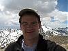
Once down the face and across the first basin, I took a last look back at the fun ski, and removed layer after layer. It was a solar oven unlike any I had ever experienced before down at this elevation. After the previous day with a copious amount of clothing, now my pack held more layers than I was currently wearing. I didn't expect to see anyone out here, so I went as far as I needed to stay comfortable. I normally don't take selfies, but I figured non of my usual ski partners would believe me, since they see how many layers I usually wear.
Valley back to the road Titania's twin
I got a couple more great turns before the slope started to really mellow out. Then I was just straight lining, hoping to keep momentum up. I turned down a steeper stream drainage, and still my skis wouldn't move. So I took them off to find a huge fin acting as a rudder. Uggg! Thankfully I carried my flourinated wax with me, and furiously spread it on my skis. Phew! Glad I packed that this morning!
Open stream drainage Puck's concoction Lazy turns in the stream
After a great ski down the drainage, I found myself on the flattish road back to the trailhead. Lots of poling and stomping in the heat. At least without all the layers I was staying cool and not dehydrating too much. Thankfully some backcountry skiers had made it as far as I got, so there was a track from the previous weekend or so. Not that it helped much, as I still sunk a little, and the fresh snow from the previous week stuck to my skis in the shady areas. It would erode on the sunny spots, so it worked out.
The long flat, sticky road home
So if you are looking for a great beginner summit ski, this should be on your radar. Not a lot of mileage or vert for a great descent and solitude.
My GPS Tracks on Google Maps (made from a .GPX file upload):
That’s a nice winter peak Otina. It’s great to see you out skiing the big peaks again, hope you can get a few more this spring. 66,400 vert at Copper? Wow, that is really moving. I think I hit 60k once, but it took a pretty full day at Vail then I tacked on some bonus night skiing runs at Keystone. It takes a day with no lines and lunch on the lift.
Oh, ditching the last layer? Really awesome! Hope you brought the sunscreen.
Steve - I have big plans for peak skiing this year. That’s why I’ve been working hard at the resort. I was hoping for 70K, but unfortunately there were small lines to deal with at times. Unfortunately I didn’t put the sunscreen on soon enough, as I have some pack lines!
Nat - I hiked the group of peaks a couple falls ago in Nov: Hoosier, Red^2 TR (Here’s a view from the unranked Red Peak C: Red Mtn pic)
Abe - Whether ’tis smarter in the body to suffer the heat and sweats of dehydration or to take off ones layers... I manage 40 GPS data servers, all named after Shakespeare characters, King Lear, Goneril, Regan and Cordelia included 8)
That looks like a fun outing. Your TR makes me want to go check that one out some day. And beautiful tracks! One can tell you’ve been doing this for a long time.
Glad to see you coming back so well. Stay safe this year.
I like this. I wonder if this peak will have any snow on it in the Fall... oh, and it was brutally hot on Sunday. My strategy was to run out of water on the summit ;)
peaks are looking completely blasted by the winds in November. I hiked Hoosier ridge once, but we didn’t even make it to Red C – too many bumps. You guys were troopers (and in better shape than us...). Thanks for the beta.
Caution: The information contained in this report may not be accurate and should not be the only resource used in preparation for your climb. Failure to have the necessary experience, physical conditioning, supplies or equipment can result in injury or death. 14ers.com and the author(s) of this report provide no warranties, either express or implied, that the information provided is accurate or reliable. By using the information provided, you agree to indemnify and hold harmless 14ers.com and the report author(s) with respect to any claims and demands against them, including any attorney fees and expenses. Please read the 14ers.com Safety and Disclaimer pages for more information.
Please respect private property: 14ers.com supports the rights of private landowners to determine how and by whom their land will be used. In Colorado, it is your responsibility to determine if land is private and to obtain the appropriate permission before entering the property.


 Good Morning Quandary")
 First good view of the north ridge")
 Meadow stream crossing")
 10 Mile range")
 Baldy looking fat")
 East face of Red Mounatin C")
 4 legged visitors")
 Moon over the fairies")
 Finally approaching the summit")
 Hoosier Ridge pano")
 Mosquito-10 Mile Pano")
 Quandary being hit hard by skiers")
 G&T, Baldy, Evans and Bierstadt")
 Non-existant cornice ridge")
 Dropping the mini cornice")
 Summit turns")
 Looking down the east face")
")
 Some lovely turns")
 Like paint brushes on a canvas")
 Last look back at a fun ski")
 Valley back to the road")
 Titania's twin")
 Open stream drainage")
 Puck's concoction")
 Lazy turns in the stream")
 The long flat, sticky road home")