Download Agreement, Release, and Acknowledgement of Risk:
You (the person requesting this file download) fully understand mountain climbing ("Activity") involves risks and dangers of serious bodily injury, including permanent disability, paralysis, and death ("Risks") and you fully accept and assume all such risks and all responsibility for losses, costs, and damages you incur as a result of your participation in this Activity.
You acknowledge that information in the file you have chosen to download may not be accurate and may contain errors. You agree to assume all risks when using this information and agree to release and discharge 14ers.com, 14ers Inc. and the author(s) of such information (collectively, the "Released Parties").
You hereby discharge the Released Parties from all damages, actions, claims and liabilities of any nature, specifically including, but not limited to, damages, actions, claims and liabilities arising from or related to the negligence of the Released Parties. You further agree to indemnify, hold harmless and defend 14ers.com, 14ers Inc. and each of the other Released Parties from and against any loss, damage, liability and expense, including costs and attorney fees, incurred by 14ers.com, 14ers Inc. or any of the other Released Parties as a result of you using information provided on the 14ers.com or 14ers Inc. websites.
You have read this agreement, fully understand its terms and intend it to be a complete and unconditional release of all liability to the greatest extent allowed by law and agree that if any portion of this agreement is held to be invalid the balance, notwithstanding, shall continue in full force and effect.
By clicking "OK" you agree to these terms. If you DO NOT agree, click "Cancel"...
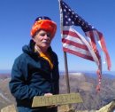
Mt. Sniktau(13,234) & Cupid(13,117)
Start Time: 7:50am End Time: 10:40am
With the snow coming in and Thanksgiving break already halfway finished, I scouted out a hike before the mountains were completely blanketed. I had hiked Mt. Morrison a day earlier, but I desired a bit more adventure (Although the scrambling at the end of the hike can be fun). The fact that Loveland Pass is basically on a ridge to begin with, along with the lack of snow on much of the trail, it appealed to me as a safe hike until I take an avalanche class and feel confident in evaluating the terrain. Until then, this will most likely be my last hike for the season. Starting up to Point 12,915, I was shocked to experience such little snow on the trail. I didn't expect much in the first place, but less than an inch on basically the entirety of the trail was unexpected. In my opinion, the toughest part of the hike was in the beginning, probably because 15 minutes in, my calves started cramping so much that it hurt to walk.
The first steps of the day.
After the cramps subsided, I followed the obvious trail, let alone its ugly ten foot width is visible from far away. I did meet two hikers who were coming back from Sniktau; we didn't talk much, but it was a bit of relief to receive a conditions report and that everything was fine. The snow that did exist remained on the east side of the ridge, easily avoidable by confronting the wind and staying on the west side. By 8:10 I had made it to the summit of Mt. Sniktau, not bad time including the stints spent switching layers, stretching out cramps, and taking a pit stop in between.
The remainder to Sniktau from Pt. 13,152
Heading back to Pt. 12,915 I found that with the lack of snow and gentle terrain, I could jog on parts of the downhill and all of the flats with ease"sounds like a good ridge run for the summer. By 9:20 I had made it up the gentle slopes of Cupid and took time to eat, take pictures, and take in the beautiful day. Sitting on the summit, I was interrupted by a huge, jolting, boom. I have to admit, I freaked out for a second until I realized it was avalanche blasting (I couldn't see any slides, so maybe it was Montezuma Bowl in A-Basin).
For another day...
That too... Looking at Keystone & Dillon Reservoir Looking back from Cupid. Pt. 12,915(Left), Pt. 13,152(Middle), Mt. Sniktau(Right)
I was still feeling fresh and was itching to make the journey to Grizzly, but I didn't want to stray from the plan (Mt. Elbert did a good deal of that). I resentfully jogged down Cupid and up back to the intersection of Pt. 12,915, back down to the parking lot. Every once in a while, a blast would catch me off guard, causing my adrenaline to kick in. Blasts aside, this hike was a great choice in terms of accessibility, and lack of technicality. For a beginner pre-winter trek, I thought it was great way to spend a morning in the mountains.
I'll have to bring my rocket launcher next time. Hehehe
Oh, and one more thing. For as long as I can remember, the fence on Mt. Bethel has confused me. It looks like a snow fence, yet I don't notice any avalanche chutes below it, so maybe someone can answer that enigma.
The mysterious fence
Thumbnails for uploaded photos (click to open slideshow):
The fence is to stop snow from being transported by the wind into the avalanche path on lookers right....on 70 you can see the path clearly, and you can see where they dug trenches to prevent debris from reaching the road.
First of all, thanks SolarAlex for the explanation. My research never made that avalanche chute obvious.
rpdawes, I’m pretty confident I drank lots of water beforehand,(I guess there’s always room to improve) but on Monday I ran my last cross country race of the season and never stretched after, along with climbing Mt Morrison on Tuesday, so I was still sore by Wednesday. Have fun on your trip and be safe!
Caution: The information contained in this report may not be accurate and should not be the only resource used in preparation for your climb. Failure to have the necessary experience, physical conditioning, supplies or equipment can result in injury or death. 14ers.com and the author(s) of this report provide no warranties, either express or implied, that the information provided is accurate or reliable. By using the information provided, you agree to indemnify and hold harmless 14ers.com and the report author(s) with respect to any claims and demands against them, including any attorney fees and expenses. Please read the 14ers.com Safety and Disclaimer pages for more information.
Please respect private property: 14ers.com supports the rights of private landowners to determine how and by whom their land will be used. In Colorado, it is your responsibility to determine if land is private and to obtain the appropriate permission before entering the property.


, Pt. 13,152(Middle), Mt. Sniktau(Right)")


 The first steps of the day.")
 The remainder to Sniktau from Pt. 13,152")
 For another day...")
 That too...")
 Looking at Keystone & Dillon Reservoir")
 I'll have to bring my rocket launcher next time. Hehehe")
 Looking back from Cupid. Pt. 12,915(Left), Pt. 13,152(Middle), Mt. Sniktau(Right)")
 The mysterious fence")