Download Agreement, Release, and Acknowledgement of Risk:
You (the person requesting this file download) fully understand mountain climbing ("Activity") involves risks and dangers of serious bodily injury, including permanent disability, paralysis, and death ("Risks") and you fully accept and assume all such risks and all responsibility for losses, costs, and damages you incur as a result of your participation in this Activity.
You acknowledge that information in the file you have chosen to download may not be accurate and may contain errors. You agree to assume all risks when using this information and agree to release and discharge 14ers.com, 14ers Inc. and the author(s) of such information (collectively, the "Released Parties").
You hereby discharge the Released Parties from all damages, actions, claims and liabilities of any nature, specifically including, but not limited to, damages, actions, claims and liabilities arising from or related to the negligence of the Released Parties. You further agree to indemnify, hold harmless and defend 14ers.com, 14ers Inc. and each of the other Released Parties from and against any loss, damage, liability and expense, including costs and attorney fees, incurred by 14ers.com, 14ers Inc. or any of the other Released Parties as a result of you using information provided on the 14ers.com or 14ers Inc. websites.
You have read this agreement, fully understand its terms and intend it to be a complete and unconditional release of all liability to the greatest extent allowed by law and agree that if any portion of this agreement is held to be invalid the balance, notwithstanding, shall continue in full force and effect.
By clicking "OK" you agree to these terms. If you DO NOT agree, click "Cancel"...
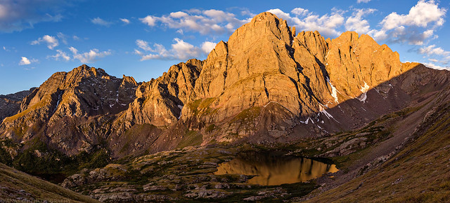
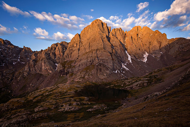
Sunrise on The Crestones and Broken Hand Peak from the trail to the summit of Humboldt Peak.
Since Diane enjoys going backpacking with me, it's been a few years since I went on a solo trip. But since she was busy this weekend, I thought it would be a good time to go on an overnight trip by myself. I have been wanting to climb my first new 14er of the year and one of my goals for the summer was to get over to the Sangre de Cristo Mountains, so I thought climbing Humboldt Peak (14,064) from the South Colony Lakes sounded like a perfect trip for the weekend. I'm a bit late getting started hiking new 14ers this year because of our traveling back to the Midwest during July and a few other planned trips during August, so I probably won't get many new ones in this year. I do hope to at least attempt another one or two this year. Though, I did enjoy the repeat of Uncompahgre Peak a few weeks ago.
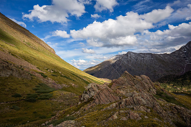
I left home early on Saturday morning for the long drive to the trailhead near Westcliffe. I stopped for an early lunch in Salida and was on the trail hiking up to the South Colony Lakes before noon. The first few miles of the hike follow the old closed road that used to go up to a mine near the South Colony Lakes, which was easy walking, but pretty boring. After leaving the road the trail was quite wet and muddy in places, but more scenic as it entered the upper part of the basin. I found a nice flat site just below the lower lake and setup camp. It was a bit chilly out for this time of the day, so I ended up putting my fleece on. I do think the cooler temperatures helped keep the mosquitoes away which I've heard can get pretty bad in this basin. I never even had to use any bug spray on this trip!
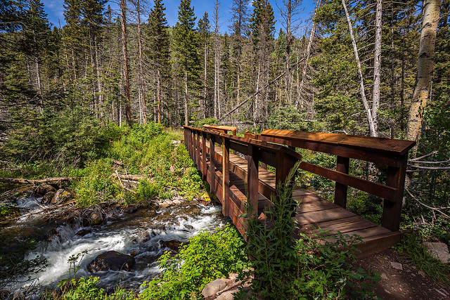
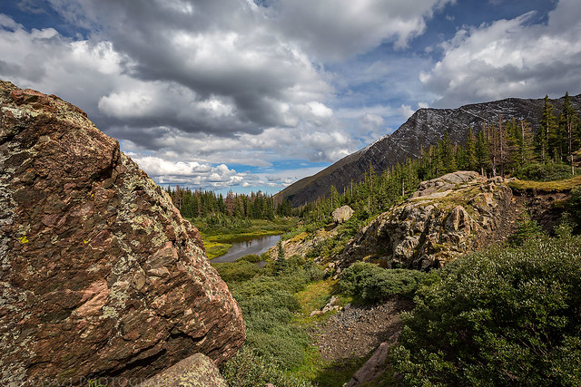
Crossing the bridge over South Colony Creek after leaving the trailhead.
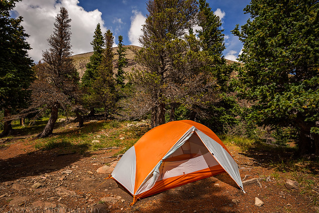
My campsite just below South Colony Lake at the base of Humboldt Peak.
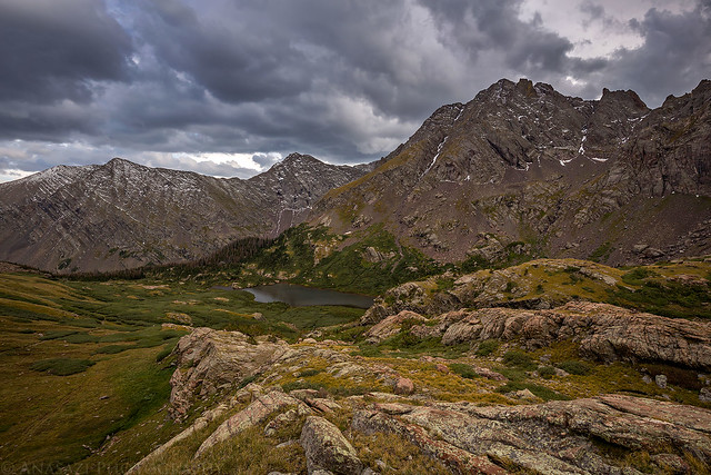
After I finished setting up camp I hiked around the lower lake and then visited the upper lake for a while. I had considered the possibility of hiking to the summit of Humboldt Peak this evening if the weather looked favorable, but it did not, so I headed back down to relax at camp and get to bed early. While I knew this was a pretty popular area, I was still surprised at just how many people were camped up in this basin. I had arrived early enough in the day that I easily found a nice campsite, but towards the evening I ran across a number of people that were having trouble finding a place to setup a tent. Shortly before sunset the sky filled with storm clouds that blocked out the sun for the rest of the evening. It started to rain around sunset with a few flashes of lightning and rumbles of thunder and would continue to rain for a little while into the night.
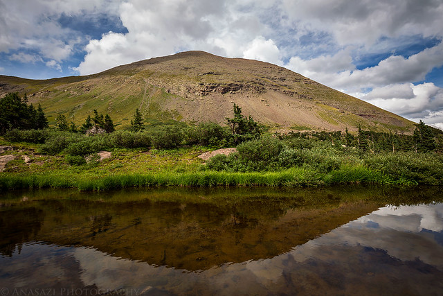
Humboldt Peak reflecting in a small tarn in the basin.
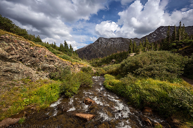
South Colony Creek right below the lower lake.
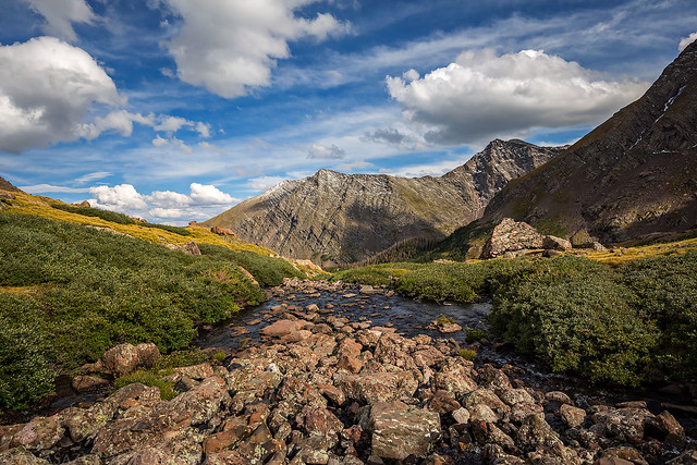
Following the trail to the upper lake.
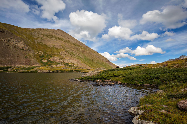
Humboldt Peak above Upper South Colony Lake.
View from the outlet of the upper lake.
Nice spotted light as I hiked back down to camp for the evening.
The dark clouds started to roll in shortly before sunset.
As I was trying to fall asleep for the night, I almost decided to pack up my stuff and head back down to my Jeep because I was feeling a bit nauseous and had a dull headache. I was worried that I was coming down with a touch of altitude sickness again. Thankfully, I was able to get to sleep and woke up feeling much better!
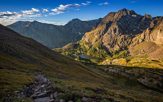
I slept in a little later than normal on Sunday morning and was on my way up the trail by 5:30am. As I hiked up towards the upper lake, I saw a long line of headlamps ascending the steep trail to Broken Hand Pass on their way to climb the nearby Crestone Peaks. I stopped to catch the sunrise from the switchbacks above the upper South Colony Lake, but there were still too many clouds to the east so it wasn't as nice as I had hoped. From there it was a slow hike to the summit for me, but I eventually made it and enjoyed the view of the surrounding mountains. There were some low hanging clouds around by the time I reached the summit, but nothing threatening yet.
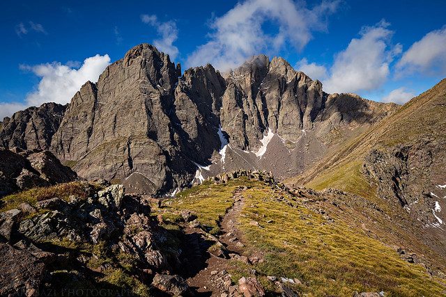
The first light of the day strikes the Crestone Needle (14,197) and Crestone Peak (14,294) as I hiked up the trail to the summit of Humboldt Peak.
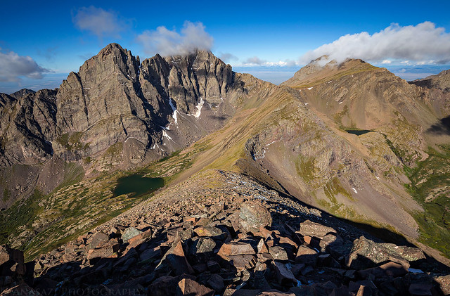
View from the trail back towards Lower South Colony Lake, Broken Hand Peak (13,573) and Milwaukee Peak (13,522).
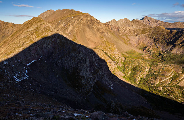
Hiking in the shadow of Humboldt Peak.
The view south of the Sangre de Cristo Range over Marble Mountain (13,266) as I climbed the West Ridge.
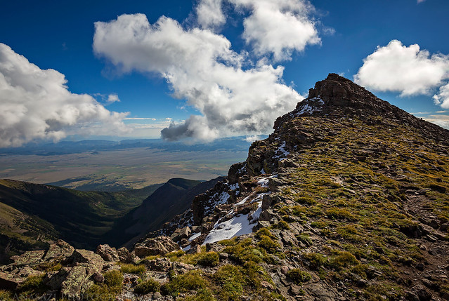
The last stretch to the summit.
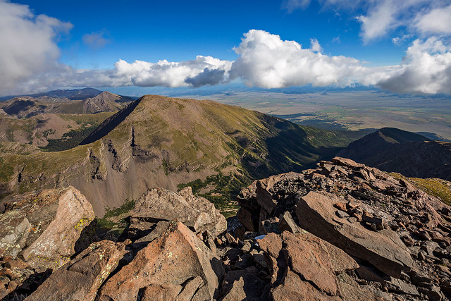
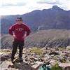
View from the summit over Colony Baldy (13,705) and the Wet Mountain Valley to the Wet Mountains in the distance.
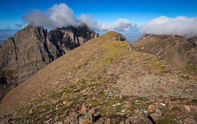
Looking back towards the false summit I hiked around with The Crestones in the clouds.
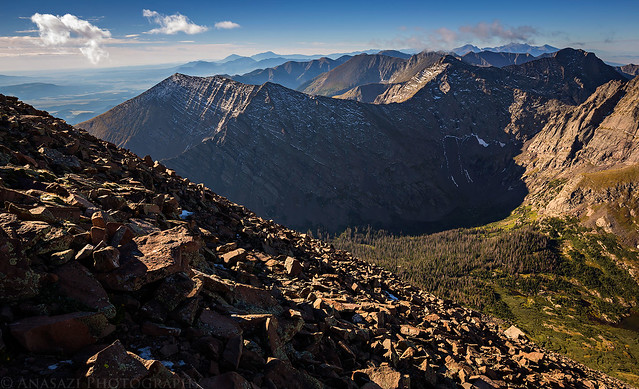
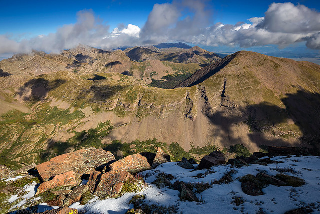
A view looking north of the Sangre de Cristo Mountains from near the summit on my way back down.
Descending back down the rocky ridge to the saddle.
The Crestone Peaks dominated the scenery throughout the hike.
After enjoying the views from the summit I hiked back down and packed my camp back into my backpack. I made good time hiking down the old road back to my Jeep at the trailhead and had a long, but uneventful drive back home on US 50. It was a good weekend!
Some of the best. Your pictures are so nice. Humboldt cracks me up; it's like the ugly step-sister...til you see her north side!
Caution: The information contained in this report may not be accurate and should not be the only resource used in preparation for your climb. Failure to have the necessary experience, physical conditioning, supplies or equipment can result in injury or death. 14ers.com and the author(s) of this report provide no warranties, either express or implied, that the information provided is accurate or reliable. By using the information provided, you agree to indemnify and hold harmless 14ers.com and the report author(s) with respect to any claims and demands against them, including any attorney fees and expenses. Please read the 14ers.com Safety and Disclaimer pages for more information.
Please respect private property: 14ers.com supports the rights of private landowners to determine how and by whom their land will be used. In Colorado, it is your responsibility to determine if land is private and to obtain the appropriate permission before entering the property.