Download Agreement, Release, and Acknowledgement of Risk:
You (the person requesting this file download) fully understand mountain climbing ("Activity") involves risks and dangers of serious bodily injury, including permanent disability, paralysis, and death ("Risks") and you fully accept and assume all such risks and all responsibility for losses, costs, and damages you incur as a result of your participation in this Activity.
You acknowledge that information in the file you have chosen to download may not be accurate and may contain errors. You agree to assume all risks when using this information and agree to release and discharge 14ers.com, 14ers Inc. and the author(s) of such information (collectively, the "Released Parties").
You hereby discharge the Released Parties from all damages, actions, claims and liabilities of any nature, specifically including, but not limited to, damages, actions, claims and liabilities arising from or related to the negligence of the Released Parties. You further agree to indemnify, hold harmless and defend 14ers.com, 14ers Inc. and each of the other Released Parties from and against any loss, damage, liability and expense, including costs and attorney fees, incurred by 14ers.com, 14ers Inc. or any of the other Released Parties as a result of you using information provided on the 14ers.com or 14ers Inc. websites.
You have read this agreement, fully understand its terms and intend it to be a complete and unconditional release of all liability to the greatest extent allowed by law and agree that if any portion of this agreement is held to be invalid the balance, notwithstanding, shall continue in full force and effect.
By clicking "OK" you agree to these terms. If you DO NOT agree, click "Cancel"...
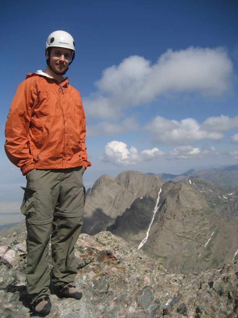
Mountains: Humboldt (14,064'), Crestone Peak (14,294') and Traverse to Crestone Needle (14,197') and Broken Hand Peak (13,573')
Route: Started at Upper TH (11,060') climbed Humboldt, traversed the ridge to Bear's Playground, ascended the North Buttress to Crestone Peak's Summit, traversed over to the Needle, descended the South Face Route off the Needle, ascended Broken Hand Peak and descended via broken hand pass back to the TH
Stats:
Elevation Gain - 5500' (approx)
Roundtrip Time - 19:30 hours including a 4 hour nap at Bears Playground and 1:30 hours on all the summits
I felt the urge to do something stupid. We'd been planning to do the Crestone traverse for a while and jcwhite's report had us smacking our lips. Why not add a mountain or two more to that agenda? The new plan was to do the traverse and throw Kit, Kat, Kitty Kat and possibly Challenger into the equation for the day. This was going to be tiring, but manageable we thought.
Joe (doumall) and I left work on Friday afternoon. After each getting a ginormous foot long pastrami sub with bacon at the Westcliffe subway we started driving up the road to the upper TH on the S. Colony Road, headbanging to the Highway to Hell. The road was not too bad but I managed to drive like a maniac and bottom out a few times... no harm done. I love Jeeps. We got to the upper TH and met Zack (gitsumpottery) and Steve (stevietwoshoes) and chatted for a bit. We then decided to crash for a couple hours and start hiking early. We were up at 10:30, Friday night and were moving up the trail by 11:10PM.
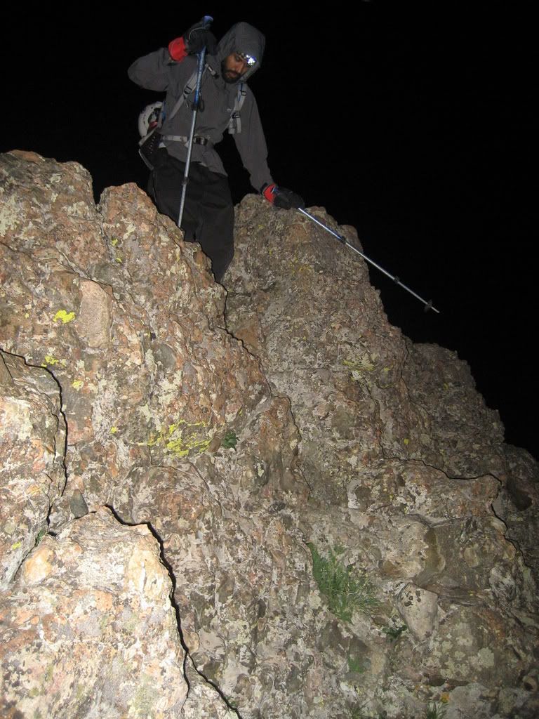
We decided not to take any ropes or gear except for rock shoes. We thought those might come in handy for those tricky class 4 traverses and down climbs we anticipated on our chosen route. We also each carried an emergency shelter, first aid kits, ice axe, extra batteries, around 4.5 liters of water, powerade, V8 and Rockstar and enough food to feed a small island nation.
The hike to Humboldt was pretty straight forward except that the lack of sleep was not helping much. We summitted Humboldt at 1:50AM. We didn't stay on summit for long but headed back down for the saddle. Here we had a bite to eat and napped for a few minutes. We then started heading up the long ridge for Bears Playground. It's hard to route-find on a new-moon night and staying right on the ridge crest seemed to be the best option.
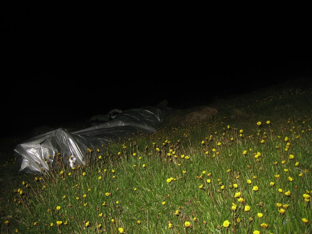
This business is tiring, to say the least, in complete darkness. Half way through the ridge we decided Kit Carson group was out of the question. We got to Bear's Playground at about 3:45AM and decided to bivy there on the grass in the closest available area that was sheltered from wind.
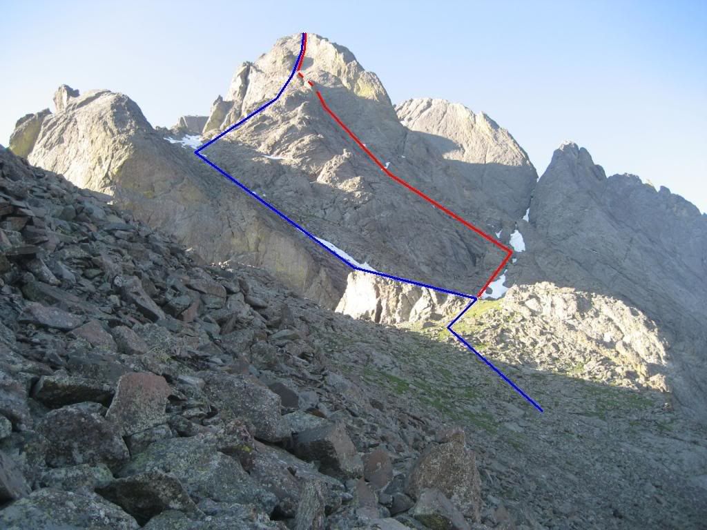
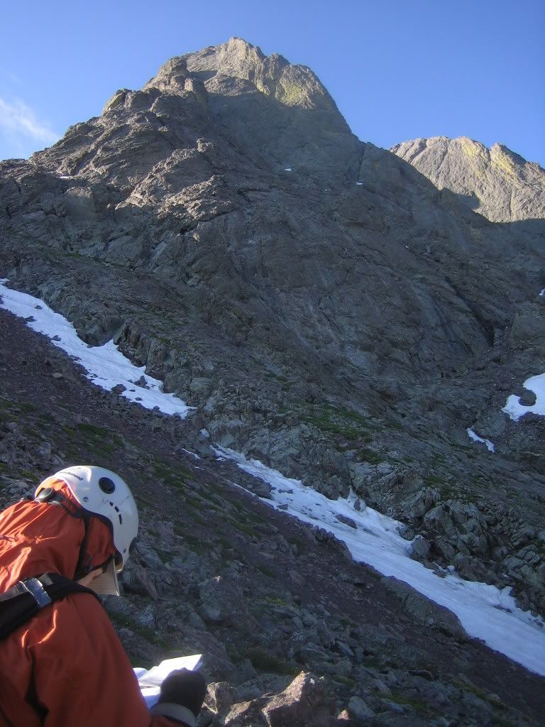
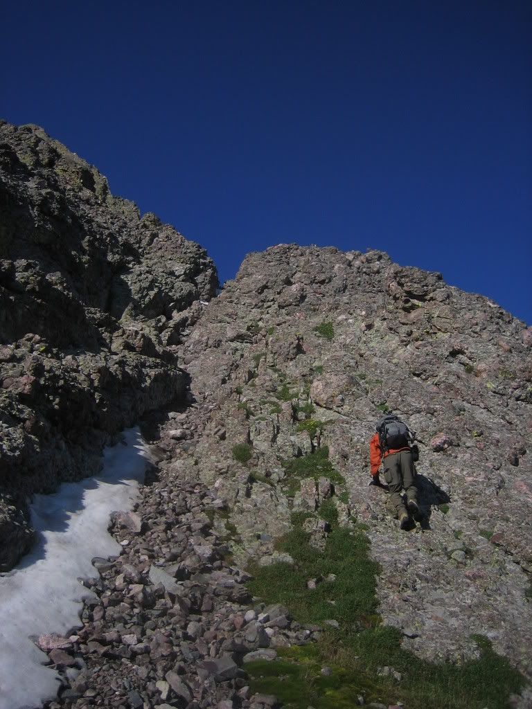
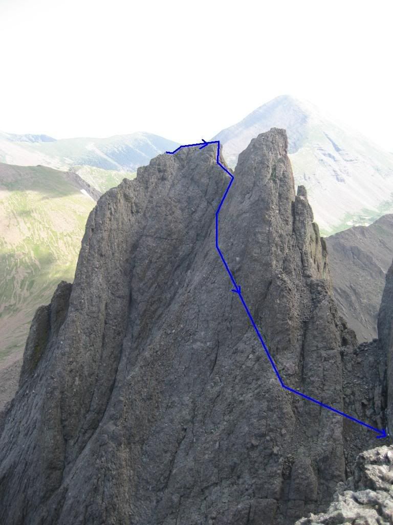
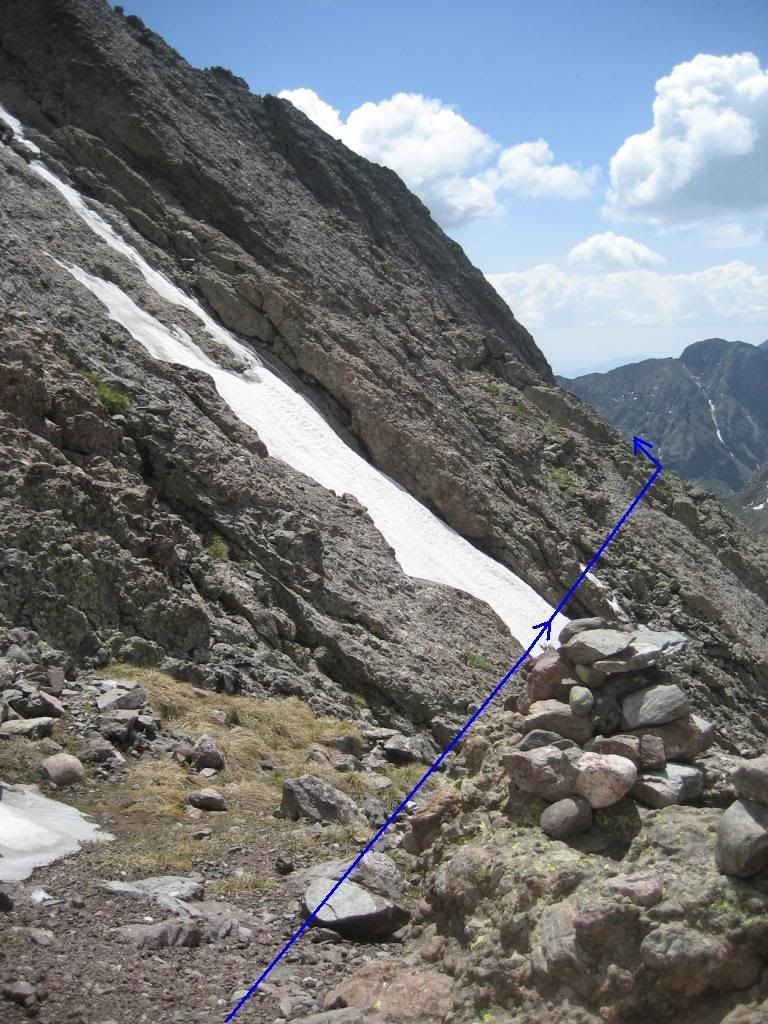
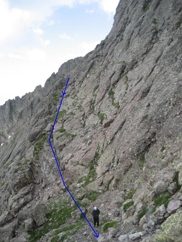
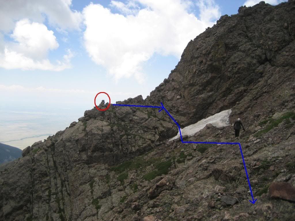
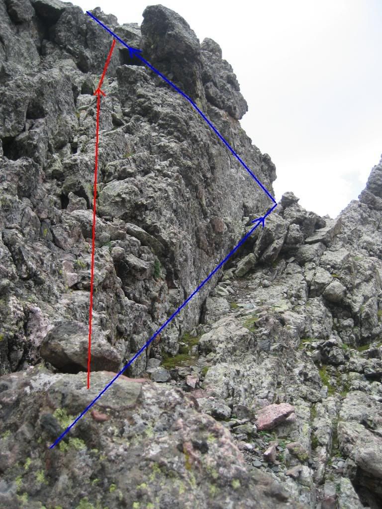
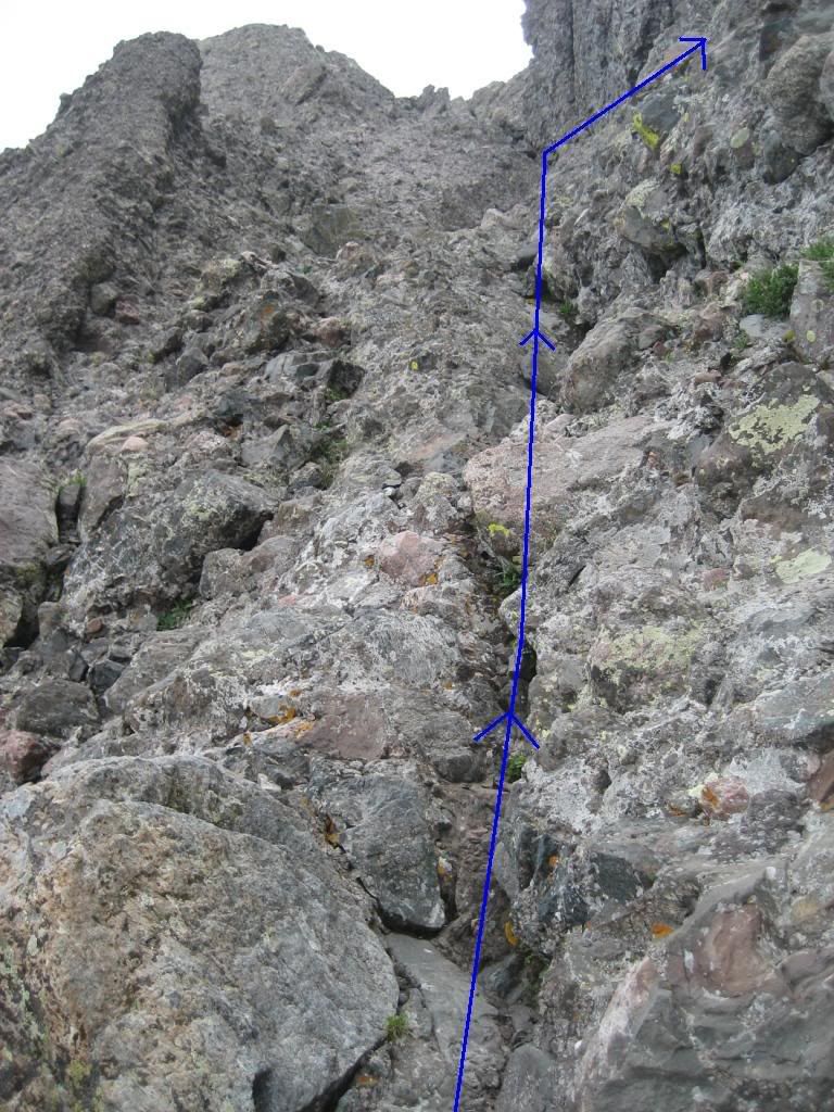
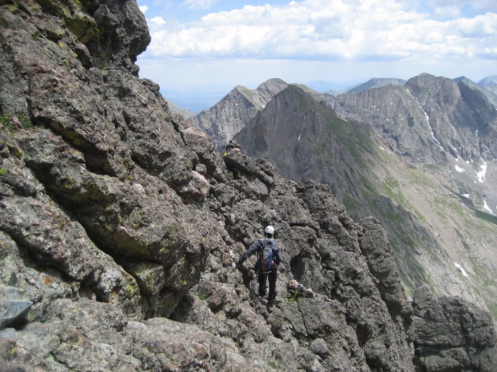
We only each had a shirt and rain coat on and were freezing. We arose at about 7AM and after warming up and eating breakfast we were on the trail to Crestone Peak by 7:20AM. We soon got to the base of the Peak... the day was just getting started. Joe marked out the routes on many of the pictures that follow (Thanks, man). The blue line marks the route we took and red marks the NW Buttress route that looks more fun, in retrospect.
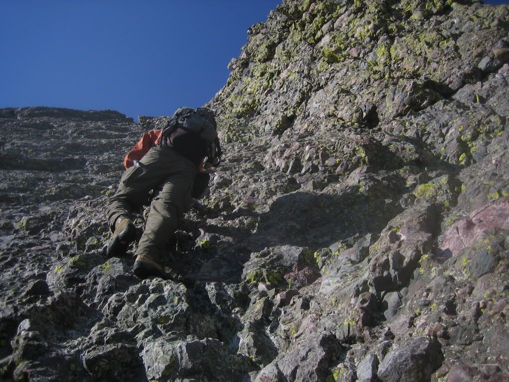
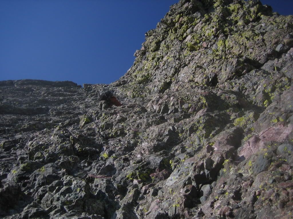
We scrambled up the couloir adjacent the buttress
There are several sections of highly enjoyable Class 3 climbing on this route.
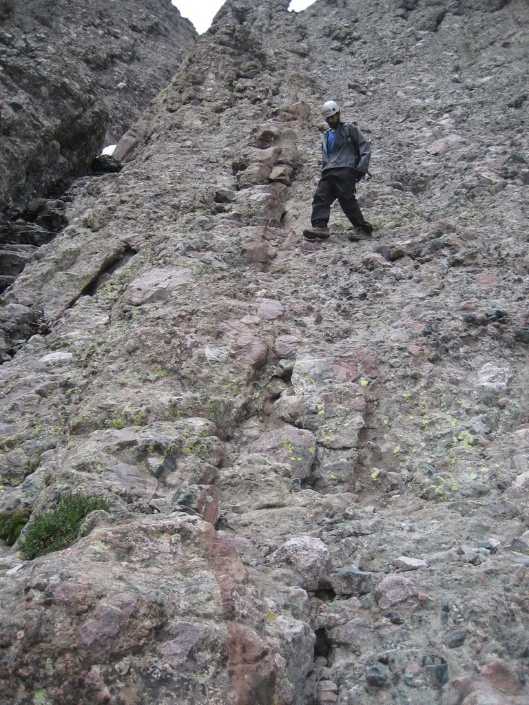
Joe dislodged a sweet piece of rock here which looked like a stolid foothold. Don't be fooled by the apparently solid holds. Test each and every hold like your life depended on it... well, it does actually.
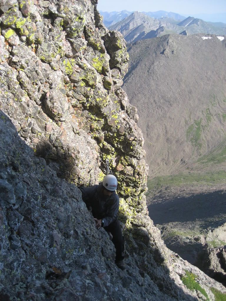
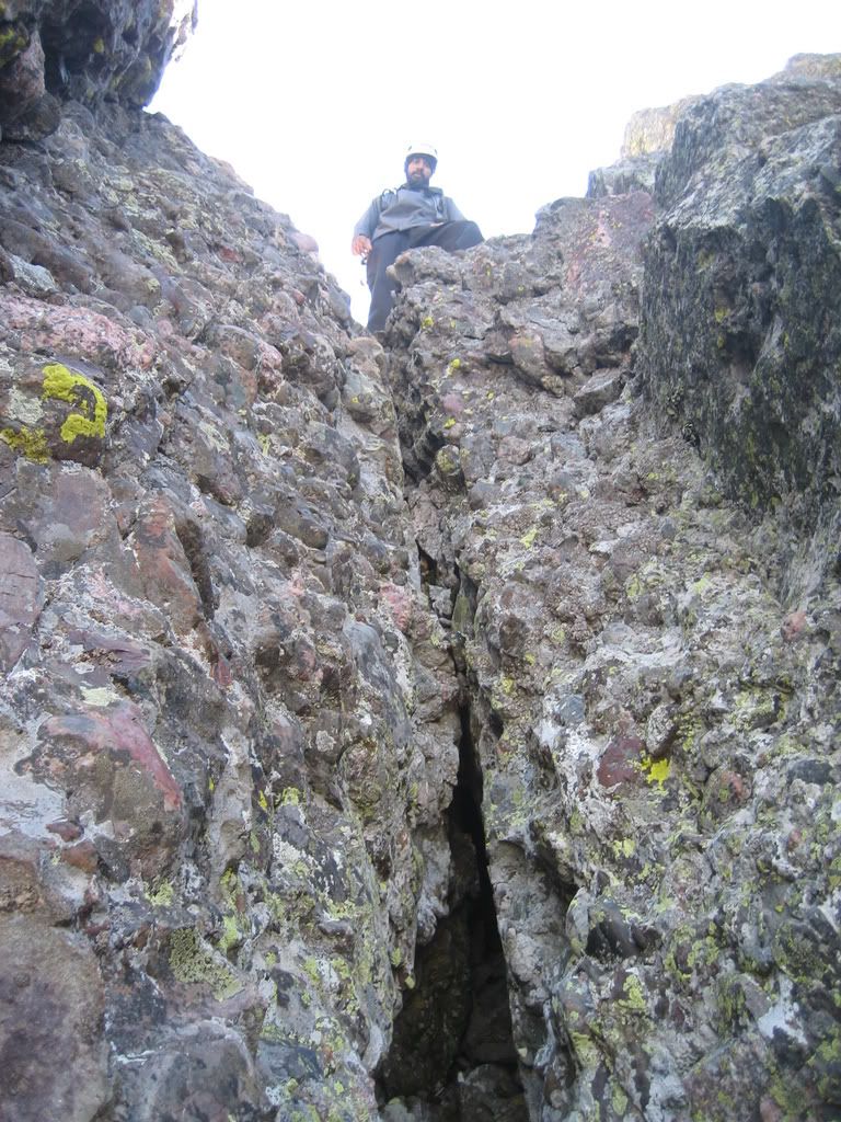
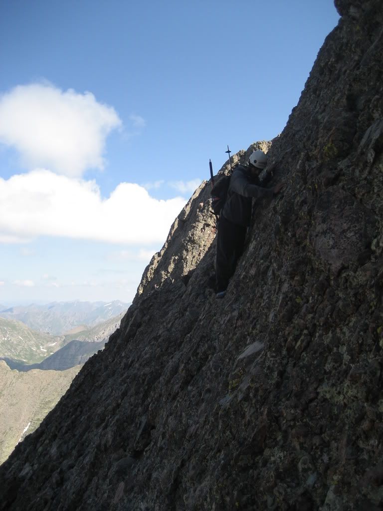
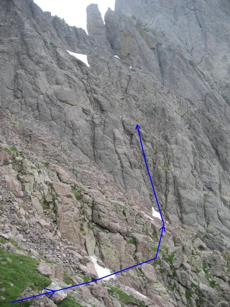
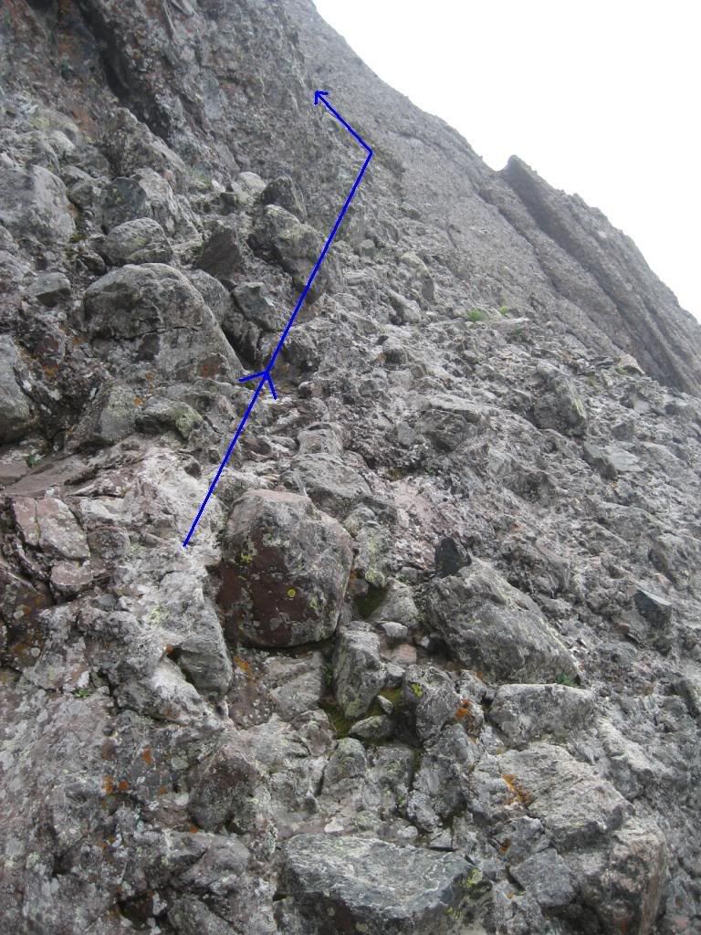
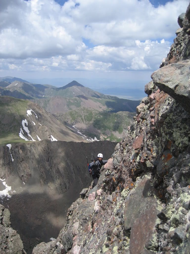
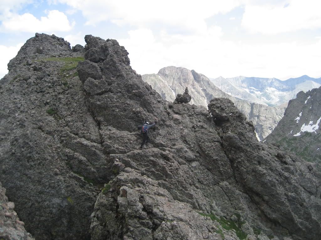
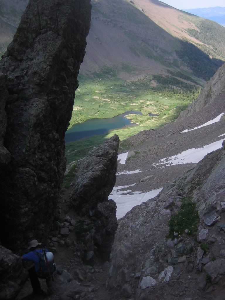
We soon got to the top of the 14,240' tower 200 yards NE of the East Summit (Roach). While climbing the tower I had fooled myself into believing that the summit was close. On the summit of the tower however, I saw Joe donning rock shoes for a down climb. I also saw that staying on the ridge and heading straight for the East summit was impossible. One look at that East summit and you will wonder why it's unranked while Cameron and N. Eolus have unofficial rankings. Yeah, E. Crestone got shafted when they were handing out the rankings. The Peak, in the mean time was not going to give up so easily. The first part of getting off the tower was to down-climb this easy chimney with great holds.
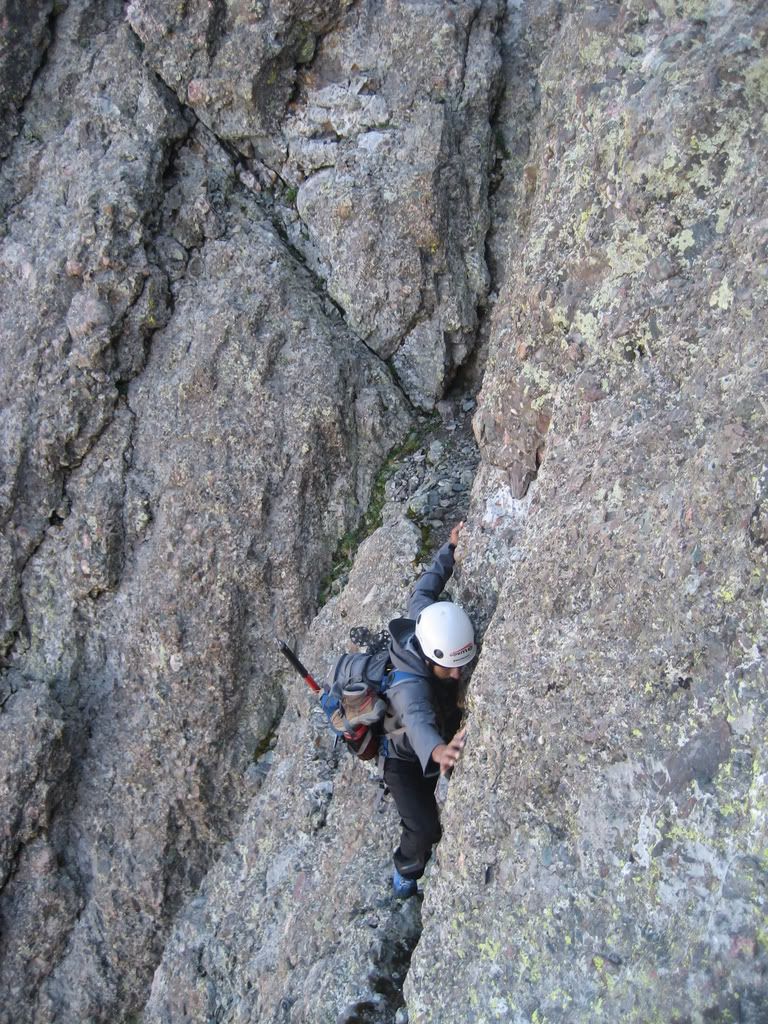
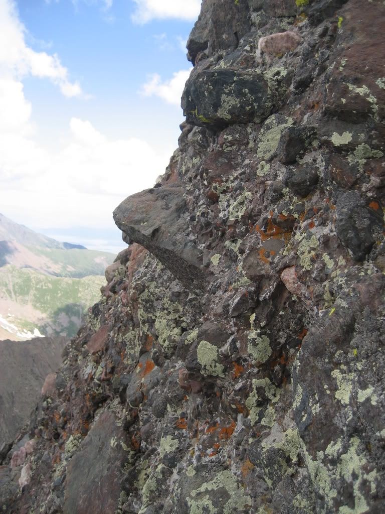
This is where the hairy traverses started that brought my lack of experience to the fore.
Lesson 1... Don't look down...
Because this is what you are traversing across...
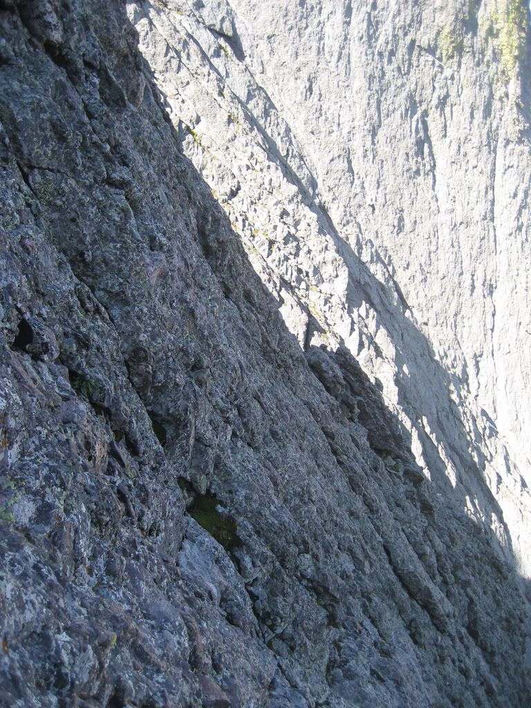
The slope you will be traversing across is close to 80 degrees at the steepest portions and the exposure is significant. Test your holds every inch of the way and don't let any loose gear hang out your pack and whack the back of your head at regular intervals... Again, don't look down. A fall here means certain death.
Here's looking back at our traverse route from the top of the 14,240' tower...
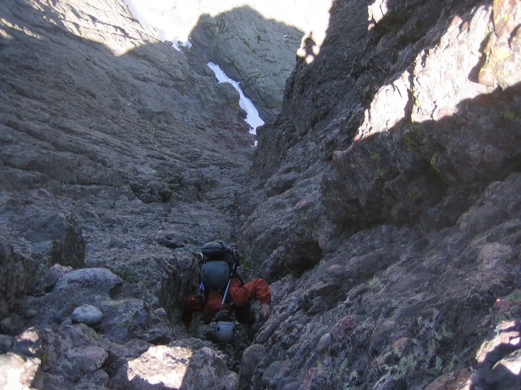
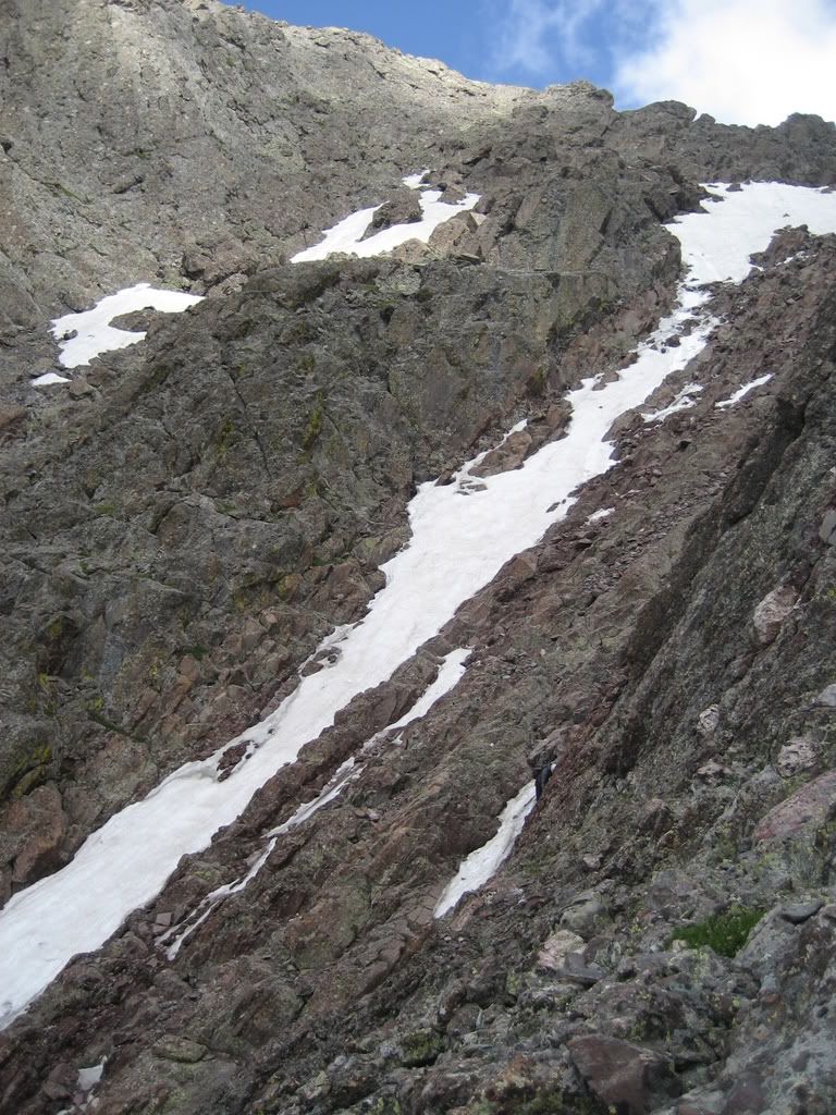
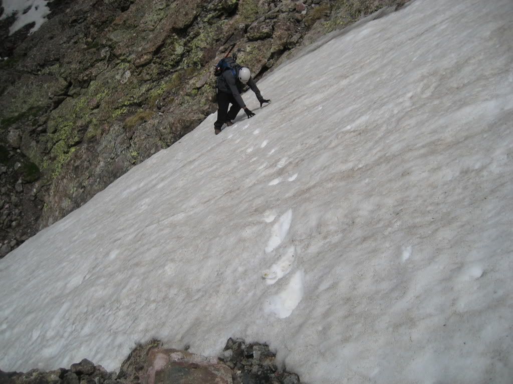
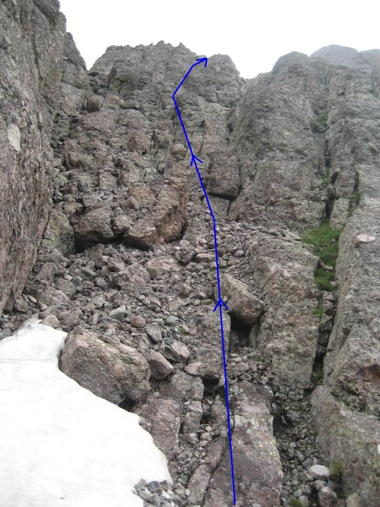
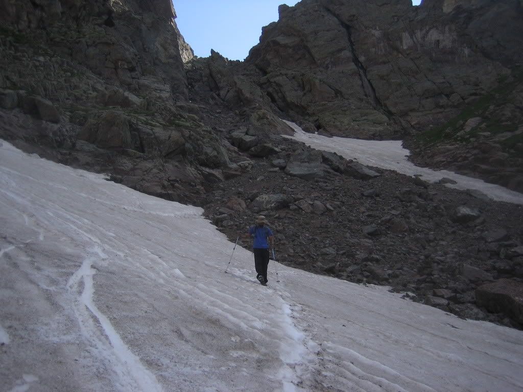
The traverses lead all the way to the red notch where you will see climbers ascending the Class 3 South Face route. This gully holds patches of snow (pictures follow). It doesn't look like you will need crampons to ascend this at the moment, but it may be icy first thing in the morning. An ice axe will be useful. From here we ascended the final 250 feet of Class 3 ledges to the summit.
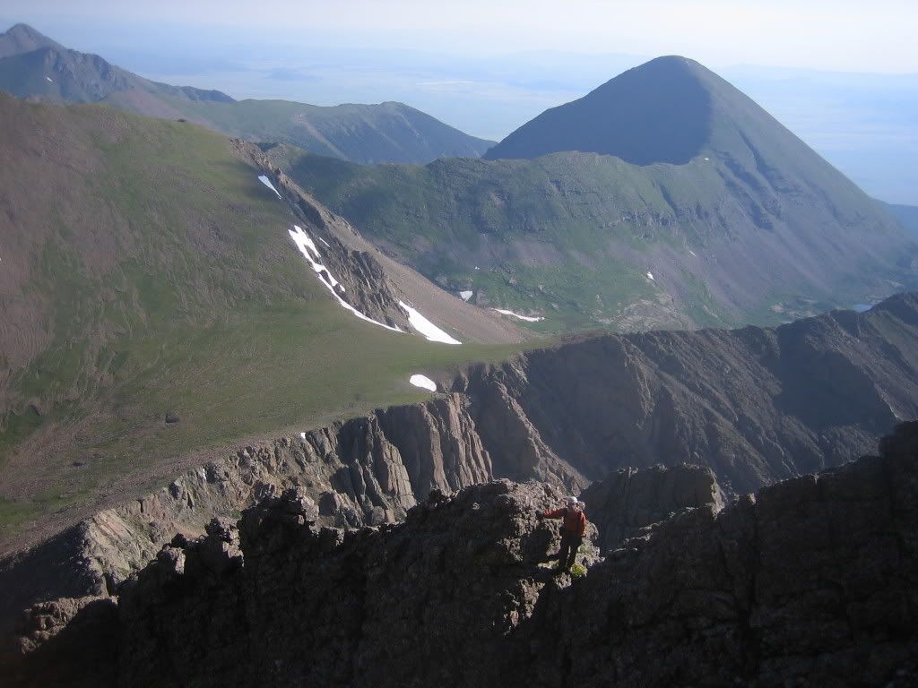
We summitted Crestone Peak at around 10 'O' Clock.
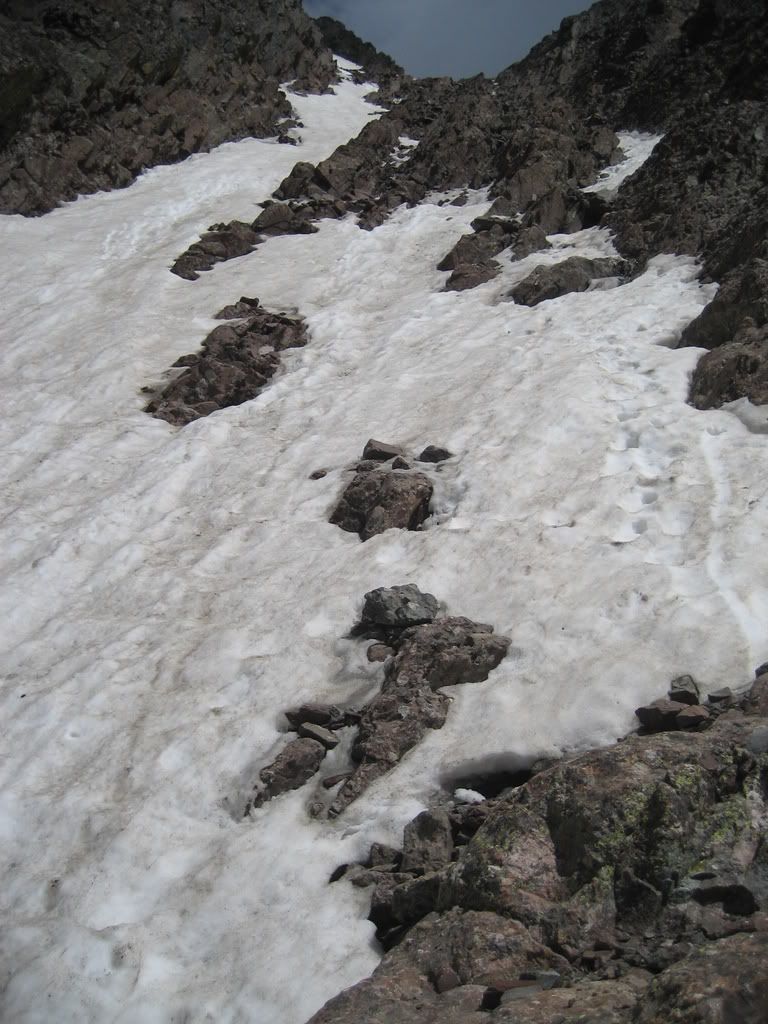
Clouds were building fast at this point and we decided not to stay on summit for too long. We started heading down the South Face couloir
The clouds that I saw half way down the couloir would have sent me down to camp but Joe figured that the high pressure system we saw on the radar the previous day was blowing the tops off of the thunderheads...
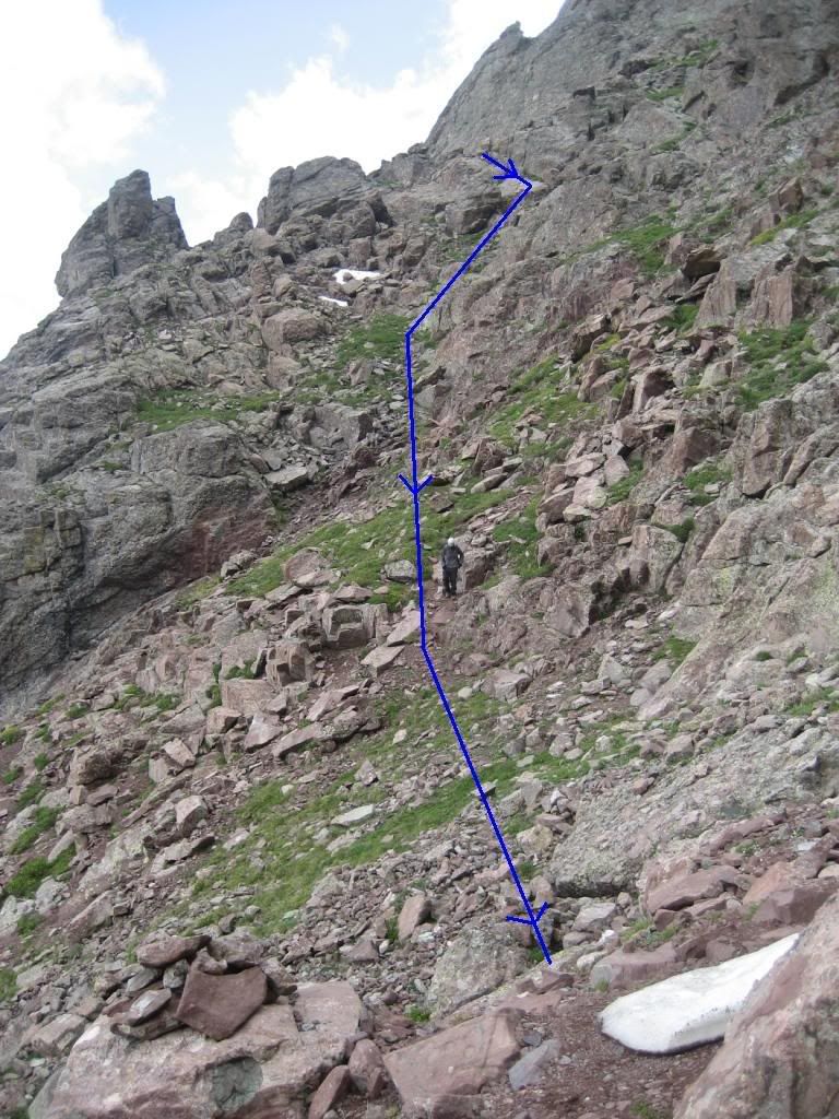
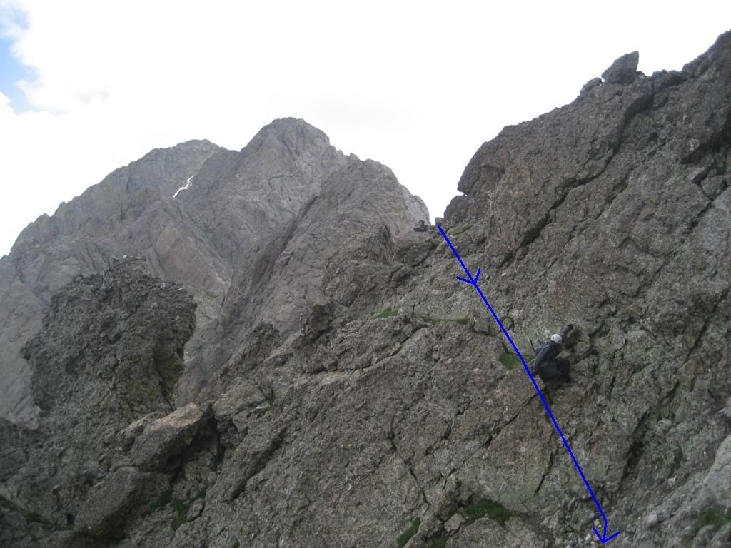
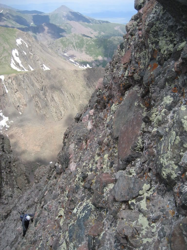
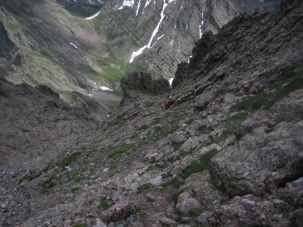
at this point we identified escape routes (there is one gully that will take you low enough to try and join the trail to Broken Hand Pass) and decided to attempt the traverse.
There is one key to completing this traverse that I cannot stress more. Stay low... resist the temptation to stay close to the ridge and retain the elevation you worked hard for. There is enough Class 4 on this route without trying to stay high on this ridge. Cairns are easy to find on the regular route lower down. Joe marked the route with blue arrows in the following pictures.
Follow grassy ledges along this traverse if you're going from the Peak to the Needle. If you have been on rock for too long and are cliffing out, you are probably too high. Go lower and you will likely be on the right track pretty soon.
The early part of the traverse from the Peak to the Needle rarely exceeded Class 2... a short, but welcome reprieve from the gnarr...
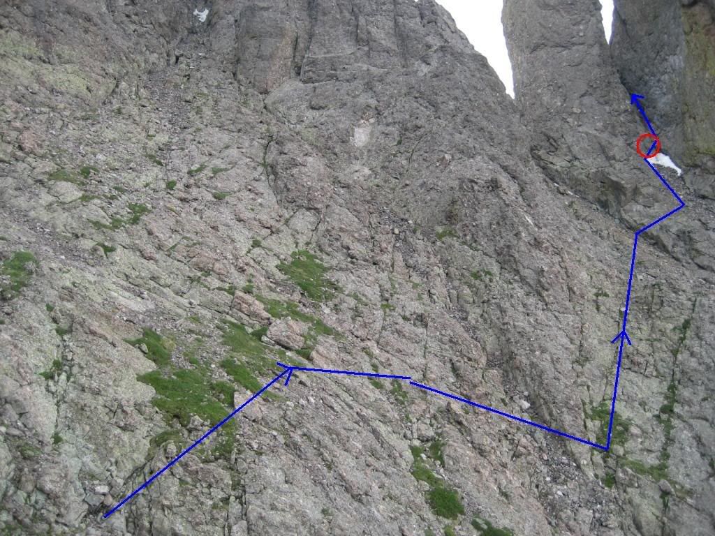
The cairn circled in red is a key marker to watch for if you are doing the traverse from the Needle to the Peak. You will likely be way up high attempting the traverse in that direction... look for this cairn down low and head for it.
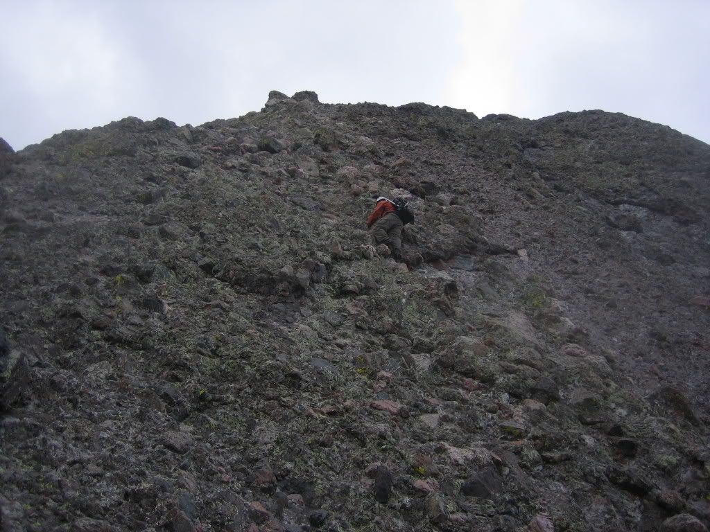
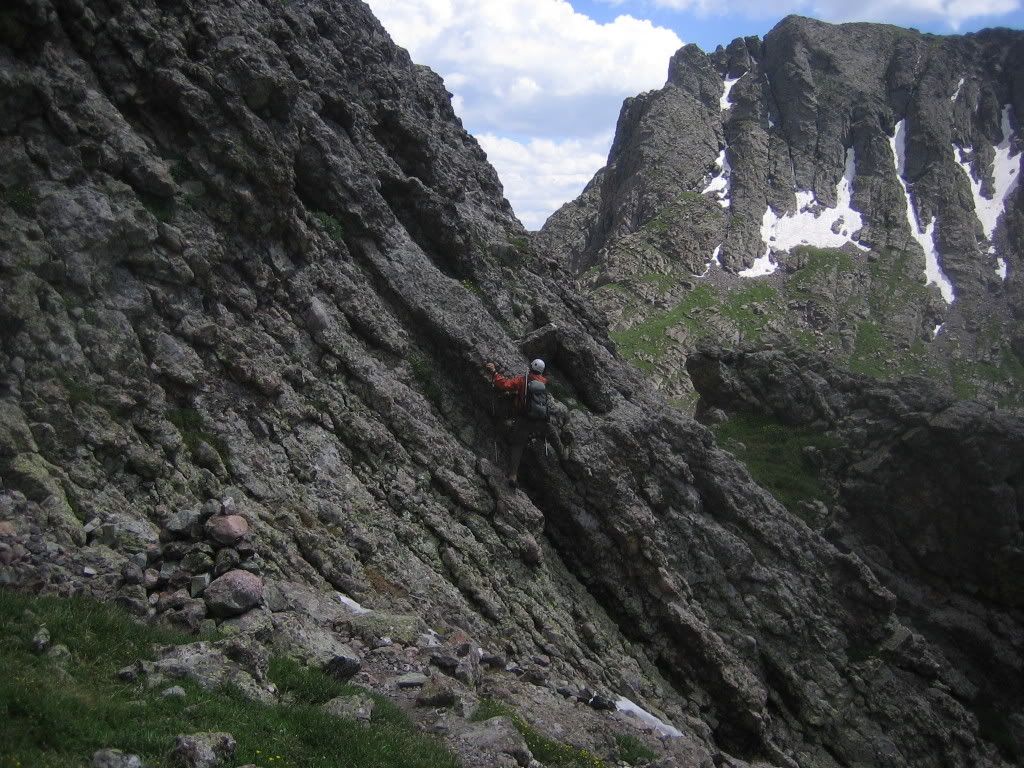
There is another steep Class 4 traverse you will have to complete to gain entry into the gully between the central and southern gendarmes. The traverse is circled in red in the following image...
And this is what it looks like, from up close
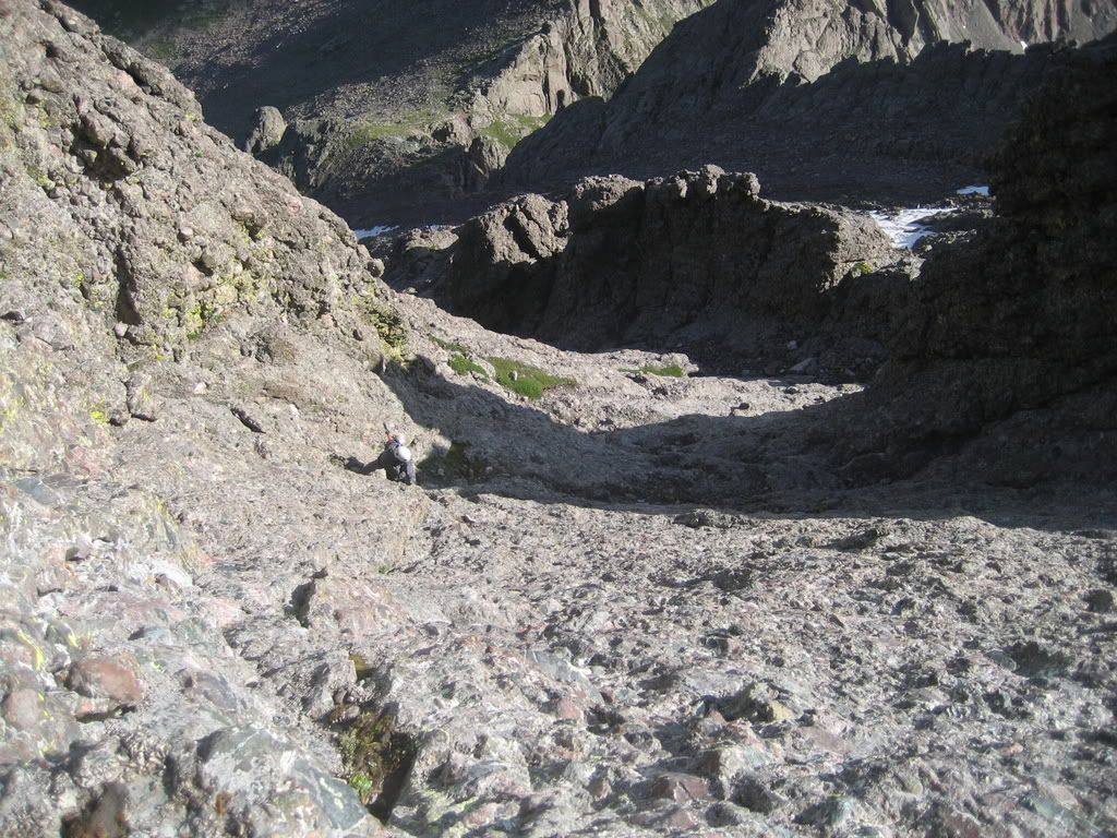
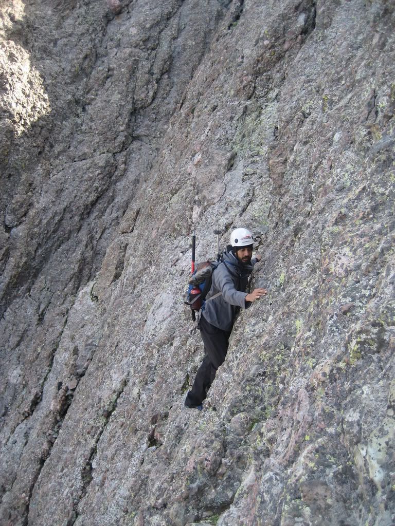
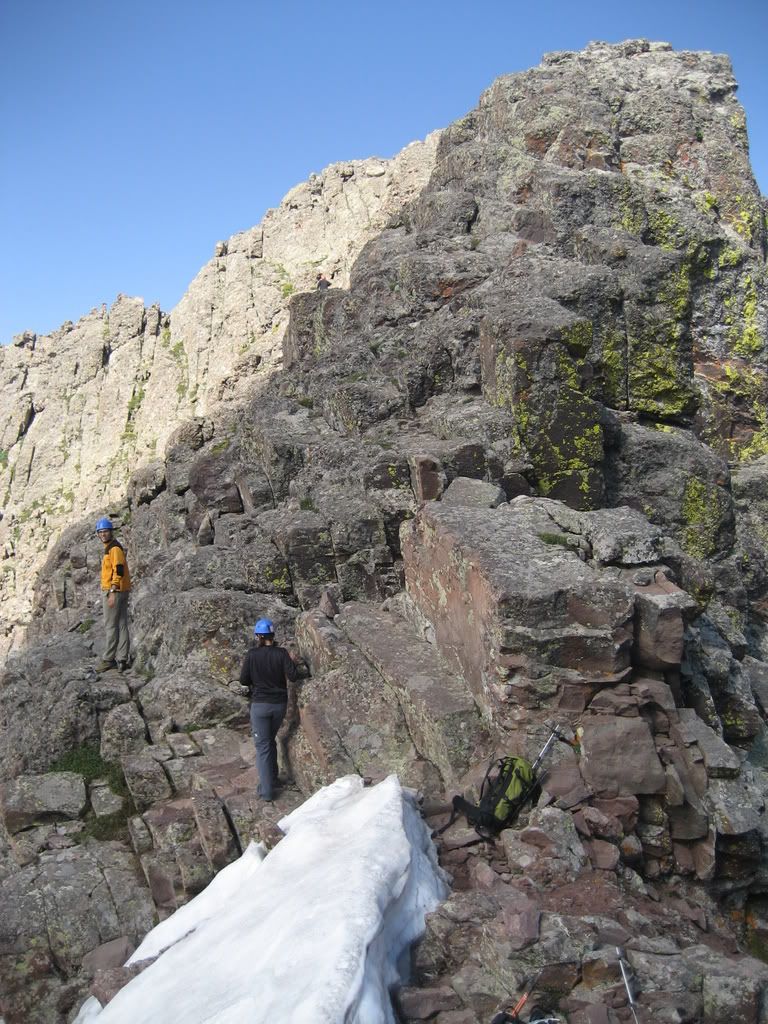
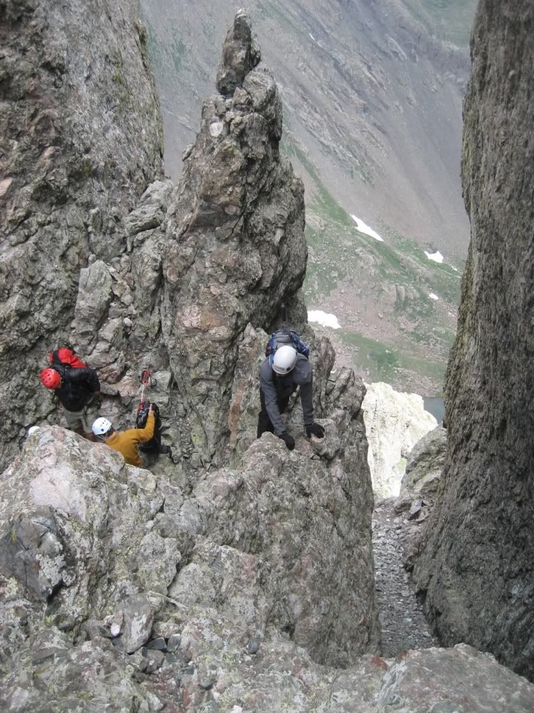
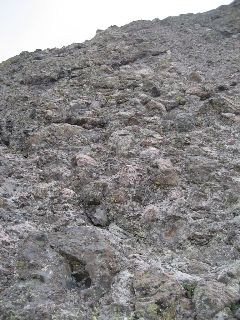
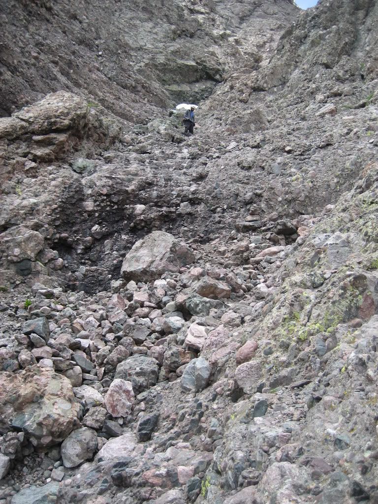
Ascending the gully is very easy Class 3 scrambling up loose rock. Watch out for climbers above you though. The rock is very loose and gains momentum very easily. I have a few bruises from rock fall to show for this trip. We got to the top of the gully where we saw a group of four climbers who were attempting the traverse in the opposite direction who were kind enough to wait for us to finish ascending the gully.
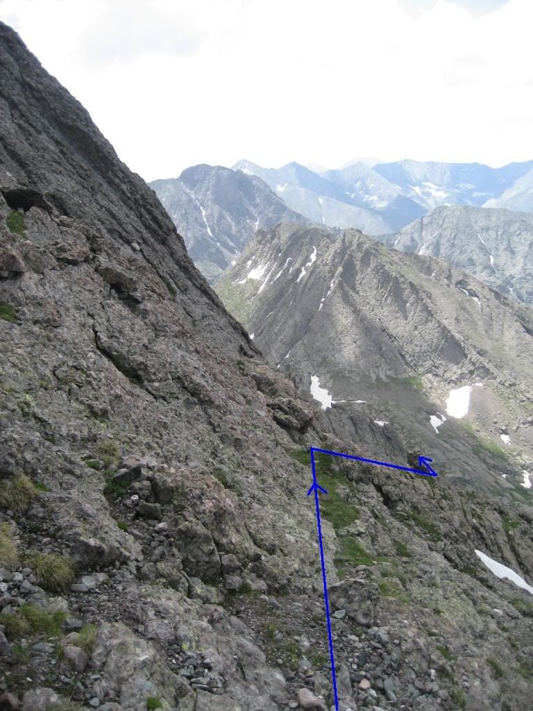
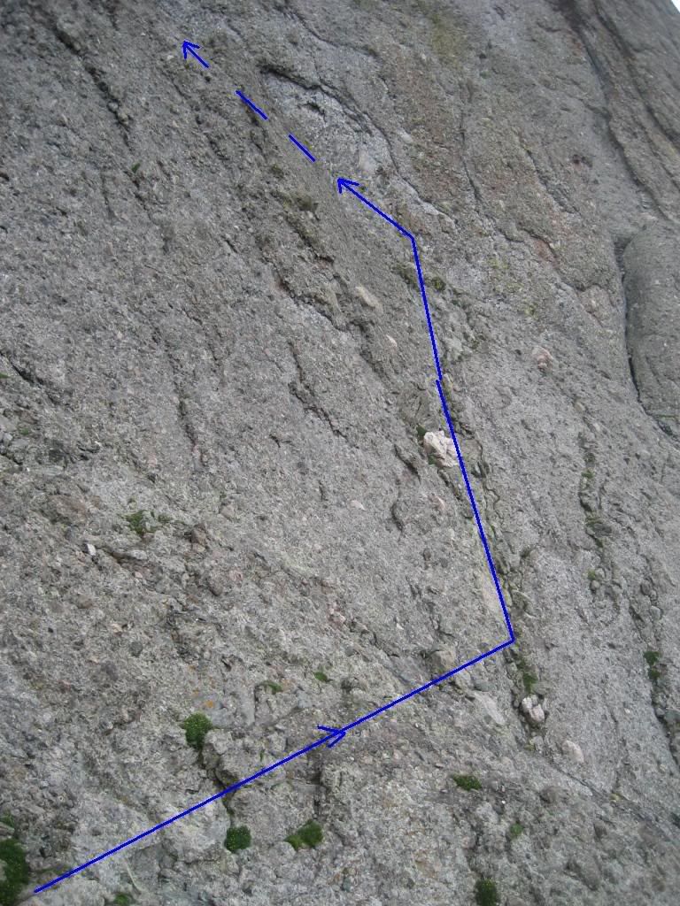
At the top of the gully there are two choices to get up to the ridge crest. The blue arrow seemed more obvious to us for whatever reason and is the route we followed. However, take the red route.
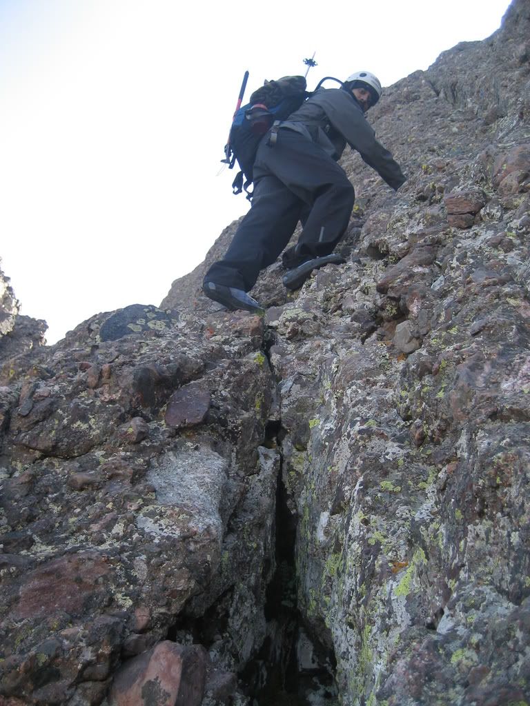
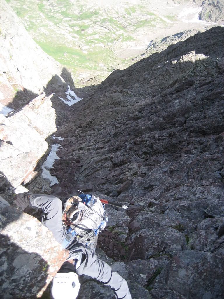
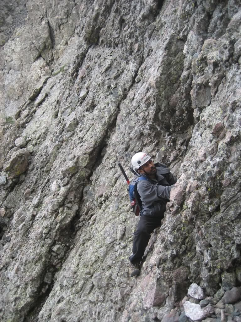
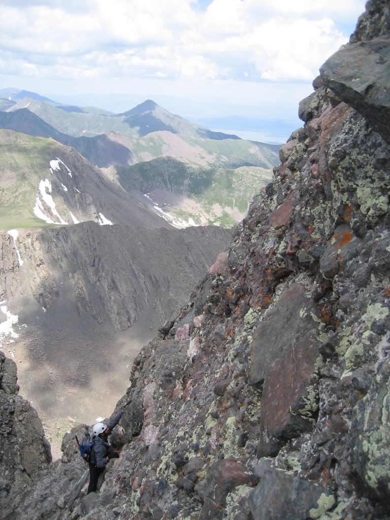
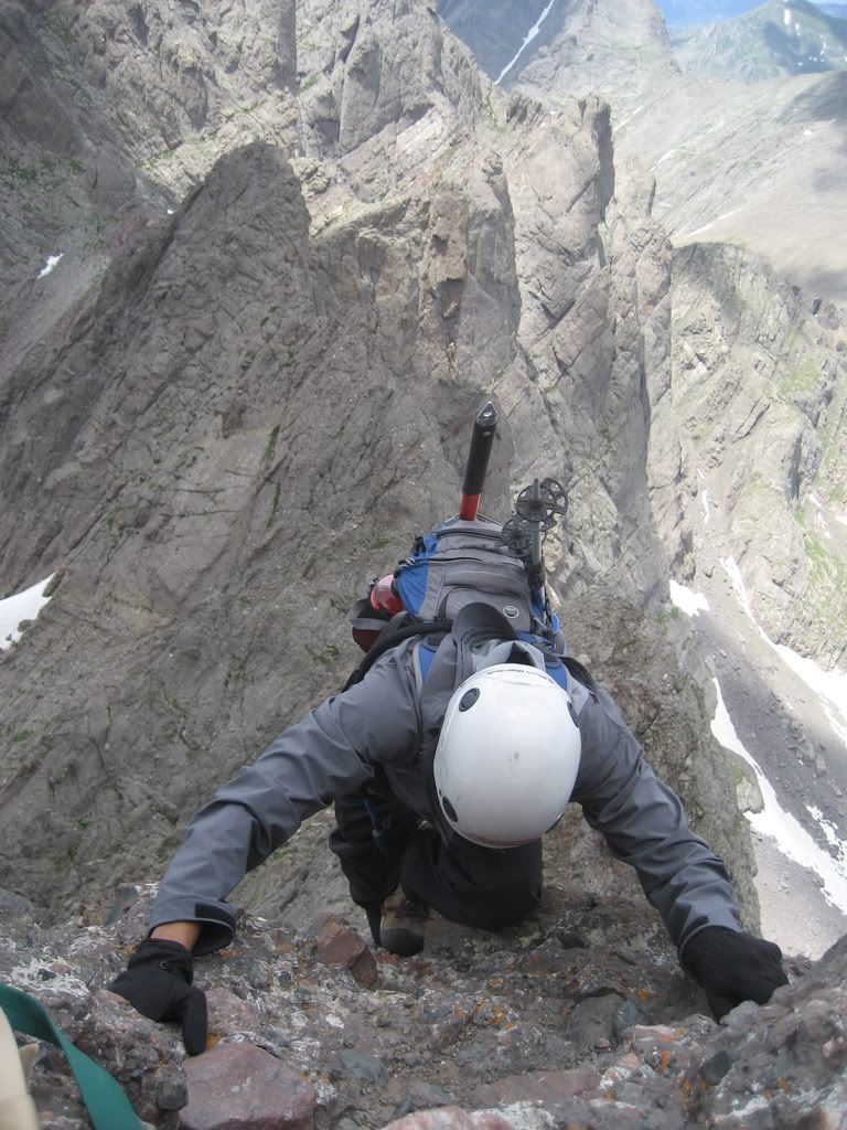
The difficulty doesn't subside. There is an interesting ledge to traverse across that leads you to the bottom of the crux.
This is not too hard however and is a good warm up for the crux.
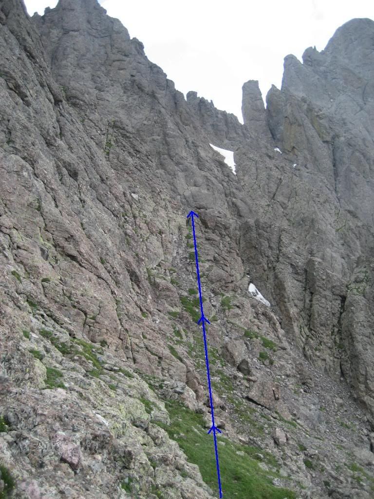
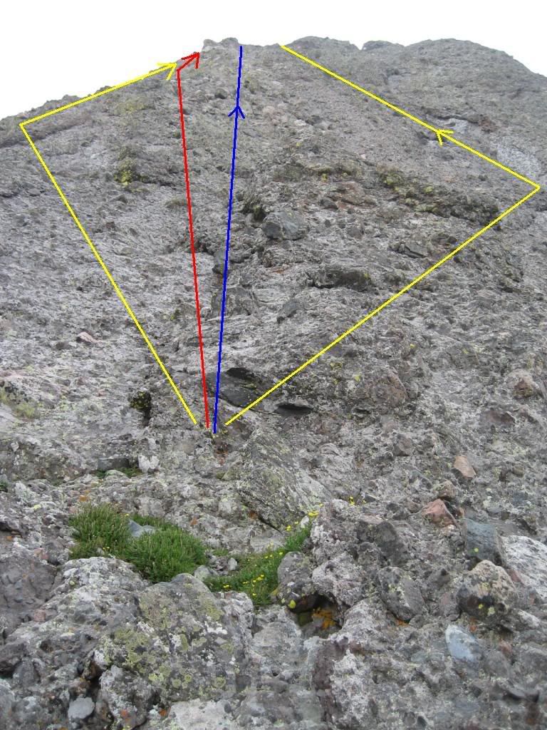
At the crux Joe switched to rock shoes for this final pitch but I opted to leave my hiking boots on. You are presented with several route options here. Joe decided to go straight up and followed the blue line. I went off to the left by a little bit along the red arrow. The yellow arrows mark two other options that might be a little easier. From where we stood at the base of the wall though there was no way of knowing what our fate would be if we followed the yellow lines, however we checked it out from the top later. It seems fine.
Here's what you will be looking at
And here's an idea of how steep it is at places...
That's Joe heading up the blue route marked out earlier
and myself, heading along the red route...
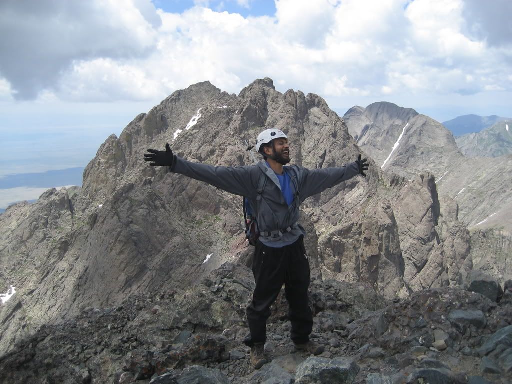
The rock is knobby and beautiful, but like I said earlier, don't rely on it too much. Don't make any dedicated moves either. Try to maintain control on rock with at least both hands and a foot or both feet and one hand. Topping out on the Needle is an amazing feeling... The deed was done at 1:20PM, 07/14/07. This was my second of Colorado's four 14er traverses.
I've summitted the Needle twice... once from each direction... Both instances were the best two moments in my short climbing career.
and apparently a very regular moment for doumall
We went down the standard South face route on the needle following the description on the route page religiously.
The descent went very smoothly. The South Face route has no snow on it and route finding is not an issue at all like it was when all that ice was covering it during my ascent of it with LordHelmut in spring.
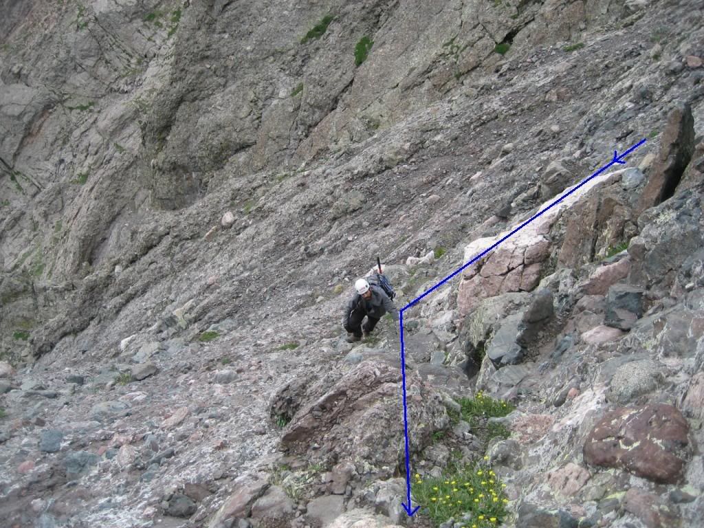
We made quick time back to Broken Hand Pass and decided to get Broken Hand Peak. There's a short cut to finding the trail to Broken Hand
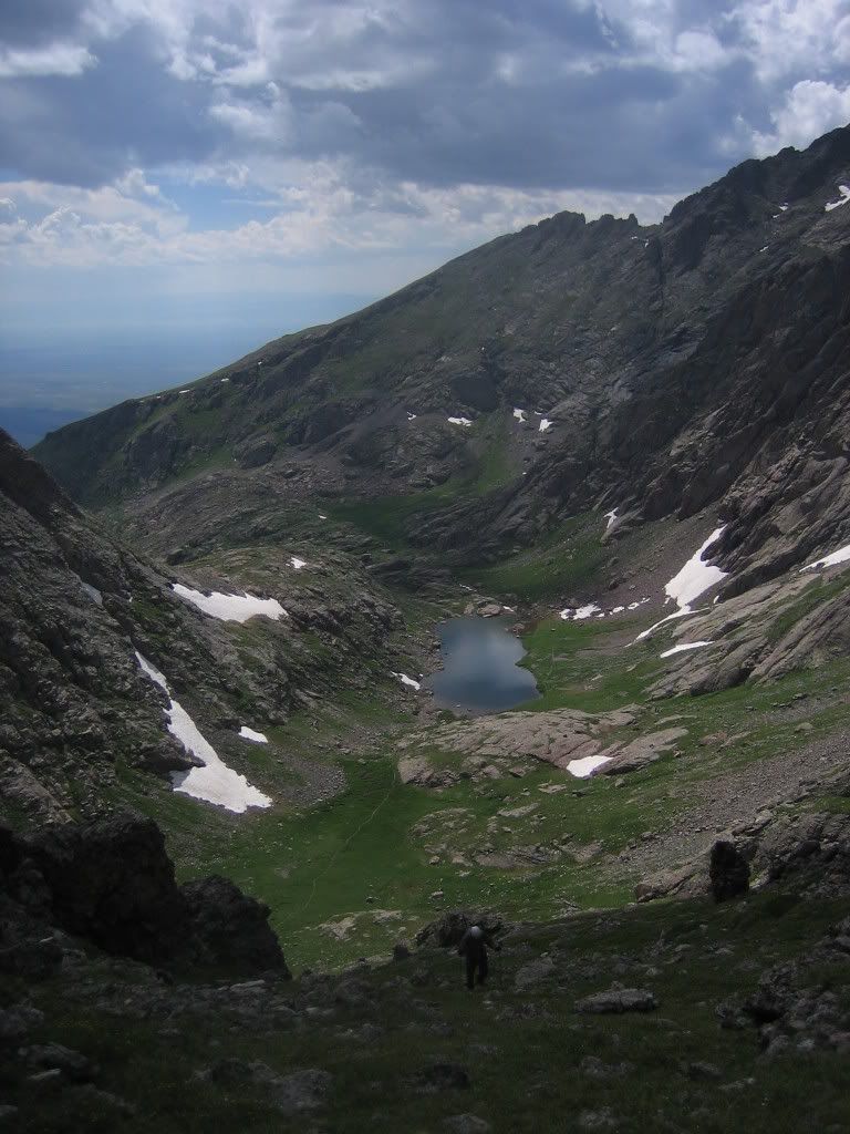
A view of Cottonwood Lake from the trail...
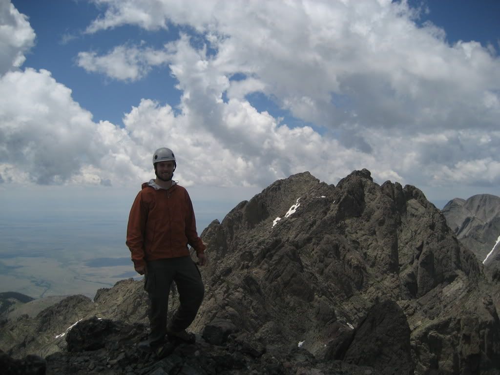
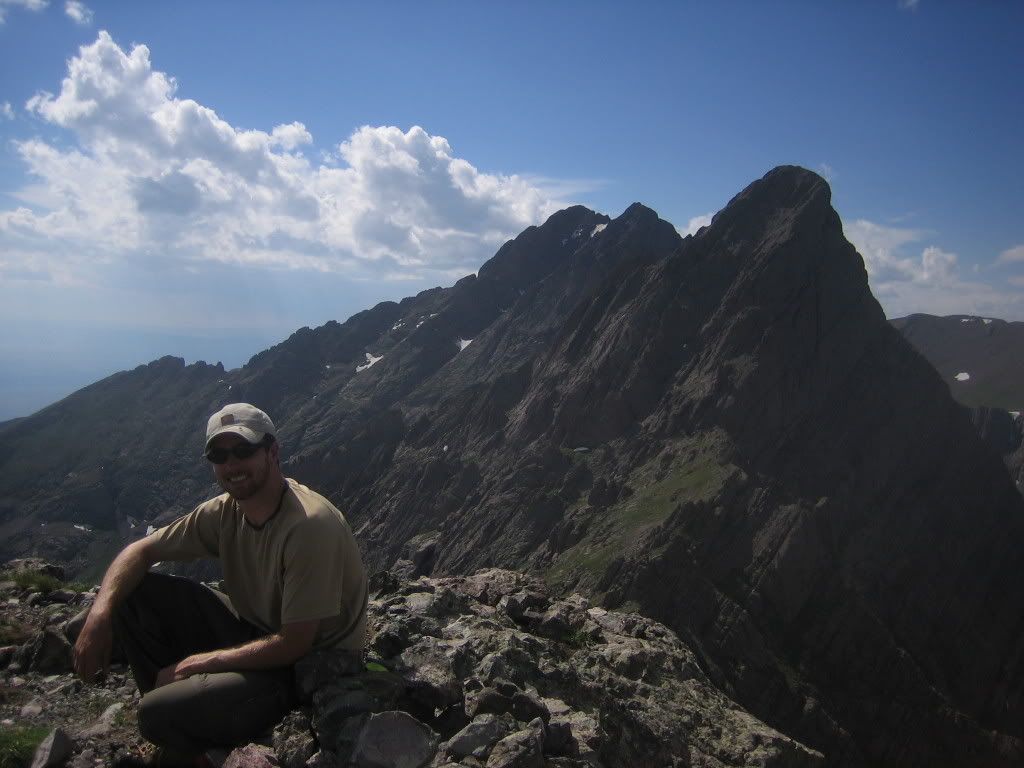
We summitted broken hand peak at 3:50PM and stayed for at least 30 minutes, recollecting all the times we'd been close to falling off the mountain over the last 15 hours. Broken Hand Peak doesn't seem to be very popular. We saw Ken Nolan's entry from long ago along with one other entry. Here's one last look at the Needle from Broken Hand.
We decided we'd had enough for the day and started heading back down towards Broken Hand pass... the weather had been kind. Several thunder heads built but got blown away by the high pressure.
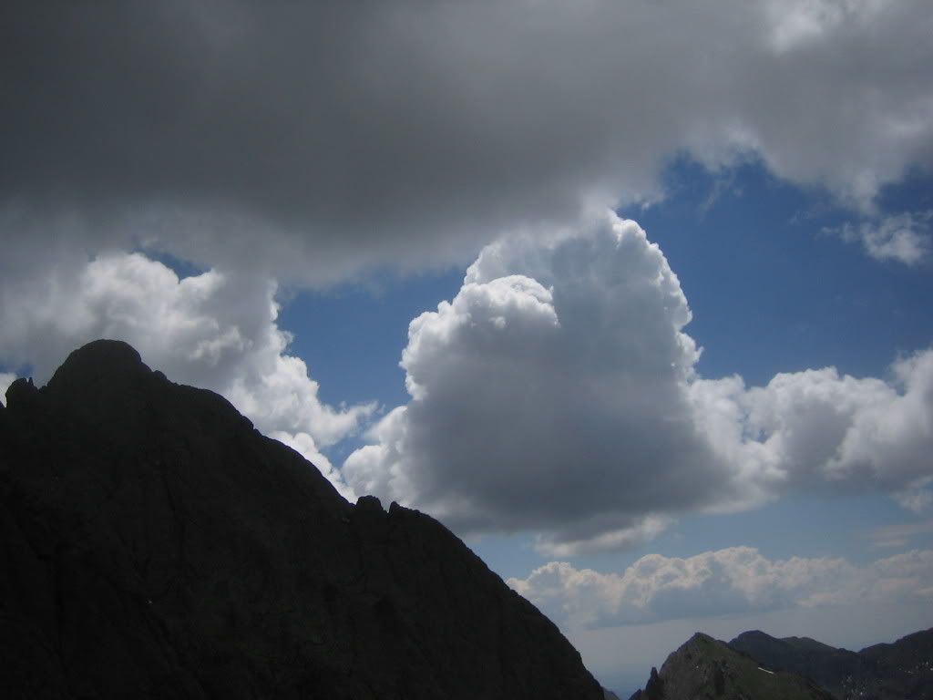
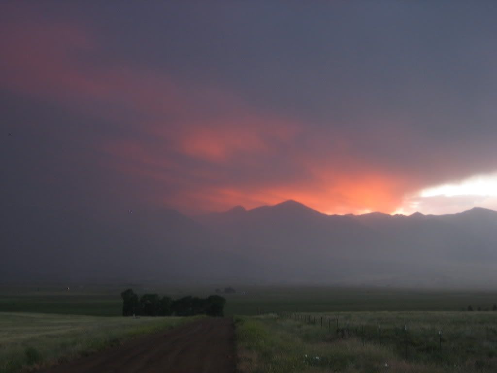
We were down in the forest when we heard the first roll of thunder. Perfect timing. This is one of several reasons doumall kicks butt as a climbing partner. We got back to my Jeep at 6:30 and met Zack and Steve again. They had summitted Crestone Peak successfully as well. We drove slowly back down S. Colony Road and polished off several cans of Rockstar trying to stay awake on the drive back to Boulder. One last breathtaking picture of the Sangres marked the end of another great weekend up in the mountains.
Thanks for the great writeup! Your description of the traverse is amazing. I look forward to trying it this summer. I envy all you guys living in Colorado!!
We're heading for the traverse this weekend. While your TR was amazing, I'm regretting looking at it before-hand. My stomach is in knots now! Nice job!!!!
Aubrey, where are you? I need lots of that beer now.
Nice work. You guys probally had the confidence of mtn goats on the 3rd class downclimb. I'm sure your legs were punished at this point though. Driving back to Boulder after all that. now thats bold.
Great job! Looks like great, helpful photos for the traverse. Any chance you want to write the site route description for it? If so, let me know and I can hook you up with access to the route entry system.
I wish Kevin and I had seen this post last year before we attempted the Peak. We took the exact same route as you--up through the saddle to the North, rather than the standard Brokenhand->Red Couloir approach...some of your pictures from the East Peak, tower, downclimb, and traverse before reaching the ridgeline bring back some crazy (and terrifying :-) ) memories. Amazing pictures, and good climb! We're headed back to Crestone this weekend to hit the Cottonwood Creek TH->Peak->Needle Traverse. Pictures, and trip report to come!
Caution: The information contained in this report may not be accurate and should not be the only resource used in preparation for your climb. Failure to have the necessary experience, physical conditioning, supplies or equipment can result in injury or death. 14ers.com and the author(s) of this report provide no warranties, either express or implied, that the information provided is accurate or reliable. By using the information provided, you agree to indemnify and hold harmless 14ers.com and the report author(s) with respect to any claims and demands against them, including any attorney fees and expenses. Please read the 14ers.com Safety and Disclaimer pages for more information.
Please respect private property: 14ers.com supports the rights of private landowners to determine how and by whom their land will be used. In Colorado, it is your responsibility to determine if land is private and to obtain the appropriate permission before entering the property.