| Peak(s): |
Grays Peak - 14,275 feet Mt. Blue Sky - 14,268 feet |
| Date Posted: | 07/13/2008 |
| Date Climbed: | 07/07/2008 |
| Author: | bblack99 |
| Peak(s): |
Grays Peak - 14,275 feet Mt. Blue Sky - 14,268 feet |
| Date Posted: | 07/13/2008 |
| Date Climbed: | 07/07/2008 |
| Author: | bblack99 |
| GRAY Grays Christmas (in July) |
|---|
|
Grays Peak (14,270' - 9th tallest in Colorado) Summit Date: July 7, 2008 Round-trip Distance: ~10mi (thanks to the rut!) Elevation Gain: 3700' (again, thanks) Thanks to recommendations from those of you on this site, I decided to make Grays and Torreys my first two fourteeners by doing the standard traverse from the Grays TH. Monday, July 7, 2008: 4:15am - Woke up, took a shower and finished packing for way too long, left Dillon on I-70 5:50am - Reached the rut in Stevens Gulch Rd. and realized just how nasty it was. With limited skill in navigating obstacles, I didn't even feel right putting a rental through that kind of punishment and parked with others to the makeshift lot on the side of the road. 6:10am - After heading up the road a ways on foot, Nick (SkiBum) and Tim were kind enough to give me a lift to the TH in their Subaru. After one minor scrape, we made it up and Nick's Subaru was the only car in the lot. 6:30am - Started across the footbridge and began snapping photos as a cold drizzle began to fall. After the first half-mile, the drizzle turned into a spitting rain, more than enough to annoy and began soaking exposed skin. At this point, I knew it wasn't going to be an easy first 14er! 7:30am - Reached the Grays/Torreys park signboard. 1.2 hours to Grays from here -- seriously? I don't know who made that sign, but it seemed about 2 hours faster than my calculations. Peaks on the ascent...or so I‘m told 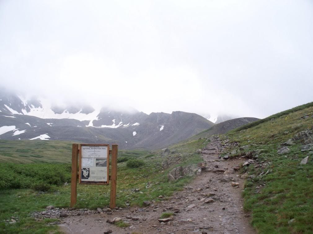 The rain had tapered off now, so I ditched the poncho and was able to pick up the pace with better ventilation. Ten minutes later, I had finished snapping photos of the creek fed by the rain and snowmelt. This spot would be one of my best views of the day! Stream from 1/2" elevation 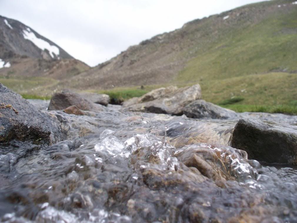 8:00am - Hooray, I reached 12,500' and the cloudbank from the peaks dropped down to stifle all views. Along with the poor visibility, light snow began to fall and put the first scare of the day into me. I had left my Super Hero softshell in the car and had only packed a thin pair of gloves to wear with my PreCip jacket. I thought surely this would pass in ten minutes and trudged on toward the trail junction. Gorgeous summer weather 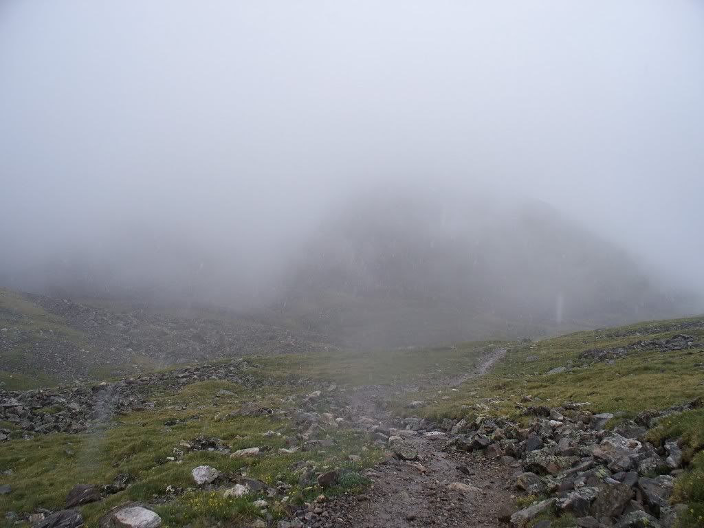 Nice, long slog 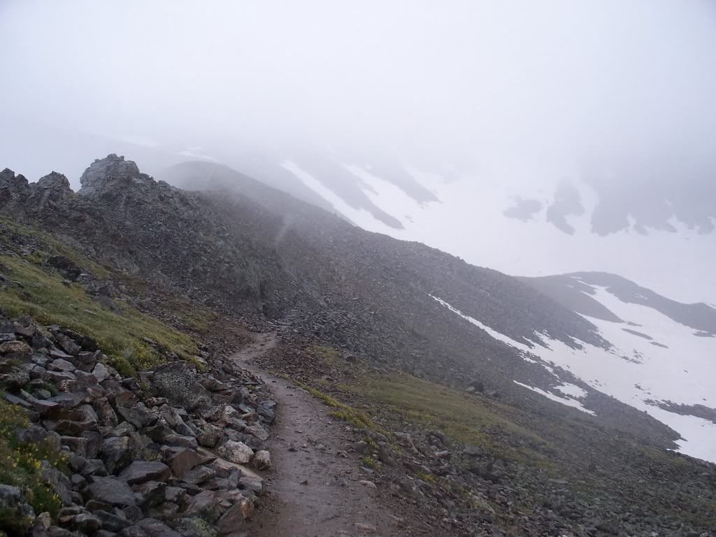 9:00am - I'm slow! I had crossed the tiny snowfields on the main trail and passed 13k. By this point, it seemed like everyone on the trail was passing me. Not that I really cared, I was soaking up the experience and taking pictures of everything...clouds, fog, overcast skies, fog, clouds, fog, snow, clouds...you get the idea! 10:00am - I'm past the rock tower and the clouds are breaking! Hooray, I'll have amazing views from the top, if I ever make it! 10:15am - Haha...no more sunshine! The mountain gods decided to tease me with a little break in the clouds, but the window had closed quickly. Maybe I should have packed winter gear 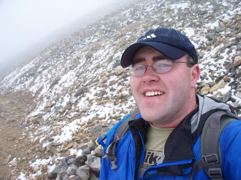 10:30am - Reaching 14,000' was nice and by this point I was a lock to summit -- my mind was made up. I had seen about ten people on their way down, with another ten heading up behind me. I met a guy from Michigan whose sons and daughters were just behind, but we couldn't see them and decided to gather at the summit. We pushed upward together in very low visibility and felt the winds pick up substantially. 10:53am - SUMMIT TIME! Grays Peak lived up to the name, as you can see from the summit photos. Wind chill had to be well below freezing, and visibility was below 50 feet. The main register was a soggy mess, so I signed the 14ers.com tube that contained a single sheet of summit info. We agreed to snap a few photos and sprint down without messing with the traverse to Torreys. The visibility was far too low and conditions were less than ideal, so there would only be one summit today. As I dug through my pack for the surprise prop, the Michigan family arrived safe and sound. I posed for a hero shot or two and took several of the family huddled together against the foggy, nasty gray background, then we all headed down at a fast pace. Mizzou hero 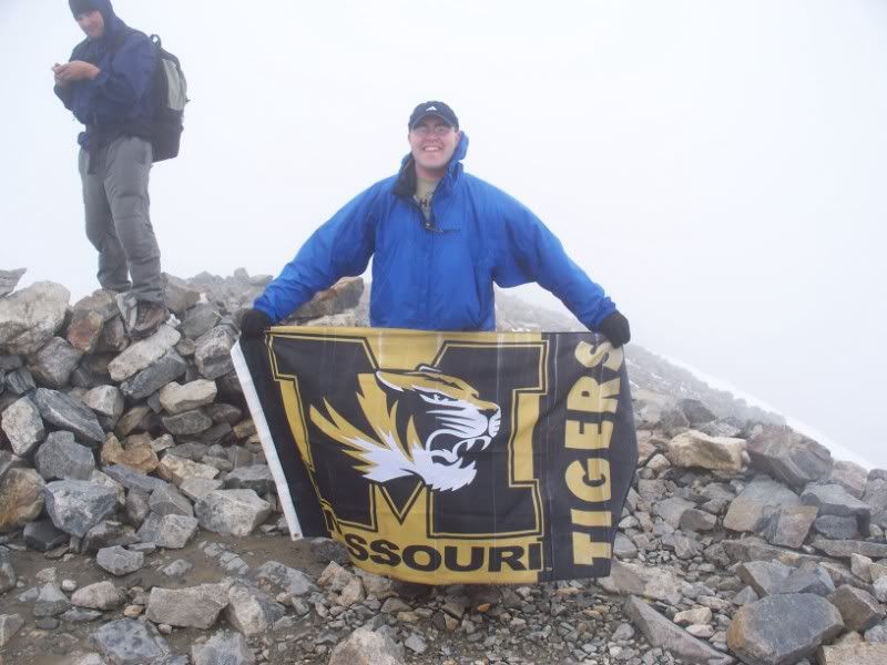 I stopped twice to eat snacks and shed layers as the clouds parted in a cruel twist of fate. I was able to get some nice photos of the summits from near the signboard and a bunch of Kelso/Parnassus/Bard. Looking north beyond Kelso 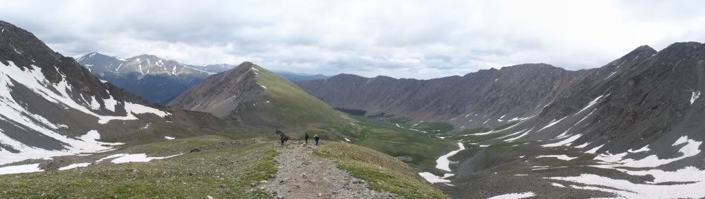 Peaks on the descent 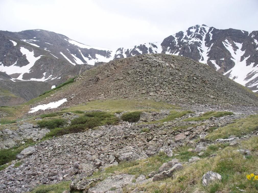 So there ARE mountains up there! 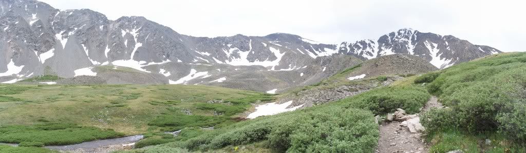 I passed several stragglers on the way down, and even saw a few people walking up Stevens Gulch Road as I headed back to my car. Another soaking rain had started by about 1pm, complete with thunderclaps in the distance. Ascent: 4.5 hours Summit time: 10 minutes Descent: ~2 hours Technically, this was a very disappointing first 14er. Terrible weather, an inaccessible trailhead, zero visibility from the top, SNOW in July, and only one 14er in the books instead of the combo. On the flipside, I pushed myself to get my first summit, so my success rate is 100% and I highly doubt I'll ever have to deal with conditions that poor again! Maybe the next 14er trip will be one of those famous bluebird days in Colorado. P.S. I snuck over to Evans via CO103 two days later with blue skies and caught up on the views I missed on summit day. Here's a small sample: Evans, Sawtooth, Bierstadt, and Spalding from Summit Lake 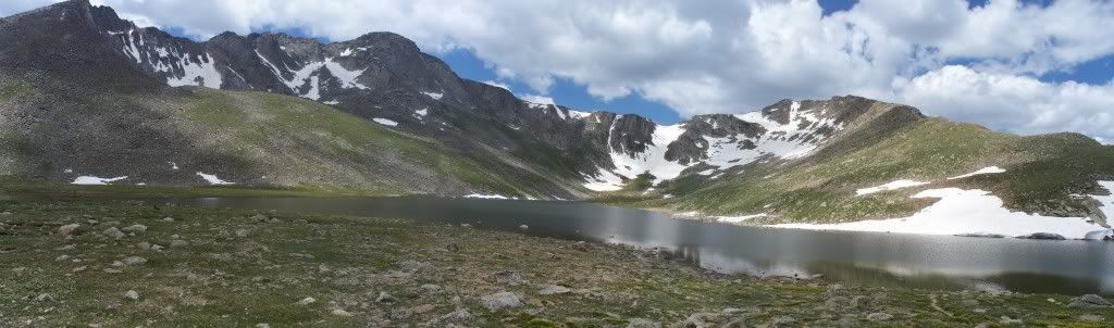 Spalding and cottonball clouds 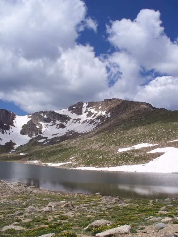 Panoramic shot to the west from Mt. Evans summit 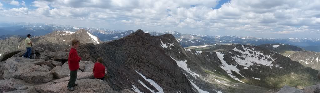 Hero shot from 10 miles away, pointing at Grays summit 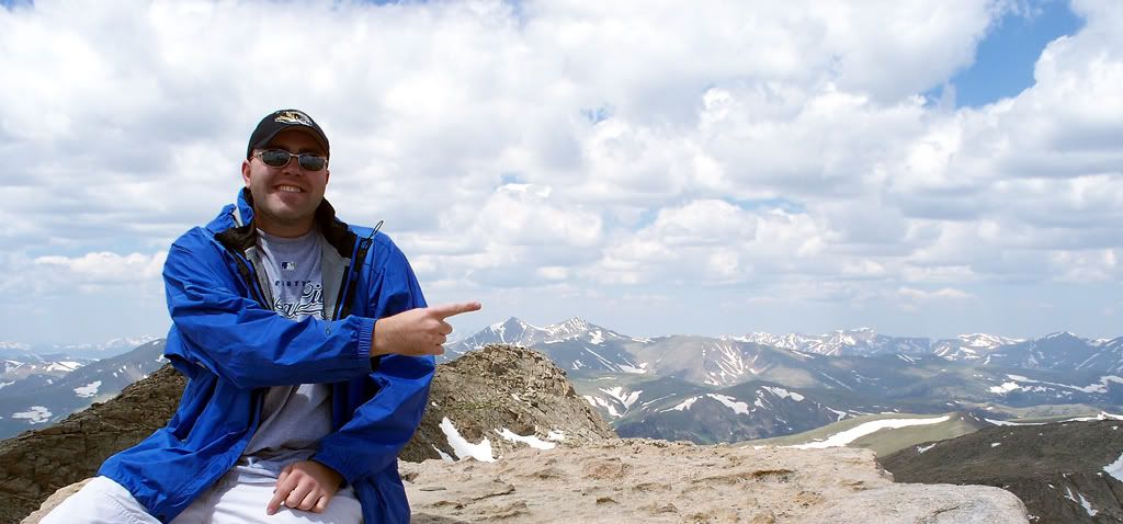 |
| Comments or Questions | |||
|---|---|---|---|
|
Caution: The information contained in this report may not be accurate and should not be the only resource used in preparation for your climb. Failure to have the necessary experience, physical conditioning, supplies or equipment can result in injury or death. 14ers.com and the author(s) of this report provide no warranties, either express or implied, that the information provided is accurate or reliable. By using the information provided, you agree to indemnify and hold harmless 14ers.com and the report author(s) with respect to any claims and demands against them, including any attorney fees and expenses. Please read the 14ers.com Safety and Disclaimer pages for more information.


