Download Agreement, Release, and Acknowledgement of Risk:
You (the person requesting this file download) fully understand mountain climbing ("Activity") involves risks and dangers of serious bodily injury, including permanent disability, paralysis, and death ("Risks") and you fully accept and assume all such risks and all responsibility for losses, costs, and damages you incur as a result of your participation in this Activity.
You acknowledge that information in the file you have chosen to download may not be accurate and may contain errors. You agree to assume all risks when using this information and agree to release and discharge 14ers.com, 14ers Inc. and the author(s) of such information (collectively, the "Released Parties").
You hereby discharge the Released Parties from all damages, actions, claims and liabilities of any nature, specifically including, but not limited to, damages, actions, claims and liabilities arising from or related to the negligence of the Released Parties. You further agree to indemnify, hold harmless and defend 14ers.com, 14ers Inc. and each of the other Released Parties from and against any loss, damage, liability and expense, including costs and attorney fees, incurred by 14ers.com, 14ers Inc. or any of the other Released Parties as a result of you using information provided on the 14ers.com or 14ers Inc. websites.
You have read this agreement, fully understand its terms and intend it to be a complete and unconditional release of all liability to the greatest extent allowed by law and agree that if any portion of this agreement is held to be invalid the balance, notwithstanding, shall continue in full force and effect.
By clicking "OK" you agree to these terms. If you DO NOT agree, click "Cancel"...
Lindsey on my mind! Northwest Ridge - Photos galore
Mt. Lindsey
Northwest Ridge
~30ft of Class 4
8.25 Miles Team: Scott (SpringsHiker), Rachel (TriAnything), Nathan (FromNO2CO), Tim
You know those trip reports that got lots of random pictures that bug the heck out of you.. well this is one of them.. I love pictures, so get ready. I'll try not to be too random and give as much useful detail as I can, but no promises.
Lindsey has been on our list for a couple of weeks now, but we were waiting for the snow to melt a bit before we tackled it. A few reports had come in saying that the route was pretty dry, and the weekend forecast was sunny sunny sunny! That's all we needed to hear. Emails ensued , and plans were made. We left springs at 3:00am on Saturday (Good lord that's early!) and headed towards Lindsey. One great thing about hiking with Scott and Nate, they plan the heck out of everything. All I had to do was roll in the car and fall asleep!
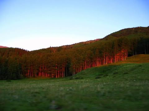
I can't tell you much about the drive, like I said I slept, but I do remember the road to the trail head was pretty smooth for the first few miles, I snoozed right through it. About 4 miles to the trailhead it got a little bumpy and I popped my head up. Good thing cause I was treated to these beautiful morning views.
Morning light on the Aspens and dawn on Mt. Blanca
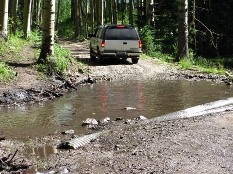
The road was pretty clear until we got to a large mud pool in the road. There were a few cars and a few SUV's parked there. An Xterra and Escape were ahead of us but stopped and pulled off to let us go ahead. I think they just wanted us to be the guinea pigs. Scott and Nate looked at each other, shrugged, and said lets go.
Mud pool on road
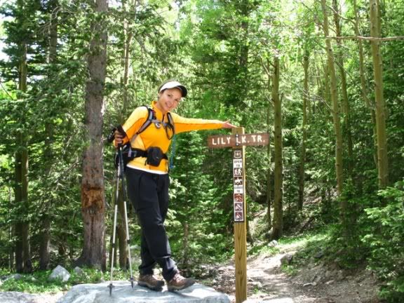
A little further up the road we picked up a hitchhicker IWishILivedinCo had parked at the mud pool and caught a ride with Tim.
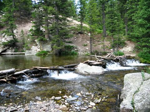
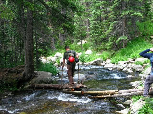
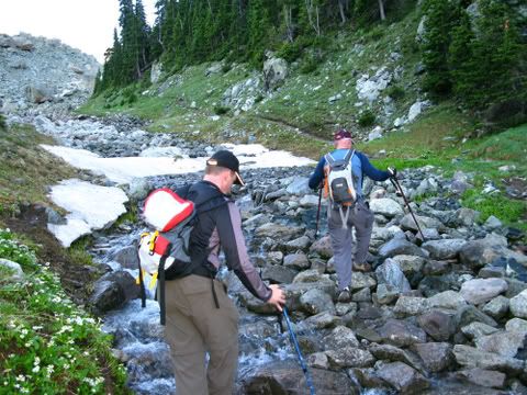
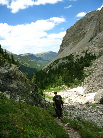
We got to the trailhead about 6:30am and geared up. We headed down the dusty trail about 6:45am. The Trail is pretty easy going for the first couple of miles. Pretty low elevation gain. You meander through the woods and cross the creek a few times. One thing I hate is creek crossings. I am not a graceful creature and often fall in the creek and get soggy feet. I must be getting better because I didn't get wet once. The first couple you just hop on rocks to get to the other side. There is one crossing that you must use a log jam to cross. There are two log jams on the river. The one upstream is very long. Scott and Tim chose to cross this one.
Long log crossing upstream
I had scoped a log crossing downstream that was shorter, but wanted to see what the others had thought. I watched Scott cross the upstream log crossing and knew the probability of me getting soaked was 99.999% I asked Nate to take a look at the other one and he gave me the thumbs up!
Nate crossing smaller log jam downstream on the way back
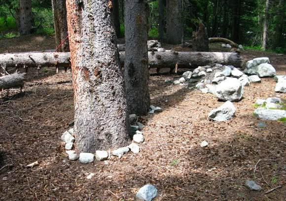
We continued meandering through the valley. There were a few people camping along the trail and I'm sure they were enjoying it. It was beautiful weather. We did come across this funny site.
We guess the previous campers wanted to decorate the campsite a little.
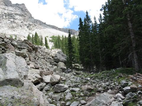
There were a few down trees along the path, but nothing substantial. You follow the trail along the southern valley wall. In a previous trip report, 14ergirl talked about being drawn to the boulder field. Well, we didn't feel that magnetic pull. So we skirted around the boulder field to the right and continued through the trees.
Avoid the magnetic pull, continue through the trees
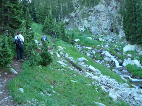
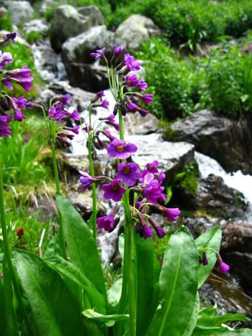
The scenery is just beautiful in this area. The plants were very lush and green along the stream. We had to cross the stream one more time, but it was no problems.
Lush Green valley, Tim getting ready to cross stream
The trail up to this point is just beautiful. I could continue to add more and more pictures, but I'll refrain.
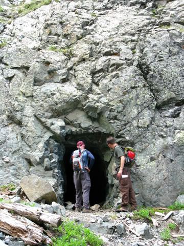
There is a small cave that you can explore a little below where you cross the stream for the last time. Nate and Scott did a little investigation and reported back.
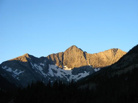
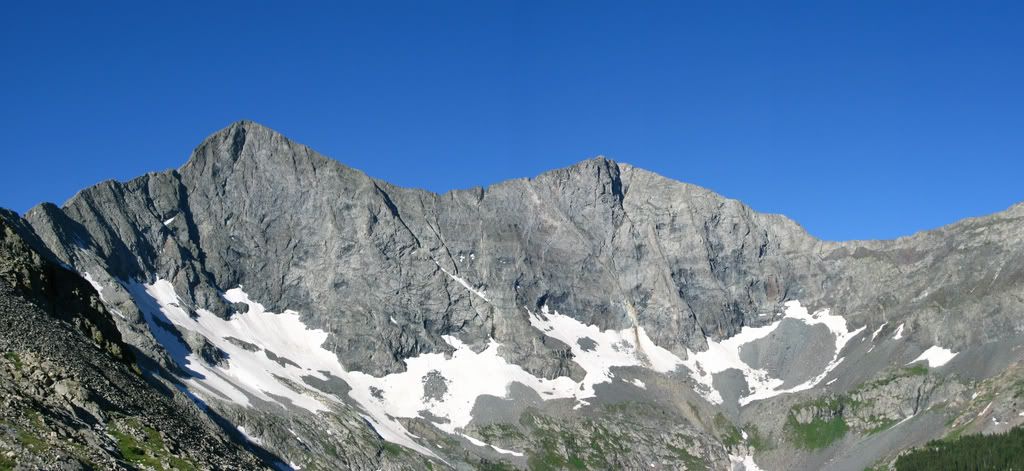
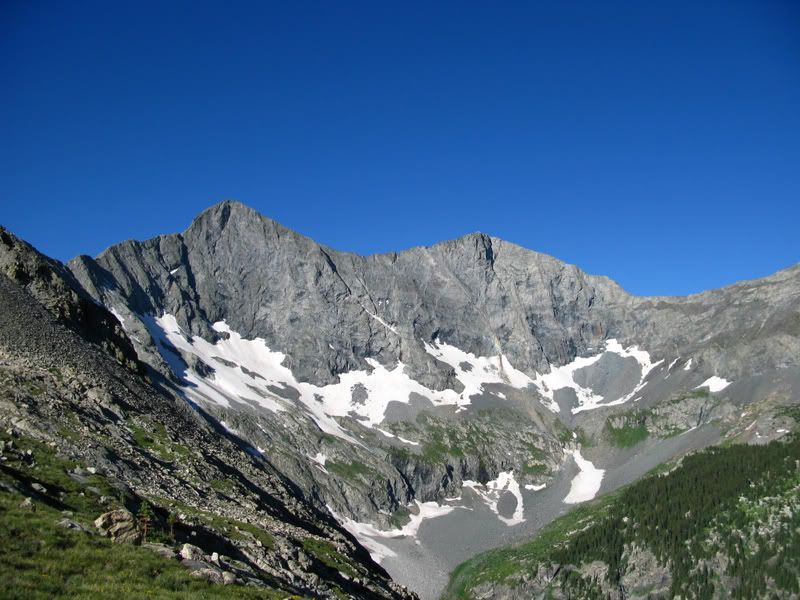
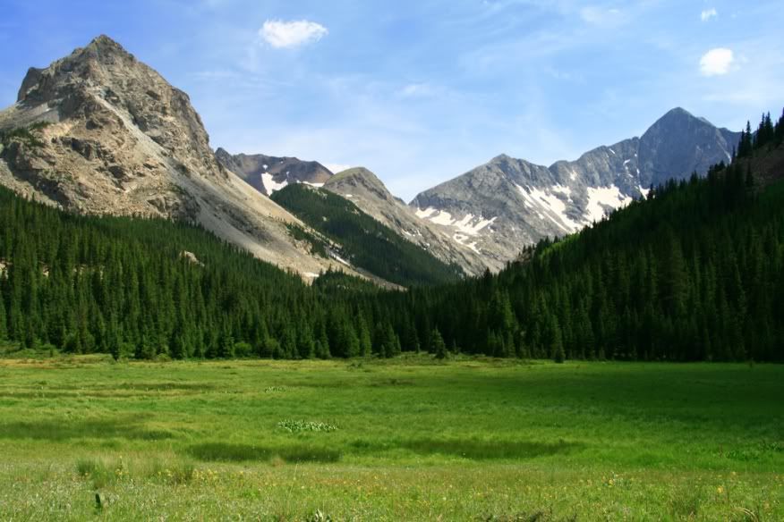
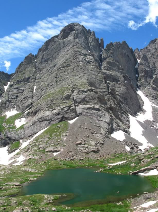
Once you get up close to tree line you are treated with excellent views of Blanca! It was just beautiful.
The trail breaks through the valley and starts heading south up to a ridge. You pass a green meadow with beautiful little white flowers.
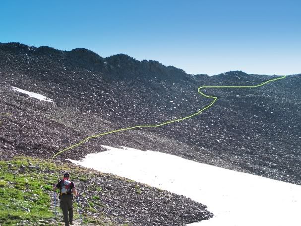
First glimpse of Lindsey
The switchbacks up to the saddle were a little steep. But the view at the top was worth it. Here we took a little break and switched got some pics of the San Luis Valley! I grew up in the valley so it's always special moment for me when I get to see it from a 14er!
From the lower saddle there is a boulder field you need to traverse to get to the upper saddle. There was a little snow on it, but it was below the actual trail.
Tim getting ready to head up to the upper saddle
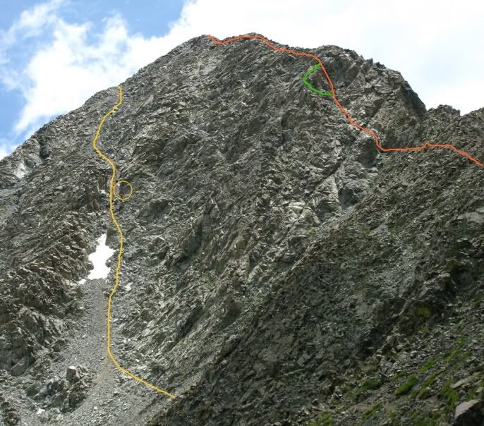
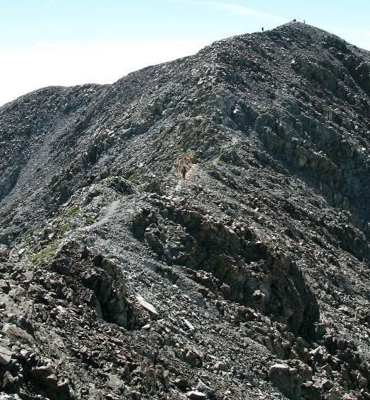
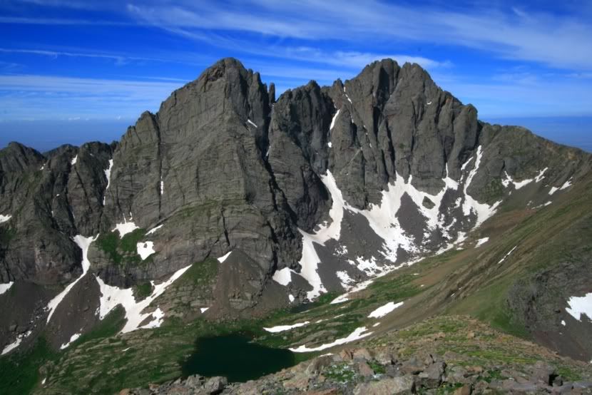
Once you get up to the upper saddle you can pretty much see the fun that lies ahead. I'm still a little green to class 3-4 so I tried not to psyche myself out. Last year myself and Scott did the Kelso route on Torrey's and he absolutely loved it. So he was itching to jump right into it. I just stayed behind and went where they went.
Orange is the route we took to go up the ridge.
Green is the small detour we took coming down.
Yellow is the standard route up the gulley.
In the circle you can see a few people on the standard route.
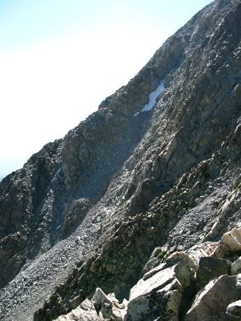
It wasn't all that bad. I had to get a little pull up on one section. Damn if only I was a few inches taller. I probably could of found a better way, but just asked for a hand anyhow. There was a group of seven behind us that decided to go the standard route. We saw them kick a large boulder loose down the gully once. A loud crash echoed around us. I'm sure glad I wasn't behind them. They followed us down the northwest ridge on the way back down and said of the two, the ridge was definitely better. That loose crummy rock would be a pain to come down.
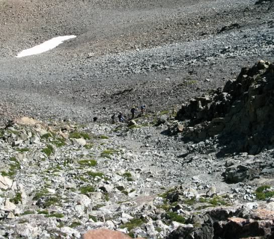
Group of 7 below us on the Standard route Standard route gully
Once you get above the face, it's pretty easy Class 2 climbing to the summit.
Woohoo we made it!
Alright, I think I've been informative enough, now I'm going to dive into hero shots and beautiful scenery.
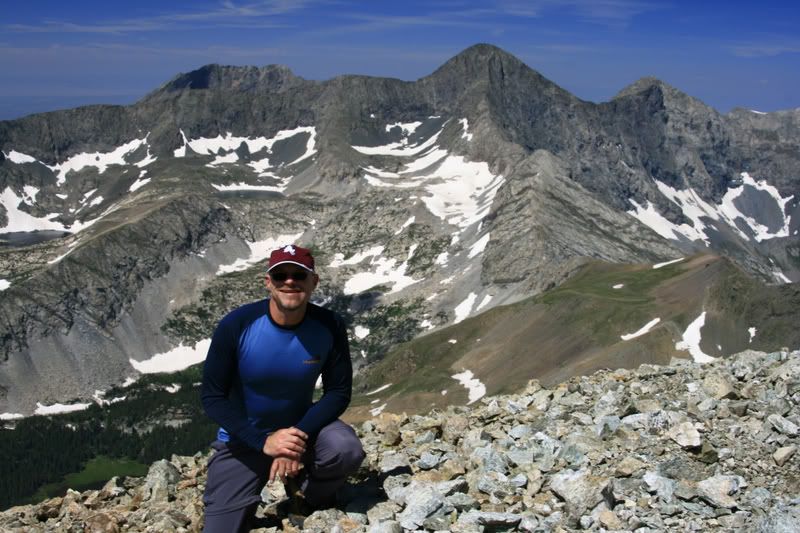
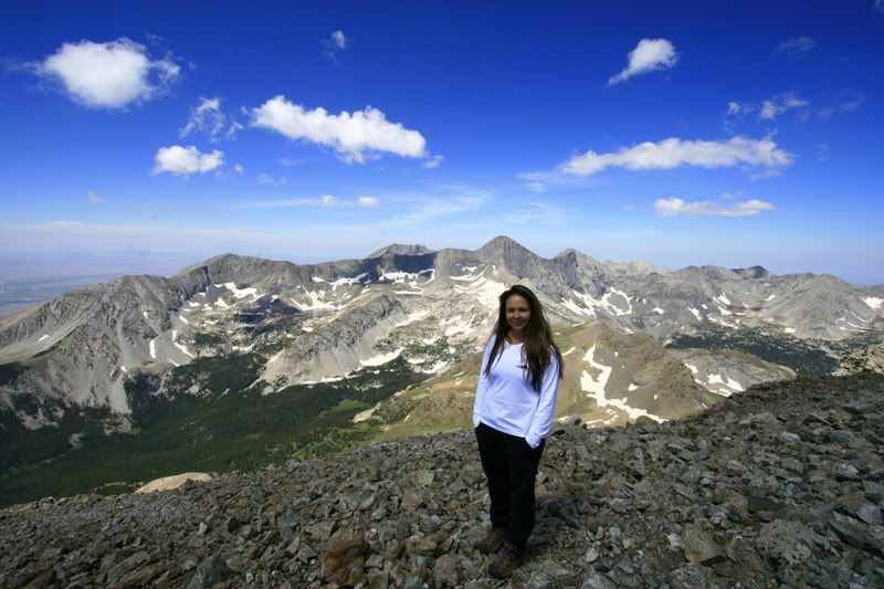
Here are our hero shots!
FromNO2CO
Tim
SpringsHiker
TriAnything Please note the very comfortable and stylish Patagonia 14ers shirt that myself and Scott are wearing. You too can purchase your own 14ers shirt by clicking here:
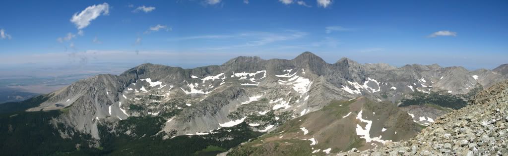
We hung out for a while and took numerous pictures of the views.
Pan shot of the Blanca Group
The hike down the wall was uneventful. I just took my time soaking in the views. At the saddle we split off from Tim, he had to get back to the springs.
We meandered back down the valley.
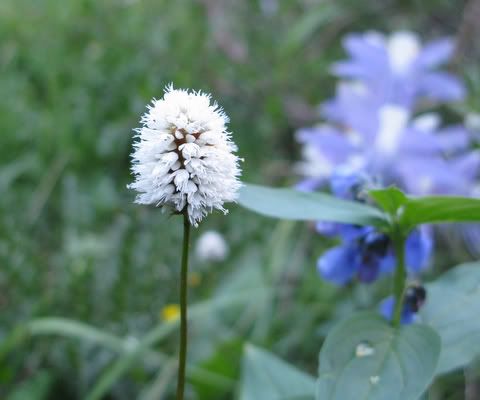
We did get a chance to see some beautiful flowers on the way down.
I call the white one the Q-tip flower. Does anyone know the name of it?
Back close to the trailhead, there is a green meadow that opens up and has a great view of blanca. It's one of my favourite pictures.
All in all it was a great hike. I would highly recommend it. Hopefully some of these pictures will entice others to head south!
We got back to the trailhead and headed off to our next destination - South Colony Lakes. I had a rematch with Humboldt to attend to! I won't create a trip report for that one, but I do want to leave you with a few great pics from that trip! I was mesmorized!
Ok, I've filled my photo quota! Hope you all enjoyed.. Until next time!
~Tri
Nice report Rachel an it looked like a beautiful day. Thanks for the invite and sorry I couldn‘t go. Instead, I Did La Plata on Sunday (TR to follow soon). Once again nice report and beautiful pictures.
In regards to the flower question... 7/22/2008 1:17pm
You have found an American Bistort.
American Bistort - Bistorta bistortoides
American Bistort produces a solitary white flowers from small grass like stems. Usually once you have found one American Bistort, you‘ve found a meadow full of them. Look for them in sunny meadows and open hillsides.
I know...I‘m a bit of a dork but I hope I‘ve answered your question.
Thanks for all the work you put into the trip report Rachel! Just to point out for others, that ridge line from Blanca to Ellingwood is sooo cool with the overhang that looks like a stadium bowl. Hard to capture it in a picture but if you look close you can see it in a couple of the summit shots. So far for our group that was the most challenging ridge we have climbed and incredibly fun.
On making it, where fatigue and exposure turned us around! We played it safe at that muddy pool in late May, thus adding 6 miles to our route, which proved to be our undoing! Now that it‘s melted out, I can‘t wait for a re-match. Thanks for the nice photos.
How can anyone climb Lindsey and STILL have their hair look that good on the summit? I refuse to climb with you again until you get out of your tent with bedhead and take some summit pics !! You‘re making the rest of us girls looks bad.....
Just read your guys‘ TR - great job. I was intimidated by the ”mudhole” - looked worse there than in the photo, but you guys got thru it easy enough. So the ride saved work on my first 14er. The weather was great. Everyone on the mtn I talked to was great. The gulley did look awfully steep on the approach, but some rocks on the right side I didn‘t think were so bad - better than in the middle.
Great job! Nice to know I‘m not the only one with that takes-a-lot-of-pictures disease. I‘m headed up there this weekend so thanks for the info (especially that river crossing).
Jason - The pictures were taken with two cameras, a Canon G9 and a Canon Rebel xti. 10 - 22mm wide angle and 70 - 300mm zoom lens. The photostitch software came with the cameras.
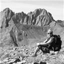
mtgirl - That's actually a running joke, since I usually take all the pics, I sensor out the bad ones of me. For that one decent shot there are 20 others of me looking pretty rough.. Kinda like this guy
Caution: The information contained in this report may not be accurate and should not be the only resource used in preparation for your climb. Failure to have the necessary experience, physical conditioning, supplies or equipment can result in injury or death. 14ers.com and the author(s) of this report provide no warranties, either express or implied, that the information provided is accurate or reliable. By using the information provided, you agree to indemnify and hold harmless 14ers.com and the report author(s) with respect to any claims and demands against them, including any attorney fees and expenses. Please read the 14ers.com Safety and Disclaimer pages for more information.
Please respect private property: 14ers.com supports the rights of private landowners to determine how and by whom their land will be used. In Colorado, it is your responsibility to determine if land is private and to obtain the appropriate permission before entering the property.