Download Agreement, Release, and Acknowledgement of Risk:
You (the person requesting this file download) fully understand mountain climbing ("Activity") involves risks and dangers of serious bodily injury, including permanent disability, paralysis, and death ("Risks") and you fully accept and assume all such risks and all responsibility for losses, costs, and damages you incur as a result of your participation in this Activity.
You acknowledge that information in the file you have chosen to download may not be accurate and may contain errors. You agree to assume all risks when using this information and agree to release and discharge 14ers.com, 14ers Inc. and the author(s) of such information (collectively, the "Released Parties").
You hereby discharge the Released Parties from all damages, actions, claims and liabilities of any nature, specifically including, but not limited to, damages, actions, claims and liabilities arising from or related to the negligence of the Released Parties. You further agree to indemnify, hold harmless and defend 14ers.com, 14ers Inc. and each of the other Released Parties from and against any loss, damage, liability and expense, including costs and attorney fees, incurred by 14ers.com, 14ers Inc. or any of the other Released Parties as a result of you using information provided on the 14ers.com or 14ers Inc. websites.
You have read this agreement, fully understand its terms and intend it to be a complete and unconditional release of all liability to the greatest extent allowed by law and agree that if any portion of this agreement is held to be invalid the balance, notwithstanding, shall continue in full force and effect.
By clicking "OK" you agree to these terms. If you DO NOT agree, click "Cancel"...
Mt. Bierstadt
Route: East Ridge (variation)
Trailhead: Mt. Evans road switchback at 13,300'
Starting Elevation: 13,300'
Summit Elevation: 14,060' (CO Rank: 38th)
Distance: About 7 miles
Elevation Gain: 3000'
Date Summited: 8/2/08
After getting my first taste of class 3 scrambling a few weeks ago on Castle, I couldn't wait to tackle Bierstadt/Evans/Sawtooth Ridge via the Tour of d'Abyss. My brother decided to join me for the first time since our failed attempt at Huron a year ago.
We left Denver at 4am and arrived at the trailhead at about 5:45am. The trailhead is located at the second major switchback after Summit Lake on the Mt. Evans road at about 13,300'. There was parking for a few cars right next to the road. With the sun rising above Denver and the plains behind us, we were on the trail at 6am. We didn't see another person until we reached Bierstadt's summit.
View of Mt. Evans road and the plains during sunrise.
First view of Bierstadt (left of center) and the Sawtooth Ridge.
The first part of this route requires descending about 1000' into a gully between Bierstadt and Evans that holds Abyss Lake. The descent was fairly steep and there was plenty of loose scree and talus.
The view down the descent of the gully beneath us.
The view from the gully of our descent.
Once we reached the gully, we stayed to the right of the small pond right in front of us. From the gully, we had some awesome views of Point 13,641', Mt. Bierstadt, Mt. Evans, and the Sawtooth Ridge.
View of Sawtooth from the gully.
Once we reached the end of the gully, the next step was to climb up to the ridge that led to Point 13,641'. This involved climbing up a steep incline directly to the ridge. This part of the hike was tough as it was about an 800' elevation gain in a short amount of distance.
Point 13,641. Our route took us straight up the grassier section on the left side.
Once we reached the ridge, the remaining route to Point 13,641 and Bierstadt was mostly class 3 scrambling with a few difficult class 2 segments. The route was mostly straight forward and easy to follow, even though there were very few cairns and no established trail. The climb was very enjoyable as the rock was solid, route finding was relatively easy, and the exposure didn't bother me. Whenever we were unsure of where to go, Bill's route description and pictures were very helpful in navigation.
Tom doing some scrambling.
Fun scrambling.
Point 13,641 with Bierstadt in the distance.
I think I found the scrambling to the top of Point 13,641 to be the most fun of the whole trip. Once we got to the summit of Point 13,641', the rest of the route became very visible. You could start to see people at the summit of Bierstadt, presumably from Guanella Pass.
The remaining route to Bierstadt from Point 13,641's summit.
Sawtooth and Abyss Lake from Point 13,641's summit.
The rest of the route involved more difficult class 2 terrain but was still mostly class 3 scrambling, especially the final pitch to Bierstadt's summit.
The final pitch to Bierstadt's summit.
We reached the summit at 9:30am and according to the register, we were about the 30th and 31st people to arrive that day (first from E. Ridge).
The east ridge (our route) from Bierstadt's summit.
It was my brother's first 14er summit (my 6th) and he seemed very content at the top. We loaded up on more water and food while I also enjoyed my new summit tradition, a Fat Tire.
Free New Belgium advertising on top of Beer-Stat!
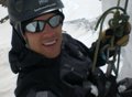
My brother and I on the summit.
As with every 14er summit, the scenery was beautiful. We stayed on top for a half hour before getting back on the trail toward the Sawtooth Ridge around 10am.
Sawtooth Ridge from just below Bierstadt's summit.
The descent down towards the Bierstadt/Sawtooth saddle was steep talus that made traveling slow. Depending on the route you took, the trail varied between difficult class 2 and class 3 down climbing. The main route along the ridge was well cairned.
As the Sawtooth inched forward, the remainder of the route appeared more daunting. The formations are really quite spectacular up front.
Close up of part of the Sawtooth from the saddle.
Once we reached the saddle between Bierstadt and the Sawtooth, my brother's endurance ran out. We decided to descend down the talus to Abyss Lake and return the way we came.
The blue line shows the recommended route for Bierstadt's east ridge. The green line shows our improvised route. The red line represents our intended route.
At this time, we also noticed some dark clouds were starting to head our way, so we tried to speed things up as much as we could. The entire route was above treeline, so there was nowhere to hide except the car. The route down to the Abyss Lake was slow as the talus was rather large and sometimes difficult to navigate. Once we reached the lake, we realized the route to the left wouldn't be much easier, but at least the scenery was very peaceful.
Abyss Lake
Once we passed the lake, we rejoined the trail recommended for the East Ridge descent. Then, we reached the part of the climb we were dreading, the 1000' ascent up to the car. By this time, both of us were starting to tire from the early start and miles of scrambling. Now we had to climb straight up a 1000' incline. We were taking breathers every three steps or so as our muscles were starting to tighten. It was definitely a mental game at this point.
After the long slug up the slope, we finally reached the car at 1:40pm. I've never done a hike that required such a drastic climb at the very end like that, so I was very relieved to be done. After a quick stop at Two Brothers in Idaho Springs, we were back in Denver shortly before 4pm.
The east ridge added a lot of excitement and difficulty to a peak that is considered to be one of the easiest to climb by it‘s standard route from Guanella Pass. It was terrific to take my brother to the top of his first 14er, the scrambling was fun, and the weather held out until after we got to the car. Not a bad day for an improvised route.
Thumbnails for uploaded photos (click to open slideshow):
Nice trip report! And well-timed for me - I plan on hiking the east ridge route (sans your variation) this Saturday.
I‘m hoping you can clarify a point for me: After dropping down the the gully, there is 1/3 to 1/2 mile hike across the basin to get to the base of the east ridge, is there a identifiable trail for this portion of the hike, or is this more of a pick-your-path section? Is there an identifiable trail up the 800‘ elevation gain to get up on the east ridge?
I don‘t want to look for a trail if there isn‘t one, or hike off-trail if there IS one.
There is no identifiable trail across the basin or up the 800‘ incline to the ridge. Stay to the right of the pond in the basin and head up the grassier section to the ridge. We zig zagged a litte bit, but for the most part it was straight up. Hope it helps, and have fun. It is a great route.
Caution: The information contained in this report may not be accurate and should not be the only resource used in preparation for your climb. Failure to have the necessary experience, physical conditioning, supplies or equipment can result in injury or death. 14ers.com and the author(s) of this report provide no warranties, either express or implied, that the information provided is accurate or reliable. By using the information provided, you agree to indemnify and hold harmless 14ers.com and the report author(s) with respect to any claims and demands against them, including any attorney fees and expenses. Please read the 14ers.com Safety and Disclaimer pages for more information.
Please respect private property: 14ers.com supports the rights of private landowners to determine how and by whom their land will be used. In Colorado, it is your responsibility to determine if land is private and to obtain the appropriate permission before entering the property.


")
")
")
")
")
")
")
")
")
")
")
")
")
")
")
")
")
")
")