Download Agreement, Release, and Acknowledgement of Risk:
You (the person requesting this file download) fully understand mountain climbing ("Activity") involves risks and dangers of serious bodily injury, including permanent disability, paralysis, and death ("Risks") and you fully accept and assume all such risks and all responsibility for losses, costs, and damages you incur as a result of your participation in this Activity.
You acknowledge that information in the file you have chosen to download may not be accurate and may contain errors. You agree to assume all risks when using this information and agree to release and discharge 14ers.com, 14ers Inc. and the author(s) of such information (collectively, the "Released Parties").
You hereby discharge the Released Parties from all damages, actions, claims and liabilities of any nature, specifically including, but not limited to, damages, actions, claims and liabilities arising from or related to the negligence of the Released Parties. You further agree to indemnify, hold harmless and defend 14ers.com, 14ers Inc. and each of the other Released Parties from and against any loss, damage, liability and expense, including costs and attorney fees, incurred by 14ers.com, 14ers Inc. or any of the other Released Parties as a result of you using information provided on the 14ers.com or 14ers Inc. websites.
You have read this agreement, fully understand its terms and intend it to be a complete and unconditional release of all liability to the greatest extent allowed by law and agree that if any portion of this agreement is held to be invalid the balance, notwithstanding, shall continue in full force and effect.
By clicking "OK" you agree to these terms. If you DO NOT agree, click "Cancel"...
The one thing I've learned since I began ultra running back in 2006 is that physically any route is possible, nothing is too long or too arduous, once the training is there it's all a mental game. Since moving to Colorado the Chicago Basin 14ers have been high on my list of "To Dos", and after reading reports about dayhiking/running them from Purgatory I became even more intrigued by this route. To my knowledge there are only 3 people who have completed this dayhike; John Prater did so in July 2008 in 14:05, Matt Mahoney in 22:03 in 2003, and Jim Nelson's FKT(Fastest Known Time) of 13:30 in 2006. The summer of 2008 was lining up to have no races between June and mid September, leaving a lot of time for adventure training runs, and this was quickly put on the calendar for mid August. Finding someone to join me was a more difficult task as my regular back country running partners were either running Leadville or Pikes Peak and would not be rested to make an attempt at this. Finally I talked with my friend Matt who is trying to climb as many 14ers this summer as he can, it was set, we'd leave Aug 21st for an attempt at the 3 peaks on Aug 22nd.
Running the Rivers
We arrived at the trailhead just after 10pm on Thursday evening after a long drive from Boulder, quickly packed up some gear and bedded down along side the road for a few hours of sleep. The alarmed blared at 2:40am, we both groggily rolled over and began to ready ourselves for the long day ahead. 4000+ calories, check, 2L of water, check, survival gear and light clothing, check, camera, double check. We were off jogging down the Purgatory Flats trail at 3:11am with our flashlights lighting the way. After a quick wrong turn detour in the meadow we were back track heading down into the Animas River gorge(there are two major spur trails in the first mile and a half, stay right at both). The trail travels through the flat valley before climbing a few hundred feet up away from the river, finally dropping down to the Animas River at 7700ft in a series of steep switchbacks.
After crossing the suspension bridge at 4:21am I started up the slow ascent to Needle Creek(I'd lost Matt on the technical downhill up higher). I ran/walked up the Animas River on mostly good trail, with some randomly interspersed sections that were overgrown with brush. In the dark the only sound was the gurgling of the Animas flowing off to my left. I trotted slowly up the trail, finally crossing Needle creek on the bridge and arriving at the Needle Junction, almost 12miles into the day at 5:33am. From the junction I began a brisk powerhike up the trail, only broken by the occasional jog through a flat or downhill section. The trail climbs continuously up Needle Creek, which I finally began to get glimpses of as light filled the sky just after 6am. The creek cascades down the valley in giant steps, flowing over granite slabs and dropping off cliffs. As I neared treeline the views on all sides opened up to spectacular rocky peaks jutting out of the valley. When I arrived at the campsites near treeline I got my first glimpse of the upper reaches of Chicago Basin and the incredibly steep climb that leads to Twin Lakes. I finally reached the Twin Lakes/Columbine Pass Junction at 7:46am, already behind schedule.
Looking back from high in Chicago Basin
Ascending toward Eolus(SW basin)
The infamous "Catwalk" on Eolus
Climbing the Peaks
The steep climb up from the junction showed that I wasn't truly recovered from the past two weekends on Nolans and at Leadville, as I trudge up the steep trail. I finally topped out at the outlet to Twin Lakes and made the hard left into Eolus's SE bowl. The trail up the bowl was good and snow was not an issue this late in the season. I made my way up to the slabs, turning right to follow a broad ledge back to the North, and finally turning back to the West and ascending to the Eolus saddle. From the saddle I got a great view of the infamous "Catwalk" over to Eolus's summit. I sped across the bridge, the "Catwalk" is way over-hyped in my opinion, as I never found any exposed or scary terrain. Once across the "Catwalk" I followed the standard route; traversing left around the initial difficulties onto the South side of the ridge, from where I scrambled up a series of sandy ledges to the summit, topping out at 9:21am. I was climbing much slower than expected and knew any shot at the FKT was long gone. I got Matt on our radios and let him know I was atop Eolus, he was ascending the steep slopes up toward Twin Lakes. After a quick snack I took off back down the south slopes then back to the "Catwalk", making quick work of this section. From the saddle it's a short scramble to the top of North Eolus where I found myself at 9:50am.
View from Eolus's summit, Purgatory is VERY far away(white cliffs in the distance)
Panorama from the summit of Eolus, Sunlight/Windom on the right
Looking back at Eolus from Sunlight
I quickly scrambled down North Eolus back to the trail where I made my way back in Eolus's SW basin. Here I met Matt climbing up, moving well, but also feeling the same lingering fatigue on the initial climb up, it was going to be a long day. I jogged across the traverse back to Twin Lakes, where I grabbed some more water and headed up the use trail toward Sunlight and Windom. Once again the fatigue in my legs really slowed my progress as I ascended into the basin. I followed the creek up toward Sunlight, finally turning off just before a bright orange gulley that led up to the saddle SE of Sunlight Peak. The gulley was a horrific ordeal, filled with steep gravel, loose rock, and scree. I slowly picked my way up the hillside trying any stable footing possible, this was a real challenge. When I finally reached the ridgeline and the rock I was ecstatic to be one something solid. I scrambled around the South side of the ridge up a chimney and under the chalk stone. Once through the gap the summit block came into view, a short scramble found me standing at the base of a 15ft slab then two big steps that led to the summit block. I quickly scampered up the slabs then paused to see the "exposed" step that is so talked about. It was really only a 20-30ft drop for the first step, which I pulled myself up, then a quick mantle onto the small summit block at 11:47am. The North side of the summit blocks drops very quickly and will get the heart pumping. I then gently lowered myself from the summit, but the second step required a short "hop" as I could not lower myself the entire way. Another quick break to munch on some PB pretzels and I was off to Windom.
The rubble heading up Windom
Looking back at Sunlight Peak from Windom
I made my way back to the saddle below Sunlight, I made a descending traverse on the rock to a ledge that took me below Sunlight Spire toward the Sunlight/Windom saddle. A little bit of class 3 found me just below the saddle, staring up at the horrible slope that Windom's NW face. I clamored up the rock, passing under a few cliff bands before hopping onto some decent class 3/4 on the North side of the face. The rock wasn't bad, but did require some care due to all the lose crap intermixed with the solid holds. I made my way up the face finally cresting on the ridge approximately 100ft below the summit. The rock on the ridge was enjoyable and I soon found myself atop the final peak of the day at 12:57pm. I radioed over to Matt who was now on his way up the hellish orange gulley to Sunlight. We chatted for a minute, I gave him a few pointers on the ascent to Windom(not to follow me) and wished him good luck on Sunlight. I immediately started down Windom's West ridge following the use trail as it disappeared and reappeared amongst the rocks. This was much more enjoyable than the other terrain I'd seen that day and I soon found myself at Twin Lakes ready for the long jog home(back to the car) at 1:45pm. I radioed Matt on last time and told him I'd be going to radio silence, but would see him back at the car around 6-8pm. The trail down to the Columbine Pass/Twin Lakes junction came quickly, at last I was back on good trail at 2:01pm.
Looking down into Chicago Basin from near Twin Lakes
Looking back at up Chicago Basin on the descent
The Long Way Home
The trail down Needle Creek is an amazingly runnable trail and was a very welcome site. After maneuvering around a herd of mountain goats I breezed past the campsites and down into the trees. As I ran down the trail I passed many a backpacker who had just left the train and were heading into the basin for the weekend. Most seemed surprised to see me jogging downhill, though the ones who asked were even more dumb founded when I said I was running back to the trailhead, "what trailhead?" they'd ask. "Purgatory" I'd reply to blank stares, oh well off I go, it's a long way home and it was getting warm. I made great time down Needle Creek, arriving at the junction at 3:15pm, still feeling good despite being on my feet for 12h+ so far. I hung a left and back on the quiet trail along the Animas; just me, a few birds/squirrels, and the train chugging by. I ran most of the trail along the Animas, occasionally breaking for a short uphill. The sounds of the river were very calming and I set into a good rhythm, finally crossing the train tracks and arriving at the base of Cascade Creek at 4:38pm. I popped my last salt cap, took a Gu and hammered uphill, almost home. The climb up from the Animas was steep, but passed by quickly and I was back to traversing high above Cascade Creek. This section was very runnable so I started jogging quite a bit more, finally meeting up with Cascade Creek, where I was treated to a nice view of Engineer Mt. The river ascends very slowly in this section, and was a real joy to run along and before I knew it I popped out of the trees and into Purgatory Flats, SO CLOSE! I jogged through the meadow, past our wrong turn junction and finally up the final climb back to the car. I powerhiked the first section, then mustered up all the energy I had left and began to jog all the uphills. Finally I passed the trailhead login and stepped on to the road, at 5:53pm, 14hours and 42minutes after I'd started running earlier that morning. The Chicago Basin dayhike was a success, and while I was tired I was amazed at how much energy my legs had mustered during the final 15miles or good trail. Matt would arrive just before 8pm, pretty beat as well, but definitely excited at the success we'd had that day. The weather held perfect all day, our legs and bodies had carried us through all 42miles and 12000ft gain/loss(according to the GPS). This is a great run for those truly looking to push their bodies and see some amazing terrain. Some day I will return, with the FKT in the front of my mind, but today it was just great to be out their pushing myself and seeing some amazing terrain.
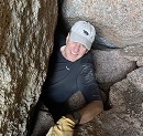
Crossing the Animas River bridge at Cascade Creek, a little disheveled, but feeling good.
Thumbnails for uploaded photos (click to open slideshow):
it was an epic day for sure. We used a steripen and chlorine dioxide tablets much smaller and lighter than a filter, just gotta live with the floaties(if yout take from the small streams the water is good up there).
As you might know, I naively set out in ‘05 with Matt M., hoping to do this in 24 hrs. Lingering snow kept us from any of the peaks, and we only put in about 31 miles--it still took over 17 hours. Your time is truly amazing. Congrats.
I've come back to it several times. Excellent beta.
And thanks for the pms earlier this season on the subject. I'm hoping to give it a shot at some point - though I'm figuring 18 hours, minimum, walking.
What a big day for you. Thats awsome that you can do this kind of stuff. Great JOB!
Caution: The information contained in this report may not be accurate and should not be the only resource used in preparation for your climb. Failure to have the necessary experience, physical conditioning, supplies or equipment can result in injury or death. 14ers.com and the author(s) of this report provide no warranties, either express or implied, that the information provided is accurate or reliable. By using the information provided, you agree to indemnify and hold harmless 14ers.com and the report author(s) with respect to any claims and demands against them, including any attorney fees and expenses. Please read the 14ers.com Safety and Disclaimer pages for more information.
Please respect private property: 14ers.com supports the rights of private landowners to determine how and by whom their land will be used. In Colorado, it is your responsibility to determine if land is private and to obtain the appropriate permission before entering the property.


")
")
")
")
")
")
")
")
")
")
")
")
")
")
")
")
")
")
")
")