Download Agreement, Release, and Acknowledgement of Risk:
You (the person requesting this file download) fully understand mountain climbing ("Activity") involves risks and dangers of serious bodily injury, including permanent disability, paralysis, and death ("Risks") and you fully accept and assume all such risks and all responsibility for losses, costs, and damages you incur as a result of your participation in this Activity.
You acknowledge that information in the file you have chosen to download may not be accurate and may contain errors. You agree to assume all risks when using this information and agree to release and discharge 14ers.com, 14ers Inc. and the author(s) of such information (collectively, the "Released Parties").
You hereby discharge the Released Parties from all damages, actions, claims and liabilities of any nature, specifically including, but not limited to, damages, actions, claims and liabilities arising from or related to the negligence of the Released Parties. You further agree to indemnify, hold harmless and defend 14ers.com, 14ers Inc. and each of the other Released Parties from and against any loss, damage, liability and expense, including costs and attorney fees, incurred by 14ers.com, 14ers Inc. or any of the other Released Parties as a result of you using information provided on the 14ers.com or 14ers Inc. websites.
You have read this agreement, fully understand its terms and intend it to be a complete and unconditional release of all liability to the greatest extent allowed by law and agree that if any portion of this agreement is held to be invalid the balance, notwithstanding, shall continue in full force and effect.
By clicking "OK" you agree to these terms. If you DO NOT agree, click "Cancel"...
Stats (as reported by motionbased.com after uploading my track logs):
Backpack into camp (with a little searching for a site): 1.75 miles, 1:13, elevation gain 934'
Ascend Crestone Peak from camp: 3.9 miles, 3:37, elevation gain 3422'
Traverse Peak to Needle: .95 miles, 3:25, elevation gain 812'
Descend Needle to Broken Hand Pass: .51 miles, 1:26
Ascend Broken Hand Peak and descend to camp: 2.7 miles, 2:50, elevation gain 930'
Backpack camp to TH: 1.56 miles, 0:39
Totals
Elevation gain: 6098' (5164' on Saturday)
Mileage: 11.37 miles
Summits: 4 (Crestone Peak, Crestone Peak East, Crestone Needle, Broken Hand Peak)
Total time: 12 hrs 24 min (including breaks, not including TH 2 camp)
Ok, I first must apologize if there are too many pictures in this report (I think I have a disease). I whittled it down to these from over 500. Ok, on to the report.
It all started when we did Capitol back in July. Some other hiker friends were doing Crestone Peak that weekend. After we finished Capitol, we started thinking about the Crestone traverse. After reading trip reports, we decided doing the Peak-to-Needle traverse was the way to go. It also worked out better, because Ben has already done the Needle and if we had to turn back after doing the Peak, he'd at least have climbed that. Our other hiker friends planned to do the Needle on this Saturday and if Ben and I didn't get the Needle, I'd be able to do it with them. So, the plan was set. Ben and I wanted to leave on Thursday afternoon so that we could get a nice campsite at the South Colony Lakes. We were all set, when out of the blue, Ben sends me a message on Wednesday saying he isn't feeling too great and is going home from work. So much for plans. Now, I was trying to figure out the other possible options, including if my Outback would make it up the road. Lucky for me, Ben called me Wednesday night and said he was feeling much better and would be ready to go.
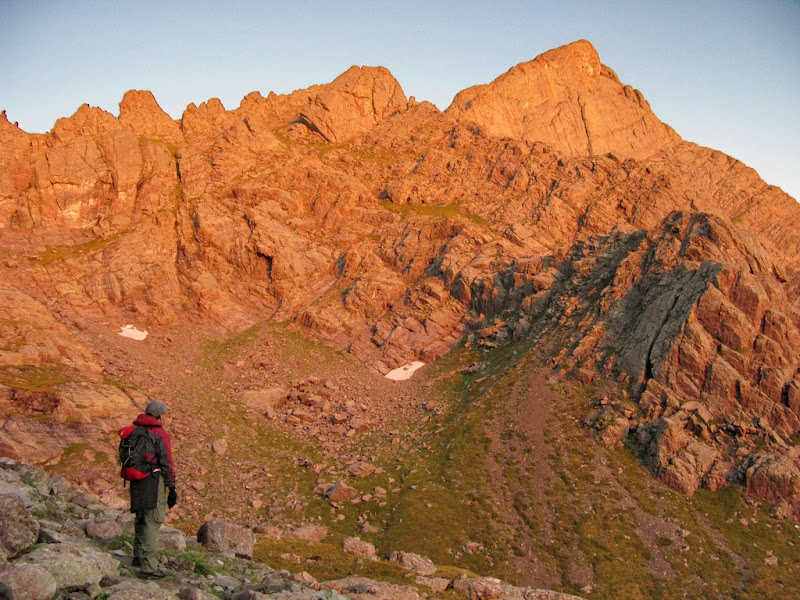
Thursday, 8/21/08, we left work approximately 2:45 PM and headed for Westcliffe. We ran into a little bit of construction (one lane road) on 115 and then got behind a semi carrying an extra heavy load coming out of Florence, so we finally got to the Westcliffe Subway about 5:15 PM. We grabbed some subs and the guy graciously offered to split the subs in half and keep the condiments off half of it so that we could pack it in without the bread becoming a mushy ball of dough. We headed down the road to the South Colony Lakes Road and had finished half our subs by the time we reached the rough part of the road. Here's a pic of the ridge between the Peak and Needle from the road leading to the South Colony Lakes road. Ben's Bronco II had no trouble with the road and we noticed that they were building some improved campsites, complete with fire rings and tent pads, on the lower part of the road. We reached the end of the road at about 6:20 PM and pulled our packs out of the truck for the trip up to the lakes.
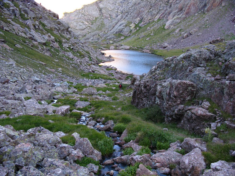
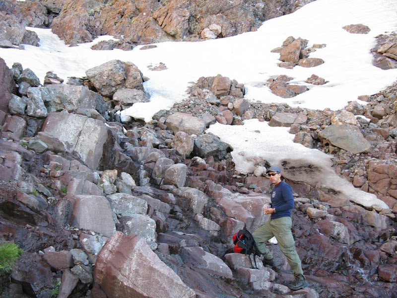
We were just about ready to go when I noticed water on the ground near my pack. At first, I thought I put my pack in an existing puddle, but when I moved it, the reality was that the water was coming from my pack. My 3 liter bladder must be leaking. Frantically, I opened up the pack and pulled out stuff to get at the bladder to find out that the hose had become unattached from the bladder and nearly all of the 3 liters had emptied into the bottom of my pack. I took the other stuff out and poured the remaining water out of the pack. The hip pads were completely soaked. We figured the best thing to do was to get up to camp as quickly as possible and pull stuff out then and hang it up to dry. We left the TH at 6:40PM.
About half way up, we thought maybe we should have taken my sleeping bag out and hung it on the outside of my pack somehow to dry it out on the way up. I figured at this point, it's better to just get to camp fast. I hurried up the trail at a fairly brisk pace and reached the junction of the trail to the Needle and the trail to Humboldt only to find that some others had taken the spot we were hoping to get. We spent a little time going further up the Humboldt trail in search of a site and finally settled on a site just to the South of the junction. It was nice and better protected from the wind. I quickly pulled out my rope and had a clothes line strung up between 2 trees on the North side of the site where the wind seemed to be coming through. I pulled out my sleeping bag to find that the nylon stuff sack had kept most of the water from reaching the bag. Whew, that was a relief. I hung it up to dry the rest of the way and the only other things that were wet was my tent (no big deal), and the shirt and shorts I had worn up since the pads on my pack were soaked. I changed clothes and hung out the wet stuff to dry. By the time I had my tent set up and self-inflating pad blown up, my sleeping bag was dry and my clothes were nearly dry.
It was nearly dark and we needed our headlamps to hike down to the stream to filter water. We made it back to camp and watched the cloudless skies darken and the bright stars become visible. It was a beautiful night for star gazing as the moon wouldn't rise until after midnight. The Milky Way was clearly visible. We made plans to wake up at 5:00 AM and to start hiking by about 5:30 AM.
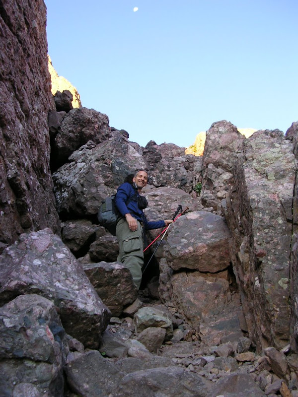
Friday, 8/22/08, 5:00AM. I had actually gotten some sleep (a rarity for me in the outdoors) until about 1:20 when I kept waking up about every hour until 04:20, when I was checking my watch every 10 minutes. I finally got out of my tent about 4:55 AM. It was a beautiful morning and despite the fact that there wasn't a cloud in the sky, it wasn't that cold. I checked for Ben. He was awake, but not out of his tent yet. Ben started his stove and made some hot cider to go with his breakfast. I had some poptarts and an oatmeal bar. We put some sunscreen on and geared up for the day and hit the trail about 5:45 AM. The trail up to Broken Hand Pass is well marked and for the most part easy to follow. The sun wasn't quite up yet, but it's rays were lighting up the sky and headlamps weren't necessary. Here's a shot before the alpenglow hits the Needle with Ben next to one of the large cairns marking the route.
And one just 7 minutes later with the alpenglow.
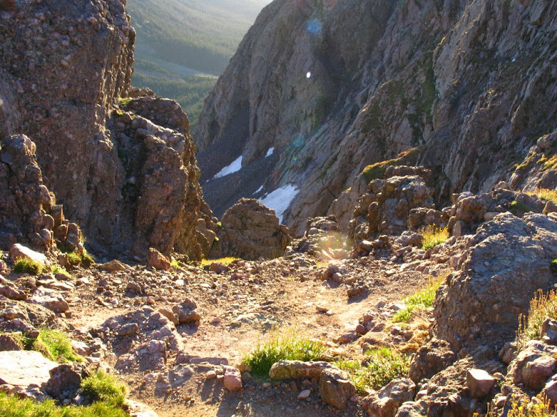
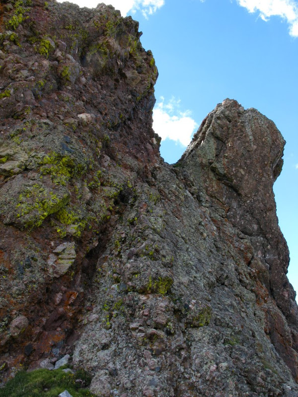
The only climbing required to get to the pass was around a fin. We went to the left.
Looking back down from Broken Hand Pass.
And looking down towards Cottonwood Lake.
The trail as we near Cottonwood Lake.
There was quite a camp set up for the trail workers here at the West end of the basin.
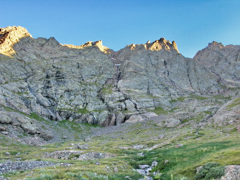
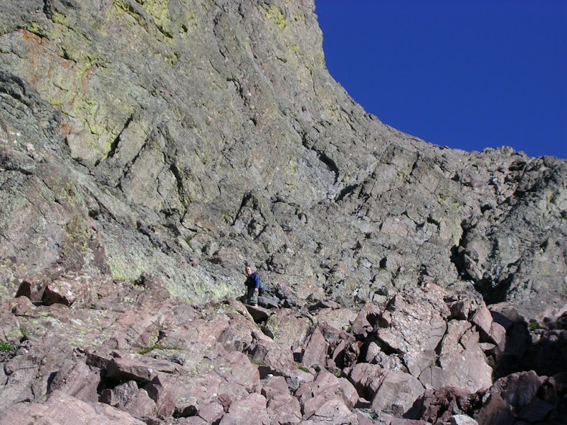
As you near the West end, the trail turns to the North and you can look straight up the red/south gulley.
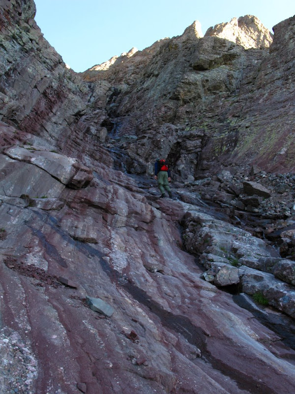
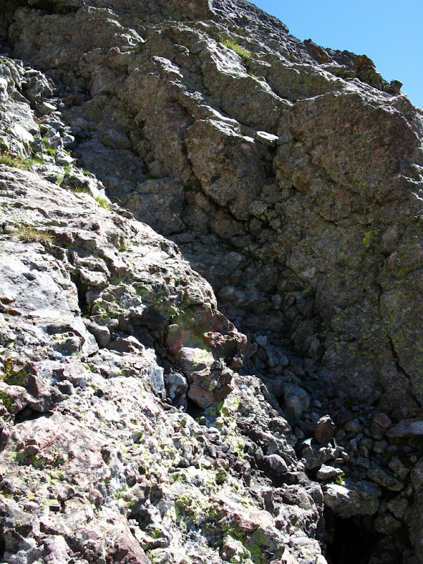
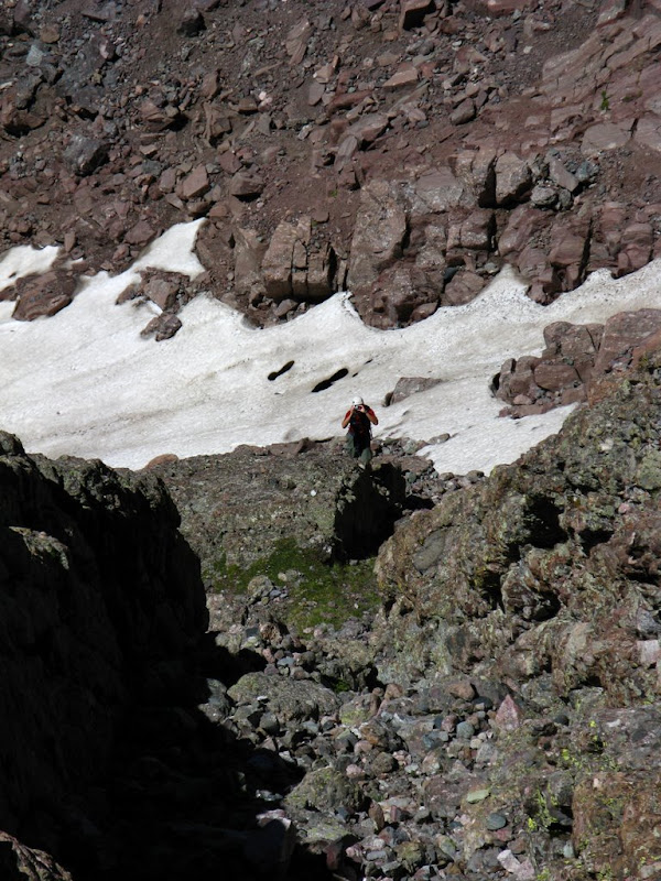
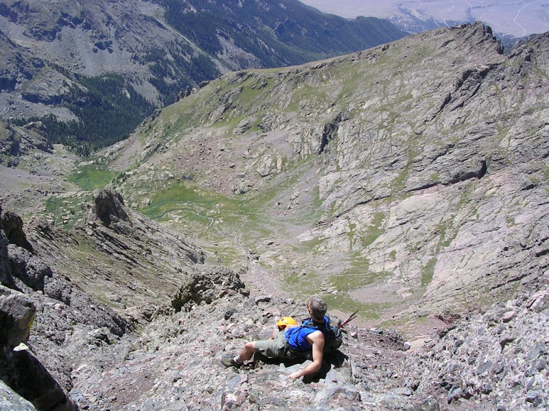
The gulley is where the route really gets steep. ~ 2000' in .5 mile. The route is pretty straight forward, just follow the gulley. We stuck to the climber's left.
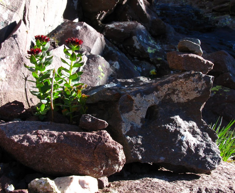
Here's a very small cairn that we happened to see. I think it was marking the flowers.
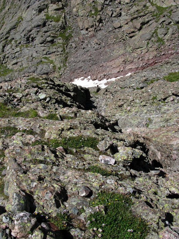
We took a short break at the base of the snow. Ben re-filled his hydration pack since he was drinking a lot of water. The snow was easily avoided on the climber's left.
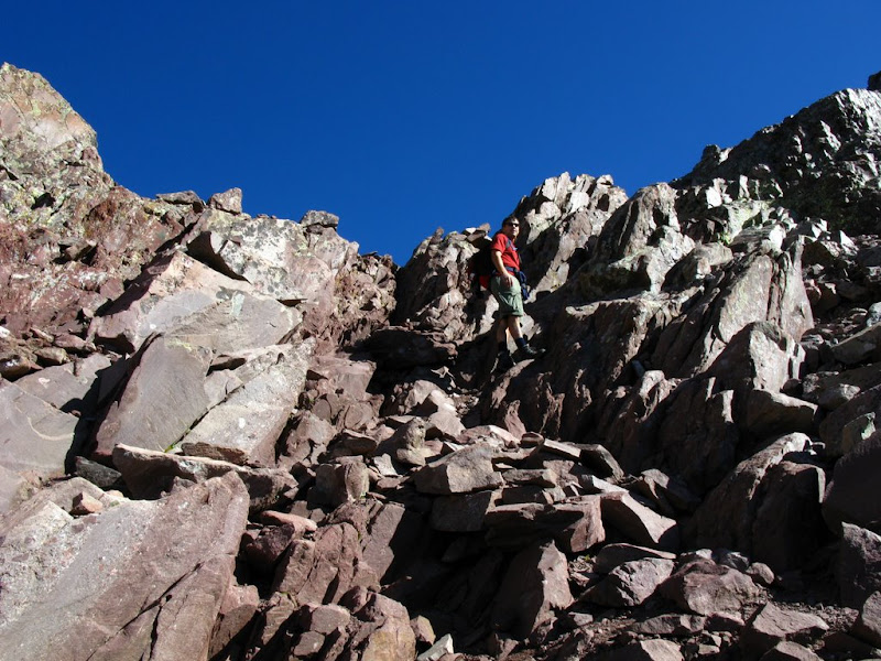
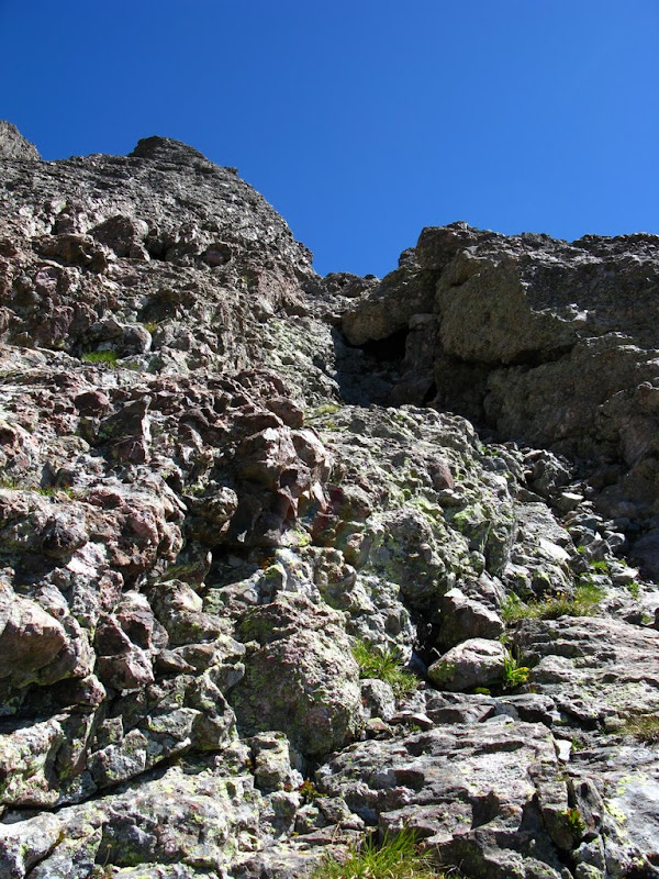
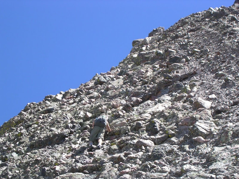
The gulley required scrambling, but didn't feel loose or dangerous. Me nearing the top of the gulley.
And Ben getting closer after some scrambling.
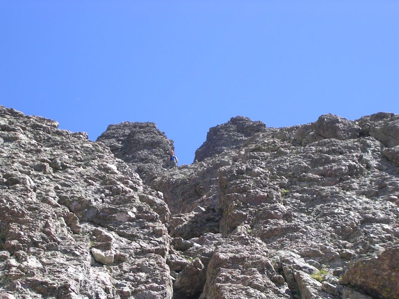
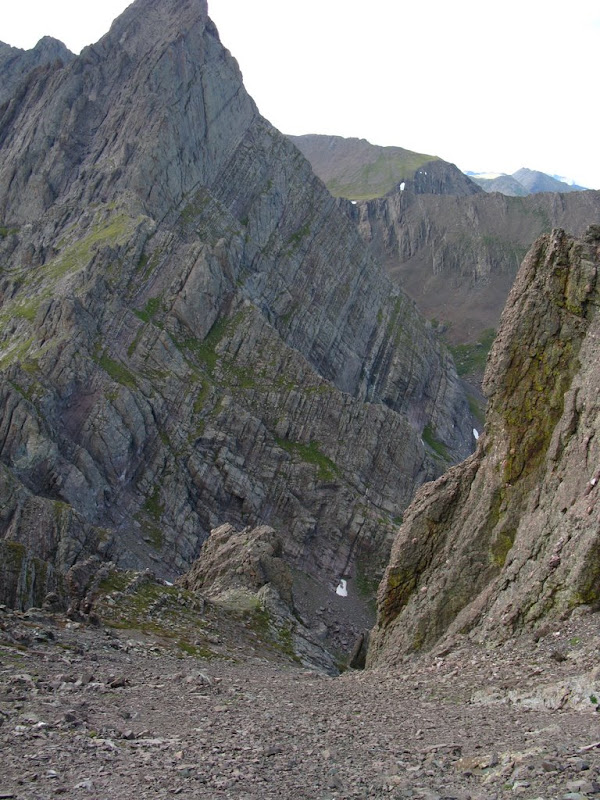
And we finally reach the top of the gulley and the notch between Creston Peak and East Crestone Peak.
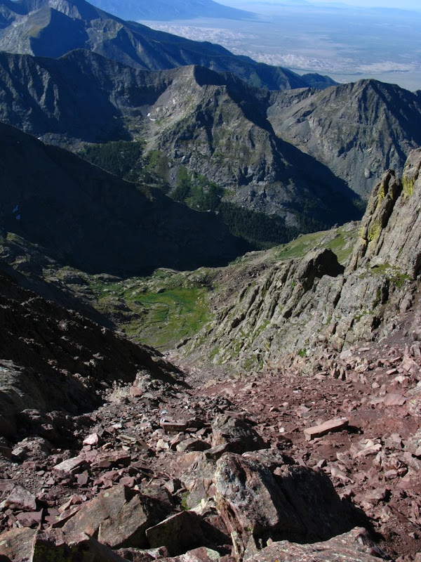
And here's looking all the way back down the gulley from the top. You can barely see the trail worker camp.
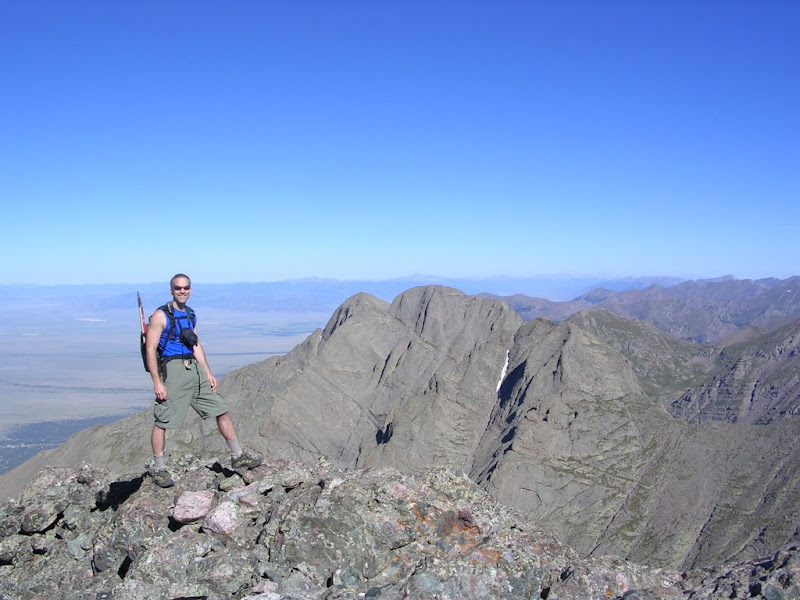
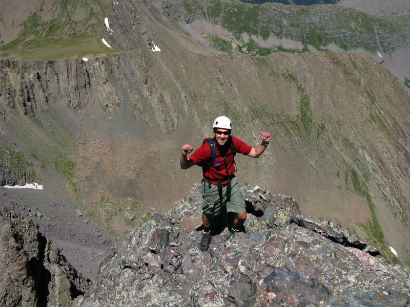
I reached the summit first and Ben was right behind at about 9:30 AM.
A summit shot of me with the Challenger and Kit Carson behind me.
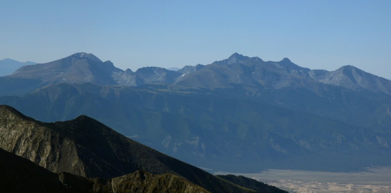
A closeup of Challenger and Kit Carson. The Kit Carson Ave is very visible from here.
A zoomed in shot of Lindsey, Iron Nipple, Blanca, Ellingwood, and Little Bear to the south.
We had the summit to ourselves. Ben hanging out on the west edge of the peak.
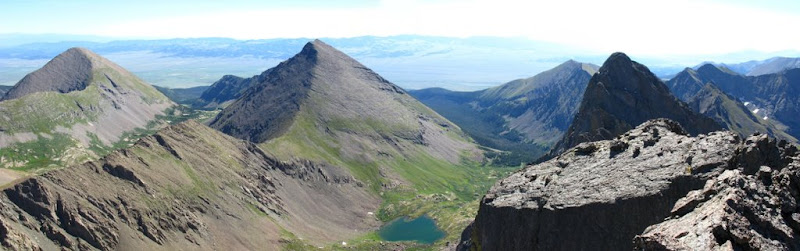
After about 30 minutes, we started down and the trail workers were on the last pitch to the summit. We passed them and went over to climb the East peak. From here, the view of Humboldt and the larger upper South Colony Lake is unobstructed.
And here's a zoomed in shot of the Needle.
The trail workers were being extra careful. Here's a closeup of them reaching the summit.
Again, the weather was beautiful, so Ben decided to see if it was an easy climb out to that slab to the East of the East peak. This was as far as he went.
We then started down the gulley and Ben thought the left (East) side looked pretty good. He took a few steps and let loose a few rocks. We both yelled rock loudly as there were 2 hikers coming up the gulley. Nobody was hit. Ben decided coming over to the West side of the gulley (the climber's left) was a better option. A few minutes later, we met the ascending climbers and after apologizing, we put on our helmets as they would now be above us.
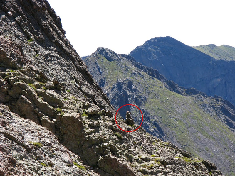
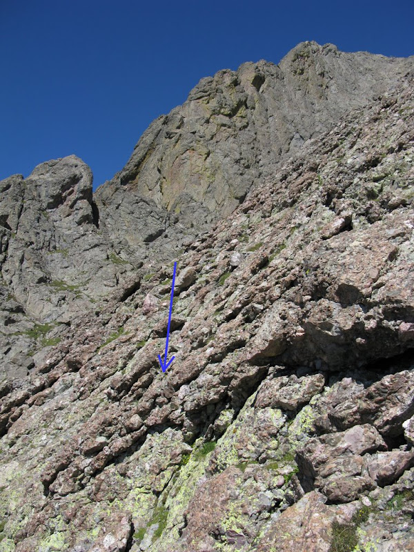
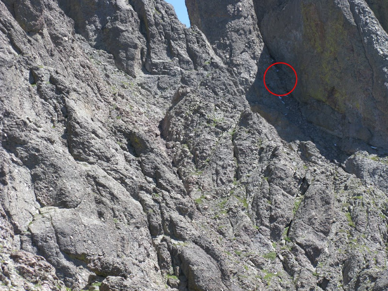
On the way up, we had seen 2 cairns that we believed marked the travers and we noted the elevation at about 13250'. My GPS altitude didn't seem to be very accurate on the way down and at about 13650', I climbed up the East side of the gulley to take a look and I saw a cairn down below and to the East.
A zoomed in shot of that same cairn.
I told Ben, but he decided he would go lower and try to find the other cairns that we saw on the way up. I remember reading that there was an upper and lower start to the traverse, so I figured we'd meet up shortly. I had to cross this gulley at first it looked impassable - looking down
But, then I looked up and saw this climbable spot about 20' above me
And here's the rest of the gulley looking up
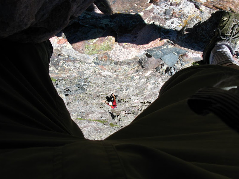
I reached the cairn and could spot the traverse to the East. Ben was still going down the gulley and I backtracked a little to make contact. Here's Ben way below near the top of the snow
And a zoomed in shot at the same spot
And a zoomed in shot from Ben's camera of me.
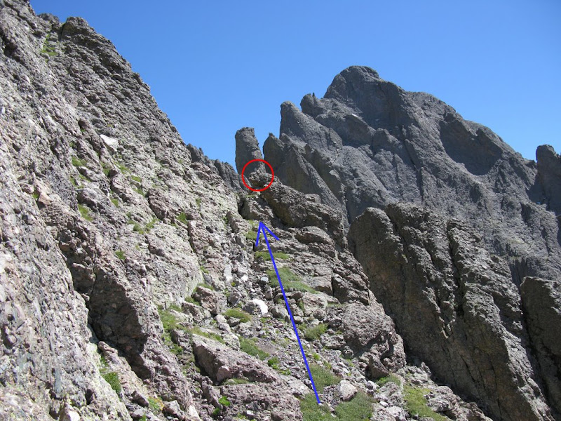
That way up looked a little too technical, so Ben and I agreed to meet a little to the East where I could see the next cairn marking the traverse. I reached the cairn in about 5 minutes and waited for Ben. Here's some pics of the route I took.
and the cairn I reached (has my orange helmet on it)
It was very steep here and I couldn't see over the ridge between me and Ben. I yelled, but got no response. After another 15 minutes, Ben finally yelled up and I could see him still way below me.
I told him I was sure I was on the traverse and that he needed to come up. Ben worked his way up and about 10 minutes later we were rejoined. The route to the next cairn was on this grassy ledge.
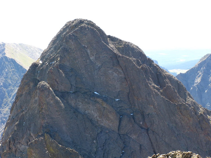
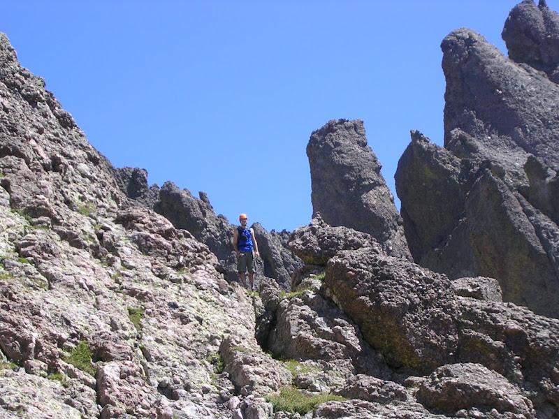
Basically, once you can see the black gendarme, you just keep going towards it.
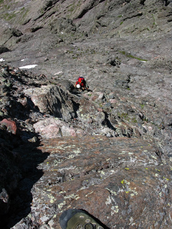
As I reached the next cairn, I took this shot looking back. Ben is on the route.
The next cairn is just ahead following the grassy ledge.
Ben coming across this section of the traverse.
And one of me standing next to the cairn. This is the cairn you can see if doing the traverse in the other direction.
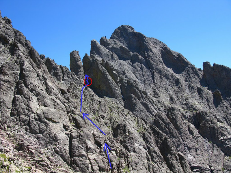
Our route from the cairn to the gendarme is shown in this pic.
A view looking back.
Ben climbing part of the route where you can't quite see the gendarme - just climb it!
Ben reaching the top.
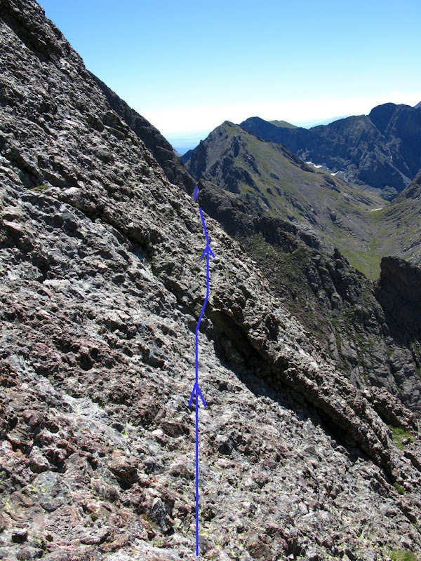
And the gendarme is still our current goal. I also circled the crux of the route at the top of the needle.
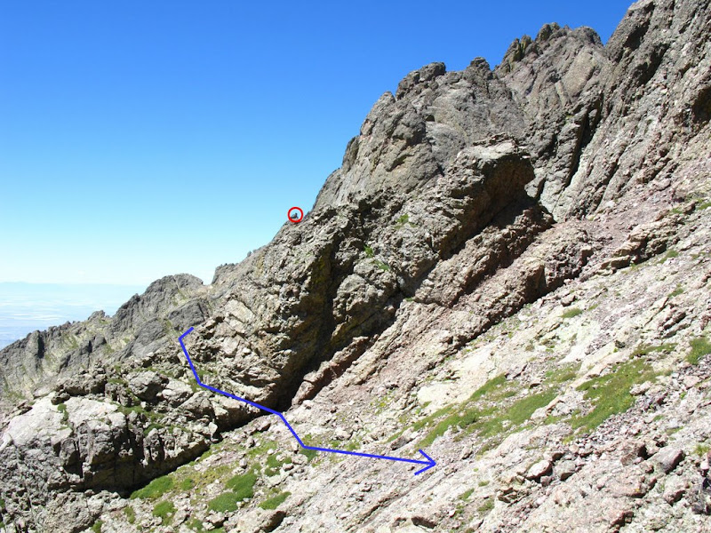
Here's looking back. The cairn is circled in red. The gulley that we climbed is behind that ridge where the blue route line disappears.
Finally, we reach the gendarme.
Ben first tried to go straight up over the crux at the bottom of the gendarme. Here's the video.
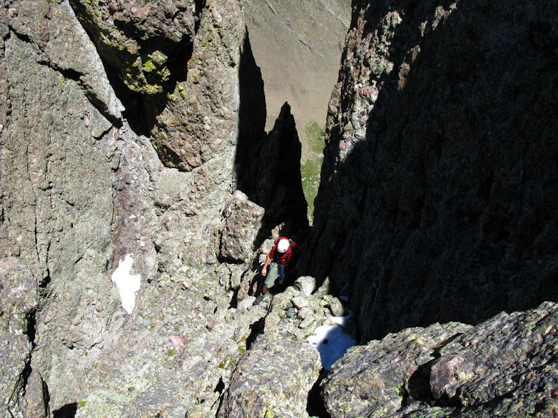
I then went up to the left and traversed over to the narrow gulley on the right side of the gendarme and Ben followed. Here's Ben making the final move to get on top of the crux and into the gulley.
Next, we climbed to the top and did the u-turn. I climbed up the narrow, slightly exposed ridge, and Ben followed.
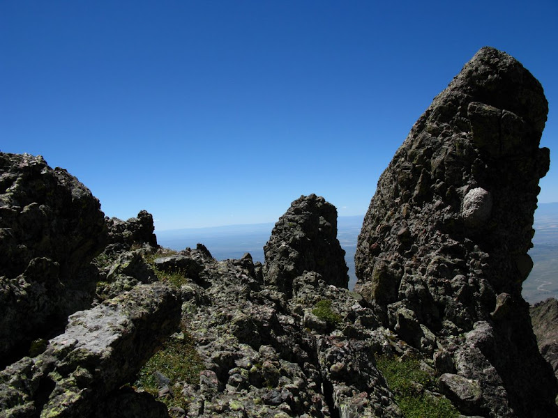
Here's the view of the top of the ridge.
And we're not done yet. Here's the traverse from here -- that's down, then across, then up that next gulley.
Ben on the traverse part.
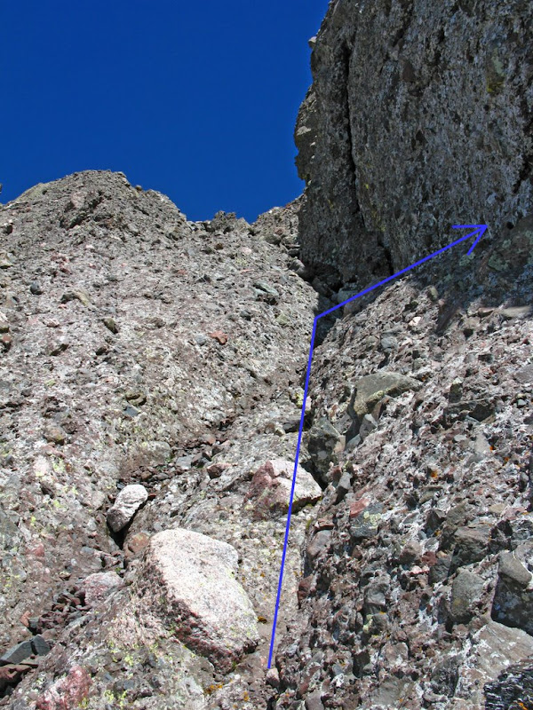
And the gulley to climb. Take a right before you get to the top
And here's me taking in the view on this part.
After you take the right, you come to the last pitch up to the needle -- the crux of the entire traverse! Me on the traverse (slightly zoomed in). You can see the cat-ear shaped rocks at the top of the crux. I went nearly straight up towards them. You can pretty much pic your route here, just test every hold.
I stopped part way up to take a few pics of Ben through my legs.
And here's what I had left.
As I reached the top, I took a few more pics as Ben climbed nearly the same route, but then traversed to the left about half way up.
And a video of Ben making the final moves and the traverse from above.
Ben was ecstatic (or relieved) as he completed the crux.
Shot of me on the summit. Woohoo!
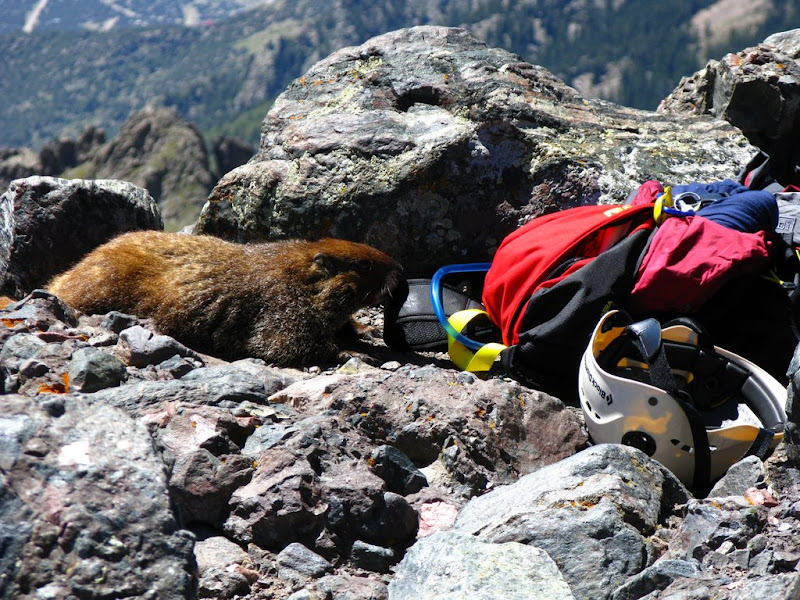
Again, we had the summit to ourselves and were taking a break when this marmot decided to go after Ben's pack.
We chased him away when he started to chew on the hydration tube. But, he came back just before we left to pose for this pic.
A zoomed in shot from the top of the needle of where we camped.
We took a combination of the east and west gulley down the Needle back to Broken Hand Pass. We noticed that many of the cairns had been marked with a pink ribbon which will hopefully help people from getting lost on their way down. We had no trouble.
As we reached the pass, we met up with two other climbers that we passed on our way down the Peak (the ones Ben almost be-knighted). As there was no weather in the near future, I decided to go up Broken Hand Peak, but the others were already quite beat. It was ~3:15PM and I figured this summit would be fairly easy. I didn't have a route description, but I saw a faint trail leading up from the pass and decided to follow that.
As I started to climb again, I realized that I didn't have quite as much energy as I thought. A shot of Humboldt and one of the South Colony Lakes from about half way up to Broken Hand Peak.
I reached this rock rib blocking the route along the ridge and didn't feel like going down to get around it. So I climbed straight up towards that notch.
As I was downclimbing the other side, I must have went to the North, very exposed side, of the rib. I took a few moments to assess the situation and then figured it was only about 30' and I couldn't see another way down from where I was. In hindsight, I should have went back up to the notch and climbed diagonally down to the left as it was much less exposed. I took this pic after I was down -- I was on the right edge of this pic.
Oh well, the rest of the route up Broken Hand Peak was uneventful, but it did have a fun little scramble to reach the summit from the South side.
And I reached the summit and signed the log. The last person to sign the log before me was on 8/8.
On my way down, I thought I'd go down this scree and loose rock gulley to save time and to avoid that rock rib. This was a big mistake. After descending a couple hundred feet, the gulley cliffed out.
In the middle of attempting to downclimb the 30' cliff, I had to pause to reassess my situation. Below me was more of the loose rock gulley and about 100' down, it appeared to cliff out again and I couldn't tell if I could downclimb that as I couldn't see it. I ran out of good foot holds about half way down and decided not to jump because I wasn't sure I could actually get out down below. So, I climbed back up and did some class 4 climbing up some loose flaky rock to get up the west ridge and then downclimbed the other side to get back to the trail on the North side of Broken Hand Pass. From there it was just simply following the trail back to camp. Ben was relaxing with a beer out near the trail and was wondering where I had been. We shared a beer and celebrated the triumphs of the day.
It was a long day and our friend's Brian and Kent were coming up tonight about 7 PM. They arrived a little after 7 and we had to help Kent engineer some support for his tent as he unpacked it to find out he didn't have any stakes or poles. Luckily, we had several ropes and bungee cords to rig it. Also, lucky for him and his friend Jason, it didn't rain.
Brian, Kent, and Jason were going to attempt Crestone Needle on Saturday. I planned on doing Humboldt and Ben planned on fishing. Our plans all worked out and I was back at camp as Ben was just starting to pack up his gear. I packed up my gear and Ben and I left for the TH about 12:35 PM. We reached the TH about 40 minutes later, packed up the truck, and headed down the bumpy road.
We stopped in Westcliffe at The Mining Co Restaurant for some pleasant service, pretty darn good burgers, and some great fries. I'd definitely recommend it.
Here's the topo map with the track log on it
And the rest of the pictures (and 2 summit videos) are at )
Thumbnails for uploaded photos (click to open slideshow):
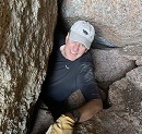
This is yet more proof that I am not a real man. Oh well, the Needle gave me at least some sense of accomplishment. Great trip report Randy. How come Ben is always behind you in all the pictures??? Maybe he figured he could catch you if you fell.
Oh, and thanks for telling the world about my MacGyver tent!
I figure some who read your report might like a picture to understand the phenomenal engineering skills we possess...
Caution: The information contained in this report may not be accurate and should not be the only resource used in preparation for your climb. Failure to have the necessary experience, physical conditioning, supplies or equipment can result in injury or death. 14ers.com and the author(s) of this report provide no warranties, either express or implied, that the information provided is accurate or reliable. By using the information provided, you agree to indemnify and hold harmless 14ers.com and the report author(s) with respect to any claims and demands against them, including any attorney fees and expenses. Please read the 14ers.com Safety and Disclaimer pages for more information.
Please respect private property: 14ers.com supports the rights of private landowners to determine how and by whom their land will be used. In Colorado, it is your responsibility to determine if land is private and to obtain the appropriate permission before entering the property.


")