Download Agreement, Release, and Acknowledgement of Risk:
You (the person requesting this file download) fully understand mountain climbing ("Activity") involves risks and dangers of serious bodily injury, including permanent disability, paralysis, and death ("Risks") and you fully accept and assume all such risks and all responsibility for losses, costs, and damages you incur as a result of your participation in this Activity.
You acknowledge that information in the file you have chosen to download may not be accurate and may contain errors. You agree to assume all risks when using this information and agree to release and discharge 14ers.com, 14ers Inc. and the author(s) of such information (collectively, the "Released Parties").
You hereby discharge the Released Parties from all damages, actions, claims and liabilities of any nature, specifically including, but not limited to, damages, actions, claims and liabilities arising from or related to the negligence of the Released Parties. You further agree to indemnify, hold harmless and defend 14ers.com, 14ers Inc. and each of the other Released Parties from and against any loss, damage, liability and expense, including costs and attorney fees, incurred by 14ers.com, 14ers Inc. or any of the other Released Parties as a result of you using information provided on the 14ers.com or 14ers Inc. websites.
You have read this agreement, fully understand its terms and intend it to be a complete and unconditional release of all liability to the greatest extent allowed by law and agree that if any portion of this agreement is held to be invalid the balance, notwithstanding, shall continue in full force and effect.
By clicking "OK" you agree to these terms. If you DO NOT agree, click "Cancel"...
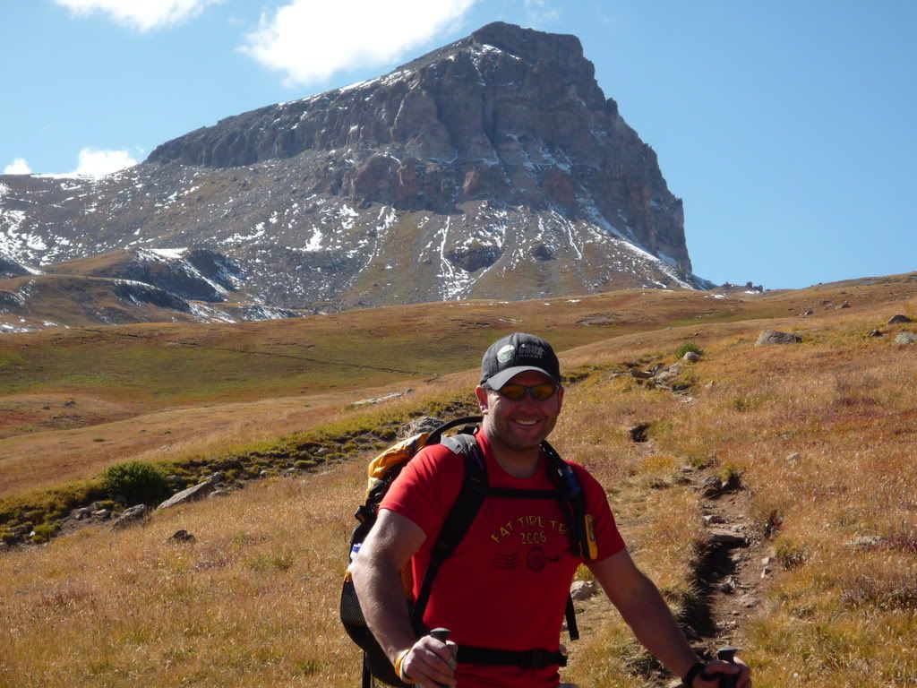
The husband and I took off Friday night for a 2 day adventure in the San Juans! We had Uncompahgre in mind since our first attempt was rained out and we were turned back at 14,000ft. We hoped to get Wetterhorn in the mix, but we were going to play it by ear.
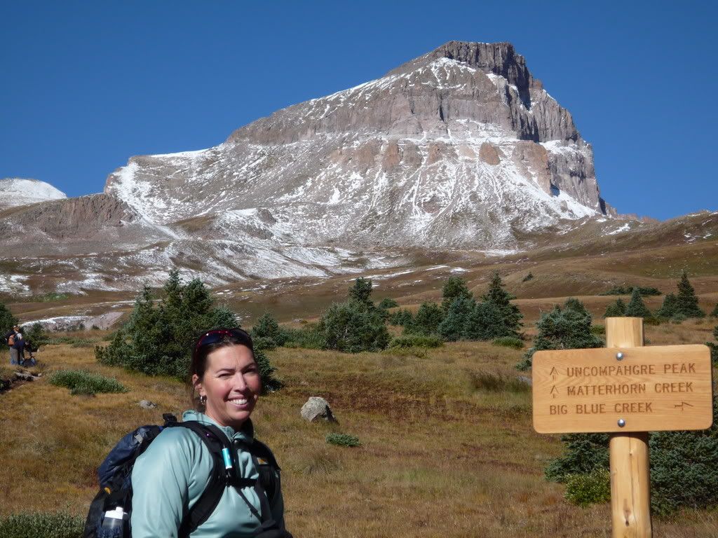
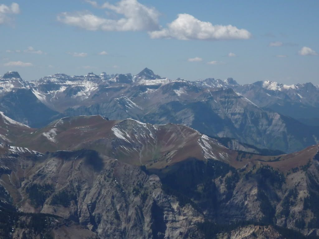
Uncompahgre report
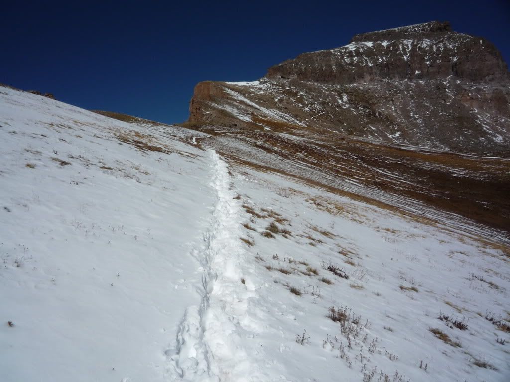
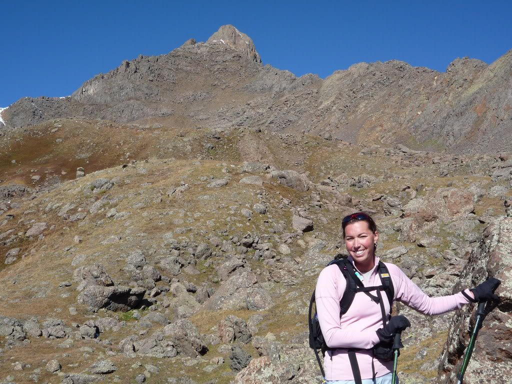
We pulled into Lake City late Friday night and decided to just camp in the back of the Tahoe at TBears campground in town. We knew the weather was going to be perfect so we set the alarm for 6, but figured a little snooze wouldn't hurt. We slept until 7 and awoke to frost on the windows, it was 22 degrees outside. We hit the bathrooms in the campground and found yummy coffee awaiting. Something warm was perfect at that moment. We paid our bill and headed up to Nellie Creek TH. The road up Henson Creek is an easy gravel road and the road up to the parking lot is 4 miles of rough 4 wheeling. Our Tahoe was fine, but we heard that it was hard on some other trucks that had turned around. We hit the trail at 9:15 and were on the summit by 1:15. The sky was so blue so we stopped a lot, took our time, relaxed and it felt great! the trail is straight forward, there was some snow on it this time around and the gully at the top was muddy and slippery, but there was a 70 year old couple climbing it and doing great!! I was impressed!!! We spent a while on the summit and took in the sun, a little too much, I am so sunburned!
Here are pictures from the hike!
Starting out
Snow on the trail
On the summit
coming down the gully
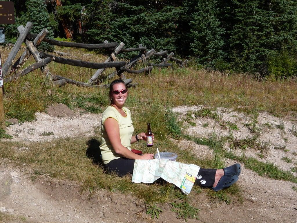
Much deserved Beer!
So after a great Chicken sandwich and cheeseburger at Southern Vittles in Lake City we headed back to the campground and showered, went to bed.
Wetterhorn report
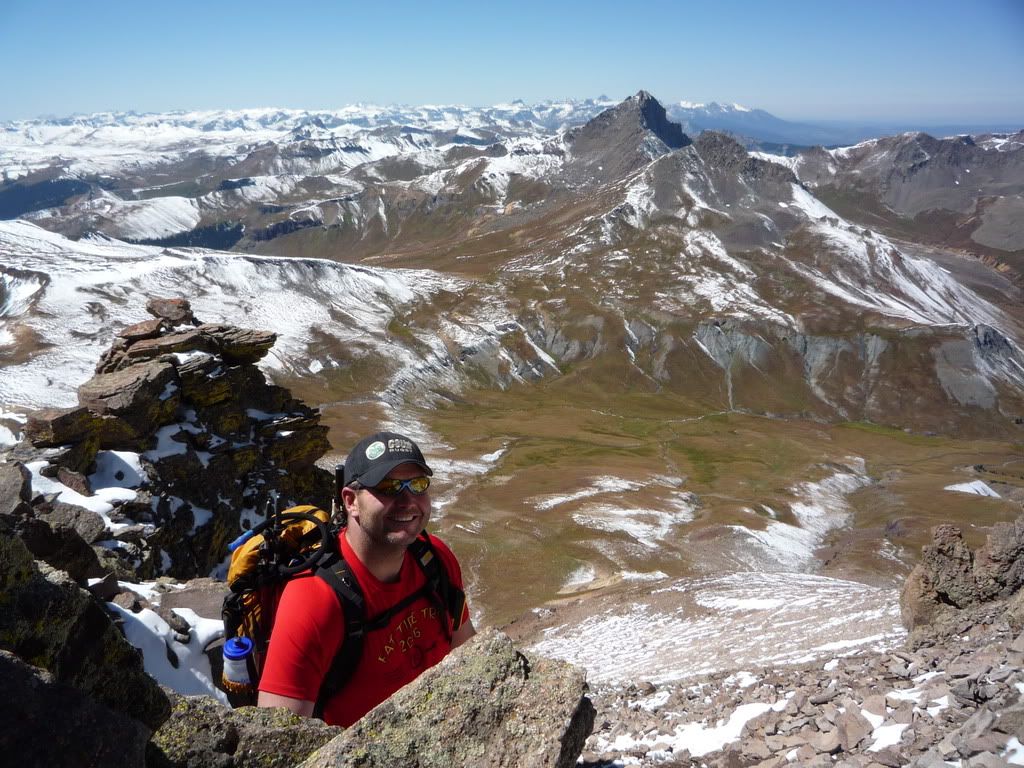
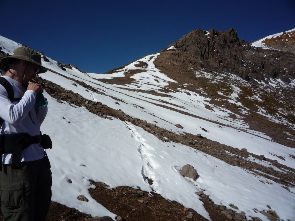
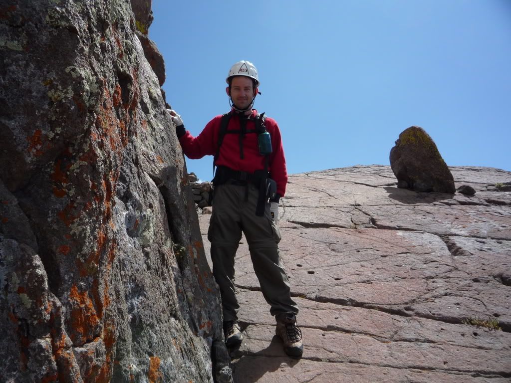
Up the next morning with anticipation of climbing Wetterhorn. I have to admit, I was really nervous. We stopped by a bakery and grabbed a breakfast buritto and coffee at 7am and headed to Matterhorn Creek TH. We made it up to the 4wd parking and met up with Carpe Diem (dave). He was hiking alone so we decided saftey in numbers and the more the merrier. We headed up the trail together at 8:15am.
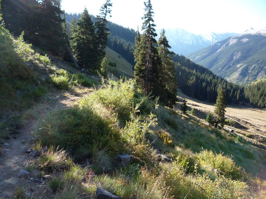
Heading out of the Valley
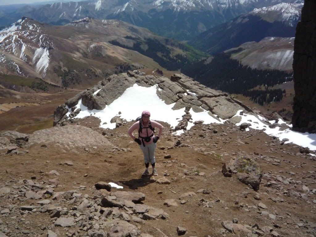
On the easy part of the trail with the danger behind us
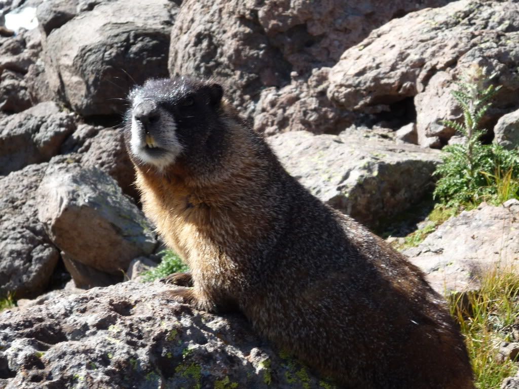
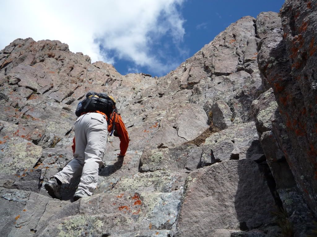
We followed the trail past 2 other turnoffs and the Wetterhorn trail is apparent as you wind underneath Matterhorn and then under Wetterhorn. We went through talus and boulders and caught some pics of a great Marmot who posed for us
Then headed up through a snowfield and onto ridge
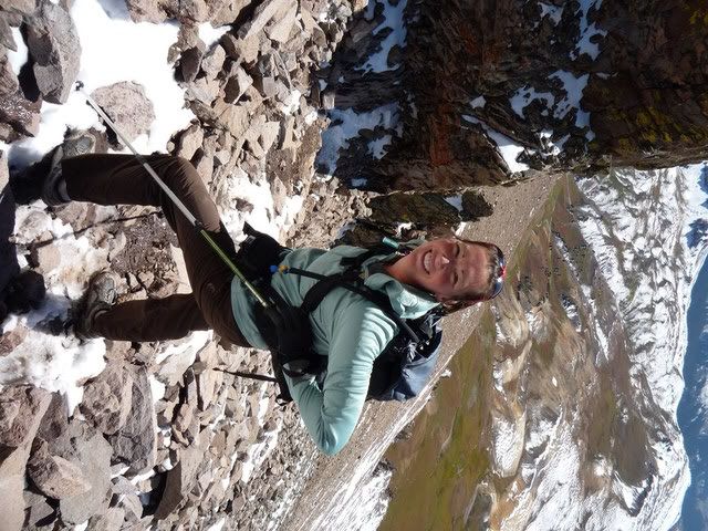
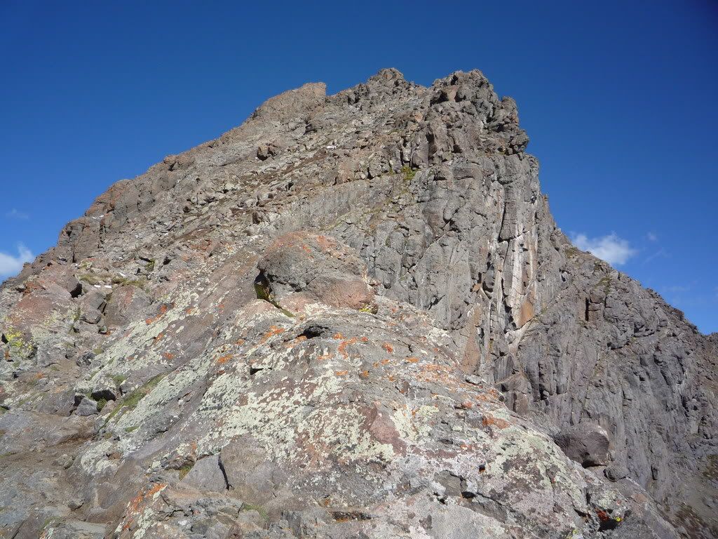
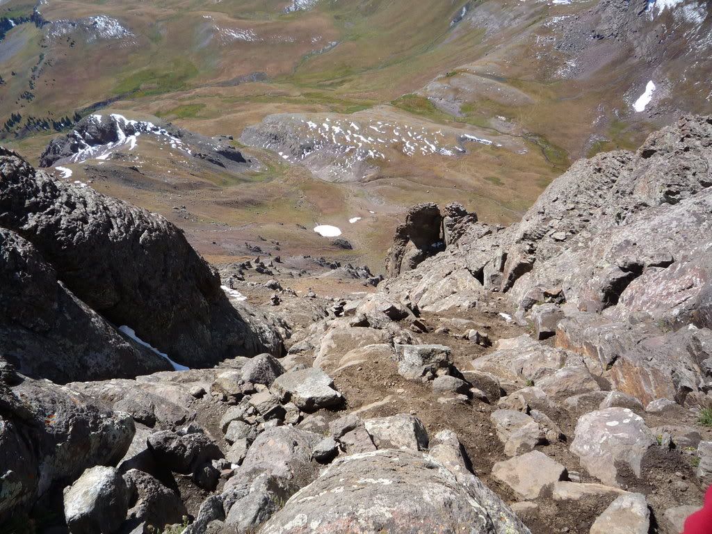
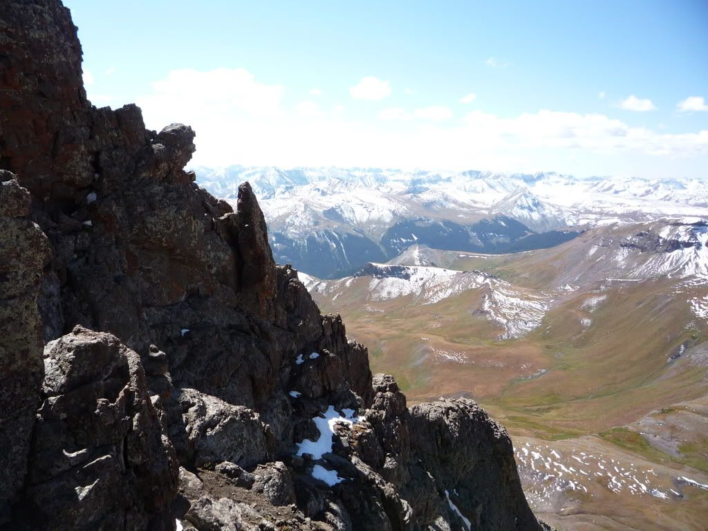
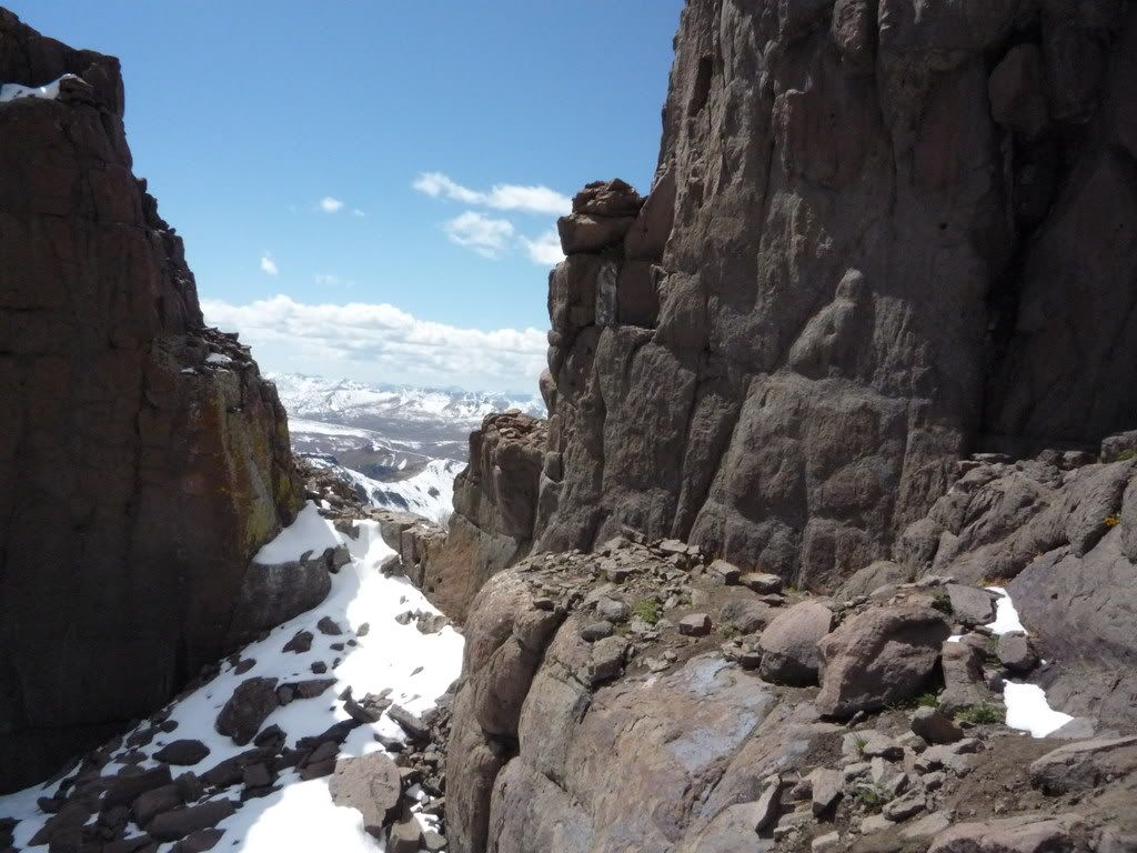
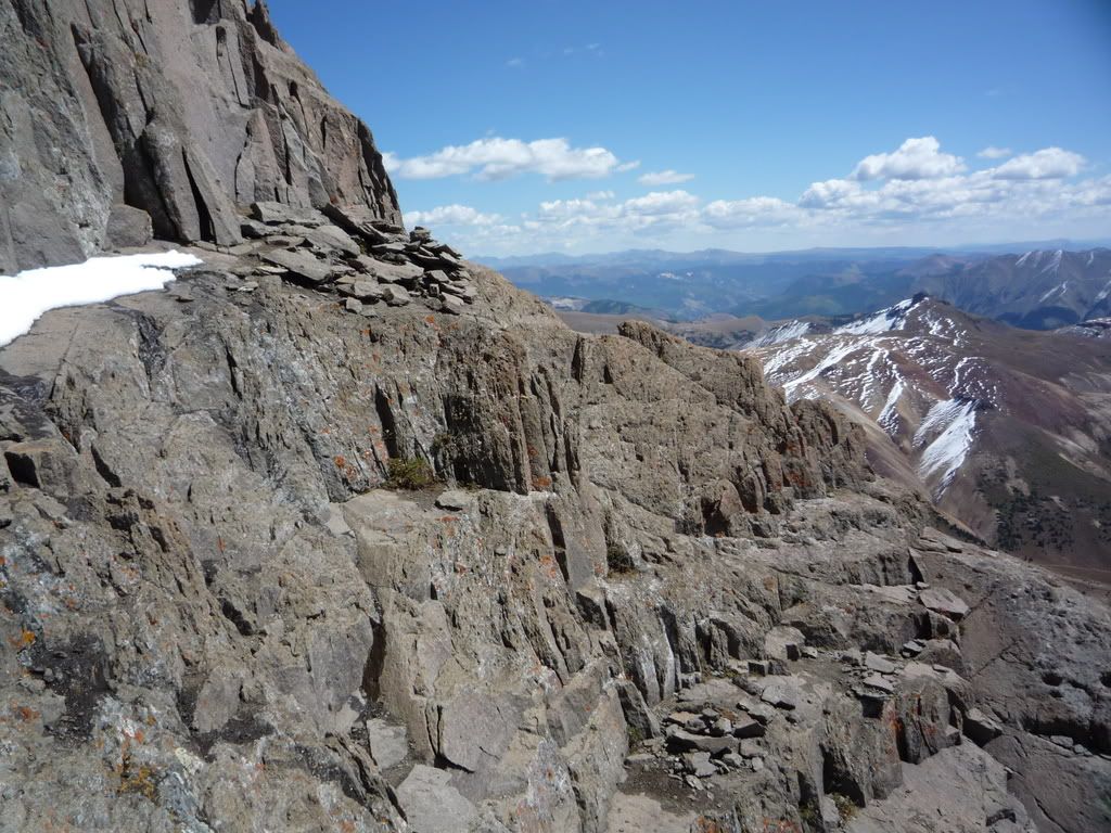
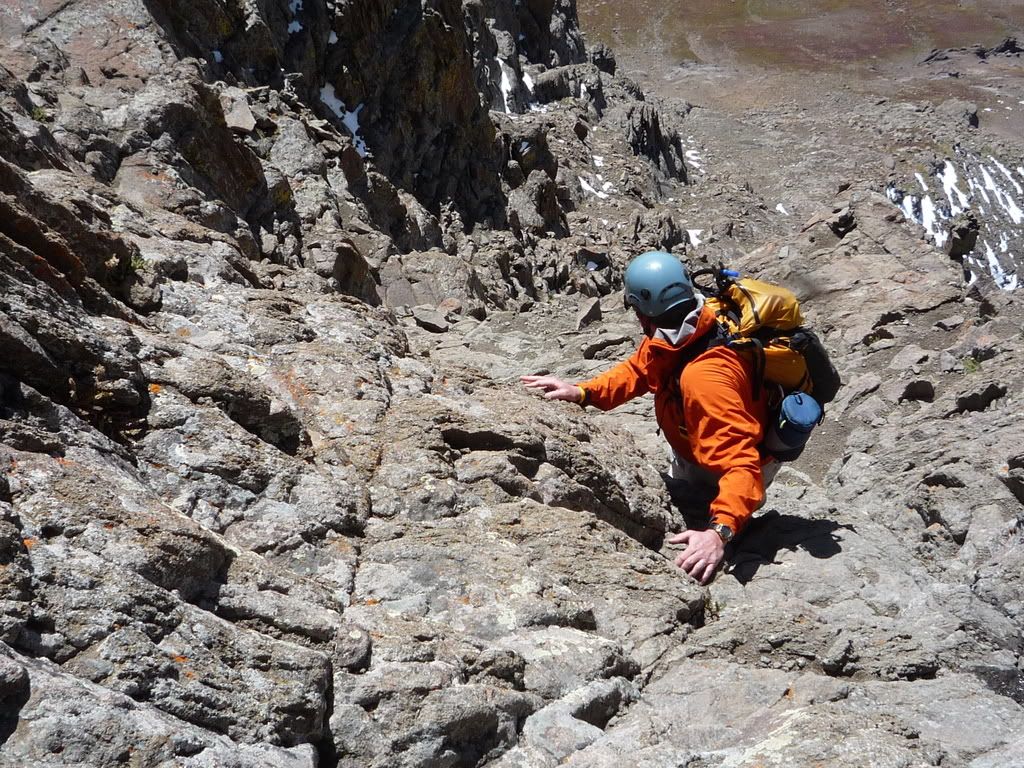
Once on the ridge you walk up and over the yellow dirt and rock and look head on at the difficulties which never exceeded class 3, but definitely gets your heart pumping at times.
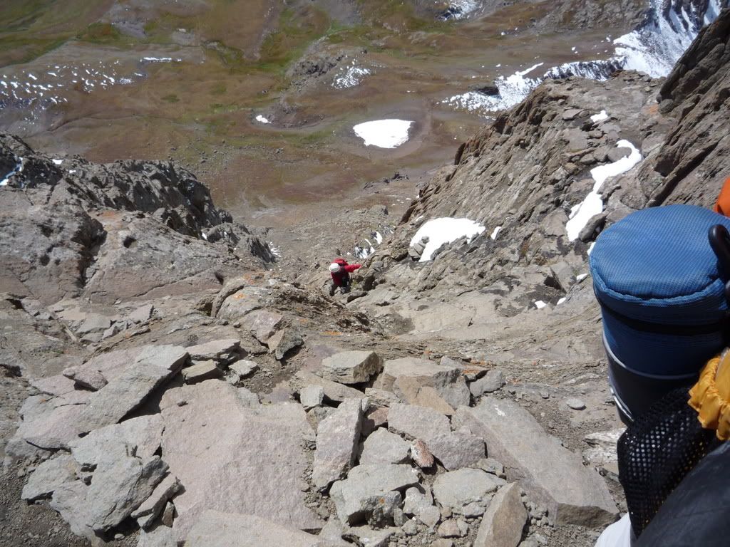
the view looking down as you traverse
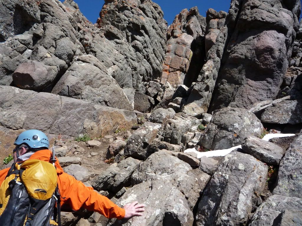
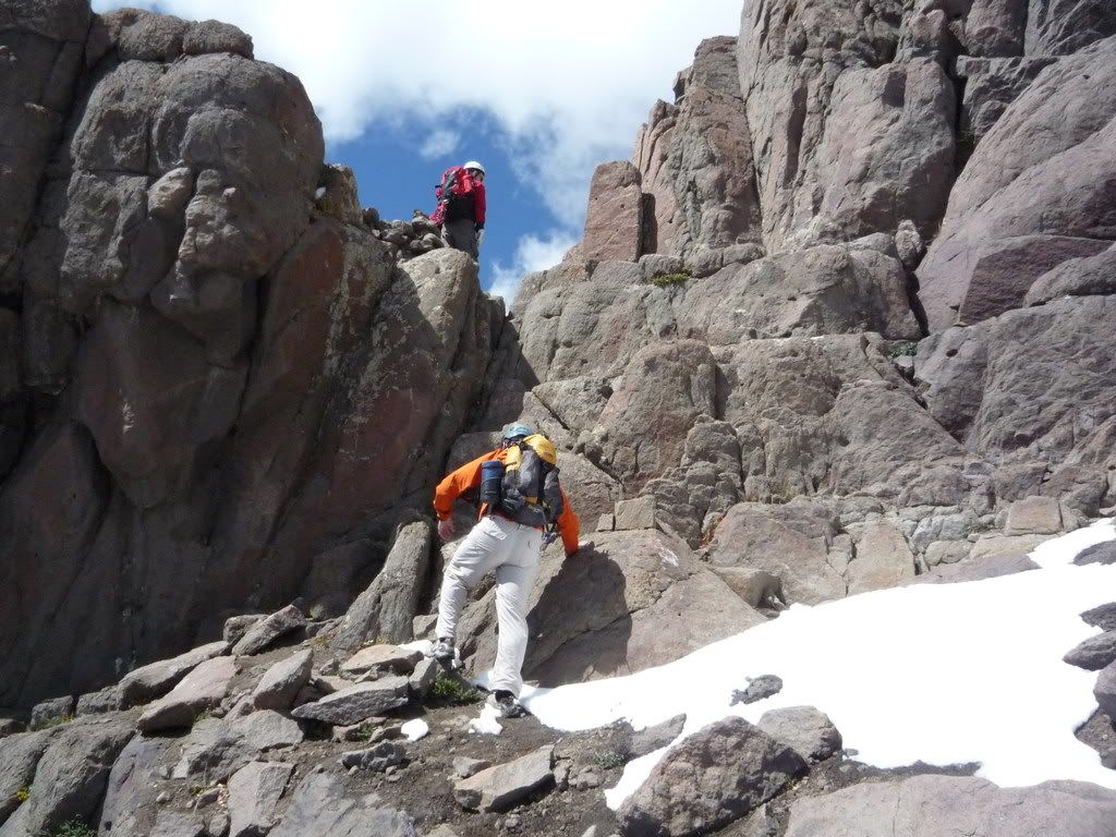
We traversed through dirt and rocks on a steep slope and up into a gully that leads you to 2 rocks that are slanted towards each other.
We assumed this was the notch where you have the 2 choices. After speaking to someone on the trail we were told to go left at this point.
Once through this notch we found a gully that we went straight up and gained the ridge, but we aren‘t sure that this was correct???
From here at the top we became very confused. We looked at Bill‘s Route and Gerry‘s route several times. We were still pretty far from the "Prow", but going left took us up over the ridge and required class 4 moves. Going back down looking around the first tower appeared to be the wrong way, so then we went back up to the ridge and went to the right and around the northeast face. We split up to try and find the route here and just found Carins going every different direction. I decided after up climbing and down climbing some class 4 stuff that this was getting to be too much and I wanted to go home. I yelled at the guys and said let‘s give up. I was shaking from fear and realized that this just wasn‘t worth it. After getting back up to the top of the ridge, my husband said he wanted to check one more time by going left around to the 2nd tower. He had to cross a few slick slabs of rock with the steep slope behind him, but once looking up he decided this was the route and we just had to get past both the towers of rock and head up the the gully to the right side of the prow.
Looking back at the notch while trying to figure out where to go
Finally getting over to the left and finding the route up to the prow, this is looking back to the notch
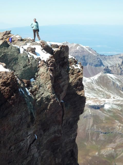
Once at the Prow
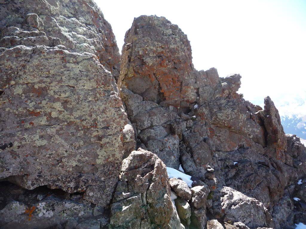
Christian going through the notch
Choose the notch on the right of the prow- not this one
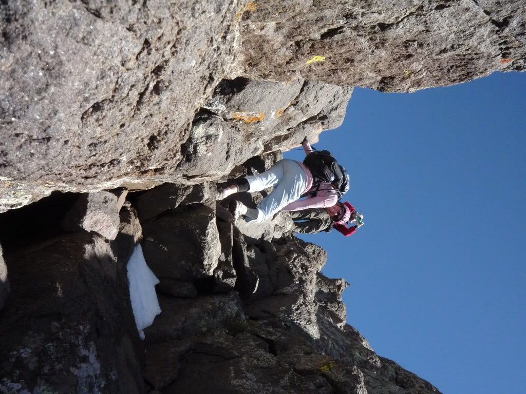
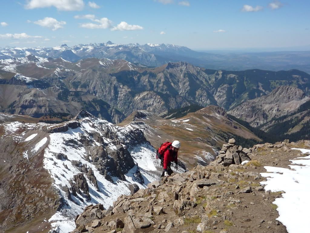
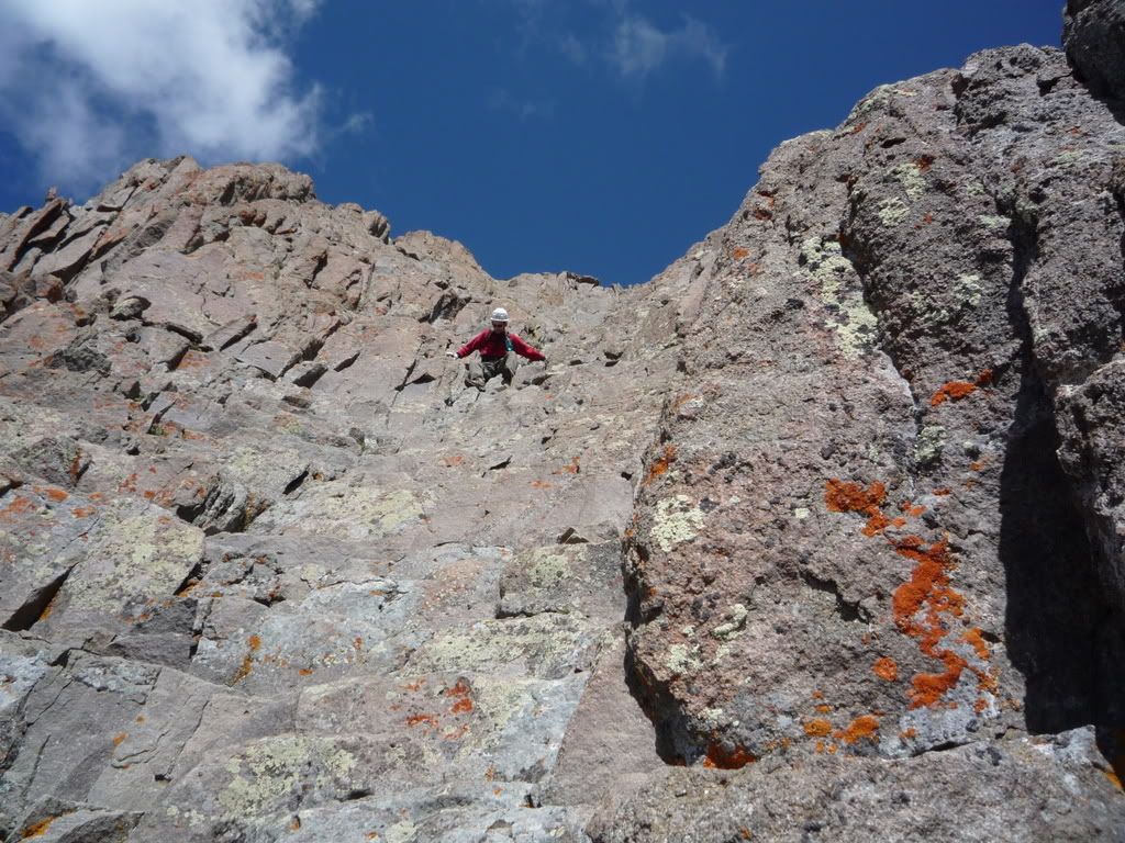
Once through the notch there is a slab of rock you come out on and then move over to the right to climb the rest of the route up a 150ft of fun class 3 scrambling!
the slab of rock after the notch
Holy Schist climbing the stairs
looking back down at Carpe Diem on his way up- we went one at a time- no sense in 2 or 3 people dying in case of fall.
Once you are 15ft from the top there is a nice ledge that you have to walk across, pucker facter with snow on it... 9/10
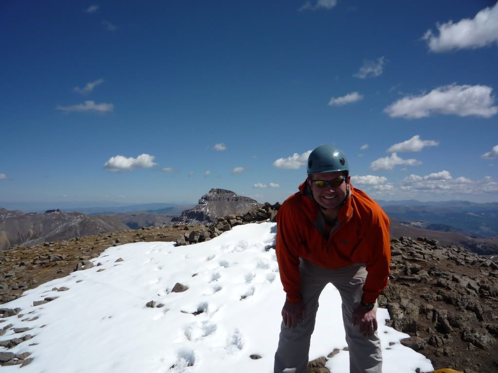
And then the summit!!! Hell YEAH!!!!!
christian sighing relief
Dave gaining the summit!
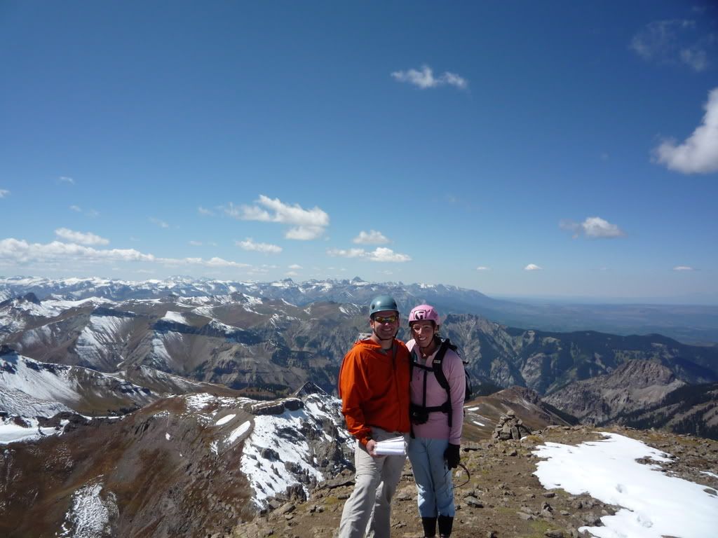
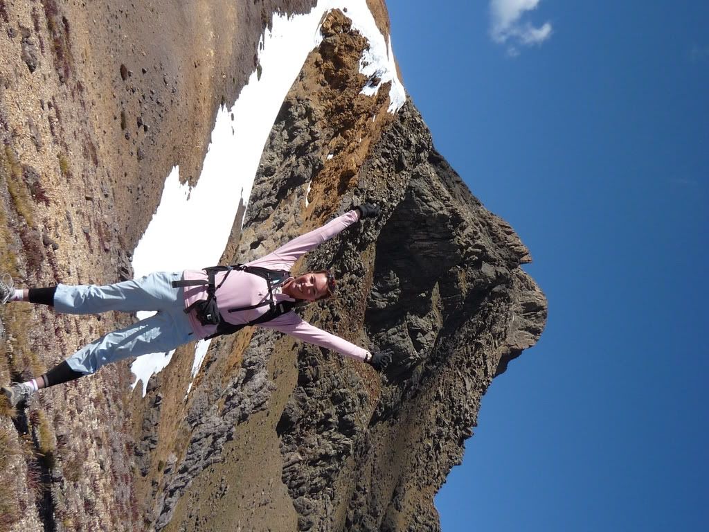
Summit photos
On the way back down we easily found the route and just had some heartpumping downclimbing, but mostly because of the exposure.
Some of the downclimbing:
And then back at the ridge/saddle:
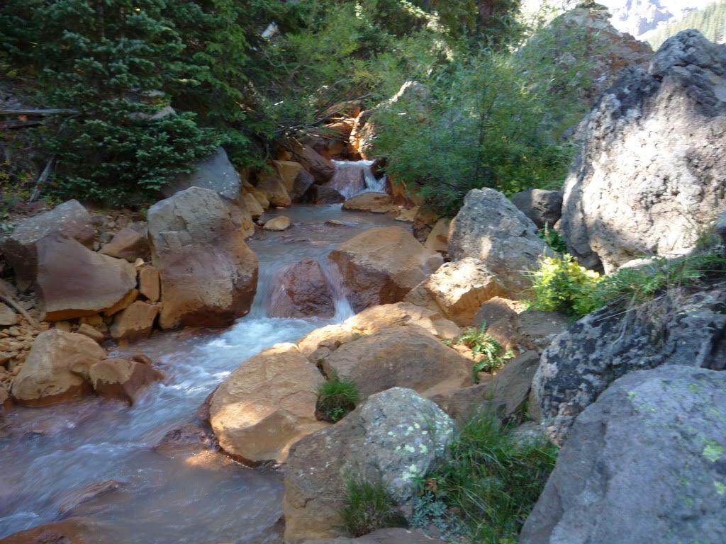
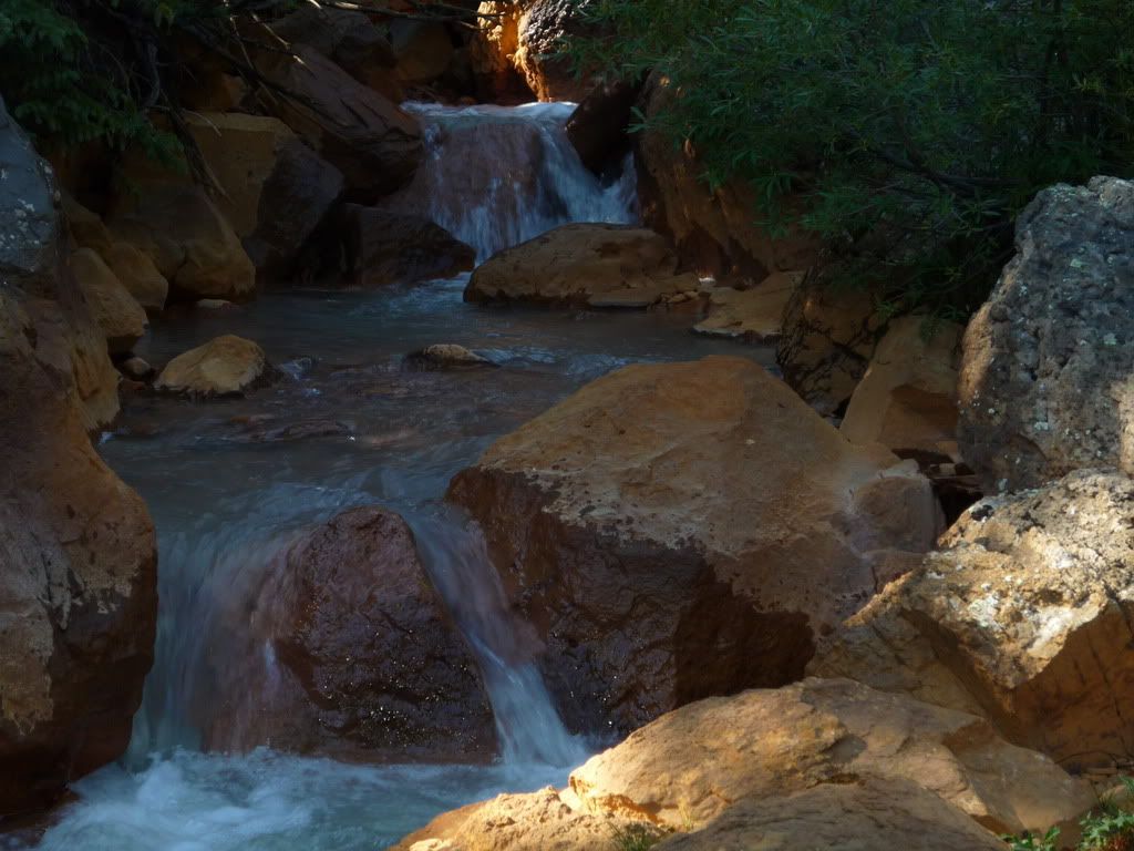
And finally a few water photos;
Carpe Diem.. Thanks for keeping us company yesterday. Hope to hike with you again sometime. What a perfect day yesterday!!! We loved your comment as we got back down on the easy trail - when you shouted your expletives of joy!! Our sentiments exactly!
A few notes on this route: Bill describes it best, but with so many options and even more carins that lead you so many different ways take your time once through the first notch and look carefully at where you want to go. It is obvious now to go all the way left once out of the notch, but it isn‘t easy so you may continue looking for the easier passage- seems to us, there isn‘t one. Once you are all the way to the left and can see the top of the prow on your left you will know you are in the right place.
I have a very healthy respect for this mountain, looking back I had a great time, but glad it is done. I don‘t think I want to do anything harder than that. Therefore there will be no finishing of the 14ers for me. :-(
Great and exciting photo‘s, made me want to be there, right now!
I LOVE the marmot pic! you either must have been rally close to him, or had acamera with telephoto!
Awesome trip report. It‘s funny that you had so much route finding difficulty on Wetterhorn; typically I‘m horrible with route finding but I found my way flawlessly on Wetterhorn.
Nice climb, guys; and nice photos, too! Not sure why you had problems with the route-finding (maybe it was the snow), but glad you hung in there and bagged this one--definitely one of my own favorite summits.
Just kidding!! I couldn‘t resist. Your pics turned out great! It certainly was a gorgeous day! And thanks for letting me tag along. I don‘t know if I would‘ve tried that last pitch alone. I‘m definitely glad I did Sneffels first and gave Wetterhorn another day to dry out. I‘d hike with you B.A.M.F.s anytime.
Powdergator, yes, 14ergirl was just about close enough to floss that marmot‘s big teeth.
cftbq, snow wasn‘t the cause of the route-finding difficulty. We just came to a point on the left (west) side of the ridge where we (or maybe it was just me) didn‘t see any more cairns, couldn‘t spot a clear trail segment, and it looked like we‘d have to traverse on/across some steep, loose dirt and possibly a little patch of snow. So we investigated the right (east) side of the ridge which did have more cairns but wasn‘t described in either route description.
The photos alone got my heart racing! 9/19/2008 4:40am
Awesome trip report... Makes me think twice about trying to tackle this peak next year...of course, I‘ve nearly run out of easy ones, so I guess it‘s time to give it a go.
I‘m glad to know the two of you made it -- I thought about y‘all while I was strolling up redcloud & sunshine... I may have to pick your brain next year when I attempt the challenge.
Side note: I caught up with the 14ers police forum and have had quite a chuckle on some of the comments... people are interesting
I bet you‘ll be chomping at the bit for a harder 14er soon enough
nickaa, do all TRs get three stars, regardless of quality?
Caution: The information contained in this report may not be accurate and should not be the only resource used in preparation for your climb. Failure to have the necessary experience, physical conditioning, supplies or equipment can result in injury or death. 14ers.com and the author(s) of this report provide no warranties, either express or implied, that the information provided is accurate or reliable. By using the information provided, you agree to indemnify and hold harmless 14ers.com and the report author(s) with respect to any claims and demands against them, including any attorney fees and expenses. Please read the 14ers.com Safety and Disclaimer pages for more information.
Please respect private property: 14ers.com supports the rights of private landowners to determine how and by whom their land will be used. In Colorado, it is your responsibility to determine if land is private and to obtain the appropriate permission before entering the property.