Download Agreement, Release, and Acknowledgement of Risk:
You (the person requesting this file download) fully understand mountain climbing ("Activity") involves risks and dangers of serious bodily injury, including permanent disability, paralysis, and death ("Risks") and you fully accept and assume all such risks and all responsibility for losses, costs, and damages you incur as a result of your participation in this Activity.
You acknowledge that information in the file you have chosen to download may not be accurate and may contain errors. You agree to assume all risks when using this information and agree to release and discharge 14ers.com, 14ers Inc. and the author(s) of such information (collectively, the "Released Parties").
You hereby discharge the Released Parties from all damages, actions, claims and liabilities of any nature, specifically including, but not limited to, damages, actions, claims and liabilities arising from or related to the negligence of the Released Parties. You further agree to indemnify, hold harmless and defend 14ers.com, 14ers Inc. and each of the other Released Parties from and against any loss, damage, liability and expense, including costs and attorney fees, incurred by 14ers.com, 14ers Inc. or any of the other Released Parties as a result of you using information provided on the 14ers.com or 14ers Inc. websites.
You have read this agreement, fully understand its terms and intend it to be a complete and unconditional release of all liability to the greatest extent allowed by law and agree that if any portion of this agreement is held to be invalid the balance, notwithstanding, shall continue in full force and effect.
By clicking "OK" you agree to these terms. If you DO NOT agree, click "Cancel"...
To celebrate our last child going off to college, Margaret and I decided to take our first "emptynester" trip to the San Juans; specifically the mighty Grenadier Range in the Weminuche Wilderness. Having viewed these impressive peaks from atop other mountains and in countless photographs, there was a clear sense of excitement knowing we would finally be standing before them.
We arrived in Durango Wednesday (9/10) at 11:00 pm and stayed in a classy motel that came equipped with a drunk, nutcase yelling expletives and banging on the locked door of his girlfriend's room.
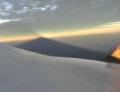
Thursday morning, we ate breakfast like it was our last meal then hopped aboard the D&SNG choo-choo train for the 3-hour ride to Elk Park. We'd been on the train before so the ride was a bit tedious, but the views of the Animas River and Pigeon Peak helped pass the time. In defense of the train, its a unique and unexplainable feeling to be dropped off in the middle of nowhere - detached from the "mother ship" - with only the provisions on your back to sustain you for the next 4 days.
From the end of the track spur, we hiked the Elk Creek trail NE to its confluence with the CT, signed the register, and made quick work of the 2.7-mile stroll to the large beaver pond that identifies the turn-off to the Vestal Creek trail . If the CT is Interstate 25, the VCT is a dirt road. Much of the time the trail is obvious, but you must pay close attention to stay on course and avoid side trails that lead to nowhere. The few people we encountered (including ourselves) strayed off trail at least once.
From the NW corner of the beaver pond, we hiked south across boulders on the pond's western edge to a fork in the trail. We beared left past some campsites and followed the trail to the top of Elk Creek's north side . We inched our way down the steep but short slope to Elk Creek, crossed over to its south side on rocks, and found the trail heading south into Vestal Creek's basin. We hiked through trees and willows to a meadow (this is where we got slightly off course - the main trail was above us to hiker's left), made the relatively steep hike to 11,200', descended slightly near Vestal Creek, and hiked the final .5 mile into the meadow at the base of Arrow Peak . We followed the VC trail to the trees at the meadow's east end and set up camp . There are several campsites in and around the meadow as well as others 100 to 300 vertical feet up and further east on the VC trail. Campsites can also be found at 12,000' at the base of Arrow and Vestal Peaks although we saw no one camping that high. Thursday evening we hiked up the trail to 11,700' to watch the waxing 3/4 moon rise over the Trinities .
Thursday night into early Friday morning it rained then snowed constantly. However, by 7:00 am the skies cleared and we were treated to excellent September weather the rest of the weekend. The inch or two of wet snow that blanketed the meadow melted by noon.
On Friday, we climbed into the upper basin below the W. Trinity-Vestal ridge and spent the entire day hiking around the base of Arrow, Vestal and W. Trinity between 11,500' and 12,500', getting our bearings and taking in the unbelievable scenery . It truly was an existential experience admiring these natural pyramids. They commanded our admiration and respect like no other mountains we'd observed before them.
Although my plan was to climb Arrow and Vestal on Saturday, I decided at about 1:00 pm Friday to take a shot at Arrow. I gained Arrow's sweeping ramp in short order and ascended to 13,300'. Unfortunately, the rain and snow from the night before made for prohibitively slick conditions on the naturally smooth, steep ramp. Since I hadn't planned on climbing Arrow that day, I didn't bring a helmet. Given the slick conditions, the lack of a brain bucket, the fact that I was climbing solo, and it was 2:30 pm with some clouds rolling in over the summit, I reluctantly turned back. If rain was coming, exiting the slicker-than-cat@#%* ramp would have been extremely dangerous; not to mention the possibility of lightning. As it turned out, the clouds amounted to nothing but my view west was blocked by the upper 500' of the mountain so I had no way of knowing what the weather gods had in store. I was able to snap this pic of Vestal's sweeping Wham Ridge before descending .
Saturday morning we climbed into the upper basin via Roach's route description to attempt Vestal via its south slopes. Margaret was not confortable climbing in the hard snow to reach the saddle between Arrow and Vestal, so we parted ways and I continued on. With some kick-stepping and trekking poles, I was able to safely gain the saddle at 12,800' . Following Roach's route description and some well-placed cairns, I climbed the ascending traverse across Vestal's south side and found the prominant gulley at 13,200' (view looking down the gulley). The gulley is long and narrow and terminates at a notch at 13,600'. Climbing in the gulley is not recommended as it is just as much a bowling alley as Little Bear's hour glass. Again, following Roach's description and cairns, I climbed north 400 vertical feet on the gully's west side (climber's left) not straying more than 50' or so from the gulley center . At no point should you cross the gulley or climb on its east side. After reaching the notch, I turned left and did an ascending traverse northwest for another 100 vertical feet to a short chute . From the top of the chute, I climbed the final 100' to gain Vestal's SE ridge and the summit, staying on the somewhat airy but level ridge crest .
The panoramic view from the summit was breathtaking. Nearly all of the San Juan 14ers and prominant 13ers were visible . I knew the view would be spectacular but it exceeded my highest expectations. There wasn't a cloud anywhere! I could have stayed on the summit for hours but after 45 minutes, I decided to descend and meet up with Margaret.
As a side note, Roach rates this route as Class 2+. In my opinion, the south slopes route easily rates as class 3. If you get too far west of the gulley, or on its east side, you'll likely encounter class 4 terrain or higher.
The return was quick and uneventful. I encountered two climbers at 13,200' as I began the descent back to the Arrow-Vestal saddle. We saw 6 other people in Vestal Basin while we were there.
For a moment, I considered heading back up to Arrow, but after meeting up with Margaret, we decided to pack up and head down to the beaver ponds. Saturday night we camped above the CT with terrific views of Arrow and Vestal. After a lazy morning stroll along the CT, we broke camp, hiked down to Elk Park, took a "bath" in the warm waters of the Animas River , and drank a few beers on the seemingly endless train ride back to Durango. Seven hours later, we pulled into our Highlands Ranch driveway and were asleep by 1:30 Monday morning.
To display your photos (uploaded below) in the final trip report, type the image number (i.e., 1, 2, 3), highlight it with your cursor, and click on the Image button on the right. Example:
Thumbnails for uploaded photos (click to open slideshow):
Great trip report! Love that area ... been there twice before and I would go back and do both of those peaks again. We camped very high just below the saddle that connects Vestal and one of the Trinity Peaks. By the way, did you have to pay extra for that room with the free ”entertainment”? Thanks for posting!
Congrats on a great trip and summit! My wife & I were there the week before you (and I still don‘t have my TR posted ). We were pretty conscientious about ensuring cairns were in place, so hopefully they helped you out. Great report... thanks.
happened to run into this while browsing. Awsome, detailed report of the Vestal Basin. Just one of those places you pretty much have to see before you die.
I agree with your assesment of the south side being more difficult than advertised. I vaguely remember my friend claiming a rock the size of a keystone light 30-pack flying down the mountain on the descent.
I guess the next pastime‘s on hold, eh?
Thanks for the amazing pics.
Caution: The information contained in this report may not be accurate and should not be the only resource used in preparation for your climb. Failure to have the necessary experience, physical conditioning, supplies or equipment can result in injury or death. 14ers.com and the author(s) of this report provide no warranties, either express or implied, that the information provided is accurate or reliable. By using the information provided, you agree to indemnify and hold harmless 14ers.com and the report author(s) with respect to any claims and demands against them, including any attorney fees and expenses. Please read the 14ers.com Safety and Disclaimer pages for more information.
Please respect private property: 14ers.com supports the rights of private landowners to determine how and by whom their land will be used. In Colorado, it is your responsibility to determine if land is private and to obtain the appropriate permission before entering the property.


")
")
")
")
")
")
")
")
")
")
")
")
")
")
")
")
")
")
")
")