Download Agreement, Release, and Acknowledgement of Risk:
You (the person requesting this file download) fully understand mountain climbing ("Activity") involves risks and dangers of serious bodily injury, including permanent disability, paralysis, and death ("Risks") and you fully accept and assume all such risks and all responsibility for losses, costs, and damages you incur as a result of your participation in this Activity.
You acknowledge that information in the file you have chosen to download may not be accurate and may contain errors. You agree to assume all risks when using this information and agree to release and discharge 14ers.com, 14ers Inc. and the author(s) of such information (collectively, the "Released Parties").
You hereby discharge the Released Parties from all damages, actions, claims and liabilities of any nature, specifically including, but not limited to, damages, actions, claims and liabilities arising from or related to the negligence of the Released Parties. You further agree to indemnify, hold harmless and defend 14ers.com, 14ers Inc. and each of the other Released Parties from and against any loss, damage, liability and expense, including costs and attorney fees, incurred by 14ers.com, 14ers Inc. or any of the other Released Parties as a result of you using information provided on the 14ers.com or 14ers Inc. websites.
You have read this agreement, fully understand its terms and intend it to be a complete and unconditional release of all liability to the greatest extent allowed by law and agree that if any portion of this agreement is held to be invalid the balance, notwithstanding, shall continue in full force and effect.
By clicking "OK" you agree to these terms. If you DO NOT agree, click "Cancel"...
Date: November 23, 2008.
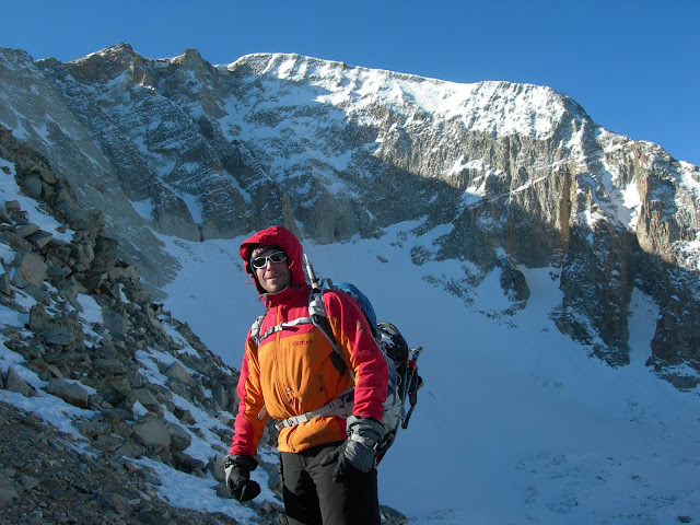
Group: Nick (Cavufool) and me.
Weather: Mostly clear. Some clouds moved in but dissapated. Periods of calm, winds on ridges gusted to 25 mph. Steady wind on summit of maybe 15 mph during our visit.
Start time: 3:55am
Return to trailhead: 3:35 pm
Roundtrip: 11:40
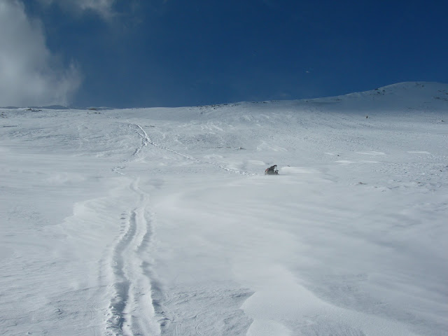
After I was corrected for my misuse of the term Sastrugi last week, I felt I needed to redeem myself. I got a few pictures of some sastrugi.
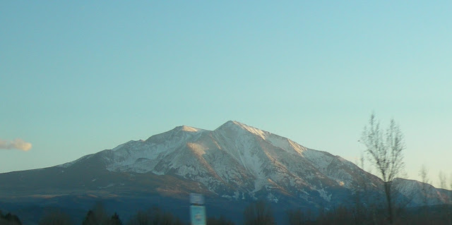
So Nick lives in this place where he can look at Mt. Sopris while taking a leak off his balcony. That is why he came up with a plan to climb a non standard ridge route on Mt. Sopris. Sopris is 12,953 feet, but the highest you can drive a vehicle anywhere near it is about 8,600. That makes it about 4,400 feet to get to the summit, assuming you fall down and get up a few dozen times during the trip.
Our route is shown here, but barely as I can‘t figure out how to make a better map in a picture.
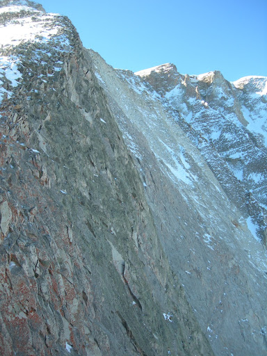
The computer thinks our route was about 12 miles and 4,400 vertical feet. The two northern ridges on Sopris look tempting on the map. The topo maps are a little deceiving. I think it is because the faces on the north side of Sopris are really steep.
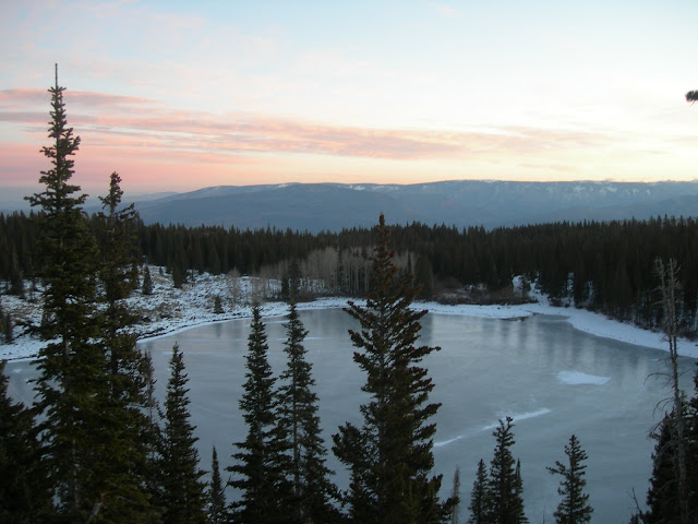
Conditions weren't that good, compared to summer. But it is November, and compared to most Novembers, it was ideal.
We wandered in the dark up the trail. The trail was easy to find, but not as simple as it sounds. It is a popular trail and there is some ice and a lot of snow on the trail. Around dawn we sat around eating for a while and tried to figure out where we were trying to go.
Once it lightened up it became easier to find our way.
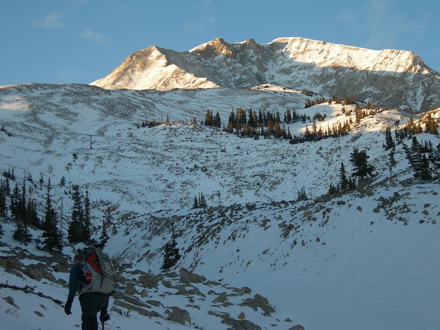
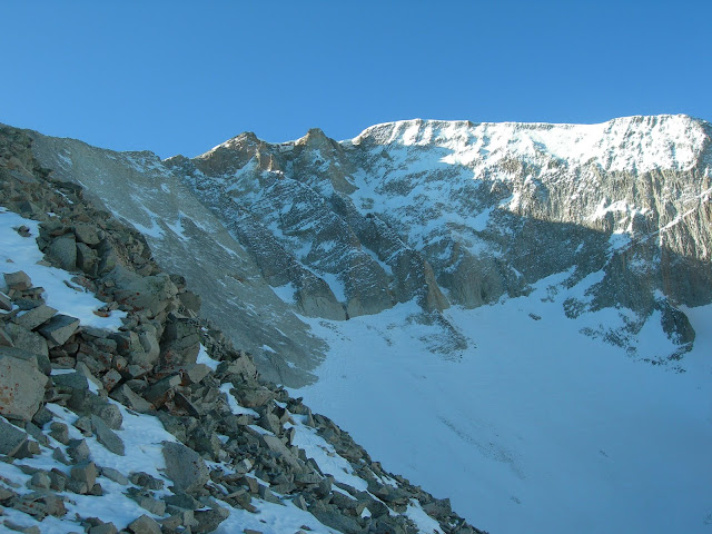
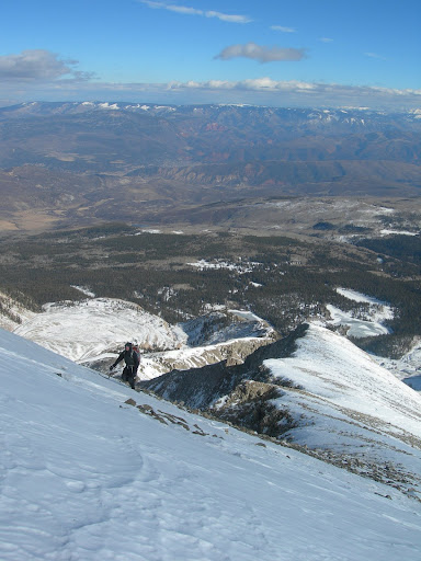
Due to some cliff bands on the east side of the ridge and our overshooting the turnoff in the dark, we traversed back around the ridge. We meandered through some talus fields in the rock glaciers and on the flanks of the ridge for quite a while. Finally we gained the ridge. The going was a little easier, but not much and now we had occasional wind gusts to deal with.
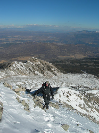
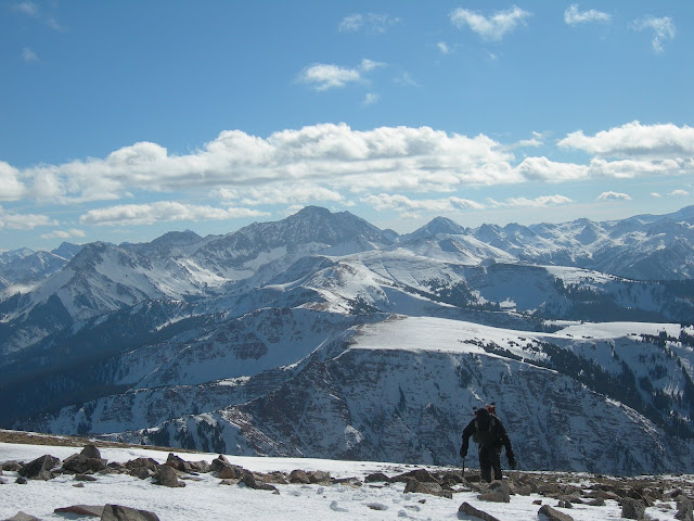
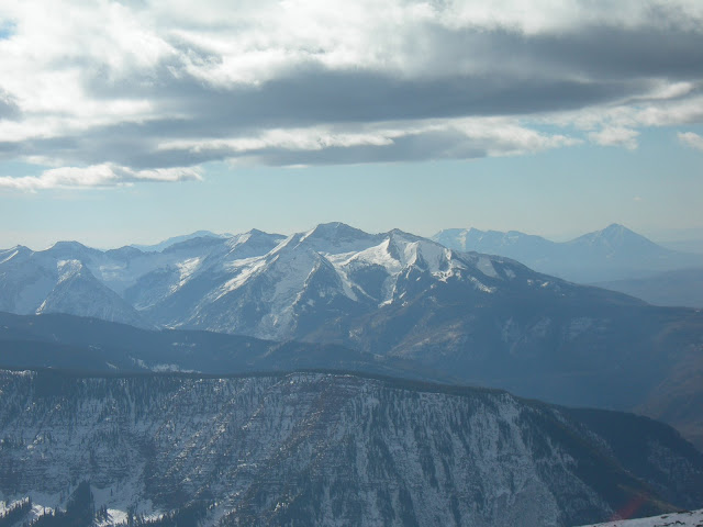
We reached the summit about 11:30. Nice views up there.
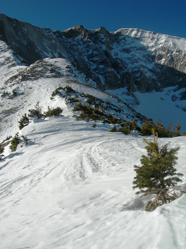
Choosing not to descend our ascent route we started down the standard route. At the cirque we assessed conditions and decided the standard route looked no better than the cirque, mostly due to the snow and talus combination.
The cirque we descended is not a good idea most of the year. It's on the north side of the mountain and southerly winds load it heavily with snow. A cornice hasn't formed but in some areas snow in gullies was over three feet deep. There are multiple coiloirs but some end in cliff bands. Couloir is french word that, by one definition, means "gully prone to avalanches".
We worked our way through the cliff bands and were able to glissade portions. Other areas we were not able to glissade due to shallow rocks or breakable crust.
We dug a couple of what I call "quick pits" to assess the snow and plunged our ice axes to rock to assess the snowpack. In the couloirs we crossed or glissaded the snow wasn't more than about three feet deep. I didn't see any signs of a temperature gradient layer. It has been relatively warm since the last snowfall, which is over a week old. Maybe two weeks? It's been a warm fall! There were a few wind deposition areas that looked like they might move on the crust, but they were very limited.
At the base of the cirque is a giant rock glacier. It was miserable crossing it. Rocks on the surface were just not close enough together and we postholed occasionally when stepping between them.
Descending the route we did might not have been a good idea the day we did it and it may not have saved any time.
I'm doing some refreshing on my avalanche assessments. It's been years since I took an actual course. So please make comments on what we did!
Sopris looks like a good mountain. Maybe I‘ll have to come out there and climb it with you in December...assuming no one is too hungover from work holiday parties.
Looks like a great mountain and I really want to see Capitol from that vantage. Nice TR and hopefully we can get together in a couple of weeks.
Caution: The information contained in this report may not be accurate and should not be the only resource used in preparation for your climb. Failure to have the necessary experience, physical conditioning, supplies or equipment can result in injury or death. 14ers.com and the author(s) of this report provide no warranties, either express or implied, that the information provided is accurate or reliable. By using the information provided, you agree to indemnify and hold harmless 14ers.com and the report author(s) with respect to any claims and demands against them, including any attorney fees and expenses. Please read the 14ers.com Safety and Disclaimer pages for more information.
Please respect private property: 14ers.com supports the rights of private landowners to determine how and by whom their land will be used. In Colorado, it is your responsibility to determine if land is private and to obtain the appropriate permission before entering the property.