Download Agreement, Release, and Acknowledgement of Risk:
You (the person requesting this file download) fully understand mountain climbing ("Activity") involves risks and dangers of serious bodily injury, including permanent disability, paralysis, and death ("Risks") and you fully accept and assume all such risks and all responsibility for losses, costs, and damages you incur as a result of your participation in this Activity.
You acknowledge that information in the file you have chosen to download may not be accurate and may contain errors. You agree to assume all risks when using this information and agree to release and discharge 14ers.com, 14ers Inc. and the author(s) of such information (collectively, the "Released Parties").
You hereby discharge the Released Parties from all damages, actions, claims and liabilities of any nature, specifically including, but not limited to, damages, actions, claims and liabilities arising from or related to the negligence of the Released Parties. You further agree to indemnify, hold harmless and defend 14ers.com, 14ers Inc. and each of the other Released Parties from and against any loss, damage, liability and expense, including costs and attorney fees, incurred by 14ers.com, 14ers Inc. or any of the other Released Parties as a result of you using information provided on the 14ers.com or 14ers Inc. websites.
You have read this agreement, fully understand its terms and intend it to be a complete and unconditional release of all liability to the greatest extent allowed by law and agree that if any portion of this agreement is held to be invalid the balance, notwithstanding, shall continue in full force and effect.
By clicking "OK" you agree to these terms. If you DO NOT agree, click "Cancel"...
I awoke on Monday with a terrible cold. Fought it for a day and then started feeling better on Tuesday afternoon. It had been two days since I had been out, so I decided that a little exercise and thin air would do me some good (an idea that ranks medically just below leeches).
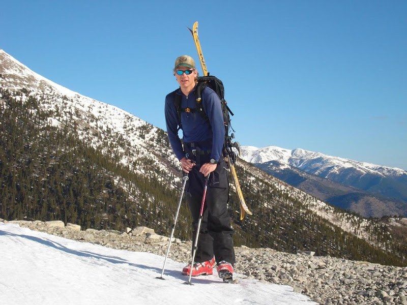
My friend Chris and I had been trying to get out for a while now, so I gave him a call. Since I had not been feeling well I thought Princeton would be a short and straight forward objective. We agreed to meet at 5:15am in Leadville.
We hit the Princeton Rd under warm clear skies. The road is completely clear to 10,400 feet, approx 1/4 of a road mile below the radio towers. It will be a few more weeks of warm weather until some of the drifts above this point will melt.
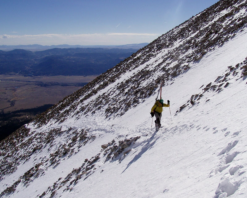
We made good boot pack time up the road and I was feeling pretty good. We hopped on the summer trail and began the snow covered traverse (the trail is still well covered with a few snow field crossings, no axes or crampons were used).
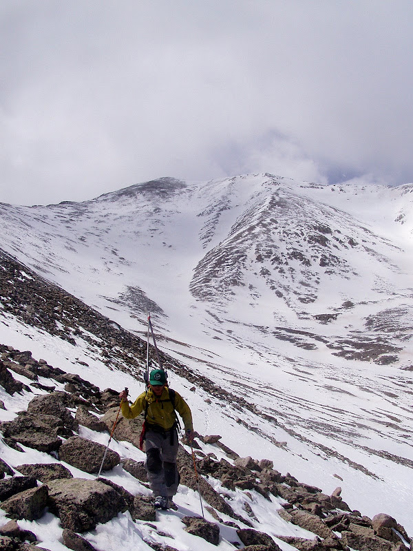
As we moved above 12,000ft, the cold hit me with force. By the time we got to 12,500, I felt like it was the end of a 12 hour 8,000 vert day. I wanted to take a 2 hour nap in the snow. It was complete exhaustion, even though we had only been out for 2 hours.
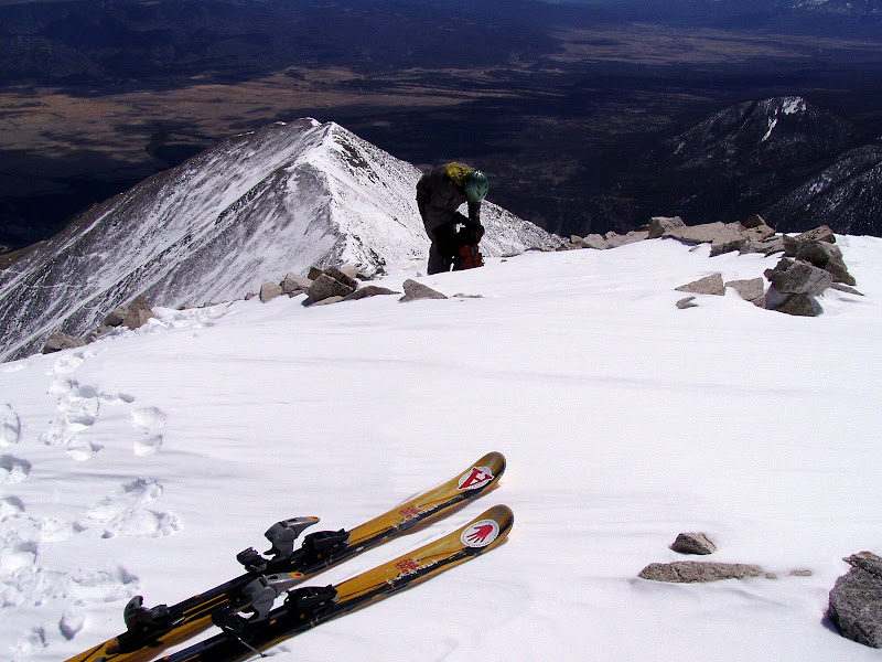
The weather was pretty good though and luckily my partner Chris is of the strong mountain folk variety. He stepped in and began kicking steps up to the base of the summit ridge above the old standard route. Putting my feet in the well kicked boot holes was an effortless relief. I thanked Chris several times as we refueled at 13,300ft on the southeast ridge.
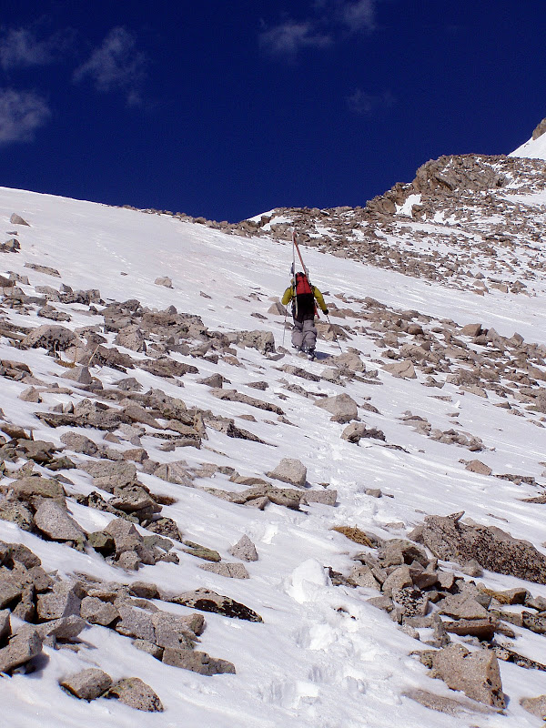
Chris continued to break trail to the summit as the wind began to battle us.
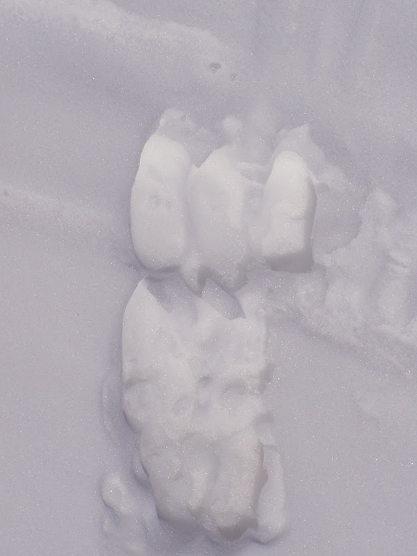
We were both surprised to see cow and calf elk tracks at 13,400ft. Perhaps our identification was incorrect but judge for yourself.
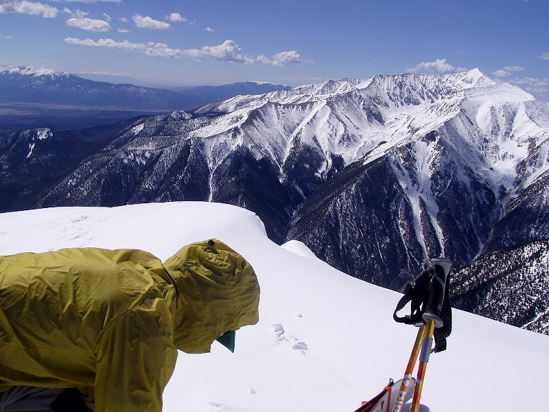
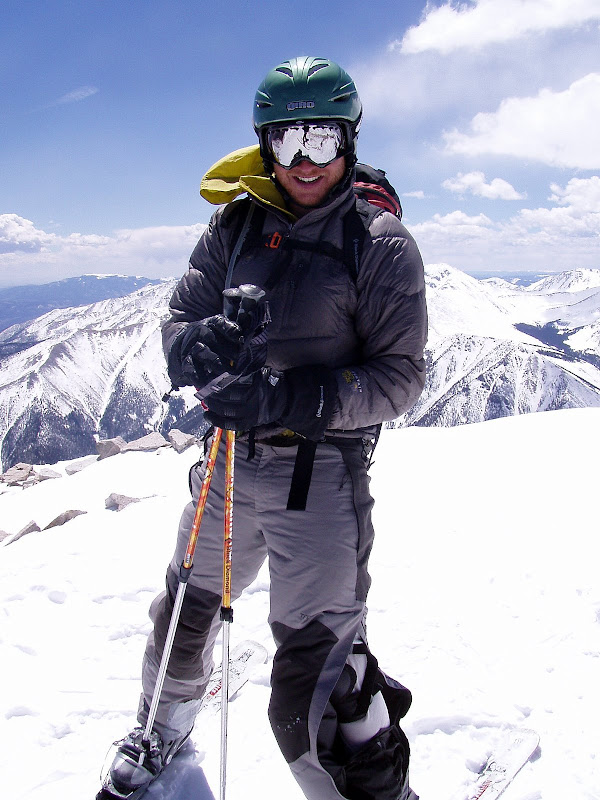
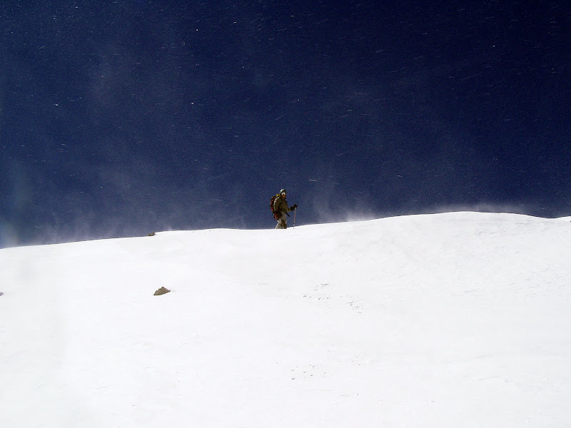
By the time we topped out it was ripping. There were clouds to the west but the skies above were clear.
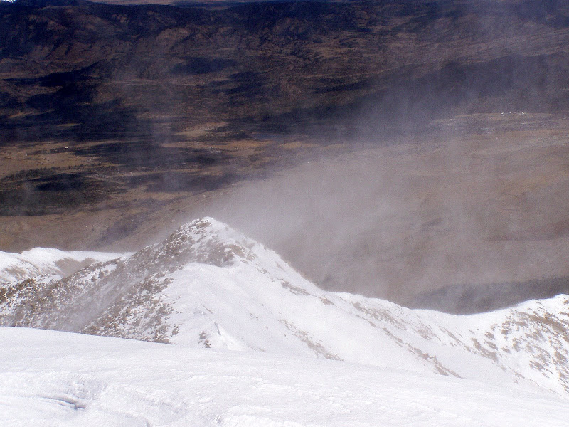
We transitioned to skis just in time to get pelted with wind. Wind speed estimation is difficult without instruments, but I would have to guess 50mph sustained. It was a "brace yourself" situation.
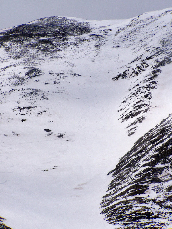
We yelled opinions of a descent route back and forth. We knew the better snow was probably in the bowl farthest down north ridge, however neither one of us had any desire to expose ourselves to the wind any longer.
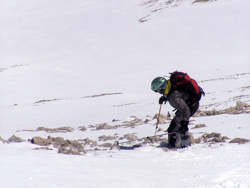
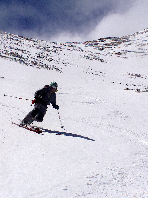
At the first wind lull, we dropped in just skiers left of the summit, picked our way through a bony choke, and got to the goods.
We were a little worried that the warm temps would eliminate the ski descent possibility on an eastern aspect, but I think the cold wind actually helped us out. The higher elevation snow was still cold and frozen while corn started to appear as we skied lower. At no point did we encounter the water saturated snowpack we had feared.
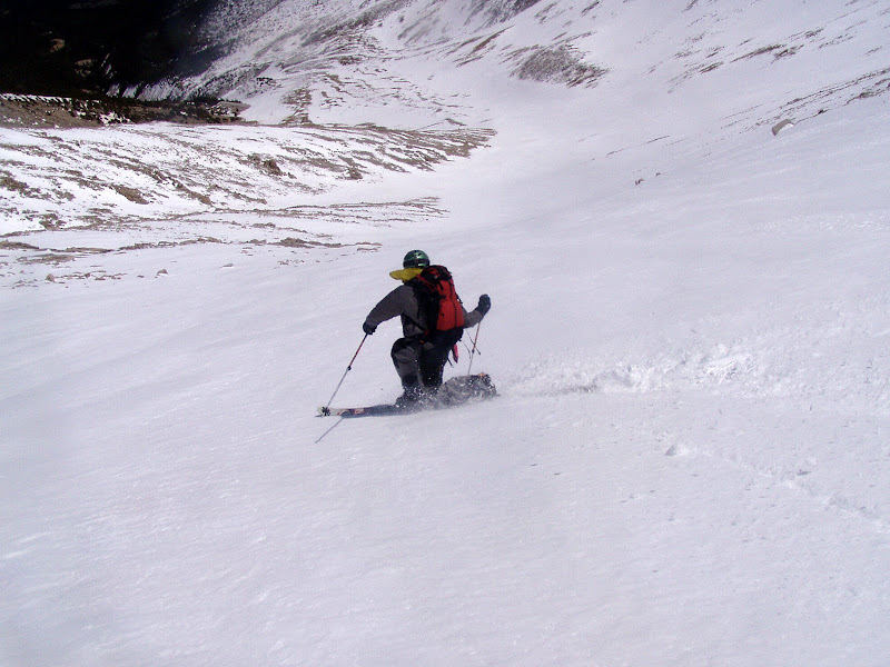
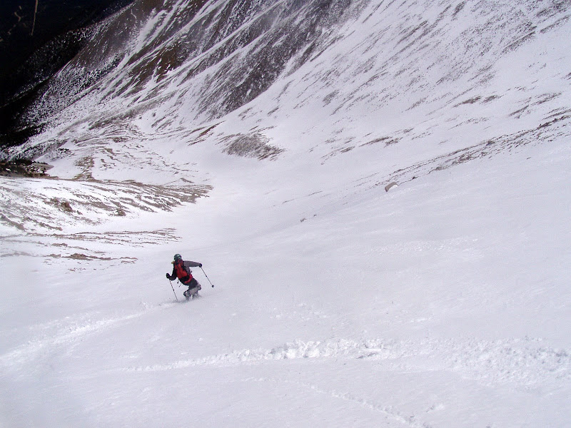
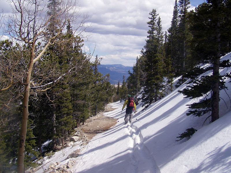
We enjoyed good skiing on a moderate slope all the way down to 11,700ft. We then traversed as far as possible on skis, clicked out, and traversed on foot to the highest switchback on the Princeton Rd. The traverse was fairly straight forward without much elevation gain or loss.
The clouds moved over the peak and a few snowflakes fell as we hit the road and skied back to the radio towers.
We booted down the last 1/4 mile to the truck and then began the business of backing down to a turn around spot.
Glad to put up some graffiti with Chris and glad he was there to build me a trail up the mountain.
Thanks for the photos, how was driving the road? 4/24/2009 12:54pm
Nice TR. Would you share your thoughts on the difficutly of the road compared to the road to Grays, or to Castle? I am in a 4WD Tacoma and am concerned about the long wheel base.
Yeah a Tacoma will have no problems. I was in a full size Dodge Ram which has a much longer wheel base. Turning around was a little tricky but not a huge issue. Side note, my wife did put a dent in my rear quarter panel last summer on this road. Not sure exactly what happened. She claims the dogs were driving.
for the beta. I‘m looking to get a Princeton ski soon.
Caution: The information contained in this report may not be accurate and should not be the only resource used in preparation for your climb. Failure to have the necessary experience, physical conditioning, supplies or equipment can result in injury or death. 14ers.com and the author(s) of this report provide no warranties, either express or implied, that the information provided is accurate or reliable. By using the information provided, you agree to indemnify and hold harmless 14ers.com and the report author(s) with respect to any claims and demands against them, including any attorney fees and expenses. Please read the 14ers.com Safety and Disclaimer pages for more information.
Please respect private property: 14ers.com supports the rights of private landowners to determine how and by whom their land will be used. In Colorado, it is your responsibility to determine if land is private and to obtain the appropriate permission before entering the property.