Download Agreement, Release, and Acknowledgement of Risk:
You (the person requesting this file download) fully understand mountain climbing ("Activity") involves risks and dangers of serious bodily injury, including permanent disability, paralysis, and death ("Risks") and you fully accept and assume all such risks and all responsibility for losses, costs, and damages you incur as a result of your participation in this Activity.
You acknowledge that information in the file you have chosen to download may not be accurate and may contain errors. You agree to assume all risks when using this information and agree to release and discharge 14ers.com, 14ers Inc. and the author(s) of such information (collectively, the "Released Parties").
You hereby discharge the Released Parties from all damages, actions, claims and liabilities of any nature, specifically including, but not limited to, damages, actions, claims and liabilities arising from or related to the negligence of the Released Parties. You further agree to indemnify, hold harmless and defend 14ers.com, 14ers Inc. and each of the other Released Parties from and against any loss, damage, liability and expense, including costs and attorney fees, incurred by 14ers.com, 14ers Inc. or any of the other Released Parties as a result of you using information provided on the 14ers.com or 14ers Inc. websites.
You have read this agreement, fully understand its terms and intend it to be a complete and unconditional release of all liability to the greatest extent allowed by law and agree that if any portion of this agreement is held to be invalid the balance, notwithstanding, shall continue in full force and effect.
By clicking "OK" you agree to these terms. If you DO NOT agree, click "Cancel"...
Team: Bogart (Chad) Distance ~ 7.5 miles Route: South Colony Lakes
This trip started on September 27th, 2008 over beer and food at Donita's Cantina in Crested Butte following the Fall Gathering. We were discussing our goals and both had Humboldt on the list. Winter came and went, but we continued to stay in contact. Finally, Chad contacted me two weeks prior to see if I was interested, which I was so plans materialized.
We met in Colorado Springs and drove to Westcliffe through some incredibly hard rain in Fremont County. Once in Westcliffe, we resigned ourselves to a rainy night, but part way up the 4X4 trail the sky's began to clear. The 4X4 trail wasn't bad in comparison to some I have been on, but careful attention was taken to save the oil pan while my rock runners took a couple hits.
At the gate closure, we were surprised at the number of people still there on a Sunday night. Chad set-up his tent while I prepared my bed in the back of my 4Runner. We ate, made a mad search for a missing I-Phone (found) and prepared for bed.
Good sleep was not on the menu for this night. Chad woke up an hour early due to a time zone issue with his clock. I was up most of the night star gazing (no moon) with dozens of shooting stars. I love starry nights like this. At 4:30, I awoke and met Chad for the early departure under headlamps.
As we headed up the trail, the sun began to rise.
Photo by Chad
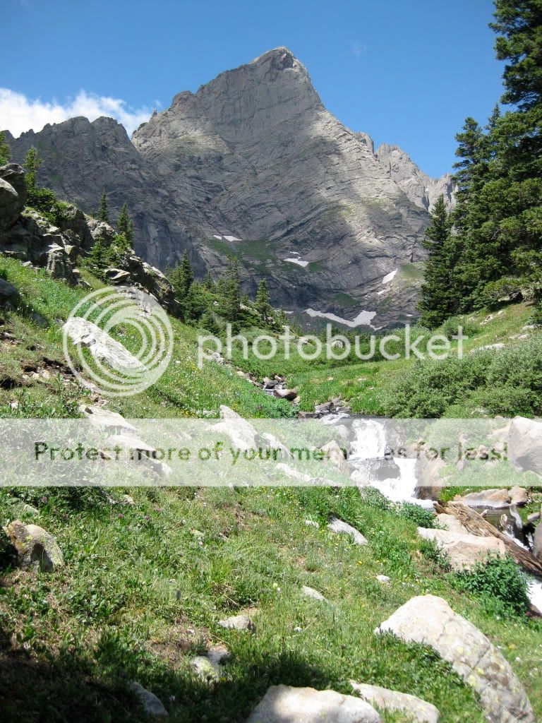
We stowed our headlamps and continued up the amazing valley watching the sun light up the beautiful mountains.
Broken Hand
Crestone Needle
Along the way, Chad and I took a wrong turn at a fork in the trail. The right fork had an established bridge and we decided to take it. Oops. Wrong way. Chad and I discovered this oversight and tried to get back across the creek until we found another trail heading the right direction. By this time, we were pretty wet from the vegetation.
Chad on the wrong side of the creek
After reaching the proper trail, we began the uphill climb to the saddle. This is pretty steep, but wasn't too bad. Trail is well marked with nice steps.
Making my way up Photo by Chad
Looking down on the lakes Photo by Chad
Chad takes in the views
Upon reaching the saddle, we were just over 1000 vertical feet from the summit, but about to start the toughest part. Wind came over the ridge and we remained in Humboldt's shadow. It was a little chilly while exposed. Chad and I ate a little and made gear modifications before heading up. The trail changed to cairn hunting and rock hopping the rest of the way.
L - R: Crestone Needle and Crestone Peak Photo by Chad
Chad taking a break - false summit in view
Trail - Not
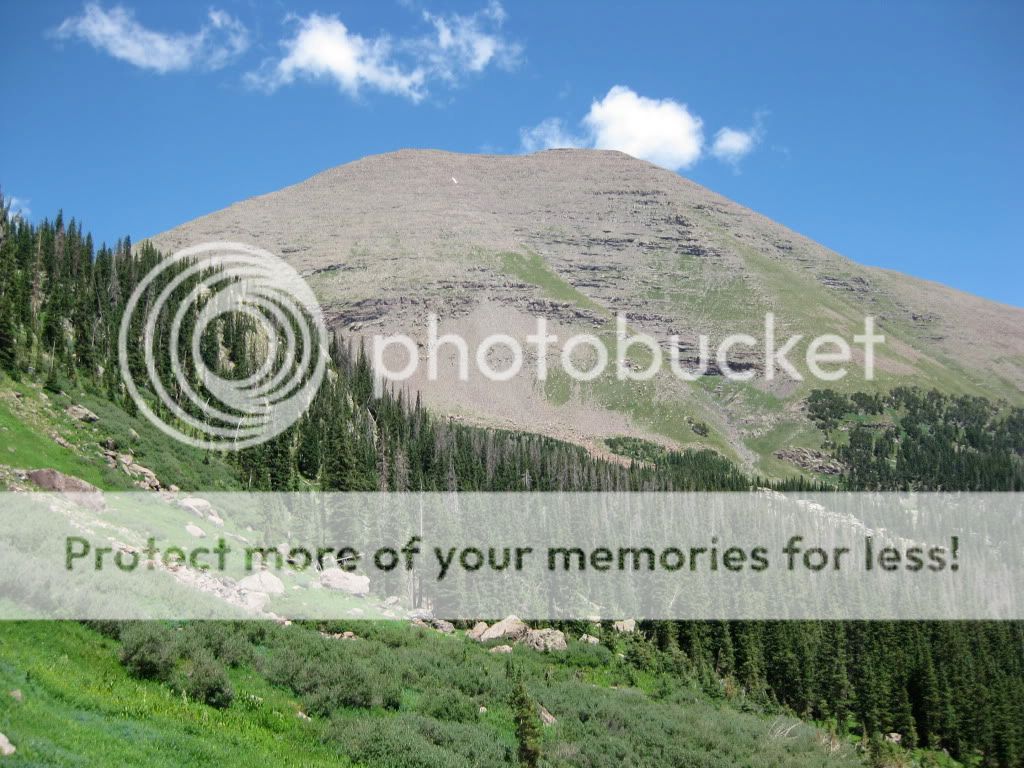
Humboldt's east slope and the valley to the north
Looking down into the valley to the north
When you get close to the false summit, the trail goes to the right where the real summit comes into view. The trail in between is relatively level with about a 100ft scramble at the end.
Bypassing the false summit - real summit in sight
Chad with the true summit
Me Phote by Chad
We arrived on the summit 3.5 hours after beginning. There were a few people on the trail but for 25 minutes the summit belonged to Chad and I and a pesky Marmot. We ate, adjusted our gear, took quite a few pictures and I made a phone call to a coworker in Allentown PA. Hey, it isn't every day you get a call from 14K on the East Coast.
The weather couldn't have been better. A little hazy to see distant peaks, but all the Sangre de Cristos were visible.
Looking down on Westcliffe
Crestones - They are right there and gorgeous
Looking down from where we started - see the trail?
Me calling Dwight Photo by Chad
Chad's summit shot
Blanca Massif Photo by Chad
Photo by Chad
Our pesky summit mate Photo by Chad
Photo by Chad
Kit Carson
After 45 minutes, we started to see the clouds acting strange and with the last known forecast, didn't want to wait. Descent to the saddle took quite a bit of time with careful stepping. Only one twisted ankle, but it didn't hurt. Upon reaching the good trail, our decent picked up speed as the views continued to be beautiful. We stopped to take a couple of pictures and made it back to the car at 12:30.
Flower along the way
Humboldt
While driving back, we talked about the trip and teaming up again on another climb when we were passed by three El Paso County SAR vehicles. Later, we discovered they were headed down to help Custer County SAR rescue a stranded hiker on the Crestones. Although they are beautiful, these mountains need respect. I don't know the circumstances on this particular rescue, however, Chad and I passed a few people who looked very ill prepared. One couple was at 13K in flip flops.
Overall, it was a great trip. Weather and company couldn't have been better. I enjoyed hiking with Chad again and we will definitely team up on another great adventure, but sooner than 10 months
Dave, It was a great trip! Thanks for driving. I really enjoyed the hike/climb with you. We need to do it again. I have an appointment tomorrow to get that ankle looked at.
Nice job guys! Isn‘t that just an incredible hike? Glad you had good weather, and thank goodness for the modern technology that goes into making a durable ankle.
Great TR and pics, Dave and Chad! I can‘t WAIT to get down there in a week or so!
Caution: The information contained in this report may not be accurate and should not be the only resource used in preparation for your climb. Failure to have the necessary experience, physical conditioning, supplies or equipment can result in injury or death. 14ers.com and the author(s) of this report provide no warranties, either express or implied, that the information provided is accurate or reliable. By using the information provided, you agree to indemnify and hold harmless 14ers.com and the report author(s) with respect to any claims and demands against them, including any attorney fees and expenses. Please read the 14ers.com Safety and Disclaimer pages for more information.
Please respect private property: 14ers.com supports the rights of private landowners to determine how and by whom their land will be used. In Colorado, it is your responsibility to determine if land is private and to obtain the appropriate permission before entering the property.