Download Agreement, Release, and Acknowledgement of Risk:
You (the person requesting this file download) fully understand mountain climbing ("Activity") involves risks and dangers of serious bodily injury, including permanent disability, paralysis, and death ("Risks") and you fully accept and assume all such risks and all responsibility for losses, costs, and damages you incur as a result of your participation in this Activity.
You acknowledge that information in the file you have chosen to download may not be accurate and may contain errors. You agree to assume all risks when using this information and agree to release and discharge 14ers.com, 14ers Inc. and the author(s) of such information (collectively, the "Released Parties").
You hereby discharge the Released Parties from all damages, actions, claims and liabilities of any nature, specifically including, but not limited to, damages, actions, claims and liabilities arising from or related to the negligence of the Released Parties. You further agree to indemnify, hold harmless and defend 14ers.com, 14ers Inc. and each of the other Released Parties from and against any loss, damage, liability and expense, including costs and attorney fees, incurred by 14ers.com, 14ers Inc. or any of the other Released Parties as a result of you using information provided on the 14ers.com or 14ers Inc. websites.
You have read this agreement, fully understand its terms and intend it to be a complete and unconditional release of all liability to the greatest extent allowed by law and agree that if any portion of this agreement is held to be invalid the balance, notwithstanding, shall continue in full force and effect.
By clicking "OK" you agree to these terms. If you DO NOT agree, click "Cancel"...
With a Citlalt�petl, aka Pico de Orizaba, climb rapidly approaching, Jen and I are trying to climb as high as we can, as often as we can. But with avalanche threats and winter-time trailhead access issues, it's not easy.
Last weekend we trained hard by skiing and drinking beer. The weekend before that we did Grizzly Peak D. This weekend we thought we'd sleep at 10,000' for a couple nights and attempt Hoosier Ridge and Mt. Elbert. Most of that plan worked out.
On Saturday, Jan. 30, at 9 a.m., we pulled into the empty lot at Hoosier Pass. The sky was mostly clear, except for a large, wispy cloud that blocked the sun, making the 5-degree air feel even colder.
Thankfully, the trail from the pass was mostly tramped down. But we wore our snowshoes anyway, fearing it might get worse farther up the mountain.
A view back toward the pass, with Quandary far-right:
This is about the time I felt the 5-degree air temp searing my cheeks.
But I found warmth in movement:
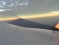
Here's a look at Quandary:
At the first "bump" on the ridge, we cached our snowshoes and pushed on up the wind-blown slope.
Fortunately, we didn't really need the snowshoes beyond that cache point, but there were still times when we postholed in drifts. And all those energy-sucking steps did suck. But, then again, snowshoes suck, too.
I was fully aware of the threats of frostbite, hypothermia and avalanches up there, but no one told me about Indians:
Or man-eating animals:
Jen was unfazed and just continued her push upward:
Apparently, the entire planet had clear skies, but that mothership of a cloud just hung out right above us, and it completely blocked the sun's warmth.
Alas, our objective finally unfolded before us, the highpoint on Hoosier Ridge (far left). Silverheels (right) will be our objective on another day.
At first the remaining ridge didn't look so bad. And, technically, it wasn't at all. But after climbing other parts of the Continental Divide over the years, I knew better than to think this would be easy. After all, being at high elevation for so long, with a lot of up and down - out and back - can wear you down pretty fast.
A glance back:
Really cool sastrugi formations were everywhere. This ocean wave-like formation, in particular, caught my eye:
The long ridge played tricks on us. At times, "bumps" on the ridge looked closer than they were. Other times they looked farther away. There were no reference points, so it was difficult to determine distances.
At one point I thought we were going to call it and turn back. But we still had some fight left in us, so we kept pushing on over the countless false summits on the ridge - in the cold, thin air.
Naturally, we started talking about where we were going to eat and have a beer, post-hike. Jen said, "Isn't there a new brewpub in Buena Vista?" I vaguely recalled hearing about a new brewpub, but I wasn't sure if it was open or not.
At noon we finally arrived at the highest bump on the ridge. Having lived in Indiana when I was in high school and college, I gave a little nod to the namesake ridge for which I have a subtle connection.
Sorry, I don't have any summit photos. I took a short video but it didn't turn out so great. And Jen was busy calling her dad to ask him to Google "Buena Vista brewery." Turns out, BV does have a brewpub now, finally. And it gave me the charge I needed to get off that ridge.
I did take a photo of Quandary from the summit of Hoosier Ridge:
And, then, Silverheels from Hoosier Ridge:
Our descent (which ascended at times) was uneventful and somewhat exhausting.
More sastrugi for my oxygen-deprived mind to hallucinate on:
We saw no one until we were almost back down to treeline. Shortly after 2:30 p.m., we were surprised to find a full parking lot back at the pass.
With wind-chapped cheeks, empty bellies and beer on the mind, we made our way to a part of Buena Vista we had never been - South Main. And that's saying a lot because we've been to BV dozens of times.
"Looks like you guys got some sun today," our Eddyline server said to us, as he brought us a sampler of house beers.
After thoroughly enjoying the food and beer at Eddyline, I took a look at the bouldering rock across the street. I was too tired to play on it, but I was able to press a button a couple times and take this pan:
Meanwhile, Jen took a rest in the living room and contemplated our climb:
Later that evening, at our hotel in Leadville, with half a growler of Eddyline IPA in my belly, I crashed hard.
Thumbnails for uploaded photos (click to open slideshow):
...and timely too. I was planning on going to try the ridge opposite the one you did (North Star and Wheeler Mnts) tomorrow but forecast is a little gloomy and the ridge looks snowier than I thought it would be. I simply hate snowshoeing. Oh well, Winter Park here I come...
Have a great trip to SA... you guys will have an awesome adventure and we‘re all at least a teensy bit jealous!
That ridge *does* go on forever! Especially on the way back out... I remember doing that one a couple years ago, in similar conditions (no sun, cold) - but with high winds and no views. It was like March of the Penguins up there. I like that shot of Quandary - it almost looks like you‘re looking down on the peak.
Sounds like you all have the perfect training in place for Orizaba (days = cold air, up high; nights = cold beer, down low) - here‘s to a fantastic trip to you both! Looking forward to seeing you break those personal altitude records...
Bill, a drink is def in order, and we find ourselves in that part of the state often.
Thanks for the kind words, akmpolsen.
susan, yes, it is long. And thanks for the cheers! We won't make a personal altitude record on Orizaba, though, as we've been up Kili, which is slightly higher ... but this one could be more challenging, altitude-wise, because you warp-speed up to 14k and then go from there, not to mention, there‘s a glacier to contend with. On Kili we ramped it up over 4-5 days.
As a fellow former Hoosier (though I‘d prefer to be called a BOILERMAKER ), I also feel like I should go up there someday. That‘s a long looking ridge and looks like a fun one to do with my dog. Nice pictures; those are cool views of Quandary. Good luck on Orizaba!
Caution: The information contained in this report may not be accurate and should not be the only resource used in preparation for your climb. Failure to have the necessary experience, physical conditioning, supplies or equipment can result in injury or death. 14ers.com and the author(s) of this report provide no warranties, either express or implied, that the information provided is accurate or reliable. By using the information provided, you agree to indemnify and hold harmless 14ers.com and the report author(s) with respect to any claims and demands against them, including any attorney fees and expenses. Please read the 14ers.com Safety and Disclaimer pages for more information.
Please respect private property: 14ers.com supports the rights of private landowners to determine how and by whom their land will be used. In Colorado, it is your responsibility to determine if land is private and to obtain the appropriate permission before entering the property.


")
")
")
")
")
")
")
")
")
")
")
")
")
")
")
")
")
")
")