Download Agreement, Release, and Acknowledgement of Risk:
You (the person requesting this file download) fully understand mountain climbing ("Activity") involves risks and dangers of serious bodily injury, including permanent disability, paralysis, and death ("Risks") and you fully accept and assume all such risks and all responsibility for losses, costs, and damages you incur as a result of your participation in this Activity.
You acknowledge that information in the file you have chosen to download may not be accurate and may contain errors. You agree to assume all risks when using this information and agree to release and discharge 14ers.com, 14ers Inc. and the author(s) of such information (collectively, the "Released Parties").
You hereby discharge the Released Parties from all damages, actions, claims and liabilities of any nature, specifically including, but not limited to, damages, actions, claims and liabilities arising from or related to the negligence of the Released Parties. You further agree to indemnify, hold harmless and defend 14ers.com, 14ers Inc. and each of the other Released Parties from and against any loss, damage, liability and expense, including costs and attorney fees, incurred by 14ers.com, 14ers Inc. or any of the other Released Parties as a result of you using information provided on the 14ers.com or 14ers Inc. websites.
You have read this agreement, fully understand its terms and intend it to be a complete and unconditional release of all liability to the greatest extent allowed by law and agree that if any portion of this agreement is held to be invalid the balance, notwithstanding, shall continue in full force and effect.
By clicking "OK" you agree to these terms. If you DO NOT agree, click "Cancel"...
Nemesis (nem-eh-sis)
-noun
1. Something that a person cannot conquer, achieve.
2. An opponent or rival whom a person cannot best or overcome.
3. Classical Mythology: The goddess of divine retribution.
HISTORY
November 15: I'm headed up Ute pass in the middle of the night in a white-out. The drive to Antero will take over four hours at this rate. I can't see a thing in the windshield. Snowflakes come in from space like Sulu's vision of knives at the helm of the Enterprise ("The Naked Time.") I turn back. Steve Gladbach has no better time of it - he can't figure out why the officer stops him. After a brief discussion he gets on the correct side of the median and continues westbound, this time in the westbound lane. Jim lives vicariously through Michael's trip report.
February 13: Sarah sends an invite for Antero, Cronin and White. The excuse this time is being tired from the one-day 26 mile El Horrendo on Huron the week before. Kevin sends photos of the summit ridge crux. Jim starts to wonder, "Nemesis?"
Antero, seen from Highway 285
March 1: Still planning, Kirk tells Jim, "that rough spot on the south ridge of Antero north of Point 13,820...they (Sarah's group) made it sound like no big deal, so I was a bit surprised when I got there." It got Kirk's attention? Just what I want to hear. So now I can skip it, having mentally climbed it several hundred times, right?
March 6: Jeff V's TR. I've never met Jeff. He seems like a very nice guy, and pretty fast. He pulls 4:18 to the summit, including a stop to don snowshoes at 12,000, and cache at 13,000. His time: 7:00, not including the summit stop. Just for fun, can we break that benchmark? But Humboldt's cat walk calls for winter's conclusion, so no Antero this year. But wait...Like every year, most of the snow comes after winter. I put it on the "to do" list for Spring.
May 7: I'm disappointed I can't make Lindsey with Steve, Britt, Collin, and John. May 8 is still free. Antero still has lots of snow, but in a month or two will be transformed into the summertime 4x4 amusement park I've heard so much about. I need a good solo trip to clear out the karmic congestion: Perfect time to get Antero while it's quiet.
But will Nemesis (The goddess of divine retribution) smile upon my fearful procrastination? Will she have her way with me on the crux? Going forth, I face my fate.
PLANNING and RESEARCH
Weather: KPUB bumps pops from 10% to 20%, and bumps gusts to 50 mph, with a chance of t-storms. Not looking good, but not off the table. The crux is on the east side, so there may be some wind break.
Map Planning: The usual winter route ascends the due-west rib to Point 13,820. The section between the road and 13820 looks steep. Further north it gets worse. Gladbach's party ascended a steep line, north of the due-west rib, in the November white-out. Kirk descended almost directly west of the summit on February 27, and advises against it due to the steep, loose terrain.
While the due-west ridge is the usual winter line, the ridge just south, a W-NW facing line to 13,000, looks like a more moderate approach. Contour lines suggest tundra rather than large talus or rock. Though steeper at the start, the upper section allows an easier SW approach to 13,820. Both are likely dry; a winter mind-set suggests the latter. Adding half a mile one-way is no penalty when vertical is the rate-limiting step. Plan B will be the standard west rib or the gulley, depending on conditions.
ON ROUTE
Baldwin Gulch TH, 9400, 07:08 am. It's a cold, dark, cloudy morning. The start of FR 277 is clear, conjuring up brief thoughts of going back for the car. Pressing on, the large drifts at 9700 definitively put any question of driving immediately to rest. The snow is firm in the morning cold; boots suffice to stay on top. If Nemesis, goddess of retribution, graces the journey with winter-like conditions, I have only to think back on what Gladbach/Davis endured last November. My make-up climb will surely be easier. Right?
Creek crossing at FR 278, 10850. A 15 minute break allows a stash of water and some digging in the pack for more clothes. No sun this morning. The creek is open, but ice on the rocks makes crossing a little exciting. I skip the ice and go for a narrower section downstream which leaves only postholing through the willows as a minor deterrent.
Above the creek crossing, the snow remains relatively firm; boots work if I stay within the minimal evidence of a prior track. Carrying the snowshoes with some occasional grumbling whenever the boots take a dive to explore the depths below, I casually wonder if Nemesis is in cahoots with Pluto. It gets a little tougher, but the ridge is nearly in sight.
Proposed W-NW ridge in background.
Treeline, 12,000 feet, 09:22 am. The west rib and the W-NW rib look mostly dry. The gulley looks good. The one-way snowshoe tracks I've been following go up the gulley. After a 15 minute break to stash 'shoes and water and layer up, I stay with Plan A and take the W-NW ridge to the flat area at 13,000.
Antero summit, top center.
A calm but cloudy morning belies the weather report for gusty winds until now. I can't believe I'm in the alpine this early, but the gathering grey-bottoms suggest this is no mistake. I'm hoping Ms. Nemesis will allow a summit before the weather gets too exciting. Already certain She is in cahoots with Zephyrus (god of the west wind,) I'm hoping she has not sought favor with Zeus (god of thunder and lightening.) The axe is not buzzing, so I press onward.
Looking back down the W-NW ridge.
Cronin's east face.
Point 13,800, 10:28 am. Greybottoms are darkening. Gusts are picking up. Peaks to the north and west are in white-out. Though confident I can pick my way back in zero visibility, I'd rather my flight home be under VFR. We'll watch the sky and keep moving.
As expected, the east side has fairly good snow coverage. The summit ridge beyond the rock towers has a typical west-dry east-snow appearance.
Summit ridge and crux.
At the saddle before the rock towers, Zephyrus taunts the climber's mettle: He snatches my favorite hat, and deposits it in the steepest part of the east-facing snowfield, where it comes to rest 40 feet below, as I gaze in momentary longing. Let it go, first things first, the weather is not looking good and I want the summit. I'll worry about it on the way back if there's time.
Ah, the crux: Two options are presented: Climb across the rock towers on top, or traverse the snowfield to the right. I choose to stay mostly on rock. The spikes stick the rock well, though there are a few sections on the east side where kicking steps is mandatory. The exposure on the tops is limited to a 30-50 foot drop to the west. The snow on the right side is 4-6 inches of wet, slippery stuff on top of a firm crust. The axe will usually punch through the crust. The crux goes smoothly, though speed takes a back seat to caution through this section.
A little steep snow on the east aspect.
Storm clouds threaten from the west and north.
The summit ridge after the rock towers is steeper than anticipated. Some of the snow is bullet-hard, making axe penetration difficult, though mostly, the snow makes for faster work than taking the dry rock to the left. The winds continue to pester as the grey-bottoms darken. We'll worry about the descent later.
Looking back on the crux.
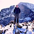
Antero summit, 14,269, 11:15 am. Though still morning, it looks more like late afternoon, given the heavy dark cloud cover. The summit is covered in snow. There is really no place to shelter from the wind. Where's that sunny, relaxed afternoon on the high perch? Not here, not today. Re-layering, taking some photos, and eating a quick lunch, seems like five minutes but turns into thirty. We know how that goes. Let's get back into the trees, or at least to the ascent ridge, before the white-out rolls in, ok?
The kicked-in steps from the ascent serve well on the sketchy sections back across the rock towers - not only for me, but for the secret sharer, who is now just making his way across. We exchange greetings. Snow flurries start blowing across the ridge.
From Antero's summit, looking back at the ridge.
Snow coverage: Winter vs. Spring.
Oh, yes, back at the hat. What's the risk? The weather is holding off for the moment. The snow is soft but slick, about a forty degree pitch, the axe penetrates well. The runout is clean, and terminates in a nearly flat snowfield above the frozen alpine tarn, 500 verts below. We'll give it a shot. Perfect afternoon for a little snow practice, right? The downhill foot wants to slide out but not enough to bother donning crampons. The axe feels secure. I reach my hat. Ah, conditions are looking better already. I don't want to commit hubris by suggesting any such feigned courage has garnered some small degree of respect from the mountain gods. The axe is still quiet, so let's just keep moving.
The ascent ridge seems longer, steeper, and looser on the descent, as expected, but the weather holds for now. Back at snowshoes, I wonder if I'll have to wear the danged contraptions. I take a long break at treeline to eat, drink, unlayer, and tidy up the pack, starting the slog back in boots. It's tricky. With each fall through, I swear I'm going to don the 'shoes with the very next bust through. This little saga continues all the way to the stream crossing, of course.
The ice is gone now, allowing for an easy walk across the rocks, to a final break for picking up water and preparing for more post-holing.
The road back is not too bad, with maybe 30% on dirt and rock. It seems odd to be slogging back in the mid-afternoon light. Snow, and no headlamp? What's up with that? Must be Spring.
Aspens along the Chalk Creek drainage.
Looking back to the west while driving 285, Princeton and Antero are notably absent. In their place is cloud and fog. Nemesis, the goddess of divine retribution, is kind today, allowing an ascent of my personal nemesis just in the nick of time. Mount White, I'll catch you next time around.
I casually wonder how it goes for Steve and the gang over on Lindsey...and hope the snow sticks for a while.
_____________________________________________________________________
All photos taken with a Canon SD 1200 IS
All images shamelessly worked in Adobe Photoshop 6.0
Thumbnails for uploaded photos (click to open slideshow):
Nice job Jim. You‘ve been spending plenty of time reading Ken‘s reports, I think! Way to be creative and express yourself, that‘s what writing a trip report should be all about.
You are going to give Jim 2 out of 5 Stars for this for name dropping. If folks didn‘t want Jim to have this info, they shouldn‘t have put it on the public internet! Shame on you. Jim, great adventure. Let‘s make another this weekend.
Thanks. Yes, north sides and especially east sides still looking very good. If you‘re planning a trip soon, there are plenty of additional photos, so pm me if needed.
Gary, I loved that shot of Cronin in the dense western skys as well - one of my favs of the whole trip. Need to get that peak next go-round. Thanks for your kind comments!
Caroline, I added them to the thumbnails, above: Images 19, 23, and 24. Go get Tab!
Yog, you were fast on the draw! I had just made it active and there was your post! Thanks, man! Yes, the ridge was very enjoyable.
Del_sur, you're right, names should have been withheld to protect the innocent. Seriously, I think you misunderstood my intentions. I've been out this winter with all those "names" (except as noted) - I don't consider them names; these are some wonderful folks. I'm sorry you were disappointed with their mention. I appreciate the kind words on the photos.
Keith, thanks for the warm words of encouragement. I try to be somewhat entertaining. And, yes, I fear catching "grid-disease." PS - thanks for helping with how to get extra photos into a TR - it has come in handy!
Brian! PM me before you run out of Sawatch 14ers!
Caroline, I think you can put together a line in the gulleys. The photos mostly focused on the ridge travel but I may have a couple more that help, so pm me if you need them. And thanks for the kind comments!
BostonBD, yes...perhaps too much drama, but it matched the moods of the weather gods. If the axe started singing Wagner (to coin Kimo : ) I'd have motored right down one of Carolyn's gulleys. Thanks for the kind words!
Michah - In Del_Sur's defense, I don't think Steve ever told that story publicly. But I didn't think he'd mind, and the visual was just too comical! Truth be told I felt ever so slightly guilty when I saw how much they suffered - they summitted just before dark that night. Steve's got more courage than all of us put together, and kudos to Michael and Jeff for sticking it out on that one. I got off way easy with the make-up trip.
Great pictures and write up, as usual! I was going to say #12 & 13 were my favorites (having not climbed Cronin yet contributes to this I think ), but then there were more great shots! Well done! That summit ridge looks pretty fun with the snow
Caution: The information contained in this report may not be accurate and should not be the only resource used in preparation for your climb. Failure to have the necessary experience, physical conditioning, supplies or equipment can result in injury or death. 14ers.com and the author(s) of this report provide no warranties, either express or implied, that the information provided is accurate or reliable. By using the information provided, you agree to indemnify and hold harmless 14ers.com and the report author(s) with respect to any claims and demands against them, including any attorney fees and expenses. Please read the 14ers.com Safety and Disclaimer pages for more information.
Please respect private property: 14ers.com supports the rights of private landowners to determine how and by whom their land will be used. In Colorado, it is your responsibility to determine if land is private and to obtain the appropriate permission before entering the property.


")
")
")
")
")
")
")
")
")
")
")
")
")
")
")
")
")
")
")
")
")
")
")
")
")
")
")
")
")
")