Download Agreement, Release, and Acknowledgement of Risk:
You (the person requesting this file download) fully understand mountain climbing ("Activity") involves risks and dangers of serious bodily injury, including permanent disability, paralysis, and death ("Risks") and you fully accept and assume all such risks and all responsibility for losses, costs, and damages you incur as a result of your participation in this Activity.
You acknowledge that information in the file you have chosen to download may not be accurate and may contain errors. You agree to assume all risks when using this information and agree to release and discharge 14ers.com, 14ers Inc. and the author(s) of such information (collectively, the "Released Parties").
You hereby discharge the Released Parties from all damages, actions, claims and liabilities of any nature, specifically including, but not limited to, damages, actions, claims and liabilities arising from or related to the negligence of the Released Parties. You further agree to indemnify, hold harmless and defend 14ers.com, 14ers Inc. and each of the other Released Parties from and against any loss, damage, liability and expense, including costs and attorney fees, incurred by 14ers.com, 14ers Inc. or any of the other Released Parties as a result of you using information provided on the 14ers.com or 14ers Inc. websites.
You have read this agreement, fully understand its terms and intend it to be a complete and unconditional release of all liability to the greatest extent allowed by law and agree that if any portion of this agreement is held to be invalid the balance, notwithstanding, shall continue in full force and effect.
By clicking "OK" you agree to these terms. If you DO NOT agree, click "Cancel"...
Antero is one of those peaks I had on my list to do before the summer crowds and 4WD traffic that would make hiking up a road even more unpleasant. None of our group had a 4WD with any clearance and so we opted to start from the lower trailhead. For those of you with a Jeep or other decent 4WD vehicle the good news is I can report that several people made it past Baldwin Creek without any problem. For those hiking across the creek you better have water proof footwear and water proof gaiters up to mid calf level.
Here is a picture me and two friends Murray and his girlfriend taken in front of the Baldwin Creek crossing. This is in the morning so just a word that runoff was much quicker and slightly deeper in the afternoon.
Baldwin Creek in the morning
Snow is still being dealt with at a number of key spots along the route. In particular we opted to head up the drainage right at treeline seen in the picture below. The standard route jogs left below where this picture is taken from but the snow in the drainage was in perfect form for booting up and saving some time. This same drainage provided some short glissading options on the descent.
Looking up the drainage at treeline. Picture taken during descent
Snow was in other areas but the only other significant part was the snow along the Class 2 ridge just before the final summit pitch. You can stay close to the rock and walk through the snow with some postholing or stay on rock for some mild scrambling. Here is a picture of that section taken from the summit.
Picture of ridge just before summit pitch
Outside of that there is nothing special to report. 15 miles RT is a long day but it was rewarding as always. By my count 12 people made the summit yesterday including the four in our party.
Here some other photos from the trip
My friend Murray negotiating an airy section on the ridge. This can certainly be avoided by going on the opposite side.
Murray on an airy section of the ridge.
Ptarmigan we encountered on the way down.
Ptarmigan in between winter and summer feathers
Summit picture 1 looking north
Summit picture 1 looking north
Summit picture 2 looking east
Summit picture 2 looking east
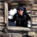
Yours truly
summit photo
Thumbnails for uploaded photos (click to open slideshow):
Always nice to see a fellow 14ers.com member on the trail.
Caution: The information contained in this report may not be accurate and should not be the only resource used in preparation for your climb. Failure to have the necessary experience, physical conditioning, supplies or equipment can result in injury or death. 14ers.com and the author(s) of this report provide no warranties, either express or implied, that the information provided is accurate or reliable. By using the information provided, you agree to indemnify and hold harmless 14ers.com and the report author(s) with respect to any claims and demands against them, including any attorney fees and expenses. Please read the 14ers.com Safety and Disclaimer pages for more information.
Please respect private property: 14ers.com supports the rights of private landowners to determine how and by whom their land will be used. In Colorado, it is your responsibility to determine if land is private and to obtain the appropriate permission before entering the property.


 Baldwin Creek in the morning")
 Looking up the drainage at treeline. Picture taken during descent")
 Picture of ridge just before summit pitch")
 Ptarmigan in between winter and summer feathers")
 Summit picture 1 looking north")
 Summit picture 2 looking east")
 summit photo")
 Murray on an airy section of the ridge.")