Download Agreement, Release, and Acknowledgement of Risk:
You (the person requesting this file download) fully understand mountain climbing ("Activity") involves risks and dangers of serious bodily injury, including permanent disability, paralysis, and death ("Risks") and you fully accept and assume all such risks and all responsibility for losses, costs, and damages you incur as a result of your participation in this Activity.
You acknowledge that information in the file you have chosen to download may not be accurate and may contain errors. You agree to assume all risks when using this information and agree to release and discharge 14ers.com, 14ers Inc. and the author(s) of such information (collectively, the "Released Parties").
You hereby discharge the Released Parties from all damages, actions, claims and liabilities of any nature, specifically including, but not limited to, damages, actions, claims and liabilities arising from or related to the negligence of the Released Parties. You further agree to indemnify, hold harmless and defend 14ers.com, 14ers Inc. and each of the other Released Parties from and against any loss, damage, liability and expense, including costs and attorney fees, incurred by 14ers.com, 14ers Inc. or any of the other Released Parties as a result of you using information provided on the 14ers.com or 14ers Inc. websites.
You have read this agreement, fully understand its terms and intend it to be a complete and unconditional release of all liability to the greatest extent allowed by law and agree that if any portion of this agreement is held to be invalid the balance, notwithstanding, shall continue in full force and effect.
By clicking "OK" you agree to these terms. If you DO NOT agree, click "Cancel"...
Peak 10 - 4th of July Bowl
Began - 5:50pm
Summited - 7:15pm
RT - 6.5 to 7 miles, 2800ft
Since moving to Summit County, I have tried to take advantage of 1, living at 10,000 feet and 2, getting in all the Tenmile, Eastern Gore and anything else within earshot of I-70 so I have more time on the weekends to focus on the goods. Since I usually get off work around 5pm, nabbing some classics in the region has been a nice change of pace from the Rec Center.
Anyways, this is more geared towards a conditions update and Tenmile beta report. Plus climbing and skiing stuff on a clear early evening is therapeutic.
Slipped out of work around 4:45pm and straight lined it for Beaver Run near the base of Peak 9 in Breckenridge. On a side note, the directions to the 4th of July TH (for low clearance vehicles) by EdF on Summitpost are sufficient enough to get you there. Just refer to his description if you are unaware of that road. From a Subaru Impreza owner's perspective, once you pass Pk.9 House, you have no more than � a mile before you should begin looking for spots, which there are plenty of FYI. Right now, high clearance 4wd vehicles can make it to just above treeline. There is still a relatively deep (2-3 foot) snowbank blocking any further passage.
snowbank just above treeline, blocking further passage for any vehicle
I decided to go with my AT boots for hiking, which wasn't too bad for such a quick outing. I had skied Breck many times over the years, but never was able to see it in this light. Very unique experience.
Not too long after the initial snow crossing, I got my first good view of the 4th of July Bowl and Peak 10. Its pretty refreshing to see this kind of coverage on any slope in any range this time of year, even if it's starting to melt a little up top.
4th of July Bowl, 2nd day of Summer, 2010
My initial plan was to just boot up the NE ridge along the snow to the summit, but hiking up the switchbacks on the road were just too convenient.
Old cabin along one of the switchbacks towards East Ridge
I turned up my Ipod and just zoned out till I reached the East Ridge and then the road topped out and I had some solid views of Quandary's North side, Crystal's East Face and the very top of Pacific and its North Couloir. Father Dyer was dry.
Quandary North Face
Crystal and Pacific
Then continued up the ridge after some Gatorade and cheese bread. Somewhere along the ridge, a wave of nostalgia passed through me as I gazed over at Crystal and Steve Winwood came on the headphones. I think it was a mixture of listening to my dad's old favorite band and my first mountain ever on AT skis, but it was an extremely calm feeling. Had I more time, I would've enjoyed it longer, but the realization of the coral reef snow and my timeframe, I pushed on to the summit, reaching it a little after 7pm. This was notably one of the more peaceful hikes I've done, so straightforward and a nice way to end a day.
Looking west towards 4th of July Bowl
This is obviously an extremely popular mountain in anytime of the year, but it's a cool feeling sitting up there after a day's work, reflecting on stuff in your life, being so close to a town, but feeling a world away. I was reminded why I love solo outings so much and to say this happened on a Tuesday is something worth cherishing.
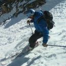
Anyways, there didn't seem to be enough hours in the day on a fine evening like this, but I eventually took some summit shots, clicked into my skis and began the rough ski down.
Flag on summit
Tenmile Range
Tenmile Traverse looking North
looking down 4th of July Bowl
The ski was rough, but quick. I can't complain cause I was up here mainly for the solitude and the exercise, skiing down 1500 feet was just a nice bonus, regardless of the hardened snow.
Some shots of the way out :
looking to the Northeast from the road out
Peak 9
Put on some Paul Simon and was back at the car in no time, just in time to get one last shot of the lights of Breckenridge with Grays and Torreys in the background.
Lights of Breckenridge
Thumbnails for uploaded photos (click to open slideshow):
I had been wondering about conditions on Crystal, thanks for the beta. Way to get P10 before it gets bumped out on the 4th! I‘m on my third year of skiing at least once a month every month... good to know where the snow is hangin‘ on. Nice TR
about 1/2 mile from top of Mercury Lift and about 2 miles from base of pk.10. Keep in mind this was a week ago and its been in the 80s in Summit County.
I drove up 6/29 just to see how far my jeep would make it, still unpassable snow blocking the road, the pic you posted looked like the same spot i got block at, and that snow looks like its going no where soon
bcrowley, thanks for the update, it was still relatively deep on the 22nd, but I‘d assume most of it would melt. Dug in like a tick is sounds like.
elkheart - don‘t let the snow deter you. Like I said, it took an hour and 25 minutes from the Mercury lift, its 6 miles and 2800 feet from where I began. If you have a higher clearance vehicle, it‘ll be probably 5 miles RT and 2200-2300 vertical. Either way, a very easy day.
Maybe we should have kept it going. 4th of July bowl looks like a pretty grand way to spend a mid work week evening.
Caution: The information contained in this report may not be accurate and should not be the only resource used in preparation for your climb. Failure to have the necessary experience, physical conditioning, supplies or equipment can result in injury or death. 14ers.com and the author(s) of this report provide no warranties, either express or implied, that the information provided is accurate or reliable. By using the information provided, you agree to indemnify and hold harmless 14ers.com and the report author(s) with respect to any claims and demands against them, including any attorney fees and expenses. Please read the 14ers.com Safety and Disclaimer pages for more information.
Please respect private property: 14ers.com supports the rights of private landowners to determine how and by whom their land will be used. In Colorado, it is your responsibility to determine if land is private and to obtain the appropriate permission before entering the property.


 snowbank just above treeline, blocking further passage for any vehicle")
 4th of July Bowl, 2nd day of Summer, 2010")
 Old cabin along one of the switchbacks towards East Ridge")
 Quandary North Face")
 Crystal and Pacific")
 Looking west towards 4th of July Bowl")
 Flag on summit")
 Tenmile Range")
 Tenmile Traverse looking North")
 looking down 4th of July Bowl")
 looking to the Northeast from the road out")
 Peak 9")
 Lights of Breckenridge")