Download Agreement, Release, and Acknowledgement of Risk:
You (the person requesting this file download) fully understand mountain climbing ("Activity") involves risks and dangers of serious bodily injury, including permanent disability, paralysis, and death ("Risks") and you fully accept and assume all such risks and all responsibility for losses, costs, and damages you incur as a result of your participation in this Activity.
You acknowledge that information in the file you have chosen to download may not be accurate and may contain errors. You agree to assume all risks when using this information and agree to release and discharge 14ers.com, 14ers Inc. and the author(s) of such information (collectively, the "Released Parties").
You hereby discharge the Released Parties from all damages, actions, claims and liabilities of any nature, specifically including, but not limited to, damages, actions, claims and liabilities arising from or related to the negligence of the Released Parties. You further agree to indemnify, hold harmless and defend 14ers.com, 14ers Inc. and each of the other Released Parties from and against any loss, damage, liability and expense, including costs and attorney fees, incurred by 14ers.com, 14ers Inc. or any of the other Released Parties as a result of you using information provided on the 14ers.com or 14ers Inc. websites.
You have read this agreement, fully understand its terms and intend it to be a complete and unconditional release of all liability to the greatest extent allowed by law and agree that if any portion of this agreement is held to be invalid the balance, notwithstanding, shall continue in full force and effect.
By clicking "OK" you agree to these terms. If you DO NOT agree, click "Cancel"...
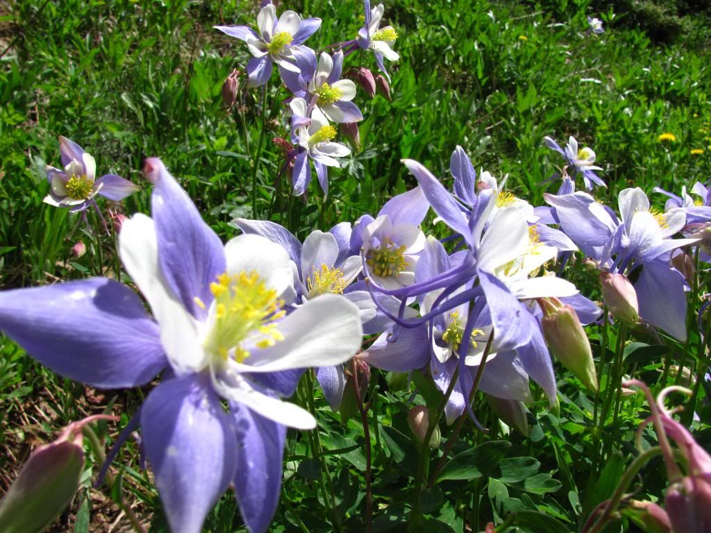
Growing up in Rollinsville, I have been up Fourth of July Trail more than any other trail in the state. Still, it wasn't until the summer of 2008 that I started my adult hiking phase at 28 years old (11 years after the last hike). That year Arapaho Pass and 12,000 feet worked me over good. Throw in another couple dozen hikes, a few 14ers and South Arapaho sounded like a walk in the park.
Coincidentally, Independence Day was the day that worked for our party's schedule. We left Loveland at 3:00am, but had to drive the speed limit because of the State's presence. Two whole frickin' hours later we parked at the trailhead and headed out. For a holiday weekend the lack of cars on the road was surprising. The road up to the trailhead is manageable by virtually any vehicle, just take care after the Hessie Trail parking area for a half mile or so.
There was quite a bit of runoff compared to my previous trips in the area. Extra socks came in handy...
Approaching the mine...
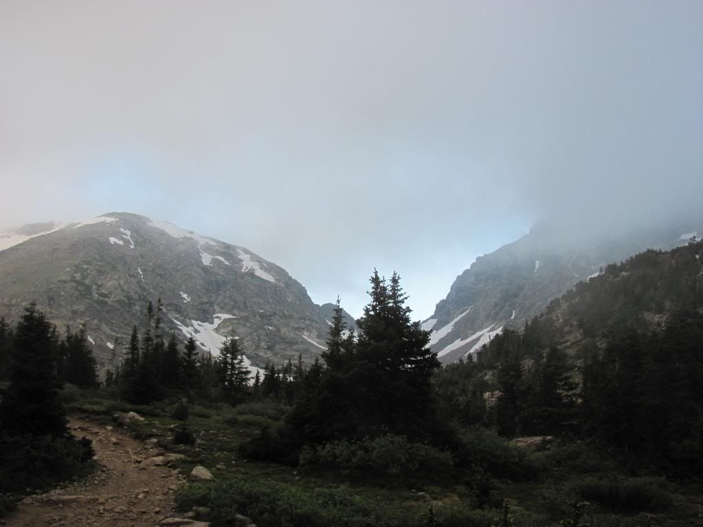
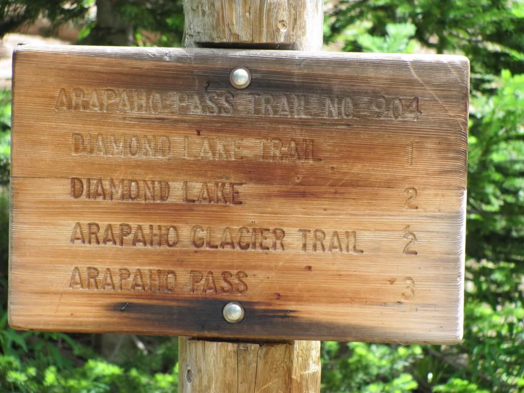
The trail is self explanatory. You hike through the trees and up (follow the signs for "Arapaho Glacier Trail"), until the right turn at the mine. A slightly wider stream crossing greets you after the mine and then it's up and into the tundra from there...
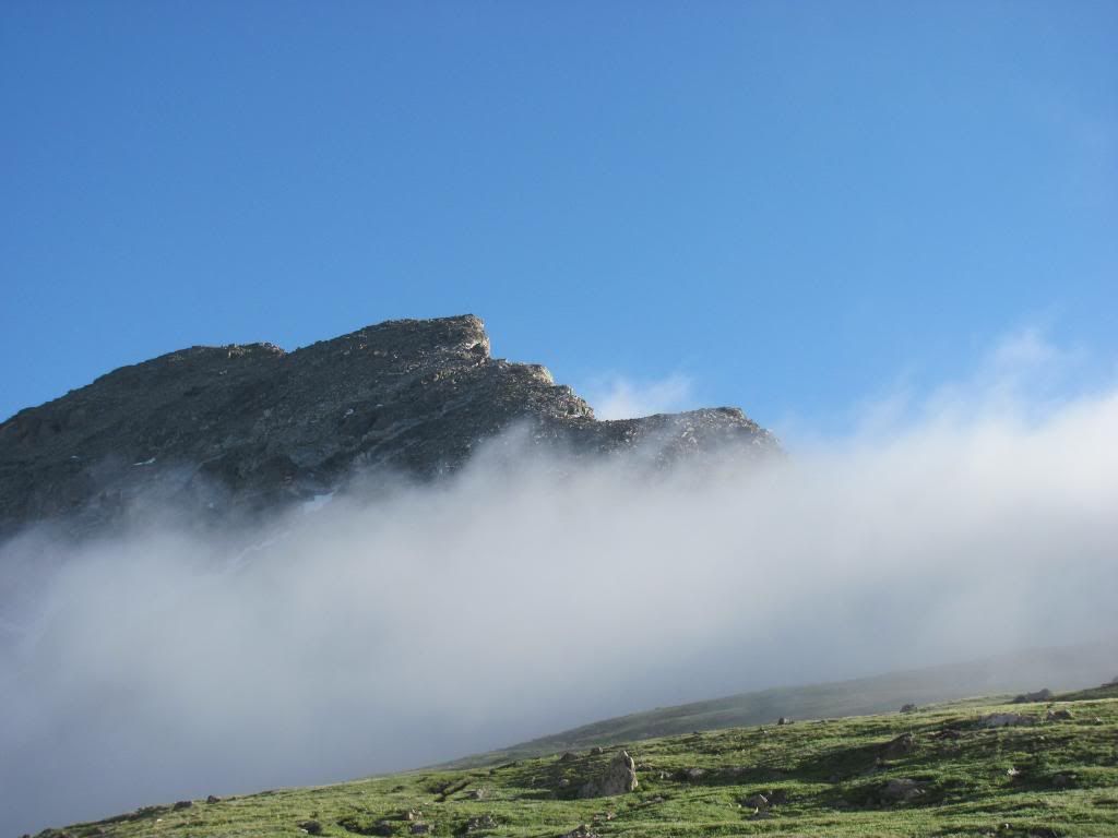
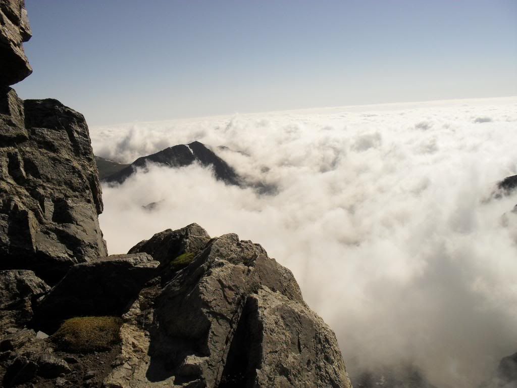
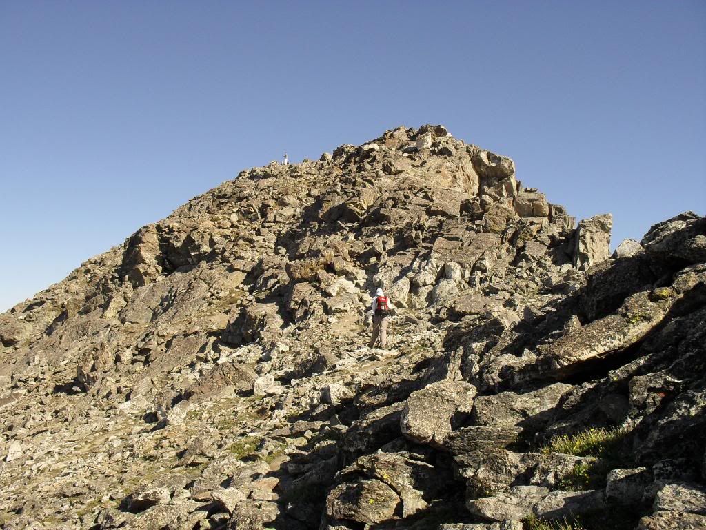
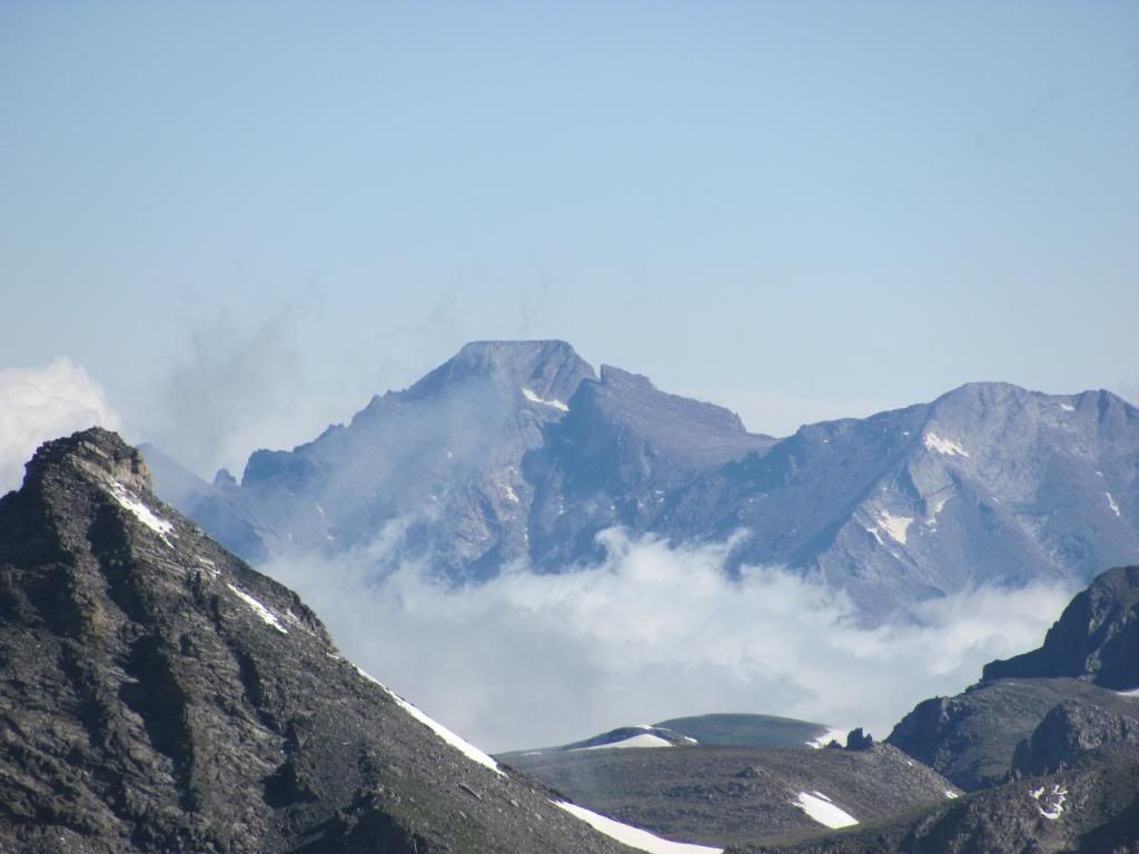
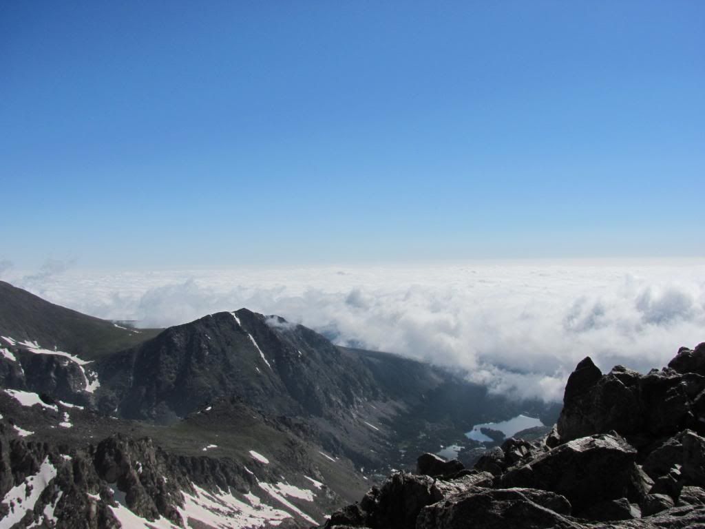
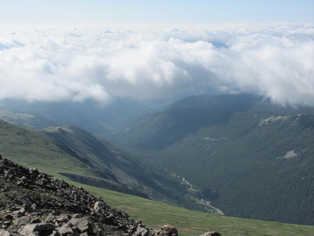
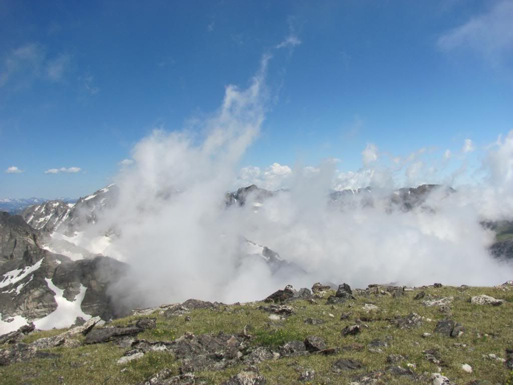
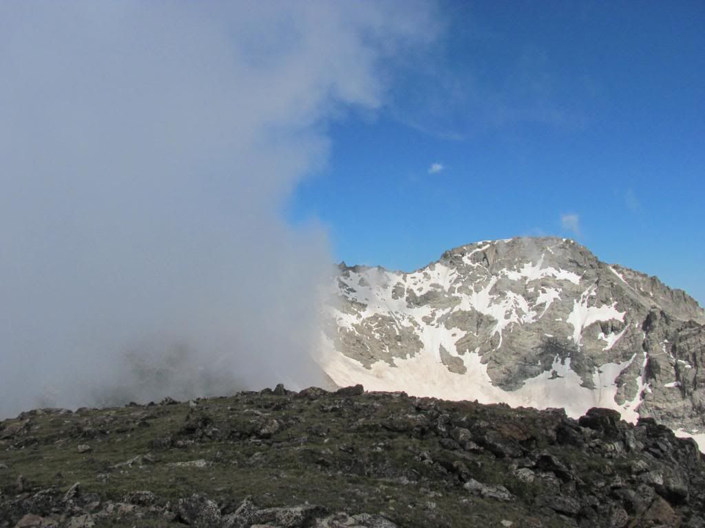
Getting close to four miles and 12,600', the saddle between "Old Baldy" and South Arapaho greets you. On this day, the clouds were beginning to thin out and the layer below had that ocean look to it...
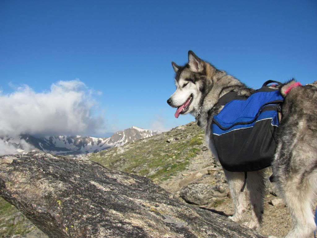
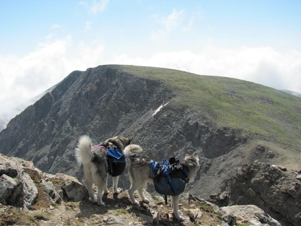
From this point forward the trail is a hodgepodge of spiderweb arms leading every which way. It's really not that hard, but I had two dogs with me that were still a bit rough around the edges on class 2 rock. I found hugging the ridge as far right as possible yielded the best lines. If memory serves me right, there are three main pitches to the summit from the saddle (pitches in a mere mortal sense). At the second pitch, I went about 10-15 yards left of the edge and found the main schizophrenically cairned route to the summit...
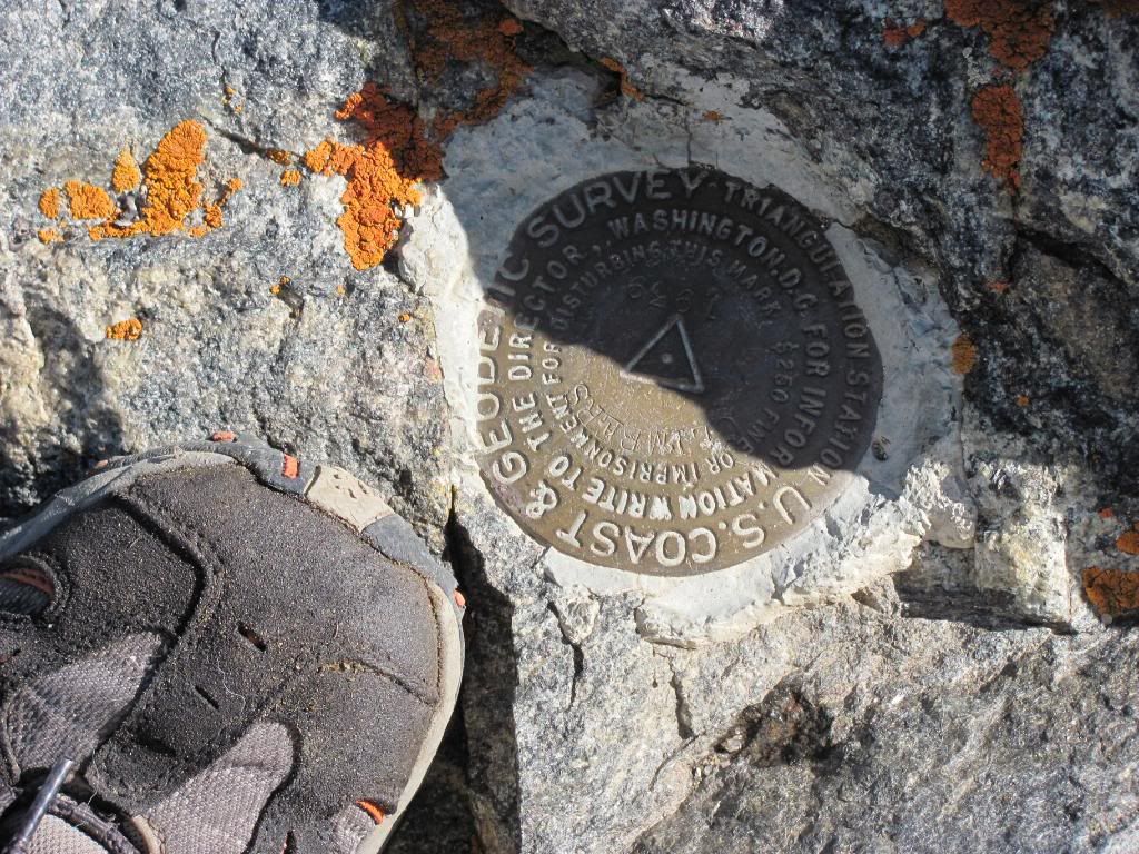
The points of interest marker was scratched up pretty good. I still managed to find a suitable angle for a pic...
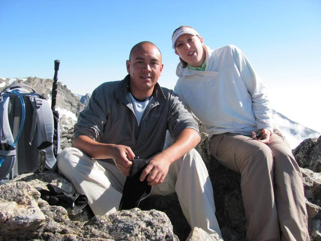
Here's me and the wife. We've lost over 100 pounds collectively since New Year's Day. Turns out that DOES make a difference in a person's endurance...
The hike down was quite easy. Being that the trail was blatantly obvious from above...
As the others went down from the saddle, I decided to throw "Old Baldy" in for good measure. Hell, we're thinking Halo Ridge next week, better cram in some extra credit while it counts...
All in all it was a great day out in the Indian Peaks. Usually I'm jamming my way through crowds on this trail. But this was an exceptional day with impeccable timing. We were the first summit, and encountered maybe a dozen folks on the way down (half of them in denim and no packs). People, stop giving us responsible dog hikers a bad name!!! I've never seen so much waste and disregard for any sort of etiquette. Hell in a handbasket I tell ya'.
With Pt. 13,038:
12.44 miles round trip
3,754 feet vertical gain
7 hours, 8 minutes
5:10AM start time
The weight control sucks, but losing the equivalent of nearly two poorly stuffed 40L packs is awesome. I can‘t out the official numbers without hearing about it later. We actually committed to the New Year‘s thing this year. Feels great, and I‘m on track to crush my hiking goals for 2010.
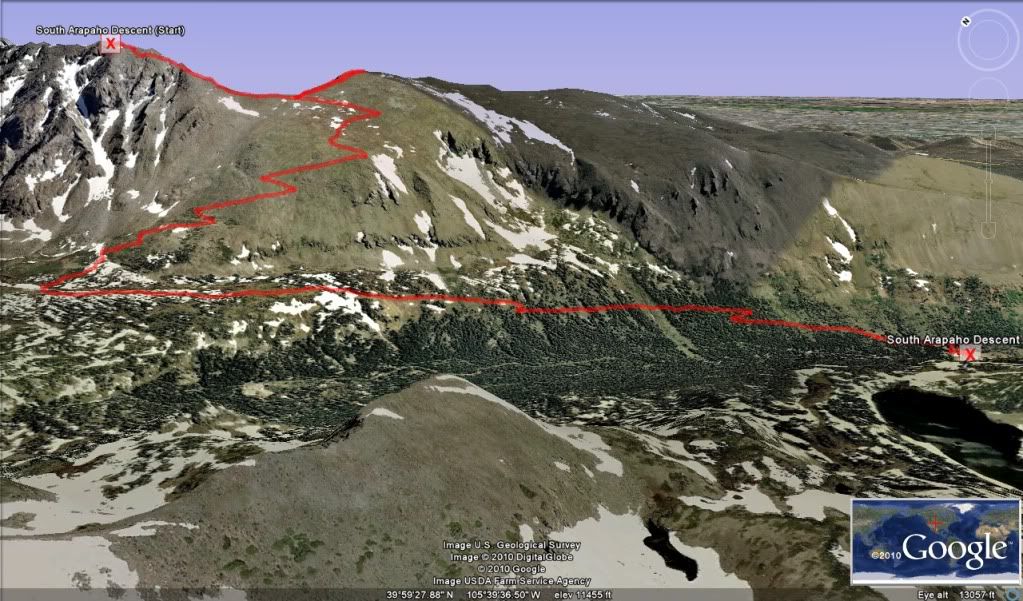
was tracked on my Android phone with MyTracks, and I send it to my Google account. Then open it in the Maps>My Maps tab and view in Google Earth. It takes a while playing around with the perspective to get a good view like that. Then I ctrl+alt+a and fly around in the simulator looking at all the hikes I‘ve done. Wastes a lot time that does.
I‘m happy to hear of your loss... 1/19/2011 3:38am
...100 pounds between the two of you. Since new year‘s day 2010? That's impressive, and I'm sure you're enjoying your time in the mountains a lot more.
Oh, and nice trip report. Thanks for posting.
Caution: The information contained in this report may not be accurate and should not be the only resource used in preparation for your climb. Failure to have the necessary experience, physical conditioning, supplies or equipment can result in injury or death. 14ers.com and the author(s) of this report provide no warranties, either express or implied, that the information provided is accurate or reliable. By using the information provided, you agree to indemnify and hold harmless 14ers.com and the report author(s) with respect to any claims and demands against them, including any attorney fees and expenses. Please read the 14ers.com Safety and Disclaimer pages for more information.
Please respect private property: 14ers.com supports the rights of private landowners to determine how and by whom their land will be used. In Colorado, it is your responsibility to determine if land is private and to obtain the appropriate permission before entering the property.