Download Agreement, Release, and Acknowledgement of Risk:
You (the person requesting this file download) fully understand mountain climbing ("Activity") involves risks and dangers of serious bodily injury, including permanent disability, paralysis, and death ("Risks") and you fully accept and assume all such risks and all responsibility for losses, costs, and damages you incur as a result of your participation in this Activity.
You acknowledge that information in the file you have chosen to download may not be accurate and may contain errors. You agree to assume all risks when using this information and agree to release and discharge 14ers.com, 14ers Inc. and the author(s) of such information (collectively, the "Released Parties").
You hereby discharge the Released Parties from all damages, actions, claims and liabilities of any nature, specifically including, but not limited to, damages, actions, claims and liabilities arising from or related to the negligence of the Released Parties. You further agree to indemnify, hold harmless and defend 14ers.com, 14ers Inc. and each of the other Released Parties from and against any loss, damage, liability and expense, including costs and attorney fees, incurred by 14ers.com, 14ers Inc. or any of the other Released Parties as a result of you using information provided on the 14ers.com or 14ers Inc. websites.
You have read this agreement, fully understand its terms and intend it to be a complete and unconditional release of all liability to the greatest extent allowed by law and agree that if any portion of this agreement is held to be invalid the balance, notwithstanding, shall continue in full force and effect.
By clicking "OK" you agree to these terms. If you DO NOT agree, click "Cancel"...
Route:
Kilpacker basin to the South Slopes route up El Diente
Traverse to Mt Wilson
Southwest slope descent off Mt Wilson back to Kilpacker
Chris (cbauer10) and I attempted Mt Wilson and El Diente a few weeks ago via Navajo but turned around at the base of El Diente when a storm hit us at 5 am (not the most fun moment in our climbing history). We ended up climbing Wilson Peak on that trip but decided to leave Mt Wilson and El Diente for another time (when hopefully the mountains were a little more dry and stable). Luckily, we managed to find a 36 hour window in our crazy schedules to try again.
This attempt, Chris and I decided to climb via Kilpacker. We had heard that the South Slopes route up El Diente is much more stable than the north side of the mountain. After a little research, we decided to try to come down Mt Wilson via the southwest slope rather than climbing down Mt Wilson on the north side to Navajo and hiking back around to Kilpacker to reach our car (as most people do, I think). We used this trip report for information on this route.
Ascent up El Diente:
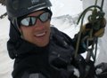
After driving down from the Denver area the evening before and getting a little sleep in the trailhead parking lot, we hit the trail at 3:30am. The approach to Kilpacker basin was straightforward and went quickly (not a whole lot of up, and even a good amount of down) and we found ourselves passing the waterfall around 5:30. A little while later, we made the left turn to start up El Diente. Based on the nightmare stories I had heard about these mountains, I was expecting the route up El Diente to be much, much harder. I kept waiting for things to get crazy but it never happened. Chris and I both thought that this route up El Diente was incredibly straight forward and safe - at least compared to what we were expecting. We followed a group ahead of us (a tour guide and his client) up the last 2,000 feet and summited about 9am. The tour guide did mention that he thought El Diente was the easiest of the three peaks if you do it by this route. Success on El Diente!
Traverse to Mt Wilson:
The weather was absolutely perfect so we went ahead with plans to do the traverse. We found that doing the traverse from El Diente to Mt Wilson the route pretty much got increasingly difficult. The first half was very well cairned and was strictly class 3. The second half had many more difficult class 3-4 moves. However, there was always solid rock where we needed it. In fact, we were expecting it to be a lot more difficult with loose rock. Again, this might be a matter of expectations and opinion. I think we did get off route about twice but it wasn't a big deal. There is one section that Chris says is a little like the knife edge on Capitol, but shorter. Definitely a lot of exposure but the rock is solid and it was actually pretty fun. The traverse took us 3 hours 20 minutes - slightly slower than some, but we were taking our time as there wasn't a cloud in the sky for miles. The Narrows on the traverse
Finally we reached the crux of the climb to Mt Wilson. For me this was the hardest part of the whole day. After the traverse, I was getting tired so the last few moves up Mt Wilson were a little interesting. I think Chris (who has a lot more experience) thought it was a bit challenging too. We passed one group coming down and met up with one hiker, Mike, who was heading up. Alas, we reached Mt Wilson just before 1pm. Big congratulations to Mike - this was his finisher!! Made it to Mt Wilson!
Descent off Mt Wilson:
We hung out and fueled up for the trip down Mt Wilson. Mike decided to come with us. Due to changes in plans he found himself without a partner for this climb and he wasn't excited about climbing down Mt Wilson on the standard Northeast Ridge trail. He thought it was pretty hairy. So instead Mike came down the South slopes with us and planned to hike around back to Navajo. We left the summit about 1:30.
The southwest slopes route off of Mt Wilson was absolutely do-able and really not bad at all. Mike said he thought it was easier than the standard trail which he had just climbed up. The first benefit was that we didn't have to downclimb the crux - something that made me very excited. We climbed down the gully which is just to the southwest of the summit. Basically, we headed off the summit exactly opposite of the way we came from the standard route and the gully is right there. The gully starts off somewhat solid but it does get more loose and steep as you climb down. We gave each other lots of space and took our time. At one point about 2/3rds of the way down we did decide to switch gullys as Chris thought our gully was about to get much more steep. Switching gullies required a short class 3 move (the only move on the whole route over class 2). We got back to the basin where the trail turns to El Diente in less than 2 hours. We reached our car at 6:15 - less than 15 hours later! Okay, not exactly super speedy but we had an awesome day weather-wise.
Chris and I highly recommend this route. To us, Kilpacker just makes more sense than Navajo. Just bring your helmet and take your time. If we did it again, we may consider going up Mt Wilson and down El Diente. That way the traverse gets easier as you go, not harder, and because the south slopes route on El Diente is so much more solid than Wilson getting down it would probably be pretty easy. However, one reason we did it the way we did was because if it had been a busier day, descending El Diente would have put us under a portion of the traverse and we would have risked groups above us kicking rocks down.
A look to Mt Wilson from the traverse. We descended via the gully just to the right of the summit (as shown in this picture). Near the top of the gully Chris, the human Cairn, marks the spot where we jumped gullys. Mike on the few class 3 moves to get between gullys The bottom portion of the gully Looking up at the bottom portion of the gully A look back at our route down (somewhere in the center of the photo!)
Again, congratulations to Mike for finishing! And good luck to Chris who now just has to Chicago Basin to go.
Glad you got back there and got the traverse! My friend and I were the hikers behind you on Wilson Peak the day you opted against El Diente due to weather/slides. Although I am confused what South Slopes route you went that was ”solid.”
Very helpful with that optional descent route! After experiencing both the north and south sides of El Diente, I would have to concur wholeheartedly that I much prefer the south slopes. Thanks for posting. Happy trails!
I thought it was incredibly solid except for about 100 feet before you reach the base of the Organ Pipes. From there is was solid to the top too.
Also, if you were one of the guys in the mining shack that we talked too a few weeks ago, what ever came of your friend? The one that accidentally went for Gladstone instead of Wilson Peak and you were worried he didn't know what he was doing. Did you end up going for Wilson Peak that day? I know you were worried because you only had shorts.
We seem to have had vastly different experiences on El Diente's South Slopes. For us, the rock was incredibly tippy, and we were nervous because of the large boulders that seemed primed to go. This also could have been because we'd just come off the Chicago Basin immediatley before and were, cumulativley, tired. Definitely agree that route-finding was not an issue, though. I do hear the South Slopes are waaaay better than the north side.
Chris--
No, we weren't the guys in the mine shack. We were the guys literally right behind you coming down Wilson Peak as it rained/hailed/grauppeled on us. The guys in the shack did go for it, though I don't know what came of their Gladstone friend. I think they realized they'd been standing around cold for an hour (!) and would be better off moving towards a summit cold!
Chris, El Diente will be my finisher. I was in Chicago Basin this Weekend and am now at 57. Don't ask me why I have to go back for a single peak. I have the scars to prove it.
Sorry, I didn't mean to say the south slopes on El Diente was "solid." How about "significantly more solid" than Wilson.
Glad you guys off Wilson Peak safely! The weather sure was nasty that day.
Glad it went so well this time and the weather worked out. I had to bail off that ridge early in the morning a couple years ago. Enjoy the rest of the summer climbing season.
Great Notes on Jumping the Gullies 7/6/2012 4:29am
Thanks for the info on jumping the gullies. I will use that in a couple of weeks.
Caution: The information contained in this report may not be accurate and should not be the only resource used in preparation for your climb. Failure to have the necessary experience, physical conditioning, supplies or equipment can result in injury or death. 14ers.com and the author(s) of this report provide no warranties, either express or implied, that the information provided is accurate or reliable. By using the information provided, you agree to indemnify and hold harmless 14ers.com and the report author(s) with respect to any claims and demands against them, including any attorney fees and expenses. Please read the 14ers.com Safety and Disclaimer pages for more information.
Please respect private property: 14ers.com supports the rights of private landowners to determine how and by whom their land will be used. In Colorado, it is your responsibility to determine if land is private and to obtain the appropriate permission before entering the property.


.")


")
 Success on El Diente!")
 The Narrows on the traverse")
 Made it to Mt Wilson!")
 A look to Mt Wilson from the traverse. We descended via the gully just to the right of the summit (as shown in this picture).")
 Near the top of the gully")
 Chris, the human Cairn, marks the spot where we jumped gullys.")
 Mike on the few class 3 moves to get between gullys")
 The bottom portion of the gully")
 Looking up at the bottom portion of the gully")
 A look back at our route down (somewhere in the center of the photo!)")