| Peak(s): |
Blanca Peak - 14,350 feet Ellingwood Point - 14,057 feet |
| Date Posted: | 11/17/2010 |
| Date Climbed: | 11/05/2010 |
| Author: | glodder |
| Peak(s): |
Blanca Peak - 14,350 feet Ellingwood Point - 14,057 feet |
| Date Posted: | 11/17/2010 |
| Date Climbed: | 11/05/2010 |
| Author: | glodder |
| Blanca/Ellingwood - Early November 2010 |
|---|
|
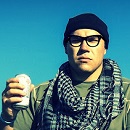
My friend, Steve, e-mailed me in late-October to say he was planning on making a trip to Colorado on Thursday, Nov. 4th for some climbing of 14ers, and that I could pick up a few more by tagging along with him. I talked it over with Kelly and we decided it was OK for me to go. The plan was to find a few 14ers which didn't have too much snow, and after research we determined the Blanca Group might be a good place to visit. Although there was some snow in mid-October throughout Colorado, the Alamosa area had enjoyed a few weeks of sunny and relatively warm days, so snow appeared to not be as much of an issue on the Blanca Group. So the plan was to climb Blanca Peak and Ellingwood Point on Thursday and Friday, then we would stay at a motel in Walsenburg on Friday night, and then potentially climb Mt. Lindsey on Saturday if we felt up to it. We would have a quick turnaround time from Kansas to Colorado's high altitudes so we had to watch out for any altitude sickness issues. Neither of us had ever had any problems with altitude sickness in the past, so we weren't overly worried about it. We both booked the same flight from KC to Denver on Thursday at 2:00 (Southwest Airlines). I had a window seat, and the pilot took us pretty far south in Colorado before turning north along the Front Range to DIA. This gave us a great preview of what the mountains looked like from above. There was hardly any snow on the southern mountains (such as the Blanca Group), and as we worked our way north, there was a lot more snow on those mountains than in the south. It appeared we had made a good decision on the mountains we were planning to climb. We arrived at DIA, obtained our rental car (a Nissan XTerra), and were driving through the Aurora area on E-470 at around 3:30. We continued down I-25, and made a stop in Pueblo for dinner at a restaurant called Jorge's Sombrero. It was a solid decision as Jorge's had some good Mexican food. After dinner, we stopped at a local grocery store, bought some food and water for the climb, and then changed into our climbing clothes. We set out for the Lake Como Road. We arrived at the turn-off for the road at around 9:00, and then started making our way up the notoriously rough road in the dark. Steve did a good job driving through the rocks and tough spots, and he made it past a few spots where I thought there was no way we would pass. We finally reached a spot where it was obviously prohibitive for the XTerra, so we parked off the side of the road in a turn-out area. At this point, we had driven 4.4 miles from the highway. Bill's 14ers.com route description mentioned a total mileage from a parking area to Lake Como of 5.25 miles. However, Roach's book gave a mileage of 6.8 miles from the road to the Lake. I was inclined to believe Roach's mileage since Bill's description didn't quite describe which parking area the mileage was measured from. So we figured we had about 2.4 miles to hike from where we parked to Lake Como. We decided to go ahead and hike to the Lake instead of spending the night where we parked, since the weather was perfect, it was a beautiful starry evening, and we figured we might as well knock out some mileage tonight since we weren't tired. So we packed up our heavy packs and began hiking at around 10:15. I wasn't exactly sure how I was going to pack everything since I had never packed things such as snowshoes, an ice axe, and so much extra clothing, but I figured it out. The pack was definitely the heaviest I've ever carried but it didn't end up being a problem at all. We were moving at a solid pace and we finally made it to the Lake around 12:30 a.m. We figured the 6.8 mile length Roach reported had to be slightly off due to how long it took us to get there (we came to this conclusion on the way down as well, due to the time it took to get down from the Lake to the car). We felt like the mileage had to be in excess of 7 miles, maybe approaching 8 miles. After arriving at the Lake, we easily found the campsites on the east side of the Lake and set up camp. We were in the tent by around 1:15 a.m. or so. It was a cold night. I didn't get much sleep, partially because I never seem to sleep well in a tent, but also due to how cold it was. I determined during this night that I need to buy a new sleeping bag that takes me down to colder temperatures! The sun finally came up and we got out of our tent at around 8:00 on Friday morning. Surprisingly, I thought it was actually warmer outside the tent than inside. This was peculiar, since we thought it would be absolutely freezing when we unzipped that tent door. The view of the Lake was very pretty. It looked like a little more than half of the Lake was frozen over. We packed up our gear into our smaller packs and started hiking up the trail toward the summits at 8:30. Here is a pic of me with Lake Como in the background:  Our plan was to summit Blanca first and then Ellingwood. The weather was again perfect at this point, and as we came up above treeline, the sun was shining on Ellingwood Point's summit. It was a beautiful view. Here are two pics, the first of me and the second of Steve:   We passed a few more lakes on the way up to the higher slopes, including Blue Lakes and Crater Lake. From above, you can see exactly why it was named Crater Lake! Above Crater Lake, the trail kind of fades but there are some cairns which point you to the best path through the cliffs. Most of the time, the cairns are relatively easy to follow, but we did lose the trail a few times due to discontinuous cairns or trying to avoid a snowfield here and there. Speaking to the snow, there was indeed some snow on the trail, but it was patchy, and where there was snow it was not more than a few inches in most spots and wasn't a problem whatsoever. In a few areas where there was more talus and broken rock to go through, the snow was a little deeper and we would posthole a little bit, but we didn't ever posthole more than to our mid-calf area. If this was the worst it got, then the snow indeed was not an issue. As we passed the ledges above Crater Lake, the trail became much less evident. The trail descriptions say to aim for a point on Blanca's North Ridge to the right of the saddle, which is exactly what we did. We made our way up the Class 2 to 2+ talus-laden terrain to the ridge. Once on the ridge, we stayed on the west (right) side of the ridge all the way to the summit. The rock all the way up to the Blanca summit was relatively solid. We arrived on the Blanca summit at noon. The Blanca summit was spectacular! I think the time of year made it even more so. The view of Little Bear was incredible from here, and the little bit of snow on the mountains added that much more to the beauty. The view of the San Luis plateau really made us think that the Blanca Group pops up out of the plateau in a very dramatic fashion. I really felt high up there with the plateau down below and not many foothills in between. Here is a picture of me on the Blanca summit, with Little Bear and the plateau in the background:  We snapped some pictures and video and decided to go for Ellingwood Point. We descended the ridge back to where we reached the ridge from below. We continued down the ridge and aimed for the point below and west (left) of the ridge which is described as the higher ridge traverse between the two peaks. Again, there was little to no snow in this area so it made the ridge traverse conditions benign. There were a few interesting moves on the traverse which definitely were classified as climbing moves (and indeed, it is considered a Class 3 ridge). There was one particular move where you had to hug the mountain side facing in, and make a few exposed steps while continuing to hug the side. These lower parts of the traverse made the higher ridge traverse route a fun route to climb. We finally reached a point where we began to ascend to Ellingwood's summit. As we got higher, the rock became a lot looser and less stable. This area was not difficult but it was a little frustrating trying to find solid footing. We kept climbing with resolve and made it to the Ellingwood summit at around 1:30 p.m. There were more excellent views here and it was great to look south to Blanca to relish in our climb we just made of the highest peak in the Sangre de Cristos. It was interesting to note that we did not find a summit register/canister on either summit. Again, we snapped some pictures and video and decided to make our way back down to Lake Como. Here is a picture of Steve on the Ellingwood summit with the Crestone Group in the background:  Here is a picture of me on the Ellingwood summit with Blanca in the background:  Here is a picture of Blanca's north slopes. It gives a little insight into the snow conditions:  The climb down Ellingwood's south face was frustrating with the loose rock. It was nice to see trail again once we got past the ledges above Crater Lake. We finally reached our camp at Lake Como at around 4:30. I was happy to see camp, and I immediately took off my pack and flopped down on my back for a few minutes. It took a while to break down camp and get my heavy pack situated again. We ended up leaving camp at around 5:20 to make our trip back down to the car. We had to stop along the way to put our headlamps back on as darkness came upon us again. We finally reached the car at 6:45 p.m. We began the drive back down the road, which was more difficult than the drive up. The XTerra did well, but we bottomed out a few times and we ended up cracking both rear wheel mud-flaps as we hopped down off of rocks we were driving over. The trek down was extremely time-consuming as we tried to figure out the best routes around rocks and we had to go very slow due to the possibility of losing control in a few places. We finally made it back to the highway at around 8:40. We were hungry so we decided to drive to Alamosa to have dinner at the San Luis Valley Brewing Co. We finally reached Alamosa at around 9:00. The folks at the Brewery were very nice and made an exception for us on their 9:00 food-serving cut-off. After we ordered, the waitress asked us where we had been (we probably looked like we had been in some sort of battle!). We told her we climbed Blanca and Ellingwood and she made a few comments about the Lake Como Road. She said some guy had recently died driving that road by driving his vehicle off the side of one of the shelves. She said there was a lot of wreckage off the sides of the road due to vehicles driving off the cliffs on the road. We had driven the road both up and down in the dark, so we didn't notice any of this. We knew the road was "nationally known as the roughest road in Colorado", but we didn't know about people dying on the road or driving their vehicles off the side. Ignorance is bliss, I guess. But I'll remember this conversation when I return to Lake Como someday to climb Little Bear! We both ate a cheeseburger and fries, and then we started our drive to Walsenburg for our stay at the Best Western Rambler motel. Steve was a trooper with his driving. He drove the whole way, while I was sitting there constantly dozing off on our drive from Alamosa to Walsenburg. My dozing off had to be pretty pathetic-looking, with my head-bobbing and what not. We finally made it to the motel for a good night's sleep. We had decided not to climb Mt. Lindsey on Saturday, and instead to drive to Denver and for me to try to get an early flight back to KC while Steve would head up to his cabin in Estes Park a day early. When we woke up on Saturday morning, we packed up our stuff, ate breakfast, and then surveyed the damage to the XTerra. There was the damage to the mud-flaps, but other than that, no other damage was too evident. There were a few scratches on the sides of the car from tree branches we scraped along the road, but it's possible some of that was already there when we rented the XTerra. We decided to stop at a Nissan dealer in Denver and buy two new mud flaps. (Steve would install these while in Estes, and when he returned the vehicle at DIA later in the week, it was returned with no comment or problems.) When we arrived in Denver on Saturday, we paid a visit to the REI Flagship store in downtown Denver. It is always a fun adventure perusing through that store! We then went to Wahoo's Fish Taco on Blake St. for lunch. Steve then dropped me off at DIA where I waited a few hours for my flight back to KC that evening. This was an excellent trip! FINAL NOTES: Neither of us had any altitude sickness on the trip. In addition, although we brought snowshoes and ice axes, we did not use them during any part of the climb. Thumbnails for uploaded photos (click to open slideshow): ")
")
")
")
")
")
")
|
| Comments or Questions | |||||||||||||||
|---|---|---|---|---|---|---|---|---|---|---|---|---|---|---|---|
|
Caution: The information contained in this report may not be accurate and should not be the only resource used in preparation for your climb. Failure to have the necessary experience, physical conditioning, supplies or equipment can result in injury or death. 14ers.com and the author(s) of this report provide no warranties, either express or implied, that the information provided is accurate or reliable. By using the information provided, you agree to indemnify and hold harmless 14ers.com and the report author(s) with respect to any claims and demands against them, including any attorney fees and expenses. Please read the 14ers.com Safety and Disclaimer pages for more information.