Download Agreement, Release, and Acknowledgement of Risk:
You (the person requesting this file download) fully understand mountain climbing ("Activity") involves risks and dangers of serious bodily injury, including permanent disability, paralysis, and death ("Risks") and you fully accept and assume all such risks and all responsibility for losses, costs, and damages you incur as a result of your participation in this Activity.
You acknowledge that information in the file you have chosen to download may not be accurate and may contain errors. You agree to assume all risks when using this information and agree to release and discharge 14ers.com, 14ers Inc. and the author(s) of such information (collectively, the "Released Parties").
You hereby discharge the Released Parties from all damages, actions, claims and liabilities of any nature, specifically including, but not limited to, damages, actions, claims and liabilities arising from or related to the negligence of the Released Parties. You further agree to indemnify, hold harmless and defend 14ers.com, 14ers Inc. and each of the other Released Parties from and against any loss, damage, liability and expense, including costs and attorney fees, incurred by 14ers.com, 14ers Inc. or any of the other Released Parties as a result of you using information provided on the 14ers.com or 14ers Inc. websites.
You have read this agreement, fully understand its terms and intend it to be a complete and unconditional release of all liability to the greatest extent allowed by law and agree that if any portion of this agreement is held to be invalid the balance, notwithstanding, shall continue in full force and effect.
By clicking "OK" you agree to these terms. If you DO NOT agree, click "Cancel"...
January 28, 2011
Trailhead: Horn Creek Trailhead
Total Mileage: ~12.4, Total Gain: ~4,600
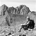
Colony Baldy from the Rainbow Trail.
Our last trip up Electric and Lakes was a bit brutal so we looked for something a little more reasonable and Colony Baldy fit the bill. I met Al in Colorado Springs at 5:30 AM and we made the short drive to the Horn Creek Trailhead where we were hiking up the Horn Creek Trail at 7:15 AM.
First mile up the Rainbow Trail. (Photo by Al)
Due to the well packed snow, we were able to start up the trail without snowshoes but after joining the Rainbow Trail, heading south, the trail was not as well packed. We continued for another mile on the Rainbow Trail before we put the snowshoes on. Enough postholing. Our travel along the Rainbow Trail went quickly and after passing the Macey Creek junction we started up the northeast ridge of Colony Baldy.
Marcey Creek Junction on the Rainbow Trail. (Photo by Al)
After leaving the Rainbow Trail, the snow became deeper and more powdery and the trail-breaking involved much more effort. Our pace slowed down dramatically but it was nice to share the misery of deep snow with someone for a change. As we slowly progressed upwards, we encountered a steeper area where the postholing was out of control. It was thigh to waist deep powder and the snow just crumbled below our feet. How much longer could this go? We switched off the enjoyment of trail-breaking and continued upward. Things got better.
Rough trail-breaking
Never ending fun. (Photo by Al)
Sugar snow.
The trench we broke.
Eventually, after a few hours of tough trail-breaking, we finally reached treeline where we ditched our snowshoes and continued upwards on snow covered talus. The southeast ridge broadened and became a mellow hike as we reached the summit at 1:10 PM. Wahoo! My 400th summit over 13,000. Even though it was a brutal 6 hour hike to the summit, the views were well above average. We were surrounded by Humboldt, the Crestones, Kit Carson and Adams. The views of the Crestones were rather sobering.
Al breaking out of treeline.
Northeast slopes of Colony Baldy.
Horn Peak.
Al working his way up the northeast side of Colony Blady.
Working up the upper northeast ridge. (Photo by Al)
Kit Carson, Challenger from the NE ridge.
Lower section NE ridge.
Upper section of the NE ridge.
Crestones!
Crestones from the summit.
Humboldt from the summit.
We took a long break absorbing the views and then started on our descent. Now for the race against the sun. Since the trail was well broken from our ascent, our descent took half of ascent time and we returned to the car at 4:40 PM with lots of daylight to spare. A great winter climb with some of the best views around.
360 Summit View.
Al descending the northeast ridge.
Mt Adams.
Mt. Adams.
Route Map.
Thanks to Al, for the GPX file.
Thumbnails for uploaded photos (click to open slideshow):
Emma-
I think you ran into my wife when I was doing a 13eener traverse at the Gibbs Creek TH 2-3 days prior? Is the trail well broken to Horn? I still need that one.
That was me. My plan was to make my own trail up to Spread Eagle but I misjudged my tentative route and it was near impossible to gain the ridge.
Horn was surprisingly well broken the first few miles. The last .75 mile to 1 mile, however, was very deep and I couldn't find the ”trail.” Although it took significant time, I was able to break trail until the ridge leading up to pt. 12~ something. That being said, I would advise snowshoes for this purpose. I think you could arguably boot it for the majority of the hike (barring whatever accumulation you've received in the last week), but without them for the section just below treeline it would be impractical.
Again it's so cool to see places I've never been! You motivate me to get out and do it!
Caution: The information contained in this report may not be accurate and should not be the only resource used in preparation for your climb. Failure to have the necessary experience, physical conditioning, supplies or equipment can result in injury or death. 14ers.com and the author(s) of this report provide no warranties, either express or implied, that the information provided is accurate or reliable. By using the information provided, you agree to indemnify and hold harmless 14ers.com and the report author(s) with respect to any claims and demands against them, including any attorney fees and expenses. Please read the 14ers.com Safety and Disclaimer pages for more information.
Please respect private property: 14ers.com supports the rights of private landowners to determine how and by whom their land will be used. In Colorado, it is your responsibility to determine if land is private and to obtain the appropriate permission before entering the property.


")
")
")
")
")
")
")
")
")
")
")
")
")
")
")
")
")
")
")
")
")
")
")