Download Agreement, Release, and Acknowledgement of Risk:
You (the person requesting this file download) fully understand mountain climbing ("Activity") involves risks and dangers of serious bodily injury, including permanent disability, paralysis, and death ("Risks") and you fully accept and assume all such risks and all responsibility for losses, costs, and damages you incur as a result of your participation in this Activity.
You acknowledge that information in the file you have chosen to download may not be accurate and may contain errors. You agree to assume all risks when using this information and agree to release and discharge 14ers.com, 14ers Inc. and the author(s) of such information (collectively, the "Released Parties").
You hereby discharge the Released Parties from all damages, actions, claims and liabilities of any nature, specifically including, but not limited to, damages, actions, claims and liabilities arising from or related to the negligence of the Released Parties. You further agree to indemnify, hold harmless and defend 14ers.com, 14ers Inc. and each of the other Released Parties from and against any loss, damage, liability and expense, including costs and attorney fees, incurred by 14ers.com, 14ers Inc. or any of the other Released Parties as a result of you using information provided on the 14ers.com or 14ers Inc. websites.
You have read this agreement, fully understand its terms and intend it to be a complete and unconditional release of all liability to the greatest extent allowed by law and agree that if any portion of this agreement is held to be invalid the balance, notwithstanding, shall continue in full force and effect.
By clicking "OK" you agree to these terms. If you DO NOT agree, click "Cancel"...
As Sam Elliot's character in The Big Lebowski so eloquently put it, "Sometimes you eat the b'ar, and sometimes the b'ar, well, he eats you." Little B'ar Peak . . . well, it did the eating this weekend. It definitely chewed us up, but at least it was kind enough to spit us out relatively unharmed, able to return for another attempt in the future.
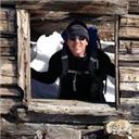
Stiffler_from_Denver and I set out from the 5280 at 7:30 p.m. on Friday evening (April 15th) in the hopes of meeting up with Yalegirl09 and anna at Lake Como for an attempt on Little Bear early Saturday morning. I had hoped to leave work early on Friday so that I could grab at least two hours of sleep before heading out, but work issues and Denver traffic (2 hour commute from Boulder to Denver that night!) killed that idea. Nevertheless, we were wide awake and energized when we turned onto Lake Como Road at around 11. We made it less than 3/4 of the way to the main trailhead before my little Chevy Cobalt started scraping bottom. We ended up parking at an elevation of around 7,500 feet. After putting our gear on and snapping a few obligatory "start of the hike" photos, we started off at 11:30 p.m.
Starting out at 11:30 p.m. I don't think we have quite enough gear.
By the time we hit the main trailhead, we had already started to hate Lake Como Road. Its 5+ miles of loose, football-sized rocks are seemingly scientifically arranged to tear up your ankles and knees. Throughout the night we trudged upward along this trail of tears, eventually realizing that our plan to reach Lake Como by 2:30 a.m., which was when we had hoped to meet up with Yalegirl09 and anna, had been ridiculously optimistic. The only incident that broke up the tedium of the trek was when we stopped in front of a derelict cabin to discuss its merits as a campsite. A burly "Good morning!" rang out from inside, giving us quite a startle. The occupant, James, later passed us on the trail. Sorry that we woke you up, James!
We finally reached the shelter on the south side of Lake Como at 6:45 a.m. To our surprise, Yalegirl09, anna, and their companion Sean were inside. Their early morning assault on Little Bear had not gone as planned, and they'd returned to the shelter to rest. Sean was ready to give it another try, however, and joined us for another attempt. As we crossed Lake Como, we could see James ascending the couloir leading up to Little Bear's west ridge (James, PM me and I can send you a few photos that I took of you).
The summit of Little Bear Peak and its west ridge. The notch on the right marks the top of the couloir that leads up to the
The small dot about 3/4 of the way up the couloir is James.
We made it to the bottom of the couloir just after 7 a.m. After strapping on our crampons and pulling out our ice axes, we started ascending at 7:10 a.m. Sean sprinted up much quicker than Stiffler_from_Denver and I, but by 8:20 we were all standing on top.
Sean and Stiffler_from_Denver starting up the couloir.
A view of Ellingwood Point from about halfway up the couloir.
A bit steeper here . . .
The next step, scrambling from the notch at the top of the couloir across Little Bear's west ridge, proved to be much easier than I expected. I had envisioned looser rock and more exposure, but at least this brief section of the west ridge route wasn't bad at all, rarely exceeding Class 2+. Not long after we started across the ridge, James passed us on his way down. He had only made it to the snowfield beneath the Hourglass (we soon found out why). Continuing onward, Sean led the way across the ridge and we followed at a considerable distance behind. I finally caught up with Sean some distance past another notch at around 12,850 ft., within 200 yards of the start of the snowfield beneath the infamous Hourglass gully on Little Bear's southwest slope. Despite my lack of sleep, I still had plenty of leg and lung left in me. I thought we still might have a chance. But Sean relayed that the conditions of the snowfield, across which we'd have to traverse to reach the bottom of the Hourglass, were unfeasible. The snow had hardened into impenetrable ice, and it was impossible to sink the shaft of an ice axe deep enough to self-belay. We begrudgingly turned around just before 10 a.m.
Stiffler_from_Denver on the west ridge.
I love this photo. Sean is on top the west ridge, with Little Bear's summit and the top of the Hourglass ahead of him.
Ever wonder how far you could hike in one night? My car is somewhere way down there in the flatland.
Expending so much energy without reaching the summit was a huge disappointment, but I also realized that trying to cross the snowfield would have been foolhardy and possibly fatal. I had witnessed Sean dislodge a small rock at the top of the snowfield, and it had sped down the slope with frightening speed before crashing catastrophically into a group of boulders near the bottom. I could easily envision a climber sliding down the slope, frantically but unsuccessfully trying to self-arrest, with deadly results. We made the right decision, but turning around on Little Bear will eat at me for months to come.
Little Bear's summit, the Hourglass, and the snowfield on the southwest slope.
The infamous Hourglass gully.
Whether due to the disappointment of the failed attempt or to fatigue, I really started to slow down on the way back across the west ridge. Two other climbers were heading up, so at least Sean was able to chat with them while he waited for me to reach the notch. We step-plunged and glissaded down the couloir, then met up with Stiffler_from_Denver, who had preceded us down, at the shelter south of Lake Como at about 11:45 a.m. We had a snack and talked for a while, then Stiffler_from_Denver and I headed back down the dreaded Lake Como Road. Sean later passed us (we were taking VERY frequent rests by that point) and told us to keep an eye out for Yalegirl09's ice axe"she'd lost it on the way down. By the time we had reached "James's" cabin, we needed at least a few minutes of sleep. I had been up for over 30 hours at that point, but a 25-minute nap on the dirt floor of the cabin got me going again.
When we reached the main trailhead, we found Yalegirl09's ice axe hanging from a signpost (thanks to whomever found it, we were able to return it to her in Colorado Springs). We finally reached my car at 4:15 p.m. I downed two New Belgium Mothership Wit beers, then laid out a blanket on the ground and dozed for about 25 minutes before we started driving back to Denver. We stopped for a steak at the Silver Sage in Ft. Garland; Stiffler_from_Denver and I long ago gave up the rule that we could only reward ourselves with post-14er steaks if we actually made the summit. In Walsenburg I got pulled over by two police cars for crossing the double-yellow by about 6 inches so that I could pass someone going 5 m.p.h. in a 30 m.p.h. zone. I rather think they should have pulled the other guy over, but at least I got off with just a friendly "I know you're from Denver, but when you're going through small towns like this you need to be a bit more patient." We met up with Yalegirl09 in Colorado Springs to drop off her ice axe and were back in Denver at 10:30 p.m. By the time I finally collapsed into my bed, I'd been up for over 40 hours with only two brief naps. Needless to say, I slept pretty well.
A parting photo of Little Bear.
I think the most important lesson I learned from this excursion is that Lake Como Road is a Bataan Death March. Hiking from the trailhead up to Lake Como is exhausting and torturous by itself. When I attempt Little Bear, Ellingwood, or Blanca in the future, I'm definitely going to take a three-day weekend: one day to hike up to the lake, one day to attempt a summit, one day to hike back down.
The Blanca Group from Highway 160.
Thumbnails for uploaded photos (click to open slideshow):
Nice effort guys! Climbing is a lot harder and more variable at this time of year. I appreciate you taking the time to do a TR to share the beta with us.
It seems like the lack of snow in the Sangres this winter is going to make for some interesting attempts on LB until it completely thaws. I don't anticipate conditions improving (ice) soon. Good try, glad you were safe!
You gave it all you had - sometimes Mamma Nature just doesn't cooperate. I think we've all been there at some point.
I agree with you, the Lake Como Rd will drain your life blood right out of you. The road eats me more than the peaks.
You definitely earned that steak!
The mountain isn't going anywhere. You'll get the job done.
Thanks for posting!
Glad you made the smart decision to turn back given the circumstances. Your description of the Lake Como road with loose football size rocks finally gives some better description to a road I have never been up and have often wondered why it was so loathed.
It was good seeing everyone up on the Bear. Sorry nobody made it but I sort of suspected as much. I think I'll make another go in a few weeks. I'd love to see more pics of me slogging up the gully. I thought the ice axe I picked up on the trail might be either Anna's or Yalegirl's so I'm glad that it made it back to its rightful owner. Let me know if anyone wants company on another weekend attempt. -James
Those mountains are certainly making things tough this year. Even on a seemingly nice day they find a nice curveball to throw at you. Good decision to turn around, you'll get it next time.
Good decision to turn around. Those slopes looked to be dicey, and you described what quite possibly could have happened on that traverse. Thanks for the beta! Hopefully with some luck and good timing I'll get a good chance at snagging the Bear in a couple weeks.
Saves me the time of having to write the same thing. We were the two you met at the top of the West Ridge Couloir on your retreat. We did in fact turn around as well not to long afterwards.
I do want to mention that the snow in the couloir (west ridge) was already getting thin in 2 sections and will probably not last too much longer. Amazing how dry it was up there. Snow in the trees was a few feet deep and postholing was minimal, even in the afternoon. Snow on the road started around 10,200' and was not continuous until above 11k' and that too will not be lasting much longer. From what I could tell (if I was correctly identifying it), the bottom of Baby Thunder looked already melted out and thin.
May try again in 2 weeks and leave my board behind. Need some time to forget that approach.
for the report and the update on conditions. Yalegirl, looking forward to what you find this week! Looking to go early next week.
Nice decision on the turn around and thanks for the pm. Be safe out there everyone!
Caution: The information contained in this report may not be accurate and should not be the only resource used in preparation for your climb. Failure to have the necessary experience, physical conditioning, supplies or equipment can result in injury or death. 14ers.com and the author(s) of this report provide no warranties, either express or implied, that the information provided is accurate or reliable. By using the information provided, you agree to indemnify and hold harmless 14ers.com and the report author(s) with respect to any claims and demands against them, including any attorney fees and expenses. Please read the 14ers.com Safety and Disclaimer pages for more information.
Please respect private property: 14ers.com supports the rights of private landowners to determine how and by whom their land will be used. In Colorado, it is your responsibility to determine if land is private and to obtain the appropriate permission before entering the property.


 Starting out at 11:30 p.m. I don't think we have quite enough gear.")
 The summit of Little Bear Peak and its west ridge. The notch on the right marks the top of the couloir that leads up to the")
 The small dot about 3/4 of the way up the couloir is James.")
 Sean and Stiffler_from_Denver starting up the couloir.")
 A view of Ellingwood Point from about halfway up the couloir.")
 A bit steeper here . . .")
 Stiffler_from_Denver on the west ridge.")
 I love this photo. Sean is on top the west ridge, with Little Bear's summit and the top of the Hourglass ahead of him.")
 Ever wonder how far you could hike in one night? My car is somewhere way down there in the flatland.")
 Little Bear's summit, the Hourglass, and the snowfield on the southwest slope.")
 The infamous Hourglass gully.")
 A parting photo of Little Bear.")
 The Blanca Group from Highway 160.")