Download Agreement, Release, and Acknowledgement of Risk:
You (the person requesting this file download) fully understand mountain climbing ("Activity") involves risks and dangers of serious bodily injury, including permanent disability, paralysis, and death ("Risks") and you fully accept and assume all such risks and all responsibility for losses, costs, and damages you incur as a result of your participation in this Activity.
You acknowledge that information in the file you have chosen to download may not be accurate and may contain errors. You agree to assume all risks when using this information and agree to release and discharge 14ers.com, 14ers Inc. and the author(s) of such information (collectively, the "Released Parties").
You hereby discharge the Released Parties from all damages, actions, claims and liabilities of any nature, specifically including, but not limited to, damages, actions, claims and liabilities arising from or related to the negligence of the Released Parties. You further agree to indemnify, hold harmless and defend 14ers.com, 14ers Inc. and each of the other Released Parties from and against any loss, damage, liability and expense, including costs and attorney fees, incurred by 14ers.com, 14ers Inc. or any of the other Released Parties as a result of you using information provided on the 14ers.com or 14ers Inc. websites.
You have read this agreement, fully understand its terms and intend it to be a complete and unconditional release of all liability to the greatest extent allowed by law and agree that if any portion of this agreement is held to be invalid the balance, notwithstanding, shall continue in full force and effect.
By clicking "OK" you agree to these terms. If you DO NOT agree, click "Cancel"...
MOUNTAIN: Mt. Yale (14,196 feet) ROUTE: Southwest Slopes from the Denny Creek TH RT DISTANCE: ~9.25 miles RT ELEVATION GAIN: ~4,600 feet RT TIME: 8 hours 35 minutes
It was Memorial Day weekend. The road to the TH is paved. The route is (relatively) easy. Surely, Mt. Yale would be a zoo?
Not so much. I don't usually hike solo, but I figured Yale would be plenty crowded and I took off by myself to Buena Vista on Saturday afternoon. I camped at the free sites across from the Avalanche Gulch TH, with the alarm set for 4:30 a.m.
When I got to the Denny Creek TH, there were only two other cars in the parking lot. I took my time getting ready, mostly to see if anyone else showed up. They didn't. I hit the trail at 5:20 a.m., certain I'd be followed by a conga line of people.
There was infrequent snow almost from the get-go, and a ton of mud. Microspikes probably would have been helpful, but I chose to do without them and just took my time on the icy patches. I made the trail junction after about 35 or 40 minutes.
Creek crossing
Trail junction (about 40 minutes into the hike)
IMPORTANT: The established snow track deviates pretty significantly from the standard summer trail. Near treeline, the summer route cuts southeast for a period before turning back northeast on Yale's southwest slopes. The snow trail takes that first turn about 400 vertical feet late. It then parallels the summer trail heading southeast, linking back up with the standard route at about the same time Yale's summit comes into view. I say this is "important" because the established route climbs a really, really steep snow and dirt slope after the second creek crossing that requires care (this is where I put on my snowshoes).
I also spent a lot of time questioning whether the snow track was heading up Yale at all. At one point, I even turned around and backtracked about 300 vertical feet to treeline and pulled out the map and compass to figure out what I needed to do. I eventually found out the snow track was viable, but it added a bit of gain to my day.
Anyway, I finally broke treeline and Yale showed her face.
Upper route in full view
I'd passed two tents on my way up - one very low on the trail and one at about treeline. They both appeared to be occupied as I strolled past. However, as I got closer to Yale I noticed some flashes on the ridge. I wasn't alone after all! There were two guys and a girl about 45 minutes ahead of me, just starting on the ridge. Can you see them? They'd camped at treeline and were training for Rainier.
Can you spot the climbers on the ridge?
I ditched my snowshoes at about the point the slopes steepened, where the summer trail would turn to switchbacks. Microspikes went on and the ice ax came out. It was steady rest-stepping up the slope, and I was on the ridge much sooner than I'd thought. The snow was fine, but if you so desired it would be viable to pick a route up the rockbands.
On the ridge, looking at the false summit
Almost there...
The three other climbers had passed me on their way down already, so I enjoyed the ridge walk in solitude. There was one spot I'd say was a bit exposed, but there was a huge rock to hold and the snow was solid. I topped out at 10:35 a.m.
I just realized while typing this -- Yale is the only 14er where I've ever had the summit completely to myself. No partner, no other parties. It was a really cool experience. I lounged for as long as I could, but I was concerned about warming snow and the wind had picked up enough to make sitting still slightly uncomfortable.
I'd also brought along an American flag for a pre-Memorial Day summit pose. Again, I thought I'd be surrounded by other climbers. The logistics of holding up a flag and taking a self-portrait proved too difficult, so I instead weighted it down and just took a photo of the flag itself.
No one else on the summit so I couldn't hold it up, had to improvise
Harvard, Columbia and Horn Fork Basin
Harvard close up. Not much has changed since March!
Princeton
Summit view
I started down 15 minutes later. While traversing the ridge, I finally saw another pair heading up. They proved to be the last fellow climbers I saw all day, bringing the total on the mountain to 6. I passed them about where my snowshoes were stashed and chatted for a few minutes. Turns out, of course, they're 14ers.com members: Flyingfish and dad. Nice meeting you guys! Congrats on the summit. Here's a photo of them starting up toward the ridge:
Flyingfish and dad heading up
After recovering my snowshoes, the descent can be summarized in one word: MISERABLE. I postholed constantly to my knees and occasionally to my hips. I caught up to the three climbers who had been ahead of me just as they finished packing up their camp. We shared the trail down for a little while (read: fell into the snow and screamed curse words constantly together). It was very, very, very slow going.
The trail did become a solid bootpack after the initial creek crossing, but I kept the snowshoes on until I was on dirt more often than snow. After that, it was a speedy jaunt down the extremely muddy path (more of a small creek) to the trailhead. There were a lot of casual hikers once past the trail junction.
Something cool I noticed while signing out at the trail register: I'd missed a local celebrity by only a day.
Missed a climbing celebrity by a day
I broke down camp in extreme winds (my tent almost blew away once I took the stakes out...I had to dive to catch it) and hit the road ASAP.
My next destination: my friend's cabin in Grand Lake, three hours from BV. A lengthy nighttime hot tub soak and a Memorial Day filled with grilled food, beer and relaxation proved a great way to wrap up the weekend.
Last look at Yale from Hwy 24
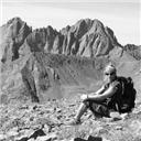
Aaaand relaxation time (Columbine Lake, CO)
Second summit of the weekend (note the steep rock face I climbed)
Thumbnails for uploaded photos (click to open slideshow):
That 5.7 pitch in photo 16 looks insane. Reminds me of your ”first ascent” on the way down Como. Yale's a cool mountain - nice work, Jeffro. Does that get you in the mood for The 'stones in 2 weeks?
I really hate to criticize....but.... 5/31/2011 2:11pm
You might receive some criticism, especially from our members of the military, for your disrespect of the American Flag. It is never to touch the ground. Here's some simple rules of flag etiquette: http://www.usa-flag-site.org/etiquette.shtml. Otherwise, it looks like a great outing !
I'm sure you meant no disrespect, but it's a touchy subject for those serving our country.
After I posted, I realized I may have come across a bit harsh and that wasn't my intention. I'm sure you had patriotic intentions. Just wanted to prepare you for some ”schooling” from our veterans. Thanks for taking my criticism lightly.
Thanks for taking the picture of us slogging up the ridge...my family only ever sees one or the other of us in one... We had similar conditions, although flyingfish at 13 years old and 130 lbs pack loaded stayed on top much more often than I did..it was a postholing nightmare... Let us know if you're looking for partners...Flyingfish has the 14er fever now...
jamie
Nice solo trip! Amazing how much snow is still left.
Thanks for a fun report!
Caution: The information contained in this report may not be accurate and should not be the only resource used in preparation for your climb. Failure to have the necessary experience, physical conditioning, supplies or equipment can result in injury or death. 14ers.com and the author(s) of this report provide no warranties, either express or implied, that the information provided is accurate or reliable. By using the information provided, you agree to indemnify and hold harmless 14ers.com and the report author(s) with respect to any claims and demands against them, including any attorney fees and expenses. Please read the 14ers.com Safety and Disclaimer pages for more information.
Please respect private property: 14ers.com supports the rights of private landowners to determine how and by whom their land will be used. In Colorado, it is your responsibility to determine if land is private and to obtain the appropriate permission before entering the property.


")


")
")
 Creek crossing")
 Trail junction (about 40 minutes into the hike)")
 Upper route in full view")
 Can you spot the climbers on the ridge?")
 On the ridge, looking at the false summit")
 Almost there...")
 No one else on the summit so I couldn't hold it up, had to improvise")
 Harvard, Columbia and Horn Fork Basin")
 Harvard close up. Not much has changed since March!")
 Princeton")
 Summit view")
 Flyingfish and dad heading up")
 Missed a climbing celebrity by a day")
 Last look at Yale from Hwy 24")
 Aaaand relaxation time (Columbine Lake, CO)")
 Second summit of the weekend (note the steep rock face I climbed)")