Sherman Group Conditions

Colorado peak questions, condition requests and other info.
Forum rules
  • This is a mountaineering forum, so please keep your posts on-topic. Posts do not all have to be related to the 14ers but should at least be mountaineering-related.
  • Personal attacks and confrontational behavior will result in removal from the forum at the discretion of the administrators.
  • Do not use this forum to advertise, sell photos or other products or promote a commercial website.
  • Posts will be removed at the discretion of the site administrator or moderator(s), including: Troll posts, posts pushing political views or religious beliefs, and posts with the purpose of instigating conflict within the forum.
    For more details, please see the Terms of Use you agreed to when joining the forum.
Post Reply
User avatar
timf
Posts: 715
Joined: 8/10/2007
14ers: 35  3 
13ers: 27
Trip Reports (2)
 

Sherman Group Conditions

Post by timf »

FYI / FWIW: One can drive to Leavick after negotiating a 2 mile section that has some packed snow. Then the snow lightens higher up.

Heck 2 vehicles were parked 200 yards from the gate right before Dauntless mine and a 3rd went all the way to the gate. ( [-X Yes you in the black Wrangler I saw you :mrgreen: ). From Horseshoe around to Sherman there's about 50% coverage and that coverage ranges from a dusting to almost submerging my trekking pole down to the handle before hitting the bed surface. (I adjust my poles to 125cm).

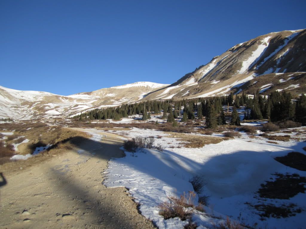
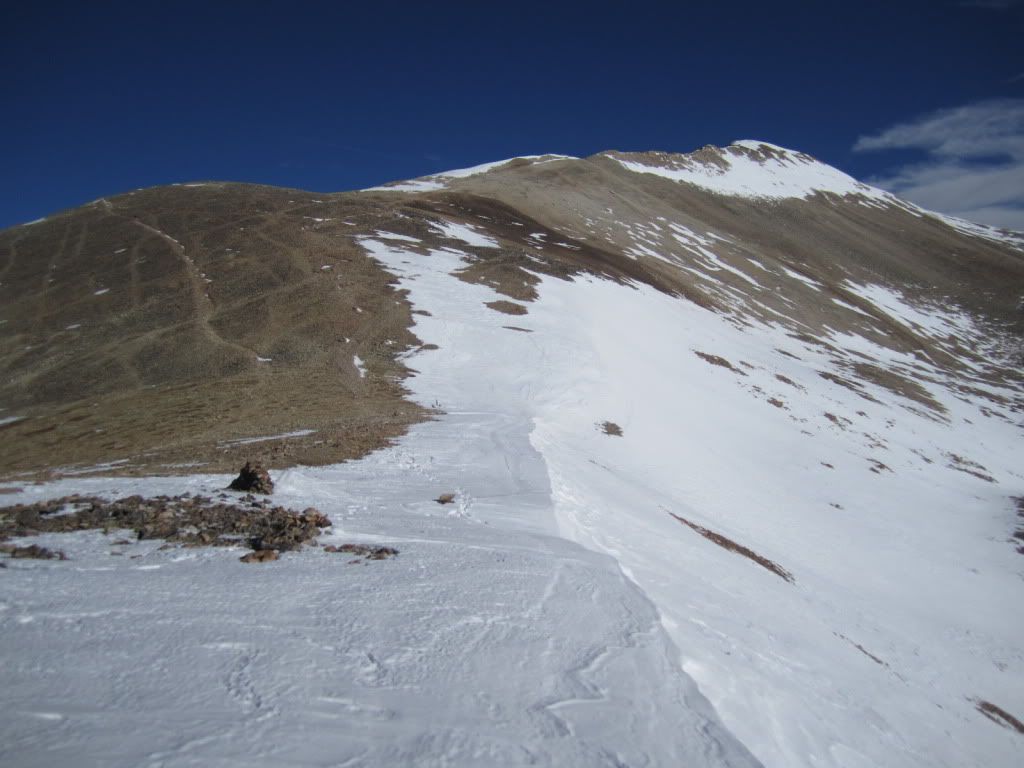
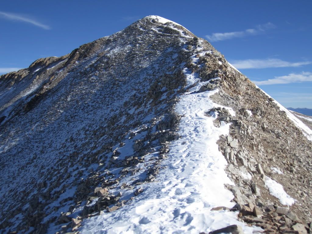
Peerless and Horseshoe you can avoid much of the snow, Sheridan has the typical loading up on opposite ridges and bare-faced in the middle (ala skunk style). Sheridan-Sherman saddle is starting to cornice up. White Ridge's west face is absolutely bare minus the gullies (seriously it looks as though you can do it in summer boots).

One heroic person today hit the left offshoot to go up Horseshoe. It wasn't me, but definite postholing at least a foot deep.

So for those hitting this group, I think you'll be good until the next foot accumulates.

Tmi
User avatar
RockyMountainMustang
Posts: 35
Joined: 7/3/2010
14ers: 32 
13ers: 1
Trip Reports (0)
 

Re: Sherman Group Conditions

Post by RockyMountainMustang »

Is the road passable to the mine in a 2wd car, and were you hiking in just boots or snowshoes/microspikes? You said 50% coverage, but how much of that is the stuff were your trekking pole sank up to the handle?

Does anyone know about the Iowa Gulch approach either? Is that road closed, or does more snow sit on that side of the mountain?
"Security is mostly a superstition. It does not exist in nature, nor do the children of men as a whole experience it. Avoiding danger is no safer in the long run than outright exposure. Life is either daring adventure, or nothing. To keep our faces toward change and behave like free spirits in the presence of fate is strength undefeatable." - Helen Keller
User avatar
WillV
Posts: 71
Joined: 8/30/2010
14ers: 52  4 
13ers: 1
Trip Reports (0)
 

Re: Sherman Group Conditions

Post by WillV »

RockyMountainMustang wrote:Is the road passable to the mine in a 2wd car, and were you hiking in just boots or snowshoes/microspikes? You said 50% coverage, but how much of that is the stuff were your trekking pole sank up to the handle?

Does anyone know about the Iowa Gulch approach either? Is that road closed, or does more snow sit on that side of the mountain?
Yes, I'd say a 2wd car could easily manage getting there (to the Leavick site). You don't need snowshoes (I brought mine but never used em - just to balance myself on occasion- ha). Microspikes, gaiters would be advised, but you could probably manage without them if you really had to. A gentlemen I passed on the way down near the summit had neither I believe. Here are some pics to give you an idea of snow coverage, via the Southwest Ridge route from Fourmile Creek. I had started at the Leavick site at around 8 am.

Past the Leavick site (about half a mile), but before the foot gate.

Image

Southwest Ridge

Image

Narrowing Ridge towards the summit

Image
Last edited by WillV on Sat Nov 06, 2010 11:01 pm, edited 1 time in total.
User avatar
timf
Posts: 715
Joined: 8/10/2007
14ers: 35  3 
13ers: 27
Trip Reports (2)
 

Re: Sherman Group Conditions

Post by timf »

RockyMountainMustang wrote:You said 50% coverage, but how much of that is the stuff were your trekking pole sank up to the handle?
The trekking pole comment was only a small 50' section (shallow gully) avobe the Dauntless Mine. I was follow a road heading towards Horseshoe and this one short sectionmade me turn on my avalanche radar eyes so a third of the way across I was poking around and was a little surprised that with force it sank up to the handle. 2 big layers of almost equal size. The bottom layers had some small facets and the top a wind blown sun crust.
User avatar
zoomie83
Posts: 226
Joined: 4/17/2007
14ers: 40 
13ers: 25
Trip Reports (1)
 

Re: Sherman Group Conditions

Post by zoomie83 »

Does anyone know about the Iowa Gulch approach either? Is that road closed, or does more snow sit on that side of the mountain?
I was wondering about that side also.
User avatar
WillV
Posts: 71
Joined: 8/30/2010
14ers: 52  4 
13ers: 1
Trip Reports (0)
 

Re: Sherman Group Conditions

Post by WillV »

zoomie83 wrote:
Does anyone know about the Iowa Gulch approach either? Is that road closed, or does more snow sit on that side of the mountain?
I was wondering about that side also.
I think anna did that route today. I think I saw her as I was going down the southwest ridge, so she was able to do it. I did see cars parked down there.

You can PM her or maybe she will chime in when she gets back.
User avatar
RockyMountainMustang
Posts: 35
Joined: 7/3/2010
14ers: 32 
13ers: 1
Trip Reports (0)
 

Re: Sherman Group Conditions

Post by RockyMountainMustang »

Thanks Anna!

I think I'll be trying the Fourmile Creek approach instead. It sounds a bit more do-able.
"Security is mostly a superstition. It does not exist in nature, nor do the children of men as a whole experience it. Avoiding danger is no safer in the long run than outright exposure. Life is either daring adventure, or nothing. To keep our faces toward change and behave like free spirits in the presence of fate is strength undefeatable." - Helen Keller
User avatar
somethingrandom
Posts: 480
Joined: 8/15/2010
14ers: 16 
13ers: 3
Trip Reports (0)
 

Re: Sherman Group Conditions

Post by somethingrandom »

RockyMountainMustang wrote:Thanks Anna!

I think I'll be trying the Fourmile Creek approach instead. It sounds a bit more do-able.
Not that I can particularly explain it, but I love Mt. Sherman. Time being, I would certainly expect Fourmile to be much more accessible (easy), as it is on the South side of the mountain, albeit facing a bit more East than you would prefer for snowmelt, it is definitely better than the North side...

My $.02
-Just as soon as you idiot proof something, some a**hole is just going to come along and make a better idiot.

-To Cessna: "November one, zero, four Lima Papa, wind 080 at 90 peak gusts 120, runway 35 cleared for takeoff"

To fellow controller: "Watch this sh!t"

-Whether climbing or flying, the single greatest thing to remember is that every ascent is optional, and if you feel like making another, your subsequent descent is mandatory.
User avatar
Muskie5280
Posts: 64
Joined: 8/29/2010
14ers: 31 
13ers: 5
Trip Reports (20)
 

Re: Sherman Group Conditions

Post by Muskie5280 »

We will be hiking Sherman tomorrow as well, but plan on getting started around 430 am. Hopefully conditions are good and we see you up there.
Post Reply