Peak ID

Colorado peak questions, condition requests and other info.
Forum rules
  • This is a mountaineering forum, so please keep your posts on-topic. Posts do not all have to be related to the 14ers but should at least be mountaineering-related.
  • Personal attacks and confrontational behavior will result in removal from the forum at the discretion of the administrators.
  • Do not use this forum to advertise, sell photos or other products or promote a commercial website.
  • Posts will be removed at the discretion of the site administrator or moderator(s), including: Troll posts, posts pushing political views or religious beliefs, and posts with the purpose of instigating conflict within the forum.
    For more details, please see the Terms of Use you agreed to when joining the forum.
Post Reply
User avatar
CO Native
Posts: 4879
Joined: 7/26/2004
14ers: 58  2  15 
13ers: 29
Trip Reports (50)
 
Contact:

Peak ID

Post by CO Native »

This was posted on a local news channel as photo of Pikes Peak taken from highway 67 in Jefferson County.

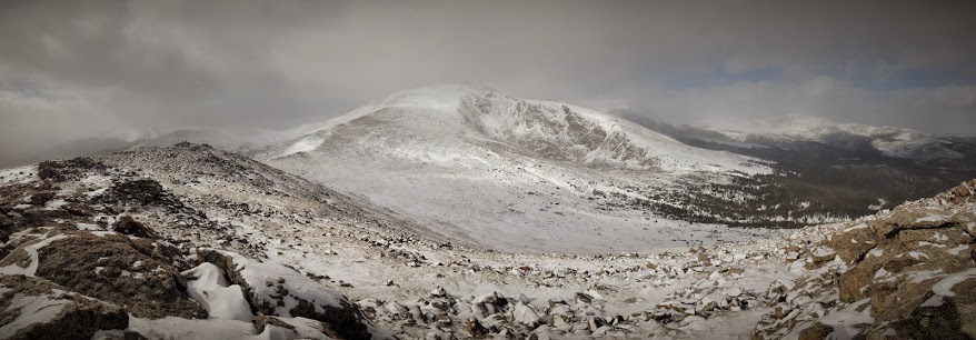
It's certainly not Pikes Peak, and 67 barely skirts the edge of Jefferson County. I'm trying to figure out which mountain it is.

I'm thinking it's Rosalie Peak with Mount Evans behind and to the right, but not totally positive. Can anyone confirm or point me to the correct peaks?
peakquestionsm.jpg
peakquestionsm.jpg (56.81 KiB) Viewed 468 times
Larger version:
peakquestion.jpg
(248.59 KiB) Not downloaded yet
Remember what your knees are for.
http://www.hikingintherockies.com
User avatar
ameristrat
Posts: 592
Joined: 2/21/2011
14ers: 58  6 
13ers: 30
Trip Reports (9)
 

Re: Peak ID

Post by ameristrat »

I'm 90% sure you're right. Looks like Rosalie with Evans behind. That said, i'm not 100% sure, so anyone else can chime in too
You cannot stay on the summit forever; you have to come down again. So why bother in the first place? Just this: What is above knows what is below, but what is below does not know what is above. One climbs, one sees. One descends, one sees no longer, but one has seen. There is an art of conducting oneself in the lower regions by the memory of what one saw higher up. When one can no longer see, one can at least still know. - Rene Daumal
User avatar
Chicago Transplant
Posts: 4013
Joined: 9/7/2004
14ers: 58  12  24 
13ers: 697 39 34
Trip Reports (66)
 

Re: Peak ID

Post by Chicago Transplant »

Yeah, I think you guys are right. I was just on Rosalie a week ago and remember that lower cirque to the right, it definitely looks like what we saw up there.
"We want the unpopular challenge. We want to test our intellect!" - Snapcase
"You are not what you own" - Fugazi
"Life's a mountain not a beach" - Fortune Cookie I got at lunch the other day
User avatar
Derek
Posts: 1156
Joined: 5/22/2006
Trip Reports (57)
 
Contact:

Re: Peak ID

Post by Derek »

L to R: Bandit, Rosalie and Epaulie? (Pegmatite Points just out of view on the right, Logan just leaving view on the left.

Looking W/NW at Rosalie from Pegmatite a couple weeks ago..
Image
User avatar
CO Native
Posts: 4879
Joined: 7/26/2004
14ers: 58  2  15 
13ers: 29
Trip Reports (50)
 
Contact:

Re: Peak ID

Post by CO Native »

Using CalTopo and based on the input of some of the peaks I back figured to the approximate location the photo was shot.

I labeled the photo with my best interpretation.
peakquestionsmlabels.jpg
peakquestionsmlabels.jpg (319.02 KiB) Viewed 394 times
Remember what your knees are for.
http://www.hikingintherockies.com
User avatar
jaymz
Posts: 1035
Joined: 6/6/2006
Trip Reports (1)
 

Re: Peak ID

Post by jaymz »

I think you may be right. This is the Evans massif from Devil's Head (I know the quality sucks). The summit shape looks much the same.
EDIT: Your labeling post beat me to it :-D
Attachments
Evans from Devils Head.jpg
Evans from Devils Head.jpg (225.34 KiB) Viewed 386 times
"But in every walk with Nature, one receives far more than he seeks."
John Muir
User avatar
Derek
Posts: 1156
Joined: 5/22/2006
Trip Reports (57)
 
Contact:

Re: Peak ID

Post by Derek »

CO Native wrote:Using CalTopo and based on the input of some of the peaks I back figured to the approximate location the photo was shot.

I labeled the photo with my best interpretation.
peakquestionsmlabels.jpg
**Edit - I posted another photo because I was convinced what you had labeled as Evans was Epaulie and or Epaulet, but after looking through some others I'm thinking you're right.. :-D
User avatar
CO Native
Posts: 4879
Joined: 7/26/2004
14ers: 58  2  15 
13ers: 29
Trip Reports (50)
 
Contact:

Re: Peak ID

Post by CO Native »

But you can see the road on that peak, there's no road on Epaulet just on Evans.

I used the view from here feature in Cal Topo and it seems to support it being Evans.
peakquestioncaltopolabels.jpg
(166.93 KiB) Not downloaded yet
Remember what your knees are for.
http://www.hikingintherockies.com
User avatar
Derek
Posts: 1156
Joined: 5/22/2006
Trip Reports (57)
 
Contact:

Re: Peak ID

Post by Derek »

CO Native wrote:But you can see the road on that peak, there's no road on Epaulet just on Evans.
Yeah, the roads are what made me finally figure it out too.

Odd, are you able to see my post pre-edit or something? Changed it quite a while ago, surprised you can still see the picture I posted.
Post Reply